- Cannelton, Indiana
Infobox Settlement
official_name = City of Cannelton, Indiana
settlement_type =City
nickname =
imagesize =
image_caption =
image_
imagesize =
image_caption =
image_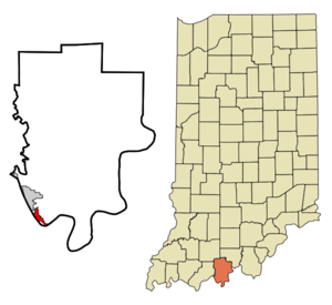
mapsize = 250x200px
map_caption = Location in the state ofIndiana
mapsize1 =
map_caption1 =
subdivision_type = Country
subdivision_name =United States
subdivision_type1 = State
subdivision_name1 =Indiana
subdivision_type2 = County
subdivision_name2 = Perry
subdivision_type3 = Township
subdivision_name3 = Troy
government_type =
leader_title =Mayor
leader_name = Morris "Smokey" Graves (D)
area_note =
established_date =
area_magnitude = 1 E6
area_total_km2 = 4.0
area_land_km2 = 3.8
area_water_km2 = 0.2
population_as_of = 2000
population_note =
population_total = 1209
population_density_km2 = 315.4
timezone = CST
utc_offset = -6
timezone_DST = CDT
utc_offset_DST = -5
area_total_sq_mi = 1.6
area_land_sq_mi = 1.5
area_water_sq_mi = 0.1
elevation_m = 125
elevation_ft = 410
latd = 37 |latm = 54 |lats = 36 |latNS = N
longd = 86 |longm = 44 |longs = 24 |longEW = W
website =
postal_code_type =ZIP code
postal_code = 47520
area_code = 812
blank_name = FIPS code
blank_info = 18-10108GR|2
blank1_name = GNIS feature ID
blank1_info = 0450757GR|3
footnotes =Cannelton is a city in Troy Township, Perry County,
Indiana , along theOhio River . The population was 1,209 at the 2000 census. Cannelton is the formercounty seat of Perry CountyGR|6. The currentcounty seat isTell City, Indiana . The name was adopted in 1844 is derived from thecannel coal once mined in the area,Geography
Cannelton is located at coor dms|37|54|36|N|86|44|24|W|city (37.910134, -86.739931)GR|1.
According to the
United States Census Bureau , the city has a total area of 1.5square mile s (4.0km² ), of which, 1.5 square miles (3.8 km²) of it is land and 0.1 square miles (0.2 km²) of it (4.52%) is water.Demographics
As of the
census GR|2 of 2000, there were 1,209 people, 509 households, and 297 families residing in the city. Thepopulation density was 816.0 people per square mile (315.4/km²). There were 577 housing units at an average density of 389.4/sq mi (150.5/km²). The racial makeup of the city was 98.01% White, 0.08% African American, 0.33% Native American, 0.08% Asian, 0.50% from other races, and 0.99% from two or more races. Hispanic or Latino of any race were 0.58% of the population.There were 509 households out of which 26.9% had children under the age of 18 living with them, 44.4% were married couples living together, 9.4% had a female householder with no husband present, and 41.5% were non-families. 38.1% of all households were made up of individuals and 19.3% had someone living alone who was 65 years of age or older. The average household size was 2.30 and the average family size was 3.08.
In the city the population was spread out with 23.7% under the age of 18, 11.2% from 18 to 24, 27.3% from 25 to 44, 21.8% from 45 to 64, and 16.0% who were 65 years of age or older. The median age was 37 years. For every 100 females there were 95.3 males. For every 100 females age 18 and over, there were 96.6 males.
The median income for a household in the city was $27,361, and the median income for a family was $37,188. Males had a median income of $26,940 versus $20,174 for females. The
per capita income for the city was $13,578. About 14.9% of families and 16.0% of the population were below thepoverty line , including 21.1% of those under age 18 and 5.9% of those age 65 or over.ites of interest
*
Cannelton Cotton Mill , built in 1849, was once the largest industrial building in the United States west of theAllegheny Mountains . It is now aNational Historic Landmark .
*Cannelton Lock and Dam provides a 114-mile stretch of calm recreational water on the Ohio River between Cannelton andLouisville, Kentucky .
*Air Crash Memorial Site 8 Miles East of Canneltonee also
*
List of cities and towns along the Ohio River References
External links
Wikimedia Foundation. 2010.