- National Register of Historic Places listings in Allen County, Indiana
-
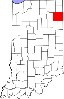 Location of Allen County in Indiana
This is a list of the National Register of Historic Places listings in Allen County, Indiana.
This is intended to be a complete list of the properties and districts on the National Register of Historic Places in Allen County, Indiana, United States. Latitude and longitude coordinates are provided for many National Register properties and districts; these locations may be seen together in a Google map.[1]
There are 58 properties and districts listed on the National Register in the county, including 1 National Historic Landmark.
-
- This National Park Service list is complete through NPS recent listings posted November 10, 2011.[2]
Current listings
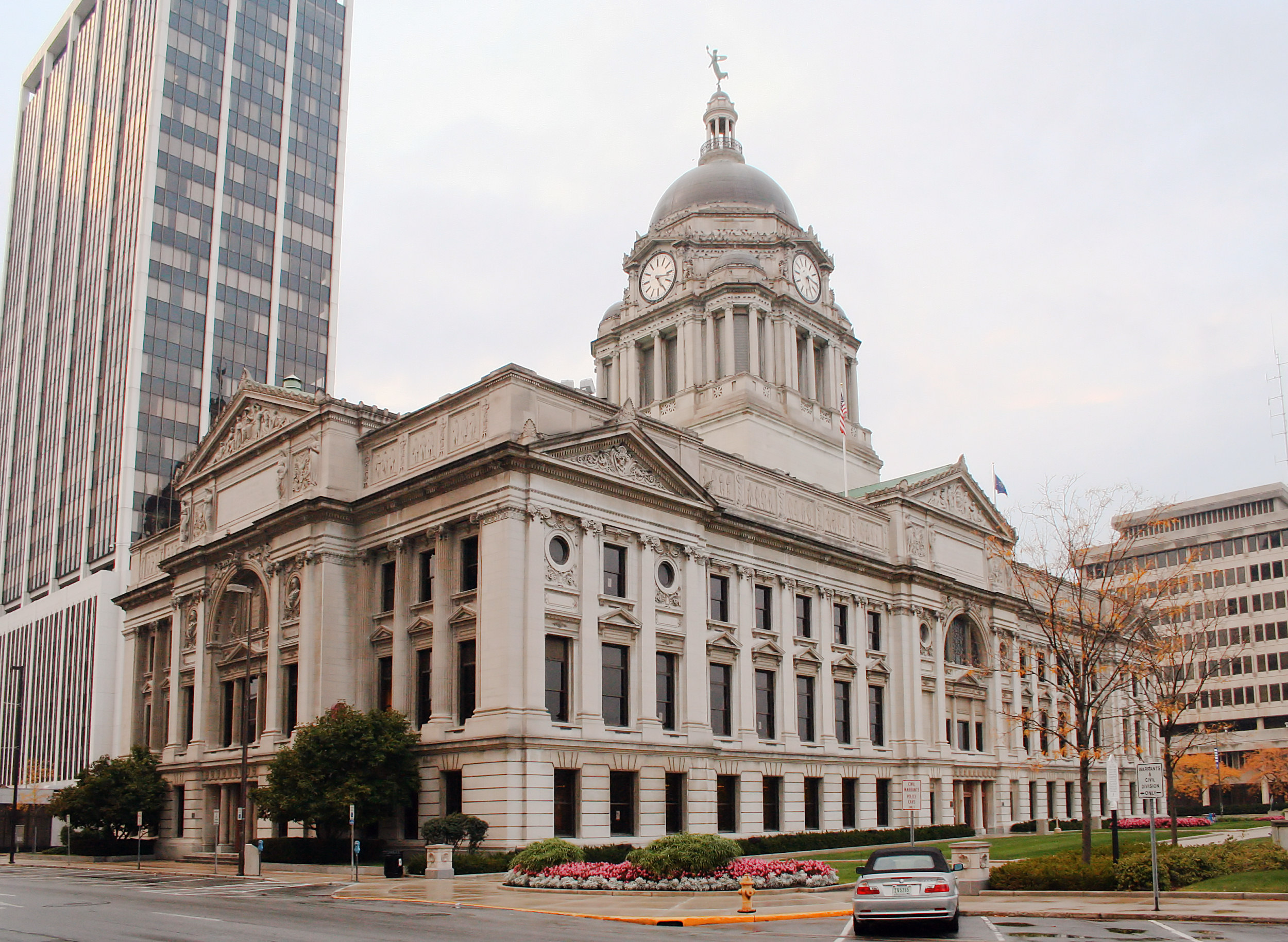
[3] Landmark name [4] Image Date listed Location City or town Summary 1 Allen County Courthouse 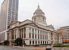
May 28, 1976 715 S. Calhoun St.
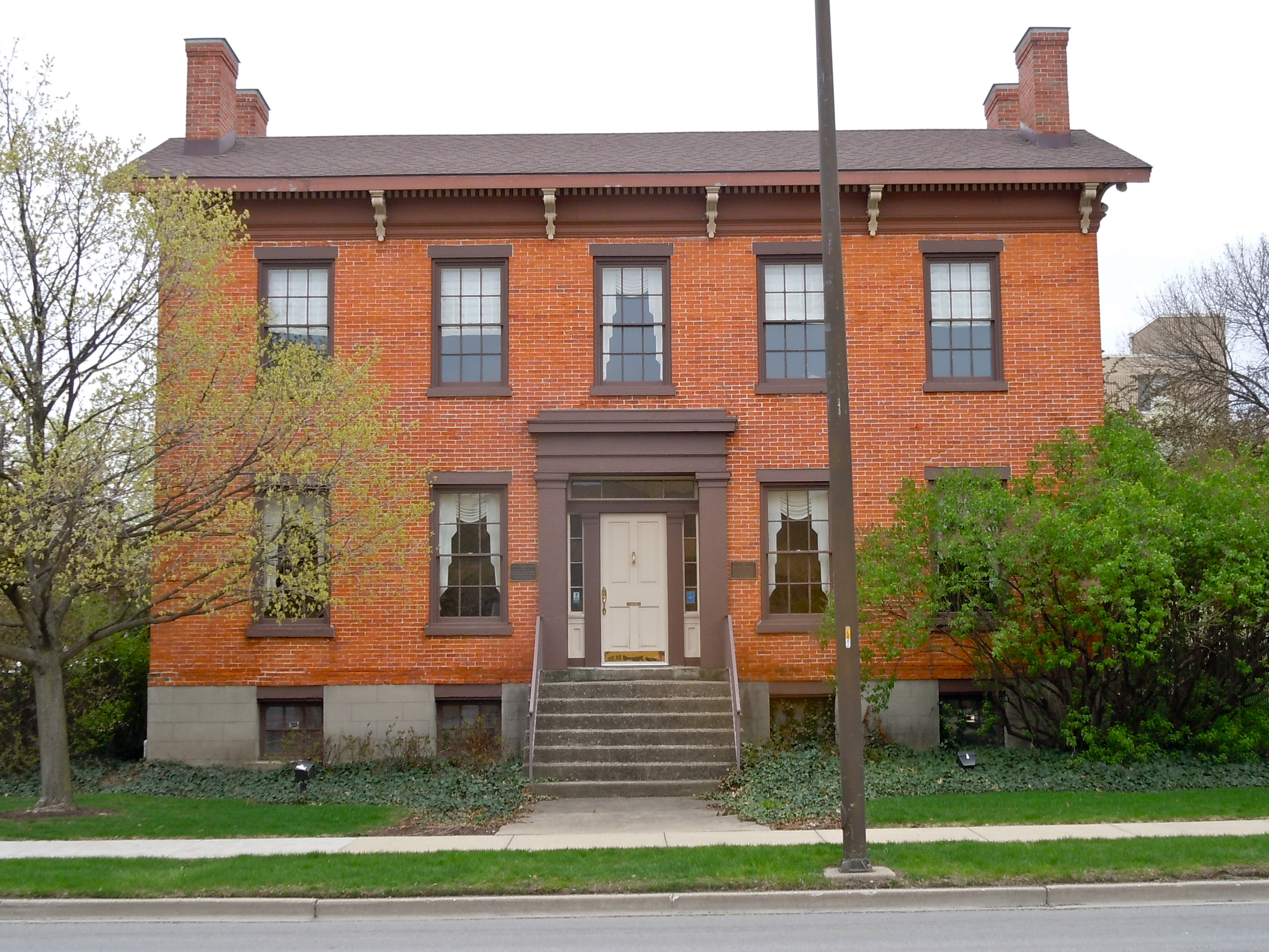
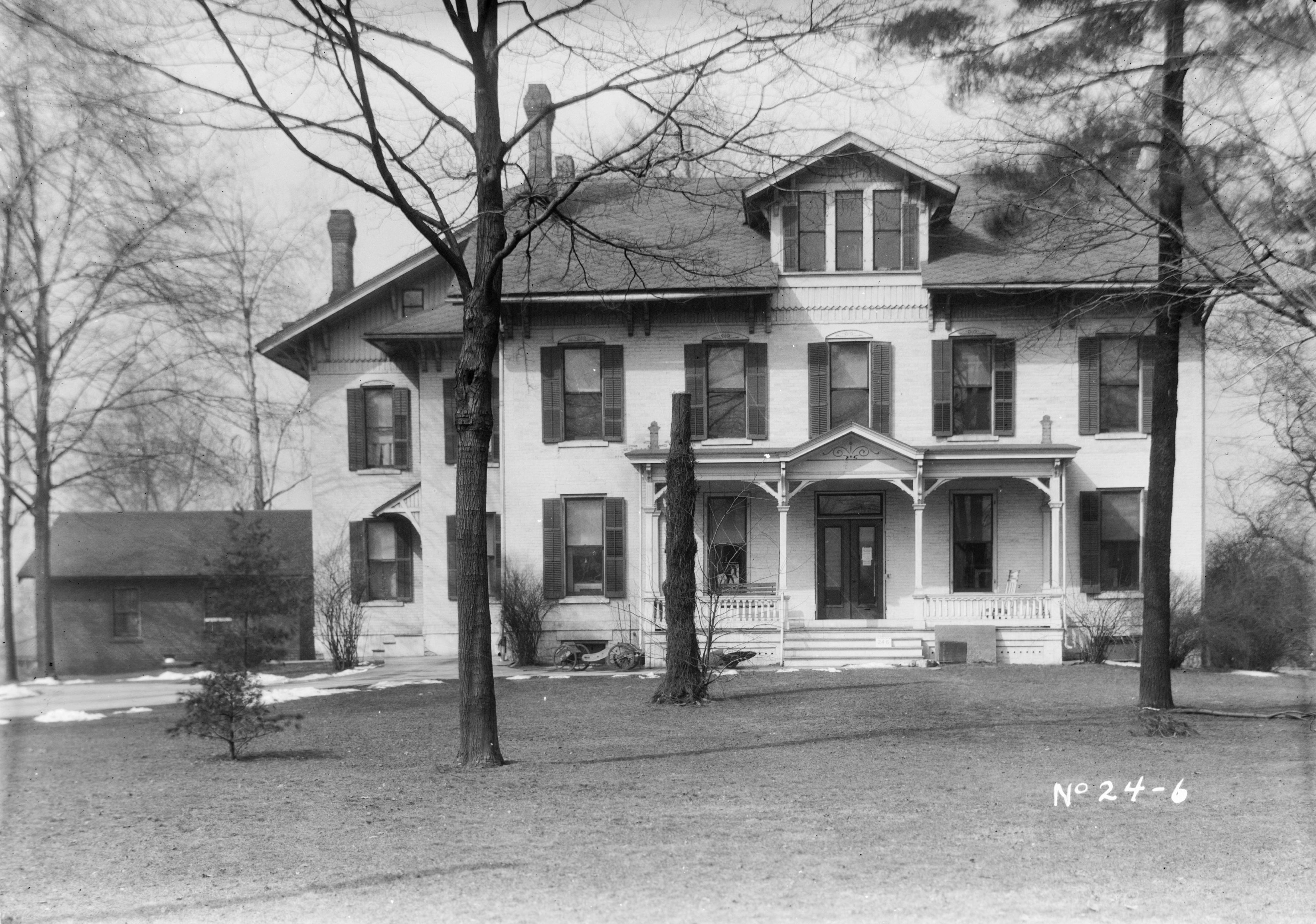
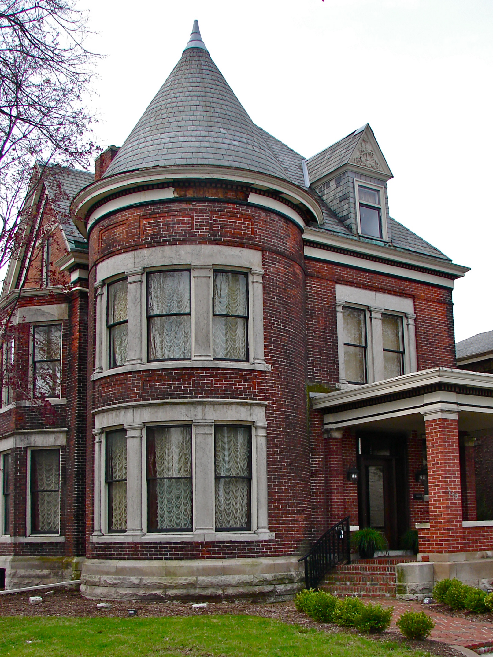
41°4′47″N 85°8′22″W / 41.07972°N 85.13944°WFort Wayne 2 John H. Bass Mansion June 2, 1982 2701 Spring St.
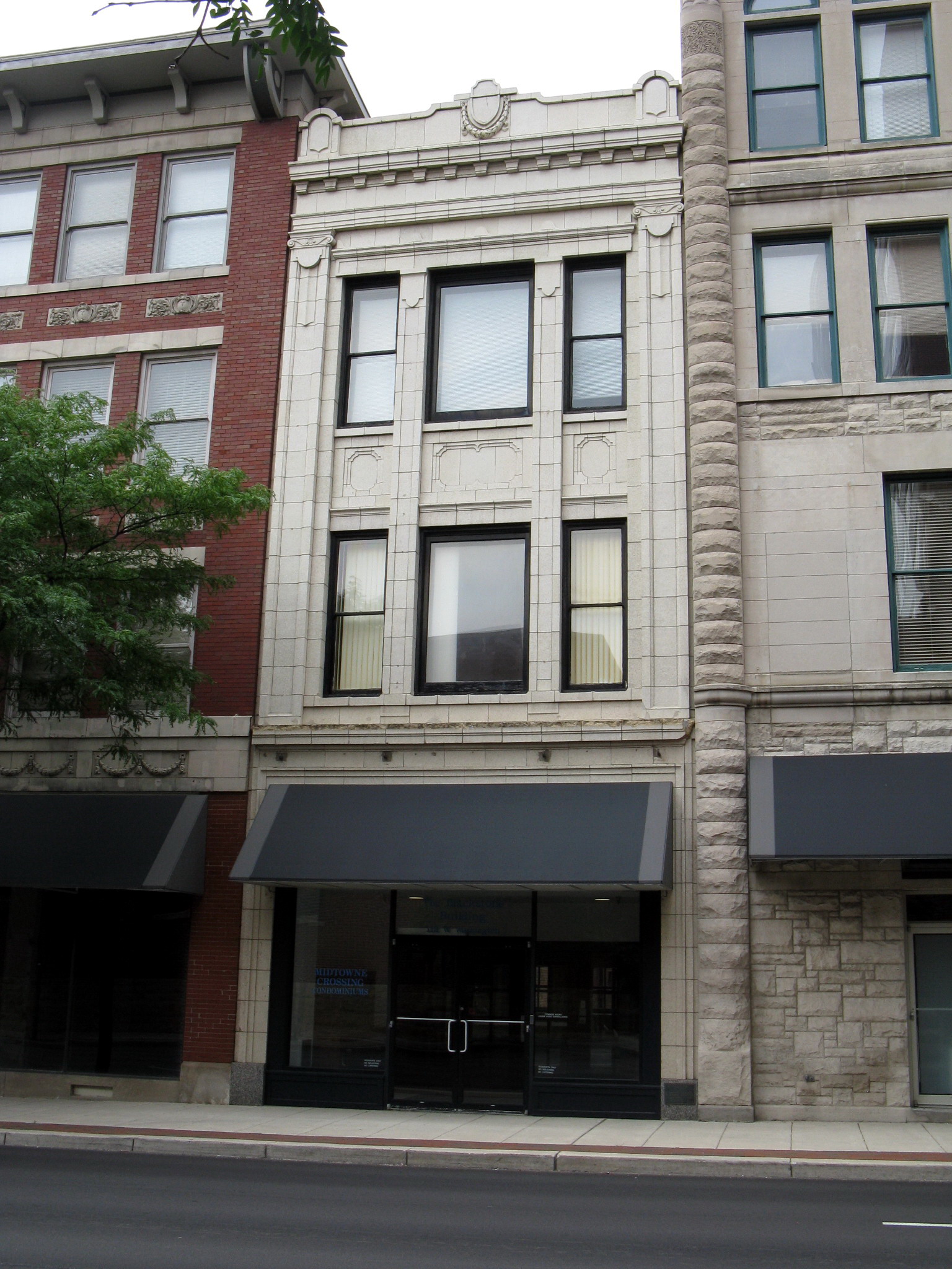
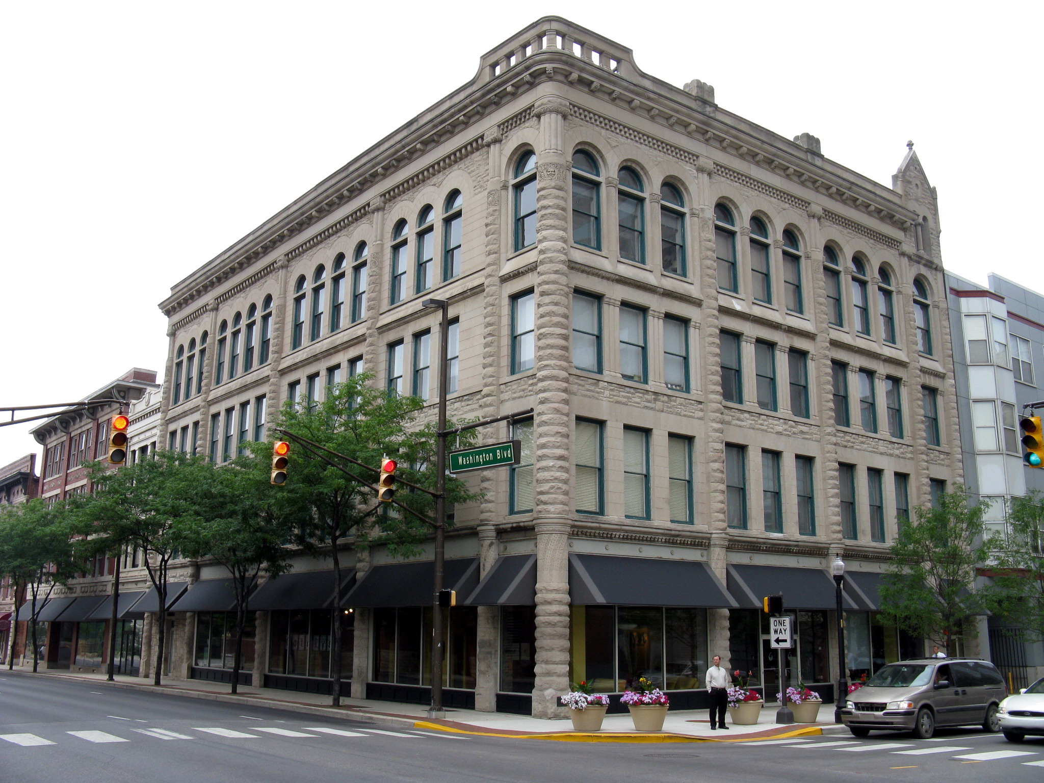
41°5′15″N 85°10′33″W / 41.0875°N 85.17583°WFort Wayne 3 Blackstone Building 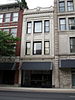
August 24, 1988 112 W. Washington
41°04′22″N 85°08′01″W / 41.072778°N 85.133611°WFort Wayne 4 Martin Blume Jr. Farm September 20, 2006 7311 Flutter Rd.
41°09′52″N 85°03′02″W / 41.164444°N 85.050556°WFort Wayne 5 Brookview-Irvington Park Historic District March 21, 2011 Roughly bounded by Norfolk Ave. to the north, Lima Rd., Spy Run Ave. Extended, and N. Clinton St. to the east, Jacobs St. to the south, and the former Penn Central right-of-way to the west
41°06′04″N 85°08′27″W / 41.101111°N 85.140833°WFort Wayne Park and Boulevard System of Fort Wayne, Indiana MPS 6 John Brown Stone Warehouse December 15, 1997 114 W. Superior St.
41°4′56″N 85°8′23″W / 41.08222°N 85.13972°WFort Wayne 7 Irene Byron Tuberculosis Sanatorium-Physicians' Residences December 6, 2004 12371 and 12407 Lima Rd.
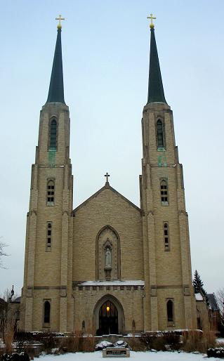
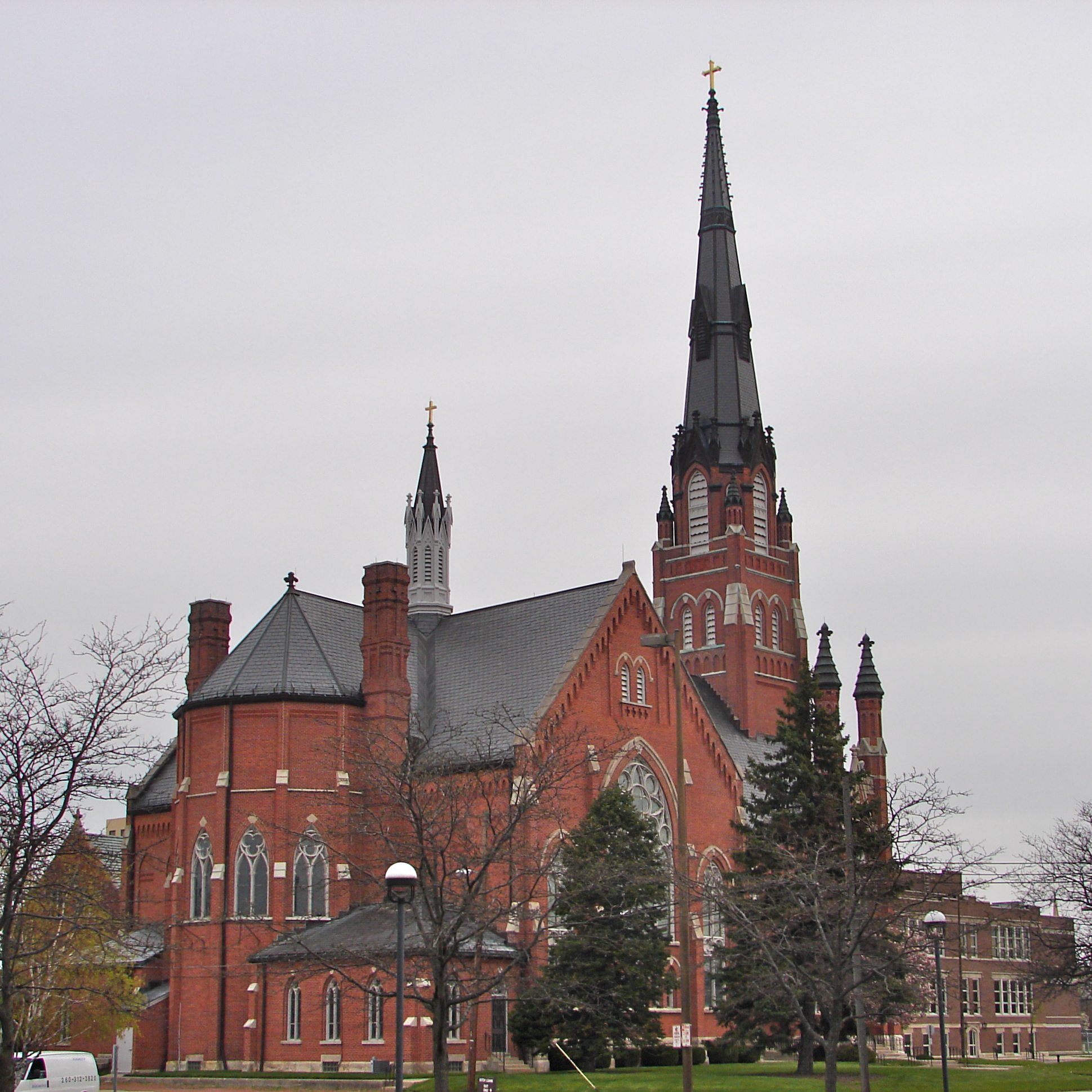
41°11′48″N 85°10′12″W / 41.196667°N 85.17°WFort Wayne 8 Cathedral of the Immaculate Conception 
October 23, 1980 Jefferson and Calhoun St.
41°04′33″N 85°08′16″W / 41.075833°N 85.137778°WFort Wayne 9 Craigville Depot October 10, 1984 Ryan and Edgerton Rds.
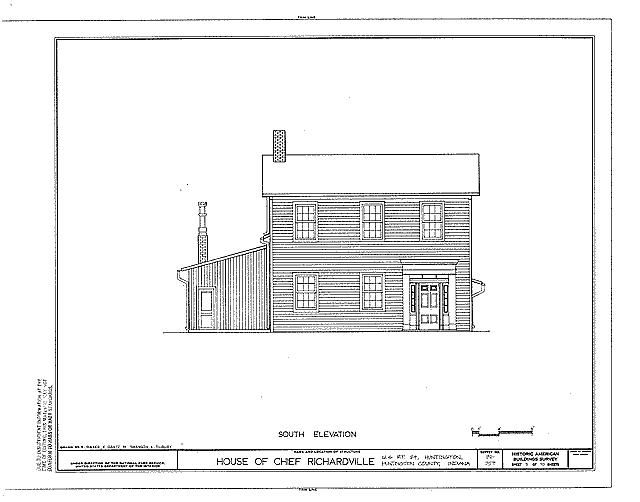
41°04′45″N 84°57′42″W / 41.079167°N 84.961667°WNew Haven 10 Chief Jean Baptiste de Richardville House 
June 27, 1997 5705 Bluffton Rd.
41°01′53″N 85°09′52″W / 41.031389°N 85.164444°WFort Wayne 11 Dutch Ridge Historic District September 14, 1995 17915 and 17819 Old Auburn Rd. and adjacent cemetery
41°15′04″N 85°05′48″W / 41.251111°N 85.096667°WHuntertown 12 William S. Edsall House 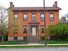
October 8, 1976 305 W. Main St.
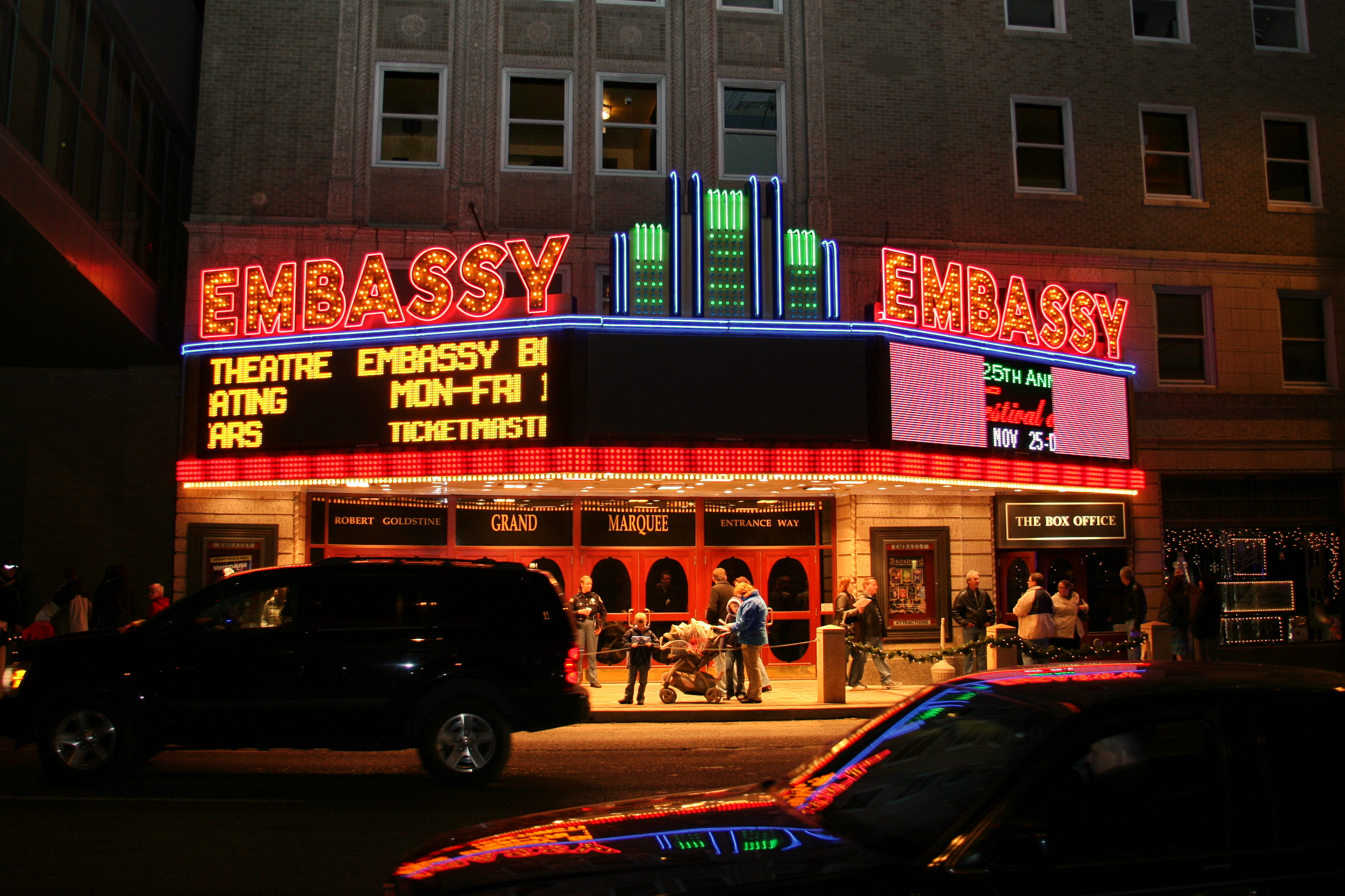
41°04′46″N 85°08′38″W / 41.079444°N 85.143889°WFort Wayne 13 Embassy Theater and Indiana Hotel 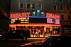
September 5, 1975 121 W. Jefferson St.
41°04′32″N 85°08′24″W / 41.075556°N 85.14°WFort Wayne 14 Engine House No. 3 July 27, 1979 226 W. Washington Boulevard
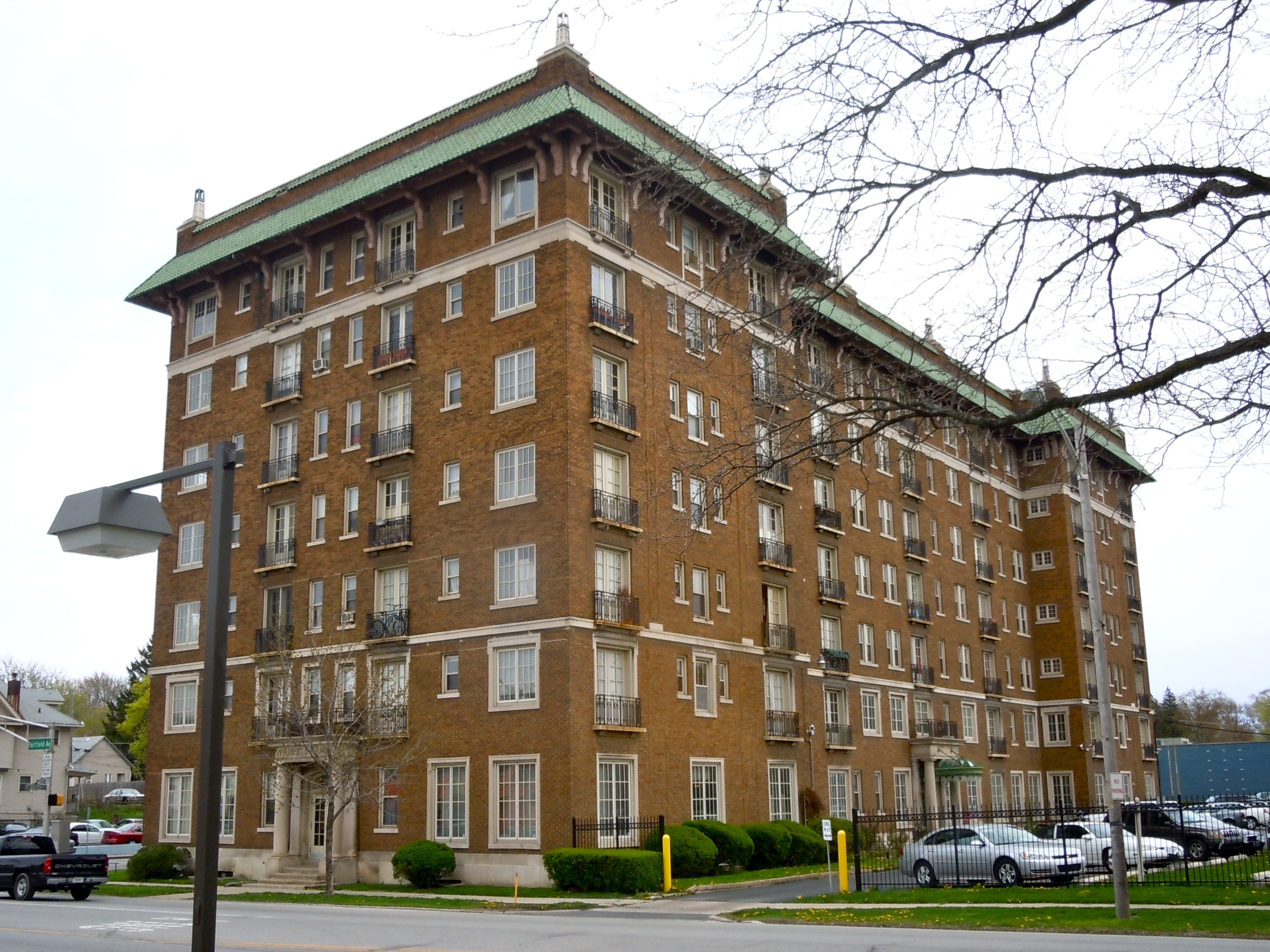
41°04′38″N 85°08′30″W / 41.077222°N 85.141667°WFort Wayne 15 Fairfield Manor 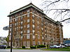
June 16, 1983 2301 Fairfield Ave.
41°03′50″N 85°08′41″W / 41.063889°N 85.144722°WFort Wayne 16 Robert M. Feustel House November 7, 1980 4101 W. Taylor St.
41°03′53″N 85°11′26″W / 41.064722°N 85.190556°WFort Wayne 17 Forest Park Boulevard Historic District March 30, 2007 Roughly bounded by Dodge Ave., the alley between Forest Park and Anthony Boulevards, Lake Ave., and the alley
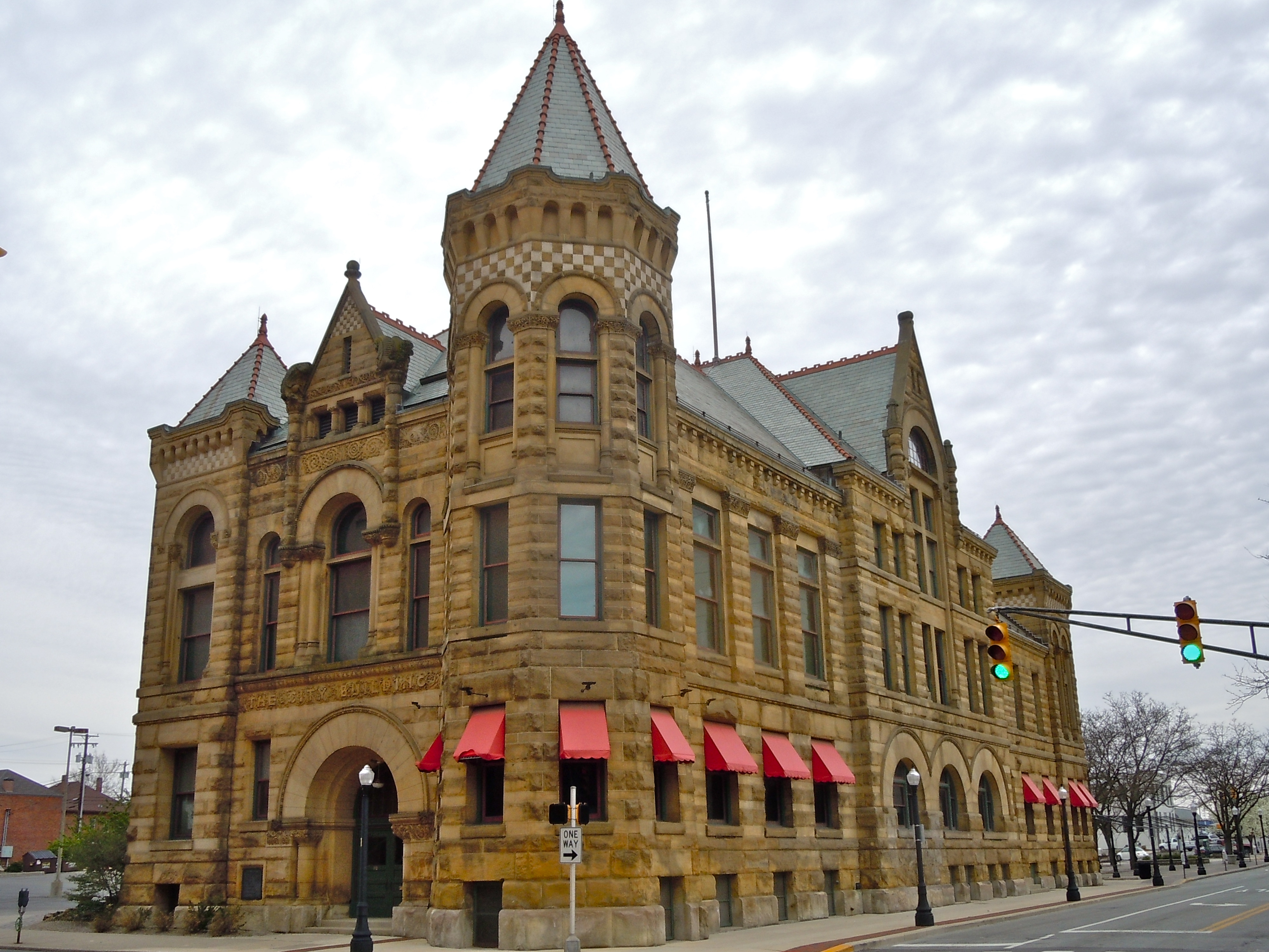
41°05′43″N 85°07′03″W / 41.0954°N 85.117464°WFort Wayne 18 Fort Wayne City Hall 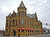
June 4, 1973 308 E. Berry St.
41°04′46″N 85°08′10″W / 41.079444°N 85.136111°WFort Wayne 19 Fort Wayne Park and Boulevard System Historic District December 28, 2010 Roughly including the following parks and adjacent rights-of-way: Franke, McCormick, McCulloch, McMillen, Memorial, Nuckols, Old Fort, Reservoir, Rockhill, Weisser, and Williams
41°03′51″N 85°05′26″W / 41.064167°N 85.090556°WFort Wayne Park and Boulevard System of Fort Wayne, Indiana MPS 20 Fort Wayne Printing Company Building 
August 24, 1988 114 W. Washington St.
41°04′38″N 85°08′23″W / 41.077222°N 85.139722°WFort Wayne 21 John and Dorothy Haynes House 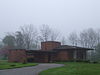
June 22, 2004 3901 N. Washington Rd.
41°4′14″N 85°11′27″W / 41.07056°N 85.19083°W[5]Fort Wayne 22 Illsley Place-West Rudisill Historic District April 20, 2006 Roughly bounded by Broadway, W. Rudisill Boulevard, Beaver Ave., and the alley north of Illsley Dr.
41°03′03″N 85°09′15″W / 41.050861°N 85.154167°WFort Wayne 23 Indian Village Historic District December 22, 2009 Roughly bounded by Nuttman Ave. on the north, Bluffton Rd. on the east, Eagle Rd. on the south, and the Norfolk Southern railway line on the west
41°02′54″N 85°10′21″W / 41.048381°N 85.172472°WFort Wayne 24 Johnny Appleseed Memorial Park January 17, 1973 Swanson Boulevard at Parnell Ave. along Old Feeder Canal
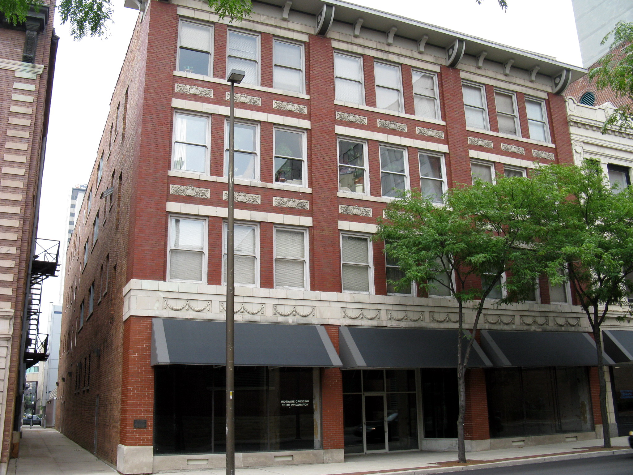
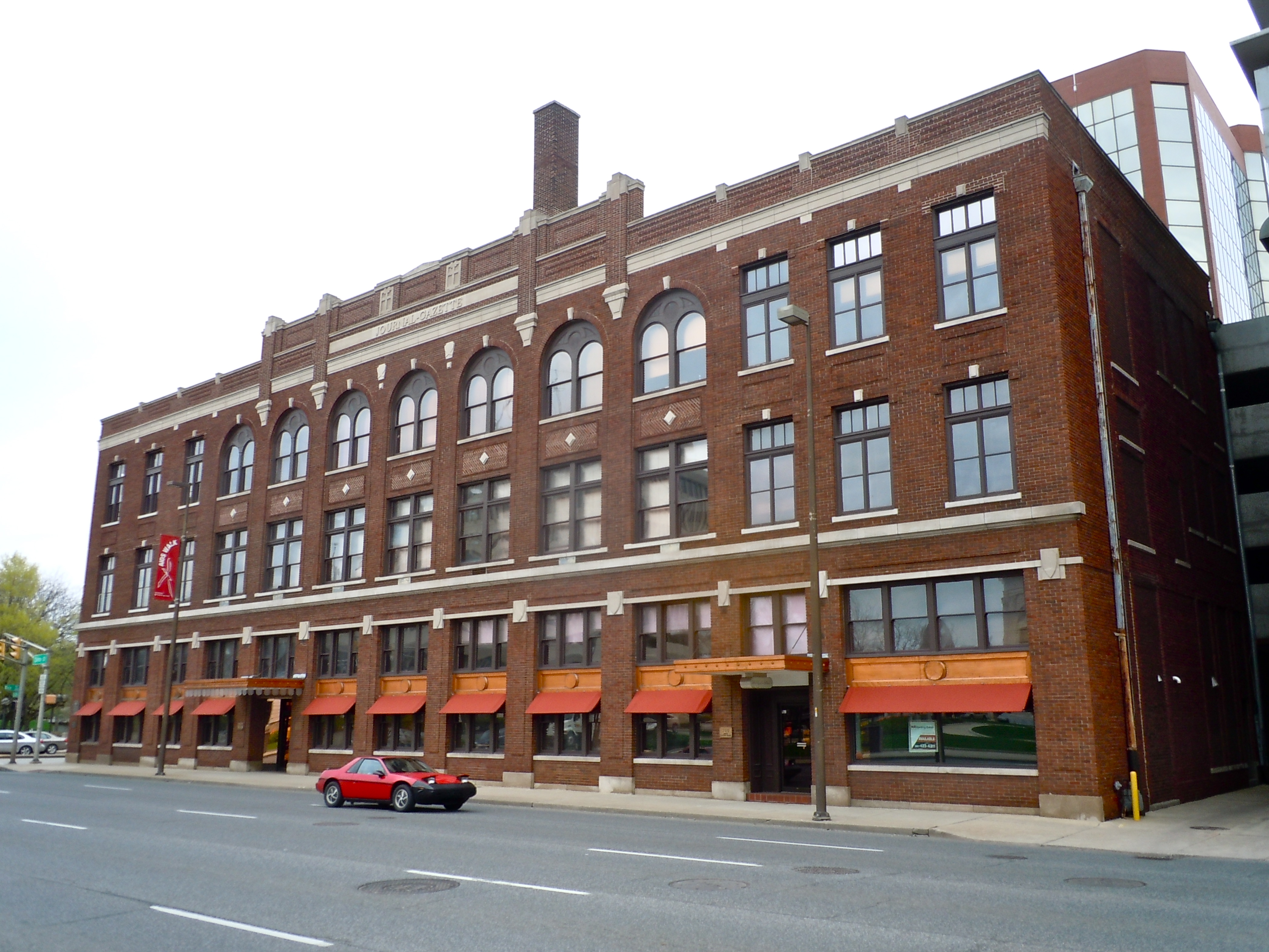
41°06′44″N 85°07′25″W / 41.112222°N 85.123611°WFort Wayne 25 Journal-Gazette Building 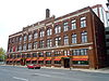
December 27, 1982 701 S. Clinton St.
41°04′49″N 85°08′17″W / 41.080278°N 85.138056°WFort Wayne 26 Harry A. Keplinger House September 1, 1983 235 W. Creighton Ave.
41°03′51″N 85°08′25″W / 41.064167°N 85.140278°WFort Wayne 27 Kresge-Groth Building 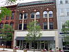
August 25, 1988 914 S. Calhoun St.
41°04′41″N 85°08′22″W / 41.078056°N 85.139444°WFort Wayne 28 The Landing Historic District 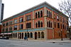
September 16, 1993 Roughly bounded by Calhoun, Harrison, Dock, and Pearl Sts., and the alley between Columbia and Main Sts.
41°04′52″N 85°08′29″W / 41.081111°N 85.141389°WFort Wayne 29 Lindenwood Cemetery February 17, 1978 2324 W. Main St.
41°04′47″N 85°10′32″W / 41.079722°N 85.175556°WFort Wayne 30 Masonic Temple 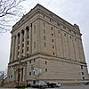
March 14, 1991 206 E. Washington Boulevard
41°04′39″N 85°08′55″W / 41.0775°N 85.148611°WFort Wayne 31 McColloch-Weatherhogg Double House 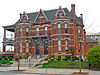
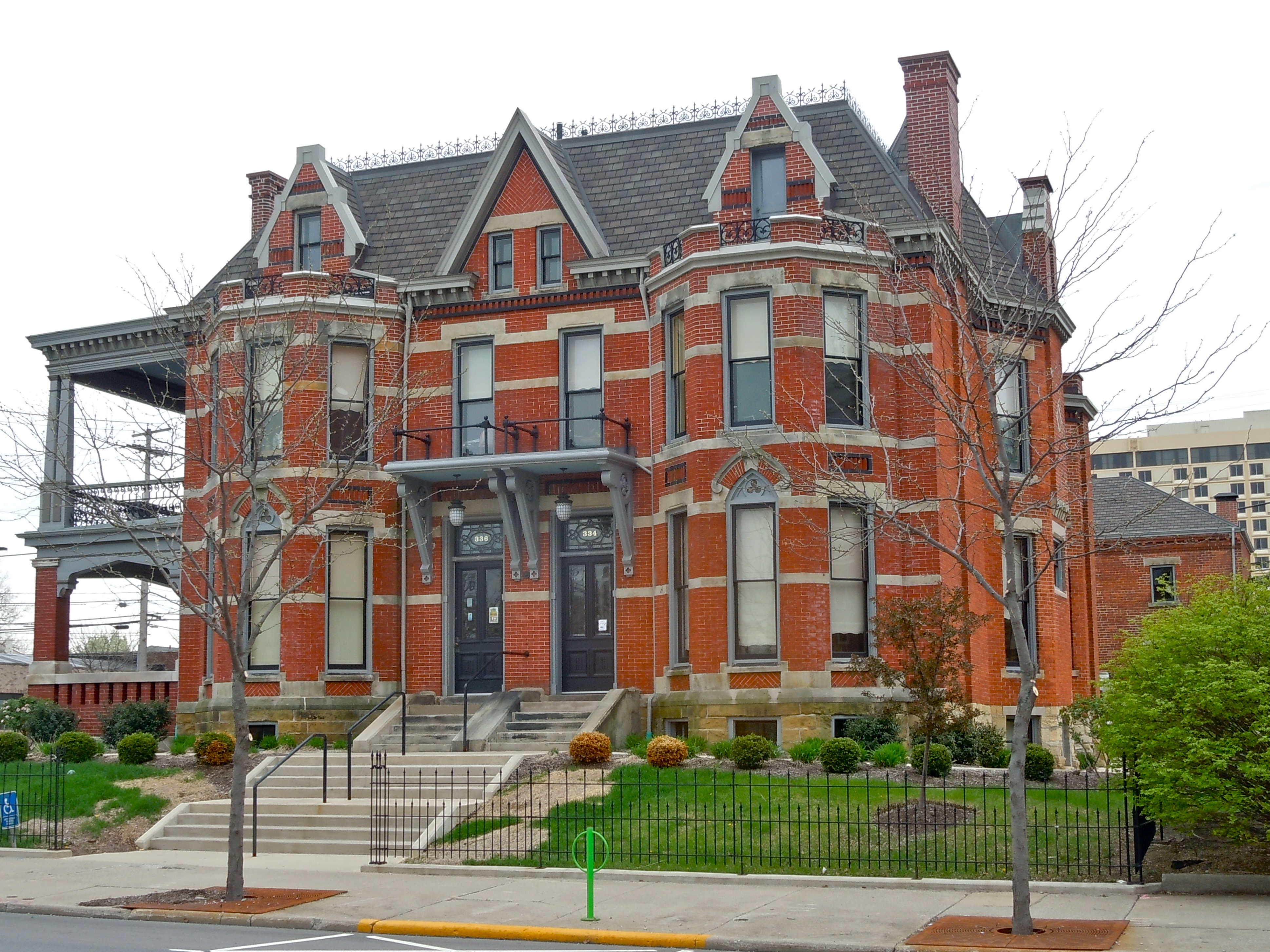
December 7, 2001 334-336 E. Berry St.
41°04′54″N 85°08′07″W / 41.081667°N 85.135278°WFort Wayne 32 Hugh McCulloch House October 23, 1980 616 W. Superior St.
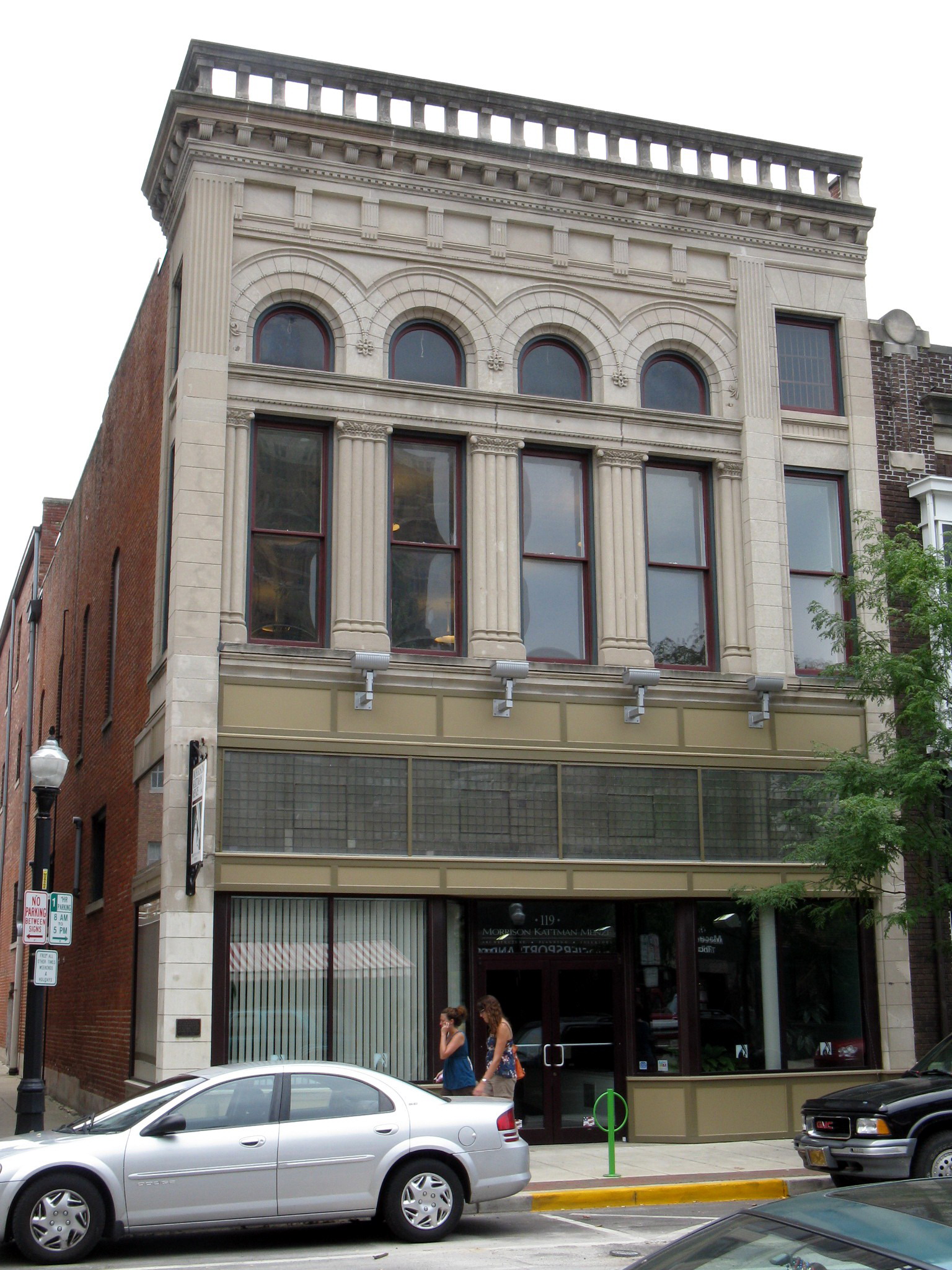
41°04′51″N 85°08′50″W / 41.080833°N 85.147222°WFort Wayne 33 Louis Mohr Block 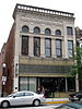
August 26, 1988 119 W. Wayne St.
41°04′41″N 85°08′24″W / 41.078056°N 85.14°WFort Wayne 34 New York Chicago and St. Louis Railroad Steam Locomotive No. 765 
September 12, 1996 15808 Edgerton Rd.
41°05′16″N 84°56′14″W / 41.087778°N 84.937222°WNew Haven 35 Oakdale Historic District September 22, 2000 Roughly along Oakdale Dr. from Harrison St. to Broadway
41°03′06″N 85°08′52″W / 41.051667°N 85.147778°WFort Wayne 36 Pennsylvania Railroad Station August 14, 1998 221 W. Baker St.
41°04′20″N 85°08′26″W / 41.072222°N 85.140556°WFort Wayne Also known as Baker Street Station 37 John Claus Peters House 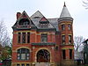
September 17, 1980 832 W. Wayne St.
41°04′36″N 85°09′03″W / 41.076667°N 85.150833°WFort Wayne 38 Randall Building 
December 7, 1990 616 and 618 S. Harrison St.
41°04′52″N 85°08′33″W / 41.081111°N 85.1425°WFort Wayne 39 Alexander Taylor Rankin House 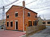
December 6, 2004 818 S. Lafayette St.
41°04′53″N 85°08′05″W / 41.081389°N 85.134722°WFort Wayne 40 Horney Robinson House March 21, 1985 7320 Lower Huntington Rd.
41°00′19″N 85°14′14″W / 41.005278°N 85.237222°WFort Wayne 41 St. Louis, Besancon, Historic District September 22, 1995 15529-15535 E. Lincoln Highway
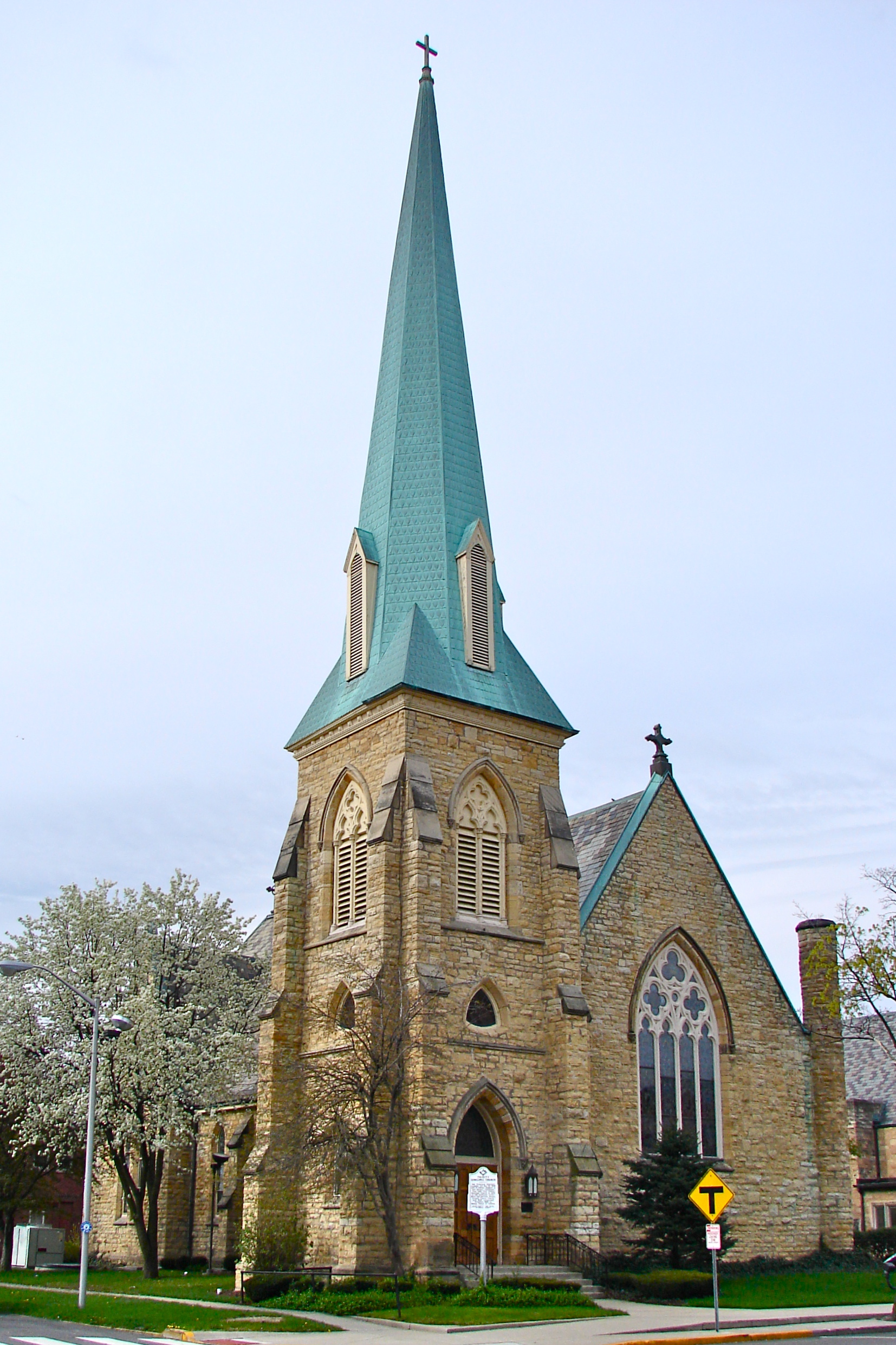
41°3′3″N 84°56′20″W / 41.05083°N 84.93889°WNew Haven 42 Saint Paul's Evangelical Lutheran Church 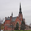
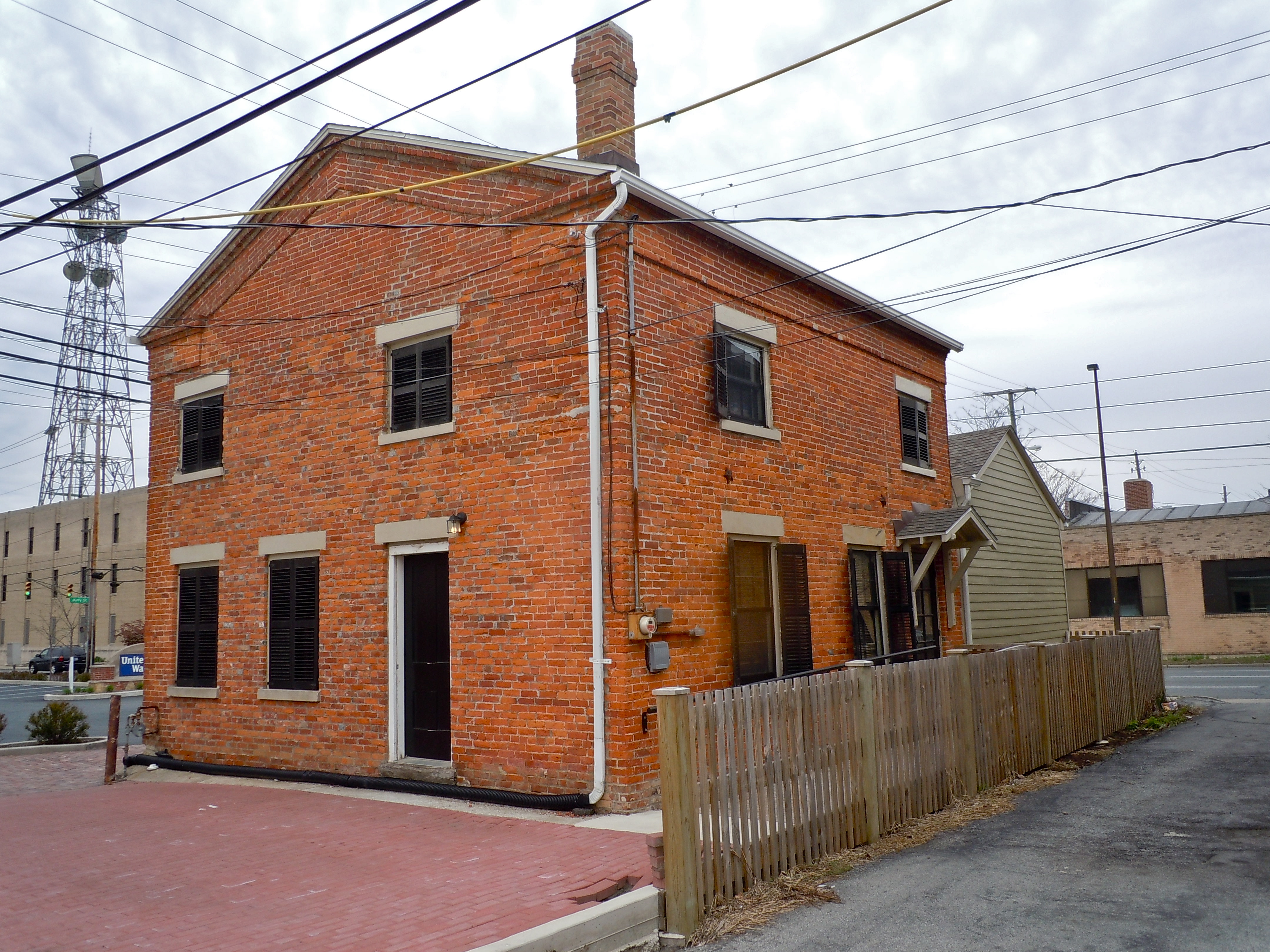
March 1, 1982 1126 S. Barr St.
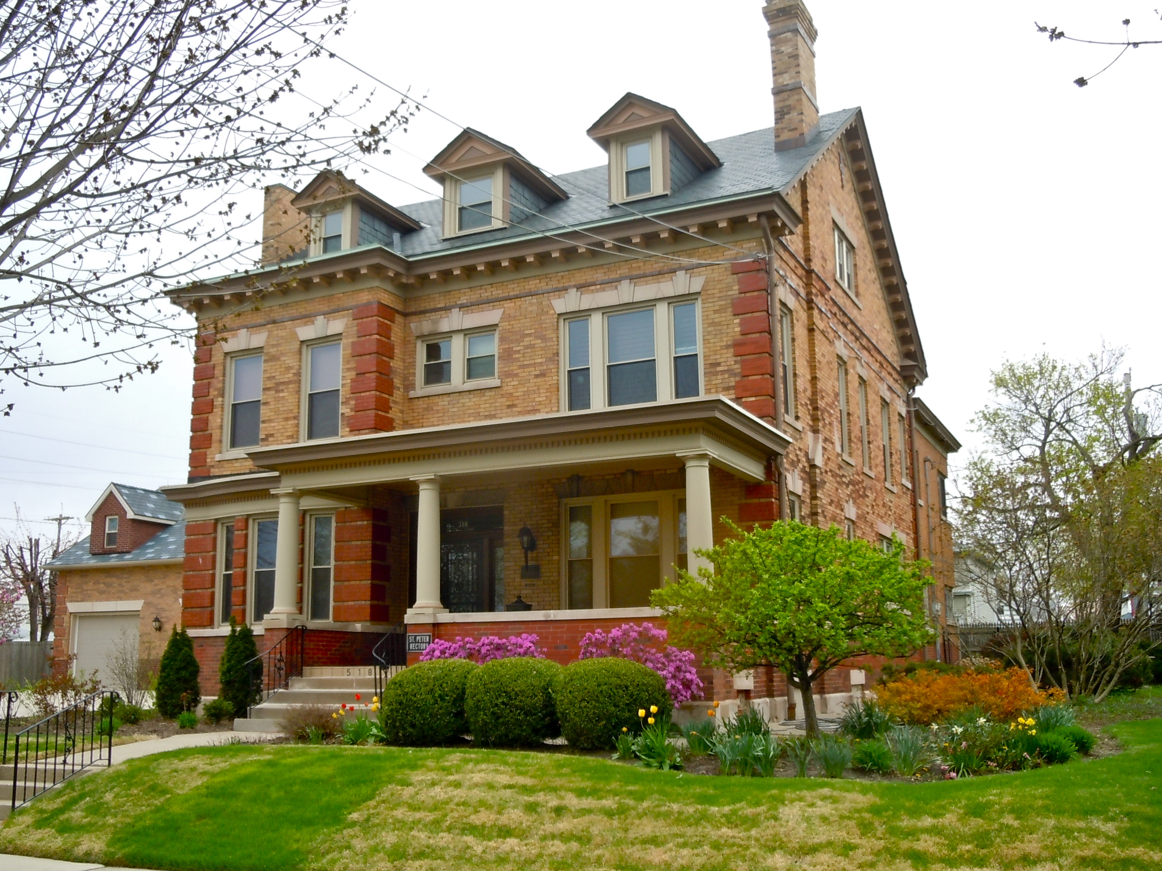
41°04′32″N 85°08′08″W / 41.075556°N 85.135556°WFort Wayne 43 St. Peter's Square 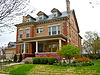
March 20, 1991 Roughly bounded by St. Martin, Hanna, E. Dewald, and Warsaw Sts., including 518 E. Dewald St.
41°3′56″N 85°7′46″W / 41.06556°N 85.12944°WFort Wayne 44 St. Vincent Villa Historic District June 10, 1994 2000 N. Wells St.
41°05′34″N 85°08′36″W / 41.092778°N 85.143333°WFort Wayne 45 Schmitz Block 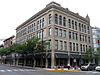
August 26, 1988 926-930 S. Calhoun St.
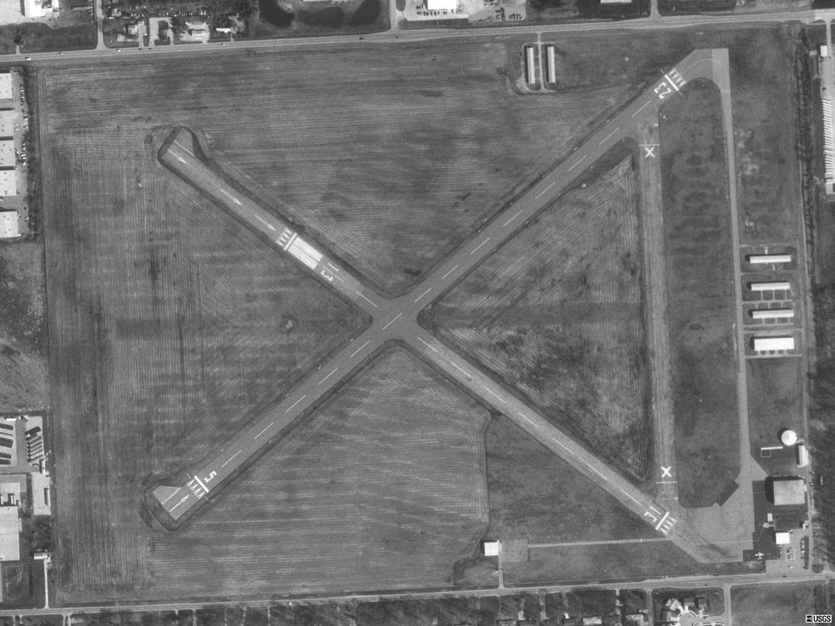
41°04′39″N 85°08′21″W / 41.0775°N 85.139167°WFort Wayne 46 Smith Field 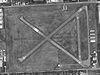
March 26, 2003 426 W. Ludwig Rd.
41°08′36″N 85°09′10″W / 41.143333°N 85.152778°WFort Wayne 47 South Wayne Historic District September 4, 1992 Roughly bounded by W. Wildwood Ave., S. Wayne Ave., Packard Ave., and Beaver Ave.
41°03′22″N 85°08′59″W / 41.056111°N 85.149722°WFort Wayne 48 Southwood Park Historic District December 22, 2009 Bounded by W. Pettit Ave., Stratford Rd., W. Sherwood Terrace, Hartman Rd., Lexington Ave., and Indiana Ave.
41°02′31″N 85°08′57″W / 41.042072°N 85.149233°WFort Wayne 49 Christian G. Strunz House October 4, 1979 333 E. Berry St.
41°04′49″N 85°08′07″W / 41.080278°N 85.135278°WFort Wayne 50 Thomas W. Swinney House 
April 27, 1981 1424 W. Jefferson St.
41°04′24″N 85°09′27″W / 41.073333°N 85.1575°WFort Wayne 51 Trinity Episcopal Church 
September 13, 1978 611 W. Berry St.
41°04′40″N 85°08′52″W / 41.077778°N 85.147778°WFort Wayne 52 US Post Office and Courthouse 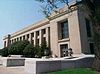
March 15, 2006 1300 W. Harrison St.
41°04′26″N 85°08′26″W / 41.073889°N 85.140556°WFort Wayne 53 Vermilyea Inn Historic District December 6, 2005 13501 Redding Dr.
41°00′45″N 85°19′11″W / 41.0125°N 85.319722°WFort Wayne 54 Wabash Railroad Depot March 26, 2003 530 State St.
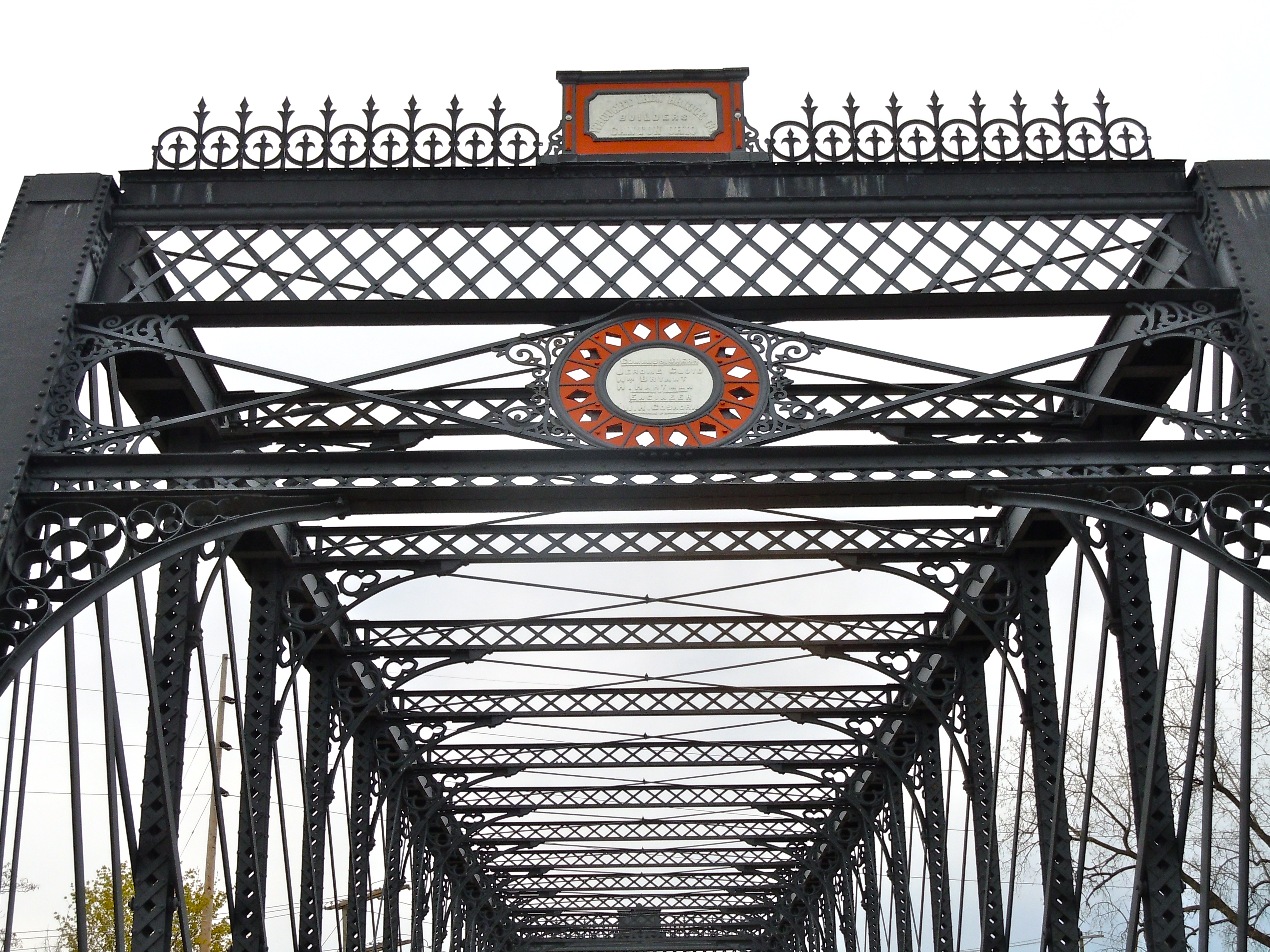
41°04′18″N 85°01′20″W / 41.071667°N 85.022222°WNew Haven 55 Wells Street Bridge 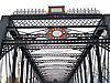
September 15, 1988 Wells St. at the St. Marys River
41°05′13″N 85°08′27″W / 41.086944°N 85.140833°WFort Wayne 56 West End Historic District 
November 15, 1984 Roughly bounded by Main, Webster, Jefferson, Broadway, Jones, and the St. Marys River
41°04′32″N 85°08′59″W / 41.075556°N 85.149722°WFort Wayne 57 Fisher West Farm June 6, 1985 17935 West Rd.
41°15′06″N 85°09′13″W / 41.251667°N 85.153611°WHuntertown 58 Williams-Woodland Park Historic District 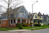
March 14, 1991 Roughly bounded by Hoagland and Creighton Aves. and Harrison and Pontiac Sts.
41°03′45″N 85°08′28″W / 41.0625°N 85.141111°WFort Wayne See also
- List of National Historic Landmarks in Indiana
- National Register of Historic Places listings in Indiana
References
- ^ The latitude and longitude information provided in this table was derived originally from the National Register Information System, which has been found to be fairly accurate for about 99% of listings. For about 1% of NRIS original coordinates, experience has shown that one or both coordinates are typos or otherwise extremely far off; some corrections may have been made. A more subtle problem causes many locations to be off by up to 150 yards, depending on location in the country: most NRIS coordinates were derived from tracing out latitude and longitudes off of USGS topographical quadrant maps created under North American Datum of 1927, which differs from the current, highly accurate GPS system used by Google maps. Chicago is about right, but NRIS longitudes in Washington are higher by about 4.5 seconds, and are lower by about 2.0 seconds in Maine. Latitudes differ by about 1.0 second in Florida. Some locations in this table may have been corrected to current GPS standards.
- ^ "National Register of Historic Places: Weekly List Actions". National Park Service, United States Department of the Interior. Retrieved on November 10, 2011.
- ^ Numbers represent an ordering by significant words. Various colorings, defined here, differentiate National Historic Landmark sites and National Register of Historic Places Districts from other NRHP buildings, structures, sites or objects.
- ^ "National Register Information System". National Register of Historic Places. National Park Service. . http://nrhp.focus.nps.gov/natreg/docs/All_Data.html.
- ^ Location derived from page 3 of the minutes of the April 2004 meeting of the Indiana Historic Preservation Review Board; the NRIS lists the site as "Address Restricted".
U.S. National Register of Historic Places Topics Lists by states Alabama • Alaska • Arizona • Arkansas • California • Colorado • Connecticut • Delaware • Florida • Georgia • Hawaii • Idaho • Illinois • Indiana • Iowa • Kansas • Kentucky • Louisiana • Maine • Maryland • Massachusetts • Michigan • Minnesota • Mississippi • Missouri • Montana • Nebraska • Nevada • New Hampshire • New Jersey • New Mexico • New York • North Carolina • North Dakota • Ohio • Oklahoma • Oregon • Pennsylvania • Rhode Island • South Carolina • South Dakota • Tennessee • Texas • Utah • Vermont • Virginia • Washington • West Virginia • Wisconsin • WyomingLists by territories Lists by associated states Other  Category:National Register of Historic Places •
  Portal:National Register of Historic Places
Municipalities and communities of Allen County, Indiana County seat: Fort Wayne Cities 
Towns Grabill | Huntertown | Leo-Cedarville | Monroeville | Zanesville‡
Townships Aboite | Adams | Cedar Creek | Eel River | Jackson | Jefferson | Lafayette | Lake | Madison | Marion | Maumee | Milan | Monroe | Perry | Pleasant | Saint Joseph | Scipio | Springfield | Washington | Wayne
Unincorporated
communitiesAboite | Arcola | Ari | Boston Corner | Cedar Canyons | Cedar Shores | Cuba | Dunn Mill | East Liberty | Edgerton | Five Points | Four Presidents Corners | Halls Corners | Harlan | Hessen Cassel | Hoagland | Lake Everett | Maples | Milan Center | Poe | Sunnymede Woods | Tillman | Timbercrest | Townley | Yoder | Zulu
Footnotes ‡This populated place also has portions in an adjacent county or counties
Categories:- National Register of Historic Places in Allen County, Indiana
- National Register of Historic Places in Indiana by county
-


Wikimedia Foundation. 2010.