- National Register of Historic Places listings in Alleghany County, Virginia
-
This list includes properties and districts listed on the National Register of Historic Places in Alleghany County, Virginia. Click the "Map of all coordinates" link to the right to view a Google map of all properties and districts with latitude and longitude coordinates in the table below.[1]
-
- This National Park Service list is complete through NPS recent listings posted November 10, 2011.[2]
[3] Landmark name [4] Image Date listed Location City or town Summary 1 Clifton Forge Commercial Historic District January 28, 1992 Roughly, E. Ridgeway St. from Roxbury St. to Main St. and Main from Commercial Ave. to Railroad St.
37°48′58″N 79°49′31″W / 37.816111°N 79.825278°WClifton Forge 2 Clifton Furnace August 16, 1977 Southeast of Clifton Forge off U.S. 220
37°48′34″N 79°47′50″W / 37.809444°N 79.797222°WClifton Forge 3 Douthat State Park Historic District September 20, 1986 VA 629
37°53′13″N 79°48′36″W / 37.886944°N 79.81°WMillboro 4 Fudge House April 29, 1993 620 Parklin Dr.
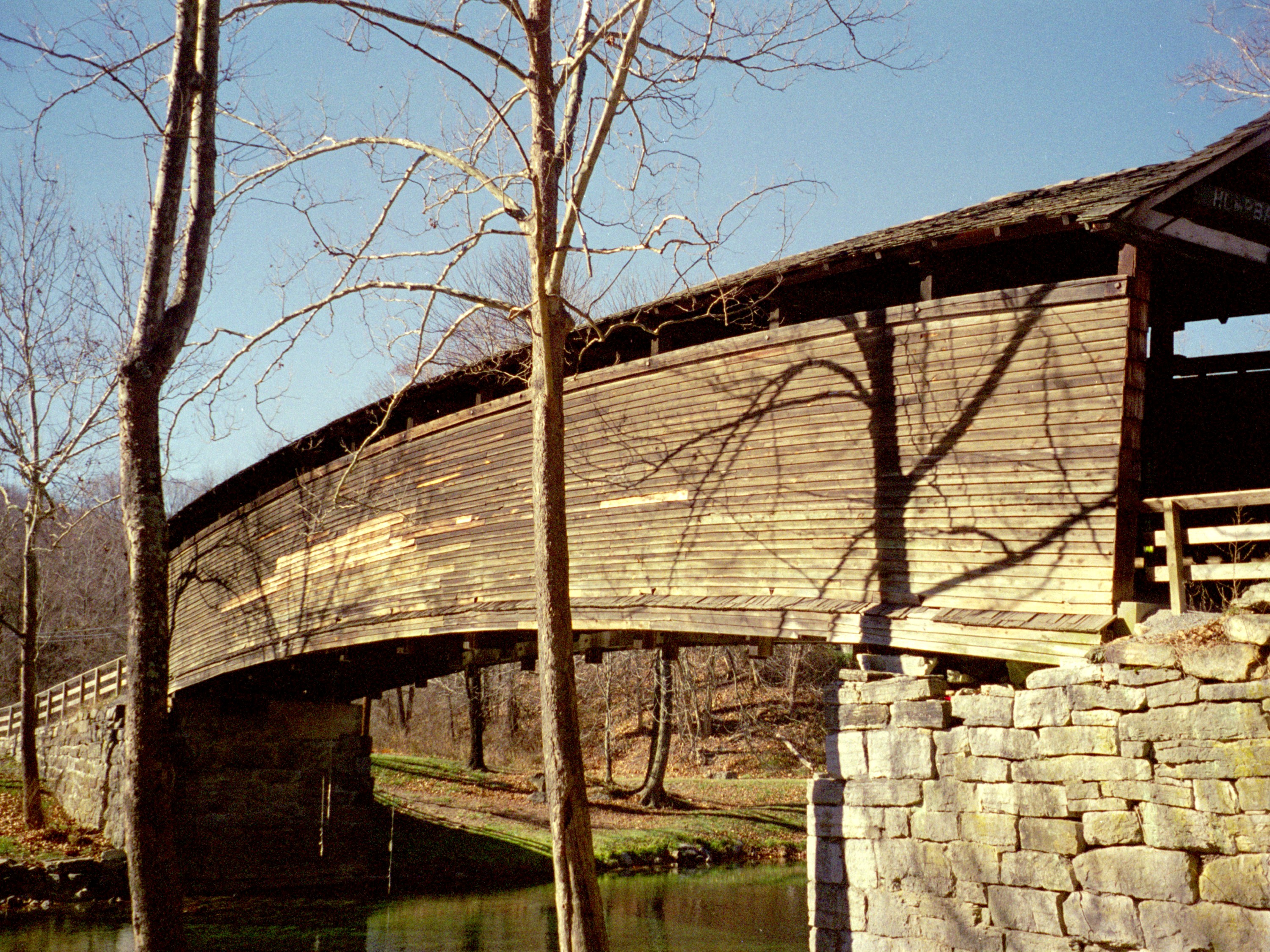
37°46′42″N 79°59′35″W / 37.778333°N 79.993056°WCovington 5 Humpback Bridge 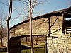
October 1, 1969 Over Dunlop Creek, southwest of junction of U.S. 60 and CR 651
37°47′50″N 80°02′48″W / 37.797222°N 80.046667°WCallaghan 6 Jefferson School December 27, 2010 A Street
37°48′57″N 79°49′8″W / 37.81583°N 79.81889°W[5]Clifton Forge 7 Longdale Furnace Historic District August 3, 1995 Roughly, along Longdale Furnace Rd., Iron Ore Ln., Church Rd. and Conner Ln.
37°48′33″N 79°41′04″W / 37.809167°N 79.684444°WClifton Forge 8 Luke Mountain Historic District June 26, 1998 Luke Mountain Rd.
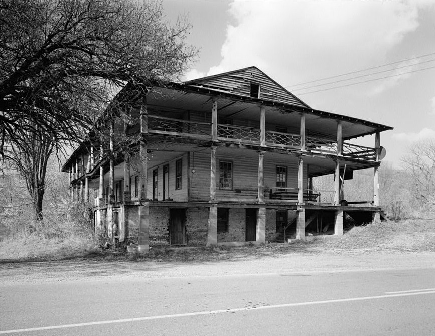
37°47′36″N 80°00′18″W / 37.793333°N 80.005°WCovington 9 Massie House July 8, 1982 US 220
37°52′41″N 79°55′15″W / 37.878056°N 79.920833°WFalling Spring 10 Oakland Grove Presbyterian Church July 8, 1982 VA 696
37°48′06″N 79°51′37″W / 37.801667°N 79.860278°WSelma 11 Persinger House July 8, 1982 VA 788
37°43′04″N 80°03′34″W / 37.717778°N 80.059444°WCovington 12 Rosedale Historic District June 26, 1998 Roughly bounded by US 60, Jackson River. and Luke's Mountain
37°47′40″N 79°59′59″W / 37.794444°N 79.999722°WCovington 13 Sweet Chalybeate Springs 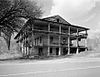
January 21, 1974 South of Earlhurst on VA 311
37°38′38″N 80°14′32″W / 37.643889°N 80.242222°WSweet Chalybeate 14 Wood Hall July 26, 1982 VA 600
37°48′58″N 80°04′21″W / 37.816111°N 80.0725°WCallaghan See also
- National Register of Historic Places listings in Virginia
- List of National Historic Landmarks in Virginia
References
- ^ The latitude and longitude information provided in this table was derived originally from the National Register Information System, which has been found to be fairly accurate for about 99% of listings. For about 1% of NRIS original coordinates, experience has shown that one or both coordinates are typos or otherwise extremely far off; some corrections may have been made. A more subtle problem causes many locations to be off by up to 150 yards, depending on location in the country: most NRIS coordinates were derived from tracing out latitude and longitudes off of USGS topographical quadrant maps created under the North American Datum of 1927, which differs from the current, highly accurate WGS84 GPS system used by Google maps. Chicago is about right, but NRIS longitudes in Washington are higher by about 4.5 seconds, and are lower by about 2.0 seconds in Maine. Latitudes differ by about 1.0 second in Florida. Some locations in this table may have been corrected to current GPS standards.
- ^ "National Register of Historic Places: Weekly List Actions". National Park Service, United States Department of the Interior. Retrieved on November 10, 2011.
- ^ Numbers represent an ordering by significant words. Various colorings, defined here, differentiate National Historic Landmark sites and National Register of Historic Places Districts from other NRHP buildings, structures, sites or objects.
- ^ "National Register Information System". National Register of Historic Places. National Park Service. . http://nrhp.focus.nps.gov/natreg/docs/All_Data.html.
- ^ Geocode coordinates determined from NRHP nomination form.
U.S. National Register of Historic Places Topics Lists by states Alabama • Alaska • Arizona • Arkansas • California • Colorado • Connecticut • Delaware • Florida • Georgia • Hawaii • Idaho • Illinois • Indiana • Iowa • Kansas • Kentucky • Louisiana • Maine • Maryland • Massachusetts • Michigan • Minnesota • Mississippi • Missouri • Montana • Nebraska • Nevada • New Hampshire • New Jersey • New Mexico • New York • North Carolina • North Dakota • Ohio • Oklahoma • Oregon • Pennsylvania • Rhode Island • South Carolina • South Dakota • Tennessee • Texas • Utah • Vermont • Virginia • Washington • West Virginia • Wisconsin • WyomingLists by territories Lists by associated states Other Municipalities and communities of Alleghany County, Virginia Towns 
CDPs Unincorporated
communitiesAlleghany | Backbone | Boiling Spring | Clearwater Park | Clifdale | Cliftondale Park | Crows | Earlehurst | Fairview Heights | Falling Spring | Griffith | Harrington | Hematite | Hooks Mill | Intervale | Iron Hill Springs | Jordan Mines | Kincaid | Longdale | Longdale Furnace | Mallow | Moss Run | Nicelytown | Oakwood Forest | Potts Creek | Rayon Terrace | Rich Patch | Rich Patch Mines | Stonewall | Sweet Chalybeate | Valley View | Westwood Place
Categories:- Alleghany County, Virginia
- National Register of Historic Places in Virginia
- Virginia-related lists
-

Wikimedia Foundation. 2010.