- National Register of Historic Places listings in Alamance County, North Carolina
-
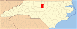
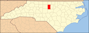
This list includes properties and districts listed on the National Register of Historic Places in Alamance County, North Carolina. Click the "Map of all coordinates" link to the right to view a Google map of all properties and districts with latitude and longitude coordinates in the table below.[1]
-
- This National Park Service list is complete through NPS recent listings posted November 10, 2011.[2]
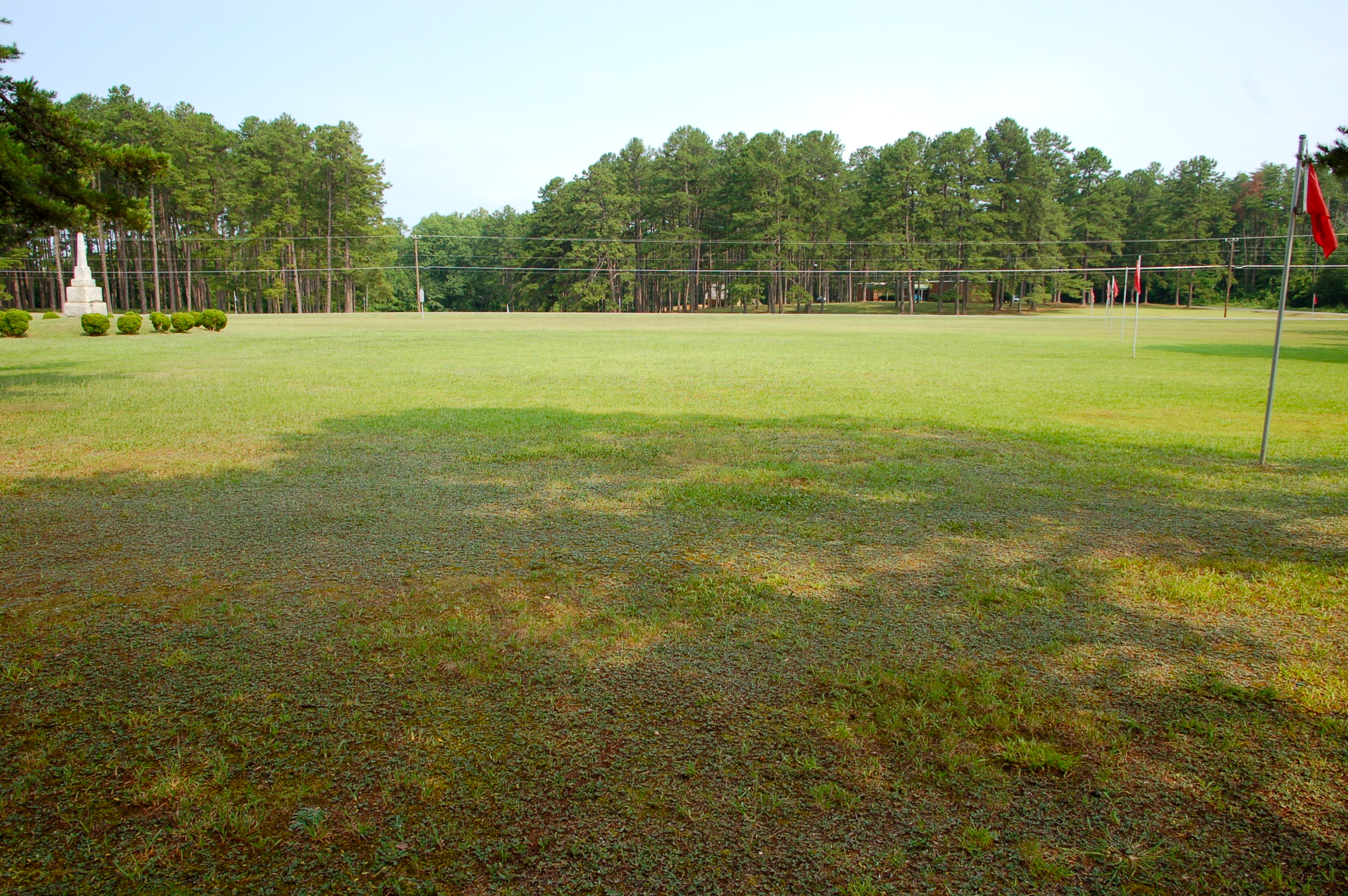
[3] Landmark name [4] Image Date listed Location City or town Summary 1 Alamance Battleground State Historic Site 
February 26, 1970 SW of Burlington on Rte. 1, off NC 62, near jct. with Rte. 1129
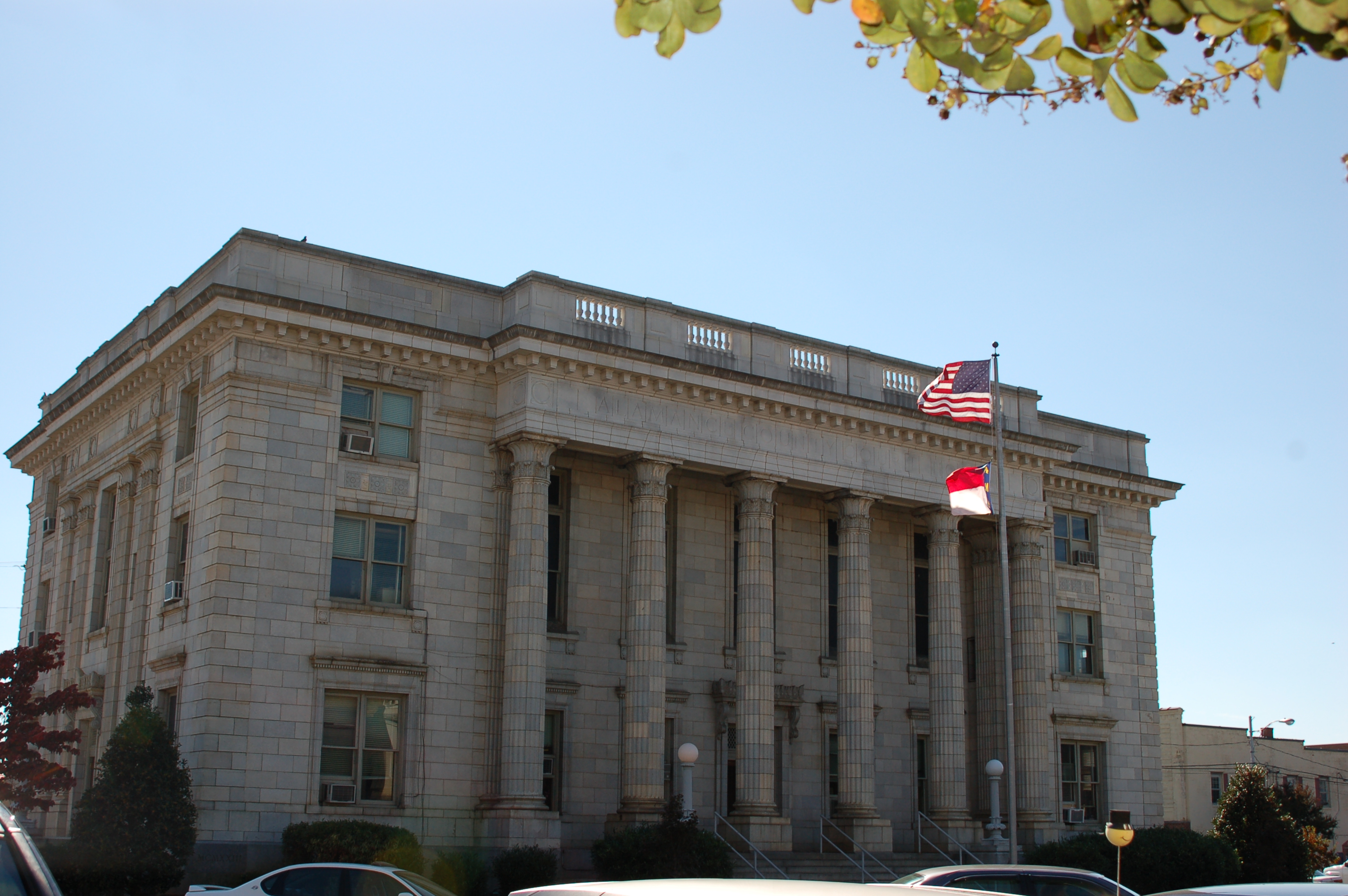
36°00′27″N 79°31′12″W / 36.0075°N 79.52°WAlamance 2 Alamance County Courthouse 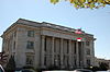
May 10, 1979 Courthouse Square
36°04′09″N 79°24′02″W / 36.069167°N 79.400556°WGraham 3 Alamance Hotel May 31, 1984 Maple Ave. and S. Main St.
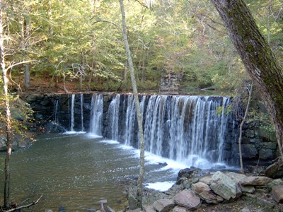
36°05′35″N 79°26′24″W / 36.093056°N 79.44°WBurlington 4 Alamance Mill Village Historic District August 16, 2007 3927-3981 NC 62 S, Great Alamance Creek W of NC 62S
36°02′22″N 79°29′14″W / 36.039531°N 79.487294°WAlamance 5 Allen House February 26, 1970 SW of Burlington on Rte. 1, off SC 62
36°00′33″N 79°31′16″W / 36.009167°N 79.521111°WBurlington 6 Altamahaw Mill Office November 20, 1984 SR 1002 and SR 1567
36°11′02″N 79°30′27″W / 36.183889°N 79.5075°WAltamahaw 7 Atlantic Bank and Trust Company Building May 31, 1984 358 S. Main St.
36°05′36″N 79°26′15″W / 36.093333°N 79.4375°WBurlington 8 Bellemont Mill Village Historic District July 1, 1987 E and W side of NC 49, S of jct. with Great Alamance Creek
36°01′33″N 79°26′34″W / 36.025833°N 79.442778°WBellemont 9 Beverly Hills Historic District August 5, 2009 Portion of 14 blocks on N. Main St., Rolling Rd., Highland Ave., Virginia Ave., N. Ireland St., N. St. John St. Burlington 10 Hiram Braxton House November 22, 1993 3440 Newlin Rd.
35°52′06″N 79°19′06″W / 35.868333°N 79.318333°WSnow Camp 11 Charles F. and Howard Cates Farm September 24, 2001 4870 Mebane Rogers Rd.
36°06′48″N 79°16′47″W / 36.113333°N 79.279722°WMebane 12 Cedarock Park Historic District 
December 4, 1986 SR 2409
35°59′26″N 79°26′30″W / 35.990556°N 79.441667°WGraham 13 William Cook House November 22, 1993 NC 2131 W side at jct. with NC 2132
36°01′59″N 79°17′03″W / 36.033056°N 79.284167°WMebane 14 Cooper School December 15, 1986 S side of SR 2143, E of jct. with SR 2142
35°59′30″N 79°16′19″W / 35.991667°N 79.271944°WMebane 15 Cross Roads Presbyterian Church and Cemetery and Stainback Store May 22, 1984 N of Mebane at SR 1910 and SR 1912
36°10′12″N 79°17′11″W / 36.17°N 79.286389°WMebane 16 Downtown Burlington Historic District September 6, 1990 Roughly bounded by Morehead, S. Main, Davis, S. Worth, E. Webb and Spring Sts.
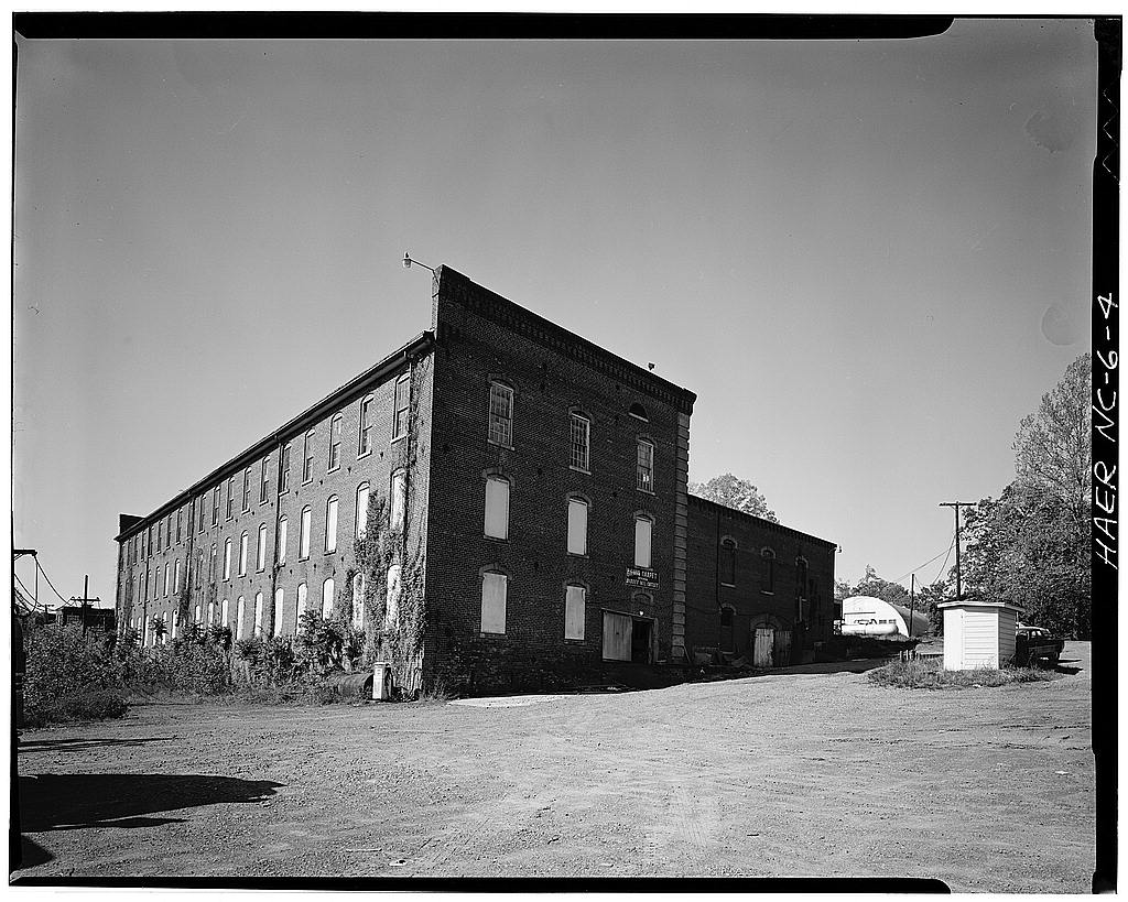
36°05′33″N 79°26′18″W / 36.0925°N 79.438333°WBurlington 17 Durham Hosiery Mill No. 15 December 27, 2010 301 W. Washington St.
36°05′48″N 79°16′25″W / 36.096667°N 79.273611°WMebane 18 East Davis Street Historic District April 20, 2000 Roughly bounded by E. Davis St., S. Mebane St., E. Webb Ave., and Tucker St.
36°05′17″N 79°25′52″W / 36.088056°N 79.431111°WBurlington 19 Efird Building May 31, 1984 133 E. Davis St.
36°05′34″N 79°26′16″W / 36.092778°N 79.437778°WBurlington 20 Elon College Historic District March 22, 1988 S side of Haggard Ave. between William and O'Kelly
36°06′07″N 79°30′17″W / 36.101944°N 79.504722°WElon College 21 First Baptist Church May 31, 1984 400 S. Broad St.
36°05′24″N 79°26′04″W / 36.09°N 79.434444°WBurlington 22 First Christian Church of Burlington May 31, 1984 415 S. Church St.
36°05′41″N 79°26′23″W / 36.094722°N 79.439722°WBurlington 23 Polly Fogleman House November 22, 1993 4331 Brick Church Rd.
36°00′27″N 79°32′18″W / 36.0075°N 79.538333°WBurlington 24 Friends Spring Meeting House March 19, 1987 Jct. of SR 1005 and SR 2338
35°54′07″N 79°19′34″W / 35.901944°N 79.326111°WSnow Camp 25 Glencoe Mill Village Historic District 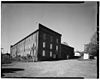
February 16, 1979 Off NC 62 at Haw River
36°08′27″N 79°25′44″W / 36.140833°N 79.428889°WGlencoe 26 Glencoe School December 27, 2010 2649 Union Ridge Rd.
36°08′48″N 79°25′25″W / 36.146667°N 79.423611°WGlencoe 27 Graham Historic District April 7, 1983 E. and W. Harden, E. and W. Elm, N. and S. Main and W. Pine Sts.
36°04′08″N 79°24′09″W / 36.068889°N 79.4025°WGraham 28 Griffis-Patton House March 17, 1983 NW of Melbane on SR 1927
36°07′01″N 79°19′03″W / 36.116944°N 79.3175°WMebane 29 Thomas Guy House November 22, 1993 NC 2135 N side, 0.3 miles W of jct. with NC 2142
36°00′34″N 79°16′06″W / 36.009444°N 79.268333°WMebane 30 Hawfields Presbyterian Church December 15, 1978 SW of Mebane on NC 119
36°03′28″N 79°18′23″W / 36.057778°N 79.306389°WMebane 31 Henderson Scott Farm Historic District September 16, 1987 Jct. of NC 119 and SR 2135
36°02′23″N 79°19′53″W / 36.039722°N 79.331389°WMebane 32 Charles T. Holt House June 1, 1982 228 Holt St.
36°05′09″N 79°22′11″W / 36.085833°N 79.369722°WHaw River Designed by architect George Franklin Barber 33 L. Banks Holt House April 18, 1977 S of Alamance on NC 62
36°01′08″N 79°29′30″W / 36.018889°N 79.491667°WAlamance 34 Holt-Frost House May 31, 1984 130 Union Ave.
36°05′59″N 79°26′19″W / 36.099722°N 79.438611°WBurlington 35 Horner Houses May 31, 1984 304 and 308 N. Fisher St.
36°05′59″N 79°26′12″W / 36.099722°N 79.436667°WBurlington 36 Johnston Hall March 7, 1994 103 Antioch St.
36°06′01″N 79°30′01″W / 36.100278°N 79.500278°WElon College 37 Kernodle-Pickett House March 23, 1987 Jct. of NC 1136 and NC 1131
36°01′18″N 79°27′43″W / 36.021667°N 79.461944°WBellemont 38 Kerr-Patton House December 5, 1985 NC 2133
36°01′37″N 79°18′48″W / 36.026944°N 79.313333°WThompson 39 Lakeside Mills Historic District May 31, 1984 404-418 Lakeside Ave., Kent Ave., and 428-437 Hatch St.
36°06′18″N 79°26′21″W / 36.105°N 79.439167°WBurlington 40 Camilus McBane House November 22, 1993 Off NC 2345 N side, 0.3 miles W of jct. with NC 2340, 0.2 miles down unnamed rd.
35°52′43″N 79°18′49″W / 35.878611°N 79.313611°WSnow Camp 41 McCauley-Watson House February 4, 1994 NC 1762 (Blanchard Rd.) SW side, 1.5 miles NW of jct. with NC 62
36°11′23″N 79°23′48″W / 36.189722°N 79.396667°WUnion Ridge 42 McCray School December 4, 1986 NW side of NC 62, S of jct. with SR 1757
36°10′49″N 79°22′48″W / 36.180278°N 79.38°WBurlington 43 Menagerie Carousel August 30, 1982 Burlington City Park, S. Main St.
36°05′03″N 79°27′13″W / 36.084167°N 79.453611°WBurlington 44 Moore-Holt-White House May 31, 1984 520 Maple ave.
36°05′19″N 79°26′06″W / 36.088611°N 79.435°WBurlington 45 William P. Morrow House August 9, 2006 NC 2146, 0.1 miles W of jct. with NC 2145 (3017 Saxapahaw-Bethlehem Church Rd.)
35°57′15″N 79°16′45″W / 35.954167°N 79.279167°WGraham 46 North Main Street Historic District June 10, 1999 Roughly bounded by Whitsett, New Hill, N. Melville, Market, Mill and Sideview Sts.
36°04′30″N 79°23′57″W / 36.075°N 79.399167°WGraham 47 Saxapahaw Spinning Mill, Former May 20, 1998 1647 Saxapahaw Bethlehem Church Rd.
35°56′48″N 79°19′16″W / 35.946667°N 79.321111°WSaxapahaw 48 Kerr Scott Farm October 31, 1987 N and S side of SR 2123
36°03′33″N 79°21′00″W / 36.059167°N 79.35°WHaw River 49 Snow Camp Mutual Telephone Exchange Building June 9, 1989 SR 1004, .2 miles S of SR 1005
35°53′20″N 79°25′50″W / 35.888889°N 79.430556°WSnow Camp 50 South Broad-East Fifth Streets Historic District December 31, 2001 Roughly bounded by E. Morehead, S. Broad, Sixth, and W. Main Sts.
36°05′20″N 79°26′25″W / 36.088889°N 79.440278°WBurlington 51 Southern Railway Passenger Station May 23, 1980 Main and Webb Sts.
36°05′38″N 79°26′12″W / 36.093889°N 79.436667°WBurlington 52 A. L. Spoon House November 22, 1993 NC 1107 N side, 0.7 miles SW of jct. with NC 1005
35°54′55″N 79°31′16″W / 35.915278°N 79.521111°WSnow Camp 53 St. Athanasius Episcopal Church and Parish House and the Church of the Holy Comforter May 29, 1979 300 E. Webb Ave. and 320 E. Davis St.
36°05′30″N 79°26′03″W / 36.091667°N 79.434167°WBurlington 54 Stagg House May 31, 1984 317 N. Park Ave.
36°05′54″N 79°26′40″W / 36.098333°N 79.444444°WBurlington 55 Sunny Side March 23, 1987 NC 1136, 3 miles E of jct. with NC 62
36°01′13″N 79°28′57″W / 36.020278°N 79.4825°WBurlington 56 James Monroe Thompson House November 22, 1993 NC 2158 E side, 0.1 miles S of jct. with NC 2150
35°58′18″N 79°19′19″W / 35.971667°N 79.321944°WSaxapahaw 57 US Post Office September 23, 1988 430 S. Spring St.
36°05′31″N 79°26′26″W / 36.091944°N 79.440556°WBurlington 58 West Davis Street-Fountain Place Historic District November 5, 1984 Roughly Bounded by Front, W. Webb, S. Fisher, E. Willowbrook, W. Davis Sts., and Fountain Pl.
36°05′43″N 79°26′45″W / 36.095278°N 79.445833°WBurlington 59 White Furniture Company July 29, 1982 E. Center and N. 5th Sts.
36°05′45″N 79°16′00″W / 36.095833°N 79.266667°WMebane 60 Windsor Cotton Mills Office May 31, 1984 Market and Gilmer Sts.
36°05′22″N 79°25′47″W / 36.089444°N 79.429722°WBurlington 61 Woodlawn School November 29, 1991 N side NC 1921 0.15 miles W of jct. with NC 1920
36°06′39″N 79°17′43″W / 36.110833°N 79.295278°WMebane See also
- National Register of Historic Places listings in North Carolina
- List of National Historic Landmarks in North Carolina
References
- ^ The latitude and longitude information provided in this table was derived originally from the National Register Information System, which has been found to be fairly accurate for about 99% of listings. For about 1% of NRIS original coordinates, experience has shown that one or both coordinates are typos or otherwise extremely far off; some corrections may have been made. A more subtle problem causes many locations to be off by up to 150 yards, depending on location in the country: most NRIS coordinates were derived from tracing out latitude and longitudes off of USGS topographical quadrant maps created under the North American Datum of 1927, which differs from the current, highly accurate WGS84 GPS system used by Google maps. Chicago is about right, but NRIS longitudes in Washington are higher by about 4.5 seconds, and are lower by about 2.0 seconds in Maine. Latitudes differ by about 1.0 second in Florida. Some locations in this table may have been corrected to current GPS standards.
- ^ "National Register of Historic Places: Weekly List Actions". National Park Service, United States Department of the Interior. Retrieved on November 10, 2011.
- ^ Numbers represent an ordering by significant words. Various colorings, defined here, differentiate National Historic Landmark sites and National Register of Historic Places Districts from other NRHP buildings, structures, sites or objects.
- ^ "National Register Information System". National Register of Historic Places. National Park Service. . http://nrhp.focus.nps.gov/natreg/docs/All_Data.html.
U.S. National Register of Historic Places Topics Lists by states Alabama • Alaska • Arizona • Arkansas • California • Colorado • Connecticut • Delaware • Florida • Georgia • Hawaii • Idaho • Illinois • Indiana • Iowa • Kansas • Kentucky • Louisiana • Maine • Maryland • Massachusetts • Michigan • Minnesota • Mississippi • Missouri • Montana • Nebraska • Nevada • New Hampshire • New Jersey • New Mexico • New York • North Carolina • North Dakota • Ohio • Oklahoma • Oregon • Pennsylvania • Rhode Island • South Carolina • South Dakota • Tennessee • Texas • Utah • Vermont • Virginia • Washington • West Virginia • Wisconsin • WyomingLists by territories Lists by associated states Other Municipalities and communities of Alamance County, North Carolina Cities Burlington‡ | Graham | Mebane‡
Towns Elon | Gibsonville‡ | Green Level | Haw River | Ossipee | Swepsonville
Village CDPs Unincorporated
communitiesBellemont | Carolina | Dogwood Acres | Eli Whitney | Glencoe | Hawfields | Mandale | McCray | Mount Hermon | Pleasant Grove | Snow Camp | Union Ridge
Footnotes ‡This populated place also has portions in an adjacent county or counties
Categories:- Alamance County, North Carolina
- National Register of Historic Places in North Carolina
- Buildings and structures in Alamance County, North Carolina
-

Wikimedia Foundation. 2010.