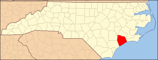
- National Register of Historic Places listings in Onslow County, North Carolina
-

This list includes properties and districts listed on the National Register of Historic Places in Onslow County, North Carolina. Click the "Map of all coordinates" link to the right to view a Google map of all properties and districts with latitude and longitude coordinates in the table below.[1]
-
- This National Park Service list is complete through NPS recent listings posted November 10, 2011.[2]
[3] Landmark name[4] Image Date listed Location City or Town Summary 1 Alum Spring January 31, 1990 SR 1211 1.6 miles S of SR 1001
34°47′53″N 77°33′54″W / 34.79806°N 77.565°WCatherine Lake 2 Avirett-Stephens Plantation April 18, 1991 US 258/24 .25 miles N of NC 1227
34°51′4″N 77°32′7″W / 34.85111°N 77.53528°WRichlands 3 Bank of Onslow and Jacksonville Masonic Temple November 13, 1989 214-216 Old Bridge St.
34°45′2″N 77°25′54″W / 34.75056°N 77.43167°WJacksonville 4 Catherine Lake Historic District November 13, 1989 Jct. SR 1001 and 1211
34°49′1″N 77°33′44″W / 34.81694°N 77.56222°WCatherine Lake 5 Futral Family Farm November 13, 1989 SR 1210, 1 miles SE of jct. with SR 1209
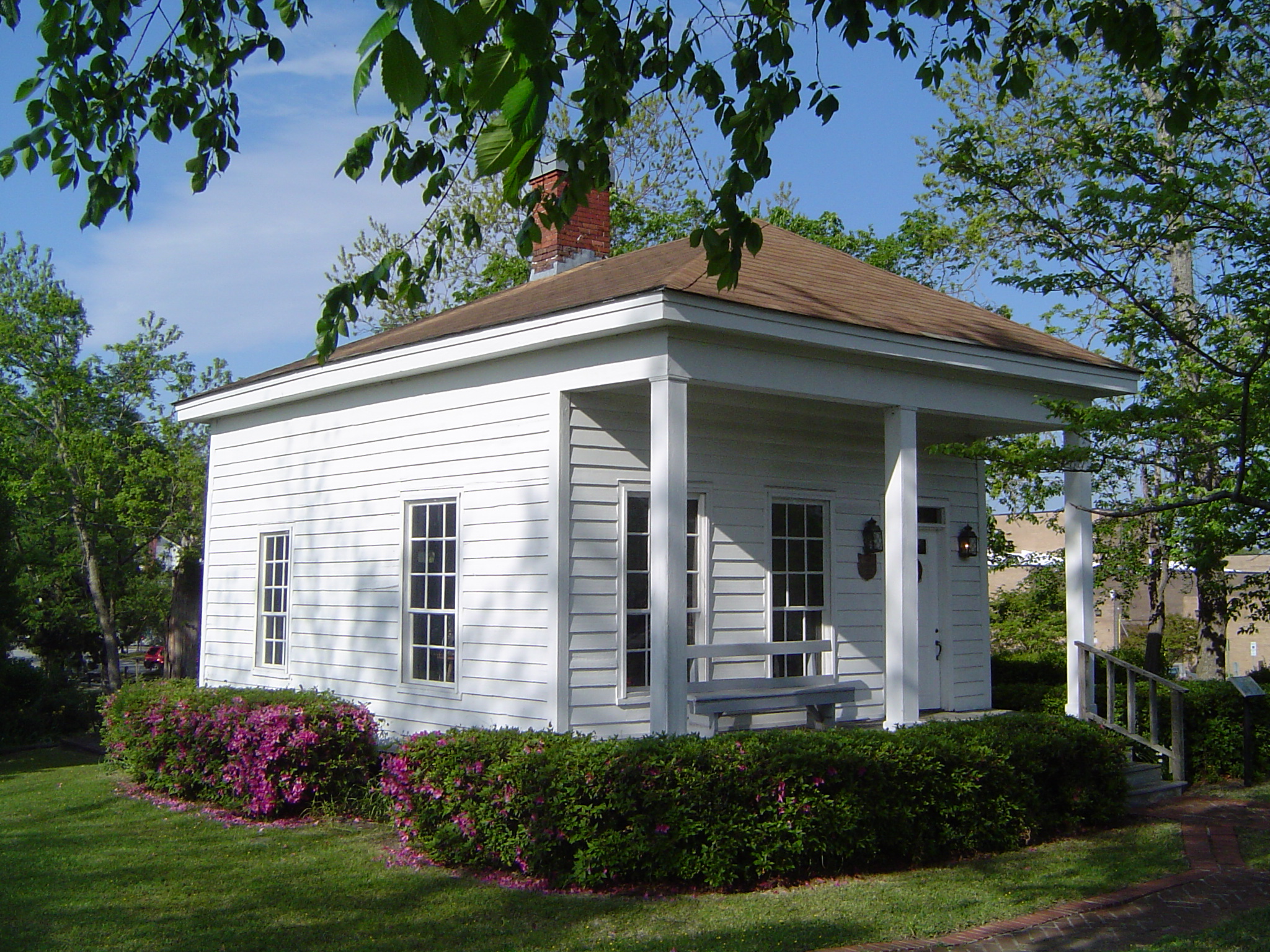
34°48′28″N 77°38′12″W / 34.80778°N 77.63667°WFountain 6 William Edward Mattocks House March 22, 1989 109 Front St.
34°41′14″N 77°7′5″W / 34.68722°N 77.11806°WSwansboro 7 Mill Avenue Historic District March 16, 1990 Roughly bounded by Bluff, College, Court, W. Railroad, Wantland, Mill, and First
34°44′56″N 77°26′3″W / 34.74889°N 77.43417°WJacksonville 8 Palo Alto Plantation October 10, 1979 SR 1434
34°48′2.26″N 77°12′49.49″W / 34.8006278°N 77.2137472°WPalopato 9 Pelletier House and Wantland Spring 
November 13, 1989 Old Bridge St. at New River
34°45′5″N 77°26′2″W / 34.75139°N 77.43389°WJacksonville 10 Richlands Historic District March 16, 1990 Roughly bounded by Foy, Trenton, Hargett, Wilmington, Franck, and Church Sts.
34°54′0″N 77°32′49″W / 34.9°N 77.54694°WRichlands 11 Southwest Historic District November 13, 1989 NC 53 and SR 1217
34°44′25″N 77°30′22″W / 34.74028°N 77.50611°WWaltons Store 12 Swansboro Historic District March 16, 1990 Roughly bounded by Walnut, Main, and Elm Sts., NC 24, White Oak River, and Church, Water, and Broad Sts.
34°41′13″N 77°7′13″W / 34.68694°N 77.12028°WSwansboro 13 Taylor Farm January 27, 1999 337 Comfort Rd.
34°55′18″N 77°31′53″W / 34.92167°N 77.53139°WRichlands 14 Venters Farm Historic District May 7, 1987 US 258 and NC 1229
34°51′46″N 77°32′56″W / 34.86278°N 77.54889°WRichlands 15 Yopps Meeting House July 22, 1999 NC 172, jct. with Sneads Ferry Rd.
34°33′30″N 77°24′16″W / 34.55833°N 77.40444°WSneads Ferry See also
- National Register of Historic Places listings in North Carolina
- List of National Historic Landmarks in North Carolina
References
- ^ The latitude and longitude information provided in this table was derived originally from the National Register Information System, which has been found to be fairly accurate for about 99% of listings. For about 1% of NRIS original coordinates, experience has shown that one or both coordinates are typos or otherwise extremely far off; some corrections may have been made. A more subtle problem causes many locations to be off by up to 150 yards, depending on location in the country: most NRIS coordinates were derived from tracing out latitude and longitudes off of USGS topographical quadrant maps created under the North American Datum of 1927, which differs from the current, highly accurate WGS84 GPS system used by Google maps. Chicago is about right, but NRIS longitudes in Washington are higher by about 4.5 seconds, and are lower by about 2.0 seconds in Maine. Latitudes differ by about 1.0 second in Florida. Some locations in this table may have been corrected to current GPS standards.
- ^ "National Register of Historic Places: Weekly List Actions". National Park Service, United States Department of the Interior. Retrieved on November 10, 2011.
- ^ Numbers represent an ordering by significant words. Various colorings, defined here, differentiate National Historic Landmark sites and National Register of Historic Places Districts from other NRHP buildings, structures, sites or objects.
- ^ "National Register Information System". National Register of Historic Places. National Park Service. 2008-04-24. http://nrhp.focus.nps.gov/natreg/docs/All_Data.html.
U.S. National Register of Historic Places Topics Lists by states Alabama • Alaska • Arizona • Arkansas • California • Colorado • Connecticut • Delaware • Florida • Georgia • Hawaii • Idaho • Illinois • Indiana • Iowa • Kansas • Kentucky • Louisiana • Maine • Maryland • Massachusetts • Michigan • Minnesota • Mississippi • Missouri • Montana • Nebraska • Nevada • New Hampshire • New Jersey • New Mexico • New York • North Carolina • North Dakota • Ohio • Oklahoma • Oregon • Pennsylvania • Rhode Island • South Carolina • South Dakota • Tennessee • Texas • Utah • Vermont • Virginia • Washington • West Virginia • Wisconsin • WyomingLists by territories Lists by associated states Other Municipalities and communities of Onslow County, North Carolina City 
Towns CDPs Unincorporated
communitiesHubert | Montclair | Petersburg
Military bases Footnotes ‡This populated place also has portions in an adjacent county or counties
Categories:- Onslow County, North Carolina
- National Register of Historic Places in North Carolina
- Buildings and structures in Onslow County, North Carolina
-
Wikimedia Foundation. 2010.