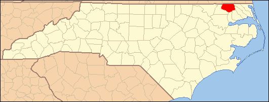
- National Register of Historic Places listings in Gates County, North Carolina
-

This list includes properties and districts listed on the National Register of Historic Places in Gates County, North Carolina. Click the "Map of all coordinates" link to the right to view a Google map of all properties and districts with latitude and longitude coordinates in the table below.[1]
-
- This National Park Service list is complete through NPS recent listings posted November 10, 2011.[2]
Landmark name Image Date listed Location City or Town Summary 1 Buckland March 5, 1986 NC 37 at SR 1220
36°28′16″N 76°46′10″W / 36.47111°N 76.76944°WBuckland 2 Elmwood Plantation February 1, 1972 East of Gatesville near junction of SR 1400 and NC 37
36°23′38″N 76°41′58″W / 36.39389°N 76.69944°WGatesville 3 Eure-Roberts House September 20, 2006 212 W. Main St.
36°24′16.7″N 76°45′9.65″W / 36.404639°N 76.7526806°WGatesville 4 Freeman House September 23, 1982 North of Gates on US 13
36°33′2″N 76°45′19″W / 36.55056°N 76.75528°WGates 5 Joseph Freeman Farm November 12, 1999 Northwest side of SR 1213, 0.7 miles northeast of the junction with SR 1212
36°32′18.56″N 76°47′18.78″W / 36.5384889°N 76.78855°WGates 6 Gates County Courthouse October 22, 1976 Court St.
36°24′13″N 76°45′11″W / 36.40361°N 76.75306°WGatesville 7 Reid's Grove School August 30, 2011 931 Main St.
36°25′4″N 76°45′29″W / 36.41778°N 76.75806°WGatesville vicinity 8 Roberts-Carter House March 1, 1984 Off NC 37
36°21′40″N 76°43′1″W / 36.36111°N 76.71694°WGatesville Destroyed[3] 9 Rountree Family Farm August 2, 2000 049 NC 37 N
36°26′31″N 76°45′19″W / 36.44194°N 76.75528°WGatesville 10 Sunbury High School May 12, 2009 101 NC 32 N.
36°26′48.42″N 76°36′18.55″W / 36.4467833°N 76.6051528°WGatesville ref number 09000332 See also
- National Register of Historic Places listings in North Carolina
- List of National Historic Landmarks in North Carolina
References
- ^ The latitude and longitude information provided in this table was derived originally from the National Register Information System, which has been found to be fairly accurate for about 99% of listings. For about 1% of NRIS original coordinates, experience has shown that one or both coordinates are typos or otherwise extremely far off; some corrections may have been made. A more subtle problem causes many locations to be off by up to 150 yards, depending on location in the country: most NRIS coordinates were derived from tracing out latitude and longitudes off of USGS topographical quadrant maps created under the North American Datum of 1927, which differs from the current, highly accurate WGS84 GPS system used by Google maps. Chicago is about right, but NRIS longitudes in Washington are higher by about 4.5 seconds, and are lower by about 2.0 seconds in Maine. Latitudes differ by about 1.0 second in Florida. Some locations in this table may have been corrected to current GPS standards.
- ^ "National Register of Historic Places: Weekly List Actions". National Park Service, United States Department of the Interior. Retrieved on November 10, 2011.
- ^ "North Carolina Listings in the National Register of Historic Places by County". North Carolina State Historic Preservation Office. 22 October 2008. http://www.hpo.ncdcr.gov/nrlist.htm. Retrieved 14 July 2009.
U.S. National Register of Historic Places Topics Lists by states Alabama • Alaska • Arizona • Arkansas • California • Colorado • Connecticut • Delaware • Florida • Georgia • Hawaii • Idaho • Illinois • Indiana • Iowa • Kansas • Kentucky • Louisiana • Maine • Maryland • Massachusetts • Michigan • Minnesota • Mississippi • Missouri • Montana • Nebraska • Nevada • New Hampshire • New Jersey • New Mexico • New York • North Carolina • North Dakota • Ohio • Oklahoma • Oregon • Pennsylvania • Rhode Island • South Carolina • South Dakota • Tennessee • Texas • Utah • Vermont • Virginia • Washington • West Virginia • Wisconsin • WyomingLists by territories Lists by associated states Other Municipalities and communities of Gates County, North Carolina Town 
Unincorporated
communitiesEason Crossroads | Eure | Hoflers Fork | Gates | Mintonsville | Selwin | Sunbury | Tarheel
Categories:- Gates County, North Carolina
- National Register of Historic Places in North Carolina
- Buildings and structures in Gates County, North Carolina
-
Wikimedia Foundation. 2010.