- National Register of Historic Places listings in Yancey County, North Carolina
-

This list includes properties and districts listed on the National Register of Historic Places in Yancey County, North Carolina. Click the "Map of all coordinates" link to the right to view a Google map of all properties and districts with latitude and longitude coordinates in the table below.[1]
-
- This National Park Service list is complete through NPS recent listings posted November 10, 2011.[2]
Landmark name Image Date listed Location City or Town Summary 1 Bald Creek Historic District January 29, 2009 Both sides of Bald Creek School Rd., 76-239 Pleasant Valley Rd., and 6193-6195 US 19E
35°54′44.74″N 82°25′22.33″W / 35.9124278°N 82.4228694°WBurnsville 2 David M. Buck House April 25, 2001 NC 1395, 1.1 miles SW of jct with NC 1401
35°57′52.5″N 82°28′24.12″W / 35.964583°N 82.4733667°WBald Mountain 3 Chase-Coletta House June 16, 2004 108 Town Sq.
region:US-NC&title=Chase%E2%80%93Coletta+House 35°55′0″N 82°17′56″W / 35.916667°N 82.29889°WBurnsville 4 Citizens Bank Building March 29, 1990 Town Sq.
35°55′0.48″N 82°17′59.69″W / 35.9168°N 82.2999139°WBurnsville 5 John Wesley McElroy House November 29, 1990 11 Academy St.
35°55′3.79″N 82°18′5.07″W / 35.9177194°N 82.3014083°WBurnsville Houses the Rush Wray Museum of Yancey County History 6 Nu-Wray Inn April 15, 1982 Off US 19E
35°55′0.23″N 82°17′57.84″W / 35.9167306°N 82.2994°WBurnsville 7 Yancey Collegiate Institute Historic District August 21, 2003 School Dr. and Green Mountain Dr.
35°55′18″N 82°17′39″W / 35.92167°N 82.29417°WBurnsville 8 Yancey County Courthouse May 10, 1979 W. Main at Town Square
35°55′1.35″N 82°18′1.75″W / 35.9170417°N 82.3004861°WBurnsville See also
- National Register of Historic Places listings in North Carolina
- List of National Historic Landmarks in North Carolina
References
- ^ The latitude and longitude information provided in this table was derived originally from the National Register Information System, which has been found to be fairly accurate for about 99% of listings. For about 1% of NRIS original coordinates, experience has shown that one or both coordinates are typos or otherwise extremely far off; some corrections may have been made. A more subtle problem causes many locations to be off by up to 150 yards, depending on location in the country: most NRIS coordinates were derived from tracing out latitude and longitudes off of USGS topographical quadrant maps created under the North American Datum of 1927, which differs from the current, highly accurate WGS84 GPS system used by Google maps. Chicago is about right, but NRIS longitudes in Washington are higher by about 4.5 seconds, and are lower by about 2.0 seconds in Maine. Latitudes differ by about 1.0 second in Florida. Some locations in this table may have been corrected to current GPS standards.
- ^ "National Register of Historic Places: Weekly List Actions". National Park Service, United States Department of the Interior. Retrieved on November 10, 2011.
U.S. National Register of Historic Places Topics Lists by states Alabama • Alaska • Arizona • Arkansas • California • Colorado • Connecticut • Delaware • Florida • Georgia • Hawaii • Idaho • Illinois • Indiana • Iowa • Kansas • Kentucky • Louisiana • Maine • Maryland • Massachusetts • Michigan • Minnesota • Mississippi • Missouri • Montana • Nebraska • Nevada • New Hampshire • New Jersey • New Mexico • New York • North Carolina • North Dakota • Ohio • Oklahoma • Oregon • Pennsylvania • Rhode Island • South Carolina • South Dakota • Tennessee • Texas • Utah • Vermont • Virginia • Washington • West Virginia • Wisconsin • WyomingLists by territories Lists by associated states Other Municipalities and communities of Yancey County, North Carolina Town 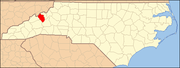
Unincorporated
communitiesBent Creek | Cane River | Green Mountain | Micaville
Categories:- Yancey County, North Carolina
- National Register of Historic Places in North Carolina
- Buildings and structures in Yancey County, North Carolina
-

Wikimedia Foundation. 2010.