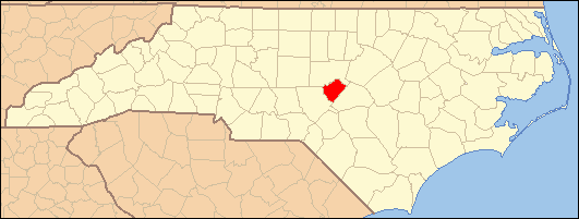
- National Register of Historic Places listings in Lee County, North Carolina
-

This list includes properties and districts listed on the National Register of Historic Places in Lee County, North Carolina. Click the "Map of all coordinates" link to the right to view a Google map of all properties and districts with latitude and longitude coordinates in the table below.[1]
-
- This National Park Service list is complete through NPS recent listings posted November 10, 2011.[2]
[3] Landmark name[4] Image Date listed Location City or Town Summary 1 Buffalo Presbyterian Church and Cemeteries February 5, 1999 1333 Carthage St.
35°27′40″N 79°11′37″W / 35.46111°N 79.19361°WSanford 2 Downtown Sanford Historic District September 28, 1985 Roughly bounded by Gordon St., Horner Blvd., Cole and Chatham Sts.
35°28′49″N 79°10′42″W / 35.48028°N 79.17833°WSanford 3 East Sanford Historic District December 28, 2010 Bounded roughly by Charlotte Ave., Goldsboro Ave., N. First St., S. Second St., and S. Eighth St.
35°28′48″N 79°10′8″W / 35.48°N 79.16889°WSanford Lee County MPS 4 Endor Iron Furnace August 13, 1974 SE of Cumnock
35°33′1″N 79°13′28″W / 35.55028°N 79.22444°WCumnock 5 Euphronia Presbyterian Church May 26, 1994 3800 Steel Bridge Rd.
35°28′17″N 79°20′51″W / 35.47139°N 79.3475°WSanford 6 Farish-Lambeth House March 1, 2002 6308 Deep River Rd.
35°36′51.62″N 79°6′59.97″W / 35.6143389°N 79.1166583°WSanford 7 Obediah Farrar House August 18, 1993 9910 Barringer Rd.
35°36′7″N 79°4′27″W / 35.60194°N 79.07417°WHaywood 8 Hawkins Avenue Historic District July 5, 2000 Roughly bounded by Hill Ave., First St., Charlotte Ave., and Horner Blvd.
35°29′10″N 79°10′50″W / 35.48611°N 79.18056°WSanford 9 Lee Avenue Historic District September 6, 2002 Roughly along Lee Avenue, W. Main St., S. Academy St., and W. Raleigh St.
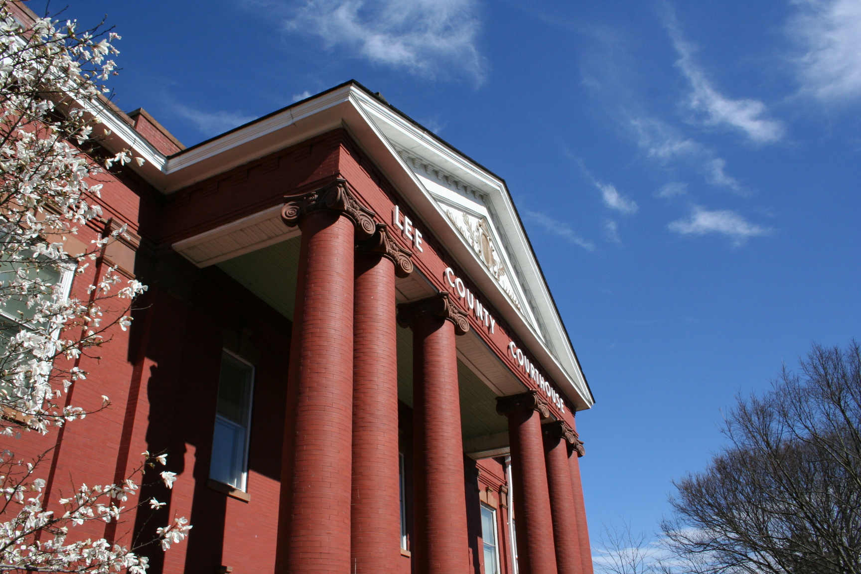
35°27′19.4″N 79°9′12.07″W / 35.455389°N 79.1533528°WSanford 10 Lee County Courthouse 
May 10, 1979 Horner Blvd., between Courtland and McIntosh Sts.
35°28′1″N 79°9′49″W / 35.46694°N 79.16361°WSanford 11 Lee County Training School December 28, 2000 806 S. Vance St.
35°28′25″N 79°10′58″W / 35.47361°N 79.18278°WSanford 12 John D. McIver Farm August 18, 1993 2007 Windmill Dr.
35°29′38″N 79°12′30″W / 35.49389°N 79.20833°WSanford 13 Railroad House January 29, 1973 Carthage St. at Hawkins Ave.
35°28′50″N 79°10′39″W / 35.48056°N 79.1775°WSanford 14 Rosemount-McIver Park Historic District March 21, 1997 Roughly bounded by N. Horner Blvd., N. Vance and Carthage Sts.
35°28′50″N 79°11′9″W / 35.48056°N 79.18583°WSanford 15 Sanford High School, Former November 29, 1995 507 N. Steele St.
35°29′8″N 79°11′4″W / 35.48556°N 79.18444°WSanford 16 Seaboard Milling Company May 2, 2002 202 Hickory Ave.
35°28′41″N 79°10′22″W / 35.47806°N 79.17278°WSanford 17 Temple Theatre September 8, 1983 120 Carthage St.
35°28′52″N 79°10′44″W / 35.48111°N 79.17889°WSanford See also
- National Register of Historic Places listings in North Carolina
- List of National Historic Landmarks in North Carolina
References
- ^ The latitude and longitude information provided in this table was derived originally from the National Register Information System, which has been found to be fairly accurate for about 99% of listings. For about 1% of NRIS original coordinates, experience has shown that one or both coordinates are typos or otherwise extremely far off; some corrections may have been made. A more subtle problem causes many locations to be off by up to 150 yards, depending on location in the country: most NRIS coordinates were derived from tracing out latitude and longitudes off of USGS topographical quadrant maps created under North American Datum of 1927, which differs from the current, highly accurate GPS system used by Google maps. Chicago is about right, but NRIS longitudes in Washington are higher by about 4.5 seconds, and are lower by about 2.0 seconds in Maine. Latitudes differ by about 1.0 second in Florida. Some locations in this table may have been corrected to current GPS standards.
- ^ "National Register of Historic Places: Weekly List Actions". National Park Service, United States Department of the Interior. Retrieved on November 10, 2011.
- ^ Numbers represent an ordering by significant words. Various colorings, defined here, differentiate National Historic Landmark sites and National Register of Historic Places Districts from other NRHP buildings, structures, sites or objects.
- ^ "National Register Information System". National Register of Historic Places. National Park Service. 2008-04-24. http://nrhp.focus.nps.gov/natreg/docs/All_Data.html.
U.S. National Register of Historic Places Topics Lists by states Alabama • Alaska • Arizona • Arkansas • California • Colorado • Connecticut • Delaware • Florida • Georgia • Hawaii • Idaho • Illinois • Indiana • Iowa • Kansas • Kentucky • Louisiana • Maine • Maryland • Massachusetts • Michigan • Minnesota • Mississippi • Missouri • Montana • Nebraska • Nevada • New Hampshire • New Jersey • New Mexico • New York • North Carolina • North Dakota • Ohio • Oklahoma • Oregon • Pennsylvania • Rhode Island • South Carolina • South Dakota • Tennessee • Texas • Utah • Vermont • Virginia • Washington • West Virginia • Wisconsin • WyomingLists by territories Lists by associated states Other  Category:National Register of Historic Places •
  Portal:National Register of Historic Places
Municipalities and communities of Lee County, North Carolina County seat: Sanford City 
Town Unincorporated
communitiesFootnotes ‡This populated place also has portions in an adjacent county or counties
Categories:- Lee County, North Carolina
- National Register of Historic Places in North Carolina
- Buildings and structures in Lee County, North Carolina
-
Wikimedia Foundation. 2010.