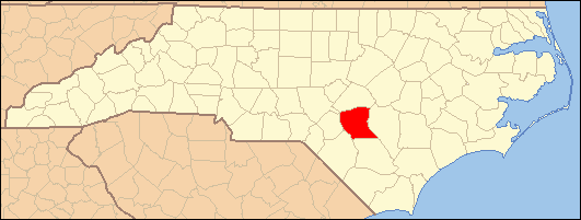
- National Register of Historic Places listings in Cumberland County, North Carolina
-

This list includes properties and districts listed on the National Register of Historic Places in Cumberland County, North Carolina. Click the "Map of all coordinates" link to the right to view a Google map of all properties and districts with latitude and longitude coordinates in the table below.[1]
-
- This National Park Service list is complete through NPS recent listings posted November 10, 2011.[2]
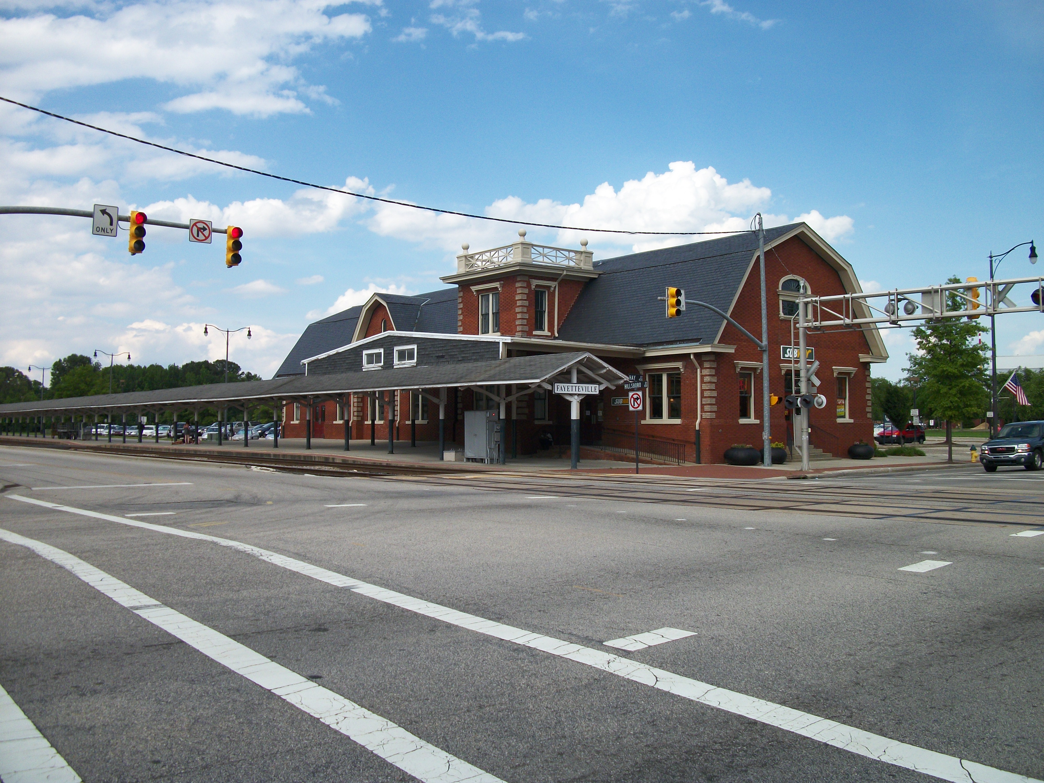
[3] Landmark name[4] Image Date listed Location City or Town Summary 1 Atlantic Coast Line Railroad Station 
July 7, 1982 472 Hay St.
35°3′18″N 78°53′5″W / 35.055°N 78.88472°WFayetteville 2 Barge's Tavern July 7, 1983 519 Ramsey St.
35°3′39″N 78°52′42″W / 35.06083°N 78.87833°WFayetteville 3 Belden-Horne House March 16, 1972 519 Ramsey St.
35°3′39″N 78°52′42″W / 35.06083°N 78.87833°WFayetteville 4 Big Rockfish Presbyterian Church July 21, 1983 SR 2268
34°57′6″N 78°55′27″W / 34.95167°N 78.92417°WHope Mills 5 Brownlea August 21, 2003 405 Southampton Court
35°3′8″N 78°54′53″W / 35.05222°N 78.91472°WFayetteville 6 Camp Ground Methodist Church July 7, 1983 Camp Ground Rd.
35°4′4″N 78°58′22″W / 35.06778°N 78.97278°WFayetteville 7 Cape Fear and Yadkin Valley Railway Passenger Depot July 7, 1983 148 Maxwell St.
35°3′8″N 78°52′56″W / 35.05222°N 78.88222°WFayetteville 8 Cape Fear Baptist Church October 13, 1983 SR 2233
34°54′21″N 78°49′37″W / 34.90583°N 78.82694°WGrays Creek 9 The Capitol May 4, 2005 126 Hay St.
35°3′18″N 78°52′45″W / 35.055°N 78.87917°WFayetteville 10 Carolina Theater July 7, 1983 443 Hay St.
35°3′15″N 78°53′3″W / 35.05417°N 78.88417°WFayetteville Destroyed[5] 11 Confederate Breastworks October 7, 1981 Address Restricted Fayetteville 12 Cool Spring Place 
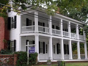
October 10, 1972 119 N. Cool Spring St.
35°3′8″N 78°52′30″W / 35.05222°N 78.875°WFayetteville 13 Cool Springs September 19, 1985 Off SR 1607 at Cumberland
35°14′2″N 78°52′29″W / 35.23389°N 78.87472°WCarvers Creek 14 Cross Creek Cemetery Number One September 25, 1998 Jct. of N. Cool Spring and Grove St.
35°3′17″N 78°52′23″W / 35.05472°N 78.87306°WFayetteville 15 Cumberland County Courthouse May 10, 1979 Franklin, Gillespie, and Russell Sts.
35°3′5″N 78°52′45″W / 35.05139°N 78.87917°WFayetteville 16 John Davis House July 7, 1983 910 Arsenal Ave.
35°3′18″N 78°53′45″W / 35.055°N 78.89583°WFayetteville 17 Devane-MacQueen House July 21, 1983 NC 87
34°52′50″N 78°50′33″W / 34.88056°N 78.8425°WGrays Creek 18 Ellerslie August 7, 1974 W of Linden on SR 1607 at jct. with SR 1606
35°13′50″N 78°52′31″W / 35.23056°N 78.87528°WLinden 19 Evans Metropolitan AME Zion Church July 7, 1983 301 N. Cool Spring St.
35°3′12″N 78°52′53″W / 35.05333°N 78.88139°WFayetteville 20 Falcon Tabernacle 
October 11, 1983 West St.
35°11′37″N 78°38′52″W / 35.19361°N 78.64778°WFalcon 21 Fayetteville Downtown Historic District July 1, 1999 Roughly along Hay, Person, Green, Gillespie, Bow, Old, W. Russell and Cool Spring Sts.
35°3′11″N 78°52′41″W / 35.05306°N 78.87806°WFayetteville 22 Fayetteville Ice and Manufacturing Company:Plant and Engineer's House July 7, 1983 436 Rowan St. and 438 Rowan St.
35°3′36″N 78°53′0″W / 35.06°N 78.883333°WFayetteville 23 Fayetteville Mutual Insurance Company Building July 7, 1983 320 Hay St.
35°3′14″N 78°52′54″W / 35.05389°N 78.88167°WFayetteville 24 Fayetteville Women's Club and Oval Ballroom 
February 6, 1973 224 Dick St.
35°2′53″N 78°52′42″W / 35.04806°N 78.87833°WFayetteville Fayetteville Women's Club is also known as Sandford House 25 First Baptist Church July 7, 1983 200 Old St.
35°3′14″N 78°52′47″W / 35.05389°N 78.87972°WFayetteville 26 First Presbyterian Church April 30, 1976 Ann and Bow Sts.
35°3′12″N 78°52′32″W / 35.05333°N 78.87556°WFayetteville 27 Gully Mill July 7, 1983 S.R. 1839
35°3′22″N 78°50′29″W / 35.05611°N 78.84139°WFayetteville 28 Hangars 4 and 5, Pope Air Force Base January 16, 1991 Bldg. 708, Pope AFB
35°10′40″N 79°0′52″W / 35.17778°N 79.01444°WFayetteville 29 Hay Street Methodist Church July 7, 1983 Hay St. at Ray and Old Sts.
35°3′11″N 78°52′27″W / 35.05306°N 78.87417°WFayetteville 30 Haymount District August 7, 1983 Roughly Hillside Ave. from Bragg Boulevard to Purshing St.; also the 100-200 blocks of Bradford Ave., 801 Hay St., and 801, 802, and 806 Arsenal Ave.
35°3′24″N 78°53′22″W / 35.05667°N 78.88944°WFayetteville Second set of addresses represents a boundary increase of April 10, 2007, the Haymount Historic District 31 Holt-Harrison House July 7, 1983 806 Hay St.
35°3′22″N 78°53′33″W / 35.05611°N 78.8925°WFayetteville 32 Hope Mills Historic District July 9, 1985 Roughly bounded by Seaboard Coastline RR tracks, Lakeview Rd., Little Creek and Cross St.
34°58′17″N 78°56′43″W / 34.97139°N 78.94528°WHope Mills 33 Kyle House June 19, 1972 234 Green St.
35°3′21″N 78°52′36″W / 35.05583°N 78.87667°WFayetteville 34 Liberty Row August 14, 1973 N Side of the first block of Person St., bounded by Market Sq. and Liberty Point
35°3′8″N 78°52′39″W / 35.05222°N 78.8775°WFayetteville 35 Long Valley Farm June 6, 1994 Address Restricted Spring Lake 36 M & O Chevrolet Company July 7, 1983 412 W. Russell St.
35°3′11″N 78°53′5″W / 35.05306°N 78.88472°WFayetteville 37 Mansard Roof House March 20, 1973 214 Mason St.
35°3′21″N 78°52′45″W / 35.05583°N 78.87917°WFayetteville 38 Market House 
September 15, 1970 Market Sq.
35°3′10″N 78°52′40″W / 35.05278°N 78.87778°WFayetteville 39 Market House Square District July 7, 1983 Hay, Person, Green, and Gillespie Sts.
35°3′9″N 78°52′44″W / 35.0525°N 78.87889°WFayetteville 40 Massey Hill High School December 23, 2004 1062 Southern Ave.
35°1′51.1″N 78°53′39.57″W / 35.030861°N 78.894325°WFayetteville 41 Maxwell House February 28, 1985 Off NC 24
35°1′18″N 78°43′23″W / 35.02167°N 78.72306°WStedman 42 McArthur-Council House July 21, 1983 SR 2244
34°53′38″N 78°55′58″W / 34.89389°N 78.93278°WGrays Creek 43 McCall House July 7, 1983 822 Arsenal Ave.
35°3′18″N 78°53′39″W / 35.055°N 78.89417°WFayetteville 44 William McDiarmid House July 7, 1983 330 Dick St.
35°2′51″N 78°52′45″W / 35.0475°N 78.87917°WFayetteville 45 Henry McLean House July 7, 1983 1006 Hay St.
35°3′23″N 78°53′50″W / 35.05639°N 78.89722°WFayetteville 46 Nimocks House 
January 20, 1972 225 Dick St.
35°3′1″N 78°52′34″W / 35.05028°N 78.87611°WFayetteville 47 North Carolina Arsenal Site February 23, 1983 Address Restricted Fayetteville 48 Oak Grove February 6, 1973 S of Erwin near jct. of NC 82 and SR 1875
35°15′0″N 78°41′25″W / 35.25°N 78.69028°WErwin 49 John A. Oates House July 7, 1983 406 St. James Sq.
35°3′26″N 78°52′35″W / 35.05722°N 78.87639°WFayetteville 50 Old Bluff Presbyterian Church August 7, 1974 N of Wade on SR 1709
35°11′2″N 78°43′25″W / 35.18389°N 78.72361°WWade 51 Orange Street School September 22, 1987 500 blk. of Orange St., jct. of Orange and Chance Sts.
35°3′50″N 78°52′49″W / 35.06389°N 78.88028°WFayetteville 52 John E. Patterson House July 7, 1983 445 Moore St.
35°3′41″N 78°53′2″W / 35.06139°N 78.88389°WFayetteville 53 Phoenix Masonic Lodge No. 8 July 7, 1983 221 Mason St.
35°3′21″N 78°52′48″W / 35.05583°N 78.88°WFayetteville 54 Edgar Allan Poe House July 7, 1983 206 Bradford Ave.
35°3′14″N 78°52′47″W / 35.05389°N 78.87972°WFayetteville 55 Pope Air Force Base Historic District January 25, 1991 Bldgs. 300, 302, 306, and Old Family Housing Units
35°10′13″N 79°0′13″W / 35.17028°N 79.00361°WFayetteville 56 Prince Charles Hotel July 7, 1983 430 Hay St.
35°3′16″N 78°53′0″W / 35.05444°N 78.883333°WFayetteville 57 Sedberry-Holmes House September 2, 1975 232 Person St.
35°3′4″N 78°52′33″W / 35.05111°N 78.87583°WFayetteville 58 Seventy-First Consolidated School December 23, 2004 6830 Raeford Rd.
35°2′17″N 79°0′34″W / 35.03806°N 79.00944°WFayetteville 59 St. John's Episcopal Church September 6, 1974 Green St.
35°3′18″N 78°52′38″W / 35.055°N 78.87722°WFayetteville 60 St. Joseph's Episcopal Church June 1, 1982 Ramsey and Moore Sts.
35°3′21″N 78°52′41″W / 35.05583°N 78.87806°WFayetteville 61 Frank H. Stedman House September 14, 2002 1516 Morganton Rd.
35°3′30″N 78°54′18″W / 35.05833°N 78.905°WFayetteville 62 Robert Strange Country House July 7, 1983 309 Kirkland Dr.
35°5′30″N 78°52′28″W / 35.09167°N 78.87444°WFayetteville 63 Taylor-Utley House July 7, 1983 916 Hay St.
35°3′23″N 78°53′46″W / 35.05639°N 78.89611°WFayetteville 64 U.S. Post Office July 7, 1983 301 Hay St.
35°3′12″N 78°52′53″W / 35.05333°N 78.88139°WFayetteville 65 Dr. William C. Verdery House September 5, 2007 1428 Raeford Rd.
35°3′25″N 78°54′16″W / 35.05694°N 78.90444°WFayetteville 66 Waddill's Store July 7, 1983 220 Hay St.
35°3′12″N 78°52′49″W / 35.05333°N 78.88028°WFayetteville 67 Westlawn September 22, 1980 1505 Fort Bragg Rd.
35°3′33″N 78°54′22″W / 35.05917°N 78.90611°WFayetteville 68 Robert Williams House July 21, 1983 SR 1728
35°5′16″N 78°48′56″W / 35.08778°N 78.81556°WEastover See also
- National Register of Historic Places listings in North Carolina
- List of National Historic Landmarks in North Carolina
References
- ^ The latitude and longitude information provided in this table was derived originally from the National Register Information System, which has been found to be fairly accurate for about 99% of listings. For about 1% of NRIS original coordinates, experience has shown that one or both coordinates are typos or otherwise extremely far off; some corrections may have been made. A more subtle problem causes many locations to be off by up to 150 yards, depending on location in the country: most NRIS coordinates were derived from tracing out latitude and longitudes off of USGS topographical quadrant maps created under the North American Datum of 1927, which differs from the current, highly accurate WGS84 GPS system used by Google maps. Chicago is about right, but NRIS longitudes in Washington are higher by about 4.5 seconds, and are lower by about 2.0 seconds in Maine. Latitudes differ by about 1.0 second in Florida. Some locations in this table may have been corrected to current GPS standards.
- ^ "National Register of Historic Places: Weekly List Actions". National Park Service, United States Department of the Interior. Retrieved on November 10, 2011.
- ^ Numbers represent an ordering by significant words. Various colorings, defined here, differentiate National Historic Landmark sites and National Register of Historic Places Districts from other NRHP buildings, structures, sites or objects.
- ^ "National Register Information System". National Register of Historic Places. National Park Service. 2008-04-24. http://nrhp.focus.nps.gov/natreg/docs/All_Data.html.
- ^ "North Carolina Listings in the National Register of Historic Places by County". North Carolina State Historic Preservation Office. 22 October 2008. http://www.hpo.ncdcr.gov/nrlist.htm. Retrieved 14 July 2009.
National Register of Historic Places listings in North Carolina by county. Counties - Alamance
- Alexander
- Alleghany
- Anson
- Ashe
- Avery
- Beaufort
- Bertie
- Bladen
- Brunswick
- Buncombe
- Burke
- Cabarrus
- Caldwell
- Camden
- Carteret
- Caswell
- Catawba
- Chatham
- Cherokee
- Chowan
- Clay
- Cleveland
- Columbus
- Craven
- Cumberland
- Currituck
- Dare
- Davidson
- Davie
- Duplin
- Durham
- Edgecombe
- Forsyth
- Franklin
- Gaston
- Gates
- Graham
- Granville
- Greene
- Guilford
- Halifax
- Harnett
- Haywood
- Henderson
- Hertford
- Hoke
- Hyde
- Iredell
- Jackson
- Johnston
- Jones
- Lee
- Lenoir
- Lincoln
- Macon
- Madison
- Martin
- McDowell
- Mecklenburg
- Mitchell
- Montgomery
- Moore
- Nash
- New Hanover
- Northampton
- Onslow
- Orange
- Pamlico
- Pasquotank
- Pender
- Perquimans
- Person
- Pitt
- Polk
- Randolph
- Richmond
- Robeson
- Rockingham
- Rowan
- Rutherford
- Sampson
- Scotland
- Stanly
- Stokes
- Surry
- Swain
- Transylvania
- Tyrrell
- Union
- Vance
- Wake
- Warren
- Washington
- Watauga
- Wayne
- Wilkes
- Wilson
- Yadkin
- Yancey
 Category:National Register of Historic Places in North Carolina •
  Portal:National Register of Historic Places
U.S. National Register of Historic Places Topics Lists by states Alabama • Alaska • Arizona • Arkansas • California • Colorado • Connecticut • Delaware • Florida • Georgia • Hawaii • Idaho • Illinois • Indiana • Iowa • Kansas • Kentucky • Louisiana • Maine • Maryland • Massachusetts • Michigan • Minnesota • Mississippi • Missouri • Montana • Nebraska • Nevada • New Hampshire • New Jersey • New Mexico • New York • North Carolina • North Dakota • Ohio • Oklahoma • Oregon • Pennsylvania • Rhode Island • South Carolina • South Dakota • Tennessee • Texas • Utah • Vermont • Virginia • Washington • West Virginia • Wisconsin • WyomingLists by territories Lists by associated states Other Municipalities and communities of Cumberland County, North Carolina City 
Towns Eastover | Falcon‡ | Godwin | Hope Mills | Linden | Spring Lake | Stedman | Wade
CDP Unincorporated
communitiesMilitary bases Fort Bragg | Pope Army Airfield
Footnotes ‡This populated place also has portions in an adjacent county or counties
Categories:- Cumberland County, North Carolina
- National Register of Historic Places in North Carolina
- Buildings and structures in Cumberland County, North Carolina
-


Wikimedia Foundation. 2010.