- National Register of Historic Places listings in Forsyth County, North Carolina
-

This list includes properties and districts listed on the National Register of Historic Places in Forsyth County, North Carolina. Click the "Map of all coordinates" link to the right to view a Google map of all properties and districts with latitude and longitude coordinates in the table below.[1]
-
- This National Park Service list is complete through NPS recent listings posted November 10, 2011.[2]
[3] Landmark name[4] Image Date listed Location City or Town Summary 1 Ardmore Historic District August 25, 2004 Roughly bounded by Knollwood, Queen, Duke, and Ardsley Sts.
36°5′3″N 80°16′29″W / 36.08417°N 80.27472°WWinston-Salem 2 Arista Cotton Mill Complex 
August 18, 1977 200 Brookstown Ave.
36°5′24″N 80°14′46″W / 36.09°N 80.24611°WWinston-Salem 3 Atkins High School (former) December 30, 1999 1215 N. Cameron Ave.
36°6′39″N 80°13′17″W / 36.11083°N 80.22139°WWinston-Salem 4 S. G. Atkins House July 22, 1979 346 Atkins St.
36°5′32″N 80°13′45″W / 36.09222°N 80.22917°WWinston-Salem 5 Agnew Hunter Bahnson House April 12, 2001 Jct. of W. Fifth and Spring Sts.
36°5′54″N 80°15′12″W / 36.09833°N 80.25333°WWinston-Salem 6 Bethabara Historic District 
November 15, 1978 N of Winston-Salem on NC 67
36°9′16″N 80°17′55″W / 36.15444°N 80.29861°WWinston-Salem 7 Bethabara Moravian Church 
September 28, 1971 2147 Bethabara Rd.
36°9′12″N 80°18′1″W / 36.15333°N 80.30028°WWinston-Salem 8 Bethania Historic District May 3, 1976 N of Winston-Salem on NC 65, SR 1611, 1628, and 1688; also roughly the area outside the original district west and north along Muddy Creek, south to Reynolda Rd., and east along Walker Rd.
36°10′51″N 80°20′16″W / 36.18083°N 80.33778°WWinston-Salem Second set of boundaries represents a boundary increase of March 25, 1991 9 George Black House and Brickyard January 28, 2000 111 Dellabrook Rd.
36°6′48″N 80°12′35″W / 36.11333°N 80.20972°WWinston-Salem 10 William Allen Blair House April 25, 1985 210 S. Cherry St.
36°5′31″N 80°14′48″W / 36.09194°N 80.24667°WWinston-Salem 11 Joseph Franklin Bland House August 21, 1984 1809 Virginia Rd.
36°6′20″N 80°16′13″W / 36.10556°N 80.27028°WWinston-Salem 12 Brickenstein-Leinbach House September 3, 1991 426 Old Salem Rd.
36°5′25″N 80°14′40″W / 36.09028°N 80.24444°WWinston-Salem 13 W.C. Brown Apartment Building June 26, 1998 311-317 E. 7th St.
36°6′9″N 80°14′28″W / 36.1025°N 80.24111°WWinston-Salem 14 Centerville Historic District May 8, 2008 Roughly bounded by Waughtown, Vargrave, Haled & Chapel Sts.
36°4′23″N 80°13′58″W / 36.07306°N 80.23278°WWinston-Salem 15 Chatham Manufacturing Company-Western Electric Company August 4, 2011 750 & 800 Chatham Rd.
36°6′17″N 80°15′18″W / 36.10472°N 80.255°WWinston-Salem 16 Clayton Family Farm October 5, 2001 5809 Stanley Dr.
36°12′3″N 80°16′19″W / 36.20083°N 80.27194°WStanleyville 17 Conrad-Starbuck House June 4, 1990 118 S. Cherry St.
36°5′36″N 80°14′50″W / 36.09333°N 80.24722°WWinston-Salem 18 Craver Apartment Building June 26, 1998 706-712 Chestnut St.
36°6′10″N 80°14′33″W / 36.10278°N 80.2425°WWinston-Salem 19 Thomas A. Crews House April 26, 1993 4997 Main St.
36°10′30″N 80°9′6″W / 36.175°N 80.15167°WWalkertown 20 Downtown North Historic District December 31, 2002 Roughly bounded by W. Fifth, W. Eighth, N. Main and N. Cherry Sts.
36°6′6″N 80°14′45″W / 36.10167°N 80.24583°WWinston-Salem 21 James B. and Diana M. Dyer House April 5, 2006 1015 W. Kent Rd.
36°6′55″N 80°16′26″W / 36.11528°N 80.27389°WWinston-Salem 22 First Baptist Church February 25, 1988 126 N. Main St.
36°7′13″N 80°4′21″W / 36.12028°N 80.0725°WKernersville 23 Gilmer Building July 29, 1982 416-424 W. 4th St.
36°5′50″N 80°14′24″W / 36.09722°N 80.24°WWinston-Salem 24 Goler Memorial African Methodist Episcopal Zion Church June 26, 1998 630 Patterson Ave.
36°6′8″N 80°14′30″W / 36.10222°N 80.24167°WWinston-Salem 25 Goler Metropolitan AME Zion Church January 27, 1999 1435 E. Fourth St.
36°5′58″N 80°13′39″W / 36.09944°N 80.2275°WWinston-Salem 26 Graylyn August 3, 1978 Reynolda Rd.
36°7′2″N 80°16′59″W / 36.11722°N 80.28306°WWinston-Salem 27 P.H. Hanes Knitting Company June 10, 2005 675 N. Main St., 101 W. Sixth St. and 600 N. Chestnut St.
36°6′6″N 80°14′39″W / 36.10167°N 80.24417°WWinston-Salem 28 J. S. Hill House July 22, 1979 914 Stadium Dr.
36°5′24″N 80°13′41″W / 36.09°N 80.22806°WWinston-Salem Destroyed[5] 29 Holly Avenue Historic District May 2, 2002 Roughly bounded by Broad and Marshall Sts., Holly Ave. and Business I-40
36°5′39″N 80°15′14″W / 36.09417°N 80.25389°WWinston-Salem 30 Hylehurst July 21, 1983 224 S. Cherry St.
36°5′32″N 80°14′48″W / 36.09222°N 80.24667°WWinston-Salem 31 Indera Mills July 15, 1999 400 S. Marshall St.
36°5′22″N 80°14′50″W / 36.08944°N 80.24722°WWinston-Salem 32 Dr. Beverly Jones House January 20, 1978 SR 1611
36°11′36″N 80°20′12″W / 36.19333°N 80.33667°WBethania 33 John Henry Kapp Farm August 31, 1992 N side NC 65, 0.1 miles E of jct. with NC 67 (4647 Bethania-Tobaccoville Rd.)
36°10′59″N 80°21′33″W / 36.18306°N 80.35917°WBethania 34 Kernersville Depot February 25, 1988 121 Railroad St.
36°7′19″N 80°4′15″W / 36.12194°N 80.07083°WKernersville 35 Korner's Folly 
March 20, 1973 Main St.
36°6′52″N 80°3′54″W / 36.11444°N 80.065°WKernersville 36 Lloyd Presbyterian Church June 26, 1998 748 Chestnut St.
36°6′13″N 80°14′33″W / 36.10361°N 80.2425°WWinston-Salem 37 Cicero Francis Lowe House December 20, 1984 204 Cascade Ave.
36°4′25″N 80°14′33″W / 36.07361°N 80.2425°WWinston-Salem 38 Col. Jacob Lott Ludlow House March 17, 1983 434 Summit St.
36°5′53″N 80°15′27″W / 36.09806°N 80.2575°WWinston-Salem 39 Mars Hill Baptist Church January 27, 1999 1331 E. Fourth St.
36°5′58″N 80°13′46″W / 36.09944°N 80.22944°WWinston-Salem 40 Isaac Harrison McKaughan House February 11, 1988 506 Salisbury St.
36°6′49″N 80°4′40″W / 36.11361°N 80.07778°WKernersville 41 Middleton House December 28, 2000 2721 Robinhood Rd.
36°7′3″N 80°17′32″W / 36.1175°N 80.29222°WWinston-Salem 42 Nissen Building March 17, 1983 310 W. Fourth St.; also 314 W. 4th St.
36°5′31″N 80°15′14″W / 36.09194°N 80.25389°WWinston-Salem 314 4th represents a boundary increase of August 25, 2004 43 S. J. Nissen Building August 16, 2007 310 E. Third St.
36°5′52″N 80°14′26″W / 36.09778°N 80.24056°WWinston-Salem 44 North Cherry Street Historic District February 25, 1988 100 blk. N. Cherry St.
36°7′15″N 80°4′27″W / 36.12083°N 80.07417°WKernersville 45 North Cherry Street Historic District December 23, 2004 N. Cherry St. bounded by Fourteenth, Twenty-third and Seventeenth St., Lincoln and Pittsburg Ave.
36°6′27″N 80°15′19″W / 36.1075°N 80.25528°WWinston-Salem 46 O'Hanlon Building July 12, 1984 103 W. 4th St.
36°5′54″N 80°14′44″W / 36.09833°N 80.24556°WWinston-Salem 47 Oak Grove School December 31, 2002 Oak Grove Circle, 0.3 miles E of jct. with Bethabara Rd.
36°10′20″N 80°19′16″W / 36.17222°N 80.32111°WWinston-Salem 48 Old Richmond Schoolhouse and Gymnasium January 21, 2009 6315 and 6375 Tobaccoville Rd.
36°12′22.19″N 80°23′22.59″W / 36.2061639°N 80.3896083°WTobaccoville 49 Old Salem Historic District 
November 13, 1966 Salem College campus and area near Salem Sq.
36°5′15″N 80°14′32″W / 36.0875°N 80.24222°WWinston-Salem 50 J. W. Paisley House July 22, 1979 934 Stadium Dr.
36°5′24″N 80°13′38″W / 36.09°N 80.22722°WWinston-Salem 51 H. D. Poindexter Houses July 31, 1978 124 and 130 West End Blvd.
36°6′3″N 80°15′11″W / 36.10083°N 80.25306°WWinston-Salem 52 Reynolda Historic District November 28, 1980 Reynolda Rd.
36°7′37″N 80°16′52″W / 36.12694°N 80.28111°WWinston-Salem 53 Richard J. Reynolds High School and Richard J. Reynolds Memorial Auditorium January 11, 1991 301 Hawthorne Rd.
36°6′5″N 80°15′48″W / 36.10139°N 80.26333°WWinston-Salem 54 Reynoldstown Historic District February 28, 2008 Portions of 800 & 900 blks. of Camel, Cameron, Graham, Jackson & Rich Aves., E. 10th St.& Cameron Ave Bridge
36°6′18.23″N 80°13′21.97″W / 36.1050639°N 80.2227694°WWinston-Salem 55 Richmond Courthouse Site January 5, 1984 Address Restricted Donnaha 56 Roberts-Justice House February 25, 1988 133 N. Main St.
36°7′13″N 80°4′23″W / 36.12028°N 80.07306°WKernersville 57 A. Robinson Building June 26, 1998 707-709 Patterson Ave.
36°6′10″N 80°14′28″W / 36.10278°N 80.24111°WWinston-Salem 58 James Mitchell Rogers House July 15, 1982 102 S. Cherry St.
36°5′38″N 80°14′50″W / 36.09389°N 80.24722°WWinston-Salem 59 Rural Hall Depot July 21, 1983 Depot St. (SR 1646)
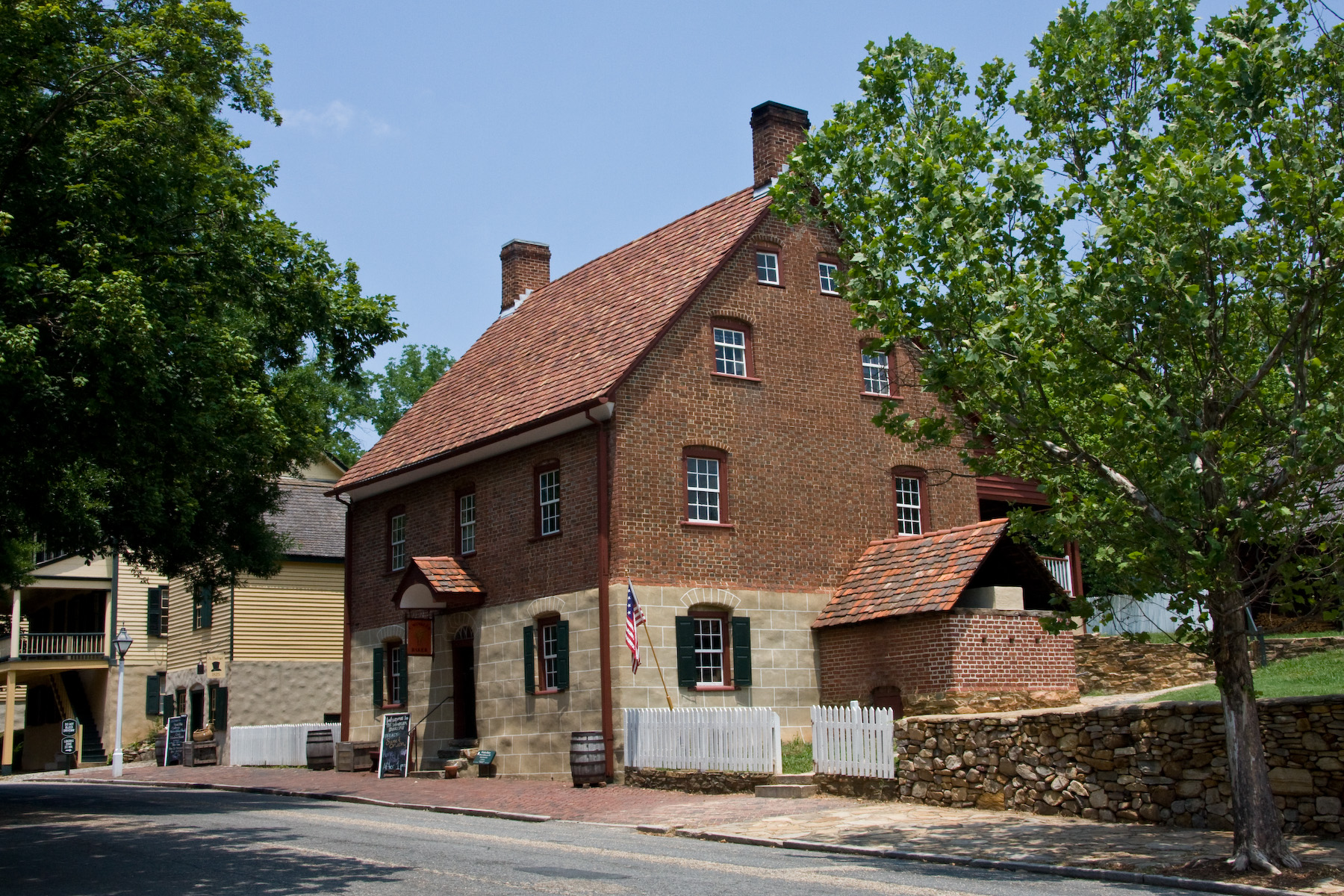
36°14′36″N 80°17′51″W / 36.24333°N 80.2975°WRural Hall 60 Salem Tavern 
October 15, 1966 800 S. Main St.
36°5′7″N 80°14′31″W / 36.08528°N 80.24194°WWinston-Salem 61 Salem Town Hall March 17, 1983 301 S. Liberty St.
36°5′30″N 80°14′38″W / 36.09167°N 80.24389°WWinston-Salem 62 John Jacob Schaub House October 7, 1982 NE of Vienna off SR 1455
36°10′4″N 80°22′50″W / 36.16778°N 80.38056°WVienna 63 Shamrock Mills May 23, 1978 3rd and Marshall Sts.
36°5′45″N 80°14′55″W / 36.09583°N 80.24861°WWinston-Salem 64 Shell Service Station 
May 13, 1976 Sprague and Peachtree Sts., NW
36°4′4″N 80°12′51″W / 36.06778°N 80.21417°WWinston-Salem 65 Christian Thomas Shultz House December 16, 2005 3960 Walnut Hills Dr.
36°8′31″N 80°20′39″W / 36.14194°N 80.34417°WWinston-Salem 66 Single Brothers Industrial Complex Site December 13, 1979 Address Restricted Winston-Salem 67 Single Brothers' House 
April 15, 1970 S. Main and Academy Sts.
36°5′14″N 80°14′33″W / 36.08722°N 80.2425°WWinston-Salem 68 W. F. Smith and Sons Leaf House and Brown Brothers Company Building February 23, 1978 4th St. between Patterson and Linden
36°5′58″N 80°14′28″W / 36.09944°N 80.24111°WWinston-Salem 69 John Wesley Snyder House October 12, 2000 2715 Old Salisbury Rd.
36°1′30″N 80°16′27″W / 36.025°N 80.27417°WWinston-Salem 70 Sosnik-Morris-Early Commercial Block April 5, 1984 500 W. 4th St.
36°5′31″N 80°15′14″W / 36.09194°N 80.25389°WWinston-Salem 71 South Main Street Historic District February 25, 1988 100-600 blks. of S. Main St.
36°6′55″N 80°4′42″W / 36.11528°N 80.07833°WKernersville 72 South Trade Street Houses December 11, 1978 434, 440, and 448 S. Trade St.
36°5′20″N 80°14′45″W / 36.08889°N 80.24583°WWinston-Salem 73 Spruce Street YMCA July 12, 1984 315 N. Spruce St.
36°5′50″N 80°14′55″W / 36.09722°N 80.24861°WWinston-Salem 74 St. Philip's Moravian Church September 3, 1991 E side, S. Church St. near Race St., Old Salem
36°5′4″N 80°14′27″W / 36.08444°N 80.24083°WWinston-Salem 75 Samuel B. Stauber Farm January 12, 1988 SR 1611
36°11′58″N 80°20′57″W / 36.19944°N 80.34917°WBethania 76 Stuart Motor Company February 25, 1988 109-111 E. Mountain St.
36°7′11″N 80°4′22″W / 36.11972°N 80.07278°WKernersville 77 Sunnyside-Central Terrace Historic District May 8, 2008 Roughly bounded by Haled, Junia, Monmouth, Glendale, Goldfloss, Brookline & Main Sts.
36°4′11.57″N 80°14′3.3″W / 36.0698806°N 80.23425°WWinston-Salem 78 Union Station December 24, 1998 300 Martin Luther King, Jr., Dr.
36°5′36″N 80°13′42″W / 36.09333°N 80.22833°WWinston-Salem 79 Wachovia Bank and Trust Company Building May 31, 1984 8 W. 3rd St.
36°5′50″N 80°14′39″W / 36.09722°N 80.24417°WWinston-Salem 80 Wachovia Building 
April 19, 2001 301 N. Main St.
36°5′53″N 80°14′37″W / 36.09806°N 80.24361°WWinston-Salem 81 Washington Park Historic District January 13, 1992 Roughly bounded by Leonard St., Acadia Ave., Sunnyside Ave., Vintage Ave., Broad St., Bond St. and Washington Park
36°4′25″N 80°14′38″W / 36.07361°N 80.24389°WWinston-Salem 82 Waughtown-Belview Historic District January 20, 2005 Roughly bounded by Dacian, Waughtown St, Bellwauwood, Sprague, Ernest, Goldfloss, and Gilbreath Dr.
36°4′3″N 80°12′42″W / 36.0675°N 80.21167°WWinston-Salem 83 West End Historic District December 4, 1986 Roughly bounded by W. End Blvd., Sixth, Broad, and Fourth Sts., I-40, Sunset Dr., and Peters Creek
36°5′48″N 80°15′32″W / 36.09667°N 80.25889°WWinston-Salem 84 West Salem Historic District January 19, 2005 Roughly bounded by Business 40, Poplar, Salem Ave., Walnut, Shober, Hutton Sts, Granville Dr. and Beaumont St.
36°5′12″N 80°14′58″W / 36.08667°N 80.24944°WWinston-Salem 85 Winston-Salem City Hall October 20, 2001 101 S. Main St.
36°5′42″N 80°14′36″W / 36.095°N 80.24333°WWinston-Salem 86 Winston-Salem Southbound Railway Freight Warehouse and Office November 29, 1991 300 S. Liberty St.
36°5′30″N 80°14′40″W / 36.09167°N 80.24444°WWinston-Salem 87 Winston-Salem Tobacco Historic District August 5, 2009 Bounded by Chestnut St. on the W., 5th and 7th Sts. on the N., Linden St. on the E., and 4th and Fogle Sts. on the S.
36°6′1.51″N 80°14′23.95″W / 36.1004194°N 80.2399861°WWinston-Salem 88 Zevely House April 24, 1973 734 Oak St.
36°5′49″N 80°15′26″W / 36.09694°N 80.25722°WWinston-Salem See also
- National Register of Historic Places listings in North Carolina
- List of National Historic Landmarks in North Carolina
References
- ^ The latitude and longitude information provided in this table was derived originally from the National Register Information System, which has been found to be fairly accurate for about 99% of listings. For about 1% of NRIS original coordinates, experience has shown that one or both coordinates are typos or otherwise extremely far off; some corrections may have been made. A more subtle problem causes many locations to be off by up to 150 yards, depending on location in the country: most NRIS coordinates were derived from tracing out latitude and longitudes off of USGS topographical quadrant maps created under North American Datum of 1927, which differs from the current, highly accurate GPS system used by Google maps. Chicago is about right, but NRIS longitudes in Washington are higher by about 4.5 seconds, and are lower by about 2.0 seconds in Maine. Latitudes differ by about 1.0 second in Florida. Some locations in this table may have been corrected to current GPS standards.
- ^ "National Register of Historic Places: Weekly List Actions". National Park Service, United States Department of the Interior. Retrieved on November 10, 2011.
- ^ Numbers represent an ordering by significant words. Various colorings, defined here, differentiate National Historic Landmark sites and National Register of Historic Places Districts from other NRHP buildings, structures, sites or objects.
- ^ "National Register Information System". National Register of Historic Places. National Park Service. 2008-04-24. http://nrhp.focus.nps.gov/natreg/docs/All_Data.html.
- ^ "North Carolina Listings in the National Register of Historic Places by County". North Carolina State Historic Preservation Office. 22 October 2008. http://www.hpo.ncdcr.gov/nrlist.htm. Retrieved 14 July 2009.
U.S. National Register of Historic Places Topics Lists by states Alabama • Alaska • Arizona • Arkansas • California • Colorado • Connecticut • Delaware • Florida • Georgia • Hawaii • Idaho • Illinois • Indiana • Iowa • Kansas • Kentucky • Louisiana • Maine • Maryland • Massachusetts • Michigan • Minnesota • Mississippi • Missouri • Montana • Nebraska • Nevada • New Hampshire • New Jersey • New Mexico • New York • North Carolina • North Dakota • Ohio • Oklahoma • Oregon • Pennsylvania • Rhode Island • South Carolina • South Dakota • Tennessee • Texas • Utah • Vermont • Virginia • Washington • West Virginia • Wisconsin • WyomingLists by territories Lists by associated states Other  Category:National Register of Historic Places •
  Portal:National Register of Historic Places
Municipalities and communities of Forsyth County, North Carolina County seat: Winston-Salem Cities 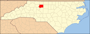
Towns Bethania | Kernersville‡ | King‡ | Lewisville | Rural Hall | Walkertown
Villages Townships Abbots Creek | Belews Creek | Bethania | Broadbay | Clemmonsville | Kernersville | Lewisville | Middle Fork | Old Richmond | Old Town | Salem Chapel | South Fork | Vienna | Winston
Unincorporated
communitiesBelews Creek | Donnaha | Dozier | Germanton | Horneytown | Pfafftown | Seward | Stanleyville | Union Cross | Vienna
Footnotes ‡This populated place also has portions in an adjacent county or counties
Categories:- Forsyth County, North Carolina
- National Register of Historic Places in North Carolina
- Buildings and structures in Forsyth County, North Carolina
-


Wikimedia Foundation. 2010.