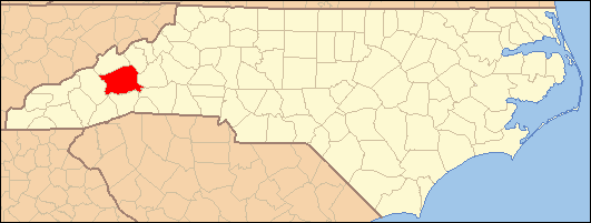
- National Register of Historic Places listings in Buncombe County, North Carolina
-
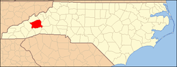
This list includes properties and districts listed on the National Register of Historic Places in Buncombe County, North Carolina. Click the "Map of all coordinates" link to the right to view a Google map of all properties and districts with latitude and longitude coordinates in the table below.[1]
-
- This National Park Service list is complete through NPS recent listings posted November 10, 2011.[2]
[3] Landmark name[4] Image Date listed Location City or Town Summary 1 Judge Junius G. Adams House October 5, 2001 11 Stuyvesant Rd.
35°32′9″N 82°32′14″W / 35.53583°N 82.53722°WBiltmore Forest 2 Alexander Inn May 31, 1984 Address Restricted Swannanoa 3 Mrs. Minnie Alexander Cottage December 21, 1989 218 Patton Ave.
35°35′34″N 82°33′40″W / 35.59278°N 82.56111°WAsheville 4 All Souls Episcopal Church and Parish House November 15, 1979 2 Angle St.
35°33′55″N 82°32′34″W / 35.56528°N 82.54278°WAsheville 5 Arcade Building May 19, 1976 Battery Park, Battle Sq.
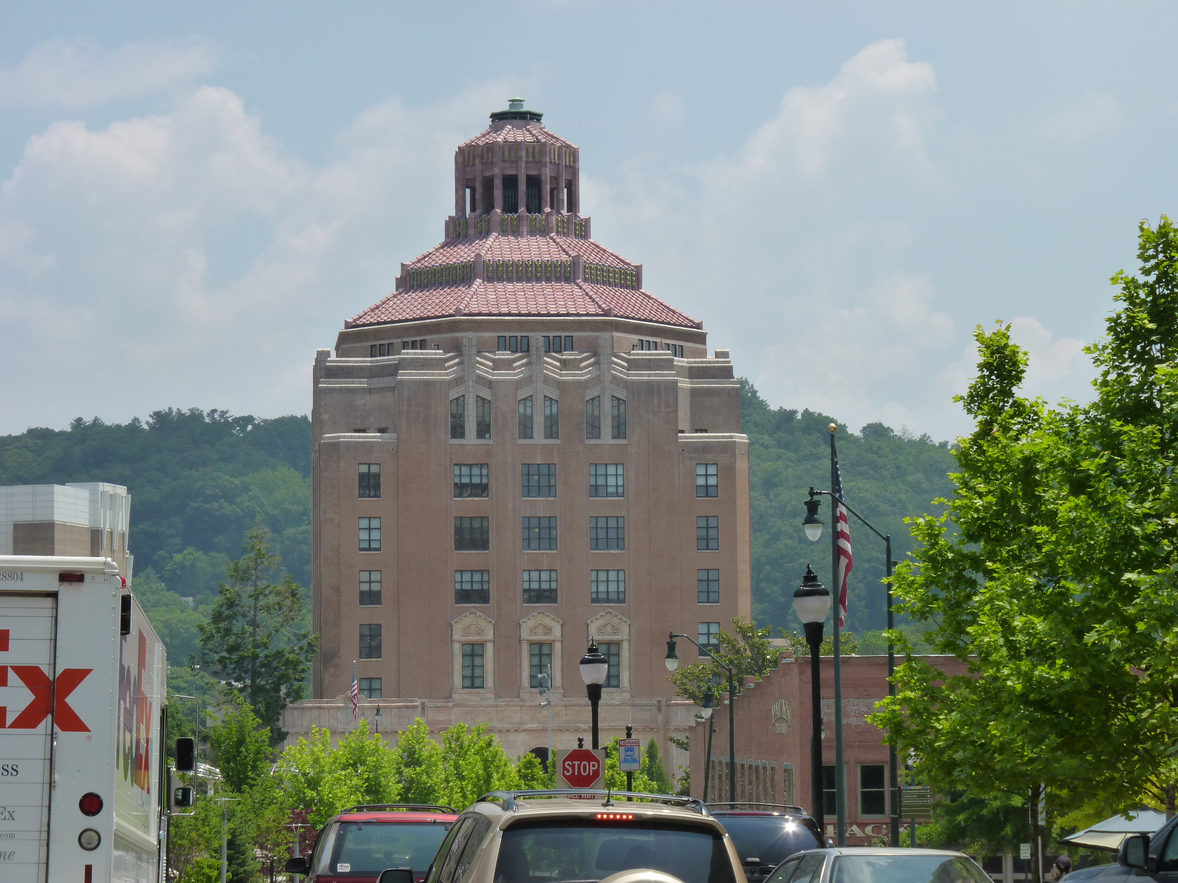
35°35′44″N 82°33′24″W / 35.59556°N 82.55667°WAsheville 6 Asheville City Hall 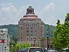
November 7, 1976 City County Plaza
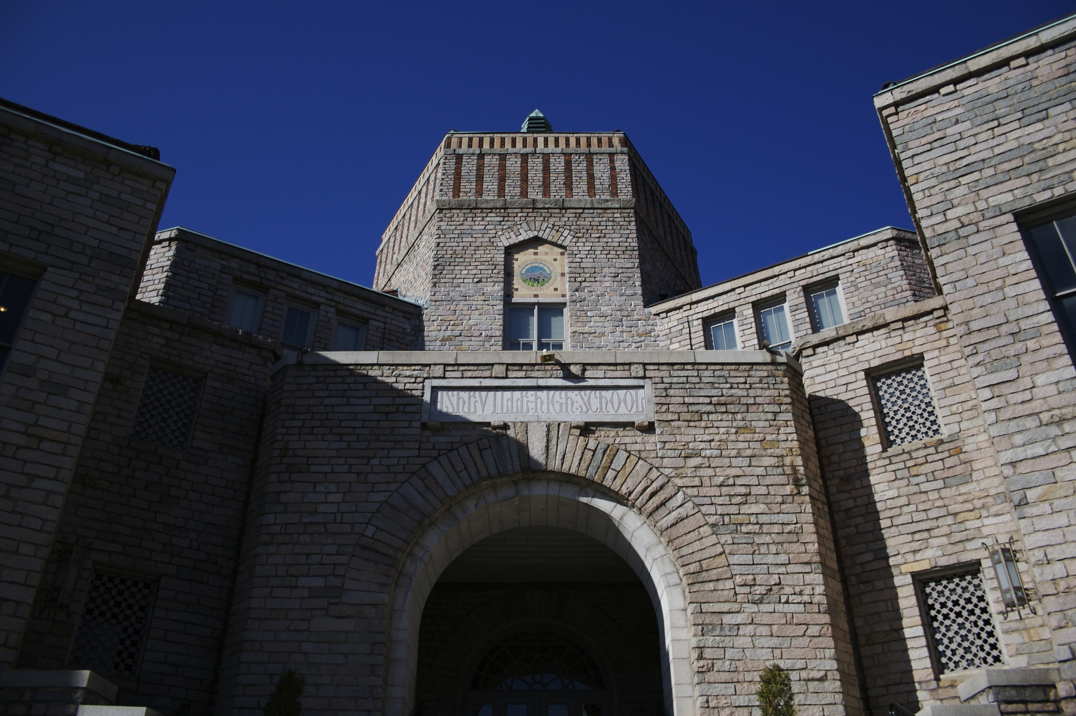
35°35′44″N 82°32′55″W / 35.59556°N 82.54861°WAsheville 7 Asheville High School 
April 26, 1996 419 McDowell St.
35°34′17″N 82°33′8″W / 35.57139°N 82.55222°WAsheville 8 Asheville School June 3, 1996 Roughly bounded by Patton Ave., Southern RR line, US 40, Sand Hill Rd., and Malvern Hills subdivision
35°33′43″N 82°37′21″W / 35.56194°N 82.6225°WAsheville 9 Asheville Transfer and Storage Company Building April 26, 1979 192-194 Coxe Ave.
35°35′14″N 82°33′16″W / 35.58722°N 82.55444°WAsheville 10 B & B Motor Company Building April 26, 1979 84-94 Coxe Ave.
35°35′28″N 82°33′17″W / 35.59111°N 82.55472°WAsheville 11 Zebulon H. Baird House April 30, 2009 460 Weaverville Rd.
35°39′57.01″N 82°35′3.08″W / 35.6658361°N 82.5841889°WWeaverville vicinity 12 Clarence Barker Memorial Hospital November 15, 1979 2-6 Reed St.
35°33′54″N 82°32′28″W / 35.565°N 82.54111°WAsheville 13 Battery Park Hotel July 14, 1977 Battle Sq.
35°35′49″N 82°32′19″W / 35.59694°N 82.53861°WAsheville 14 Bent Creek Campus of the Appalachian Forest Experiment Station April 29, 1993 Brevard Rd. S of jct. with I-26
35°30′9″N 82°35′49″W / 35.5025°N 82.59694°WAsheville 15 Biltmore Estate 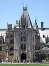
October 15, 1966 One Biltmore Plaza
35°34′2.97″N 82°32′34.29″W / 35.5674917°N 82.5428583°WAsheville 16 Biltmore Estate Office November 15, 1979 10 Biltmore Plaza
35°34′3″N 82°32′34″W / 35.5675°N 82.54278°WAsheville 17 Biltmore Hardware Building August 21, 2003 28-32 Hendersonville Rd.
35°34′3″N 82°32′38″W / 35.5675°N 82.54389°WAsheville 18 Biltmore Hospital September 1, 2005 14 All Souls Crecent
35°33′52″N 82°32′29″W / 35.56444°N 82.54139°WAsheville 19 Biltmore Industries, Inc. February 1, 1980 Grovewood Rd.
35°37′20″N 82°32′41″W / 35.62222°N 82.54472°WAsheville 20 Biltmore Shoe Store November 15, 1979 8 Lodge St.
35°34′3″N 82°32′34″W / 35.5675°N 82.54278°WAsheville 21 Biltmore Village Commercial Buildings November 15, 1979 Brook St. and Biltmore Plaza
35°34′3″N 82°32′34″W / 35.5675°N 82.54278°WAsheville 22 Biltmore Village Cottage District November 15, 1979 Swan St., All Souls Cresent and Boston Way
35°33′58″N 82°32′29″W / 35.56611°N 82.54139°WAsheville 23 Biltmore Village Cottages November 15, 1979 18 Angle St. and 75 Hendersonville Rd.
35°33′58″N 82°32′38″W / 35.56611°N 82.54389°WAsheville 24 Biltmore-Oteen Bank Building November 15, 1979 12 Lodge St.
35°34′3″N 82°32′34″W / 35.5675°N 82.54278°WAsheville 25 Black Mountain College Historic District October 5, 1982 SR 2468
35°37′59″N 82°22′17″W / 35.63306°N 82.37139°WBlack Mountain 26 Black Mountain Downtown Historic District June 2, 2004 Black Mountain Ave., Sutton Ave., Cherry, Broadway and State Sts.
35°36′58″N 82°19′14″W / 35.61611°N 82.32056°WBlack Mountain 27 Blake House August 30, 2010 150 Royal Pines Dr.
35°28′28″N 82°31′1″W / 35.47444°N 82.51694°WArden 28 Bledsoe Building April 18, 2003 771-783 Haywood Rd.
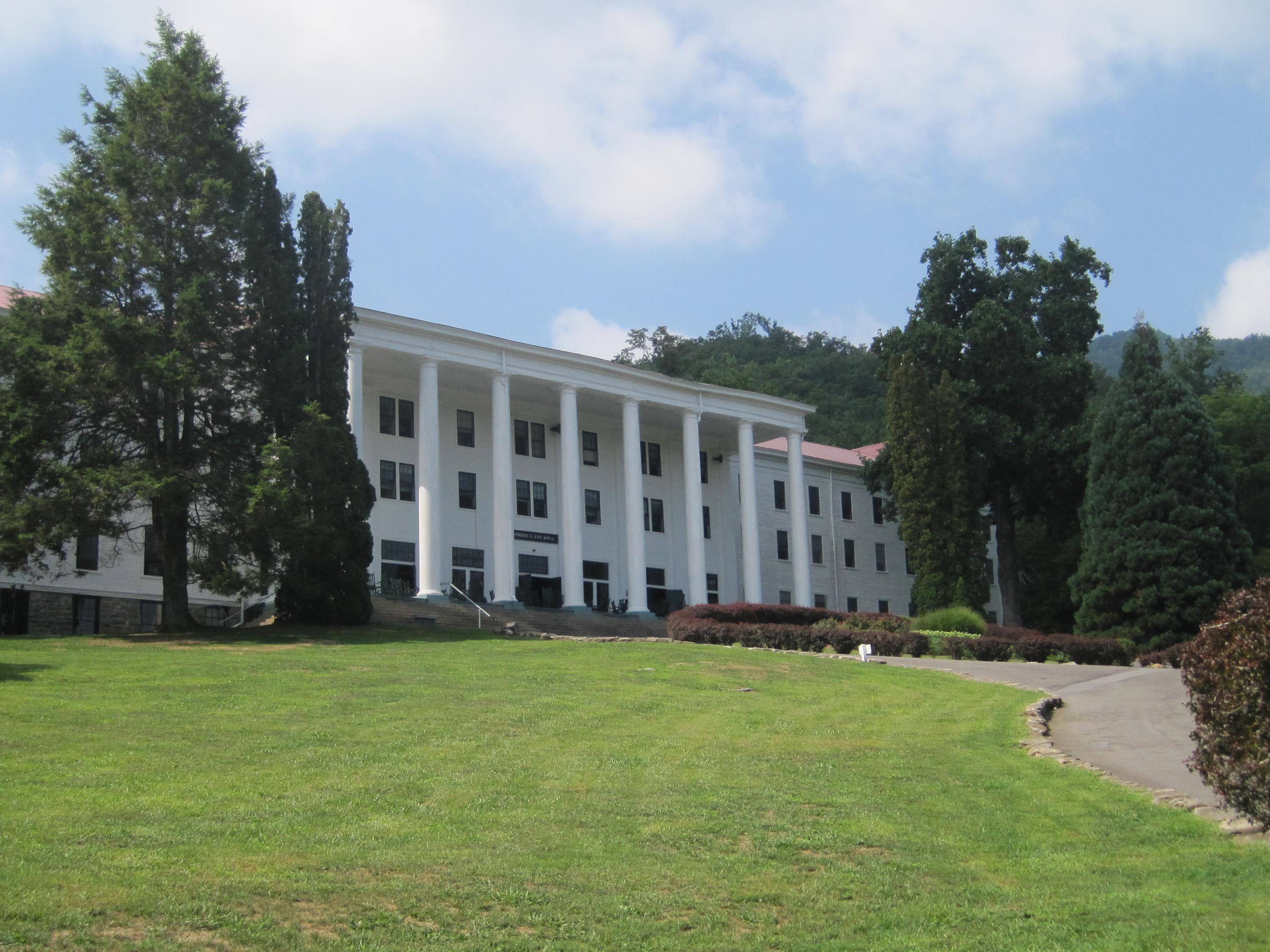
35°34′44″N 82°35′40″W / 35.57889°N 82.59444°WAsheville 29 Blue Ridge Assembly Historic District 
September 17, 1979 S of Black Mountain on SR 2720
35°35′6″N 82°20′21″W / 35.585°N 82.33917°WBlack Mountain 30 William E. Breese, Sr., House April 28, 1980 674 Biltmore Ave.
35°34′23″N 82°32′44″W / 35.57306°N 82.54556°WAsheville 31 Brigman-Chambers House June 2, 2004 NC 1003, 0.6. miles W of jct. with NC 2118
35°42′22″N 82°29′27″W / 35.70611°N 82.49083°WWeaverville 32 Broadway Market Building September 1, 2005 201 Broadway
35°36′4″N 82°33′22″W / 35.60111°N 82.55611°WAsheville 33 William Jennings Bryan House June 23, 1983 107 Evelyn Pl.
35°36′45″N 82°33′2″W / 35.6125°N 82.55056°WAsheville 34 Building at 130-132 Biltmore Avenue April 26, 1979 130-132 Biltmore Ave.
35°35′25″N 82°33′4″W / 35.59028°N 82.55111°WAsheville 35 Building at 134-136 1/2 Biltmore Avenue April 26, 1979 134-136 1/2 Biltmore Ave.
35°35′25″N 82°33′4″W / 35.59028°N 82.55111°WAsheville 36 Building at 140 Biltmore Avenue April 26, 1979 140 Biltmore Ave.
35°35′25″N 82°33′4″W / 35.59028°N 82.55111°WAsheville 37 Buncombe County Boys' Training School, (Former) September 30, 1997 177 Erwin Hills Rd.
35°37′14″N 82°37′23″W / 35.62056°N 82.62306°WAsheville 38 Buncombe County Courthouse May 10, 1979 College and Davidson Sts.
35°35′45″N 82°32′55″W / 35.59583°N 82.54861°WAsheville 39 Camp Academy September 19, 1985 NC 63
35°39′22″N 82°42′52″W / 35.65611°N 82.71444°WLeicester 40 William Nelson Camp, Jr., House December 17, 1998 92 Flat Top Mountain Rd.
35°32′56″N 82°23′31″W / 35.54889°N 82.39194°WFairview 41 Carter-Swain House July 2, 1987 E side SR 2162, N of jct. with SR 2163
35°47′24″N 82°29′31″W / 35.79°N 82.49194°WDemocrat 42 Chestnut Hill Historic District March 17, 1983 Roughly bounded by Hillside, Washington, Broad, Hollywood, Orchards Sts. and Merrimon Ave.
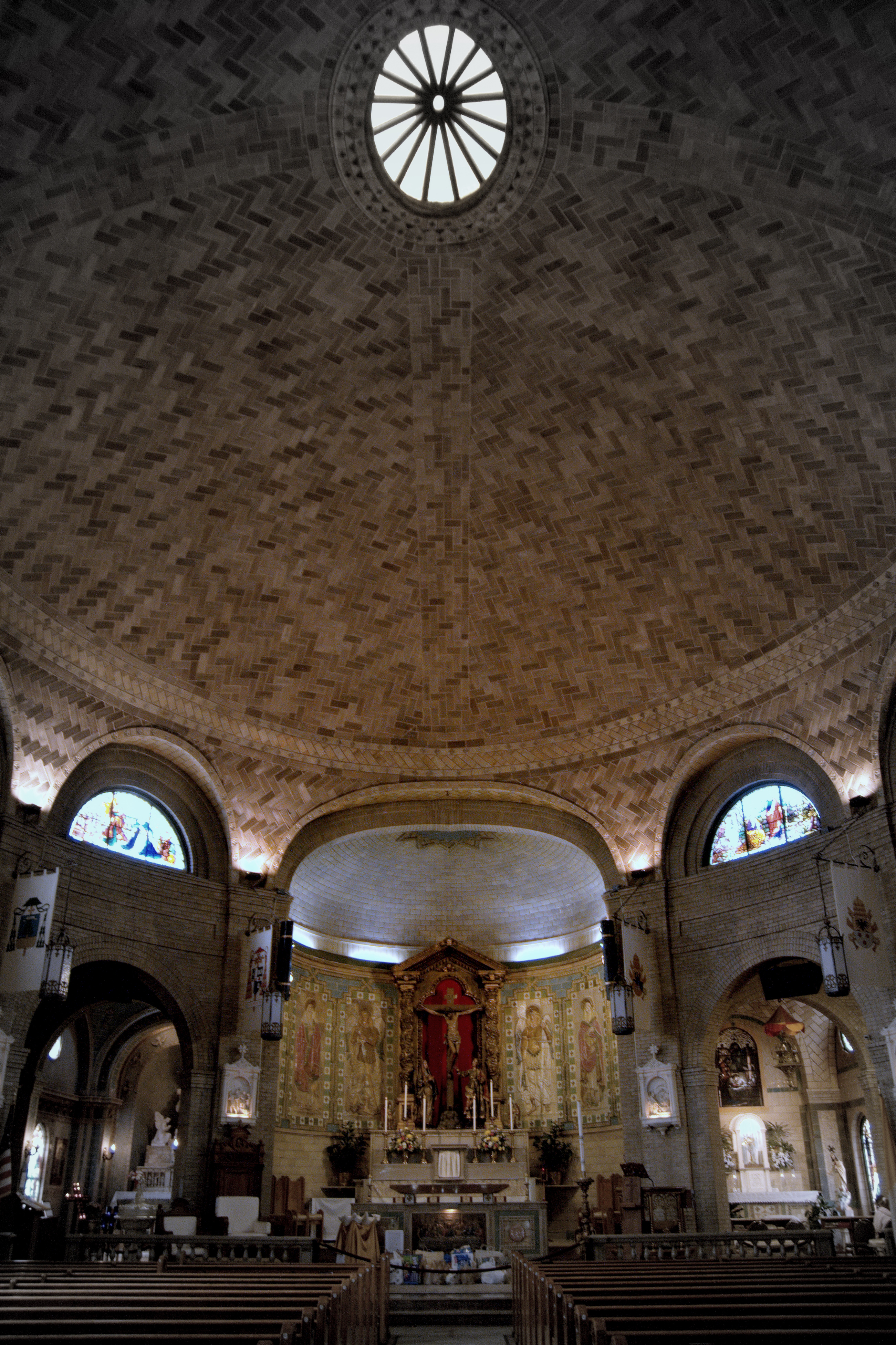
35°36′13″N 82°32′55″W / 35.60361°N 82.54861°WAsheville 43 Church of St. Lawrence 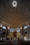
March 24, 1978 97 Haywood St.
35°35′51″N 82°33′23″W / 35.5975°N 82.55639°WAsheville 44 Church of the Redeemer September 19, 1985 1202 Riverside Dr.
35°37′28″N 82°35′33″W / 35.62444°N 82.5925°WAsheville 45 Claxton School June 4, 1992 241 Merrimon Ave.
35°36′28″N 82°33′13″W / 35.60778°N 82.55361°WAsheville 46 Clingman Avenue Historic District June 9, 2004 Roughly along Clingman Ave., from Hillard Ave. to Haywood Ave.
35°35′24″N 82°33′48″W / 35.59°N 82.56333°WAsheville 47 Conabeer Chrysler Building April 26, 1979 162-164 Coxe Ave.
35°35′18″N 82°33′17″W / 35.58833°N 82.55472°WAsheville 48 Demens-Rumbough-Crawley House June 1, 1982 31 Park Ave.
35°35′21″N 82°33′59″W / 35.58917°N 82.56639°WAsheville 49 Dougherty Heights Historic District January 14, 2011 Church St., Connally St., and North Dougherty St., Laurel Circle, Prospect St., and New Bern Ave.
35°37′3″N 82°19′26″W / 35.6175°N 82.32389°WBlack Mountain 50 Downtown Asheville Historic District April 26, 1979 Roughly bounded by 1240 Valley St., Hilliard Ave., and Broad Ave.; also 60 and 64 Biltmore Ave.; also Church St. and Ravenscroft Dr.
35°35′42″N 82°33′12″W / 35.595°N 82.55333°WAsheville Second and third sets of addresses represent boundary increases of May 25, 1989 and August 23, 1990 respectively 51 E. D. Latta Nurses' Residence April 26, 1979 159 Woodfin St.
35°35′58″N 82°32′48″W / 35.59944°N 82.54667°WAsheville 52 Eliada Home April 22, 1993 2 Compton Dr.
35°36′8″N 82°37′8″W / 35.60222°N 82.61889°WAsheville 53 Joseph P. Eller House August 11, 2004 494 Clarks' Chapel Rd.
35°43′51″N 82°34′20″W / 35.73083°N 82.57222°WWeaverville 54 Douglas Ellington House October 16, 1986 583 Chunns Cove Rd.
35°37′7″N 82°31′24″W / 35.61861°N 82.52333°WAsheville 55 Engadine September 24, 2001 US 19/23, 0.3 miles E of Haywood
35°32′20″N 82°45′43″W / 35.53889°N 82.76194°WChandler 56 Fire Station Number 4 April 6, 2000 300 Merrimon Ave.
35°36′32″N 82°33′17″W / 35.60889°N 82.55472°WAsheville 57 First Baptist Church July 13, 1976 Oak and Woodfin Sts.
35°35′57″N 82°32′52″W / 35.59917°N 82.54778°WAsheville 58 George A. Mears House April 26, 1979 137 Biltmore Ave.
35°35′25″N 82°33′4″W / 35.59028°N 82.55111°WAsheville 59 Grove Park Historic District April 13, 1989 Roughly bounded by Evelyn Pl., Macon Ave., Howland Rd., Woodland Rd., Canterbury Ln., Charlotte St., and Murdock Ave.; also roughly Kimberly Ave. from Maywood St. to north of Evelyn Pl., including Grove Park Inn Country Club
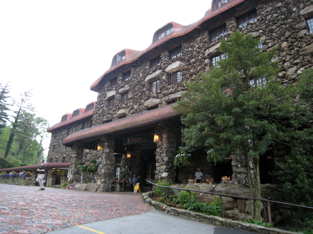
35°36′38″N 82°32′45″W / 35.61056°N 82.54583°WAsheville Second set of boundaries represents a boundary increase of December 18, 1990 60 Grove Park Inn 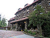
April 3, 1973 Macon Ave.
35°37′15″N 82°31′26″W / 35.62083°N 82.52389°WAsheville 61 Rafael Guastavino, Sr., Estate July 13, 1989 NC 9, 0.8 miles S of jct. with SR 2713
35°35′51″N 82°18′35″W / 35.5975°N 82.30972°WBlack Mountain 62 Gunston Hall October 24, 1991 324 Vanderbilt Rd.
35°32′50″N 82°32′11″W / 35.54722°N 82.53639°WBiltmore Forest 63 Intheoaks April 10, 1991 510 Vance Ave.
35°36′40″N 82°19′40″W / 35.61111°N 82.32778°WBlack Mountain 64 Thomas Jarrett House January 21, 1994 46 Louisiana Ave.
35°34′47″N 82°35′28″W / 35.57972°N 82.59111°WAsheville 65 Kenilworth Inn December 31, 2001 60 Caledonia Rd.
35°34′20″N 82°32′27″W / 35.57222°N 82.54083°WAsheville 66 John A. Lanning House September 23, 1982 W of Fairview on SR 3128
35°31′15″N 82°25′56″W / 35.52083°N 82.43222°WFairview 67 Manor and Cottages January 26, 1978 265 Charlotte St.
35°36′29″N 82°32′33″W / 35.60806°N 82.5425°WAsheville 68 Dr. Cireo McAfee McCracken House September 1, 1995 1384 Charlotte Hwy.
35°31′28″N 82°24′34″W / 35.52444°N 82.40944°WFairview 69 McGeahy Building November 15, 1979 7 1/2 Biltmore Plaza
35°34′3″N 82°32′34″W / 35.5675°N 82.54278°WAsheville 70 Monte Vista Hotel April 30, 2008 308 W. State St.
35°36′49.76″N 82°19′36.5″W / 35.6138222°N 82.326806°WBlack Mountain 71 Montford Area Historic District November 25, 1977 Irregular pattern along Montford Ave.
35°36′10″N 82°33′53″W / 35.60278°N 82.56472°WAsheville 72 Municipal Golf Course April 20, 2005 226 Fairway Dr.
35°34′45″N 82°30′8″W / 35.57917°N 82.50222°WAsheville 73 North Carolina Electrical Power Company Electric Generating Plant June 25, 1999 2024 Riverside Dr.
35°38′25″N 82°35′53″W / 35.64028°N 82.59806°WWoodfin 74 Norwood Park Historic District August 29, 2008 District is bounded roughly on the W. and S. by Murdock St.; on the N. by Woodward Ave; on the E. by Norwood Ave.
35°36′55.62″N 82°33′8.65″W / 35.61545°N 82.5524028°WAsheville 75 Oteen Veterans Administration Hospital Historic District November 20, 1985 N side of US 70
35°35′27″N 82°29′5″W / 35.59083°N 82.48472°WAsheville 76 Ottari Sanitarium October 16, 1986 491 Kimberly Ave.
35°37′45″N 82°32′51″W / 35.62917°N 82.5475°WAsheville 77 Overlook October 22, 1980 710 Town Mountain Rd.
35°36′40″N 82°32′4″W / 35.61111°N 82.53444°WAsheville 78 Proximity Park Historic District October 8, 2008 Roughly bounded by Macon Ave., Howland Rd., Woodlink Rd., Charlotte St., and Sunset Trail
35°36′51.91″N 82°32′33.09″W / 35.6144194°N 82.542525°WAsheville 79 Thomas Wadley Raoul House November 28, 2006 394 Vanderbilt Rd.
35°32′3″N 82°32′24″W / 35.53417°N 82.54°WAsheville 80 Ravenscroft School December 12, 1978 29 Ravenscroft Dr.
35°35′29″N 82°33′15″W / 35.59139°N 82.55417°WAsheville 81 Samuel Harrison Reed House November 15, 1979 119 Dodge St.
35°33′51″N 82°32′22″W / 35.56417°N 82.53944°WAsheville 82 Reynolds House September 13, 1984 100 Reynolds Hts.
35°38′37″N 82°34′41″W / 35.64361°N 82.57806°WAsheville 83 Dr. Carl V. Reynolds House August 19, 1982 86 Edgemont Rd.
35°36′52″N 82°32′32″W / 35.61444°N 82.54222°WAsheville 84 Richbourg Motors Building April 26, 1979 50 Coxe Ave.
35°35′32″N 82°33′17″W / 35.59222°N 82.55472°WAsheville 85 Richmond Hill House August 16, 1977 45 Richmond Hill Rd.
35°36′40″N 82°34′50″W / 35.61111°N 82.58056°WAsheville 86 Riverside Industrial Historic District August 11, 2004 Roughly bounded by Clingman Ave., Lyman St., Roberts St., and Riverside Dr.
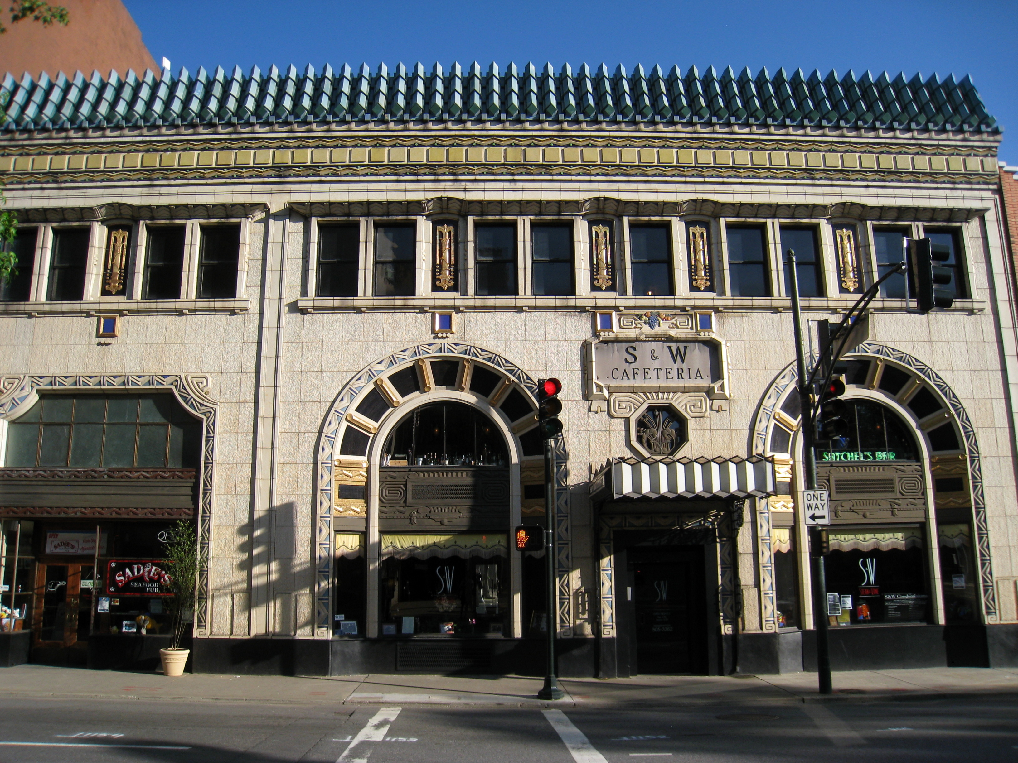
35°35′10″N 82°34′1″W / 35.58611°N 82.56694°WAsheville 87 S and W Cafeteria 
March 28, 1977 Patton Ave.
35°35′39.91″N 82°33′14.18″W / 35.5944194°N 82.5539389°WAsheville 88 Sawyer Motor Company Building April 26, 1979 100 Coxe Ave.
35°35′26″N 82°33′17″W / 35.59056°N 82.55472°WAsheville 89 Schoenberger Hall April 26, 1979 60 Ravenscroft Dr.
35°35′25″N 82°33′12″W / 35.59028°N 82.55333°WAsheville Destroyed[5] 90 Sherrill's Inn April 16, 1975 2.5 miles S of Fairview off U.S. 74
35°29′36″N 82°21′59″W / 35.49333°N 82.36639°WFairview 91 Richard Sharp Smith House January 22, 2009 655 Chunns Cove Rd.
35°37′7.45″N 82°31′27.78″W / 35.6187361°N 82.5243833°WAsheville 92 Whitford G. Smith House May 4, 2005 263 Haywood St.
35°35′41″N 82°33′43″W / 35.59472°N 82.56194°WAsheville 93 Smith-McDowell House August 1, 1975 283 Victoria Rd.
35°34′23″N 82°33′18″W / 35.57306°N 82.555°WAsheville 94 South Montreat Road Historic District December 27, 2010 Along Montreat Rd., 102 First St., 100 Third St., 100 Ninth St., and 101 Beech St.
35°37′23″N 82°19′15″W / 35.62306°N 82.32083°WBlack Mountain 95 Southern Railway Passenger Depot November 15, 1979 1 Biltmore Plaza
35°34′3″N 82°32′34″W / 35.5675°N 82.54278°WAsheville 96 Spinning Wheel July 28, 1999 1096 Hendersonville Rd.
35°32′7″N 82°31′41″W / 35.53528°N 82.52806°WAsheville 97 St. Luke's Episcopal Church September 30, 1997 219 Chunn's Cove Rd.
35°36′7″N 82°31′53″W / 35.60194°N 82.53139°WAsheville 98 St. Mary's Church December 23, 1994 337 Charlotte St.
35°36′39″N 82°32′42″W / 35.61083°N 82.545°WAsheville 99 St. Matthias Episcopal Church May 10, 1979 Valley St.
35°35′30″N 82°32′54″W / 35.59167°N 82.54833°WAsheville 100 Sunset Terrace Historic District December 16, 2005 9-48 Sunset Terrace
35°36′58″N 82°32′30″W / 35.61611°N 82.54167°WAsheville 101 Thomas Chapel A.M.E. Zion Church April 30, 2009 300 Cragmont Rd.
35°37′9.42″N 82°21′20.36″W / 35.6192833°N 82.3556556°WBlack Mountain 102 Weaverville United Methodist Church March 1, 1996 85 N. Main St.
35°41′57″N 82°33′37″W / 35.69917°N 82.56028°WWeaverville 103 West Asheville End of Car Line Historic District August 9, 2006 Both sides of Haywood Rd. from 715 to 814 and 7-9 Brevard Rd.
35°34′41″N 82°35′39″W / 35.57806°N 82.59417°WAsheville 104 West Asheville-Aycock School Historic District August 23, 2006 401-441 Haywood Rd.
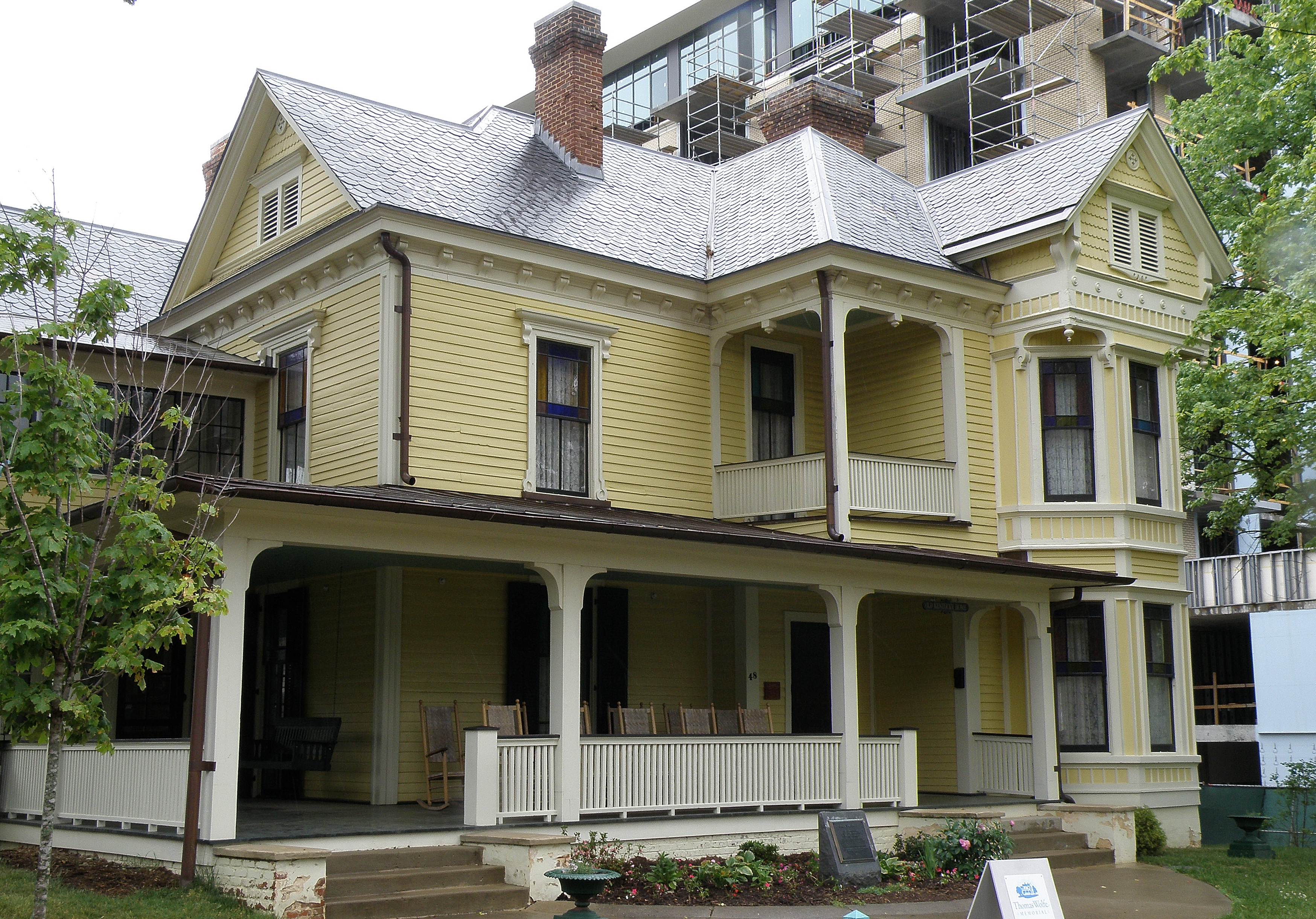
35°34′42″N 82°34′53″W / 35.57833°N 82.58139°WAsheville 105 Thomas Wolfe House 
November 11, 1971 48 Spruce St.
35°35′51″N 82°32′43″W / 35.5975°N 82.54528°WAsheville 106 Young Men's Institute Building July 14, 1977 Market and Eagle Sts.
35°35′38″N 82°33′1″W / 35.59389°N 82.55028°WAsheville 107 Zealandia March 14, 1977 40 Vance Gap Rd.
35°35′47″N 82°32′21″W / 35.59639°N 82.53917°WAsheville See also
- National Register of Historic Places listings in North Carolina
- List of National Historic Landmarks in North Carolina
References
- ^ The latitude and longitude information provided in this table was derived originally from the National Register Information System, which has been found to be fairly accurate for about 99% of listings. For about 1% of NRIS original coordinates, experience has shown that one or both coordinates are typos or otherwise extremely far off; some corrections may have been made. A more subtle problem causes many locations to be off by up to 150 yards, depending on location in the country: most NRIS coordinates were derived from tracing out latitude and longitudes off of USGS topographical quadrant maps created under the North American Datum of 1927, which differs from the current, highly accurate WGS84 GPS system used by Google maps. Chicago is about right, but NRIS longitudes in Washington are higher by about 4.5 seconds, and are lower by about 2.0 seconds in Maine. Latitudes differ by about 1.0 second in Florida. Some locations in this table may have been corrected to current GPS standards.
- ^ "National Register of Historic Places: Weekly List Actions". National Park Service, United States Department of the Interior. Retrieved on November 10, 2011.
- ^ Numbers represent an ordering by significant words. Various colorings, defined here, differentiate National Historic Landmark sites and National Register of Historic Places Districts from other NRHP buildings, structures, sites or objects.
- ^ "National Register Information System". National Register of Historic Places. National Park Service. 2008-04-24. http://nrhp.focus.nps.gov/natreg/docs/All_Data.html.
- ^ "North Carolina Listings in the National Register of Historic Places by County". North Carolina State Historic Preservation Office. 22 October 2008. http://www.hpo.ncdcr.gov/nrlist.htm. Retrieved 14 July 2009.
U.S. National Register of Historic Places Topics Lists by states Alabama • Alaska • Arizona • Arkansas • California • Colorado • Connecticut • Delaware • Florida • Georgia • Hawaii • Idaho • Illinois • Indiana • Iowa • Kansas • Kentucky • Louisiana • Maine • Maryland • Massachusetts • Michigan • Minnesota • Mississippi • Missouri • Montana • Nebraska • Nevada • New Hampshire • New Jersey • New Mexico • New York • North Carolina • North Dakota • Ohio • Oklahoma • Oregon • Pennsylvania • Rhode Island • South Carolina • South Dakota • Tennessee • Texas • Utah • Vermont • Virginia • Washington • West Virginia • Wisconsin • WyomingLists by territories Lists by associated states Other Municipalities and communities of Buncombe County, North Carolina City 
Towns CDPs Avery Creek | Bent Creek | Fairview | Leicester | Royal Pines | Swannanoa
Unincorporated
communitiesArden | Barnardsville | Candler | Enka | Jupiter | Ridgecrest | Skyland
Categories:- Buncombe County, North Carolina
- National Register of Historic Places in North Carolina
- Buildings and structures in Buncombe County, North Carolina
-

Wikimedia Foundation. 2010.