- National Register of Historic Places listings in Bulloch County, Georgia
-
This is a list of properties and districts in Bulloch County, Georgia that are listed on the National Register of Historic Places (NRHP).
-
- This National Park Service list is complete through NPS recent listings posted November 10, 2011.[1]
Current listings
Landmark name Image Date listed Location City or Town Summary 1 Sol Akins Farm March 22, 1990 Old Register Rd. off US 301, 1.2 mi. S of Statesboro
32°24′26″N 81°48′10″W / 32.40722°N 81.80278°WStatesboro 2 James Alonzo Brannen House September 6, 1989 112 S. Main St./US 301
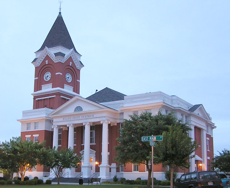
32°26′46″N 81°46′59″W / 32.44611°N 81.78306°WStatesboro 3 Bulloch County Courthouse 
September 18, 1980 Courthouse Sq.
32°26′57″N 81°46′59″W / 32.44917°N 81.78306°WStatesboro 4 Donehoo-Brannen House July 7, 1995 332 Savannah Ave.
32°26′34″N 81°46′17″W / 32.44278°N 81.77139°WStatesboro 5 East Main Street Commercial Historic District September 6, 1989 Roughly E. Main St./US 301 between Siebald and Oak Sts.
32°26′58″N 81°40′32″W / 32.44944°N 81.67556°WStatesboro 6 East Vine Street Warehouse and Depot District September 6, 1989 Roughly bounded by E. Vine St., Central of Georgia Railroad tracks, and Cherry St.
32°26′52″N 81°40′30″W / 32.44778°N 81.675°WStatesboro 7 Dr. Madison Monroe Holland House September 6, 1989 27 S. Main St./US 301
32°26′51″N 81°47′3″W / 32.4475°N 81.78417°WStatesboro 8 Jaeckel Hotel June 17, 1982 50 E. Main St.
32°26′54″N 81°46′53″W / 32.44833°N 81.78139°WStatesboro 9 John A. McDougald House June 21, 1982 121 S. Main St.
32°26′44″N 81°47′3″W / 32.44556°N 81.78417°WStatesboro 10 Dr. John C. Nevil House August 10, 1989 US 301 S of Register
32°17′8″N 81°52′38″W / 32.28556°N 81.87722°WRegister 11 North College Street Residential Historic District September 6, 1989 Roughly N. College St. from Northside Dr. to Elm St.
32°27′12″N 81°47′6″W / 32.45333°N 81.785°WStatesboro 12 North Main Street Commercial Historic District September 6, 1989 Roughly N. Main St. between Courtland and W. Main Sts.
32°26′57″N 81°47′0″W / 32.44917°N 81.783333°WStatesboro 13 William W. Olliff Farm December 4, 1987 New Hope Rd.
32°17′25″N 81°56′35″W / 32.29028°N 81.94306°WRegister 14 William G. Raines House August 31, 1987 106 S. Main St.
32°26′47″N 81°47′3″W / 32.44639°N 81.78417°WStatesboro 15 Savannah Avenue Historic District November 15, 1996 Along Savannah Ave. and E. Grady St. between S. Crescent Cir.
32°26′38″N 81°46′24″W / 32.44389°N 81.77333°WStatesboro 16 South Main Street Historic District September 6, 1989 Roughly S. Main St. between W. Main and Vine Sts.
32°26′55″N 81°47′0″W / 32.44861°N 81.783333°WStatesboro 17 South Main Street Residential Historic District September 6, 1989 Roughly College Ln., Southern Railway right-of-way, Walnut, Mikell, and S. Main Sts.
32°26′25″N 81°47′1″W / 32.44028°N 81.78361°WStatesboro 18 Statesboro City Hall and Fire Station September 6, 1989 Siebald and Courtland Sts.
32°26′59″N 81°46′56″W / 32.44972°N 81.78222°WStatesboro 19 Stewart Stores May 20, 1993 Jct. of Railroad and Grady Sts.
32°32′17″N 81°55′55″W / 32.53806°N 81.93194°WPortal 20 Dr. James A. Stewart House May 27, 1993 Grady St.
32°32′23″N 81°55′52″W / 32.53972°N 81.93111°WPortal 21 Upper Lott's Creek Primitive Baptist Church and Cemetery December 4, 2008 Metter-Portal Hwy. and Westside Rd. Metter 22 US Post Office-Statesboro September 6, 1989 26 S. Main St./US 301
32°26′51″N 81°47′0″W / 32.4475°N 81.783333°WStatesboro 23 West Main Street Commercial Historic District September 6, 1989 Roughly W. Main St. between Walnut and N. and S. Main Sts.
32°26′56″N 81°47′3″W / 32.44889°N 81.78417°WStatesboro References
- ^ "National Register of Historic Places: Weekly List Actions". National Park Service, United States Department of the Interior. Retrieved on November 10, 2011.
Categories:- National Register of Historic Places in Georgia (U.S. state)
- Buildings and structures in Bulloch County, Georgia
-
Wikimedia Foundation. 2010.