- National Register of Historic Places listings in Muscogee County, Georgia
-
This is a list of properties and districts in Muscogee County, Georgia that are listed on the National Register of Historic Places (NRHP).
-
- This National Park Service list is complete through NPS recent listings posted November 10, 2011.[1]
Current listings
Landmark name Image Date listed Location City or Town Summary 1 Adams Cotton Gin Building May 17, 1984 6601 Hamilton Rd.
32°32′26″N 84°57′18″W / 32.54056°N 84.955°WColumbus 2 George O. Berry House September 29, 1980 912 2nd Ave.
32°27′47″N 84°59′26″W / 32.46306°N 84.99056°WColumbus 3 Bibb City Historic District February 24, 2010 Roughly bounded by Chattahoochee River, Woodland Cir., 2nd Ave. and 35th St.
32°30′8.45″N 84°59′30.07″W / 32.5023472°N 84.9916861°WBibb City 4 Broad Street Methodist Episcopal Church South December 2, 1980 1323-1325 Broadway
32°28′17″N 84°59′37″W / 32.47139°N 84.99361°WColumbus 5 Building at 1007 Broadway September 29, 1980 1007 Broadway
32°27′53″N 84°59′37″W / 32.46472°N 84.99361°WColumbus 6 Building at 1009 Broadway September 29, 1980 1009 Broadway
32°27′54″N 84°59′37″W / 32.465°N 84.99361°WColumbus 7 Building at 1400 Third Avenue September 29, 1980 1400 Third Ave.
32°28′21″N 84°59′20″W / 32.4725°N 84.98889°WColumbus 8 Building at 1519 3rd Avenue December 2, 1980 1519 3rd Ave.
32°28′30″N 84°59′21″W / 32.475°N 84.98917°WColumbus 9 Building at 1531 3rd Avenue December 2, 1980 1531 3rd Ave.
32°28′31″N 84°59′21″W / 32.47528°N 84.98917°WColumbus 10 Building at 1612 3rd Avenue December 2, 1980 1612 3rd Ave.
32°28′35″N 84°59′20″W / 32.47639°N 84.98889°WColumbus 11 Building at 1617 Third Avenue September 29, 1980 1617 Third Ave.
32°28′37″N 84°59′21″W / 32.47694°N 84.98917°WColumbus 12 Building at 1619 Third Avenue September 29, 1980 1619 Third Ave.
32°28′37″N 84°59′21″W / 32.47694°N 84.98917°WColumbus 13 Building at 1625 Third Avenue September 29, 1980 1625 Third Ave.
32°28′38″N 84°59′21″W / 32.47722°N 84.98917°WColumbus 14 Building at 215 Ninth Street September 29, 1980 215 Ninth St.
32°28′51″N 84°59′21″W / 32.48083°N 84.98917°WColumbus 15 Building at 221 Ninth Street September 29, 1980 221 Ninth St.
32°27′46″N 84°59′22″W / 32.46278°N 84.98944°WColumbus 16 Building at 303 11th St. December 2, 1980 303 11th St.
32°28′0″N 84°59′20″W / 32.466667°N 84.98889°WColumbus 17 Building at 920 Ninth Avenue September 29, 1980 920 Ninth Ave.
32°27′45″N 84°58′49″W / 32.4625°N 84.98028°WColumbus 18 Building at 921 Fifth Avenue September 29, 1980 921 Fifth Ave.
32°27′49″N 84°59′12″W / 32.46361°N 84.98667°WColumbus 19 Building at 944 Second Avenue September 29, 1980 944 Second Ave.
32°27′52″N 84°59′25″W / 32.46444°N 84.99028°WColumbus 20 Bullard-Hart House July 28, 1977 1408 3rd Ave.
32°28′23″N 84°59′20″W / 32.47306°N 84.98889°WColumbus 21 Bush-Philips Hardware Co. December 2, 1980 1025 Broadway
32°27′56″N 84°59′37″W / 32.46556°N 84.99361°WColumbus 22 Thomas V. Butts House September 29, 1980 1214 3rd Ave.
32°28′9″N 84°59′20″W / 32.46917°N 84.98889°WColumbus 23 C.S.S. MUSCOGEE AND CHATTAHOOCHEE (gunboats) 
May 13, 1970 4th St. W of U.S. 27
32°27′9″N 84°59′24″W / 32.4525°N 84.99°WColumbus CSS Chattahoochee and CSS Muscogee 24 Walter Hurt Cargill September 29, 1980 1415 3rd Ave.
32°28′22″N 84°59′22″W / 32.47278°N 84.98944°WColumbus (seems like it should be "Walter Hurt Cargill House" or "Building" or something) 25 Carter and Bradley, Cotton Factors and Warehouseman 
December 2, 1980 1001-1037 Front Ave.
32°27′56″N 84°59′42″W / 32.46556°N 84.995°WColumbus 26 The Cedars November 23, 1971 2039 13th St.
32°28′20″N 84°57′48″W / 32.47222°N 84.96333°WColumbus 27 Central of Georgia Railroad Terminal (700 12th St.) December 2, 1980 700 12th St.
32°28′7″N 84°59′1″W / 32.46861°N 84.98361°WColumbus 28 Central of Georgia Railroad Terminal (1200 6th Ave.) September 29, 1980 1200 6th Ave.
32°28′7″N 84°59′1″W / 32.46861°N 84.98361°WColumbus 29 Church of the Holy Family 
September 29, 1980 320 12th St.
32°28′6″N 84°59′18″W / 32.46833°N 84.98833°WColumbus 30 Church Square December 2, 1980 Roughly bounded by 2nd and 3rd Aves., 11th and 12th Sts.
32°28′3″N 84°59′23″W / 32.4675°N 84.98972°WColumbus 31 City Fire Department September 29, 1980 1338 and 1340 Broadway
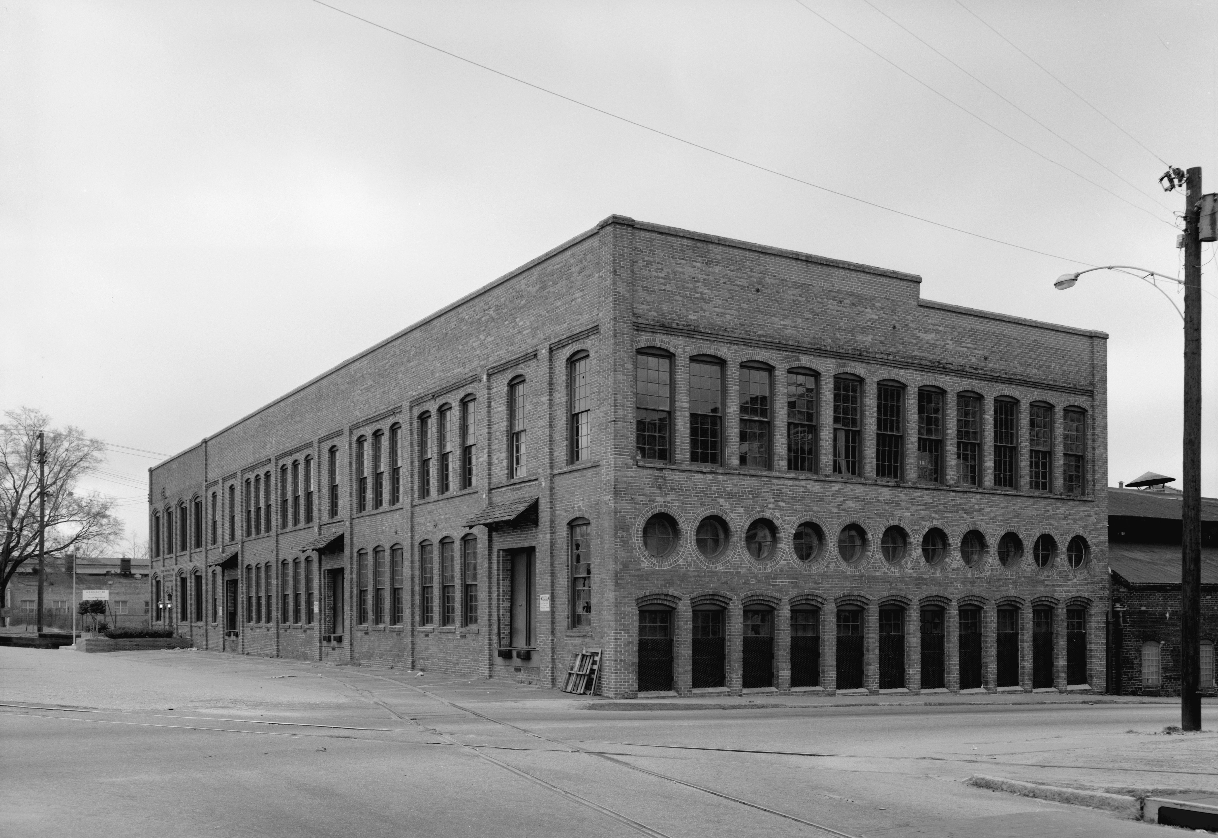
32°28′19″N 84°59′35″W / 32.47194°N 84.99306°WColumbus 32 Cole-Hatcher-Hampton Wholesale Grocers September 29, 1980 22 W. 10 St.
32°27′53″N 84°59′40″W / 32.46472°N 84.99444°WColumbus 33 Colored Cemetery September 29, 1980 10th Ave.
32°27′11″N 84°58′54″W / 32.45306°N 84.98167°WColumbus 34 Columbian Lodge No. 7 Free and Accepted Masons September 29, 1980 101 12th St.
32°28′7″N 84°59′30″W / 32.46861°N 84.99167°WColumbus 35 Columbus High School September 29, 1980 320 11th St.
32°27′59″N 84°59′17″W / 32.46639°N 84.98806°WColumbus 36 Columbus Historic District July 29, 1969 and October 21, 1999 Roughly bounded by 9th and 4th sts., 4th Ave., and the Chattahoochee River (original); Bounded by Ninth and Fourth Sts., Chattahoochee River and Fourth Ave. (increase)
32°27′29″N 84°59′32″W / 32.45806°N 84.99222°WColumbus 37 Columbus Historic Riverfront Industrial District 
June 2, 1978 Columbus River from 8th St. N. to 38th St.
32°29′7.99″N 84°59′31.26″W / 32.4855528°N 84.9920167°WColumbus 38 Columbus Investment Company Building September 29, 1980 21 12th St.
32°28′7″N 84°59′32″W / 32.46861°N 84.99222°WColumbus 39 Columbus Ironworks 
July 29, 1969 901 Front Ave.
32°27′47″N 84°59′43″W / 32.46306°N 84.99528°WColumbus 40 Columbus Manufacturing Company 
July 10, 2007 3201 1st Ave.
32°29′39.66″N 84°59′28.67″W / 32.49435°N 84.9912972°WColumbus 41 Columbus Stockade December 2, 1980 622 10th St.
32°27′52″N 84°59′2″W / 32.46444°N 84.98389°WColumbus 42 Wm. L. Cooke House December 2, 1980 1523 3rd Ave.
32°28′31″N 84°59′21″W / 32.47528°N 84.98917°WColumbus 43 William H. Denson House 
September 29, 1980 930 5th Ave.
32°27′50″N 84°59′10″W / 32.46389°N 84.98611°WColumbus 44 Depot Business Buildings September 29, 1980 519, 521 and 523 E. 12th St.
32°28′7″N 84°59′8″W / 32.46861°N 84.98556°WColumbus 45 Dinglewood 
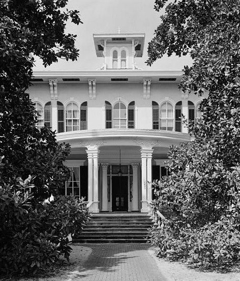
February 1, 1972 1429 Dinglewood St.
32°28′7″N 84°58′19″W / 32.46861°N 84.97194°WColumbus An Italian Villa style house built in 1859 46 Dinglewood Historic District November 21, 2001 Bounded by 13th and 16th Ave., 13th St., and Wynnton Rd.
32°28′7.51″N 84°58′13.75″W / 32.4687528°N 84.9704861°WColumbus A historic district 47 Robert E. Dismukes Sr. House January 8, 1979 1617 Summit Dr.
32°28′34″N 84°57′46″W / 32.47611°N 84.96278°WColumbus 48 Elisha P. Dismukes House December 2, 1980 1515 3rd Ave.
32°28′29″N 84°59′21″W / 32.47472°N 84.98917°WColumbus 49 First African Baptist Church September 29, 1980 901 5th Ave.
32°27′46″N 84°59′12″W / 32.46278°N 84.98667°WColumbus 50 First African Baptist Church Parsonage September 29, 1980 911 5th Ave.
32°27′47″N 84°59′12″W / 32.46306°N 84.98667°WColumbus 51 First National Bank 
November 1, 1974 1048 Broadway
32°27′52″N 84°59′36″W / 32.46444°N 84.99333°WColumbus 52 First Presbyterian Church 
September 29, 1980 1100 1st Ave.
32°28′0″N 84°59′30″W / 32.466667°N 84.99167°WColumbus 53 John T. Fletcher House September 29, 1980 311 11th St.
32°28′0″N 84°59′19″W / 32.466667°N 84.98861°WColumbus 54 Fontaine Building September 29, 1980 13 W. 11th St.
32°27′59″N 84°59′39″W / 32.46639°N 84.99417°WColumbus 55 Forston House June 3, 1999 1100 Forston Rd.
32°36′19″N 84°56′10″W / 32.60528°N 84.93611°WForston 56 Frank Brothers December 2, 1980 18 W. 10th St.
32°27′53″N 84°59′39″W / 32.46472°N 84.99417°WColumbus 57 Gann's Pharmacy September 29, 1980 1611 2nd Ave.
32°28′36″N 84°59′26″W / 32.47667°N 84.99056°WColumbus 58 Garrett-Bullock House September 29, 1980 1402 2nd Ave.
32°28′21″N 84°59′25″W / 32.4725°N 84.99028°WColumbus 59 Girard Colored Mission September 29, 1980 1002 6th Ave.
32°27′55″N 84°59′15″W / 32.46528°N 84.9875°WColumbus 60 Goetchius-Wellborn House July 29, 1969 405 Broadway
32°27′14″N 84°59′38″W / 32.45389°N 84.99389°WColumbus 61 Golden Brothers, Founders and Machinsts September 29, 1980 600 12th St.
32°28′4″N 84°59′5″W / 32.46778°N 84.98472°WColumbus 62 Green Island Ranch February 7, 1997 6551 Green Island Dr.
32°32′31″N 85°0′11″W / 32.54194°N 85.00306°WColumbus 63 Harrison-Gibson House September 29, 1980 309 11th St.
32°28′0″N 84°59′19″W / 32.466667°N 84.98861°WColumbus 64 High Uptown Historic District July 7, 2004 Roughly bounded by 2nd and 3rd Aves. between Railroad and 13th Sts.
32°28′25″N 84°59′22″W / 32.47361°N 84.98944°WColumbus 65 Highland Hall April 1, 1980 1504 17th St.
32°28′42″N 84°58′5″W / 32.47833°N 84.96806°WColumbus 66 Hillcrest-Wildwood Circle Historic District July 14, 2002 Roughly bounded by Wildwood Ave., 13th and 17th Sts., and Dixon Dr.
32°28′31″N 84°57′21″W / 32.47528°N 84.95583°WColumbus 67 Hilton January 20, 1972 2505 Macon Rd.
32°28′24″N 84°57′14″W / 32.47333°N 84.95389°WColumbus 68 Hofflin & Greentree Building September 30, 1982 1128-1130 Broadway
32°28′4″N 84°59′35″W / 32.46778°N 84.99306°WColumbus 69 Illges House June 19, 1973 1428 2nd Ave.
32°28′26″N 84°59′24″W / 32.47389°N 84.99°WColumbus 70 John Paul Illges House September 29, 1980 1425 3rd Ave.
32°28′24″N 84°59′21″W / 32.47333°N 84.98917°WColumbus 71 Isaac Maund House December 2, 1980 1608 3rd Ave.
32°28′35″N 84°59′20″W / 32.47639°N 84.98889°WColumbus 72 Joseph House July 29, 1969 828 Broadway
32°27′44″N 84°59′35″W / 32.46222°N 84.99306°WColumbus 73 Kress September 29, 1980 1117 Broadway
32°28′2″N 84°59′37″W / 32.46722°N 84.99361°WColumbus 74 Abraham Lafkowitz House September 29, 1980 934 5th Ave.
32°27′51″N 84°59′10″W / 32.46417°N 84.98611°WColumbus 75 Ledger-Enquirer Building December 2, 1980 17 W. 12th St.
32°28′6″N 84°59′40″W / 32.46833°N 84.99444°WColumbus 76 Lewis-Rothchild Building March 26, 2004 1214 First Ave.
32°28′8″N 84°59′30″W / 32.46889°N 84.99167°WColumbus 77 Liberty Theater May 22, 1984 821 8th Ave.
32°27′42″N 84°58′58″W / 32.46167°N 84.98278°WColumbus 78 Lion House January 20, 1972 1316 3rd Ave.
32°28′16″N 84°59′22″W / 32.47111°N 84.98944°WColumbus 79 Sol Loeb Building-Garrett-Joy Building 
March 15, 2005 900 Front Ave. and 901 Broadway
32°27′46″N 84°59′37″W / 32.46278°N 84.99361°WMuscogee 80 McArdle House September 29, 1980 927 3rd Ave.
32°27′49″N 84°59′22″W / 32.46361°N 84.98944°WColumbus 81 McGehee-Woodall House January 20, 1972 1534 2nd Ave.
32°28′33″N 84°59′26″W / 32.47583°N 84.99056°WColumbus 82 Methodist Tabernacle September 29, 1980 1605 3rd Ave.
32°28′34″N 84°59′22″W / 32.47611°N 84.98944°WColumbus 83 Mott House 
December 3, 1974 Front Ave.
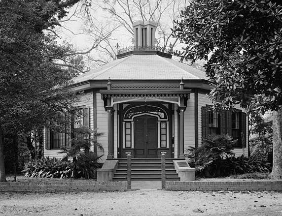
32°28′22″N 84°59′39″W / 32.47278°N 84.99417°WColumbus 84 Octagon House 
July 29, 1969 527 1st Ave.
32°27′21″N 84°59′37″W / 32.45583°N 84.99361°WColumbus 85 Old City Cemetery September 29, 1980 Linwood Blvd.
32°28′39″N 84°59′0″W / 32.4775°N 84.983333°WColumbus 86 Old Dawson Place January 8, 1979 1420 Wynnton Rd.
32°27′57″N 84°58′22″W / 32.46583°N 84.97278°WColumbus 87 Peabody-Warner House December 29, 1970 1445 2nd Ave.
32°28′26″N 84°59′27″W / 32.47389°N 84.99083°WColumbus 88 Peacock Woods-Dimon Circle Historic District March 26, 2003 Bounded by Cherokee and Forest Aves. and 13th and 17 Sts.
32°28′31″N 84°57′47″W / 32.47528°N 84.96306°WColumbus 89 Pemberton House September 28, 1971 11 7th St.
32°27′33″N 84°59′34″W / 32.45917°N 84.99278°WColumbus 90 George Phillips House September 29, 1980 1406 3rd Ave.
32°28′22″N 84°59′20″W / 32.47278°N 84.98889°WColumbus 91 George Pond House September 29, 1980 922 2nd Ave.
32°27′49″N 84°59′26″W / 32.46361°N 84.99056°WColumbus 92 Power and Baird, Wholesale Dry Goods and Notions December 2, 1980 1107 Broadway
32°28′1″N 84°59′37″W / 32.46694°N 84.99361°WColumbus 93 Gertrude Ma Pridgett Rainey House November 18, 1992 805 5th Ave.
32°27′41″N 84°59′12″W / 32.46139°N 84.98667°WColumbus 94 Rankin House 
March 16, 1972 1440 2nd Ave.
32°28′20″N 84°59′25″W / 32.47222°N 84.99028°WColumbus 95 Rankin Square October 7, 1977 Bounded by Broadway, 1st Ave., 10th and 11th Sts.
32°27′56″N 84°59′34″W / 32.46556°N 84.99278°WColumbus 96 Reich Dry Goods Company April 1, 2004 14 W 11th St.
32°28′0″N 84°59′40″W / 32.466667°N 84.99444°WColumbus 97 Ridgewood April 2, 1980 Jenkins Rd.
32°33′19″N 84°44′26″W / 32.55528°N 84.74056°WUpatoi 98 John Spencer Roberts House September 29, 1980 927 5th Ave.
32°27′50″N 84°59′12″W / 32.46389°N 84.98667°WColumbus 99 Max Rosenberg House September 29, 1980 1011 3rd Ave.
32°27′54″N 84°59′22″W / 32.465°N 84.98944°WColumbus 100 David Rothschild's Wholesale Dry Goods September 29, 1980 1029 Broadway
32°27′57″N 84°59′37″W / 32.46583°N 84.99361°WColumbus 101 David Rothschild House September 29, 1980 1220 3rd Ave.
32°28′10″N 84°59′20″W / 32.46944°N 84.98889°WColumbus 102 Secondary Industrial School April 9, 1980 1112 29th St.
32°29′21″N 84°58′41″W / 32.48917°N 84.97806°WColumbus 103 Silver's Five and Dime Store-H.L. Green Co. August 4, 2005 1101-1103 Broadway
32°28′14″N 84°59′37″W / 32.47056°N 84.99361°WColumbus 104 Sixteenth Street School September 29, 1980 1532 3rd Ave.
32°28′33″N 84°59′20″W / 32.47583°N 84.98889°WColumbus 105 Southern Railway Freight Depot August 21, 1997 1300 6th Ave.
32°28′17″N 84°59′5″W / 32.47139°N 84.98472°WColumbus 106 William Henry Spencer House May 23, 1978 745 4th Ave.
32°27′37″N 84°59′18″W / 32.46028°N 84.98833°WColumbus 107 Springer Opera House 
December 29, 1970 105 10th St.
32°27′53″N 84°59′27″W / 32.46472°N 84.99083°WColumbus 108 St. Christoper's Normal and Industrial Parish School 
September 29, 1980 900 5th Ave.
32°27′46″N 84°59′10″W / 32.46278°N 84.98611°WColumbus 109 St. Elmo 
April 7, 1971 2810 St. Elmo Dr.
32°29′21″N 84°57′58″W / 32.48917°N 84.96611°WColumbus 110 St. John Chapel September 29, 1980 1516 5th Ave.
32°28′29″N 84°59′10″W / 32.47472°N 84.98611°WColumbus 111 Swift-Kyle House 
April 11, 1973 303 12th St.
32°28′9″N 84°59′20″W / 32.46917°N 84.98889°WColumbus 112 C. B. Tarver Building August 4, 2005 18-23 W. 11th St.
32°28′14″N 84°59′40″W / 32.47056°N 84.99444°WColumbus 113 Alma Thomas House October 20, 2009 411 21st St.
32°29′3.79″N 84°59′13.08″W / 32.4843861°N 84.9869667°WColumbus 114 Triangle Building 
September 29, 1980 1330 Broadway
32°28′17″N 84°59′35″W / 32.47139°N 84.99306°WColumbus 115 Trinity Episcopal Church September 29, 1980 1130 1st Ave.
32°28′3″N 84°59′30″W / 32.4675°N 84.99167°WColumbus 116 Charles E. Turner House September 29, 1980 909 3rd Ave.
32°27′48″N 84°59′22″W / 32.46333°N 84.98944°WColumbus 117 U.S. Post Office and Courthouse 
September 29, 1980 120 12th St.
32°28′6″N 84°59′27″W / 32.46833°N 84.99083°WColumbus 118 W. Jacob Burrus House December 2, 1980 307 11th St.
32°28′0″N 84°59′20″W / 32.466667°N 84.98889°WColumbus 119 Walker-Peters-Langdon House July 29, 1969 716 Broadway
32°27′36″N 84°59′41″W / 32.46°N 84.99472°WColumbus 120 Waverly Terrace December 1, 1983 Roughly bounded by Hamilton Rd., Peabody Ave., 27th and 30th Sts.
32°29′23″N 84°58′44″W / 32.48972°N 84.97889°WColumbus 121 Wells-Bagley House July 29, 1969 22 6th St.
32°27′23″N 84°59′37″W / 32.45639°N 84.99361°WColumbus 122 Weracoba-St. Elmo Historic District July 1, 1994 Roughly bounded by 13th and Virginia Sts., 13th, 15th, 16th and Cherokee Aves. and Talbotton Rd.
32°28′51″N 84°58′5″W / 32.48083°N 84.96806°WMuscogee 123 Wolfson Printing and Paper Co. December 2, 1980 24 W. 10th St.
32°27′53″N 84°59′41″W / 32.46472°N 84.99472°WColumbus 124 Ernest Woodruff House September 29, 1980 1414 2nd Ave.
32°28′22″N 84°59′25″W / 32.47278°N 84.99028°WColumbus 125 Henry Lindsay Woodruff House December 2, 1980 1535 3rd Ave.
32°28′32″N 84°59′21″W / 32.47556°N 84.98917°WColumbus 126 Henry Lindsay Woodruff Second House September 29, 1980 1420 2nd Ave.
32°28′23″N 84°59′25″W / 32.47306°N 84.99028°WColumbus 127 John W. Woolfolk House January 22, 1979 1615 12th St.
32°28′7″N 84°58′6″W / 32.46861°N 84.96833°WColumbus 128 Wynn House February 1, 1972 1240 Wynnton Rd.
32°27′57″N 84°58′28″W / 32.46583°N 84.97444°WColumbus 129 Wynn's Hill-Overlook-Oak Circle Historic District May 10, 2005 Roughly bounded by Bradley Rd., Buena Vista Rd., Overlook Ave., Crest Dr., and Oakview Ave.
32°27′53″N 84°58′14″W / 32.46472°N 84.97056°WColumbus 130 Wynnton Academy April 11, 1972 2303 Wynnton Rd.
32°27′57″N 84°58′28″W / 32.46583°N 84.97444°WColumbus 131 Wynnton Village Historic District June 22, 2005 Roughly bounded by Wildwood Ave., Forest Ave., 18th St., 13th St., 16th ave. Wynnton Rd.
32°28′22″N 84°57′49″W / 32.47278°N 84.96361°WColumbus 132 Wynnwood January 20, 1972 1846 Buena Vista Rd.
32°27′56″N 84°57′57″W / 32.46556°N 84.96583°WColumbus 133 Y.M.C.A. September 29, 1980 124 11th St.
32°27′59″N 84°59′27″W / 32.46639°N 84.99083°WColumbus Former listing
Landmark name Image Date listed Location City or Town Summary 1 John Stewart House July 7, 2004 1618 3rd Ave. Columbus References
- ^ "National Register of Historic Places: Weekly List Actions". National Park Service, United States Department of the Interior. Retrieved on November 10, 2011.
Categories:- National Register of Historic Places in Georgia (U.S. state)
- Buildings and structures in Muscogee County, Georgia
-


Wikimedia Foundation. 2010.