- National Register of Historic Places listings in Wilkes County, Georgia
-
This is a list of properties and districts in Wilkes County, Georgia that are listed on the National Register of Historic Places (NRHP).
-
- This National Park Service list is complete through NPS recent listings posted November 10, 2011.[1]
Current listings
Landmark name Image Date listed Location City or Town Summary 1 Anderson House September 29, 1976 GA 44
33°52′10″N 82°39′16″W / 33.86944°N 82.65444°WDanburg 2 Arnold-Callaway Plantation April 11, 1972 NW of Washington on U.S. 78
33°46′27″N 82°48′46″W / 33.77417°N 82.81278°WWashington 3 Campbell-Jordan House 
July 14, 1971 208 Liberty St.
33°44′1″N 82°44′15″W / 33.73361°N 82.7375°WWashington 4 The Cedars April 11, 1972 210 Sims St.
33°44′29″N 82°44′19″W / 33.74139°N 82.73861°WWashington 5 James and Cunningham Daniel House 
November 24, 1980 S of Rayle on Bartram Trace Rd.
33°40′59″N 82°54′35″W / 33.68306°N 82.90972°WRayle 6 East Robert Toombs Historic District 
April 11, 1972 East Robert Toombs Ave. between Alexander Ave. and Grove St.
33°44′12″N 82°44′12″W / 33.73667°N 82.73667°WWashington 7 Fitzpatrick Hotel 
December 17, 1982 18 W. Public Square
33°44′14″N 82°44′24″W / 33.73722°N 82.74°WWashington 8 Gartrell Family House June 14, 2002 854 Boyd Rd.
33°55′28″N 82°46′24″W / 33.92444°N 82.77333°WTignall 9 Gilbert-Alexander House April 11, 1972 116 Alexander Dr.
33°44′28″N 82°44′14″W / 33.74111°N 82.73722°WWashington 10 Thomas M. Gilmer House November 2, 1977 5 miles (8.0 km) W of Washington on U.S. 78
33°58′38″N 82°50′7″W / 33.97722°N 82.83528°WWashington 11 Holly Court April 11, 1972 301 S. Alexander St.
33°44′0″N 82°44′12″W / 33.733333°N 82.73667°WWashington 12 Kettle Creek Battlefield June 26, 1975 9 miles (14 km) SW of Washington off Tyrone Rd.
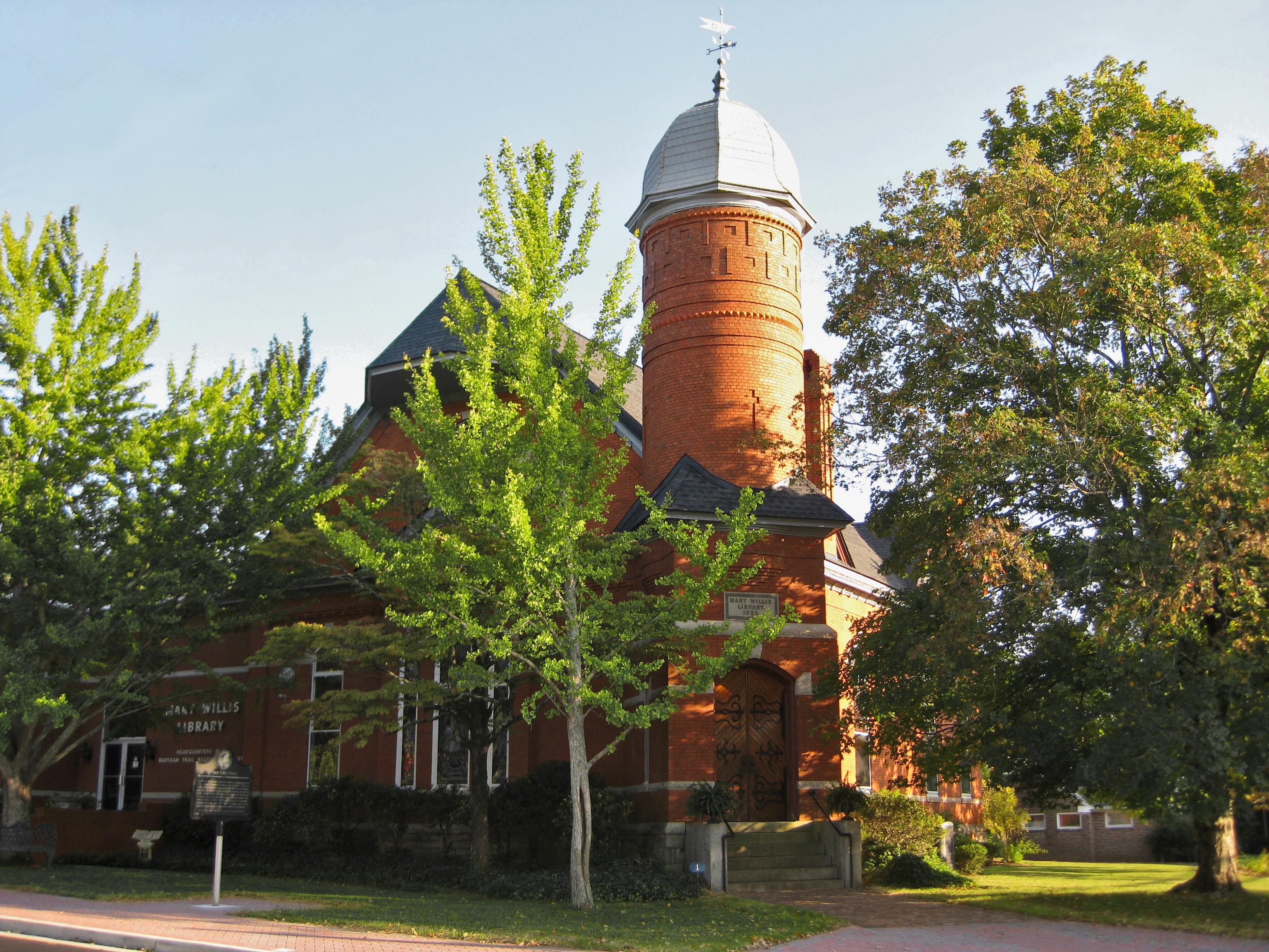
33°41′26″N 82°53′11″W / 33.69056°N 82.88639°WWashington 13 Mary Willis Library 
April 11, 1972 204 E. Liberty (at S. Jefferson St.)
33°44′7″N 82°44′17″W / 33.73528°N 82.73806°WWashington 14 North Washington District March 7, 1973 Bounded by Jefferson and Court Sts., Poplar Dr., and U.S. 78
33°44′40″N 82°44′22″W / 33.74444°N 82.73944°WWashington 15 Old Jail June 5, 1974 103 Court St.
33°44′20″N 82°44′28″W / 33.73889°N 82.74111°WWashington 16 Peacewood April 11, 1972 120 Tignall Rd.
33°45′20″N 82°44′8″W / 33.75556°N 82.73556°WWashington 17 Pharr-Callaway-Sethness House March 26, 1976 N of Tignall on GA 2193
33°56′14″N 82°44′12″W / 33.93722°N 82.73667°WTignall 18 Poplar Corner April 11, 1972 210 W. Liberty St.
33°44′3″N 82°44′35″W / 33.73417°N 82.74306°WWashington 19 Robert Shand Smith House November 7, 2002 902 S. Spring St.
33°43′33″N 82°44′35″W / 33.72583°N 82.74306°WWashington 20 Robert Toombs House 
April 11, 1972 216 E. Robert Toombs Ave.
33°44′11″N 82°44′2″W / 33.73639°N 82.73389°WWashington 21 Tupper-Barnett House 
April 11, 1972 101 W. Robert Toombs Ave.
33°44′15″N 82°44′32″W / 33.7375°N 82.74222°WWashington 22 Washington Commercial Historic District 
March 6, 1986 Roughly bounded by Court St., Jefferson St., Robert Toombs Ave., and Allison St.
33°44′14″N 82°44′22″W / 33.73722°N 82.73944°WWashington 23 Washington Historic District December 6, 2004 Centered on West Robert Toombs Ave. and N. Alexander St.
33°44′7″N 82°44′34″W / 33.73528°N 82.74278°WWashington 24 Washington Presbyterian Church 
April 11, 1972 206 E. Robert Toombs Ave.
33°44′8″N 82°44′10″W / 33.73556°N 82.73611°WWashington 25 Washington-Wilkes Historical Museum 
May 13, 1970 308 E. Robert Toombs Ave.
33°44′7″N 82°44′3″W / 33.73528°N 82.73417°WWashington 26 West Robert Toombs District March 1, 1973 W. Robert Toombs Ave. between Allison St. and Rte. 44 and Lexington Ave.
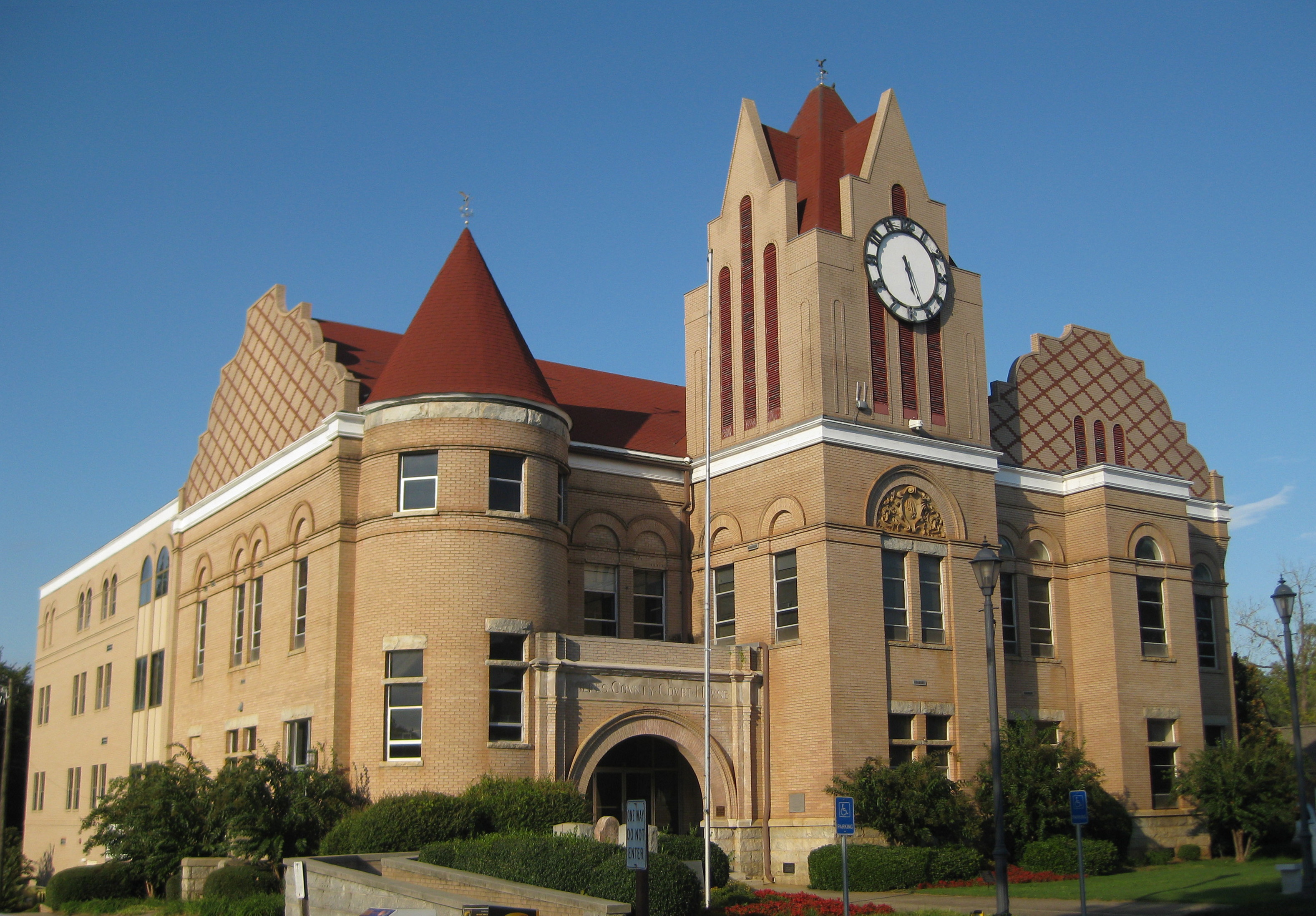
33°44′10″N 82°44′50″W / 33.73611°N 82.74722°WWashington 27 Wilkes County Courthouse 
September 18, 1980 Court St.
33°44′17″N 82°44′22″W / 33.73806°N 82.73944°WWashington 28 Willis-Sale-Stennett House October 14, 1976 N of Danburg off GA 79 on SR 1445
33°55′33″N 82°39′16″W / 33.92583°N 82.65444°WDanburg References
- ^ "National Register of Historic Places: Weekly List Actions". National Park Service, United States Department of the Interior. Retrieved on November 10, 2011.
Categories:- National Register of Historic Places in Georgia (U.S. state)
- Buildings and structures in Wilkes County, Georgia
-


Wikimedia Foundation. 2010.