- National Register of Historic Places listings in Thomas County, Georgia
-
This is a list of properties and districts in Thomas County, Georgia that are listed on the National Register of Historic Places (NRHP).
-
- This National Park Service list is complete through NPS recent listings posted November 10, 2011.[1]
Current listings
Landmark name Image Date listed Location City or Town Summary 1 D. B. Anderson and Company Building August 19, 1982 E. Railroad and Brayton Sts.
30°58′28″N 84°3′14″W / 30.97444°N 84.05389°WOchlocknee 2 B'nai Israel Synagogue and Cemetery October 14, 1997 210 S. Crawford St.
30°51′6″N 83°59′16″W / 30.85167°N 83.98778°WThomasville 3 Bethany Congregational Church March 7, 1985 112 Lester St.
30°49′13″N 83°59′11″W / 30.82028°N 83.98639°WThomasville 4 Joe M. Beutell House August 29, 1991 101 Montrose Dr.
30°50′53″N 83°58′17″W / 30.84806°N 83.97139°WThomasville 5 Birdwood May 2, 1986 Millpond Rd. and Pinetree Blvd.
30°48′54″N 83°57′52″W / 30.815°N 83.96444°WThomasville 6 Boston Historic District 
May 1, 2007 Roughly bounded by US 84, Roundtree and S. Oak Sts, Washington St. and W. Jefferson and W. Railroad Sts.
30°47′31″N 83°47′24″W / 30.79194°N 83.79°WBoston 7 Box Hall Plantation November 16, 1989 Lower Cairo Rd. at Pinetree Blvd.
30°49′44″N 84°0′57″W / 30.82889°N 84.01583°WThomasville 8 Dr. David Brandon House 
September 4, 1970 329 N. Broad St.
30°50′24″N 83°58′59″W / 30.84°N 83.98306°WThomasville 9 Hardy Bryan House 
August 12, 1970 312 N. Broad St.
30°50′24″N 83°58′54″W / 30.84°N 83.98167°WThomasville 10 Burch-Mitchell House September 4, 1970 737 Remington Ave.
30°50′28″N 83°58′0″W / 30.84111°N 83.966667°WThomasville 11 Church of the Good Shepherd 
February 5, 1987 511-519 Oak St.
30°50′22″N 83°59′17″W / 30.83944°N 83.98806°WThomasville 12 Dawson Street Residential Historic District 
September 7, 1984 Roughly bounded by North Blvd., Madison, Jackson, and Hansell Sts.
30°50′39″N 83°58′55″W / 30.84417°N 83.98194°WThomasville 13 Dewey City Historic District August 28, 2008 Roughly bounded by Martin Luther King, Jr. Dr., Wolf St., Culpepper St., Burns St., and Felix St.
30°50′21″N 83°59′50″W / 30.83917°N 83.99722°WThomasville 14 East End Historic District September 7, 1984 (original)
July 25, 2003 (increase and decrease)Roughly bounded by Metcalf, Loomis, Colton, and Blackshear Sts. (original); roughly bounded by Metcalf Ave., Simeon St., Grady St., and East Loomis St. (increase and decrease), Thomasville, Georgia
30°49′59″N 83°58′11″W / 30.83306°N 83.96972°WThomasville 15 East Side School 
December 16, 1977 120 N. Hansell St.
30°50′37″N 83°58′28″W / 30.84361°N 83.97444°WThomasville 16 Fletcherville Historic District April 18, 1985 Roughly bounded by Siexas, Wright, S. College and W. Jackson St.
30°49′49″N 83°58′56″W / 30.83028°N 83.98222°WThomasville 17 Glenwood Historic District October 14, 2010 Roughly bounded by Clay St., Glenwood Dr., East Jackson St., and Euclid Dr.
30°50′55″N 83°58′6″W / 30.84861°N 83.96833°WThomasville 18 Gordon Avenue Apartments March 24, 1983 424 Gordon Ave.
30°49′49″N 83°58′35″W / 30.83028°N 83.97639°WThomasville 19 Gordon Avenue Historic District April 18, 1985 Gordon Ave.
30°49′18″N 83°58′27″W / 30.82167°N 83.97417°WThomasville 20 Greenwood Plantation May 13, 1976 GA 84
30°51′9″N 84°1′4″W / 30.8525°N 84.01778°WThomasville 21 Augustine Hansell House 
June 22, 1970 429 S. Hansell St.
30°50′13″N 83°58′16″W / 30.83694°N 83.97111°WThomasville 22 Hollywood Plantation November 15, 2003 1701 Old Monticello Rd.
30°49′13″N 83°57′19″W / 30.82028°N 83.95528°WThomasville 23 Lapham-Patterson House 
August 12, 1970 626 N. Dawson St.
30°50′46″N 83°58′59″W / 30.84611°N 83.98306°WThomasville A National Historic Landmark 24 MacIntyre Park and MacIntyre Park High School April 14, 2000 117 Glenwood Dr.
30°50′44″N 83°58′21″W / 30.84556°N 83.9725°WThomasville 25 Melrose and Sinkola Plantations January 4, 1990 SW of Thomasville on US 13
30°47′24″N 84°3′17″W / 30.79°N 84.05472°WThomasville 26 Metcalfe Historic District September 20, 1978 Roughly bounded by Magnolia, Hancock, Louis and Williams Sts.
30°42′3″N 83°59′18″W / 30.70083°N 83.98833°WMetcalf 27 Mill Creek Plantation April 14, 1997 100 Mill Creek Plantation
30°46′3″N 83°55′36″W / 30.7675°N 83.92667°WThomasville 28 Millpond Plantation December 12, 1976 S of Thomasville on Pine Tree Blvd.
30°48′3″N 83°58′19″W / 30.80083°N 83.97194°WThomasville 29 Paradise Park Historic District September 7, 1984(original)
April 1, 2002 (increase)Roughly bounded by Metcalf Ave., Colton, Broad, and Loomis Sts. (original), 502 S. Broad St. (increase)
30°49′56″N 83°58′25″W / 30.83222°N 83.97361°WThomasville 30 Park Front August 12, 1970 711 S. Hansell St.
30°49′55″N 83°58′19″W / 30.83194°N 83.97194°WThomasville 31 Pebble Hill Plantation February 23, 1990 US 319, 4 mi. SW of Thomasville
30°46′9″N 84°5′37″W / 30.76917°N 84.09361°WThomasville 32 Martha Poe Dogtrot House May 20, 1998 0.75 W of jct of Twelve Mile Post Rd. and GA 19
30°41′34″N 83°50′58″W / 30.69278°N 83.84944°WMetcalf 33 Ephraim Ponder House 
August 12, 1970 324 N. Dawson St.
30°50′19″N 83°58′56″W / 30.83861°N 83.98222°WThomasville 34 Stevens Street Historic District May 10, 2001 Along Stevens St., 1 blk. NW of Thomas County Courthouse
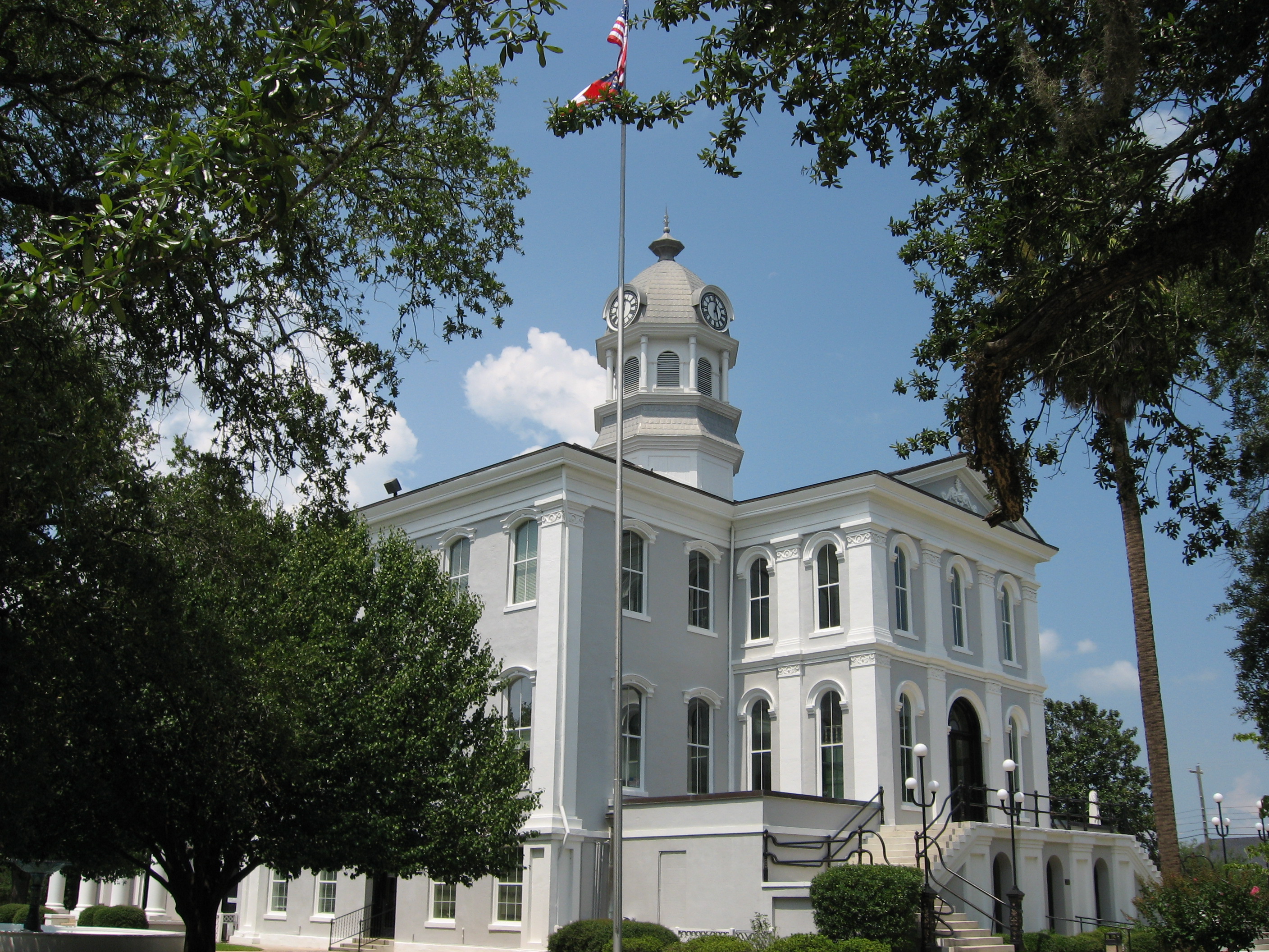
30°50′28″N 83°59′21″W / 30.84111°N 83.98917°WThomasville 35 Thomas County Courthouse 
June 22, 1970 N. Broad St.
30°50′20″N 83°58′55″W / 30.83889°N 83.98194°WThomasville 36 Thomasville Commercial Historic District 
September 7, 1984 (original)
October 28, 2004 (increase and decrease)Roughly N. Stevens, N. Madison, N. Broad, Remington, Jackson, and Jefferson Sts. (original), Downtown Thomasville bet. Jefferson St. and Smith Ave. and bet. Crawford And Siexas St. (increase and decrease)
30°50′12″N 83°58′53″W / 30.83667°N 83.98139°WThomasville 37 Thomasville Depot May 19, 1988 420 W. Jackson St./US 319
30°50′1″N 83°59′3″W / 30.83361°N 83.98417°WThomasville 38 Tockwotton-Love Place Historic District 
September 7, 1984 Roughly bounded by McLean Ave., Hansell, Jackson, and Seward Sts.
30°50′24″N 83°58′23″W / 30.84°N 83.97306°WThomasville 39 Wright House August 12, 1970 415 Fletcher St.
30°49′53″N 83°58′55″W / 30.83139°N 83.98194°WThomasville References
- ^ "National Register of Historic Places: Weekly List Actions". National Park Service, United States Department of the Interior. Retrieved on November 10, 2011.
Categories:- National Register of Historic Places in Georgia (U.S. state)
- Buildings and structures in Thomas County, Georgia
-


Wikimedia Foundation. 2010.