- National Register of Historic Places listings in Fulton County, Georgia
-
This is a list of properties and districts in Fulton County, Georgia that are listed on the National Register of Historic Places (NRHP). It covers most of the NRHP properties in Atlanta, Georgia; other Atlanta listings are covered in National Register of Historic Places listings in DeKalb County, Georgia.
-
- This National Park Service list is complete through NPS recent listings posted November 10, 2011.[1]
Current listings
Landmark name Image Date listed Location City or Town Summary 1 61 16th Street Apartment Building August 30, 2006 61 16th St.
33°47′34″N 84°23′3″W / 33.79278°N 84.38417°WAtlanta 2 63 Magnum Street Industrial Building June 28, 1996 63–69 Mangum St.–398–400 Markham St.
33°45′9″N 84°24′1″W / 33.7525°N 84.40028°WAtlanta 3 705 Piedmont Avenue Apartments 
December 19, 1991 705 Piedmont Ave.
33°46′25″N 84°22′52″W / 33.77361°N 84.38111°WAtlanta Designed by architect Russell Conklin in 1924. 4 Academy of Medicine 
April 30, 1980 875 W. Peachtree St., NE.
33°46′45″N 84°23′13″W / 33.77917°N 84.38694°WAtlanta 5 Adair Park Historic District June 2, 2000 Bounded by Metropolitan Parkway, Lexington Ave., Norfolk Southern RR and Shelton Ave.
33°43′52″N 84°24′34″W / 33.73111°N 84.40944°WAtlanta 6 Jack and Helen Adams Lustron House March 18, 1996 832 Burchill St., SW.
33°42′44″N 84°24′57″W / 33.71222°N 84.41583°WAtlanta A Lustron house 7 Cecil and Hermione Alexander House March 25, 2010 2232 Mt. Paran Rd, N.W.
33°51′30.34″N 84°26′20.47″W / 33.8584278°N 84.4390194°WAtlanta 8 Ansley Park Historic District 
April 20, 1979 Ansley Park and environs
33°47′44″N 84°22′45″W / 33.79556°N 84.37917°WAtlanta 9 Apartments at 2 Collier Road September 10, 2007 2 Collier Rd.
33°48′31″N 84°23′39″W / 33.80861°N 84.39417°WAtlanta 10 Apartments at 22–24 Collier Road September 10, 2007 22-24 Collier Rd.
33°48′32″N 84°23′42″W / 33.80889°N 84.395°WAtlanta 11 Thomas P. Arnold House May 10, 1984 518 S. Main St.
33°30′40″N 84°40′18″W / 33.51111°N 84.67167°WPalmetto 12 Ashby Street Car Barn August 6, 1998 981 Ashby St. NW.
33°47′2″N 84°25′1″W / 33.78389°N 84.41694°WAtlanta 13 Atkins Park District August 30, 1982 St. Augustine St., St. Charles, and St. Louis Pls. between N. Highland Ave. and Briarcliff Rd.
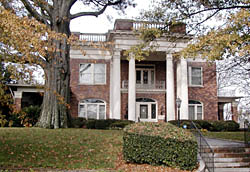
33°46′31″N 84°21′1″W / 33.77528°N 84.35028°WAtlanta 14 Atlanta and West Point Railroad Freight Depot March 26, 1976 215 Decatur St.
33°45′32″N 84°22′58″W / 33.75889°N 84.38278°WAtlanta 15 Atlanta Biltmore Hotel and Biltmore Apartments 
January 20, 1980 817 W. Peachtree St.
33°46′36″N 84°23′11″W / 33.77667°N 84.38639°WAtlanta 16 Atlanta Buggy Company and Warehouse-Hatcher Bros. Furniture Company August 21, 1992 530–544 Means St.
33°46′21″N 84°24′20″W / 33.7725°N 84.40556°WAtlanta 17 Atlanta City Hall 
July 13, 1983 68 Mitchell St. SW.
33°44′56″N 84°23′25″W / 33.74889°N 84.39028°WAtlanta 18 Atlanta Spring and Bed Company-Block Candy Company July 28, 1995 512 Means St.
33°46′20″N 84°24′19″W / 33.77222°N 84.40528°WAtlanta 19 Atlanta Stockade June 25, 1987 760 Glenwood Ave.
33°44′30″N 84°21′44″W / 33.74167°N 84.36222°WAtlanta 20 Atlanta University Center District July 12, 1976 Roughly bounded by transit right-of-way, Northside Dr., Walnut, Fair, Roach, W. End Dr., Euralee and Chestnut Sts.
33°45′0″N 84°24′33″W / 33.75°N 84.40917°WAtlanta 21 Atlanta Waterworks Hemphill Avenue Station March 29, 1978 1210 Hemphill Ave., NW.
33°47′14″N 84°24′30″W / 33.78722°N 84.40833°WAtlanta 22 Atlanta Women's Club January 31, 1979 1150 Peachtree St., NE.
33°47′9″N 84°22′59″W / 33.78583°N 84.38306°WAtlanta 23 Levi Ballard House October 22, 1980 U.S. 29 and GA 154
33°31′46″N 84°39′43″W / 33.52944°N 84.66194°WPalmetto 24 Baltimore Block 
June 3, 1976 5,7,9,11,13,15,17,19 Baltimore Pl.
33°46′6″N 84°23′16″W / 33.76833°N 84.38778°WAtlanta 25 Barrington Hall 
December 9, 1971 60 Marietta St.
34°0′47″N 84°21′50″W / 34.01306°N 84.36389°WRoswell 26 Bass Furniture Building January 8, 1979 142–150 Mitchell St.
33°45′7″N 84°23′32″W / 33.75194°N 84.39222°WAtlanta 27 John F. Beavers House March 29, 1984 NW of Fairburn off GA 92
33°39′14″N 84°40′16″W / 33.65389°N 84.67111°WFairburn 28 Berkeley Park Historic District June 23, 2003 Roughly bounded by Bellemeade Rd., Northside Dr., Atlanta Waterworks and Howell Mill Rd.
33°48′0″N 84°24′47″W / 33.8°N 84.41306°WAtlanta 29 Dr. Brailsford R. Brazeal House April 8, 2005 193 Joseph E. Lowery Boulevard
33°45′3″N 84°25′5″W / 33.75083°N 84.41806°WAtlanta 30 Briarcliff Hotel 
September 9, 1982 1050 Ponce de Leon Ave.
33°46′26″N 84°21′11″W / 33.77389°N 84.35306°WAtlanta 31 Dr. Marion Luther Brittain, Sr., House September 23, 1993 1109 W. Peachtree St.
33°47′16″N 84°23′15″W / 33.78778°N 84.3875°WAtlanta 32 Brookhaven Historic District January 24, 1986 E of Peachtree-Dunwoody and N and E of Peachtree Rds.
33°51′49″N 84°21′2″W / 33.86361°N 84.35056°WAtlanta 33 Brookwood Hills Historic District December 21, 1979 Off U.S. 19 and GA 9
33°48′21″N 84°23′23″W / 33.80583°N 84.38972°WAtlanta 34 Building at 161 Spring St. June 14, 2001 161 Spring St., NW.
33°45′37″N 84°23′23″W / 33.76028°N 84.38972°WAtlanta 35 Bulloch Hall 
May 27, 1971 Bulloch Ave.
34°0′55″N 84°22′4″W / 34.01528°N 84.36778°WRoswell 36 Burns Cottage December 1, 1983 988 Alloway Pl., SE.
33°43′37″N 84°21′20″W / 33.72694°N 84.35556°WAtlanta 37 Butler Street Colored Methodist Episcopal Church May 9, 1983 23 Butler St., SE.
33°45′13″N 84°22′51″W / 33.75361°N 84.38083°WAtlanta 38 Cabbagetown District 
January 1, 1976 Bounded by Boulevard, Pearl St., Memorial Dr., and railroad tracks
33°44′59″N 84°21′59″W / 33.74972°N 84.36639°WAtlanta 39 Campbell County Courthouse 
March 26, 1976 E. Broad and Cole Sts.
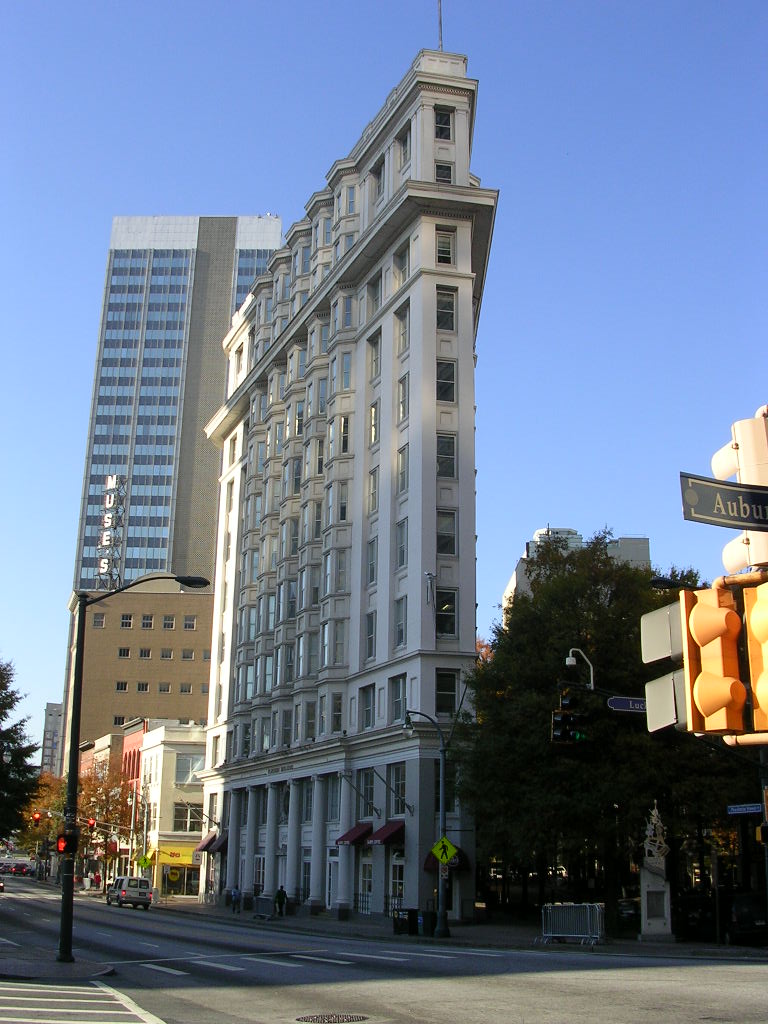
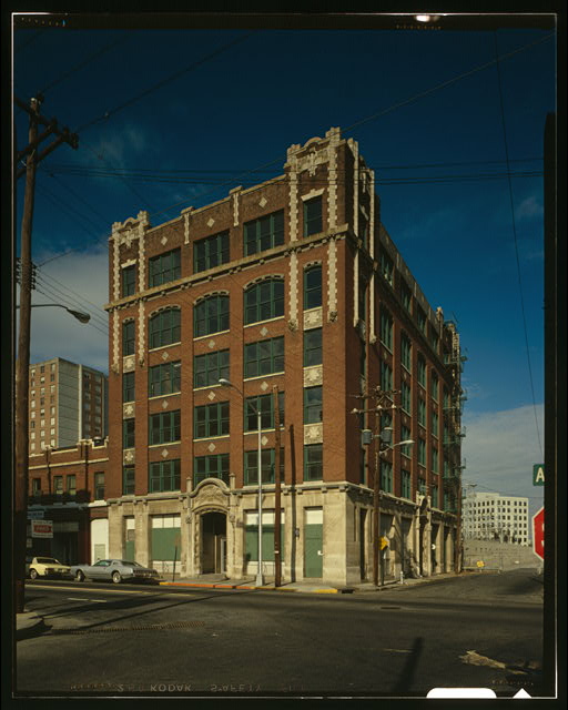
33°34′0″N 84°34′46″W / 33.566667°N 84.57944°WFairburn 40 Candler Building 
August 24, 1977 127 Peachtree St., NE.
33°45′26″N 84°23′16″W / 33.75722°N 84.38778°WAtlanta 41 Canton Apartments December 8, 1980 2846–2840 Peachtree Rd.
33°49′57″N 84°23′4″W / 33.8325°N 84.38444°WAtlanta 42 Capital City Club 
September 15, 1977 7 Harris St., NW.
33°45′39″N 84°23′16″W / 33.76083°N 84.38778°WAtlanta 43 Castleberry Hill Historic District 
August 8, 1985 Roughly bounded by Nelson St., Southern & Central of Georgia RR, McDaniel, Peters & Walker Sts.
33°44′52″N 84°24′3″W / 33.74778°N 84.40083°WAtlanta 44 Central Presbyterian Church March 13, 1986 201 Washington St. SW.
33°44′59″N 84°23′21″W / 33.74972°N 84.38917°WAtlanta 45 Church of the Sacred Heart of Jesus May 13, 1976 335 Ivy St., NE.
33°45′50″N 84°23′7″W / 33.76389°N 84.38528°WAtlanta 46 Citizen's and Southern Bank Building August 18, 1977 35 Broad St.
33°45′17″N 84°23′23″W / 33.75472°N 84.38972°WAtlanta 47 Coca-Cola Building Annex October 18, 1996 187 Edgewood Ave.
33°45′21″N 84°22′53″W / 33.75583°N 84.38139°WAtlanta 48 College Park Historic District November 15, 1996 Roughly bounded by Vesta Ave., Yale Ave., Madison St., Harris St., and Washington Rd.
33°39′38″N 84°27′12″W / 33.66056°N 84.45333°WCollege Park 49 College Street School July 21, 1995 580 College St.
33°39′20″N 84°24′31″W / 33.65556°N 84.40861°WHapeville 50 Collier Heights Historic District June 23, 2009 Bounded approximately by Hamilton E. Holmes Drive on the east, Donald Lee Hollowell Parkway on the north, Interstate 285 on the west, and Interstate 20 on the south
33°46′19″N 84°29′2″W / 33.77194°N 84.48389°WAtlanta 51 F. J. Cooledge and Sons, Company-Hastings' Seed Company October 31, 1995 434 Marietta St.
33°45′53″N 84°23′52″W / 33.76472°N 84.39778°WAtlanta 52 Cox-Carlton Hotel 
November 1, 2006 683 Peachtree St., NE.
33°46′28″N 84°23′5″W / 33.77444°N 84.38472°WAtlanta Designed by Atlanta architectural firm Pringle & Smith in 1925 53 Crescent Apartments 
June 21, 1996 979 Crescent Ave., NW.
33°46′52″N 84°23′4″W / 33.78111°N 84.38444°WAtlanta Where Margaret Mitchell wrote much of Gone With the Wind 54 William H. Crogman School July 14, 2005 103 West Ave.
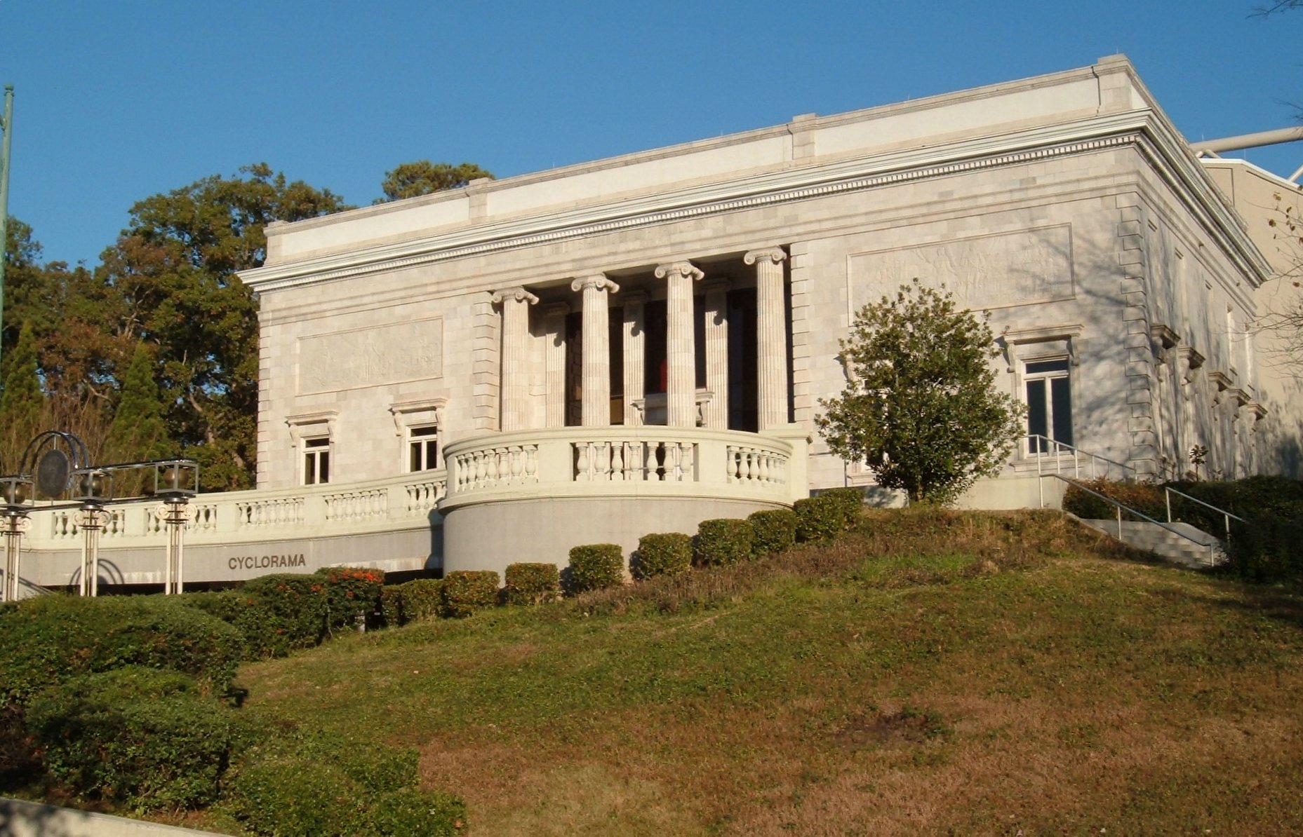
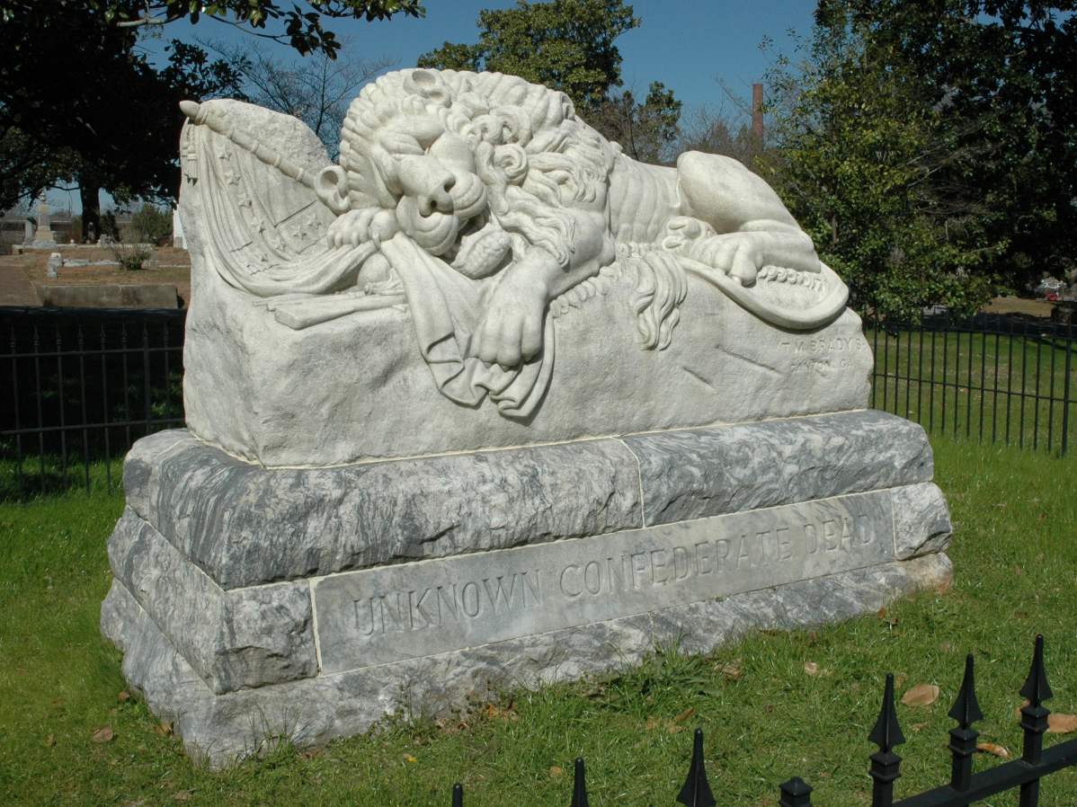
33°43′36″N 84°23′46″W / 33.72667°N 84.39611°WAtlanta 55 Cyclorama of the Battle of Atlanta 
December 9, 1971 Cherokee Ave., Grant Park
33°43′33″N 84°22′16″W / 33.72583°N 84.37111°WAtlanta 56 H. B. Davis Building-Hotel Roxy 
September 11, 1997 764–772 Marietta St.
33°46′32″N 84°24′16″W / 33.77556°N 84.40444°WAtlanta 57 Degive's Grand Opera House June 17, 1977 157 Peachtree St., NE.
33°45′27″N 84°23′13″W / 33.7575°N 84.38694°WAtlanta 58 Dixie Coca-Cola Bottling Company Plant July 20, 1977 125 Edgewood Ave.
33°45′16″N 84°23′3″W / 33.75444°N 84.38417°WAtlanta 59 East Point Industrial District September 5, 1985 Roughly bounded by Martin and Taylor Sts. Norman Berry Dr. and RR tracks
33°40′42″N 84°26′19″W / 33.67833°N 84.43861°WEast Point 60 Rutherford and Martha Ellis House May 6, 2009 543 W. Wesley Rd., NW.
33°49′47.33″N 84°24′19.93″W / 33.8298139°N 84.4055361°WAtlanta 61 Empire Manufacturing Company Building February 20, 2002 575 Glen Iris Dr., NE.
33°46′19″N 84°22′1″W / 33.77194°N 84.36694°WAtlanta 62 English-American Building 
March 26, 1976 74 Peachtree St.
33°45′22″N 84°23′19″W / 33.75611°N 84.38861°WAtlanta 63 Thomas and Rae Epting Lustron House March 18, 1996 1692 Brewer Boulevard, SW.
33°42′31″N 84°25′1″W / 33.70861°N 84.41694°WAtlanta A Lustron house 64 Fairburn Commercial Historic District October 20, 1988 Roughly along W. Broad St. and RR tracks between Smith and Dood Sts.
33°34′0″N 84°34′54″W / 33.566667°N 84.58167°WFairburn 65 Fairlie-Poplar Historic District 
September 9, 1982 Roughly bounded by Peachtree, Luckie, Cone, and Marietta Sts.
33°45′22″N 84°23′24″W / 33.75611°N 84.39°WAtlanta 66 Farlinger September 30, 1982 343 Peachtree St., NE.
33°45′49″N 84°23′9″W / 33.76361°N 84.38583°WAtlanta 67 Fire Station No. 11 
February 12, 1980 30 North Ave.
33°46′17″N 84°23′9″W / 33.77139°N 84.38583°WAtlanta Architects were Bruce & Morgan. Built 1907. First fire station to respond to Winecoff Fire in 1946. 68 First Congregational Church January 19, 1979 105 Courtland St., NE.
33°45′27″N 84°23′1″W / 33.7575°N 84.38361°WAtlanta 69 First Methodist Episcopal Church, South December 7, 2010 360 Peachtree St., NW
33°45′52″N 84°23′9″W / 33.76444°N 84.38583°WAtlanta 70 Ford Motor Company Assembly Plant 
May 10, 1984 699 Ponce de Leon Ave.
33°46′22″N 84°21′52″W / 33.77278°N 84.36444°WAtlanta 71 Forscom Command Sergeant Major's Quarters February 25, 1975 Bldg. 532
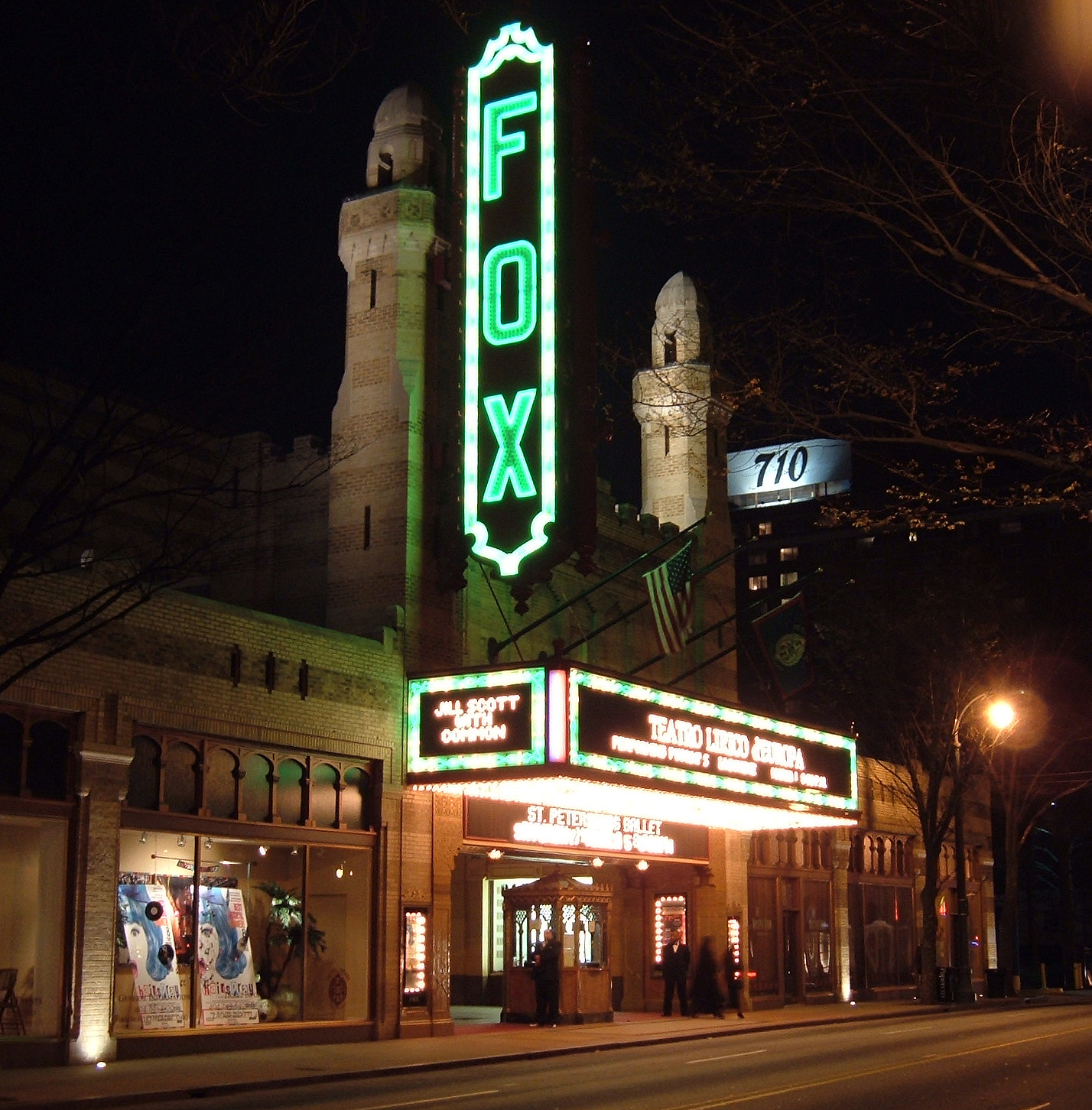
33°42′44″N 84°26′14″W / 33.71222°N 84.43722°WFort McPherson 72 Fox Theatre 
May 17, 1974 600 Peachtree St.
33°46′20″N 84°23′12″W / 33.77222°N 84.38667°WAtlanta 73 Fox Theatre Historic District 
October 7, 1978 Peachtree St. and Ponce de Leon Ave.
33°46′20″N 84°23′12″W / 33.77222°N 84.38667°WAtlanta 74 Freeman Ford Building August 6, 1998 75 John Wesley Dobbs Ave.
33°45′31″N 84°23′4″W / 33.75861°N 84.38444°WAtlanta 75 Fulton County Courthouse 
September 18, 1980 160 Pryor St., SW.
33°45′3″N 84°23′27″W / 33.75083°N 84.39083°WAtlanta 76 Garden Hills Historic District 
August 17, 1987 Roughly bounded by Delmont and Brentwood and N. Hills Drs., Piemont, E. Wesley, and Peachtree Rds.
33°49′54″N 84°22′45″W / 33.83167°N 84.37917°WAtlanta 77 Garrison Apartments January 29, 1979 1325–1327 Peachtree St., NE.
33°47′27″N 84°23′5″W / 33.79083°N 84.38472°WAtlanta 78 General Electric Company Repair Shop Warehouse October 10, 2008 488 Glenn Ave.
33°44′17.29″N 84°24′12.72″W / 33.7381361°N 84.4035333°WFulton 79 Georgia Institute of Technology Historic District 
August 25, 1978 225 North Ave.
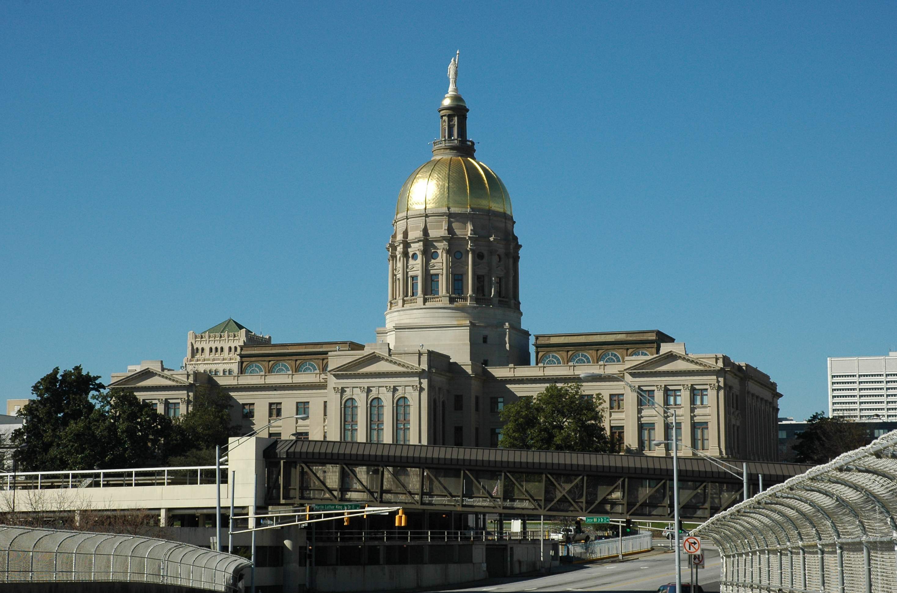
33°46′21″N 84°23′40″W / 33.7725°N 84.39444°WAtlanta 80 Georgia State Capitol 
December 9, 1971 Capitol Sq.
33°44′56″N 84°23′17″W / 33.74889°N 84.38806°WAtlanta 81 Jeremiah S. Gilbert House 
April 17, 1980 2238 Perkerson Rd., SW.
33°41′36″N 84°24′38″W / 33.69333°N 84.41056°WAtlanta 82 Glenn Building April 29, 2008 110 Marietta St.
33°45′25.17″N 84°23′33.62″W / 33.7569917°N 84.3926722°WAtlanta 83 Glenridge Hall June 17, 1982 6615 Glenridge Dr.
33°56′9″N 84°21′50″W / 33.93583°N 84.36389°WAtlanta 84 Grady Hospital 
August 13, 1981 36 Butler St., SE.
33°45′12″N 84°22′51″W / 33.75333°N 84.38083°WAtlanta 85 Grant Park Historic District 
July 20, 1979 Roughly bounded by Glenwood and Atlanta Aves., Kelly and Eloise Sts.
33°44′10″N 84°22′18″W / 33.73611°N 84.37167°WAtlanta 86 Grant Park North March 17, 1986 Roughly bounded by Woodward Ave., Boulevard, I-20, and Hill St.
33°44′42″N 84°22′25″W / 33.745°N 84.37361°WAtlanta 87 W. D. Grant Building January 8, 1979 44 Broad St., NW.
33°45′20″N 84°23′24″W / 33.75556°N 84.39°WAtlanta 88 Great Atlantic & Pacific Tea Company October 27, 2004 881 Memorial Dr.
33°44′52″N 84°21′44″W / 33.74778°N 84.36222°WAtlanta 89 Griffith School of Music May 12, 1999 650 Bonaventore Ave., NE.
33°46′26″N 84°21′41″W / 33.77389°N 84.36139°WAtlanta 90 Habersham Memorial Hall June 7, 1974 15th St., W of jct. with Piedmont Ave.
33°47′18″N 84°22′40″W / 33.78833°N 84.37778°WAtlanta 91 Hapeville Historic District October 14, 2009 Bounded by I-75 on the east, Mt. Zion Rd. on the north, I-85 on the west, Airport Loop Rd. on the south, and Sylvan and Springdale Rds. west of I-85
33°39′36.39″N 84°24′36.74″W / 33.6601083°N 84.4102056°WHapeville 92 Joel Chandler Harris House 
October 15, 1966 1050 Gordon St., SW.
33°44′14″N 84°25′21″W / 33.73722°N 84.4225°WAtlanta 93 Healey Building 
August 12, 1977 57 Forsyth St.
33°45′22″N 84°23′23″W / 33.75611°N 84.38972°WAtlanta 94 Herndon Home 
February 16, 2000 587 University Place, NW.
33°45′29″N 84°24′25″W / 33.75806°N 84.40694°WAtlanta 95 Highland School November 1, 2006 978 North Ave., NE.
33°46′22″N 84°21′19″W / 33.77278°N 84.35528°WAtlanta 96 Home Park School July 26, 1989 1031 State St., NW.
33°46′58″N 84°23′54″W / 33.78278°N 84.39833°WAtlanta 97 Hotel Row Historic District July 20, 1989 205–235 Mitchell St.
33°45′8″N 84°23′43″W / 33.75222°N 84.39528°WAtlanta 98 Howell Interlocking Historic District July 25, 2003 Roughly centered on Howell Interlocking at Marietta, W. Marietta Sts., Howell Mill Rd. and Lowery Boulevard
33°47′3″N 84°24′51″W / 33.78417°N 84.41417°WAtlanta 99 Howell Station Historic District April 17, 1997 Roughly bounded by W. Marietta, Rice, Baylor, and Herndon Sts., Niles Cir., and Longley Ave.
33°47′6″N 84°25′11″W / 33.785°N 84.41972°WAtlanta 100 Mrs. George Arthur Howell, Jr., House January 11, 1991 400 W. Paces Ferry Rd. NW.
33°50′41″N 84°23′56″W / 33.84472°N 84.39889°WAtlanta 101 Hurt Building 
April 13, 1977 45 Edgewood Ave., NE.
33°45′15″N 84°23′13″W / 33.75417°N 84.38694°WAtlanta 102 Imperial Hotel March 31, 1983 355 Peachtree St.
33°45′50″N 84°23′8″W / 33.76389°N 84.38556°WAtlanta 103 Inman Park Historic District 
July 23, 1973 Roughly bounded by I-485, DeKalb and Lake Aves.; also roughly bounded by Lake, Hurt, and DeKalb Aves. and Krog St.
33°45′20″N 84°21′34″W / 33.75556°N 84.35944°WAtlanta Second set of boundaries represents a boundary increase of September 16, 2001 104 Inman Park-Moreland Historic District June 5, 1986 Roughly bounded by N. Highland, Seminole and Euclid, DeKalb, and Degress and Nashita Aves.; also roughly bounded by Cleburne, Moreland and DeKalb Aves., Battery Place, and a city park
33°45′50″N 84°21′7″W / 33.76389°N 84.35194°WAtlanta Extends into DeKalb County. Second set of boundaries represents a boundary increase of October 13, 2003 105 King Plow Company March 28, 1996 887 W. Marietta St.
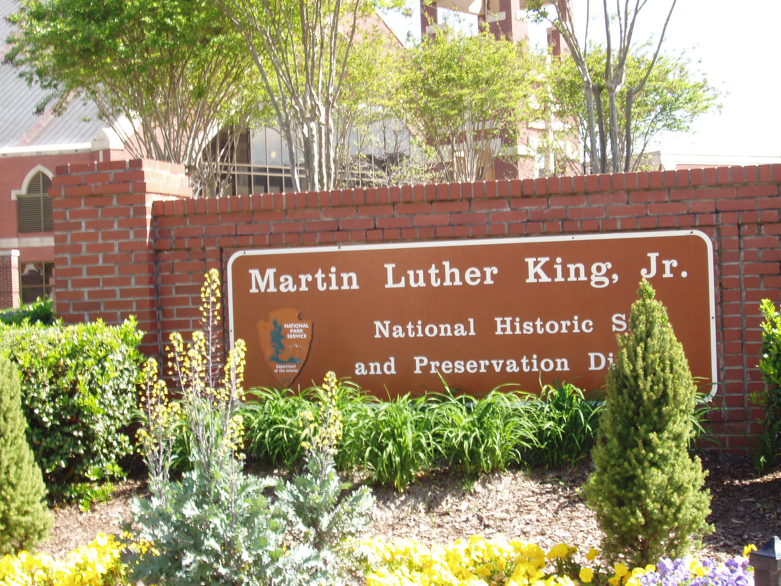
33°46′53″N 84°24′58″W / 33.78139°N 84.41611°WAtlanta 106 Martin Luther King, Jr., Historic District 
May 2, 1974 Bounded roughly by Irwin, Randolph, Edgewood, Jackson, and Auburn Aves.; also roughly bounded by Freedom Parkway, John Wesley Dobbs Ave., Decatur St., the former Southern railroad tracks, and Interstates 75/85
33°45′18″N 84°22′20″W / 33.755°N 84.37222°WAtlanta Second set of boundaries represents a boundary increase of June 12, 2001 107 Martin Luther King, Jr., National Historic Site and Preservation District 
October 10, 1980 Roughly bounded by Courtland, Randolph, Chamberlain Sts. and Irwin Ave.
33°45′18″N 84°22′20″W / 33.755°N 84.37222°WAtlanta 108 William and Ruth Knight Lustron House March 18, 1996 9166 Northside Dr.
33°49′6″N 84°24′28″W / 33.81833°N 84.40778°WAtlanta A Lustron house 109 Knox Apartments, Cauthorn House and Peachtree Road Apartments Historic District March 19, 1998 2214–2230 Peachtree Rd.
33°48′54″N 84°23′31″W / 33.815°N 84.39194°WAtlanta 110 Victor H. Kriegshaber House January 8, 1979 292 Moreland Ave., NE.
33°45′44″N 84°20′58″W / 33.76222°N 84.34944°WAtlanta 111 Lakewood Heights Historic District July 5, 2002 Jct. of Jonesboro Rd. and Lakewood Ave.
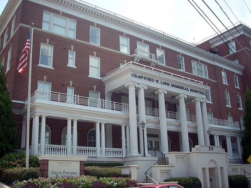
33°42′23″N 84°22′53″W / 33.70639°N 84.38139°WAtlanta 112 Crawford W. Long Memorial Hospital 
September 1, 1988 35 Linden Ave., NE.
33°46′10″N 84°23′9″W / 33.76944°N 84.38583°WAtlanta Davis-Fischer Sanitarium (Crawford Long Hospital) designed by Atlanta architect Eugene C. Wachendorff in 1911. 113 Means Street Historic District June 14, 2001 Bounded by Marietta St., Bankhead and Ponders Aves., and the Southern rail liNE.
33°46′22″N 84°24′18″W / 33.77278°N 84.405°WAtlanta 114 Memorial to the Six Million April 21, 2008 1173 Cascade Ave. SW.
33°43′26.38″N 84°26′56.77″W / 33.7239944°N 84.4491028°WAtlanta 115 Midtown Historic District February 12, 1999 Roughly bounded by 10th St., Ponce de Leon Ave., Piedmont Ave., and Lakeview Ave.
33°46′40″N 84°22′28″W / 33.77778°N 84.37444°WAtlanta 116 Mozley Park Historic District August 11, 1995 Roughly bounded by Westview Dr., West Lake Ave., Seaboard Coast Line RR tracks and M. L. King and Rockmart Dr.
33°45′4″N 84°26′14″W / 33.75111°N 84.43722°WAtlanta 117 National NuGrape Company December 20, 1996 794 Ralph McGill Boulevard
33°46′9″N 84°21′42″W / 33.76917°N 84.36167°WAtlanta 118 New Hope African Methodist Episcopal Church and Cemetery January 9, 2009 3012 Arden Rd., NW.
33°50′15.31″N 84°24′14.22″W / 33.8375861°N 84.40395°WAtlanta 119 Newtown Elementary School August 30, 2006 3115 Old Alabama Rd.
34°1′14″N 84°16′8″W / 34.02056°N 84.26889°WAlpharetta 120 William P. Nicolson House March 25, 1977 821 Piedmont Ave.
33°46′36″N 84°22′52″W / 33.77667°N 84.38111°WAtlanta 121 North Avenue Presbyterian Church 
November 17, 1978 607 Peachtree Ave., NE.
33°46′16″N 84°23′4″W / 33.77111°N 84.38444°WAtlanta Designed by Bruce & Morgan. Built 1900. 122 Oakland Cemetery 
April 28, 1976 248 Oakland Ave., SE.
33°44′55″N 84°22′17″W / 33.74861°N 84.37139°WAtlanta 123 Oakland City Historic District April 11, 2003 Bounded by Donnelly St., Lee St., Campbellton Rd., and Ingram Rd., Cascade Ave., Westmont Rd., and Epworth Rd.
33°43′41″N 84°25′40″W / 33.72806°N 84.42778°WAtlanta 124 Odd Fellows Building and Auditorium 
May 2, 1975 228–250 Auburn Ave., NE.
33°45′20″N 84°22′46″W / 33.75556°N 84.37944°WAtlanta 125 Omega Chapter of the Chi Phi Fraternity June 17, 1982 720 Fowler St., NW.
33°46′27″N 84°23′38″W / 33.77417°N 84.39389°WAtlanta 126 J. K. Orr Shoe Company September 29, 1995 16 William Holmes Borders, Sr. Ave.
33°45′14″N 84°22′29″W / 33.75389°N 84.37472°WAtlanta 127 Palmer House and Phelan House Apartments October 27, 2004 952 Peachtree St. and 81 and 93 Peachtree Place
33°46′56″N 84°23′4″W / 33.78222°N 84.38444°WAtlanta 128 Park Street Methodist Episcopal Church, South May 9, 1997 793 Park St., SW.
33°44′38″N 84°24′49″W / 33.74389°N 84.41361°WAtlanta 129 Peachtree Christian Church May 17, 1984 1580 Peachtree St. NW.
33°47′48″N 84°23′22″W / 33.79667°N 84.38944°WAtlanta 130 Peachtree Heights Park December 8, 1980 Peachtree, Habersham, and Wesley Rds., Andrews Dr., and Peachtree Battle Ave.
33°49′34″N 84°23′34″W / 33.82611°N 84.39278°WAtlanta 131 Peachtree Highlands Historic District (superseded in 2008 by the larger Peachtree Highlands-Peachtree Park Historic District) June 5, 1986 Roughly bounded by Highland Dr., Martina Dr., E. Pace Ferry, and Piedmont Rds.
33°50′32″N 84°22′2″W / 33.84222°N 84.36722°WAtlanta 132 Peachtree Highlands-Peachtree Park Historic District April 25, 2008 Roughly bounded by Piedmont & Peachtree Rds., GA 400 & MARTA N-S line.
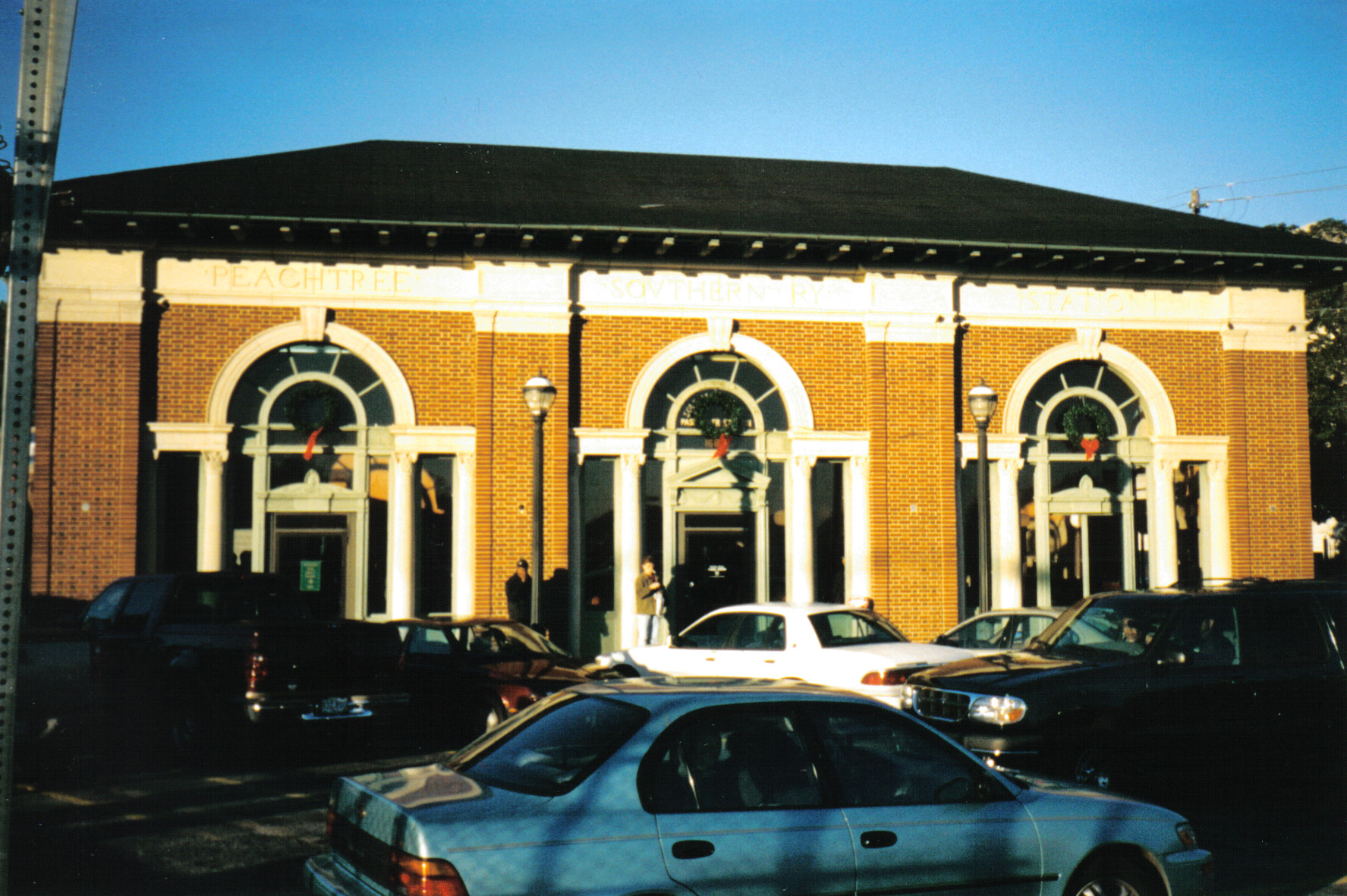
33°50′7.7″N 84°21′50.37″W / 33.835472°N 84.3639917°WAtlanta 133 Peachtree Southern Railway Station 
September 14, 1976 1688 Peachtree St., NW.
33°47′57″N 84°23′33″W / 33.79917°N 84.3925°WAtlanta 134 Edward C. Peters House 
January 20, 1972 179 Ponce de Leon Ave.
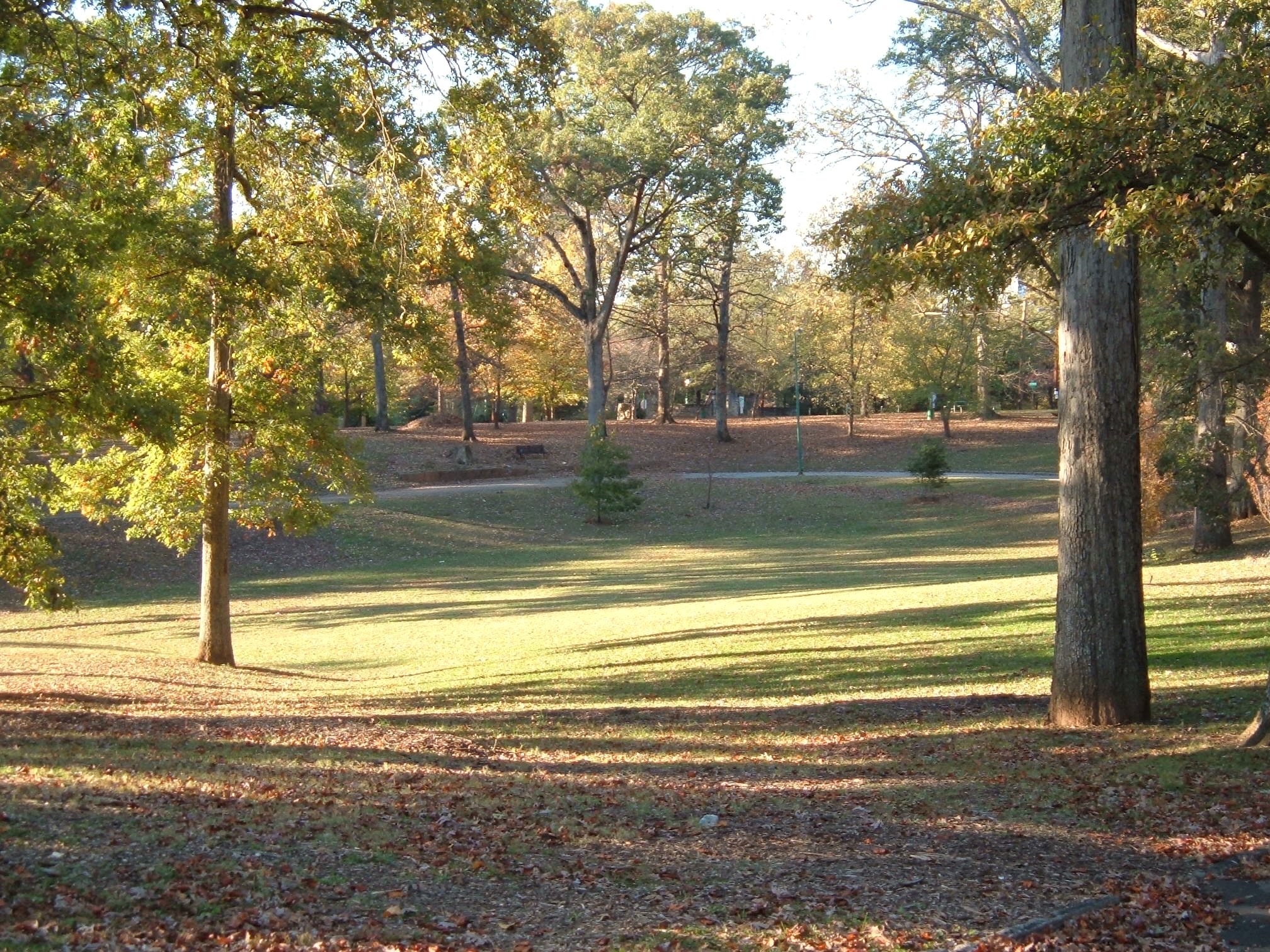
33°46′51″N 84°22′50″W / 33.78083°N 84.38056°WAtlanta A Queen Anne style house 135 Piedmont Park 
May 13, 1976 Bounded by 10th St., Southern Rwy. and Piedmont Rd.
33°47′17″N 84°22′27″W / 33.78806°N 84.37417°WAtlanta 136 Piedmont Park Apartments October 28, 2003 266 11th St.
33°47′4″N 84°22′43″W / 33.78444°N 84.37861°WAtlanta 137 Thomas H. Pitts House and Dairy June 27, 1979 3105 Cascade Rd., SW.
33°43′16″N 84°29′22″W / 33.72111°N 84.48944°WAtlanta 138 Pittsburgh Historic District June 14, 2006 Roughly bordered by Shelton Ave. Stewart Ave., University Ave., and the RR
33°43′44″N 84°24′7″W / 33.72889°N 84.40194°WAtlanta 139 William G. Raoul House December 15, 1986 848 Peachtree St.
33°46′40″N 84°23′6″W / 33.77778°N 84.385°WAtlanta 140 Retail Credit Company Home Office Building January 8, 1980 90 Fairlie St., SW.
33°45′25″N 84°23′24″W / 33.75694°N 84.39°WAtlanta 141 Reynoldstown Historic District April 3, 2003 Roughly bounded by the CSX rail line, Memorial Dr., Pearl St., and Moreland
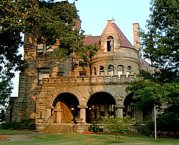
33°45′7″N 84°21′16″W / 33.75194°N 84.35444°WAtlanta 142 Rhodes Memorial Hall 
March 1, 1974 1516 Peachtree St.
33°47′45″N 84°23′18″W / 33.79583°N 84.38833°WAtlanta 143 Rhodes-Haverty Building 
January 19, 1979 134 Peachtree St., NW.
33°45′26″N 84°23′17″W / 33.75722°N 84.38806°WAtlanta Architects: Pringle & Smith (1929) 144 Isaac Roberts House April 10, 2008 9725 Roberts Dr.
34°0′10.08″N 84°20′55.03″W / 34.0028°N 84.3486194°WSandy Springs 145 Rock Spring Presbyterian Church May 24, 1990 1824 Piedmont Ave. NE.
33°48′17″N 84°22′5″W / 33.80472°N 84.36806°WAtlanta 146 Roscoe-Dunaway Gardens Historic District December 6, 1996 Roughly bounded by the Chattahoochee R., Cedar Cr., Hood Branch, and White Oak Cr.
33°29′54″N 84°50′0″W / 33.49833°N 84.833333°WRoscoe 147 Rufus M. Rose House 
September 20, 1977 537 Peachtree St.
33°46′8″N 84°23′5″W / 33.76889°N 84.38472°WAtlanta Designed by architect Emil Charles Seiz. Built in 1901. Late Victorian/simplified Queen-Anne. Rare 19th century town house of the affluent. Tiny yard is singular survivor from Peachtree Road's residential heyday. 148 Roswell Historic District May 2, 1974 Roughly bounded by Big Creek, King and Dam Sts., SW along New Marietta Hwy.
34°0′54″N 84°21′42″W / 34.015°N 84.36167°WRoswell 149 Simeon and Jane Rucker Log House April 18, 1997 755 Old Rucker Rd.
34°4′43″N 84°20′23″W / 34.07861°N 84.33972°WAlpharetta 150 St. Andrews Apartments June 13, 1986 1041 W. Peachtree St.
33°47′4″N 84°23′14″W / 33.78444°N 84.38722°WAtlanta 151 St. Mark Methodist Church 
November 2, 1987 781 Peachtree St.
33°46′37″N 84°23′2″W / 33.77694°N 84.38389°WAtlanta Architect: Willis Franklin Denny. Built 1902-1903. 152 Charles E. Sciple House March 1, 1984 1112 Peachtree St.
33°47′6″N 84°23′0″W / 33.785°N 84.383333°WAtlanta 153 Selig Company Building February 22, 1996 330-346 Marietta St.
33°45′43″N 84°23′49″W / 33.76194°N 84.39694°WAtlanta 154 Shrine of the Immaculate Conception December 12, 1976 48 Hunter St., SW.
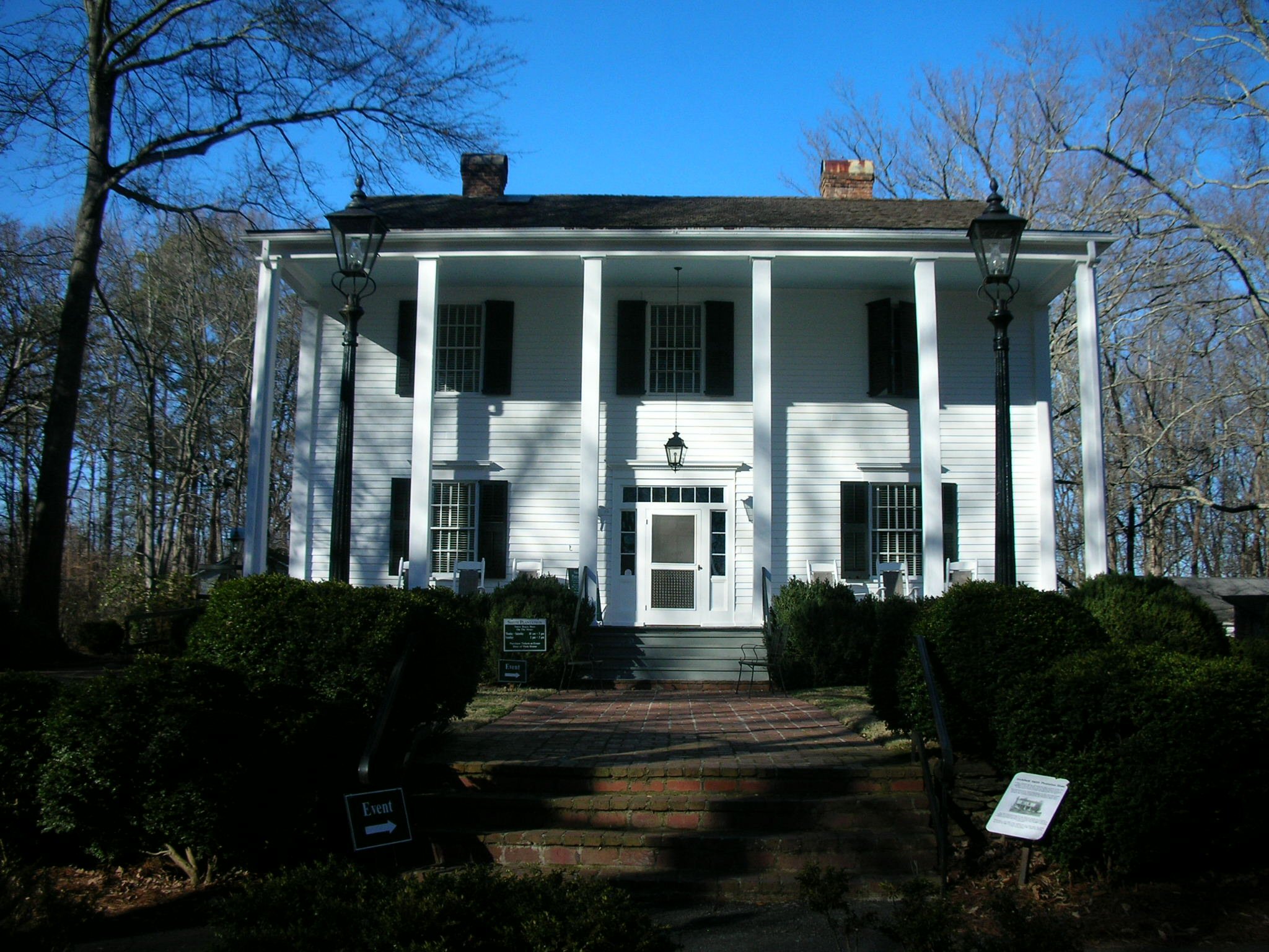
33°45′1″N 84°23′22″W / 33.75028°N 84.38944°WAtlanta 155 Archibald Smith House 
August 30, 2006 935 Alpharetta St.
34°1′26″N 84°21′36″W / 34.02389°N 84.36°WRoswell 156 Tullie Smith House November 20, 1970 3099 Andrews Dr., NW.
33°50′26″N 84°23′8″W / 33.84056°N 84.38556°WAtlanta 157 Southern Bell Telephone Company Building 
December 1, 1978 51 Ivy St., NE.
33°45′20″N 84°23′8″W / 33.75556°N 84.38556°WAtlanta 158 Southern Belting Company Building August 10, 1988 236 Forsyth St., SW.
33°44′53″N 84°23′48″W / 33.74806°N 84.39667°WAtlanta 159 Southern Dairies August 21, 2002 593 Glen Iris Dr.
33°46′21″N 84°22′3″W / 33.7725°N 84.3675°WAtlanta 160 Southern Railway North Avenue Yards Historic District July 16, 2002 539 John St. NW.
33°46′9″N 84°24′0″W / 33.76917°N 84.4°WAtlanta 161 Southern Spring Bed Company March 1, 2007 300 Martin Luther King, Jr., Dr.
33°44′57″N 84°22′33″W / 33.74917°N 84.37583°WAtlanta 162 Spotswood Hall February 5, 2002 555 Argonne Dr., NW.
33°50′13″N 84°24′19″W / 33.83694°N 84.40528°WAtlanta 163 Staff Row and Old Post Area-Fort McPherson November 5, 1974 NE corner of Fort McPherson
33°42′40″N 84°25′50″W / 33.71111°N 84.43056°WAtlanta 164 Stewart Avenue Methodist Episcopal Church South March 2, 1989 867 Stewart Ave., SW.
33°43′52″N 84°24′30″W / 33.73111°N 84.40833°WAtlanta 165 Stone Hall, Atlanta University 
December 2, 1974 Morris-Brown College campus
33°45′21″N 84°29′3″W / 33.75583°N 84.48417°WAtlanta 166 Swan House 
September 13, 1977 3099 Andrews Dr., NW.
33°50′25″N 84°23′17″W / 33.84028°N 84.38806°WAtlanta 167 Sweet Auburn Historic District 
December 8, 1976 Auburn Ave.
33°45′14″N 84°22′52″W / 33.75389°N 84.38111°WAtlanta 168 Techwood Homes Historic District June 29, 1976 Roughly bounded by North Ave., Parker, Williams, and Lovejoy Sts.
33°46′4″N 84°23′30″W / 33.76778°N 84.39167°WAtlanta 169 The Temple September 9, 1982 1589 Peachtree St.
33°47′52″N 84°23′21″W / 33.79778°N 84.38917°WAtlanta 170 The Texas June 19, 1973 Cyclorama Bldg., Grant Park
33°44′2″N 84°22′15″W / 33.73389°N 84.37083°WAtlanta Steam locomotive that chased in the Great Locomotive Chase 171 Albert E. Thornton House December 8, 1980 105 W. Paces Ferry Rd.
33°50′41″N 84°23′27″W / 33.84472°N 84.39083°WAtlanta 172 Thorton Building February 23, 1984 10 Pryor St. (10 Park Place South)
33°45′15″N 84°23′19″W / 33.75417°N 84.38861°WAtlanta 173 Henry B. Tompkins House December 12, 1976 125 W. Wesley Rd., NW.
33°49′44″N 84°23′29″W / 33.82889°N 84.39139°WAtlanta 174 Trio Steam Laundry September 18, 1997 19 Hilliard St.
33°41′32″N 84°22′46″W / 33.69222°N 84.37944°WAtlanta 175 Troy Peerless Laundry Building September 9, 1999 650 Glen Iris Dr.
33°46′32″N 84°22′5″W / 33.77556°N 84.36806°WAtlanta 176 Trygveson December 8, 1980 3418 Pinestream Rd., NW.
33°50′54″N 84°25′21″W / 33.84833°N 84.4225°WAtlanta 177 Mary Elizabeth Tyler House January 30, 2006 2887 Howell Mill Rd.
33°50′2″N 84°25′3″W / 33.83389°N 84.4175°WAtlanta 178 Tyree Building July 15, 1982 679 Durant Pl., NE.
33°46′23″N 84°22′31″W / 33.77306°N 84.37528°WAtlanta 179 U.S. Post Office and Courthouse 
May 2, 1974 76 Forsyth St.
33°41′3″N 84°23′33″W / 33.68417°N 84.3925°WAtlanta 180 Underground Atlanta Historic District July 24, 1980 Roughly bounded by Martin Luther King, Jr., Dr., Central Ave., Wall and Peachtree Sts.
33°45′7″N 84°23′21″W / 33.75194°N 84.38917°WAtlanta 181 United States Post Office, Federal Annex February 10, 2006 77 Forsyth St.
33°45′16″N 84°23′40″W / 33.75444°N 84.39444°WAtlanta 182 E. Van Winkle Gin and Machine Works September 10, 1979 Foster St.
33°47′8″N 84°24′59″W / 33.78556°N 84.41639°WAtlanta 183 Villa Lamar June 8, 1988 801 West Paces Ferry Rd.
33°51′1″N 84°24′47″W / 33.85028°N 84.41306°WAtlanta 184 Virginia-Highland Historic District May 10, 2005 Roughly bounded by Amsterdam Ave., Rosedale Rd., Ponce de Leon ave., and the Norfolk Southern Railroad
33°46′59″N 84°21′25″W / 33.78306°N 84.35694°WAtlanta 185 Anne Wallace Branch-Carnegie Library of Atlanta December 4, 2003 535 Luckie St. NW.
33°46′14″N 84°23′46″W / 33.77056°N 84.39611°WAtlanta 186 Washington Park Historic District February 28, 2000 Jct. of Martin Luther King, Jr. Dr. and Ashby St.
33°45′36″N 84°25′16″W / 33.76°N 84.42111°WAtlanta 187 Booker T. Washington High School 
March 18, 1986 45 Whitehouse Dr. SW.
33°45′12″N 84°25′18″W / 33.75333°N 84.42167°WAtlanta 188 West End Historic District February 25, 1999 Roughly Bounded by US 20, Lee, White, and Langhorn Sts.
33°44′16″N 84°25′23″W / 33.73778°N 84.42306°WAtlanta 189 Western and Atlantic Railroad Zero Milepost September 19, 1977 Central Ave. between Wall St. and Railroad Ave.
33°45′8″N 84°23′19″W / 33.75222°N 84.38861°WAtlanta 190 Western Electric Company Building November 8, 2000 820 Ralph McGill Boulevard
33°46′11″N 84°21′40″W / 33.76972°N 84.36111°WAtlanta 191 Westinghouse Electric Company Building February 9, 2001 426 Marietta St., NW.
33°46′0″N 84°23′52″W / 33.766667°N 84.39778°WAtlanta 192 Whittier Mills Historic District September 13, 2001 Roughly the jct. of Bolton Rd. and Parrot Ave., approx. 7 mi. NW of central business district of Atlanta
33°48′42″N 84°29′1″W / 33.81167°N 84.48361°WAtlanta 193 Judge William Wilson House February 15, 1980 501 Fairburn Rd., SW.
33°44′46″N 84°30′41″W / 33.74611°N 84.51139°WAtlanta 194 Winecoff Hotel 
March 31, 2009 179 Peachtree Street, NW.
33°49′29.5″N 84°23′16″W / 33.824861°N 84.38778°WAtlanta 195 George, Jr., and Emily Winship House May 10, 2005 2626 Brookwood Dr., NE.
33°49′40″N 84°22′53″W / 33.82778°N 84.38139°WAtlanta 196 Stuart Witham House December 22, 1978 2922 Andrews Dr., NW.
33°50′6″N 84°23′35″W / 33.835°N 84.39306°WAtlanta 197 Yonge Street School January 24, 1980 89 Yonge St.
33°45′6″N 84°22′31″W / 33.75167°N 84.37528°WAtlanta References
- ^ "National Register of Historic Places: Weekly List Actions". National Park Service, United States Department of the Interior. Retrieved on November 10, 2011.
Categories:- National Register of Historic Places in Georgia (U.S. state)
- Buildings and structures in Fulton County, Georgia
-


Wikimedia Foundation. 2010.