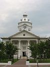
National Register of Historic Places listings in Colquitt County, Georgia
- National Register of Historic Places listings in Colquitt County, Georgia
-
This is a list of properties and districts in Colquitt County, Georgia that are listed on the National Register of Historic Places (NRHP).
-
- This National Park Service list is complete through NPS recent listings posted November 10, 2011.[1]
Current listings
|
Landmark name |
Image |
Date listed |
Location |
City or Town |
Summary |
| 1 |
W. W. Ashburn House |
|
01982-07-15 July 15, 1982 |
609 1st Ave.
31°10′42″N 83°47′45″W / 31.17833°N 83.79583°W / 31.17833; -83.79583 (Ashburn, W. W., House) |
Moultrie |
|
| 2 |
Carnegie Library of Moultrie |
|
01982-07-15 July 15, 1982 |
39 N. Main St.
31°10′50″N 83°47′21″W / 31.18056°N 83.78917°W / 31.18056; -83.78917 (Carnegie Library of Moultrie) |
Moultrie |
|
| 3 |
James W. Coleman House |
|
01983-12-22 December 22, 1983 |
GA 33
31°13′28″N 83°47′49″W / 31.22444°N 83.79694°W / 31.22444; -83.79694 (Coleman, James W., House) |
Moultrie |
|
| 4 |
Colquitt County Courthouse |
 |
01980-09-18 September 18, 1980 |
Courthouse Sq.
31°10′45″N 83°47′18″W / 31.17917°N 83.78833°W / 31.17917; -83.78833 (Colquitt County Courthouse) |
Moultrie |
|
| 5 |
Colquitt County Jail |
|
01980-10-10 October 10, 1980 |
126 1st Ave., SE
31°10′42″N 83°47′12″W / 31.17833°N 83.78667°W / 31.17833; -83.78667 (Colquitt County Jail) |
Moultrie |
|
| 6 |
Mother Easter Baptist Church and Parsonage |
|
01999-04-01 April 1, 1999 |
400 Second Ave., NW
31°10′54″N 83°47′38″W / 31.18167°N 83.79389°W / 31.18167; -83.79389 (Mother Easter Baptist Church and Parsonage) |
Moultrie |
|
| 7 |
Moultrie Commercial Historic District |
|
01994-06-03 June 3, 1994 |
Roughly bounded by NE. First Ave., SE. Second Ave., W. First St. and E. Fourth St.
31°10′48″N 83°47′14″W / 31.18°N 83.78722°W / 31.18; -83.78722 (Moultrie Commercial Historic District) |
Moultrie |
|
| 8 |
Moultrie High School |
|
01982-06-17 June 17, 1982 |
7th Ave.
31°10′20″N 83°47′40″W / 31.17222°N 83.79444°W / 31.17222; -83.79444 (Moultrie High School) |
Moultrie |
|
| 9 |
Henry Crawford Tucker Log House and Farmstead |
|
01982-07-26 July 26, 1982 |
Off GA 37
31°12′37″N 83°50′39″W / 31.21028°N 83.84417°W / 31.21028; -83.84417 (Tucker, Henry Crawford, Log House and Farmstead) |
Moultrie |
|
References
Categories:
- National Register of Historic Places in Georgia (U.S. state)
- Buildings and structures in Colquitt County, Georgia
Wikimedia Foundation.
2010.
Look at other dictionaries:
National Register of Historic Places listings in Fulton County, Georgia — This is a list of properties and districts in Fulton County, Georgia that are listed on the National Register of Historic Places (NRHP). It covers most of the NRHP properties in Atlanta, Georgia; other Atlanta listings are covered in National… … Wikipedia
National Register of Historic Places listings in Miller County, Georgia — This is a list of properties and districts in Miller County, Georgia that are listed on the National Register of Historic Places (NRHP). Map of all coordinates from Google Map of all coordinates from Bing … Wikipedia
National Register of Historic Places listings in Muscogee County, Georgia — This is a list of properties and districts in Muscogee County, Georgia that are listed on the National Register of Historic Places (NRHP). Map of all coordinates from Google Map of all coordinates from Bing … Wikipedia
National Register of Historic Places listings in Bartow County, Georgia — This is a list of properties and districts in Bartow County, Georgia that are listed on the National Register of Historic Places (NRHP). Map of all coordinates from Google Map of all coordinates from Bing … Wikipedia
National Register of Historic Places listings in Bibb County, Georgia — This is a list of properties and districts in Bibb County, Georgia that are listed on the National Register of Historic Places (NRHP). Map of all coordinates from Google Map of all coordinates from Bing … Wikipedia
National Register of Historic Places listings in Bulloch County, Georgia — This is a list of properties and districts in Bulloch County, Georgia that are listed on the National Register of Historic Places (NRHP). Map of all coordinates from Google Map of all coordinates from Bing … Wikipedia
National Register of Historic Places listings in Banks County, Georgia — This is a list of properties and districts in Banks County, Georgia that are listed on the National Register of Historic Places (NRHP). Map of all coordinates from Google Map of all coordinates from Bing … Wikipedia
National Register of Historic Places listings in Barrow County, Georgia — This is a list of properties and districts in Barrow County, Georgia that are listed on the National Register of Historic Places (NRHP). Map of all coordinates from Google Map of all coordinates from Bing … Wikipedia
National Register of Historic Places listings in Catoosa County, Georgia — This is a list of properties and districts in Catoosa County, Georgia that are listed on the National Register of Historic Places (NRHP). Map of all coordinates from Google Map of all coordinates from Bing … Wikipedia
National Register of Historic Places listings in Clarke County, Georgia — This is a list of properties and districts in Clarke County, Georgia that are listed on the National Register of Historic Places (NRHP). Map of all coordinates from Google Map of all coordinates from Bing … Wikipedia

