National Register of Historic Places listings in Lumpkin County, Georgia
- National Register of Historic Places listings in Lumpkin County, Georgia
-
This is a list of properties and districts in Lumpkin County, Georgia that are listed on the National Register of Historic Places (NRHP).
-
- This National Park Service list is complete through NPS recent listings posted November 10, 2011.[1]
Current listings
|
Landmark name |
Image |
Date listed |
Location |
City or Town |
Summary |
| 1 |
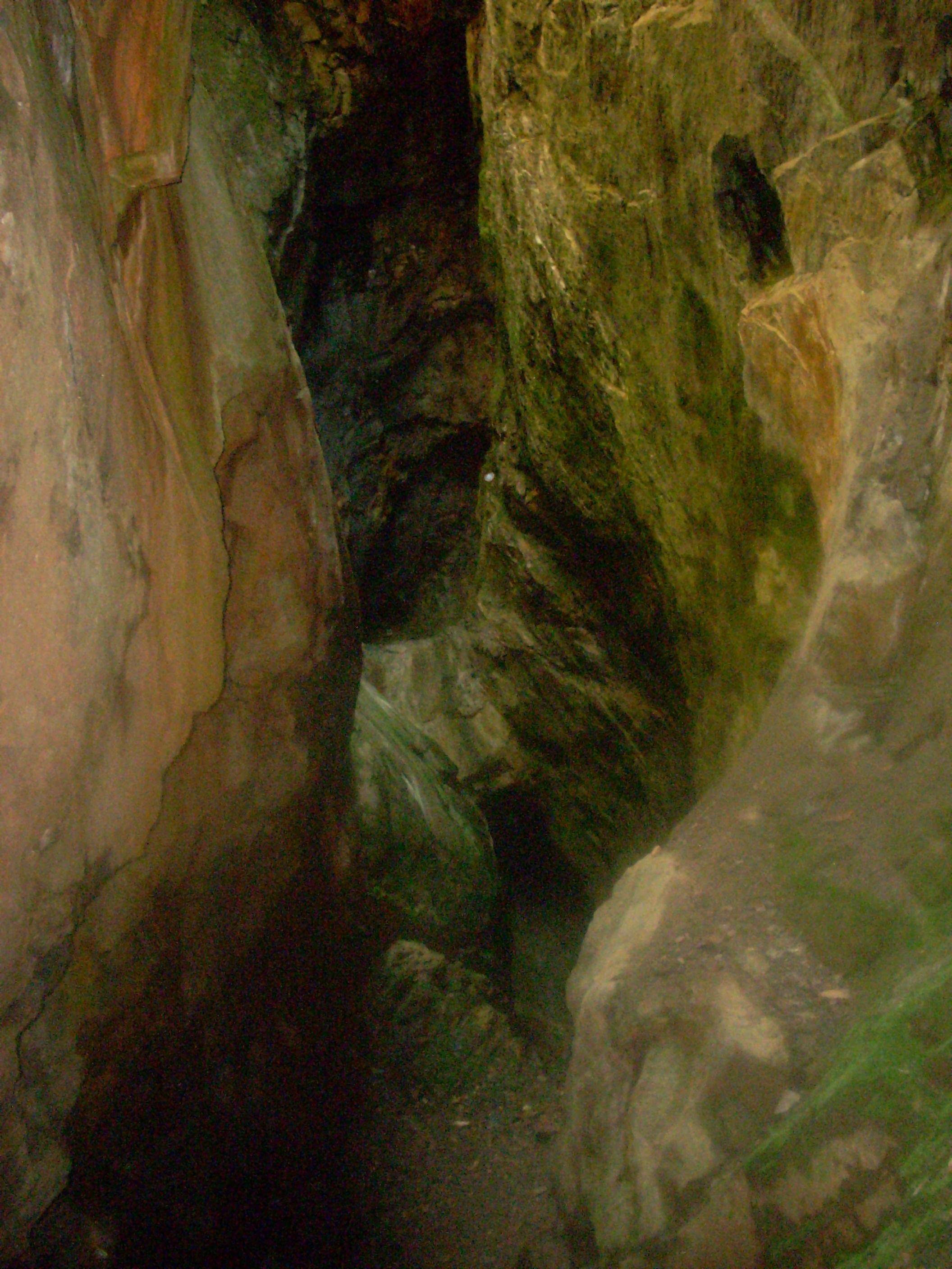
Calhoun Mine |
|
01973-11-07 November 7, 1973 |
3 mi. S of Dahlonega off GA 60
34°33′43″N 83°59′9″W / 34.56194°N 83.98583°W / 34.56194; -83.98583 (Calhoun Mine) |
Dahlonega |
|
| 2 |
Dahlonega Commercial Historic District |
|
01983-04-07 April 7, 1983 |
Chestates, Park, and Main Sts.
34°31′57″N 83°59′5″W / 34.5325°N 83.98472°W / 34.5325; -83.98472 (Dahlonega Commercial Historic District) |
Dahlonega |
|
| 3 |
Dahlonega Consolidated Gold Mine |
 |
01980-02-27 February 27, 1980 |
NE of Dahlonega
34°32′18″N 83°58′12″W / 34.53833°N 83.97°W / 34.53833; -83.97 (Dahlonega Consolidated Gold Mine) |
Dahlonega |
|
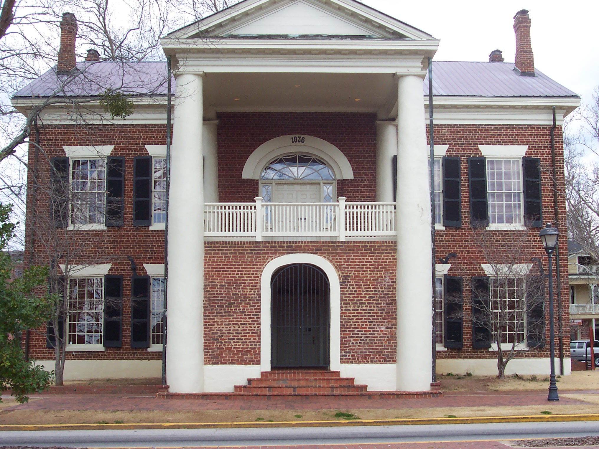
| 4 |
Dahlonega Courthouse Gold Museum |
 |
01971-08-26 August 26, 1971 |
U.S. 19
34°31′57″N 83°59′6″W / 34.5325°N 83.985°W / 34.5325; -83.985 (Dahlonega Courthouse Gold Museum) |
Dahlonega |
|
| 5 |
Daniel M. Davis House |
|
01998-03-12 March 12, 1998 |
GA 9, 1.5 SW of jct. of GA 9 and GA 52
34°30′49″N 84°3′51″W / 34.51361°N 84.06417°W / 34.51361; -84.06417 (Davis, Daniel M., House) |
Dahlonega |
|
| 6 |
Fields Place-Vickery House |
|
01978-12-14 December 14, 1978 |
W. Main St. and Vickery Dr.
34°31′49″N 83°59′17″W / 34.53028°N 83.98806°W / 34.53028; -83.98806 (Fields Place-Vickery House) |
Dahlonega |
|
| 7 |
Hawkins Street Historic District |
|
01995-05-12 May 12, 1995 |
Roughly, Hawkins St. from Church St. to N. Meaders St., including adjacent parts of Water, N. Chestatee and N. Park Sts.
34°32′0″N 83°59′11″W / 34.533333°N 83.98639°W / 34.533333; -83.98639 (Hawkins Street Historic District) |
Dahlonega |
|
| 8 |
Holly Theatre |
|
02002-02-21 February 21, 2002 |
69 W. Main St.
34°31′53″N 83°59′9″W / 34.53139°N 83.98583°W / 34.53139; -83.98583 (Holly Theatre) |
Dahlonega |
|
| 9 |
Lumpkin County Jail |
 |
01985-09-13 September 13, 1985 |
Clarksville St.
34°32′3″N 83°58′55″W / 34.53417°N 83.98194°W / 34.53417; -83.98194 (Lumpkin County Jail) |
Dahlonega |
|
| 10 |
Price Memorial Hall |
|
01972-01-20 January 20, 1972 |
College Ave.
34°31′47″N 83°59′13″W / 34.52972°N 83.98694°W / 34.52972; -83.98694 (Price Memorial Hall) |
Dahlonega |
|
| 11 |
Seven Oaks |
|
01982-07-15 July 15, 1982 |
403 S. Park St.
34°31′51″N 83°58′56″W / 34.53083°N 83.98222°W / 34.53083; -83.98222 (Seven Oaks) |
Dahlonega |
|
References
Categories:
- National Register of Historic Places in Georgia (U.S. state)
- Buildings and structures in Lumpkin County, Georgia
Wikimedia Foundation.
2010.
Look at other dictionaries:
National Register of Historic Places listings in Fulton County, Georgia — This is a list of properties and districts in Fulton County, Georgia that are listed on the National Register of Historic Places (NRHP). It covers most of the NRHP properties in Atlanta, Georgia; other Atlanta listings are covered in National… … Wikipedia
National Register of Historic Places listings in Clarke County, Georgia — This is a list of properties and districts in Clarke County, Georgia that are listed on the National Register of Historic Places (NRHP). Map of all coordinates from Google Map of all coordinates from Bing … Wikipedia
National Register of Historic Places listings in Stewart County, Georgia — This is a list of properties and districts in Stewart County, Georgia that are listed on the National Register of Historic Places (NRHP). Map of all coordinates from Google Map of all coordinates from Bing … Wikipedia
National Register of Historic Places listings in Muscogee County, Georgia — This is a list of properties and districts in Muscogee County, Georgia that are listed on the National Register of Historic Places (NRHP). Map of all coordinates from Google Map of all coordinates from Bing … Wikipedia
National Register of Historic Places listings in McDuffie County, Georgia — This is a list of properties and districts in McDuffie County, Georgia that are listed on the National Register of Historic Places (NRHP). Map of all coordinates from Google Map of all coordinates from Bing … Wikipedia
National Register of Historic Places listings in Banks County, Georgia — This is a list of properties and districts in Banks County, Georgia that are listed on the National Register of Historic Places (NRHP). Map of all coordinates from Google Map of all coordinates from Bing … Wikipedia
National Register of Historic Places listings in Bartow County, Georgia — This is a list of properties and districts in Bartow County, Georgia that are listed on the National Register of Historic Places (NRHP). Map of all coordinates from Google Map of all coordinates from Bing … Wikipedia
National Register of Historic Places listings in Bibb County, Georgia — This is a list of properties and districts in Bibb County, Georgia that are listed on the National Register of Historic Places (NRHP). Map of all coordinates from Google Map of all coordinates from Bing … Wikipedia
National Register of Historic Places listings in Bulloch County, Georgia — This is a list of properties and districts in Bulloch County, Georgia that are listed on the National Register of Historic Places (NRHP). Map of all coordinates from Google Map of all coordinates from Bing … Wikipedia
National Register of Historic Places listings in Catoosa County, Georgia — This is a list of properties and districts in Catoosa County, Georgia that are listed on the National Register of Historic Places (NRHP). Map of all coordinates from Google Map of all coordinates from Bing … Wikipedia