National Register of Historic Places listings in Macon County, Georgia
- National Register of Historic Places listings in Macon County, Georgia
-
This is a list of properties and districts in Macon County, Georgia that are listed on the National Register of Historic Places (NRHP).
-
- This National Park Service list is complete through NPS recent listings posted November 10, 2011.[1]
Current listings
|
Landmark name |
Image |
Date listed |
Location |
City or Town |
Summary |
| 1 |
Alma Fruit Farm |
|
01980-11-25 November 25, 1980 |
GA 49W |
Marshallville |
|
| 2 |
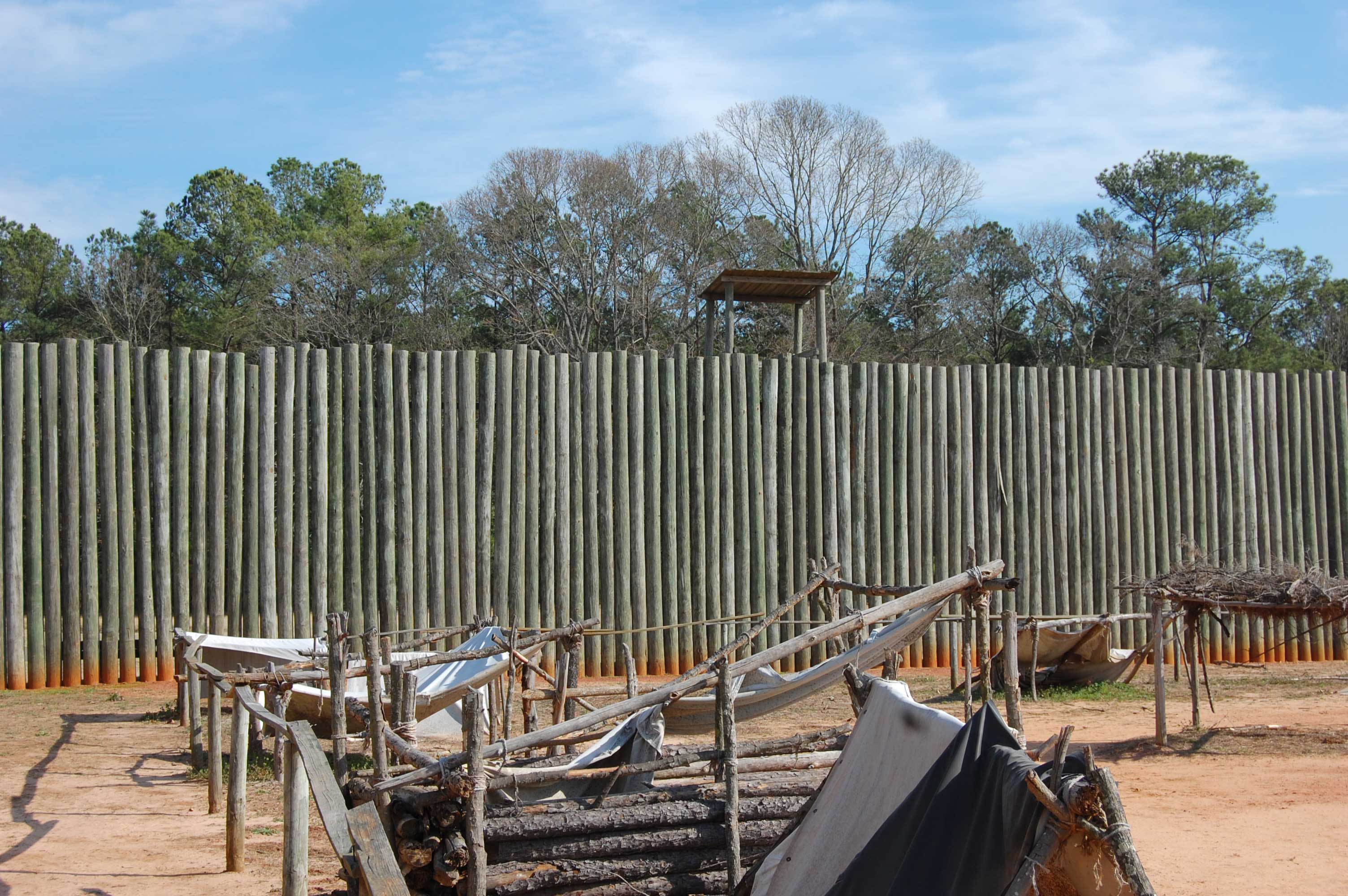
Andersonville National Historic Site |
 |
01970-10-16 October 16, 1970 |
1 mi. E of Andersonville on GA 49
32°12′23″N 84°7′24″W / 32.20639°N 84.12333°W / 32.20639; -84.12333 (Andersonville National Historic Site) |
Andersonville |
|
| 3 |
Billy Place |
|
01980-11-25 November 25, 1980 |
Rt. 1
32°25′10″N 83°57′44″W / 32.41944°N 83.96222°W / 32.41944; -83.96222 (Billy Place) |
Marshallville |
|
| 4 |
DeVaughn-Lewis House |
|
01985-05-02 May 2, 1985 |
510 S. Dooly St.
32°17′38″N 84°1′53″W / 32.29389°N 84.03139°W / 32.29389; -84.03139 (DeVaughn-Lewis House) |
Montezuma |
|
| 5 |
East Main Street Residential District |
|
01980-11-25 November 25, 1980 |
E. Main St.
32°27′18″N 83°56′12″W / 32.455°N 83.93667°W / 32.455; -83.93667 (East Main Street Residential District) |
Marshallville |
|
| 6 |
William Hamilton Felton House |
|
01980-11-25 November 25, 1980 |
McCaskill St.
32°26′53″N 83°56′57″W / 32.44806°N 83.94917°W / 32.44806; -83.94917 (Felton, William Hamilton, House) |
Marshallville |
|
| 7 |
Wilkes Knob Plantation |
|
01980-11-25 November 25, 1980 |
Rt. 1
32°28′22″N 83°52′36″W / 32.47278°N 83.87667°W / 32.47278; -83.87667 (Knob, Wilkes, Plantation) |
Marshallville |
|
| 8 |
Lamson-Richardson School |
|
01981-05-18 May 18, 1981 |
Railroad St.
32°26′49″N 83°56′40″W / 32.44694°N 83.94444°W / 32.44694; -83.94444 (Lamson-Richardson School) |
Marshallville |
|
| 9 |
Macon County Courthouse |
|
01980-09-18 September 18, 1980 |
Courthouse Sq.
32°17′35″N 84°3′37″W / 32.29306°N 84.06028°W / 32.29306; -84.06028 (Macon County Courthouse) |
Oglethorpe |
|
| 10 |
Marshallville Commercial District |
|
01980-11-25 November 25, 1980 |
Main St.
32°27′23″N 83°55′24″W / 32.45639°N 83.92333°W / 32.45639; -83.92333 (Marshallville Commercial District) |
Marshallville |
|
| 11 |
Massee Lane |
|
01980-11-25 November 25, 1980 |
Rt. 1
32°29′21″N 83°56′9″W / 32.48917°N 83.93583°W / 32.48917; -83.93583 (Massee Lane) |
Marshallville |
|
| 12 |
Montezuma Depot |
|
01980-06-12 June 12, 1980 |
S. Dooly St.
32°18′2″N 84°1′46″W / 32.30056°N 84.02944°W / 32.30056; -84.02944 (Montezuma Depot) |
Montezuma |
|
| 13 |
Montezuma Historic District |
|
02003-10-13 October 13, 2003 |
Roughly centered along N. and S. Dooly St.
32°18′11″N 84°1′47″W / 32.30306°N 84.02972°W / 32.30306; -84.02972 (Montezuma Historic District) |
Montezuma |
|
| 14 |
Thronateeska |
|
01980-11-25 November 25, 1980 |
Rt. 1
32°25′4″N 84°0′51″W / 32.41778°N 84.01417°W / 32.41778; -84.01417 (Thronateeska) |
Marshallville |
|
| 15 |
West Main Street Residential District |
|
01980-11-25 November 25, 1980 |
W. Main St.
32°27′21″N 83°56′59″W / 32.45583°N 83.94972°W / 32.45583; -83.94972 (West Main Street Residential District) |
Marshallville |
|
| 16 |
Willow Lake |
|
01980-11-25 November 25, 1980 |
Rt. 1
32°28′36″N 83°53′32″W / 32.47667°N 83.89222°W / 32.47667; -83.89222 (Willow Lake) |
Marshallville |
|
References
Categories:
- National Register of Historic Places in Georgia (U.S. state)
- Buildings and structures in Macon County, Georgia
Wikimedia Foundation.
2010.
Look at other dictionaries:
National Register of Historic Places listings in Fulton County, Georgia — This is a list of properties and districts in Fulton County, Georgia that are listed on the National Register of Historic Places (NRHP). It covers most of the NRHP properties in Atlanta, Georgia; other Atlanta listings are covered in National… … Wikipedia
National Register of Historic Places listings in Macon County, North Carolina — Map of all coordinates from Google Map of all coordinates from Bing … Wikipedia
National Register of Historic Places listings in Macon County, Illinois — See also: List of Registered Historic Places in Illinois Contents: List of Registered Historic Places in Macon County, Illinois, USA: This National Park Service list is complete through NPS recent listings posted November 10, 2011.[1] Landmark… … Wikipedia
National Register of Historic Places listings in Bibb County, Georgia — This is a list of properties and districts in Bibb County, Georgia that are listed on the National Register of Historic Places (NRHP). Map of all coordinates from Google Map of all coordinates from Bing … Wikipedia
National Register of Historic Places listings in Muscogee County, Georgia — This is a list of properties and districts in Muscogee County, Georgia that are listed on the National Register of Historic Places (NRHP). Map of all coordinates from Google Map of all coordinates from Bing … Wikipedia
National Register of Historic Places listings in Chatham County, Georgia — This is a list of properties and districts in Chatham County, Georgia that are listed on the National Register of Historic Places (NRHP). Map of all coordinates from Google Map of all coordinates from Bing … Wikipedia
National Register of Historic Places listings in Monroe County, Georgia — This is a list of properties and districts in Monroe County, Georgia that are listed on the National Register of Historic Places (NRHP). Map of all coordinates from Google Map of all coordinates from Bing … Wikipedia
National Register of Historic Places listings in Peach County, Georgia — This is a list of properties and districts in Peach County, Georgia that are listed on the National Register of Historic Places (NRHP). Map of all coordinates from Google Map of all coordinates from Bing … Wikipedia
National Register of Historic Places listings in Bulloch County, Georgia — This is a list of properties and districts in Bulloch County, Georgia that are listed on the National Register of Historic Places (NRHP). Map of all coordinates from Google Map of all coordinates from Bing … Wikipedia
National Register of Historic Places listings in Henry County, Georgia — This is a list of properties and districts in Henry County, Georgia that are listed on the National Register of Historic Places (NRHP). Map of all coordinates from Google Map of all coordinates from Bing … Wikipedia