- Marshallville, Georgia
-
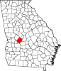
Marshallville, Georgia — City — Location in Macon County and the state of Georgia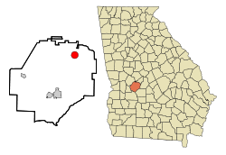
Coordinates: 32°27′12″N 83°56′32″W / 32.45333°N 83.94222°WCoordinates: 32°27′12″N 83°56′32″W / 32.45333°N 83.94222°W Country United States State Georgia County Macon Area - Total 3.2 sq mi (8.2 km2) - Land 3.2 sq mi (8.2 km2) - Water 0 sq mi (0 km2) Elevation 515 ft (157 m) Population (2000) - Total 1,335 - Density 417.2/sq mi (162.8/km2) Time zone Eastern (EST) (UTC-5) - Summer (DST) EDT (UTC-4) ZIP code 31057 Area code(s) 478 FIPS code 13-49924[1] GNIS feature ID 0356378[2] Marshallville is a city in Macon County, Georgia, United States. The population was 1,335 at the 2000 census.
Geography
Marshallville is located at 32°27′12″N 83°56′32″W / 32.45333°N 83.94222°W (32.453423, -83.942159)[3].
According to the United States Census Bureau, the city has a total area of 3.2 square miles (8.3 km2), all of it land.
Demographics
As of the census[1] of 2000, there were 1,335 people, 523 households, and 365 families residing in the city. The population density was 422.8 people per square mile (163.1/km²). There were 582 housing units at an average density of 184.3 per square mile (71.1/km²). The racial makeup of the city was 20.82% White, 78.43% African American, 0.30% Native American, 0.15% from other races, and 0.30% from two or more races. Hispanic or Latino of any race were 0.45% of the population.
There were 523 households out of which 29.4% had children under the age of 18 living with them, 30.2% were married couples living together, 35.0% had a female householder with no husband present, and 30.2% were non-families. 28.9% of all households were made up of individuals and 14.5% had someone living alone who was 65 years of age or older. The average household size was 2.55 and the average family size was 3.13.
In the city the population was spread out with 27.1% under the age of 18, 11.4% from 18 to 24, 22.7% from 25 to 44, 24.9% from 45 to 64, and 13.9% who were 65 years of age or older. The median age was 36 years. For every 100 females there were 80.4 males. For every 100 females age 18 and over, there were 74.4 males.
The median income for a household in the city was $21,800, and the median income for a family was $24,375. Males had a median income of $27,557 versus $20,167 for females. The per capita income for the city was $11,306. About 27.1% of families and 29.5% of the population were below the poverty line, including 44.7% of those under age 18 and 30.1% of those age 65 or over.
References
- ^ a b "American FactFinder". United States Census Bureau. http://factfinder.census.gov. Retrieved 2008-01-31.
- ^ "US Board on Geographic Names". United States Geological Survey. 2007-10-25. http://geonames.usgs.gov. Retrieved 2008-01-31.
- ^ "US Gazetteer files: 2010, 2000, and 1990". United States Census Bureau. 2011-02-12. http://www.census.gov/geo/www/gazetteer/gazette.html. Retrieved 2011-04-23.
Municipalities and communities of Macon County, Georgia Cities Ideal | Marshallville | Montezuma | Oglethorpe
 Categories:
- Cities in Georgia (U.S. state)
- Populated places in Macon County, Georgia
- Populated places in Georgia (U.S. state) with African American majority populations


Wikimedia Foundation. 2010.