- Macon County, Georgia
Infobox U.S. County
county = Macon County
state = Georgia
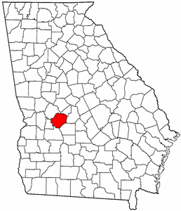
map size = 225
founded = December 14, 1837
seat = Oglethorpe
largest city = Oglethorpe
area_total_sq_mi = 406
area_total_km2 = 1051
area_land_sq_mi = 403
area_land_km2 = 1044
area_water_sq_mi = 3
area_water_km2 = 7
area percentage = 0.66%
census estimate yr = 2005
pop = 13745
density_sq_mi = 35
density_km2 = 13
time zone = Eastern
UTC offset = -5
DST offset = -4
web =Macon County is a
county located in theU.S. state of Georgia. As of the 2000census , thepopulation is 14,074. The 2007 Census Estimate shows a population of 13,542 [http://www.census.gov/popest/counties/tables/CO-EST2007-01-13.xls] . Thecounty seat is Oglethorpe, GeorgiaGR|6. [http://www.cviog.uga.edu/Projects/gainfo/courthouses/maconCH.htm]History
Macon County was created in 1837 from Houston ("house-ton") and Marion counties, effective
December 14 of that year. The 91st county, it was named for the recently-deceasedGeneral Nathaniel Macon ofNorth Carolina , who served in theU.S. Congress for 37 years and ran forU.S. vice president . (The city of Macon, Georgia was also named for him, but is actually the seat of another county.) Parts of the county were used to create Taylor and Peach counties, in 1852 and 1924 respectively.The first county seat was actually not chosen until 1838 when the county's
inferior court selected Lanier. TheGeorgia General Assembly (state legislature) designated it so onDecember 29 of that year and incorporated it as atown . TheCentral of Georgia Railroad was then built through Oglethorpe in the 1850s, and the assembly called for areferendum on moving the seat to Oglethorpe in February of both 1854 and 1856. Little is known about the first vote, but the second resulted in the change to the new county seat the following year.The infamous
Andersonville National Cemetery is at the southwestern tip of the county. During theAmerican Civil War , 13,000 died there fromstarvation anddisease . [http://maconcounty.georgia.gov] There is also an activeMennonite community within the county. Thearea code for Macon County is currently 478.Geography
According to the
U.S. Census Bureau , the county has a total area of 406square mile s (1,051km² ), of which, 403 square miles (1,044 km²) of it is land and 3 square miles (7 km²) of it (0.66%) is water.Major highways
*
*
*
*
*
*Adjacent counties
*Peach County (northeast)
*Houston County (east)
*Dooly County (southeast)
*Sumter County (south)
*Schley County (southwest)
*Taylor County (northwest)National
protected area *
Andersonville National Historic Site (part)Demographics
As of the
census GR|2 of 2000, there were 14,074 people, 4,834 households, and 3,485 families residing in the county. Thepopulation density was 35 people per square mile (13/km²). There were 5,495 housing units at an average density of 14 per square mile (5/km²). The racial makeup of the county was 37.37% White, 59.48% Black or African American, 0.22% Native American, 0.60% Asian, 0.05% Pacific Islander, 1.52% from other races, and 0.75% from two or more races. 2.59% of the population were Hispanic or Latino of any race.There were 4,834 households out of which 34.50% had children under the age of 18 living with them, 42.70% were married couples living together, 24.40% had a female householder with no husband present, and 27.90% were non-families. 25.20% of all households were made up of individuals and 10.40% had someone living alone who was 65 years of age or older. The average household size was 2.71 and the average family size was 3.25.
In the county the population was spread out with 27.60% under the age of 18, 9.70% from 18 to 24, 27.60% from 25 to 44, 22.30% from 45 to 64, and 12.70% who were 65 years of age or older. The median age was 35 years. For every 100 females there were 98.50 males. For every 100 females age 18 and over, there were 96.70 males.
The median income for a household in the county was $24,224, and the median income for a family was $29,402. Males had a median income of $26,922 versus $18,611 for females. The
per capita income for the county was $11,820. About 22.10% of families and 25.80% of the population were below thepoverty line , including 39.00% of those under age 18 and 22.60% of those age 65 or over.Cities and towns
*Ideal
*Marshallville
*Montezuma
*OglethorpePop Culture
Macon County is the setting for the 1974 film "Macon County Line" [http://www.imdb.com/title/tt0071788/] and the 1975 sequel "Return to Macon County" [http://www.imdb.com/title/tt0073624/] .
Macon County and the films mentioned above are referenced in the
The Mountain Goats song "Going To Georgia" [http://www.themountaingoats.net/lyrics/zopilote_lyr.html#georgia] .External links
* [http://www.maconcountyga.org Macon County government]
Wikimedia Foundation. 2010.