- National Register of Historic Places listings in Richmond County, Georgia
-
This is a list of properties and districts in Richmond County, Georgia that are listed on the National Register of Historic Places (NRHP).
-
- This National Park Service list is complete through NPS recent listings posted November 10, 2011.[1]
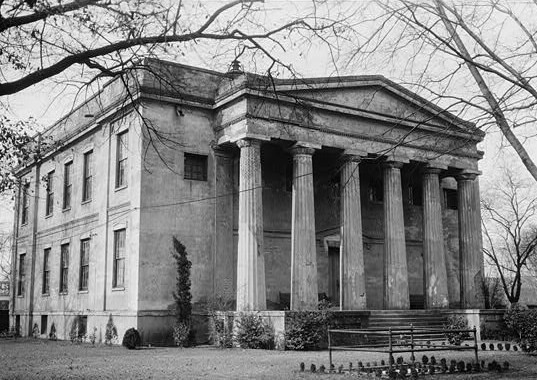
Landmark name Image Date listed Location City or Town Summary 1 Academy of Richmond County 
April 11, 1973 540 Telfair St.
33°28′12″N 81°57′45″W / 33.47°N 81.9625°WAugusta 2 Academy of Richmond County-1926 Campus January 28, 2004 910 Russell St.
33°28′25″N 82°0′17″W / 33.47361°N 82.00472°WAugusta 3 Augusta Canal Industrial District 
May 27, 1971 Along the west bank of the Savannah River from the Richmond-Columbia county line to 10th and Fenwick Sts.
33°29′51″N 81°59′47″W / 33.4975°N 81.99639°WAugusta 4 Augusta Cotton Exchange Building July 20, 1978 Reynolds St.
33°28′35″N 81°57′53″W / 33.47639°N 81.96472°WAugusta 5 Augusta Downtown Historic District 
June 11, 2004 Roughly bounded by 13th St., Gordon Hwy, Walton Way and the Savannah R.
33°28′18″N 81°57′50″W / 33.47167°N 81.96389°WAugusta 6 Bath Presbyterian Church and Cemetery October 27, 2004 Edie Bath Rd., 0.5 mi. W of US 1
33°20′9″N 82°10′22″W / 33.33583°N 82.17278°WBlythe 7 Stephen Vincent Benet House 
November 11, 1971 2500 Walton Way
33°28′32″N 82°1′24″W / 33.47556°N 82.02333°WAugusta 8 Bethlehem Historic District December 1, 1997 Roughly bounded by Wrightsboro Rd., MLK Jr. Blvd., Railroad , Poplar, and Clay Sts.
33°27′32″N 81°59′5″W / 33.45889°N 81.98472°WAugusta 9 Brahe House April 11, 1973 456 Telfair St.
33°28′9″N 81°57′37″W / 33.46917°N 81.96028°WAugusta 10 Broad Street Historic District April 28, 1980 Broad St. between 5th and 13th Sts.
33°28′30″N 81°58′2″W / 33.475°N 81.96722°WAugusta 11 Cauley-Wheeler Memorial Building June 4, 2008 1339 Laney-Walker Blvd. Augusta 12 Church of the Most Holy Trinity March 21, 1997 720 Telfair St.
33°28′18″N 81°58′1″W / 33.47167°N 81.96694°WAugusta 13 College Hill 
November 11, 1971 2216 Wrightsboro Rd.
33°28′0″N 82°0′49″W / 33.466667°N 82.01361°WAugusta 14 Joseph Darling House April 18, 1991 3066 Dennis Rd.
33°31′38″N 82°2′58″W / 33.52722°N 82.04944°WMartinez 15 Engine Company Number One May 25, 1988 452 Ellis St.
33°28′17″N 81°57′34″W / 33.47139°N 81.95944°WAugusta 16 First Baptist Church of Augusta March 23, 1972 Greene and 8th Sts.
33°28′21″N 81°58′3″W / 33.4725°N 81.9675°WAugusta 17 First Presbyterian Church of Augusta 
February 21, 1997 642 Telfair St.
33°28′13″N 81°57′54″W / 33.47028°N 81.965°WAugusta 18 FitzSimons-Hampton House October 29, 1976 GA 28
33°26′59″N 81°55′17″W / 33.44972°N 81.92139°WAugusta 19 Fruitlands May 25, 1979 2604 Washington Rd.
33°30′3″N 82°1′20″W / 33.50083°N 82.02222°WAugusta 20 Gertrude Herbert Art Institute March 20, 1973 506 Telfair St.
33°28′11″N 81°57′41″W / 33.46972°N 81.96139°WAugusta 21 Gould-Weed House July 16, 1979 828 Milledge Rd.
33°28′35″N 82°0′46″W / 33.47639°N 82.01278°WAugusta 22 Greene Street Historic District December 3, 1980 Greene St.
33°28′25″N 81°58′5″W / 33.47361°N 81.96806°WAugusta 23 Harris-Pearson-Walker House October 28, 1969 1822 Broad St.
33°29′4″N 81°59′42″W / 33.48444°N 81.995°WAugusta 24 Harrisburg-West End Historic District June 7, 1990 Roughly bounded by 15th St., Walton Way, Heard Ave., Milledge Rd., and the Augusta Canal
33°28′55″N 81°59′50″W / 33.48194°N 81.99722°WAugusta 25 Lamar Building 
April 24, 1979 753 Broad St.
33°28′31″N 81°57′54″W / 33.47528°N 81.965°WAugusta 26 Joseph Rucker Lamar Boyhood Home June 13, 1996 415 7th St.
33°28′19″N 81°57′55″W / 33.47194°N 81.96528°WAugusta 27 Laney-Walker North Historic District September 5, 1985 Bounded by D'Antignac, 7th, Twiggs, Phillips and Harrison Sts., Walton Way and Laney-Walker Blvd.
33°28′1″N 81°58′29″W / 33.46694°N 81.97472°WAugusta 28 Liberty Methodist Church November 7, 1997 2040 Liberty Church Rd.
33°19′12″N 82°2′17″W / 33.32°N 82.03806°WHephzibah 29 Meadow Garden 
July 19, 1976 1230 Nelson St.
33°28′25″N 81°58′48″W / 33.47361°N 81.98°WAugusta Home of George Walton, youngest signer of the U.S. Declaration of Independence 30 Old Medical College Building 
March 16, 1972 Telfair and 6th Sts.
33°28′13″N 81°57′47″W / 33.47028°N 81.96306°WAugusta 31 Old Richmond County Courthouse December 22, 1978 432 Telfair St.
33°28′9″N 81°57′34″W / 33.46917°N 81.95944°WAugusta 32 Pinched Gut Historic District March 6, 1980 Roughly bounded by Gordon Hwy., E. Boundary, Reynolds and Gwinnett Sts.
33°27′47″N 81°57′22″W / 33.46306°N 81.95611°WAugusta 33 Reid-Jones-Carpenter House November 13, 1979 2249 Walton Way
33°28′41″N 82°0′56″W / 33.47806°N 82.01556°WAugusta 34 Sacred Heart Catholic Church March 16, 1972 Greene and 13th Sts.
33°28′38″N 81°58′37″W / 33.47722°N 81.97694°WAugusta 35 Sands Hill Historic District July 9, 1997 Roughly bounded by Monte Sano and North View Aves., Mount Auburn St., Johns Rd., and Augusta Country Club.
33°29′0″N 82°1′13″W / 33.483333°N 82.02028°WAugusta 36 Seclusaval and Windsor Spring October 11, 1988 Jct. of Windsor Spring and Tobacco Rds.
33°23′5″N 82°4′21″W / 33.38472°N 82.0725°WHephzibah 37 Shiloh Orphanage December 30, 1996 1635 15th St.
33°27′32″N 81°59′55″W / 33.45889°N 81.99861°WAugusta 38 Springfield Baptist Church June 17, 1982 (original)
July 5, 1990 (increase)112 12th St. (original) and 114 12th St. (increase)
33°28′43″N 81°58′18″W / 33.47861°N 81.97167°WAugusta 39 St. Paul's Episcopal Church 
April 11, 1973 6th and Reynolds Sts.
33°28′33″N 81°57′42″W / 33.47583°N 81.96167°WAugusta 40 Summerville Historic District May 22, 1980 Roughly bounded by Milledge Lane, Wrightsboro Rd., Highland and Heard Aves., Cumming and Henry Sts.
33°28′32″N 82°1′7″W / 33.47556°N 82.01861°WAugusta 41 Tubman High School March 7, 1994 1740 Walton Way
33°28′25″N 81°59′51″W / 33.47361°N 81.9975°WAugusta 42 United States Post Office and Courthouse 
January 21, 2000 500 E. Ford St.
33°28′20″N 81°58′3″W / 33.47222°N 81.9675°WAugusta 43 Woodrow Wilson Boyhood Home 
February 28, 1979 419 7th St.
33°28′18″N 81°57′55″W / 33.47167°N 81.96528°WAugusta References
- ^ "National Register of Historic Places: Weekly List Actions". National Park Service, United States Department of the Interior. Retrieved on November 10, 2011.
Categories:- National Register of Historic Places in Georgia (U.S. state)
- Buildings and structures in Richmond County, Georgia
-


Wikimedia Foundation. 2010.