- National Register of Historic Places listings in Richmond, Virginia
-
This list includes properties and districts listed on the National Register of Historic Places in the independent city of Richmond, Virginia. Click the "Map of all coordinates" link to the right to view a Google map of all properties and districts with latitude and longitude coordinates in the table below.[1]
-
- This National Park Service list is complete through NPS recent listings posted November 10, 2011.[2]
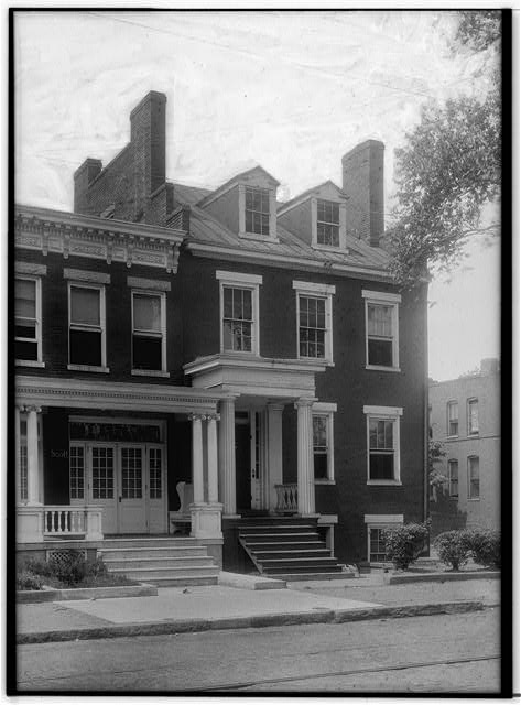
[3] Landmark name[4] Image Date listed Location City or Town Summary 1 2900 Block Grove Avenue Historic District 
February 20, 1973 2901, 2905, 2911, and 2915 Grove Ave.
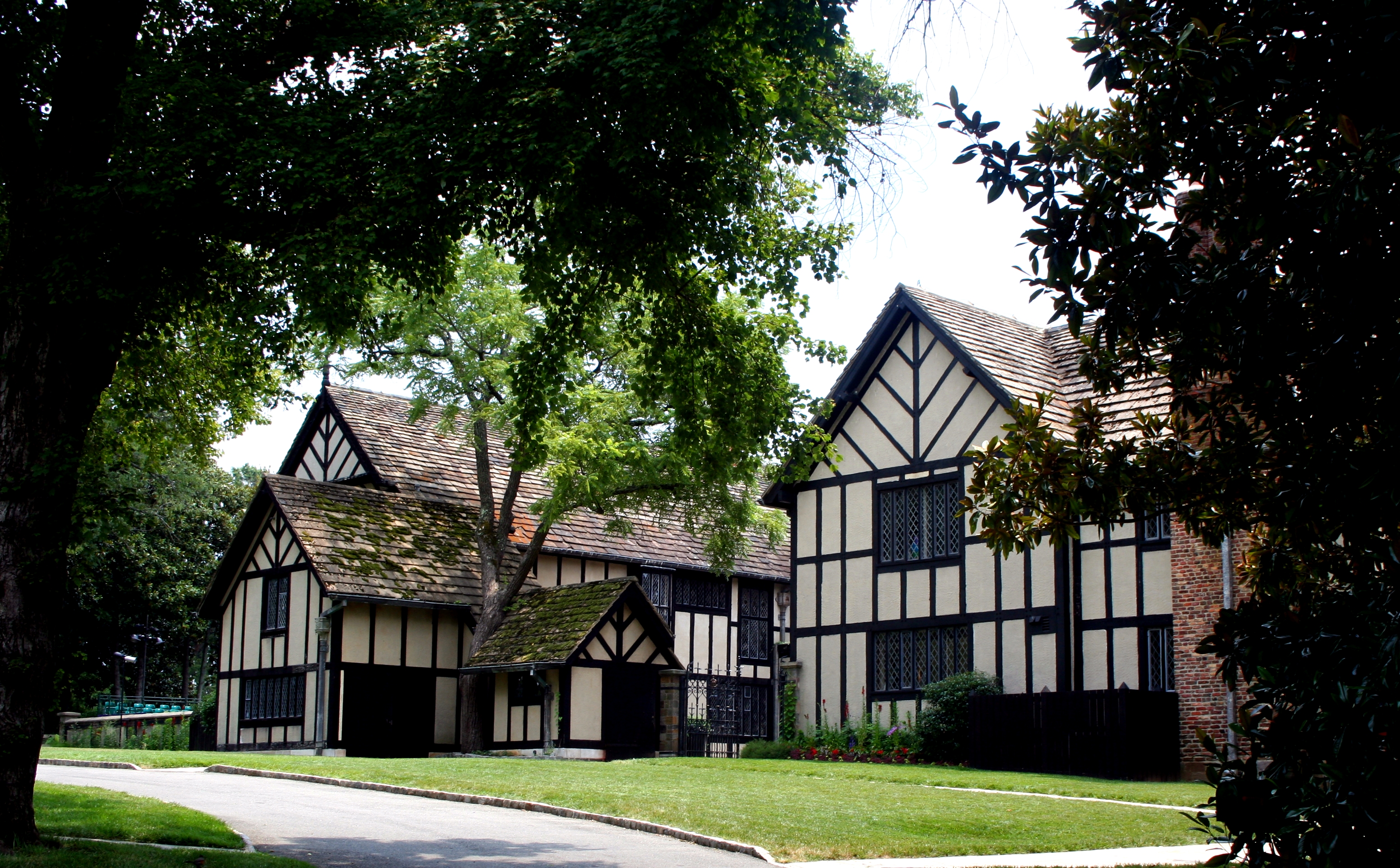
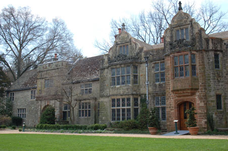
37°33′20″N 77°28′36″W / 37.55556°N 77.47667°WRichmond 2 Agecroft 
December 13, 1978 4305 Sulgrave Rd.
37°33′10″N 77°30′23″W / 37.55278°N 77.50639°WRichmond 3 The Almshouse 
October 29, 1981 210 Hospital St.
37°33′11″N 77°25′50″W / 37.55306°N 77.43056°WRichmond Boundary increase (listed June 13, 1990): 210 Hospital St. 4 Atlantic Motor Company 
November 16, 2005 1840 W. Broad St.
37°33′31″N 77°27′36″W / 37.55861°N 77.46°WRichmond 5 Nathaniel Bacon School 
August 24, 1992 815 N. 35th St.
37°31′49″N 77°24′17″W / 37.53028°N 77.40472°WRichmond 6 Barret House 
February 23, 1972 15 S. 5th St.
37°32′22″N 77°26′26″W / 37.53944°N 77.44056°WRichmond 7 Barton Heights Cemeteries April 10, 2002 1600 Lamb Ave.
37°33′29″N 77°25′58″W / 37.55806°N 77.43278°WRichmond 8 Battery Court Historic District October 9, 2003 Roughly Dupont C., Edgewood, Fendall, Greenwood, Griffin, Montrose, Moss Side, Noble, North, Edgehill, Graham.
37°34′2″N 77°26′23″W / 37.56722°N 77.43972°WRichmond 9 William Beers House 
April 16, 1969 1228 E. Broad St.
37°32′19″N 77°25′48″W / 37.53861°N 77.43°WRichmond 10 Belgian Building 
February 26, 1970 Lombardy St., jct. with Brook Rd.
37°33′6″N 77°27′0″W / 37.55167°N 77.45°WRichmond 11 Bell Tower 
June 11, 1969 Capitol Sq.
37°32′20″N 77°26′7″W / 37.53889°N 77.43528°WRichmond 12 Belle Isle 
March 17, 1995 James R. at US 1/301
37°31′45″N 77°27′13″W / 37.52917°N 77.45361°WRichmond 13 Block 0-100 East Franklin Street Historic District 
February 27, 1980 Roughly bounded by 1st, Main, Foushee and Grace Sts.
37°32′35″N 77°26′37″W / 37.54306°N 77.44361°WRichmond 14 Blues Armory 
May 17, 1976 6th and Marshall Sts.
37°32′35″N 77°26′9″W / 37.54306°N 77.43583°WRichmond 15 Boulevard Historic District 
September 18, 1986 10-300 S. Boulevard and 10-800 N. Boulevard
37°33′23″N 77°28′29″W / 37.55639°N 77.47472°WRichmond 16 Branch Building 
April 17, 1970 1015 E. Main St.
37°32′14″N 77°26′8″W / 37.53722°N 77.43556°WRichmond 17 Branch House 
February 23, 1984 2501 Monument Ave.
37°33′29″N 77°28′7″W / 37.55806°N 77.46861°WRichmond 18 Broad Street Commercial Historic District 
April 9, 1987 Along Broad St. area roughly bounded by Belvidere, Marshall, Fourth and Grace
37°32′45″N 77°26′35″W / 37.54583°N 77.44306°WRichmond Boundary increase I (listed August 11, 2004): 709-916 W. Broad St., 308-310 N. Laurel St., 301-306 Gilmer St.; Boundary increase II (listed March 27, 2007): 100 Blk of E. Marshall St., S side. 300 Blks 1st and 2nd Sts. bet. Broad and Marshall Sts. 19 Broad Street Station 
February 23, 1972 Broad and Robinson Sts.
37°33′40″N 77°27′57″W / 37.56111°N 77.46583°WRichmond 20 Brookland Park Historic District August 6, 2003 Roughly Griffin, Fendall, Hanes, Garland, North, Barton, Lamb, Cliff Aves., Norwood, Hooper, Essex, Brookland Park.
37°34′58″N 77°26′51″W / 37.58278°N 77.4475°WRichmond 21 Joseph Bryan Park November 21, 2002 4308 Hermitage Rd.
37°35′37″N 77°28′26″W / 37.59361°N 77.47389°WRichmond 22 Byrd Theatre 
September 24, 1979 2908 W. Cary St.
37°33′9″N 77°28′41″W / 37.5525°N 77.47806°WRichmond 23 William Byrd Hotel December 16, 1996 2501 W. Broad St.
37°33′36″N 77°28′1″W / 37.56°N 77.46694°WRichmond 24 Henry Coalter Cabell House 
December 27, 1972 116 S. 3rd St.
37°32′23″N 77°26′37″W / 37.53972°N 77.44361°WRichmond 25 Carver Industrial Historic District May 26, 2000 Marshall, Lombardy, Clay, and Harrison Sts.
37°33′15″N 77°27′11″W / 37.55417°N 77.45306°WRichmond Boundary increase (listed November 1, 2006): 909-1011 W. Marshall St. 26 Carver Residential Historic District April 12, 2002 700-1500 blks. W. Leigh, 700-1400 blks. W. Catherine, Clay, & Marshall
37°33′12″N 77°27′0″W / 37.55333°N 77.45°WRichmond 27 Cary Street Park and Shop Center July 5, 2001 3120-3158 West Cary St.
37°33′13″N 77°28′55″W / 37.55361°N 77.48194°WRichmond 28 John B. Cary School 
August 24, 1992 2100 Idlewood Ave.
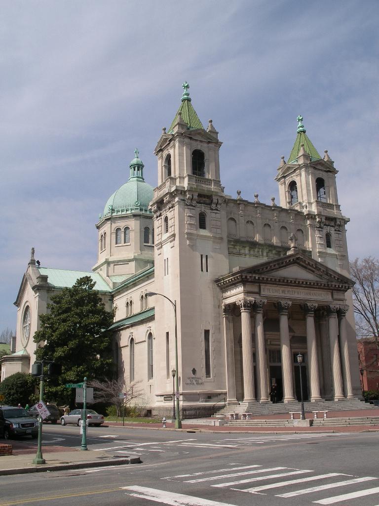
37°32′49″N 77°28′10″W / 37.54694°N 77.46944°WRichmond 29 Cathedral of the Sacred Heart 
July 8, 1982 Floyd Ave. and Laurel St.
37°32′51″N 77°27′9″W / 37.5475°N 77.4525°WRichmond 30 Centenary Church 
December 28, 1979 411 E. Grace St.
37°32′32″N 77°26′21″W / 37.54222°N 77.43917°WRichmond 31 Central National Bank 
September 20, 1979 3rd and Broad Sts.
37°32′37″N 77°26′24″W / 37.54361°N 77.44°WRichmond 32 Chamberlayne Gardens 
May 2, 2007 4301-4313 and 4315-4327 Chamberlayne Ave. and 4800-4818 Old Brook Rd.
37°35′44″N 77°26′57″W / 37.59556°N 77.44917°WRichmond 33 Chestnut Hill-Plateau Historic District 
April 12, 2002 1st, 2nd, 3rd, 4th and 5th Aves. from Brooklyn Park Blvd. to Trigg St.
37°33′47″N 77°25′17″W / 37.56306°N 77.42139°WRichmond 34 Church Hill North Historic District September 5, 1997 Along Marshall, Clay Leigh and M. Sts., bounded by 21st and 30th Sts.
37°31′58″N 77°24′57″W / 37.53278°N 77.41583°WRichmond Boundary increase (listed August 16, 2000): Roughly bounded by 25th St., T St., 32nd St. and M St. 35 Church of the Sacred Heart 
November 20, 2002 1401 Perry St.
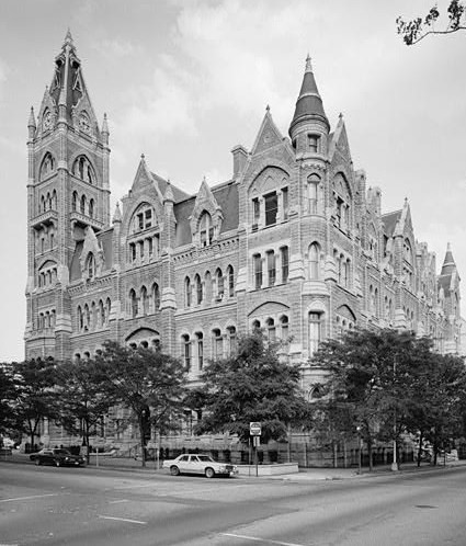
37°31′21″N 77°26′57″W / 37.5225°N 77.44917°WRichmond 36 City Hall 
October 1, 1969 Bounded by 10th, Broad, 11th, and Capitol Sts.
37°32′23″N 77°25′59″W / 37.53972°N 77.43306°WRichmond 37 The Coliseum-Duplex Envelope Company Building 
January 27, 1999 1339-1363 W. Broad St.
37°33′11″N 77°26′42″W / 37.55306°N 77.445°WRichmond 38 Columbia 
September 16, 1982 1142 W. Grace St.
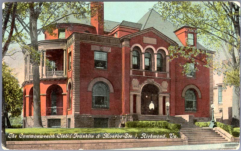
37°33′12″N 77°27′25″W / 37.55333°N 77.45694°WRichmond 39 Commonwealth Club Historic District 
April 7, 1983 319-415 and 400-500 W. Franklin St.
37°32′46″N 77°26′52″W / 37.54611°N 77.44778°WRichmond 40 Confederate Memorial Chapel 
February 23, 1972 2900 Grove Ave.
37°33′20″N 77°28′33″W / 37.55556°N 77.47583°WRichmond 41 Crenshaw House 
August 30, 2010 919 W. Franklin St.
37°32′59″N 77°27′14″W / 37.54972°N 77.45389°WRichmond 42 Crozet House 
February 23, 1972 100 E. Main St.
37°32′33″N 77°26′37″W / 37.5425°N 77.44361°WRichmond 43 Decatur O. Davis House 
May 11, 2000 1001 E. Clay St.
37°32′31″N 77°25′54″W / 37.54194°N 77.43167°WRichmond 44 Department of Public Utilities Howard (Overbrook) Road Facility 
July 24, 2007 1307, 1311, 1315, 1317, 1319 Overbrook Rd.
37°33′55.35″N 77°27′11.09″W / 37.565375°N 77.4530806°WRichmond 45 Donnan-Asher Iron-Front Building 
February 26, 1970 1207-1211 E. Main St.
37°32′10″N 77°26′2″W / 37.53611°N 77.43389°WRichmond 46 Egyptian Building April 16, 1969 SW corner of E. Marshall and College Sts.
37°32′25″N 77°25′45″W / 37.54028°N 77.42917°WRichmond 47 English Village 
September 29, 1983 3418-3450 Grove Ave.
37°33′31″N 77°29′3″W / 37.55861°N 77.48417°WRichmond 48 Fairmount Historic District 
February 19, 2008 Roughly bounded by 24th, Y, 20th, T, R, Q & P Sts., Fairfield & Carrington Aves., & Mechanicsville Tpk.
37°32′43″N 77°24′47″W / 37.54528°N 77.41306°WRichmond 49 Fairmount School 
November 9, 2005 1501 N. 21st St.
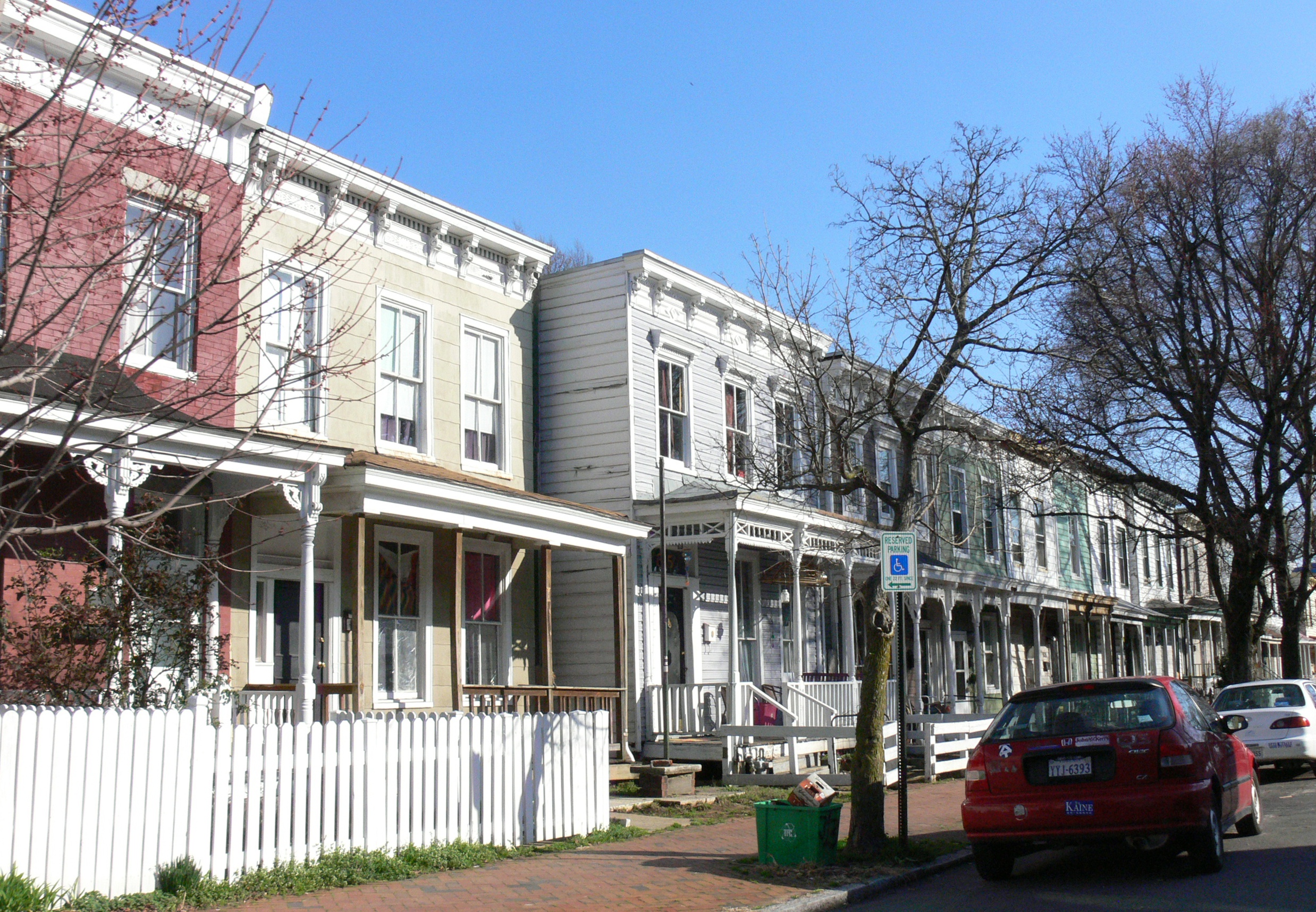
37°32′43″N 77°24′47″W / 37.54528°N 77.41306°WRichmond 50 Fan Area Historic District 
September 12, 1985 Roughly bounded by N. Harrison, W. Main, W. Grace and N. Mullberry Sts.
37°33′9″N 77°27′56″W / 37.5525°N 77.46556°WRichmond Boundary increase (listed May 30, 1986): Roughly bounded by W. Main St., S. Harrison St., Richmond Metropolitan Expressway, and S. Boulevard 51 Fifth and Main Downtown Historic District August 30, 2006 400-500 Blks E. Franklin St., 400-600 blks E. Main St., 00 blks N 4th, 5th and 6th Sts., 00 blk S 5th St.
37°32′32″N 77°26′23″W / 37.54222°N 77.43972°WRichmond 52 First African Baptist Church 
April 16, 1969 NE corner of College and E. Broad Sts.
37°32′18″N 77°25′46″W / 37.53833°N 77.42944°WRichmond 53 First Baptist Church April 16, 1969 NW corner of 12th and E. Broad Sts.
37°32′22″N 77°25′53″W / 37.53944°N 77.43139°WRichmond 54 First Battalion Virginia Volunteers Armory 
December 23, 2009 122 W. Leigh St.
37°33′0.44″N 77°26′28.73″W / 37.5501222°N 77.4413139°WRichmond 55 First National Bank Building April 12, 1982 825-27 East Main St.
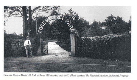
37°32′17″N 77°26′13″W / 37.53806°N 77.43694°WRichmond 56 Forest Hill Park 
November 22, 2002 Bet. Riverside Dr., Forest Hill Ave., and 42nd St., and 34th St.
37°31′10″N 77°28′24″W / 37.51944°N 77.47333°WRichmond 57 Fourth Baptist Church September 7, 1979 2800 P St.
37°32′9″N 77°24′36″W / 37.53583°N 77.41°WRichmond 58 Fraternal Order of Eagles Building May 3, 2006 220 E. Marshall St.
37°32′49″N 77°26′20″W / 37.54694°N 77.43889°WRichmond 59 Ginter Park Historic District September 22, 1986 Roughly bounded by North Ave., Moss Side and Hawthorne and Chamberlayne Aves., Brookland Park Blvd., and Brook Rd.
37°34′50″N 77°26′50″W / 37.58056°N 77.44722°WRichmond 60 Ginter Park Terrace Historic District 
December 4, 2004 3000 blks of Hawthorne, Noble, Moss Side, Montrose and Edgewood Aves.
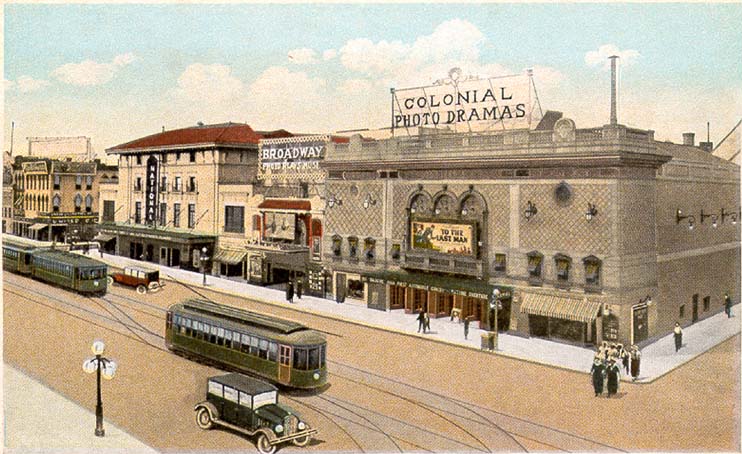
37°34′24″N 77°26′27″W / 37.57333°N 77.44083°WRichmond 61 Ellen Glasgow House 
November 11, 1971 1 W. Main St.
37°32′34″N 77°26′42″W / 37.54278°N 77.445°WRichmond 62 Gordon-Baughan-Warren House February 1, 2006 6303 Towana Rd.
37°34′21″N 77°31′36″W / 37.5725°N 77.52667°WRichmond 63 Governor's Mansion 
June 4, 1969 Capitol Sq.
37°32′19″N 77°25′57″W / 37.53861°N 77.4325°WRichmond 64 Grace Hospital 
August 11, 2004 401 West Grace St.
37°32′55″N 77°26′48″W / 37.54861°N 77.44667°WRichmond 65 Grace Street Commercial Historic District 
July 13, 1998 Roughly bounded by Adams, Broad, 8th and Franklin Sts.
37°32′31″N 77°26′19″W / 37.54194°N 77.43861°WRichmond Boundary increase (listed November 12, 2009): 626, 700 E. Broad St., 12-118 N. 8th St., 707-715 E. Franklin St., 2-18 and 13 W. Franklin St. 66 William H. Grant House 
April 16, 1969 1008 E. Clay St.
37°32′30″N 77°25′52″W / 37.54167°N 77.43111°WRichmond 67 Elliott Grays Marker-Jefferson Davis Highway August 31, 2006 Jct. of Harwood St., Ingram Ave., and Jefferson Davis Hwy.
37°30′18″N 77°26′48″W / 37.505°N 77.44667°WRichmond 68 Green's Farm (Huntley) November 9, 2005 6510 Three Chopt Rd.
37°34′53.41″N 77°31′46.67″W / 37.5815028°N 77.5296306°WRichmond 69 Hancock-Wirt-Caskie House 
April 17, 1970 2 N. 5th St.
37°32′27″N 77°26′24″W / 37.54083°N 77.44°WRichmond 70 Hasker and Marcuse Factory 
August 11, 1983 2401-2413 Venable St.
37°32′17″N 77°24′52″W / 37.53806°N 77.41444°WRichmond 71 Bolling Haxall House 
March 16, 1972 211 E. Franklin St.
37°32′32″N 77°26′29″W / 37.54222°N 77.44139°WRichmond 72 Hebrew Cemetery 
May 5, 2006 400 Hospital St.
37°33′7.41″N 77°25′48.48″W / 37.5520583°N 77.4301333°WRichmond 73 Hermitage Road Historic District 
February 9, 2006 3800-4200 blks of Hermitage Rd.
37°35′20.2″N 77°27′50.21″W / 37.588944°N 77.4639472°WRichmond 74 Highland Park Plaza Historic District December 4, 2004 Roughly bounded by Meadowbridge Rd., Missouri Ave., City limits, and Detroit Ave.
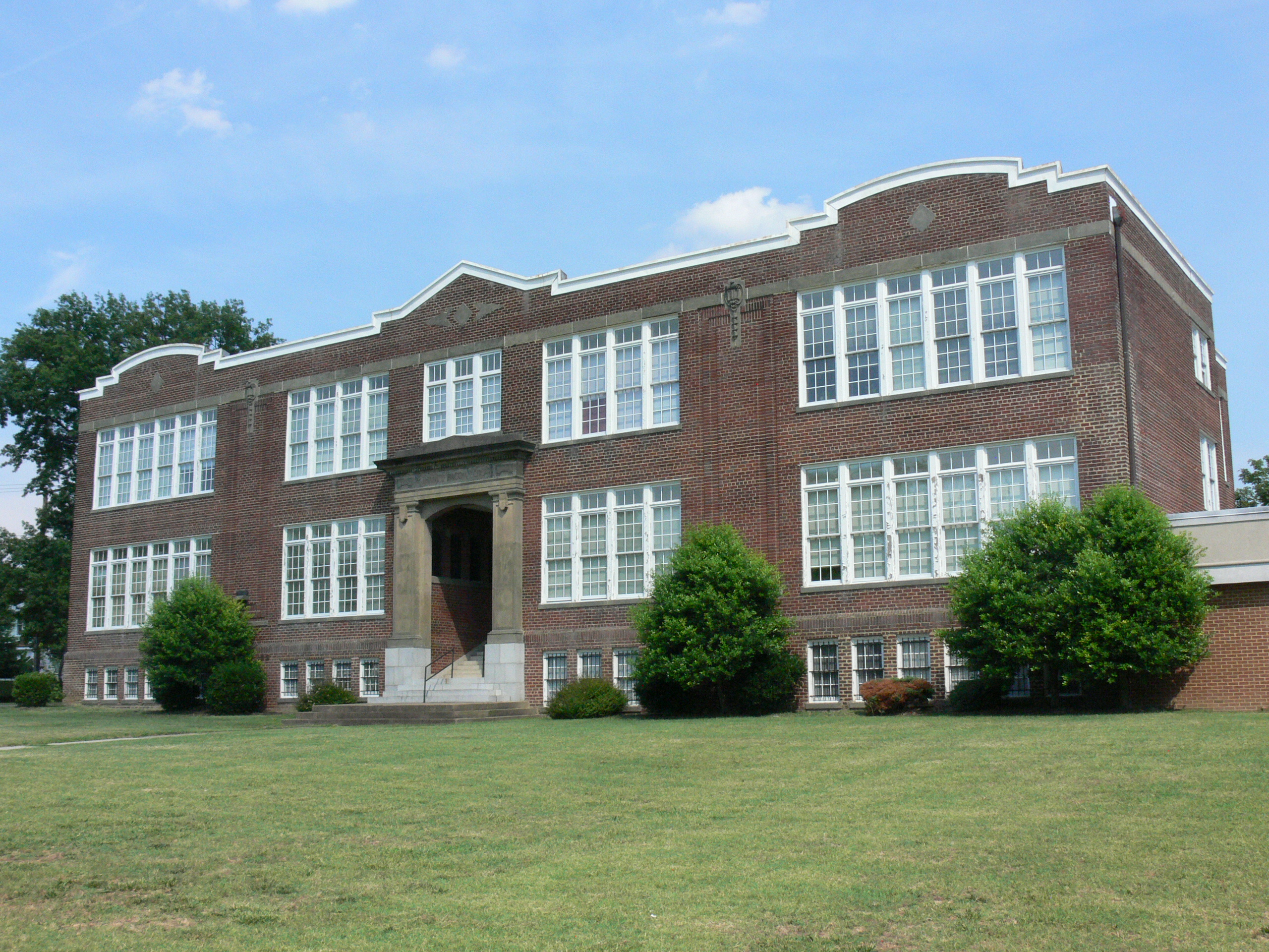
37°34′29″N 77°24′58″W / 37.57472°N 77.41611°WRichmond 75 Highland Park Public School 
October 22, 1991 2928 Second Ave.
37°34′10″N 77°25′9″W / 37.56944°N 77.41917°WRichmond 76 Holly Lawn 
August 26, 1982 4015 Hermitage Rd.
37°35′21″N 77°27′49″W / 37.58917°N 77.46361°WRichmond 77 Hollywood Cemetery 
November 12, 1969 412 S. Cherry St.
37°32′10″N 77°27′30″W / 37.53611°N 77.45833°WRichmond 78 Home For Confederate Women 
November 7, 1985 301 N. Sheppard St.
37°33′25″N 77°28′34″W / 37.55694°N 77.47611°WRichmond 79 Hunt-Sitterding House 
September 12, 2008 901 Floyd Ave.
37°32′49.24″N 77°27′11.06″W / 37.5470111°N 77.4530722°WRichmond 80 Jackson Ward Historic District 
July 30, 1976 Roughly bounded by 5th, Marshall, and Gilmer Sts., and the Richmond-Petersburg Tpke.
37°32′54″N 77°26′25″W / 37.54833°N 77.44028°WRichmond Boundary increase I (listed September 26, 2005): 1/2-17 E. Marshall St.; 0-24 W. Marshall St.; Boundary increase II (listed May 16, 2008): 400 blks. 1st, 2nd, & 3rd Sts., 106-108 E. Marshall, 411-413 N. Adams St. 81 James River and Kanawha Canal Historic District 
August 26, 1971 Extends from Ship Locks to Bosher's Dam
37°32′46″N 77°30′10″W / 37.54611°N 77.50278°WRichmond 82 Jefferson Hotel 
June 4, 1969 104 W. Main St.
37°32′39″N 77°26′44″W / 37.54417°N 77.44556°WRichmond 83 John Rolfe Apartments September 9, 2010 101 Tempsford Lane
37°33′59″N 77°31′11″W / 37.56639°N 77.51972°WRichmond 84 Kent Road Village August 18, 2011 920-924 N. Hamilton St. & 905-935 Kent Rd.
37°33′58″N 77°29′6″W / 37.56611°N 77.485°WRichmond Federal Housing Administration-Insured Garden Apartments in Richmond, Virginia MPS 85 Kent-Valentine House 
December 18, 1970 12 E. Franklin St.
37°32′38″N 77°26′34″W / 37.54389°N 77.44278°WRichmond 86 Laburnum Park Historic District February 5, 2002 Westwood, Palmyra, Confederate, Wilmington, W. Laburnum Aves., Chatham, Gloucester and Lamont Sts.
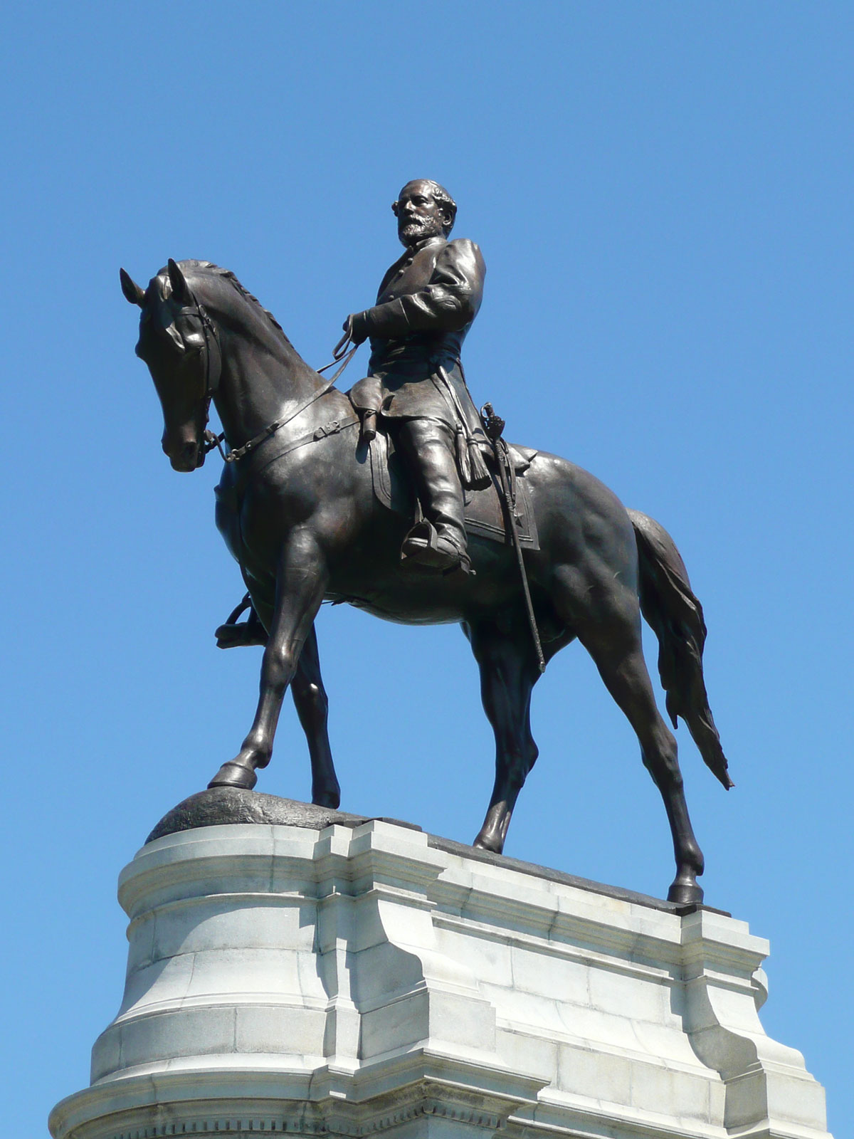
37°34′52″N 77°27′23″W / 37.58111°N 77.45639°WRichmond 87 Robert E. Lee Monument 
January 5, 2007 1700 Monument Ave., jct. of Monument and Allen Aves.
37°33′20″N 77°27′36″W / 37.55556°N 77.46°WRichmond 88 Leigh Street Baptist Church 
March 16, 1972 517 N. 25th St.
37°32′1″N 77°25′0″W / 37.53361°N 77.416667°WRichmond 89 Benjamin Watkins Leigh House 
April 16, 1969 1000 E. Clay St.
37°32′31″N 77°25′52″W / 37.54194°N 77.43111°WRichmond 90 Linden Row 
November 23, 1971 100-114 E. Franklin St.
37°32′36″N 77°26′33″W / 37.54333°N 77.4425°WRichmond 91 Loews Theatre 
November 20, 1979 6th and Grace Sts.
37°32′27″N 77°26′17″W / 37.54083°N 77.43806°WRichmond 92 Main Street Banking Historic District 
June 1, 2005 E. Main St. between 7th & Governors Sts.
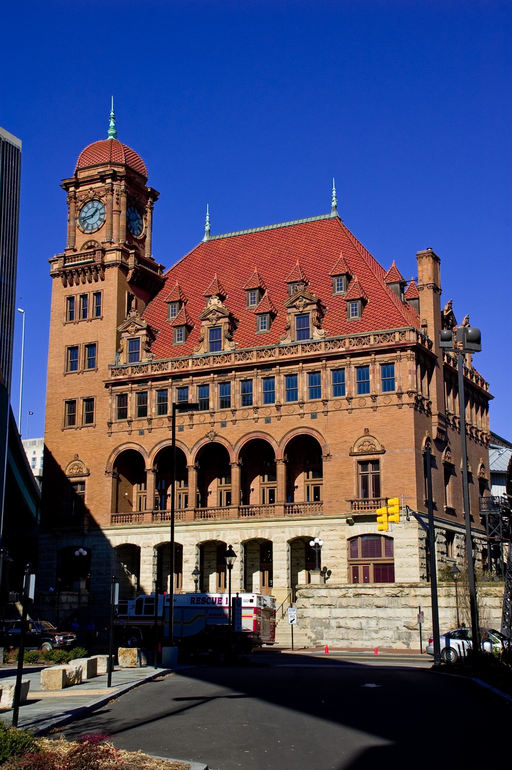
37°32′17″N 77°26′11″W / 37.53806°N 77.43639°WRichmond 93 Main Street Station and Trainshed 
October 15, 1970 1020 E. Main St.
37°32′5″N 77°25′45″W / 37.53472°N 77.42917°WRichmond 94 Manchester Courthouse 
May 8, 1998 920 Hull St.
37°31′16″N 77°26′28″W / 37.52111°N 77.44111°WRichmond 95 Manchester Industrial Historic District 
August 2, 2000 Roughly bounded by Perry St., James R., Mayo's Bridge, Maury St., and 10th St.
37°31′35″N 77°26′13″W / 37.52639°N 77.43694°WRichmond Boundary increase (listed September 22, 2004): 700 Block of Stockton St. 96 Manchester Residential and Commercial Historic District May 16, 2002 Roughly bounded by 9th St., McDonough St., Cowardin Ave., and Stockton St.
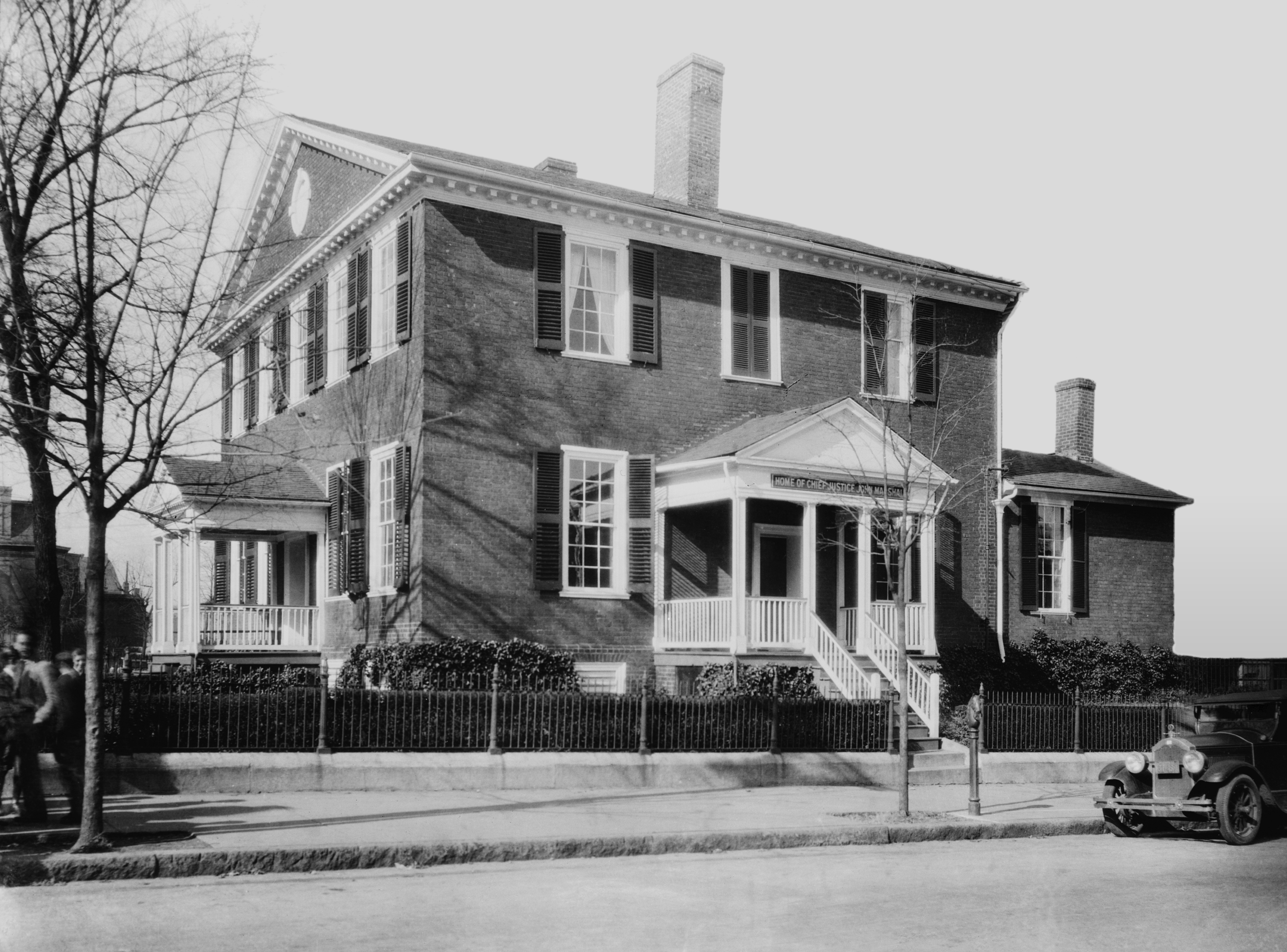
37°31′18″N 77°26′49″W / 37.52167°N 77.44694°WRichmond Boundary increase (listed November 1, 2006): 1211-17, 1301–1305 and 1418 McDonough St., 310-12 W. 12th St., 309 W. 13th St., 314 and 400 w. 14th St. 97 John Marshall House 
October 15, 1966 9th and Marshall Sts.
37°32′34″N 77°25′59″W / 37.54278°N 77.43306°WRichmond 98 Mason's Hall 
July 2, 1973 1807 E. Franklin St.
37°31′59″N 77°25′36″W / 37.53306°N 77.42667°WRichmond 99 Masonic Temple 
February 10, 1983 101-107 W. Broad St.
37°32′46″N 77°26′37″W / 37.54611°N 77.44361°WRichmond 100 Maury Street Marker, Jefferson Davis Highway 
June 2, 2004 Jct. of Maury St. and Jefferson Davis Highway
37°30′45″N 77°26′55″W / 37.5125°N 77.44861°WRichmond 101 Maymont 
December 16, 1971 Hampton St. (Spottswood Rd.)
37°32′5″N 77°28′43″W / 37.53472°N 77.47861°WRichmond 102 Monroe Park Historic District 
July 5, 1984 Roughly bounded by Belvidere, Main, Cherry, Park, Laurel, and Franklin Sts.
37°32′49″N 77°27′4″W / 37.54694°N 77.45111°WRichmond 103 Monroe Ward January 27, 2000 Roughly Main and Cary St., and 3rd to Jefferson Sts.
37°32′31″N 77°26′41″W / 37.54194°N 77.44472°WRichmond 104 James Monroe Tomb 
November 11, 1971 Hollywood Cemetery, 412 S. Cherry St.
37°32′6″N 77°27′20″W / 37.535°N 77.45556°WRichmond 105 Monument Avenue Historic District 
February 16, 1970 Bounded by Grace and Birch Sts., Park Ave., and Roseneath Rd.
37°33′30″N 77°28′4″W / 37.55833°N 77.46778°WRichmond Boundary increase (listed January 17, 1991): Roughly, Franklin St. from Roseneath Rd. to Cleveland St. 106 Monumental Church 
April 16, 1969 1224 E. Broad St.
37°32′20″N 77°25′48″W / 37.53889°N 77.43°WRichmond 107 Moore's Auto Body and Paint Shop October 14, 1993 401 W Broad St.
37°32′51″N 77°26′46″W / 37.5475°N 77.44611°WRichmond 108 Morson's Row June 11, 1969 219-223 Governor St.
37°32′17″N 77°25′54″W / 37.53806°N 77.43167°WRichmond 109 National Theater 
April 2, 2003 700-710 E. Broad St.
37°32′30″N 77°26′9″W / 37.54167°N 77.43583°WRichmond 110 New Pump-House 
November 21, 2002 1708 Pump House Dr.
37°32′8″N 77°29′7″W / 37.53556°N 77.48528°WRichmond 111 Ninth Street Office Building 
September 16, 2009 202 N. 9th St.
37°32′24.26″N 77°26′4.51″W / 37.5400722°N 77.4345861°WRichmond 112 Oakwood-Chimborazo Historic District 
March 18, 2005 Roughly N 30th-N 39th St., Chimborazo,Meldon,Oakwood,E Broad,Briel,E Clay,E Leigh,M,E Marshall,N,O,and P
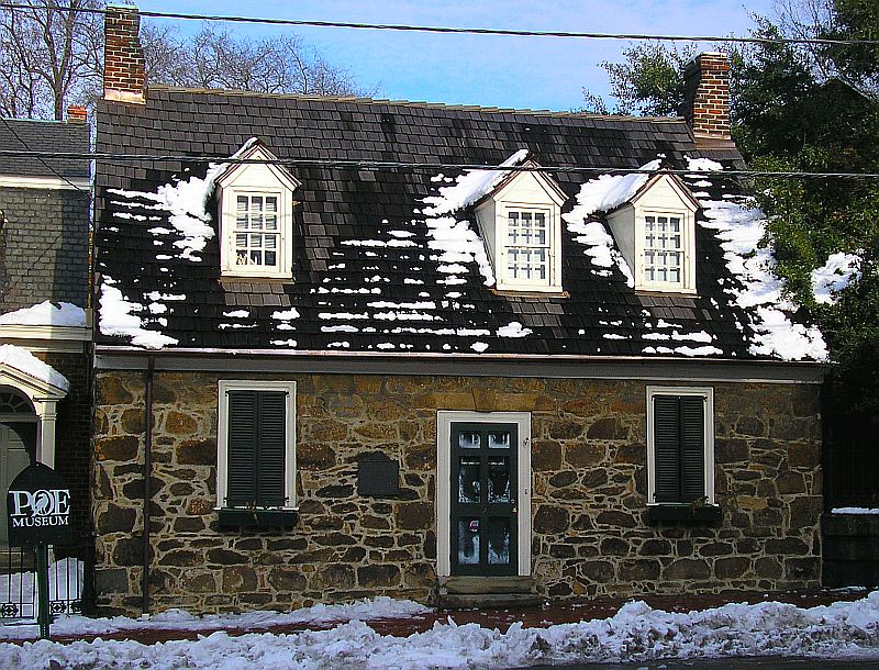
37°31′53″N 77°24′3″W / 37.53139°N 77.40083°WRichmond 113 Old Stone House 
November 14, 1973 1914 E. Main St.
37°31′55″N 77°25′35″W / 37.53194°N 77.42639°WRichmond 114 Oregon Hill Historic District 
February 5, 1991 Roughly bounded by W. Cary St., Belvidere St., Oregon Hill Park, S. Cherry St. and S. Linden St.
37°32′24″N 77°27′7″W / 37.54°N 77.45194°WRichmond 115 Pace-King House 
July 30, 1976 205 N. 19th St.
37°32′3″N 77°25′30″W / 37.53417°N 77.425°WRichmond 116 Pine Camp Tuberculosis Hospital 
April 4, 2003 4901 Old Brook Rd.
37°35′57″N 77°26′42″W / 37.59917°N 77.445°WRichmond 117 Planters National Bank February 10, 1983 12th and E. Main Sts.
37°32′11″N 77°26′2″W / 37.53639°N 77.43389°WRichmond 118 Putney Houses 
June 11, 1969 1010-1012 E. Marshall St.
37°32′27″N 77°25′53″W / 37.54083°N 77.43139°WRichmond 119 Randolph School October 4, 1984 300 S. Randolph St.
37°32′37″N 77°27′38″W / 37.54361°N 77.46056°WRichmond 120 Reveille February 1, 1979 4200 Cary Street Rd.
37°33′41″N 77°29′44″W / 37.56139°N 77.49556°WRichmond 121 Rice House March 30, 1999 1000 Old Locke Lane
37°33′20″N 77°31′3″W / 37.55556°N 77.5175°WRichmond 122 Richmond Academy of Medicine 
August 16, 1984 1200 E. Clay St.
37°32′27″N 77°25′47″W / 37.54083°N 77.42972°WRichmond 123 Richmond and Chesapeake Bay Railway Car Barn 
May 4, 2006 1620 Brook Rd.
37°33′36″N 77°26′48″W / 37.56°N 77.44667°WRichmond 124 Richmond Locomotive and Machine Works April 27, 2007 1331 North Blvd.
37°34′2.74″N 77°28′2.75″W / 37.5674278°N 77.4674306°WRichmond 125 Scott House 
November 26, 2007 909 W. Franklin St.
37°33′1″N 77°27′5″W / 37.55028°N 77.45139°WRichmond 126 Scott's Addition Historic District 
August 12, 2005 Roughly bounded by Cutshaw Ave, Boulevard, and the Richmond Fredericksburg and Potomac RR
37°34′6″N 77°28′21″W / 37.56833°N 77.4725°WRichmond 127 Second Presbyterian Church March 29, 1972 9 N. 5th St.
37°32′25″N 77°26′23″W / 37.54028°N 77.43972°WRichmond 128 Shockoe Hill Cemetery 
July 7, 1995 Jct. of Hospital and 2nd Sts.
37°33′5″N 77°25′56″W / 37.55139°N 77.43222°WRichmond 129 Shockoe Slip Historic District 
March 29, 1972 Roughly along E. Carey St. between S. 14th and S. 12 Sts.
37°32′5″N 77°26′0″W / 37.53472°N 77.433333°WRichmond Boundary increase I (listed April 20, 1983): Roughly bounded by Seaboard RR tracks, Downtown Expressway, Main, Dock, and 12th Sts.; Boundary increase II (listed August 24, 2005): 11-15 and 101 South 15th St., 1433 East Main St. 130 Shockoe Valley and Tobacco Row Historic District 
February 24, 1983 Roughly bounded by Dock, 15th, Clay, Franklin, and Peach Sts.
37°31′56″N 77°25′29″W / 37.53222°N 77.42472°WRichmond 131 Sixth Mount Zion Baptist Church 
December 16, 1996 14 W. Duval St.
37°33′2″N 77°26′19″W / 37.55056°N 77.43861°WRichmond 132 Southern Stove Works 
May 26, 2005 1215 Hermitage Rd.
37°33′41″N 77°27′34″W / 37.56139°N 77.45944°WRichmond 133 Southern Stove Works, Manchester 
February 21, 2008 516-520 Dinwiddie Ave.
37°31′4″N 77°25′57″W / 37.51778°N 77.4325°WRichmond 134 Springfield School 
August 24, 1992 608 N. 26th St.
37°32′3″N 77°24′56″W / 37.53417°N 77.41556°WRichmond 135 St. Alban's Hall September 9, 1982 300-302 E. Main St.
37°32′31″N 77°26′34″W / 37.54194°N 77.44278°WRichmond 136 St. Andrew's Church 
June 22, 1979 223, 224, and 227 S. Cherry St.
37°32′34″N 77°27′12″W / 37.54278°N 77.45333°WRichmond 137 St. Catherine's School 
May 4, 2007 6001 Grove Ave.
37°34′22.29″N 77°31′18.23″W / 37.5728583°N 77.5217306°WRichmond 138 St. Christopher's School 
March 13, 2002 711 St. Christopher's Rd/
37°34′49″N 77°31′16″W / 37.58028°N 77.52111°WRichmond 139 St. John's Church Historic District 
September 15, 1970 Bounded roughly by 22nd, Marshall, 32nd, Main, and Franklin Sts. and Williamsburg Ave.
37°31′45″N 77°25′5″W / 37.52917°N 77.41806°WRichmond Boundary increase (listed January 17, 1991): Roughly bounded by 21st, E. Marshall, 22nd and E. Franklin Sts. 140 St. John's Episcopal Church 
October 15, 1966 E. Broad St. between 24th and 25th Sts.
37°31′53″N 77°25′11″W / 37.53139°N 77.41972°WRichmond 141 St. Luke Building 
September 16, 1982 900 St. James St.
37°33′4″N 77°26′15″W / 37.55111°N 77.4375°WRichmond 142 St. Paul's Church 
June 4, 1969 815 E. Grace St.
37°32′23″N 77°26′7″W / 37.53972°N 77.43528°WRichmond 143 St. Peter's Church June 23, 1969 800 E. Grace St.
37°32′26″N 77°26′8″W / 37.54056°N 77.43556°WRichmond 144 St. Sophia Home of the Little Sisters of the Poor 
May 7, 1980 16 N. Harvie St.
37°32′50″N 77°27′32″W / 37.54722°N 77.45889°WRichmond 145 Steamer Company Number 5 
February 8, 1995 200 W. Marshall St.
37°32′51″N 77°26′36″W / 37.5475°N 77.44333°WRichmond 146 Stearns Iron-Front Building 
February 26, 1970 1007-1013 E. Main St.
37°32′14″N 77°26′8″W / 37.53722°N 77.43556°WRichmond 147 Stewart-Lee House 
May 5, 1972 707 E. Franklin St.
37°32′23″N 77°26′14″W / 37.53972°N 77.43722°WRichmond 148 Stonewall Jackson School 
May 3, 1984 1520 W. Main St.
37°32′51″N 77°27′39″W / 37.5475°N 77.46083°WRichmond 149 Taylor Farm 
January 24, 1991 4012 Walmsley Blvd.
37°28′20″N 77°28′12″W / 37.47222°N 77.47°WRichmond 150 Taylor-Mayo House April 2, 1973 110 W. Franklin St.
37°32′42″N 77°26′43″W / 37.545°N 77.44528°WRichmond 151 Third Street Bethel A.M.E. Church June 5, 1975 616 N. 3rd St.
37°32′51″N 77°26′11″W / 37.5475°N 77.43639°WRichmond 152 Thomas Jefferson High School December 23, 1993 4100 W. Grace St.
37°34′19″N 77°29′11″W / 37.57194°N 77.48639°WRichmond 153 E. M. Todd Company September 14, 2002 1128 Hermitage Rd.
37°33′44″N 77°27′40″W / 37.56222°N 77.46111°WRichmond 154 Town of Barton Heights Historic District August 6, 2003 Roughly arton, Fendall, Greenwood, Lamb, Miller, Monterio, North, Rose, Dove, Home, Minor, Poe, Wellford, Wickham.
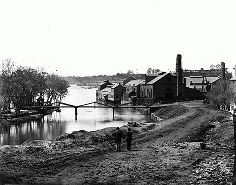
37°33′37″N 77°25′57″W / 37.56028°N 77.4325°WRichmond 155 Tredegar Iron Works 
July 2, 1971 500 Tredegar St.
37°32′8″N 77°26′43″W / 37.53556°N 77.44528°WRichmond 156 Trinity Methodist Church 
April 16, 1987 2000 E. Broad St.
37°32′4″N 77°25′24″W / 37.53444°N 77.42333°WRichmond 157 Tuckahoe Apartments 
February 2, 2001 5621 Cary Street Rd.
37°34′5″N 77°31′26″W / 37.56806°N 77.52389°WRichmond 158 Two Hundred Block West Franklin Street Historic District 
November 17, 1977 200 block of W. Franklin St.
37°32′42″N 77°26′47″W / 37.545°N 77.44639°WRichmond Boundary increase (listed October 21, 1994): 212—220 W. Main St. 159 U.S. Post Office and Customhouse 
June 4, 1969 1000 E. Main St.
37°32′15″N 77°26′6″W / 37.5375°N 77.435°WRichmond 160 Union Hill Historic District December 31, 2002 Roughly 20th, 21st, 22nd, 23rd, 24th 25th, Jessamine, Pink, Burton, Carrington, Cedar, Clay, Jefferson, Leigh, M, O, Sts
37°32′14″N 77°25′5″W / 37.53722°N 77.41806°WRichmond 161 Union Seminary 
April 14, 1983 3401 Brook Rd.
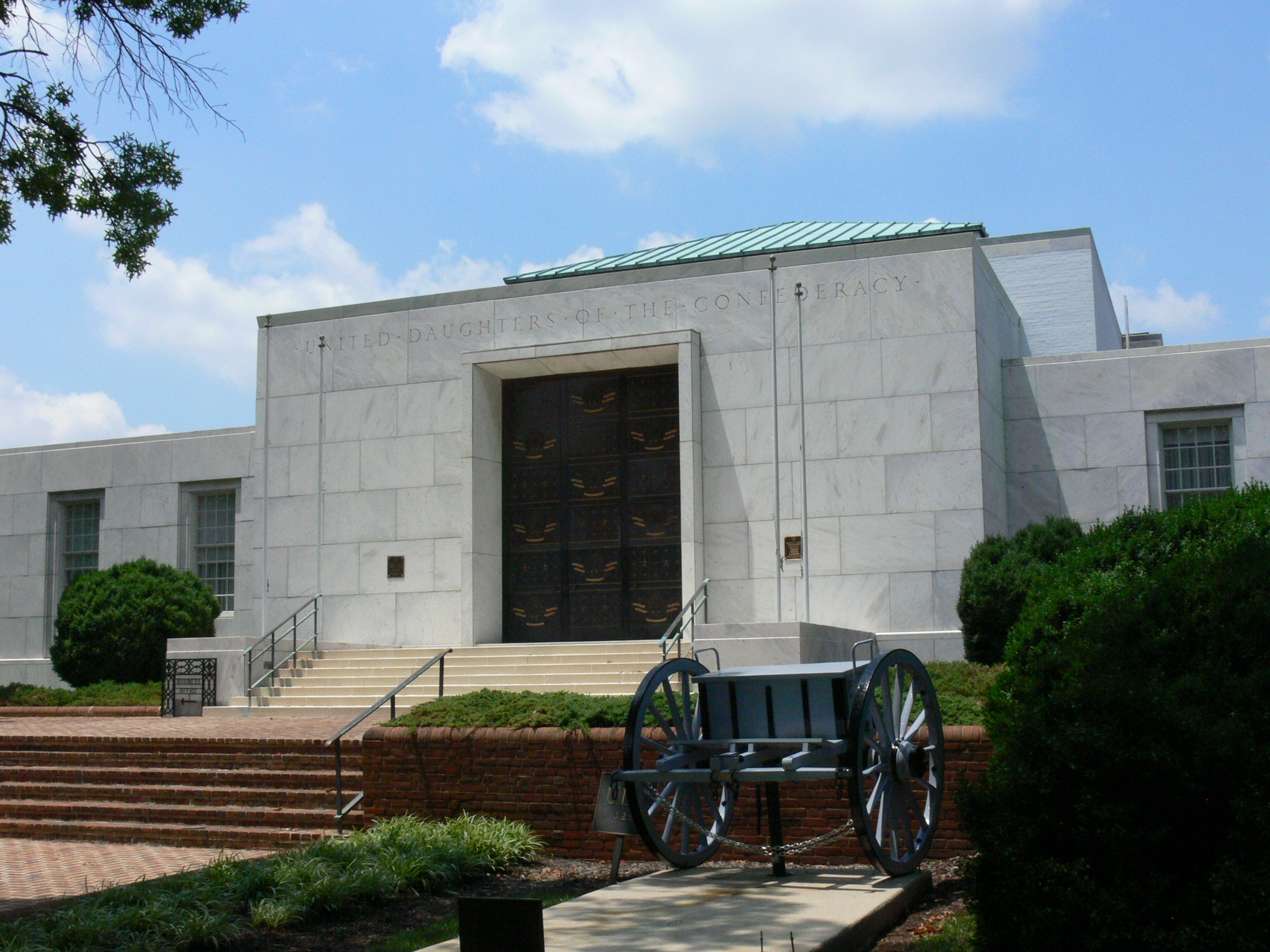
37°34′44″N 77°26′54″W / 37.57889°N 77.44833°WRichmond 162 United Daughters of the Confederacy Memorial Building 
April 24, 2008 328 North Blvd.
37°33′25.14″N 77°28′24.24″W / 37.5569833°N 77.4734°WRichmond 163 Valentine Museum 
June 11, 1969 1005-1015 E. Clay St.
37°32′29″N 77°25′52″W / 37.54139°N 77.43111°WRichmond 164 Virginia Department of Highways Building 
April 5, 2004 1401 E. Broad St.
37°32′17″N 77°25′51″W / 37.53806°N 77.43083°WRichmond 165 Virginia House 
June 13, 1990 4301 Sulgrave Rd.
37°33′12″N 77°30′12″W / 37.55333°N 77.50333°WRichmond 166 Virginia Mutual Building November 7, 1977 821 E. Main St.
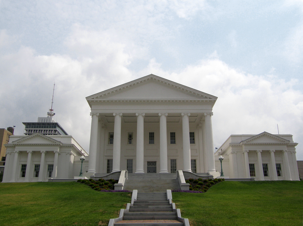
37°32′17″N 77°26′13″W / 37.53806°N 77.43694°WRichmond 167 Virginia State Capitol 
October 15, 1966 Capitol Sq.
37°32′19″N 77°26′1″W / 37.53861°N 77.43361°WRichmond 168 Virginia State Library 
August 9, 2005 1111 E. Broad St.
37°32′21″N 77°25′56″W / 37.53917°N 77.43222°WRichmond 169 Virginia State Library-Oliver Hill Building 
June 20, 2008 102 Governor St.
37°32′12.76″N 77°25′57.59″W / 37.5368778°N 77.4326639°WRichmond 170 Virginia Union University July 26, 1982 1500 N. Lombardy St.
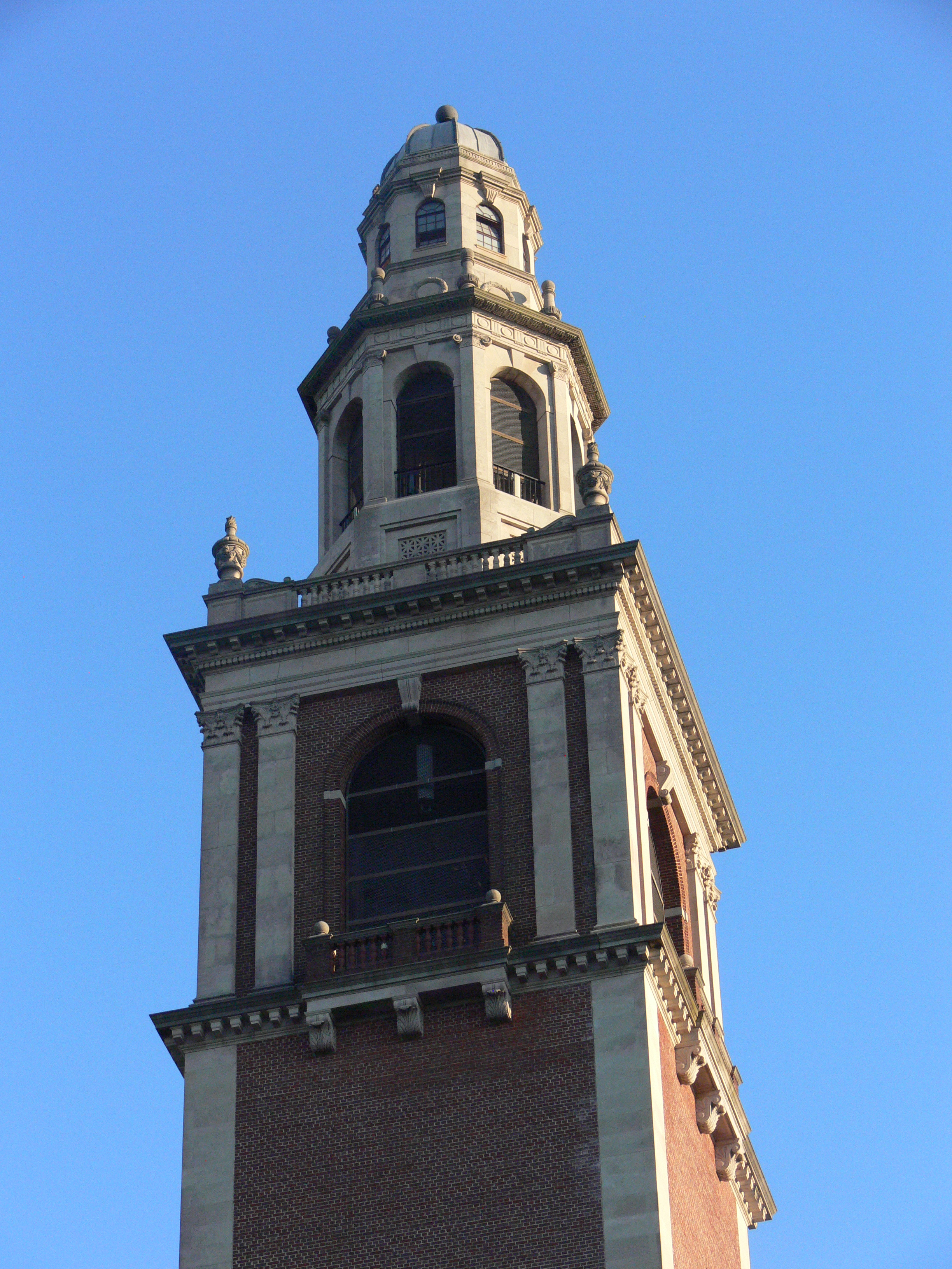
37°33′39″N 77°27′7″W / 37.56083°N 77.45194°WRichmond 171 Virginia War Memorial Carillon 
October 4, 1984 1300 Blanton Ave.
37°32′27″N 77°29′2″W / 37.54083°N 77.48389°WRichmond 172 Virginia Washington Monument 
January 15, 2004 Capitol Square
37°32′21″N 77°26′4″W / 37.53917°N 77.43444°WRichmond 173 The Virginia 
February 10, 1983 1 N. Fifth St.
37°32′25″N 77°26′23″W / 37.54028°N 77.43972°WRichmond 174 Maggie L. Walker High School 
September 9, 1998 1000 N. Lombardy St.
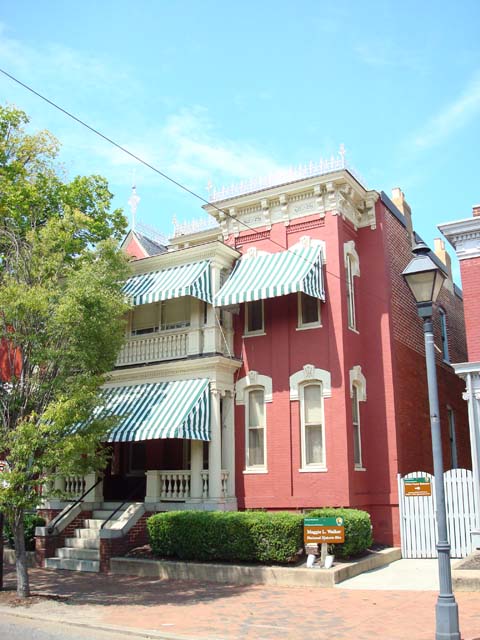
37°33′29″N 77°27′25″W / 37.55806°N 77.45694°WRichmond 175 Maggie Lena Walker House 
May 12, 1975 110A E. Leigh St.
37°32′52″N 77°26′17″W / 37.54778°N 77.43806°WRichmond 176 George Washington Building 
May 18, 2011 1100 Bank St.
37°32′15″N 77°26′0″W / 37.5375°N 77.433333°WRichmond 177 Weisiger-Carroll House 
May 19, 1994 2408 Bainbridge St.
37°30′59″N 77°27′20″W / 37.51639°N 77.45556°WRichmond 178 West Broad Street Commercial Historic District January 16, 2001 1300-1600 West Broad St.
37°33′13″N 77°27′21″W / 37.55361°N 77.45583°WRichmond 179 West Broad Street Industrial and Commercial Historic District August 18, 2011 1800-2100 blocks of Broad & Marshall Sts., bounded by Allison & Allen Sts.
37°33′26″N 77°27′37″W / 37.55722°N 77.46028°WRichmond 180 West Franklin Street Historic District 
September 14, 1972 W. Franklin St. between Laurel and Ryland Sts.
37°32′58″N 77°27′13″W / 37.54944°N 77.45361°WRichmond Boundary increase (listed September 16, 2009): 900 blk. West Grace St., 4000 blk. N. Harrison St., 300 blk. Shafer St. 181 West of Boulevard Historic District March 7, 1994 Roughly bounded by Colonial Ave., W. Grace St., Cutshaw Ave., Thompson St., and Ellwood Ave.
37°33′35″N 77°28′46″W / 37.55972°N 77.47944°WRichmond 182 Westbourne January 27, 2000 330 Oak Ln.
37°34′25″N 77°30′27″W / 37.57361°N 77.5075°WRichmond 183 White House of the Confederacy 
October 15, 1966 Clay and 12th Sts.
37°32′27″N 77°25′47″W / 37.54083°N 77.42972°WRichmond 184 John Whitworth House February 5, 1999 2221 Grove Ave.
37°33′9″N 77°28′5″W / 37.5525°N 77.46806°WRichmond 185 Charlotte Williams Memorial Hospital 
April 9, 2004 1201 E. Broad St.
37°32′19″N 77°25′54″W / 37.53861°N 77.43167°WRichmond 186 Wilton 
April 30, 1976 S of Richmond, on N bank of James River
37°33′45″N 77°31′14″W / 37.5625°N 77.52056°WRichmond 187 Joseph P. Winston House 
June 11, 1979 101-103 E. Grace St.
37°32′38″N 77°26′32″W / 37.54389°N 77.44222°WRichmond 188 Woodland Heights Historic District 
September 30, 2009 Bounded by James River, W. 24th St., Bainbridge St. and Forest Hill Ave., and W. 32nd and 34th Sts.
37°31′16.85″N 77°27′46.89″W / 37.5213472°N 77.463025°WRichmond 189 Woodward House 
June 19, 1974 3017 Williamsburg Ave.
37°31′28″N 77°25′1″W / 37.52444°N 77.41694°WRichmond 190 Young Women's Christian Association 
May 3, 1984 6 N. 5th St.
37°32′26″N 77°26′25″W / 37.54056°N 77.44028°WRichmond See also
- National Register of Historic Places listings in Virginia
- National Register of Historic Places listings in Chesterfield County, Virginia
- National Register of Historic Places listings in Hanover County, Virginia
- National Register of Historic Places listings in Henrico County, Virginia
- List of National Historic Landmarks in Virginia
References
- ^ The latitude and longitude information provided in this table was derived originally from the National Register Information System, which has been found to be fairly accurate for about 99% of listings. For about 1% of NRIS original coordinates, experience has shown that one or both coordinates are typos or otherwise extremely far off; some corrections may have been made. A more subtle problem causes many locations to be off by up to 150 yards, depending on location in the country: most NRIS coordinates were derived from tracing out latitude and longitudes off of USGS topographical quadrant maps created under North American Datum of 1927, which differs from the current, highly accurate GPS system used by Google maps. Chicago is about right, but NRIS longitudes in Washington are higher by about 4.5 seconds, and are lower by about 2.0 seconds in Maine. Latitudes differ by about 1.0 second in Florida. Some locations in this table may have been corrected to current GPS standards.
- ^ "National Register of Historic Places: Weekly List Actions". National Park Service, United States Department of the Interior. Retrieved on November 10, 2011.
- ^ Numbers represent an ordering by significant words. Various colorings, defined here, differentiate National Historic Landmark sites and National Register of Historic Places Districts from other NRHP buildings, structures, sites or objects.
- ^ "National Register Information System". National Register of Historic Places. National Park Service. 2008-04-24. http://nrhp.focus.nps.gov/natreg/docs/All_Data.html.
External Links
U.S. National Register of Historic Places Topics Lists by states Alabama • Alaska • Arizona • Arkansas • California • Colorado • Connecticut • Delaware • Florida • Georgia • Hawaii • Idaho • Illinois • Indiana • Iowa • Kansas • Kentucky • Louisiana • Maine • Maryland • Massachusetts • Michigan • Minnesota • Mississippi • Missouri • Montana • Nebraska • Nevada • New Hampshire • New Jersey • New Mexico • New York • North Carolina • North Dakota • Ohio • Oklahoma • Oregon • Pennsylvania • Rhode Island • South Carolina • South Dakota • Tennessee • Texas • Utah • Vermont • Virginia • Washington • West Virginia • Wisconsin • WyomingLists by territories Lists by associated states Other  Category:National Register of Historic Places •
  Portal:National Register of Historic PlacesCategories:
- National Register of Historic Places in Virginia
- Virginia-related lists
- History of Richmond, Virginia
- Buildings and structures in Richmond, Virginia
-


Wikimedia Foundation. 2010.