- National Register of Historic Places listings in Lowndes County, Georgia
-
This is a list of properties and districts in Lowndes County, Georgia that are listed on the National Register of Historic Places (NRHP).
-
- This National Park Service list is complete through NPS recent listings posted November 10, 2011.[1]
Current listings
Landmark name Image Date listed Location City or Town Summary 1 Barber-Pittman House 
February 12, 1980 416 N. Ashley St.
30°50′7″N 83°16′47″W / 30.83528°N 83.27972°WValdosta 2 Brookwood North Historic District 
June 2, 1995 Roughly bounded by Patterson St., Georgia Ave., Oak St., Park Ave., Williams St. and Brookwood Dr.
30°51′6″N 83°17′16″W / 30.85167°N 83.28778°WValdosta 3 Carnegie Library of Valdosta 
January 12, 1984 305 W. Central Ave.
30°49′50″N 83°16′58″W / 30.83056°N 83.28278°WValdosta 4 Converse-Dalton House 
April 28, 1983 305 N. Patterson St.
30°49′59″N 83°16′48″W / 30.83306°N 83.28°WValdosta 5 The Crescent 
January 8, 1980 904 N. Paterson St.
30°50′22″N 83°17′2″W / 30.83944°N 83.28389°WValdosta 6 Crestwood January 12, 1984 502 Eager Rd.
30°52′10″N 83°18′9″W / 30.86944°N 83.3025°WValdosta 7 Dasher High School 
April 18, 1985 900 S. Troup St.
30°50′49″N 83°16′11″W / 30.84694°N 83.26972°WValdosta 8 East End Historic District 
May 21, 2005 NE of downtown Valdosta roughly bounded by North Ashley and E. Ann Sts., East Hill Ave., and Georgia and Florida RR
30°50′19″N 83°16′25″W / 30.83861°N 83.27361°WValdosta 9 Ewell Brown General Store 
February 21, 1997 RR Ave., jct. with Lawrence St.
30°41′0″N 83°10′54″W / 30.683333°N 83.18167°WLake Park 10 Fairview Historic District 
June 28, 1984 W. Central, Floyd, River, Varnedoe, and Wells Sts.
30°49′50″N 83°17′7″W / 30.83056°N 83.28528°WValdosta 11 First Presbyterian Church 
November 2, 1987 313 N. Patterson St.
30°50′3″N 83°16′10″W / 30.83417°N 83.26944°WValdosta 12 North Patterson Street Historic District June 28, 1984 1003-1111 N. Patterson St.
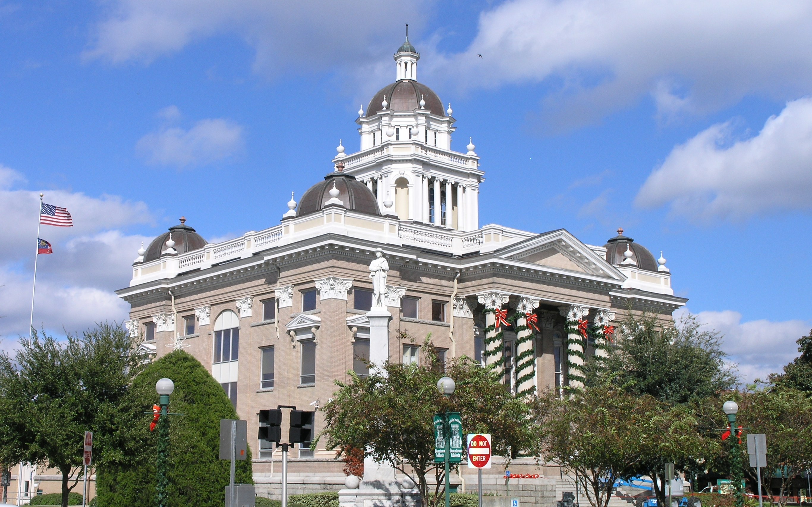
30°50′30″N 83°17′5″W / 30.84167°N 83.28472°WValdosta 13 Old Lowndes County Courthouse 
September 18, 1980 Central and Ashley Sta.
30°49′57″N 83°16′45″W / 30.8325°N 83.27917°WValdosta 14 Southside Historic District 
April 27, 2007 Roughly bounded by CSX trks, Bunche Dr., Griffin Ave., Old Statenville Rd., Wisenbake Ln, Dasher Ln., and S. Patterson R Valdosta 15 Sunset Hill Cemetery September 10, 2004 110 N. Oak St.
30°50′31″N 83°17′29″W / 30.84194°N 83.29139°WValdosta 16 Valdosta Commercial Historic District 
September 15, 1983 Roughly bounded by Savannah Ave., Lee, Toombs, and Valley Sts.
30°49′53″N 83°16′43″W / 30.83139°N 83.27861°WValdosta References
- ^ "National Register of Historic Places: Weekly List Actions". National Park Service, United States Department of the Interior. Retrieved on November 10, 2011.
Categories:- National Register of Historic Places in Georgia (U.S. state)
- Buildings and structures in Lowndes County, Georgia
-


Wikimedia Foundation. 2010.