- National Register of Historic Places listings in Walton County, Georgia
-
This is a list of properties and districts in Walton County, Georgia that are listed on the National Register of Historic Places (NRHP).
-
- This National Park Service list is complete through NPS recent listings posted November 10, 2011.[1]
Current listings
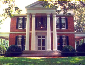
Landmark name Image Date listed Location City or Town Summary 1 Bank of Jersey March 7, 1984 Main St.
33°43′1″N 83°47′59″W / 33.71694°N 83.79972°WJersey 2 A. J. Boss House December 28, 1983 324 Edwards St.
33°47′54″N 83°42′34″W / 33.79833°N 83.70944°WMonroe 3 Samuel H. Brodnax House June 17, 1982 GA 81
33°44′26″N 83°51′8″W / 33.74056°N 83.85222°WWalnut Grove 4 Casulon Plantation 
October 10, 1975 E of Good Hope off GA 186
33°47′45″N 83°31′40″W / 33.79583°N 83.52778°WGood Hope 5 Tom Chick House December 28, 1983 1102 E. Church St.
33°47′23″N 83°41′40″W / 33.78972°N 83.69444°WMonroe 6 Davis-Edwards House 
August 14, 1973 238 N. Broad St.
33°47′50″N 83°42′48″W / 33.79722°N 83.71333°WMonroe 7 East Church Street Historic District December 28, 1983 E. Church St. and S. Madison Ave.
33°47′30″N 83°42′23″W / 33.79167°N 83.70639°WMonroe 8 East Marable Street Historic District December 28, 1983 E. Marable St.
33°48′11″N 83°42′49″W / 33.80306°N 83.71361°WMonroe 9 William Harris Family Farmstead June 22, 1982 GA 11
33°53′38″N 83°43′23″W / 33.89389°N 83.72306°WCampton 10 Jones, Walter, Rock House November 4, 1993 4435 GA 186 NE
33°47′48″N 83°33′2″W / 33.79667°N 83.55056°WGood Hope 11 McDaniel Street Historic District December 28, 1983 S. Broad and McDaniel Sts.
33°47′27″N 83°42′56″W / 33.79083°N 83.71556°WMonroe 12 McDaniel-Tichenor House 
February 8, 1980 319 McDaniel St.
33°47′24″N 83°42′55″W / 33.79°N 83.71528°WMonroe 13 Monland Place Historic District December 28, 1983 Alvoca St. and Blvd.
33°47′15″N 83°42′51″W / 33.7875°N 83.71417°WMonroe 14 Monroe and Walton Mills Historic District December 28, 1983 S. Broad St., S. Madison Ave., and Georgia RR line
33°47′5″N 83°42′33″W / 33.78472°N 83.70917°WMonroe 15 Monroe City Hall December 28, 1983 227 S. Broad St.
33°47′33″N 83°42′45″W / 33.7925°N 83.7125°WMonroe 16 Monroe Commercial Historic District December 28, 1983 Spring and Broad Sts.
33°47′40″N 83°42′46″W / 33.79444°N 83.71278°WMonroe 17 North Broad Street Historic District December 28, 1983 N. Broad and Walton Sts.
33°47′50″N 83°42′54″W / 33.79722°N 83.715°WMonroe 18 Social Circle Historic District March 27, 1980 GA 11 and GA 229
33°39′19″N 83°43′8″W / 33.65528°N 83.71889°WSocial Circle 19 South Broad Street Historic District December 28, 1983 S. Broad St.
33°47′20″N 83°42′40″W / 33.78889°N 83.71111°WMonroe 20 South Madison Avenue-Pannell Road Historic District December 28, 1983 S. Madison Ave. and Pannell Rd.
33°46′35″N 83°42′0″W / 33.77639°N 83.7°WMonroe 21 James Berrien Upshaw House 
March 6, 1986 US 78/GA 11
33°49′2″N 83°48′28″W / 33.81722°N 83.80778°WBetween 22 Walton County Courthouse September 18, 1980 Courthouse Sq.
33°47′40″N 83°42′45″W / 33.79444°N 83.7125°WMonroe 23 Walton County Jail December 28, 1983 203 Milledge Ave.
33°47′37″N 83°42′33″W / 33.79361°N 83.70917°WMonroe 24 Walton Hotel July 15, 1982 Broad and Court Sts.
33°47′38″N 83°42′47″W / 33.79389°N 83.71306°WMonroe 25 Williamson House December 28, 1983 925 E. Church St.
33°47′34″N 83°41′54″W / 33.79278°N 83.69833°WMonroe References
- ^ "National Register of Historic Places: Weekly List Actions". National Park Service, United States Department of the Interior. Retrieved on November 10, 2011.
Categories:- National Register of Historic Places in Georgia (U.S. state)
- Buildings and structures in Walton County, Georgia
-


Wikimedia Foundation. 2010.