- National Register of Historic Places listings in Walton County, Florida
-
 Location of Walton County in Florida
This is a list of the National Register of Historic Places listings in Walton County, Florida.
This is intended to be a complete list of the properties and districts on the National Register of Historic Places in Walton County, Florida, United States. The locations of National Register properties and districts for which the latitude and longitude coordinates are included below, may be seen in a Google map.[1]
There are 5 properties and districts listed on the National Register in the county.
-
- This National Park Service list is complete through NPS recent listings posted November 10, 2011.[2]
Contents: Counties in Florida (non-linked contain no National Register listings) Alachua - Baker - Bay - Bradford - Brevard - Broward - Calhoun - Charlotte - Citrus - Clay - Collier - Columbia - DeSoto - Dixie - Duval - Escambia - Flagler - Franklin - Gadsden - Gilchrist - Glades - Gulf - Hamilton - Hardee - Hendry - Hernando - Highlands - Hillsborough - Holmes - Indian River - Jackson - Jefferson - Lafayette - Lake - Lee - Leon - Levy - Liberty - Madison - Manatee - Marion - Martin - Miami-Dade - Monroe - Nassau - Okaloosa - Okeechobee - Orange - Osceola - Palm Beach - Pasco - Pinellas - Polk - Putnam - Santa Rosa - Sarasota - Seminole - St. Johns - St. Lucie - Sumter - Suwannee - Taylor - Union - Volusia - Wakulla - Walton - Washington Current listings
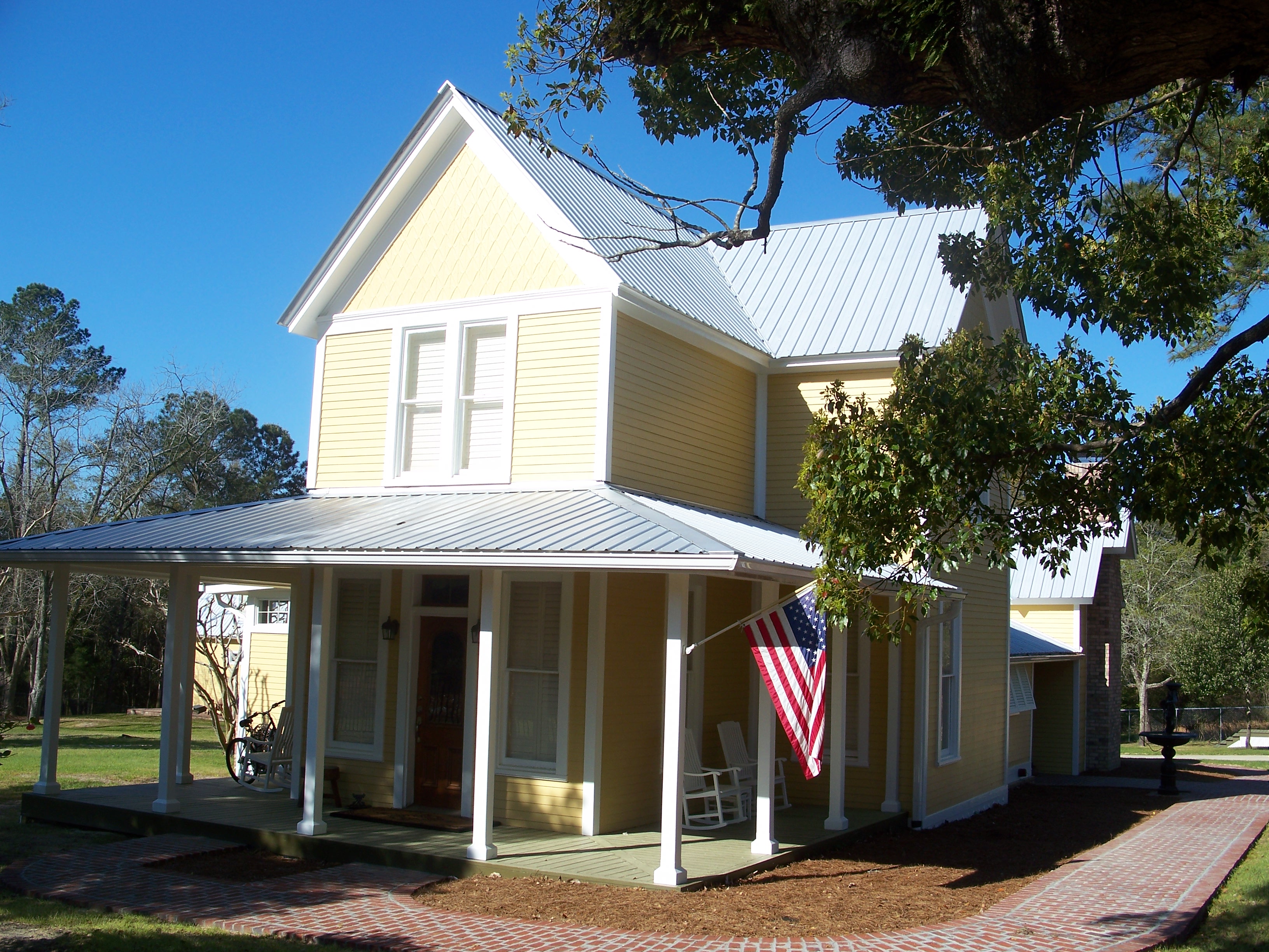
[3] Landmark name [4] Image Date listed Location City or town Summary 1 Perry L. Biddle House 
August 28, 1992 203 Scribner Avenue
30°43′13″N 86°07′12″W / 30.720278°N 86.12°WDeFuniak Springs NRHP# 92001049 2 Chautauqua Hall of Brotherhood 
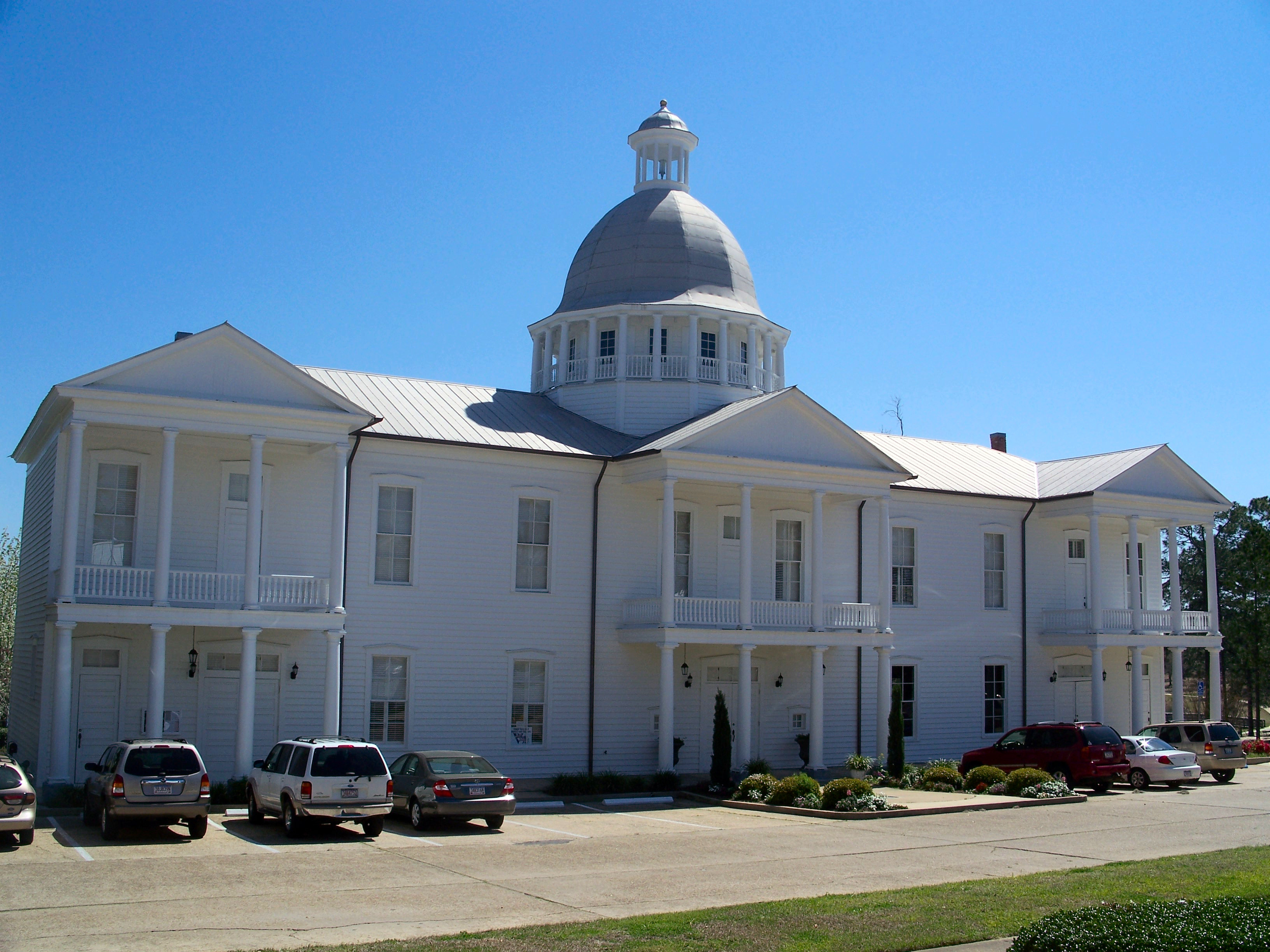
August 7, 1972 95 Circle Drive
30°43′00″N 86°06′57″W / 30.716667°N 86.115833°WDeFuniak Springs NRHP# 72000358 3 DeFuniak Springs Historic District 
August 28, 1992 Roughly bounded by Nelson and Park Avenues and 2nd and 12th Streets
30°43′00″N 86°06′53″W / 30.716667°N 86.114722°WDeFuniak Springs NRHP# 92001048 4 Operation Crossbow Site 
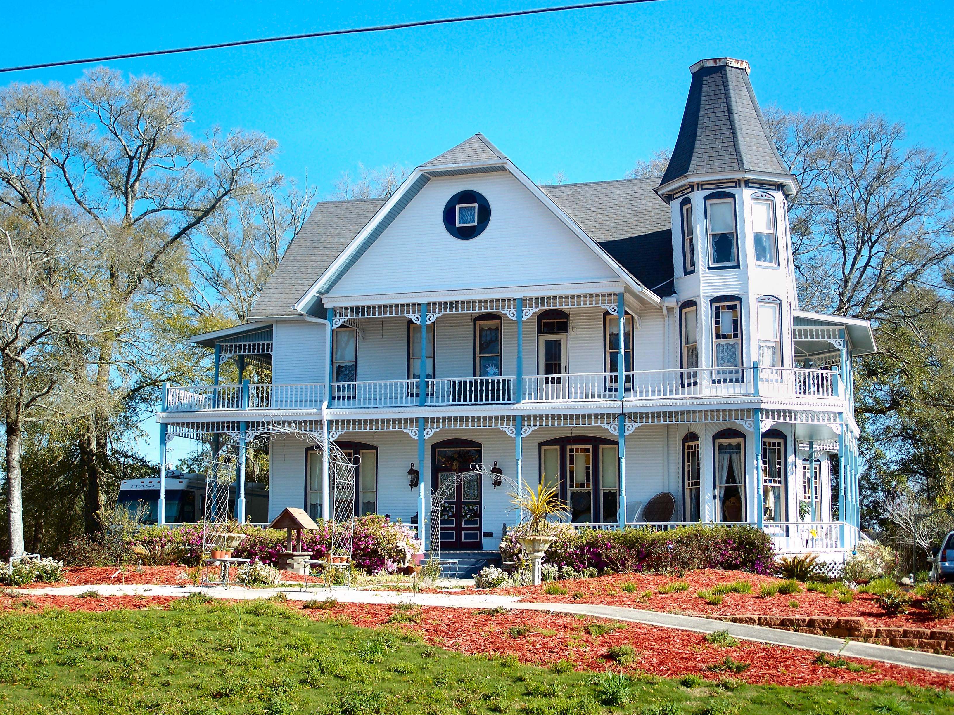
October 22, 1998 Address Restricted Eglin Air Force Base NRHP# 98001256 5 Sun Bright 
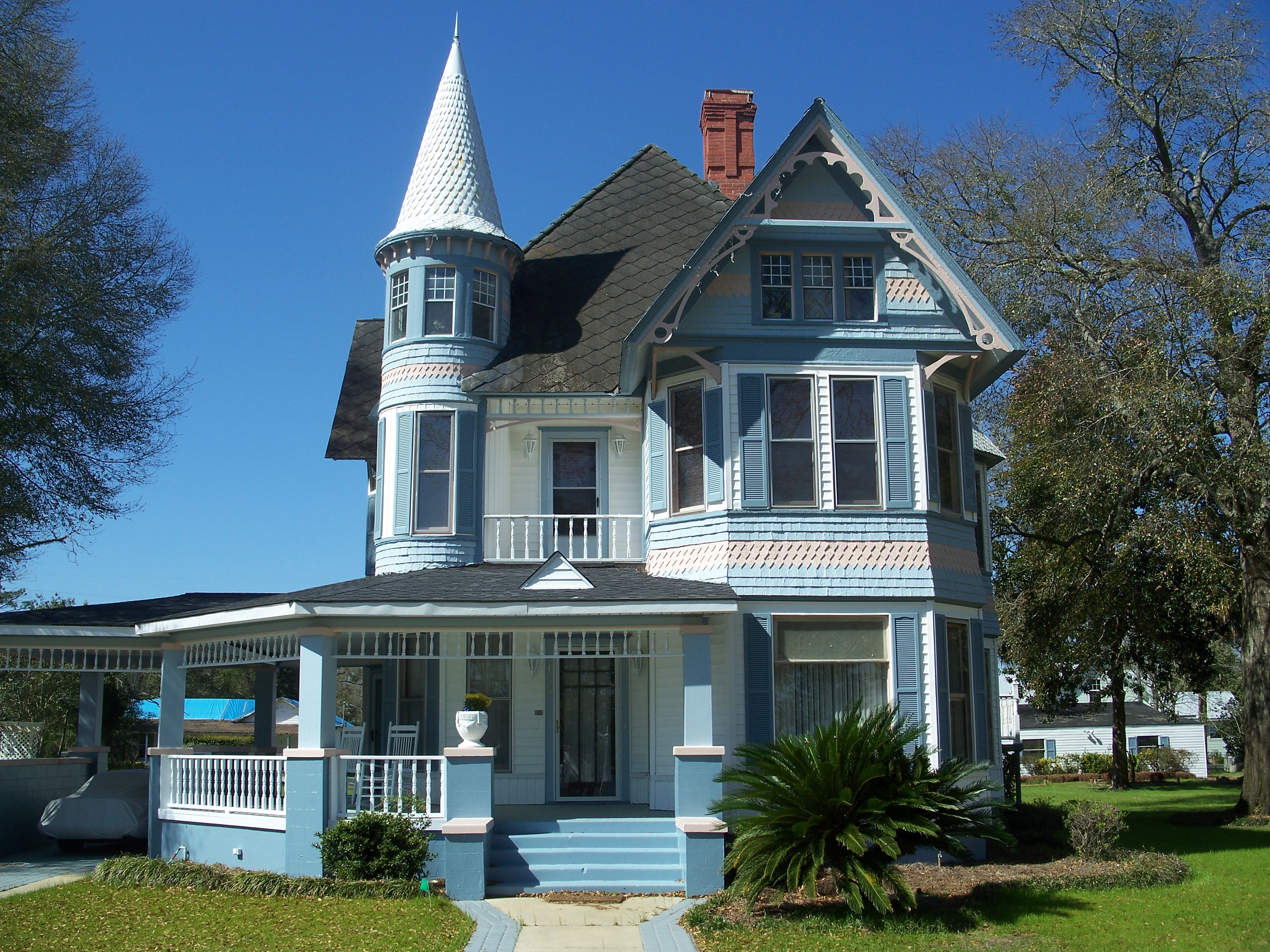
May 7, 1979 606 Live Oak Avenue
30°43′11″N 86°07′18″W / 30.719722°N 86.121667°WDeFuniak Springs NRHP# 79000693 See also
- List of National Historic Landmarks in Florida
- National Register of Historic Places listings in Florida
References
- ^ The latitude and longitude information provided in this table was derived originally from the National Register Information System, which has been found to be fairly accurate for about 99% of listings. For about 1% of NRIS original coordinates, experience has shown that one or both coordinates are typos or otherwise extremely far off; some corrections may have been made. A more subtle problem causes many locations to be off by up to 150 yards, depending on location in the country: most NRIS coordinates were derived from tracing out latitude and longitudes off of USGS topographical quadrant maps created under the North American Datum of 1927, which differs from the current, highly accurate WGS84 GPS system used by Google maps. Chicago is about right, but NRIS longitudes in Washington are higher by about 4.5 seconds, and are lower by about 2.0 seconds in Maine. Latitudes differ by about 1.0 second in Florida. Some locations in this table may have been corrected to current GPS standards.
- ^ "National Register of Historic Places: Weekly List Actions". National Park Service, United States Department of the Interior. Retrieved on November 10, 2011.
- ^ Numbers represent an ordering by significant words. Various colorings, defined here, differentiate National Historic Landmark sites and National Register of Historic Places Districts from other NRHP buildings, structures, sites or objects.
- ^ "National Register Information System". National Register of Historic Places. National Park Service. . http://nrhp.focus.nps.gov/natreg/docs/All_Data.html.
U.S. National Register of Historic Places in Florida Lists by county Alachua • Baker • Bay • Bradford • Brevard • Broward • Calhoun • Charlotte • Citrus • Clay • Collier • Columbia • DeSoto • Dixie • Duval • Escambia • Flagler • Franklin • Gadsden • Gilchrist • Glades • Gulf • Hamilton • Hardee • Hendry • Hernando • Highlands • Hillsborough • Holmes • Indian River • Jackson • Jefferson • Lafayette • Lake • Lee • Leon • Levy • Liberty • Madison • Manatee • Marion • Martin • Miami-Dade • Monroe • Nassau • Okaloosa • Okeechobee • Orange • Osceola • Palm Beach • Pasco • Pinellas • Polk • Putnam • Santa Rosa • Sarasota • Seminole • St. Johns • St. Lucie • Sumter • Suwannee • Taylor • Union • Volusia • Wakulla • Walton • Washington
Lists by city Other lists Municipalities and communities of Walton County, Florida Cities 
Town CDP Unincorporated
communitiesGrayton Beach | Lakewood | Rosemary Beach | Sandestin | Seaside
Categories:- Walton County, Florida
- National Register of Historic Places in Florida by county
-


Wikimedia Foundation. 2010.