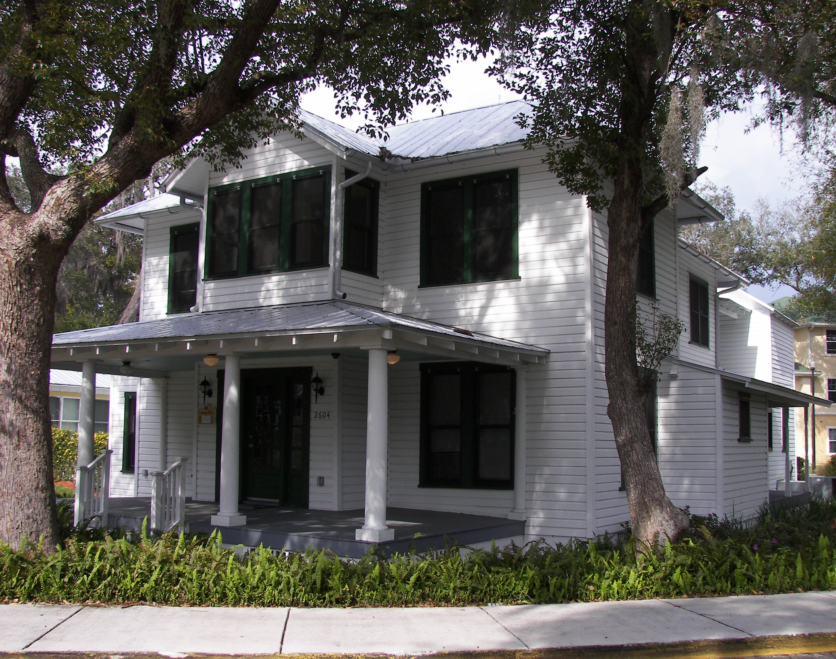
| [3] |
Landmark name [4] |
Image |
Date listed |
Location |
City or town |
Summary |
| 1 |
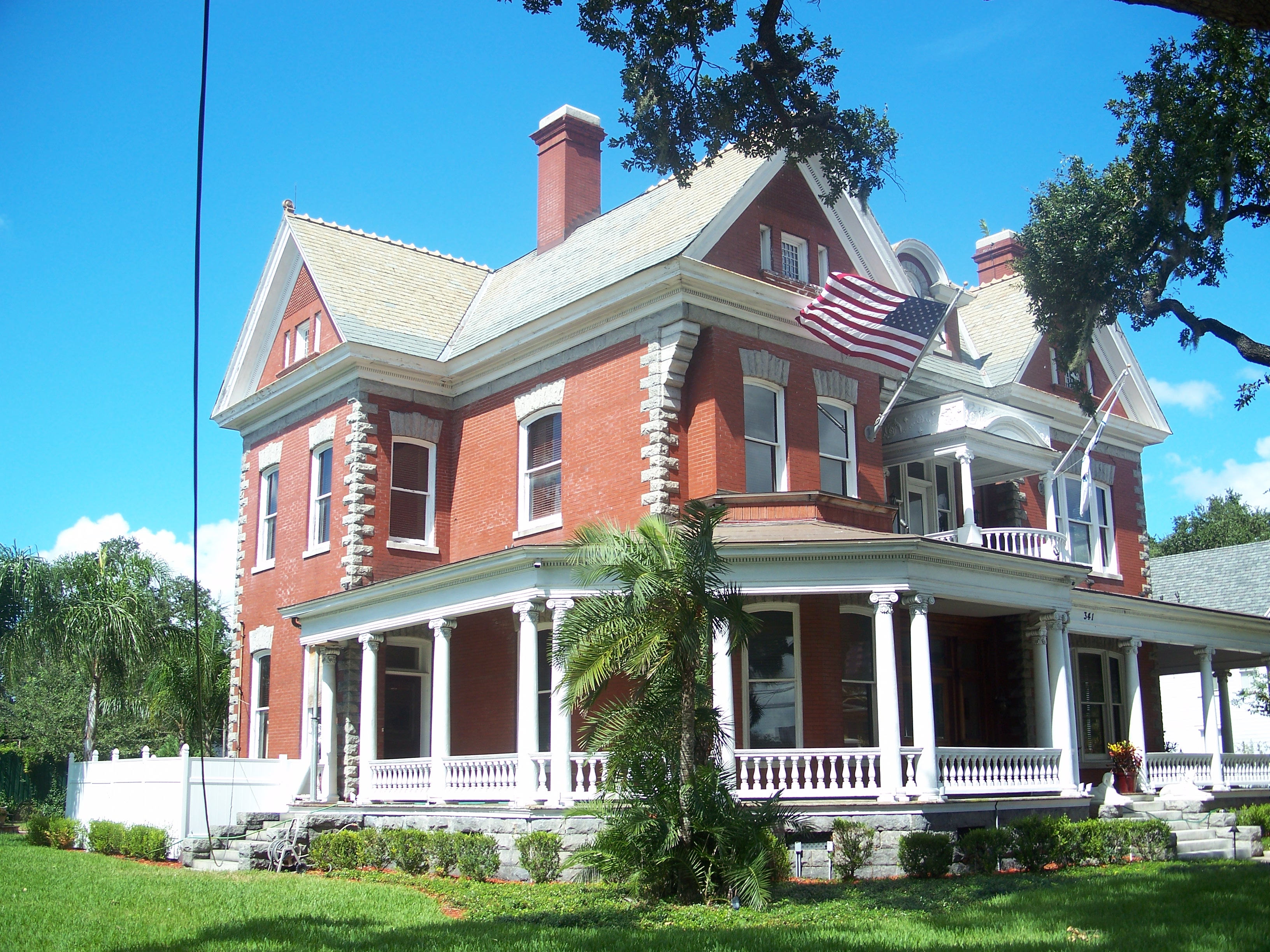
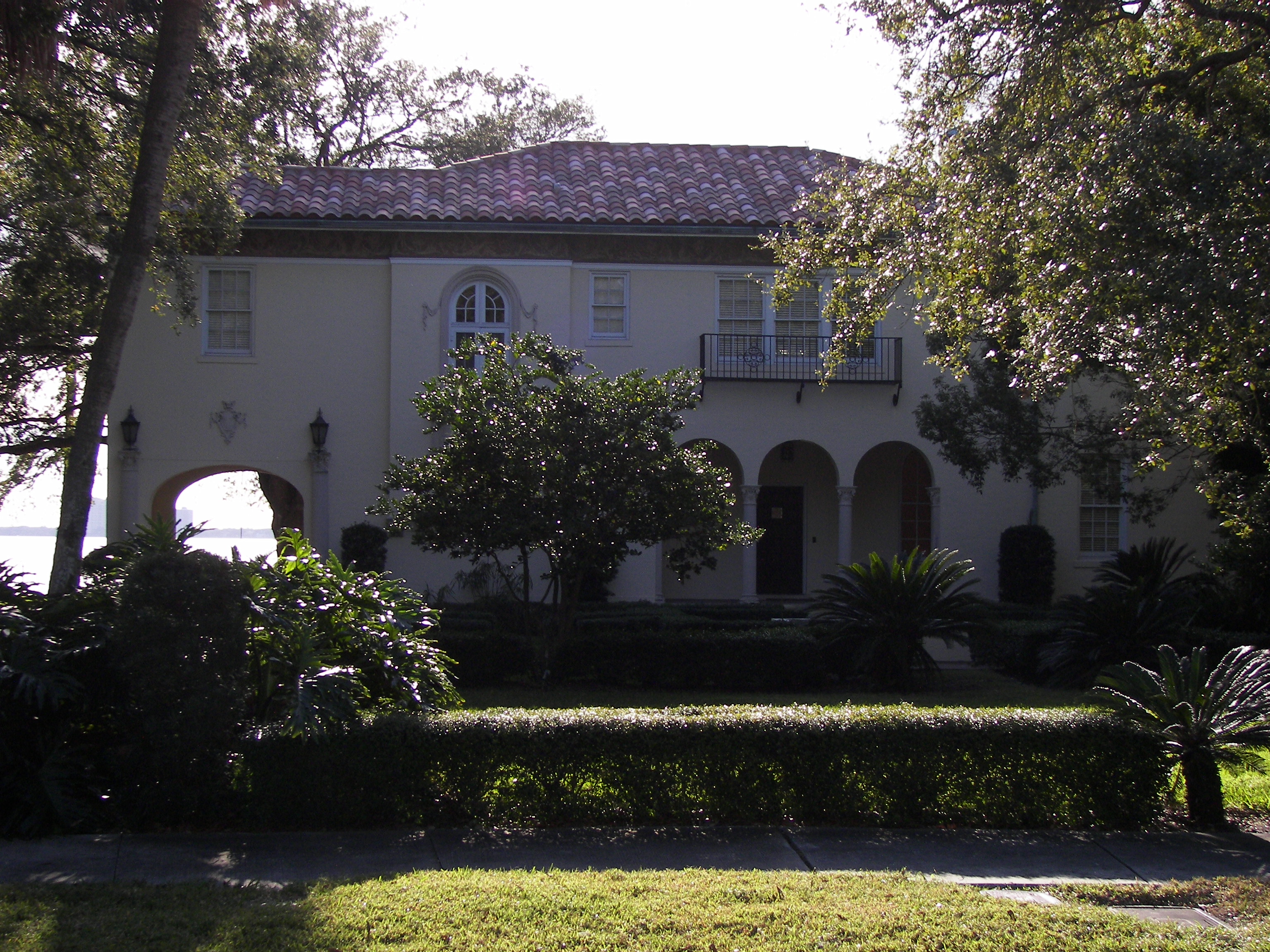
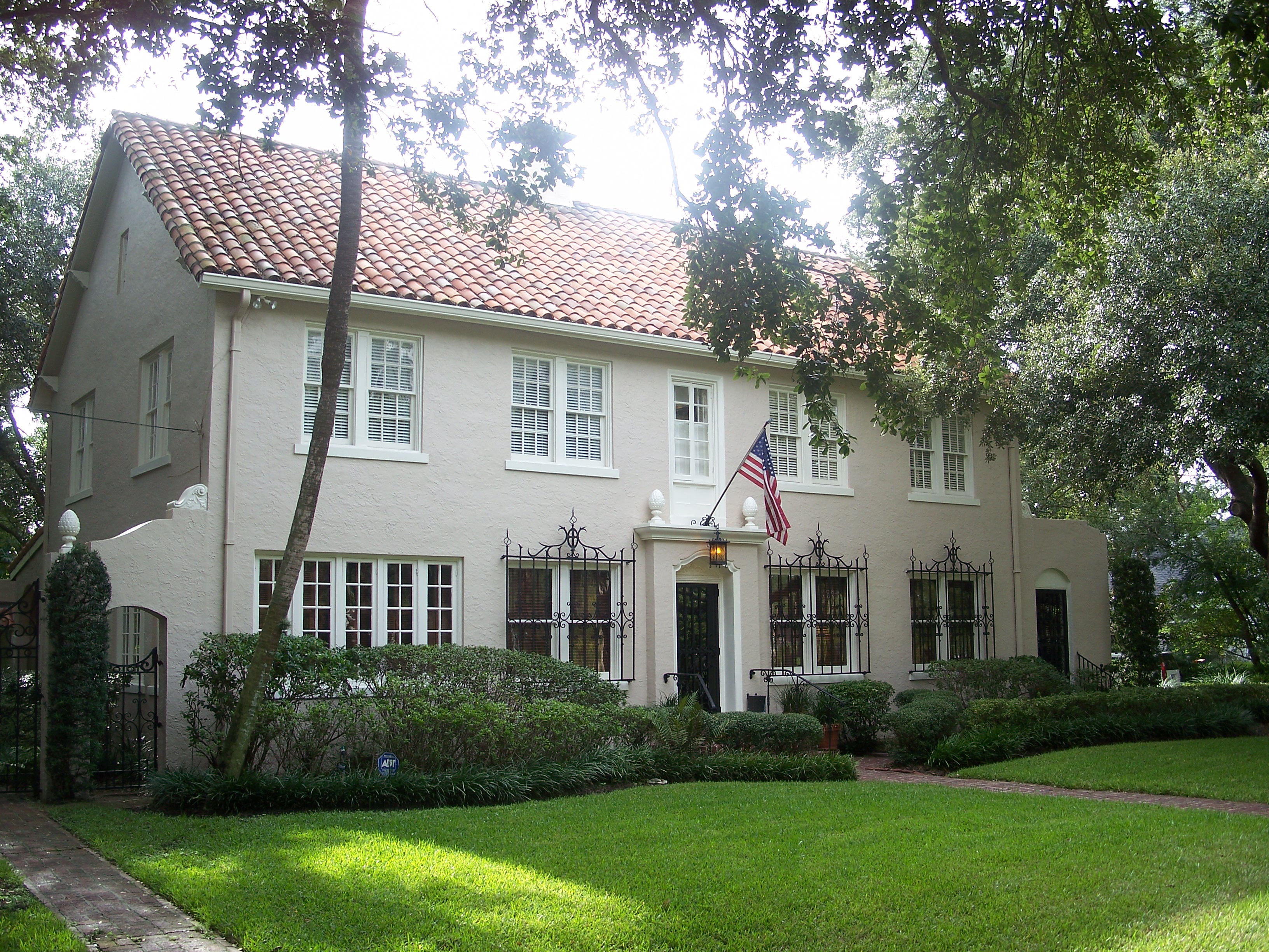
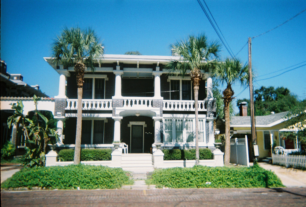
Anderson-Frank House |
|
01982-04-22April 22, 1982 |
341 Plant Avenue
27°56′21″N 82°27′48″W / 27.939167°N 82.463333°W / 27.939167; -82.463333 (Anderson-Frank House) |
Tampa |
|
| 2 |
Bay Isle Commercial Building |
|
01989-08-03August 3, 1989 |
238 East Davis Boulevard
27°55′33″N 82°27′13″W / 27.925833°N 82.453611°W / 27.925833; -82.453611 (Bay Isle Commercial Building) |
Tampa |
Part of the Mediterranean Revival Style Buildings of Davis Islands MPS |
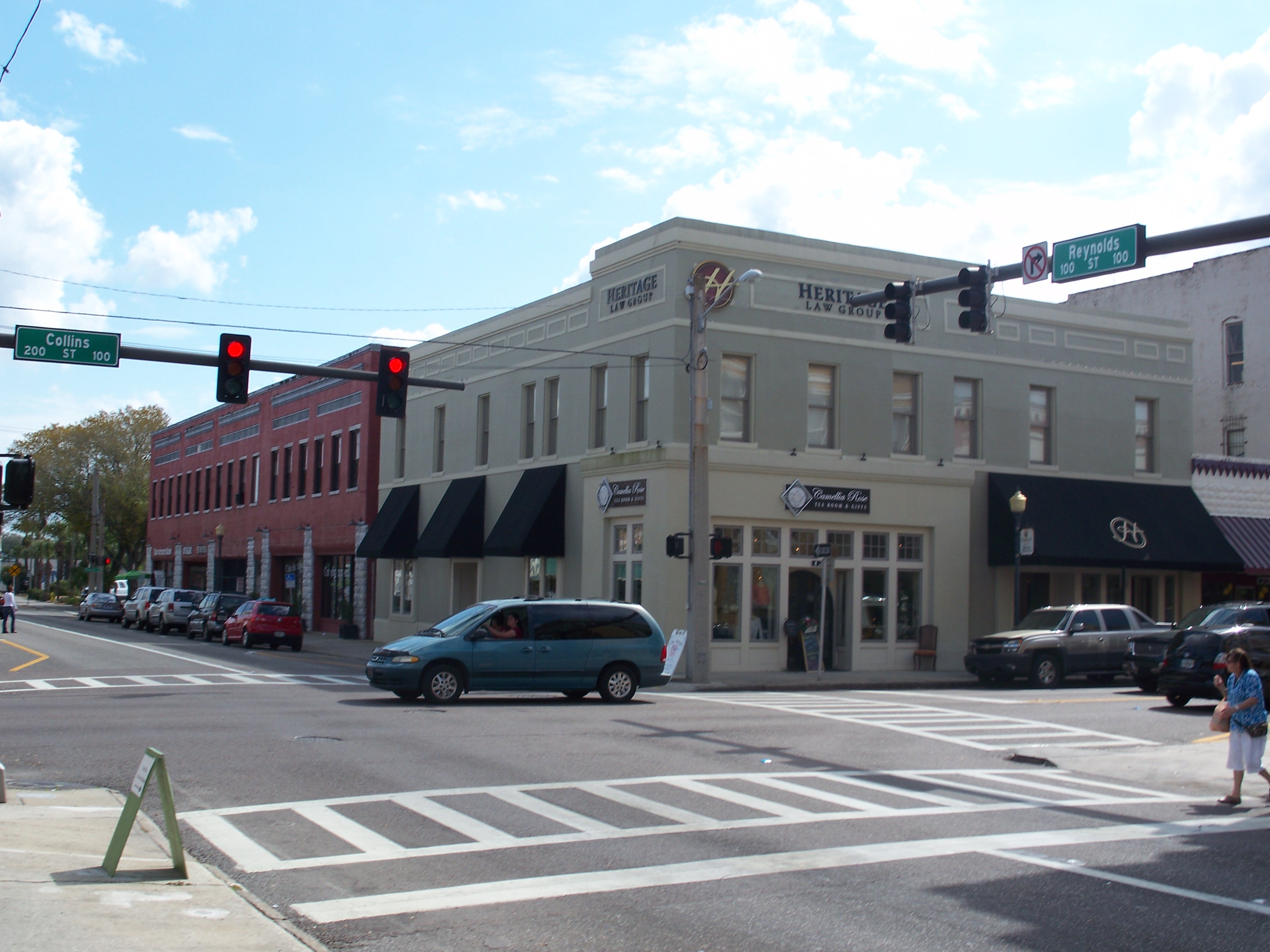
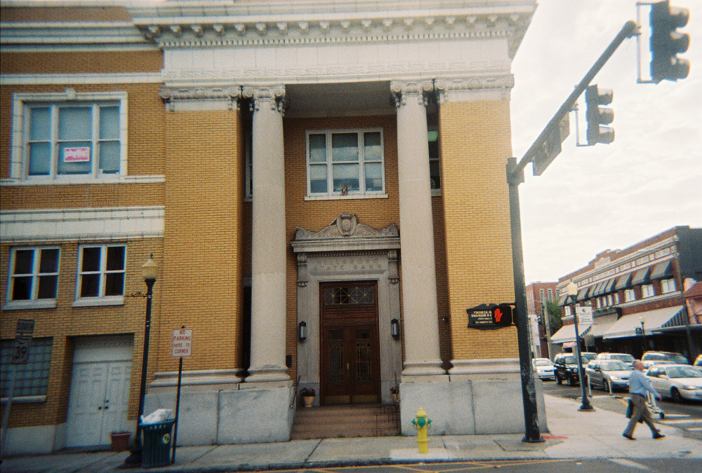
| 3 |
Bing Rooming House |
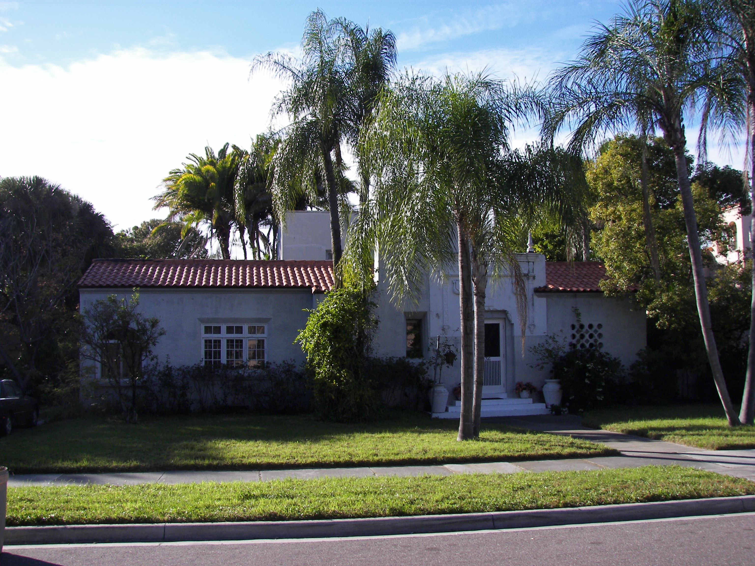
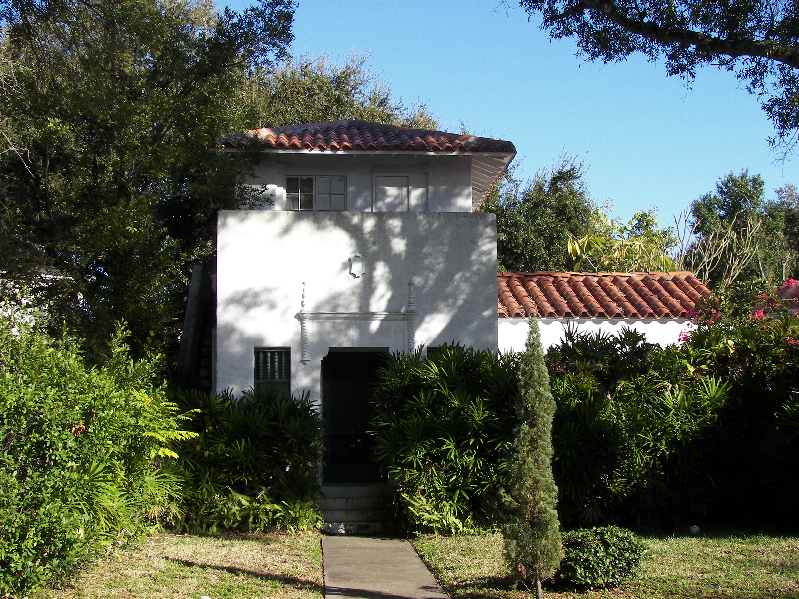
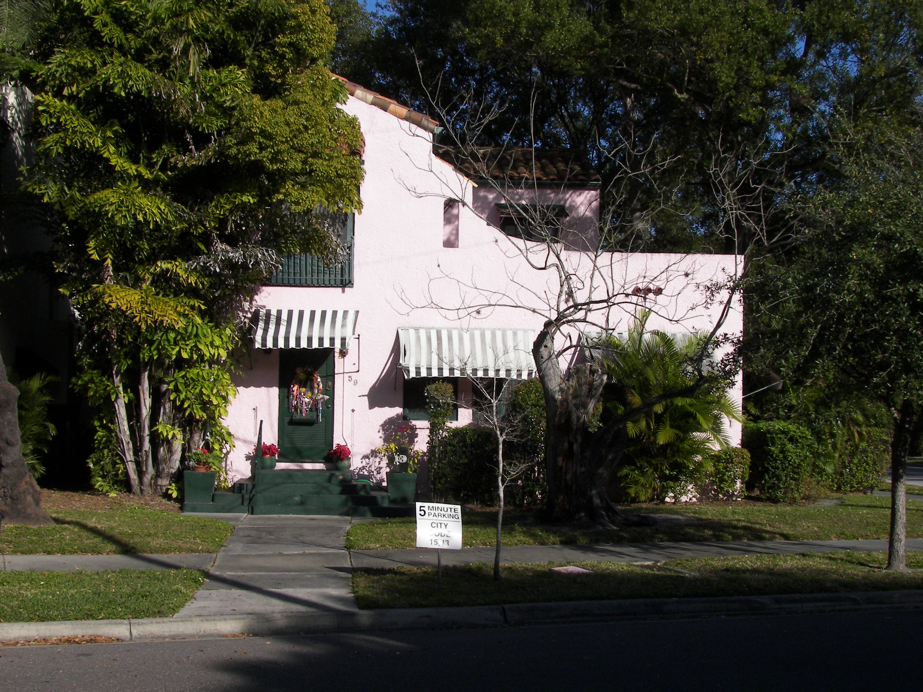
|
02002-09-14September 14, 2002 |
205 South Allen Street
28°00′57″N 82°06′58″W / 28.015833°N 82.116111°W / 28.015833; -82.116111 (Bing Rooming House) |
Plant City |
|
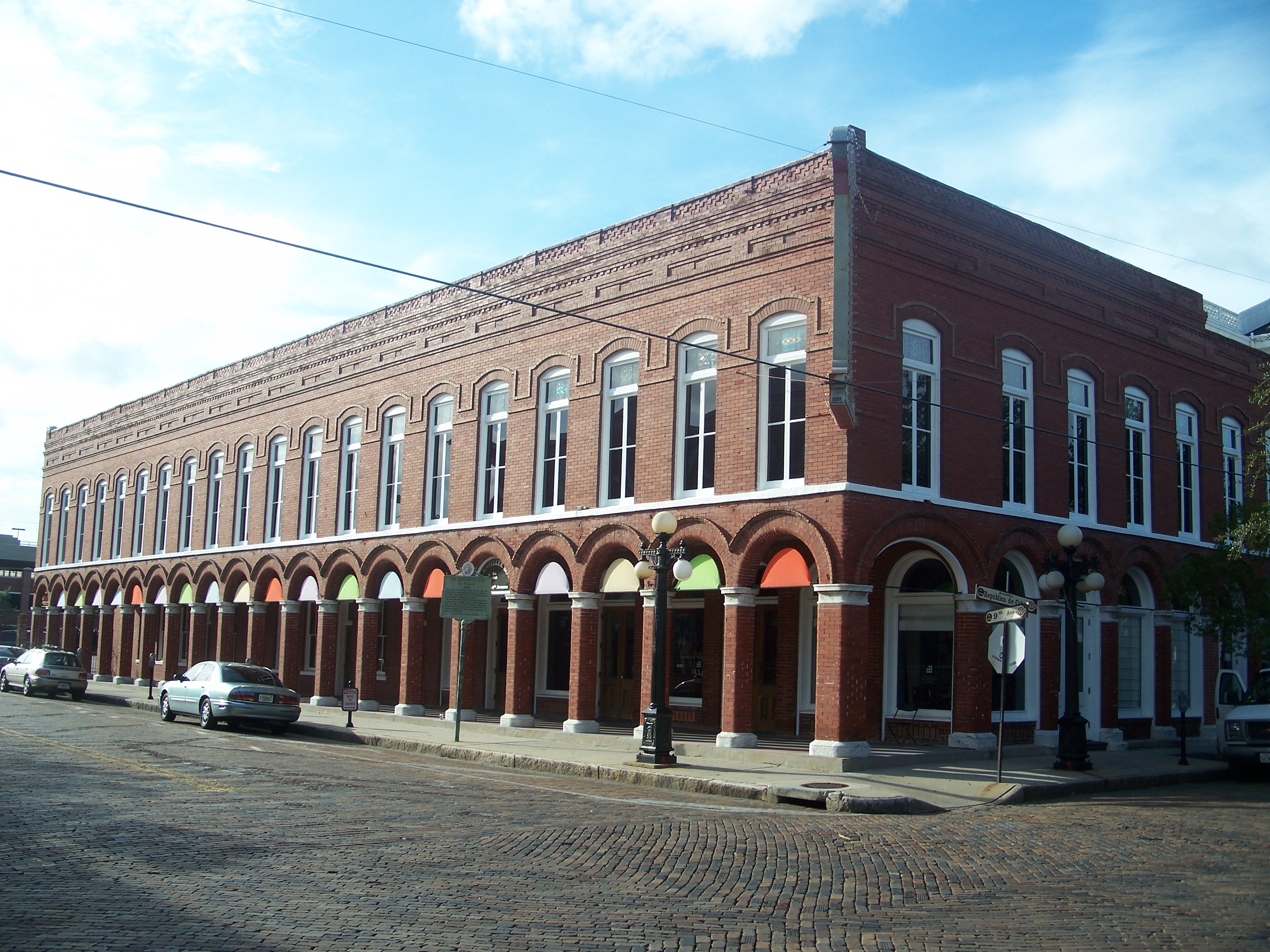
| 4 |
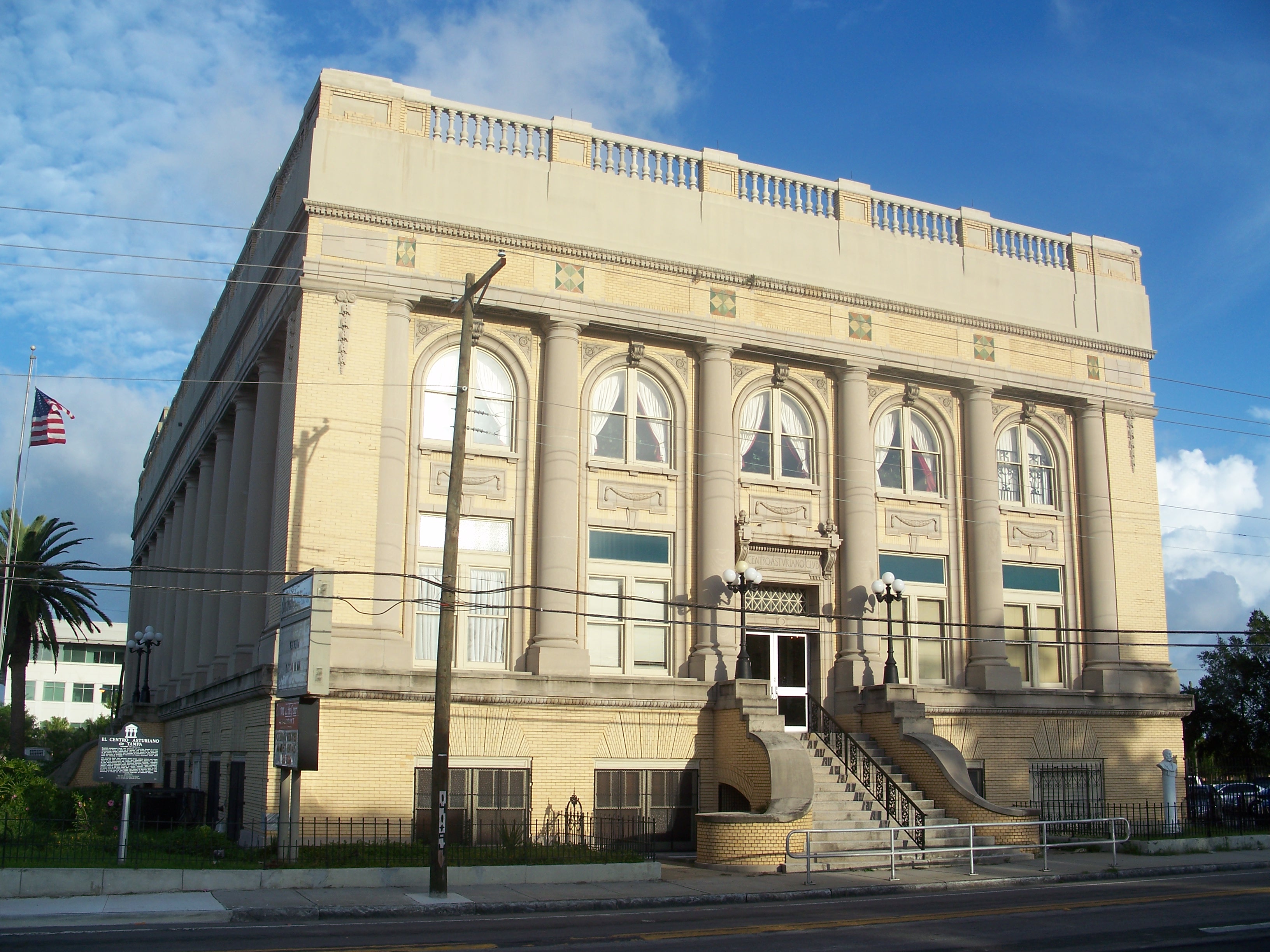
Centro Asturiano |
|
01974-07-24July 24, 1974 |
1913 Nebraska Avenue
27°57′42″N 82°27′03″W / 27.961667°N 82.450833°W / 27.961667; -82.450833 (Centro Asturiano) |
Tampa |
|
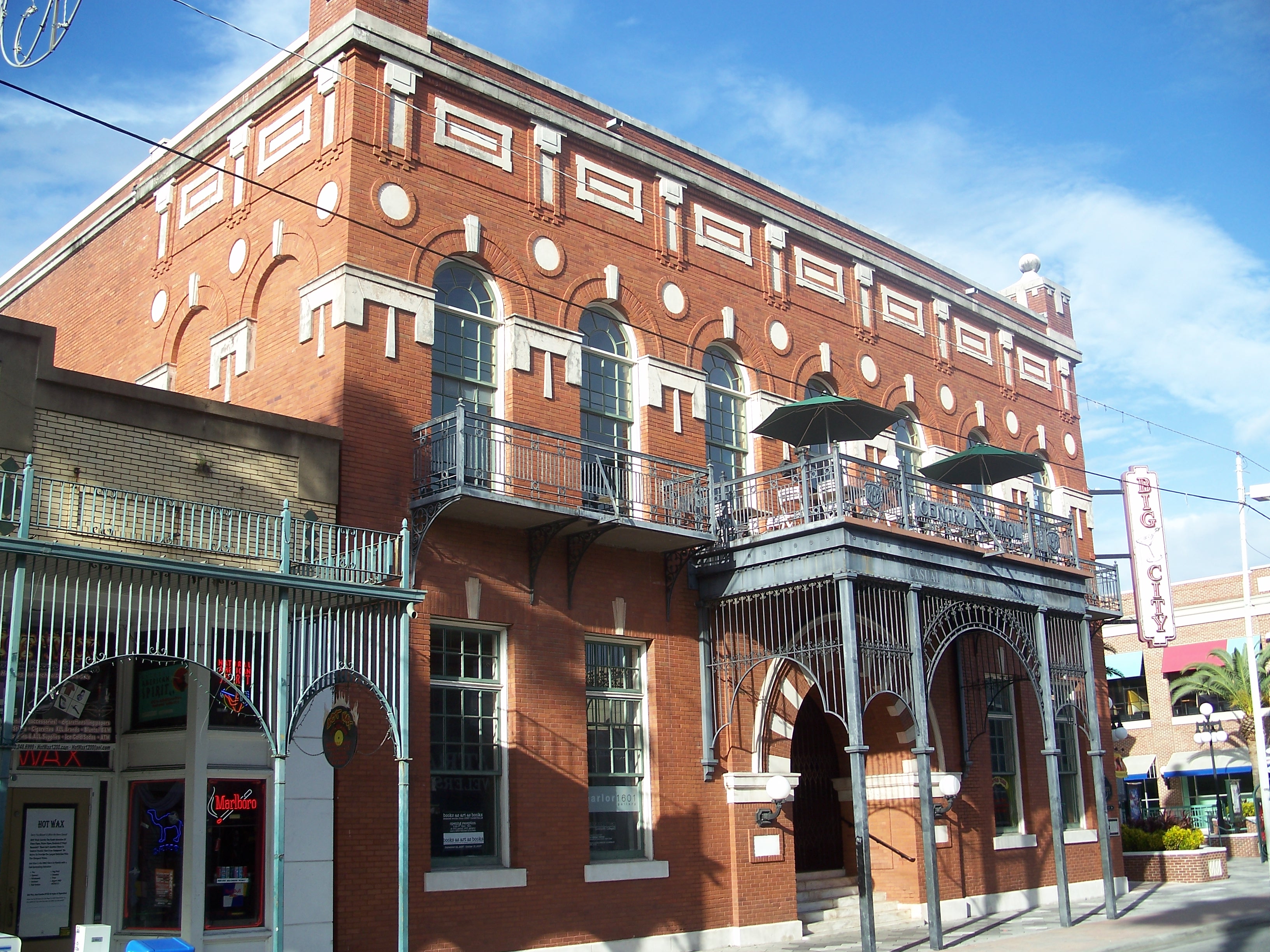
| 5 |
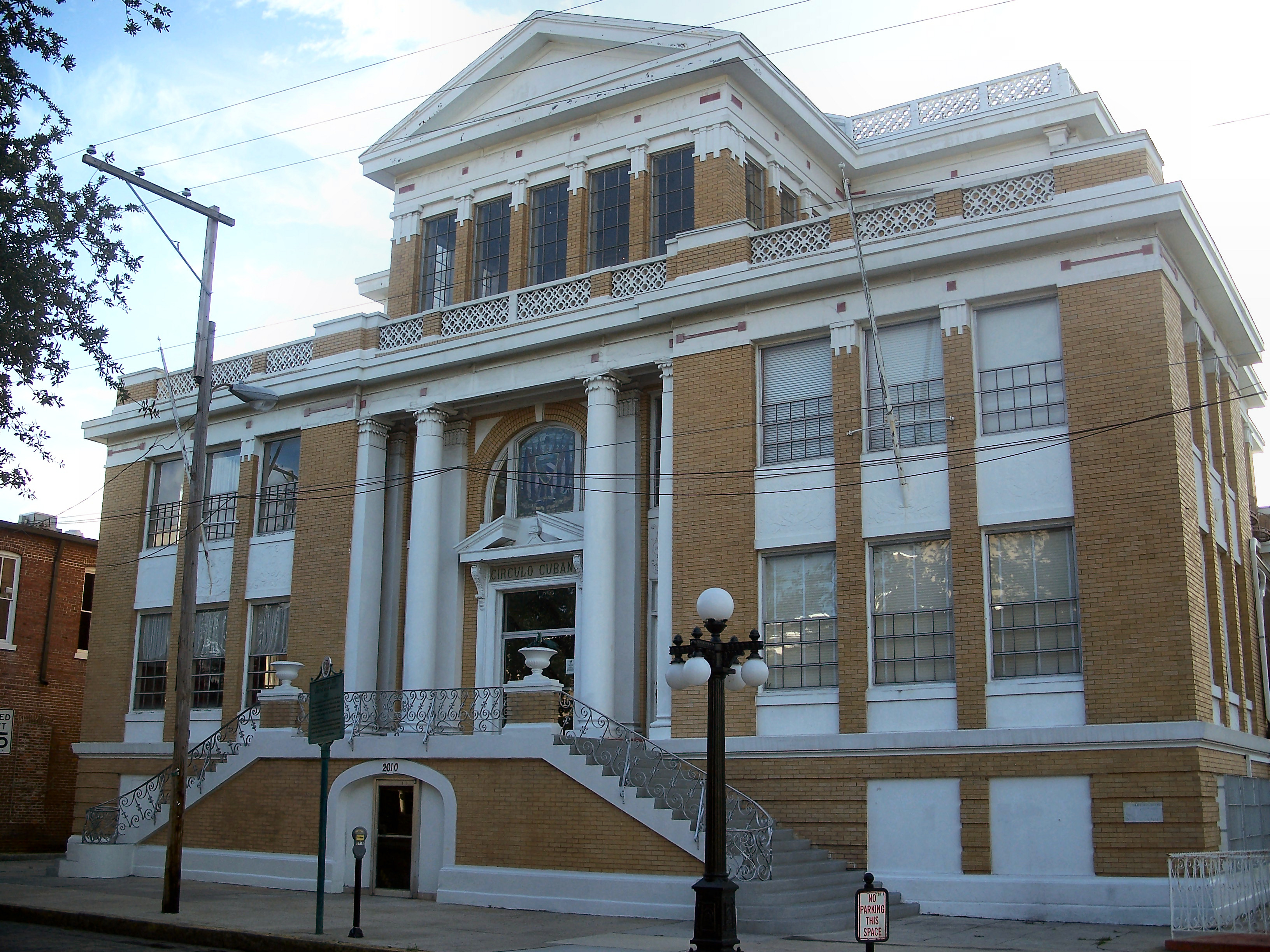
Circulo Cubano de Tampa |
|
01972-11-15November 15, 1972 |
10th Avenue and 14th Street
27°57′39″N 82°26′42″W / 27.960833°N 82.445°W / 27.960833; -82.445 (Circulo Cubano de Tampa) |
Tampa |
|
| 6 |
Cockroach Key |
|
01973-12-04December 4, 1973 |
Address Restricted
|
Ruskin |
|
| 7 |
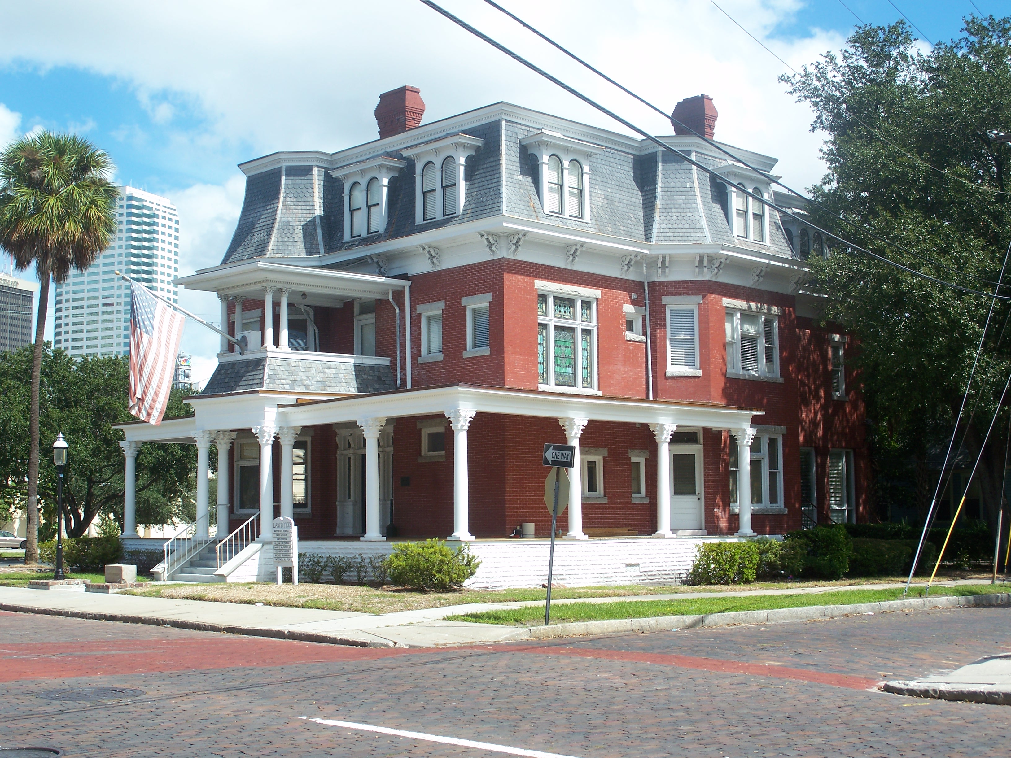
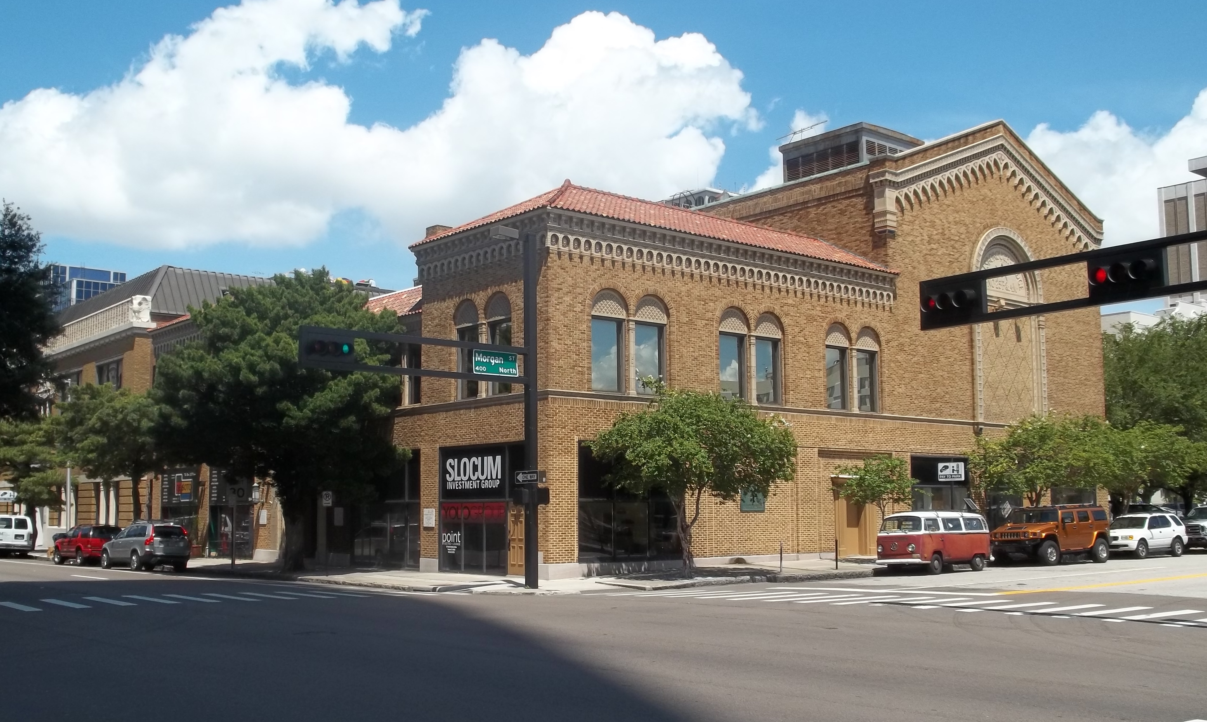
William E. Curtis House |
|
01987-08-27August 27, 1987 |
808 East Curtis Street
27°59′16″N 82°27′46″W / 27.987778°N 82.462778°W / 27.987778; -82.462778 (William E. Curtis House) |
Tampa |
|
| 8 |
A. P. Dickman House |
|
02000-07-14July 14, 2000 |
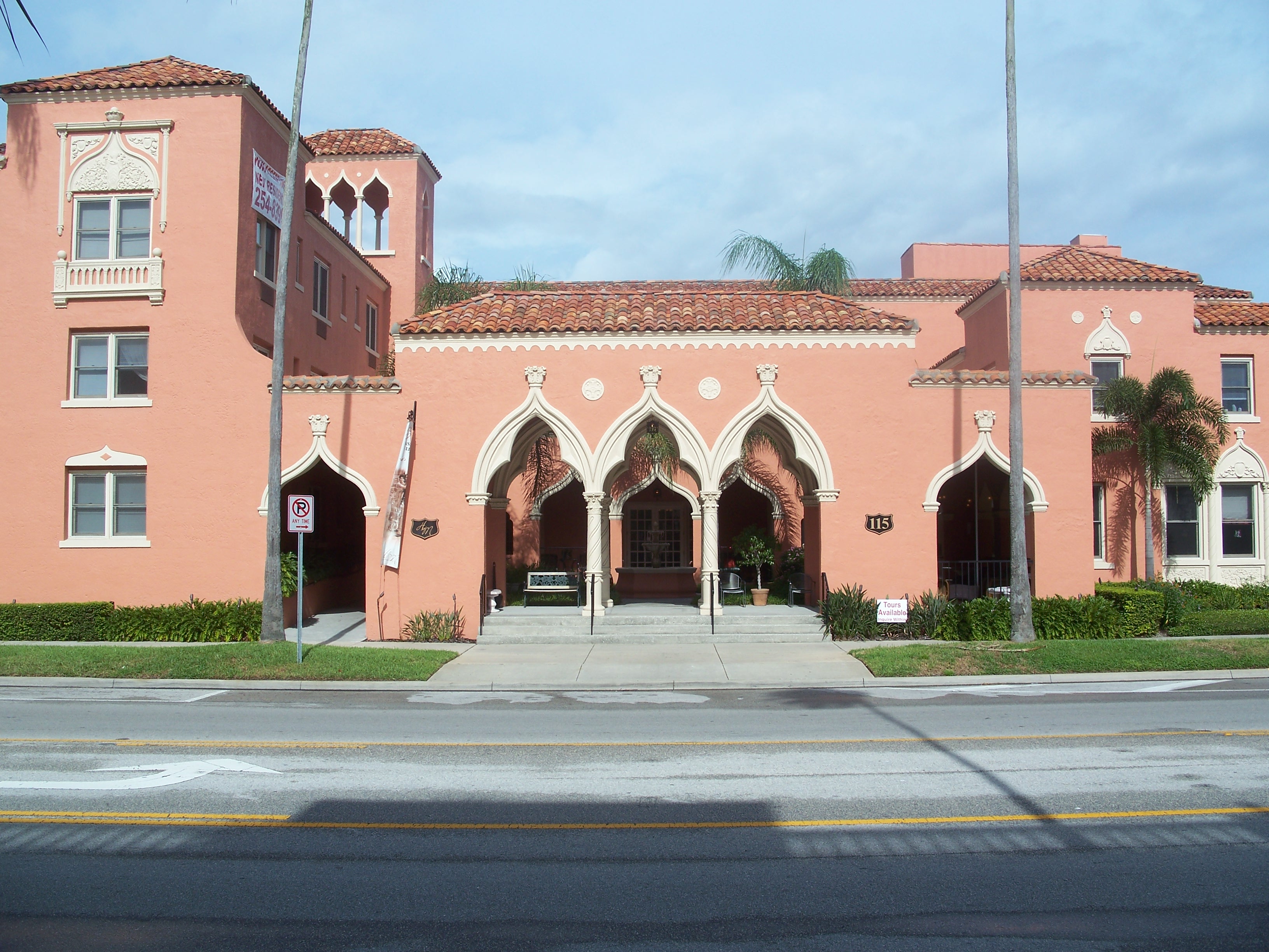
120 Dickman Drive, Southeast
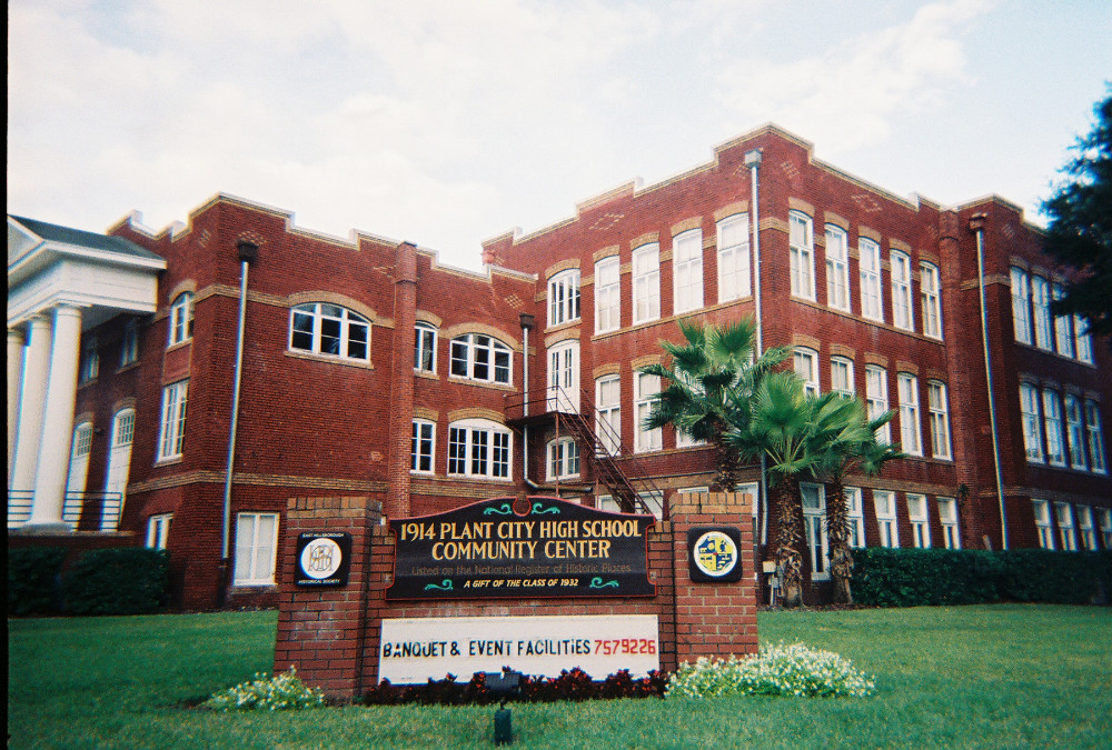
27°43′02″N 82°26′10″W / 27.717222°N 82.436111°W / 27.717222; -82.436111 (A. P. Dickman House) |
Ruskin |
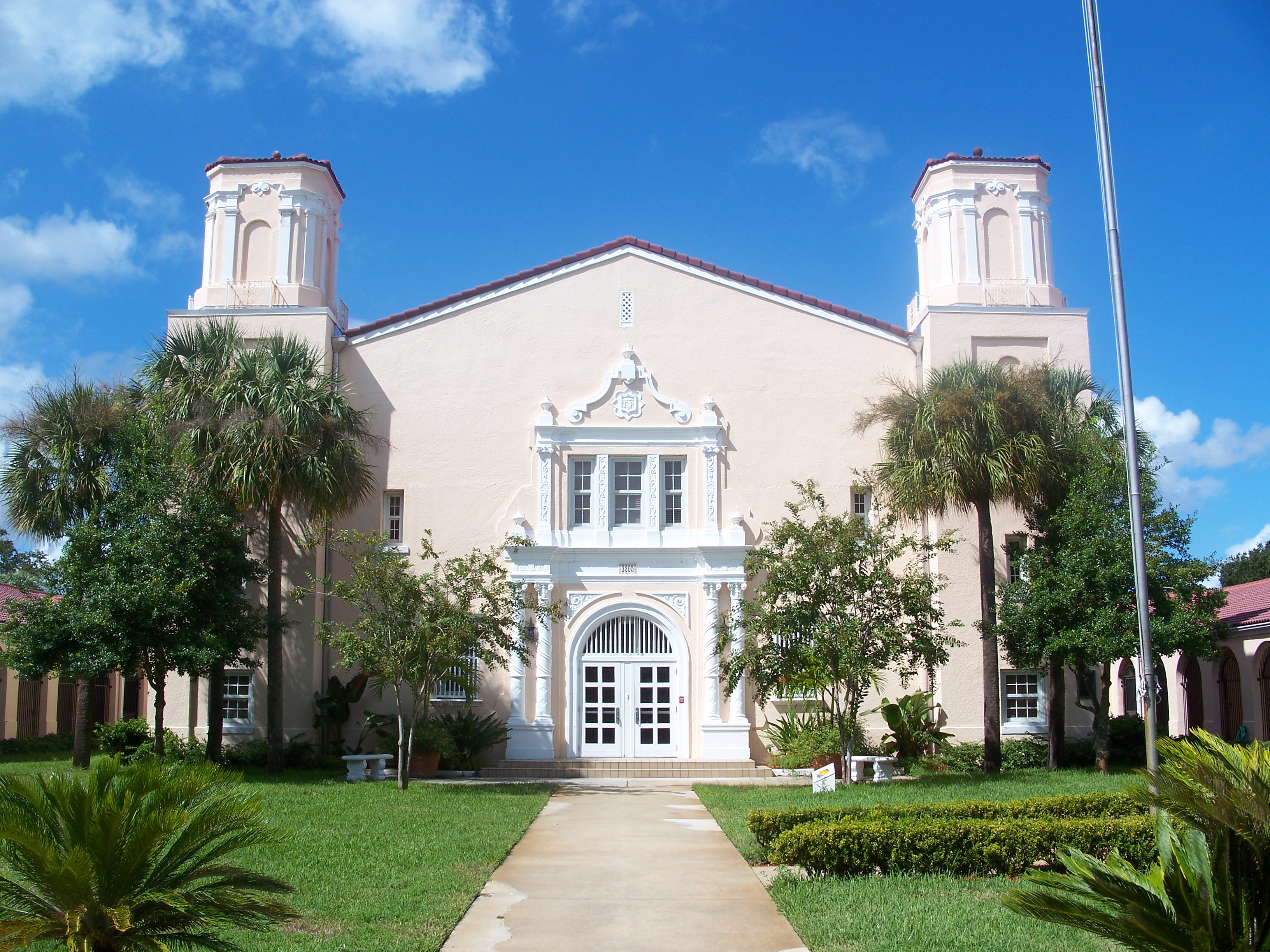
|
| 9 |
Downtown Plant City Commercial District |
|
01993-06-08June 8, 1993 |
Bounded by Baker and Wheeler Streets and the former Seaboard Coast Line railroad tracks
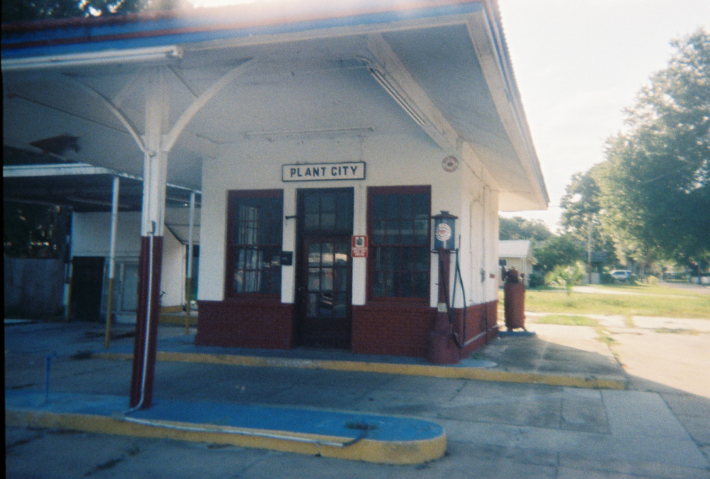
28°00′56″N 82°07′25″W / 28.015556°N 82.123611°W / 28.015556; -82.123611 (Downtown Plant City Commercial District) |
Plant City |
|
| 10 |
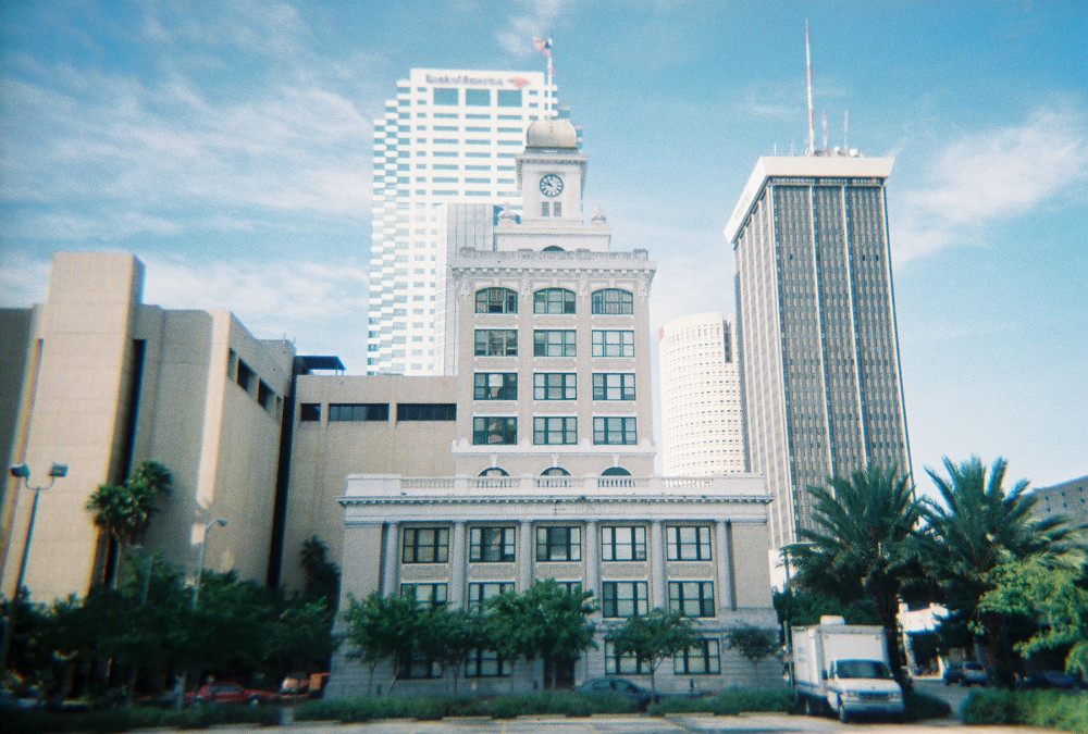
Downtown Plant City Historic Residential District |
|
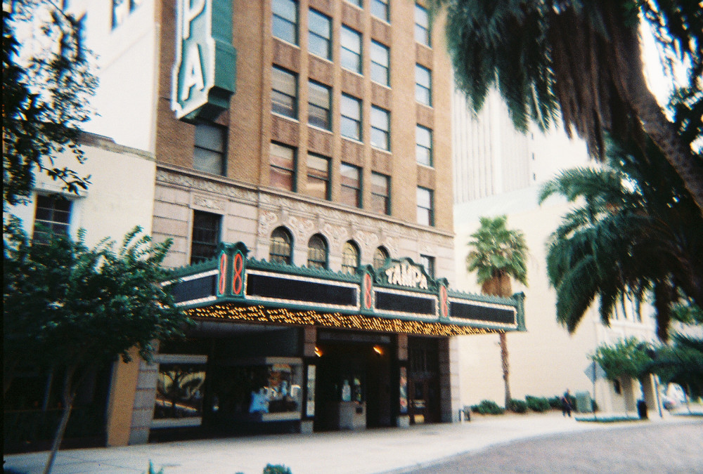
01998-08-12August 12, 1998 |
Bounded by North Drane, Thomas, West Tever, Franklin, and Carey Streets
28°01′10″N 82°07′50″W / 28.019444°N 82.130556°W / 28.019444; -82.130556 (Downtown Plant City Historic Residential District) |
Plant City |
|
| 11 |
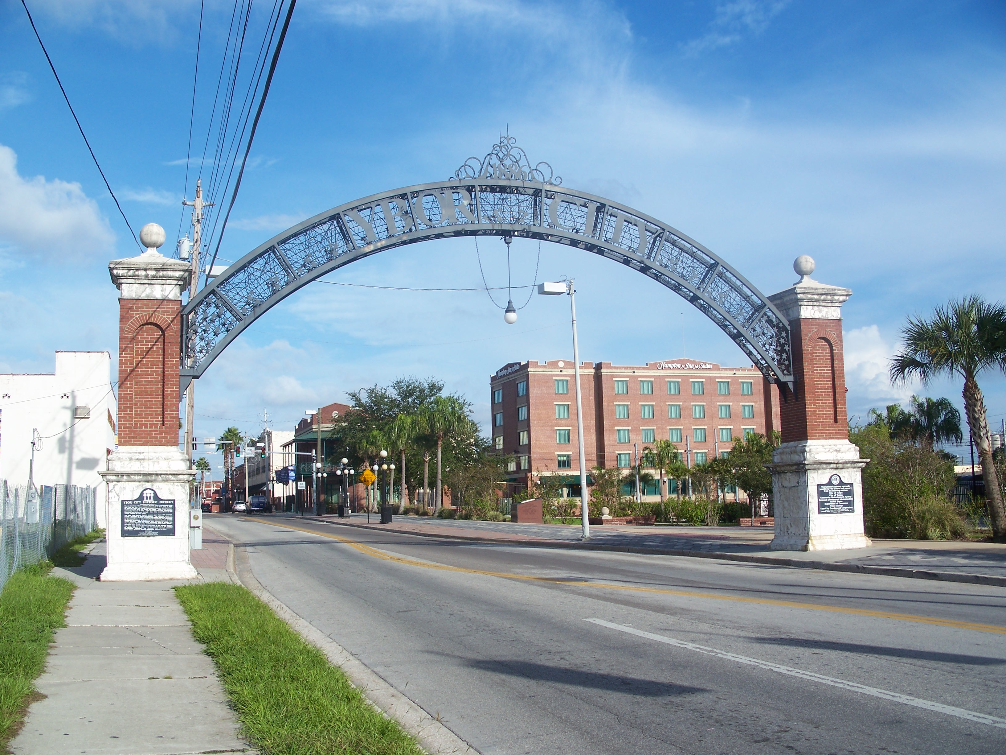
Egmont Key |
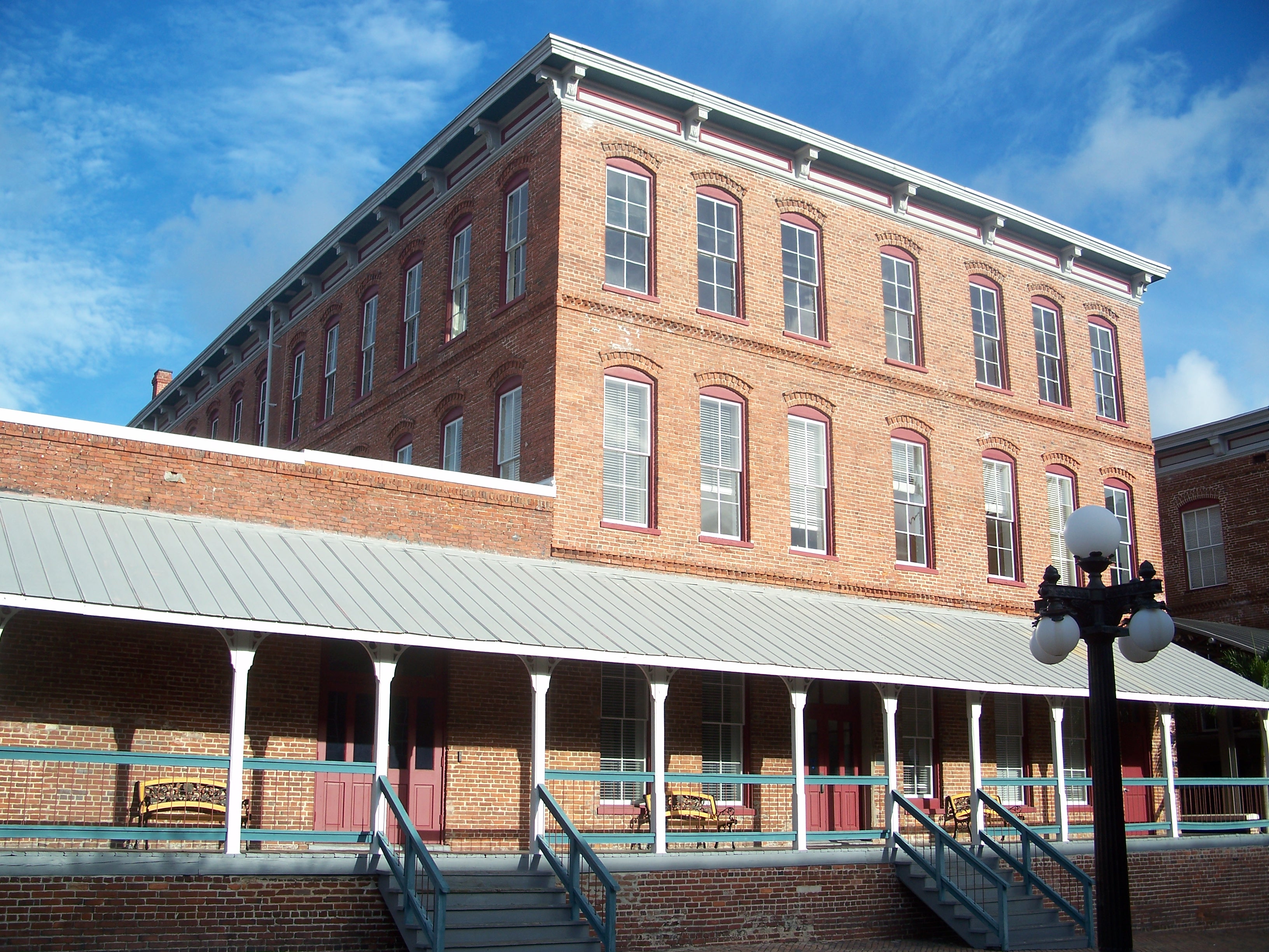
|
01978-12-11December 11, 1978 |
West of Tampa at the entrance to Tampa Bay
27°35′24″N 82°45′46″W / 27.59°N 82.762778°W / 27.59; -82.762778 (Egmont Key) |
Tampa |
|
| 12 |
El Centro Español de Tampa |
|
01988-06-03June 3, 1988 |
1526-1536 East Seventh Avenue
27°57′36″N 82°26′31″W / 27.96°N 82.441944°W / 27.96; -82.441944 (El Centro Español de Tampa) |
Tampa |
|
| 13 |
El Centro Espanol of West Tampa |
|
01974-07-30July 30, 1974 |
2306 North Howard Street
27°57′41″N 82°29′00″W / 27.961389°N 82.483333°W / 27.961389; -82.483333 (El Centro Espanol of West Tampa) |
Tampa |
|
| 14 |
El Pasaje |
|
01972-11-15November 15, 1972 |
14th Street and Palm Avenue
27°57′42″N 82°26′41″W / 27.961667°N 82.444722°W / 27.961667; -82.444722 (El Pasaje) |
Tampa |
|
| 15 |
Episcopal House of Prayer |
|
01991-02-21February 21, 1991 |
2708 Central Avenue
27°58′00″N 82°27′20″W / 27.966667°N 82.455556°W / 27.966667; -82.455556 (Episcopal House of Prayer) |
Tampa |
|
| 16 |
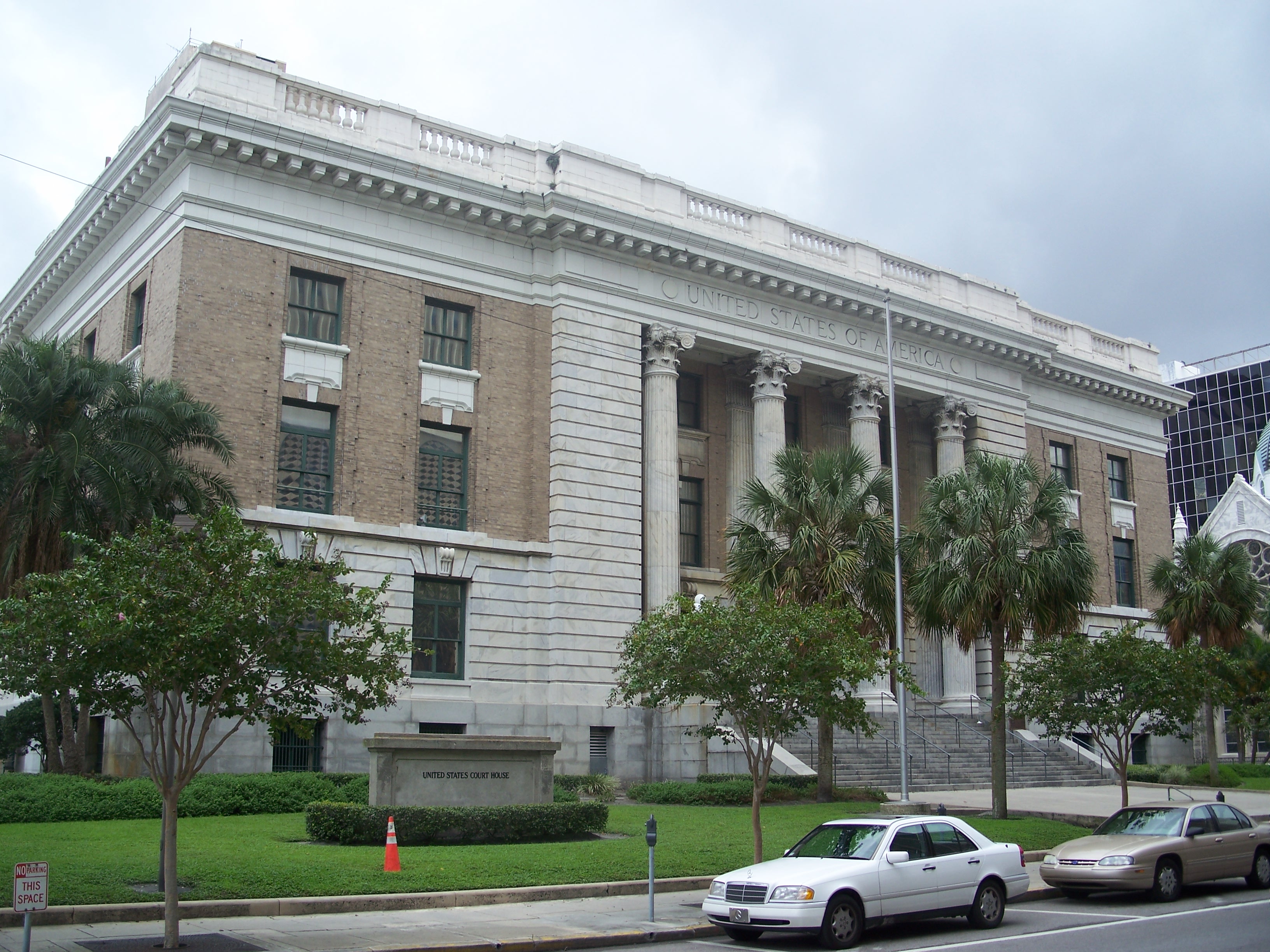
Federal Building, U.S. Courthouse, Downtown Postal Station |
|
01974-06-07June 7, 1974 |
601 Florida Avenue
27°56′59″N 82°27′27″W / 27.949722°N 82.4575°W / 27.949722; -82.4575 (Federal Building, U.S. Courthouse, Downtown Postal Station) |
Tampa |
|
| 17 |
Floridan Hotel |
|
01996-03-12March 12, 1996 |
905 North Florida Avenue
27°57′06″N 82°26′54″W / 27.951667°N 82.448333°W / 27.951667; -82.448333 (Floridan Hotel) |
Tampa |
|
| 18 |
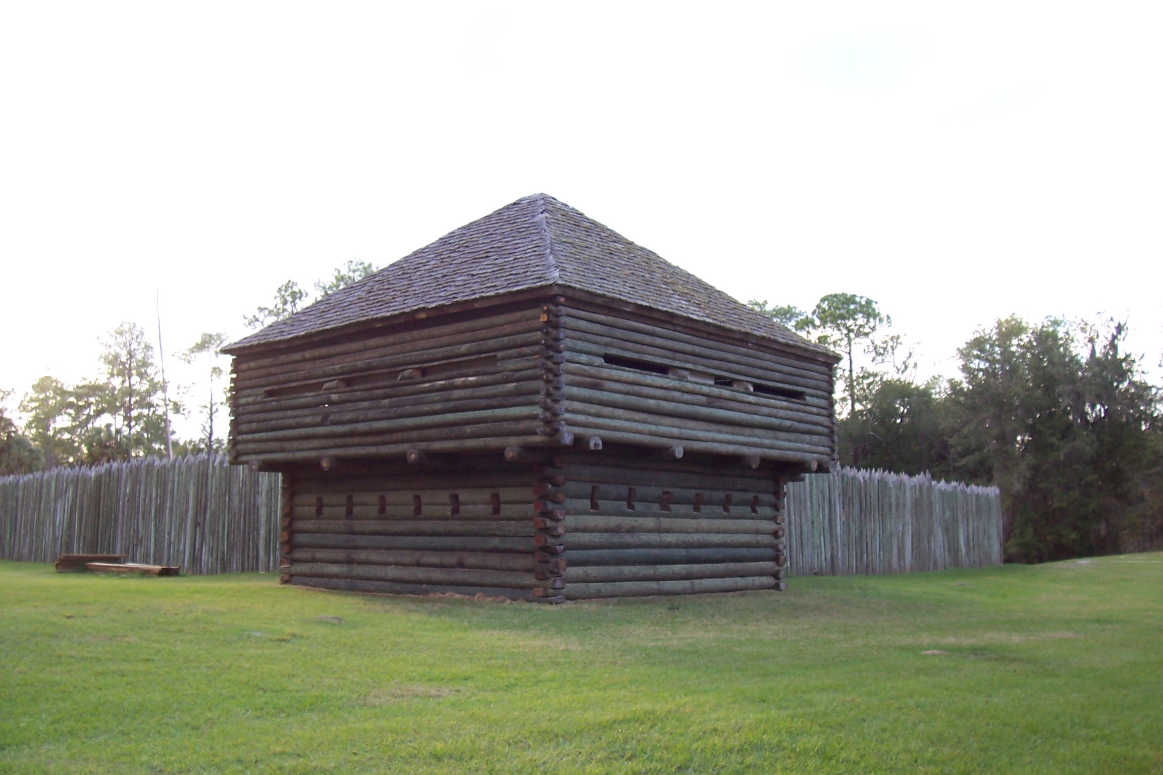
Fort Foster |
|
01972-06-13June 13, 1972 |
9 miles south of Zephyrhills
28°09′01″N 82°13′14″W / 28.150278°N 82.220556°W / 28.150278; -82.220556 (Fort Foster) |
Zephyrhills |
|
| 19 |
Isaac Gardner, Sr., House |
|
02003-10-13October 13, 2003 |
209 West Palm Avenue
27°57′51″N 82°27′47″W / 27.964167°N 82.463056°W / 27.964167; -82.463056 (Isaac Gardner, Sr., House) |
Tampa |
|
| 20 |
Glover School |
|
02001-11-29November 29, 2001 |
5110 Horton Road, Bealsville
27°56′33″N 82°04′44″W / 27.9425°N 82.078889°W / 27.9425; -82.078889 (Glover School) |
Plant City |
|
| 21 |
George Guida, Sr. House |
|
02006-03-29March 29, 2006 |
1516 North Renfrew Avenue
27°57′31″N 82°29′49″W / 27.958611°N 82.496944°W / 27.958611; -82.496944 (George Guida, Sr. House) |
Tampa |
|
| 22 |
Hampton Terrace Historic District |
|
01999-01-27January 27, 1999 |
Roughly bounded by Hanna Avenue, 15th Street, Hillsborough Avenue, and Nebraska Avenue
27°59′58″N 82°26′50″W / 27.999444°N 82.447222°W / 27.999444; -82.447222 (Hampton Terrace Historic District) |
Tampa |
|
| 23 |
Hillsboro State Bank Building |
|
01984-08-01August 1, 1984 |
121 North Collins Street
28°00′57″N 82°06′50″W / 28.015833°N 82.113889°W / 28.015833; -82.113889 (Hillsboro State Bank Building) |
Plant City |
|
| 24 |
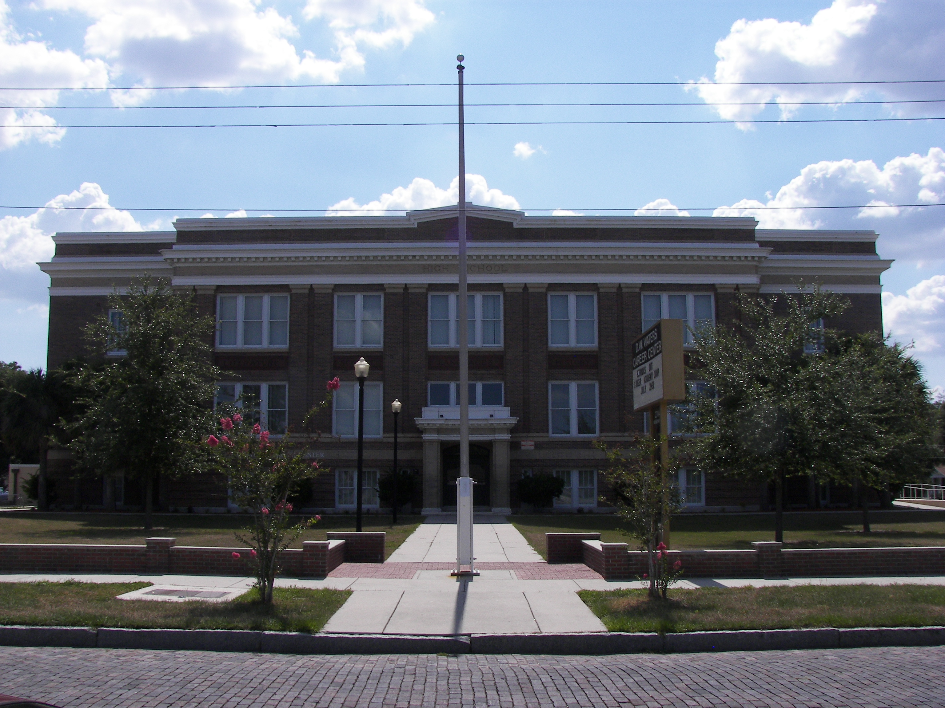
Historic Turkey Creek High School |
|
02001-03-02March 2, 2001 |
5005 Turkey Creek Road, South
27°56′47″N 82°10′17″W / 27.946389°N 82.171389°W / 27.946389; -82.171389 (Historic Turkey Creek High School) |
Plant City |
|
| 25 |
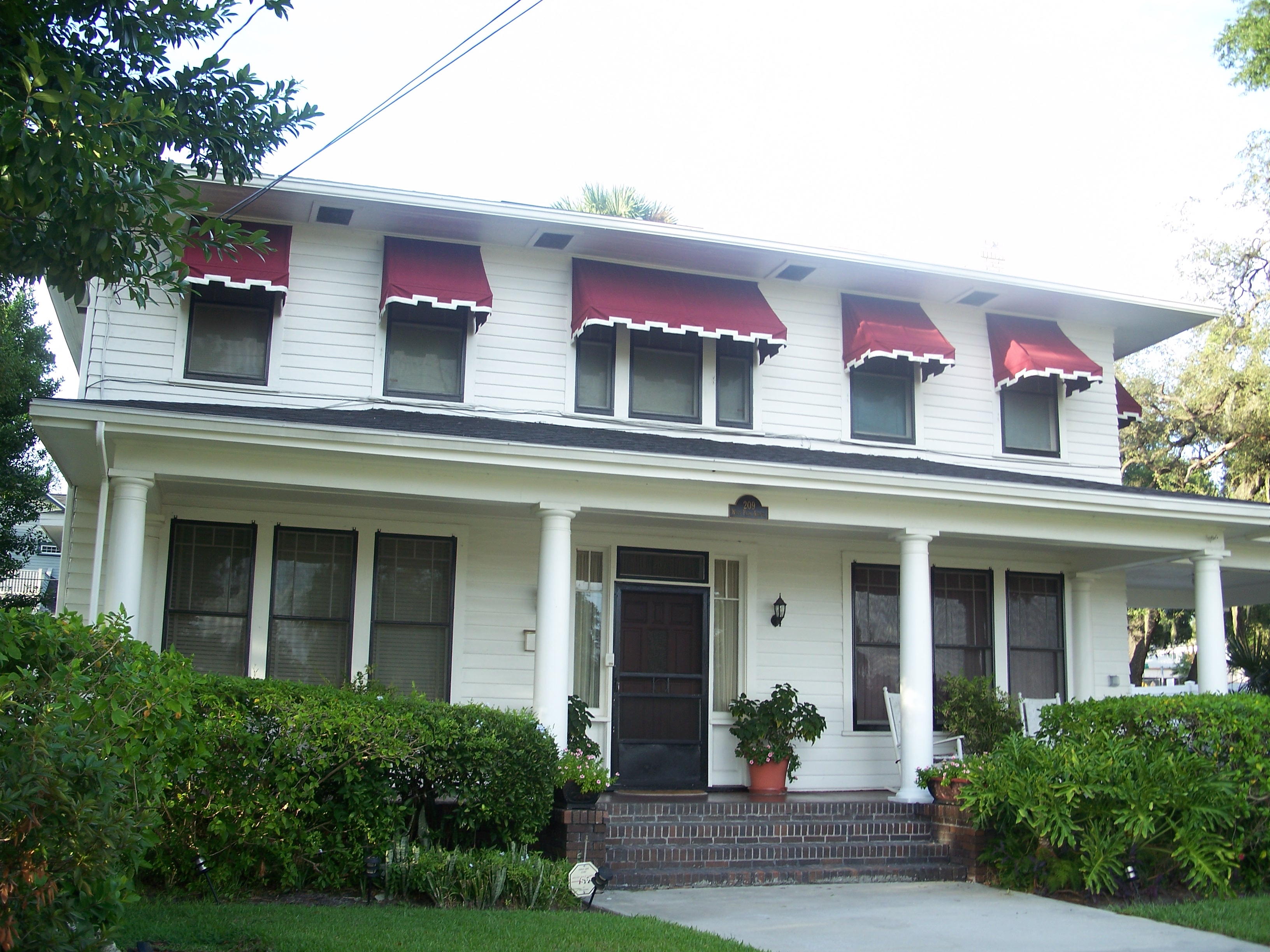
House at 36 Aegean Avenue |
|
01989-11-13November 13, 1989 |
36 Aegean Avenue
27°56′04″N 82°27′34″W / 27.934444°N 82.459444°W / 27.934444; -82.459444 (House at 36 Aegean Avenue) |
Tampa |
Part of the Mediterranean Revival Style Buildings of Davis Islands MPS |
| 26 |
House at 36 Columbia Drive |
|
01989-08-03August 3, 1989 |
36 Columbia Drive
27°56′05″N 82°27′26″W / 27.934722°N 82.457222°W / 27.934722; -82.457222 (House at 36 Columbia Drive) |
Tampa |
Part of the Mediterranean Revival Style Buildings of Davis Islands MPS |
| 27 |
House at 53 Aegean Avenue |
|
01989-08-03August 3, 1989 |
53 Aegean Avenue
27°55′58″N 82°27′33″W / 27.932778°N 82.459167°W / 27.932778; -82.459167 (House at 53 Aegean Avenue) |
Tampa |
Part of the Mediterranean Revival Style Buildings of Davis Islands MPS |
| 28 |
House at 59 Aegean Avenue |
|
01989-08-03August 3, 1989 |
59 Aegean Avenue
27°55′57″N 82°27′33″W / 27.9325°N 82.459167°W / 27.9325; -82.459167 (House at 59 Aegean Avenue) |
Tampa |
Part of the Mediterranean Revival Style Buildings of Davis Islands MPS |
| 29 |
House at 84 Adalia Avenue |
|
01989-08-03August 3, 1989 |
84 Adalia Avenue
27°55′51″N 82°27′40″W / 27.930833°N 82.461111°W / 27.930833; -82.461111 (House at 84 Adalia Avenue) |
Tampa |
Part of the Mediterranean Revival Style Buildings of Davis Islands MPS |
| 30 |
House at 97 Adriatic Avenue |
|
01989-08-03August 3, 1989 |
97 Adriatic Avenue
27°55′55″N 82°27′37″W / 27.931944°N 82.460278°W / 27.931944; -82.460278 (House at 97 Adriatic Avenue) |
Tampa |
Part of the Mediterranean Revival Style Buildings of Davis Islands MPS |
| 31 |
House at 100 West Davis Boulevard |
|
01989-08-03August 3, 1989 |
100 West Davis Boulevard
27°55′48″N 82°27′25″W / 27.93°N 82.456944°W / 27.93; -82.456944 (House at 100 West Davis Boulevard) |
Tampa |
Part of the Mediterranean Revival Style Buildings of Davis Islands MPS |
| 32 |
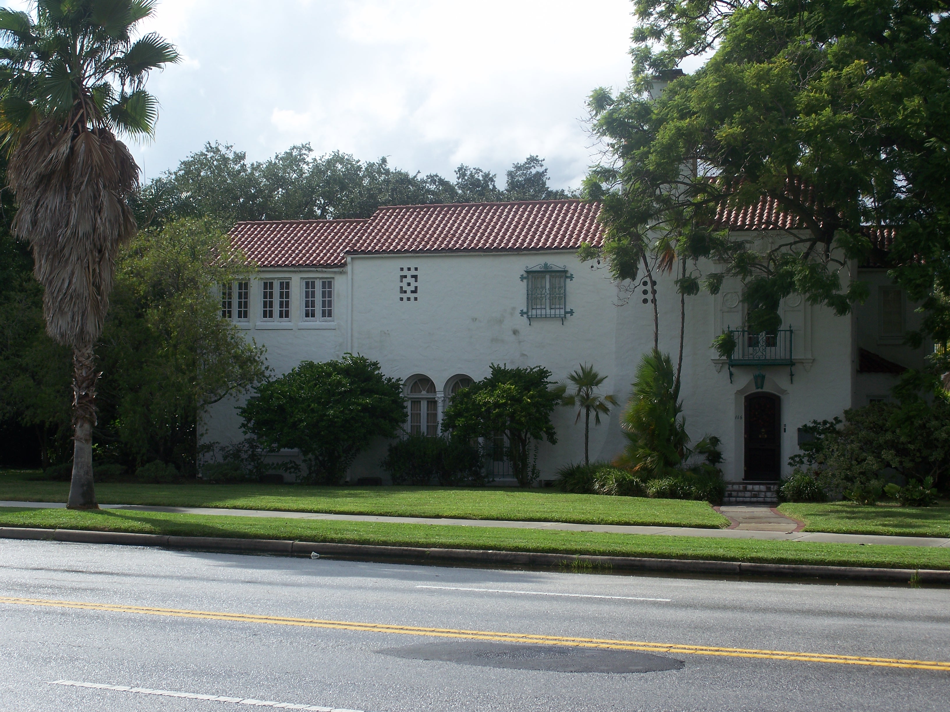
House at 116 West Davis Boulevard |
|
01989-08-03August 3, 1989 |
116 West Davis Boulevard
27°55′42″N 82°27′27″W / 27.928333°N 82.4575°W / 27.928333; -82.4575 (House at 116 West Davis Boulevard) |
Tampa |
Part of the Mediterranean Revival Style Buildings of Davis Islands MPS |
| 33 |
House at 124 Baltic Circle |
|
01989-08-03August 3, 1989 |
124 Baltic Circle
27°55′48″N 82°27′33″W / 27.93°N 82.459167°W / 27.93; -82.459167 (House at 124 Baltic Circle) |
Tampa |
Part of the Mediterranean Revival Style Buildings of Davis Islands MPS |
| 34 |
House at 125 Baltic Circle |
|
01989-08-03August 3, 1989 |
125 Baltic Circle
27°55′48″N 82°27′30″W / 27.93°N 82.458333°W / 27.93; -82.458333 (House at 125 Baltic Circle) |
Tampa |
Part of the Mediterranean Revival Style Buildings of Davis Islands MPS |
| 35 |
House at 131 West Davis Boulevard |
|
01990-01-08January 8, 1990 |
131 West Davis Boulevard
27°55′38″N 82°27′28″W / 27.927222°N 82.457778°W / 27.927222; -82.457778 (House at 131 West Davis Boulevard) |
Tampa |
Part of the Mediterranean Revival Style Buildings of Davis Islands MPS |
| 36 |
House at 132 Baltic Circle |
|
01989-08-03August 3, 1989 |
132 Baltic Circle
27°55′46″N 82°27′31″W / 27.929444°N 82.458611°W / 27.929444; -82.458611 (House at 132 Baltic Circle) |
Tampa |
Part of the Mediterranean Revival Style Buildings of Davis Islands MPS |
| 37 |
House at 161 Bosporous Avenue |
|
01989-08-03August 3, 1989 |
161 Bosporous Avenue
27°55′33″N 82°27′26″W / 27.925833°N 82.457222°W / 27.925833; -82.457222 (House at 161 Bosporous Avenue) |
Tampa |
Part of the Mediterranean Revival Style Buildings of Davis Islands MPS |
| 38 |
House at 190 Bosporous Avenue |
|
01989-08-03August 3, 1989 |
190 Bosporous Avenue
27°55′31″N 82°27′27″W / 27.925278°N 82.4575°W / 27.925278; -82.4575 (House at 190 Bosporous Avenue) |
Tampa |
Part of the Mediterranean Revival Style Buildings of Davis Islands MPS |
| 39 |
House at 200 Corsica Avenue |
|
01989-08-03August 3, 1989 |
200 Corsica Avenue
27°55′31″N 82°27′38″W / 27.925278°N 82.460556°W / 27.925278; -82.460556 (House at 200 Corsica Avenue) |
Tampa |
Part of the Mediterranean Revival Style Buildings of Davis Islands MPS |
| 40 |
House at 202 Blanca Avenue |
|
01989-08-03August 3, 1989 |
202 Blanca Avenue
27°55′36″N 82°27′42″W / 27.926667°N 82.461667°W / 27.926667; -82.461667 (House at 202 Blanca Avenue) |
Tampa |
Part of the Mediterranean Revival Style Buildings of Davis Islands MPS |
| 41 |
House at 220 Blanca Avenue |
|
01989-08-03August 3, 1989 |
220 Blanca Avenue
27°55′31″N 82°27′39″W / 27.925278°N 82.460833°W / 27.925278; -82.460833 (House at 220 Blanca Avenue) |
Tampa |
Part of the Mediterranean Revival Style Buildings of Davis Islands MPS |
| 42 |
House at 301 Caspian Street |
|
01989-08-03August 3, 1989 |
301 Caspian Street
27°55′27″N 82°27′34″W / 27.924167°N 82.459444°W / 27.924167; -82.459444 (House at 301 Caspian Street) |
Tampa |
Part of the Mediterranean Revival Style Buildings of Davis Islands MPS |
| 43 |
House at 418 Blanca Avenue |
|
01989-08-03August 3, 1989 |
418 Blanca Avenue
27°55′17″N 82°27′33″W / 27.921389°N 82.459167°W / 27.921389; -82.459167 (House at 418 Blanca Avenue) |
Tampa |
Part of the Mediterranean Revival Style Buildings of Davis Islands MPS |
| 44 |
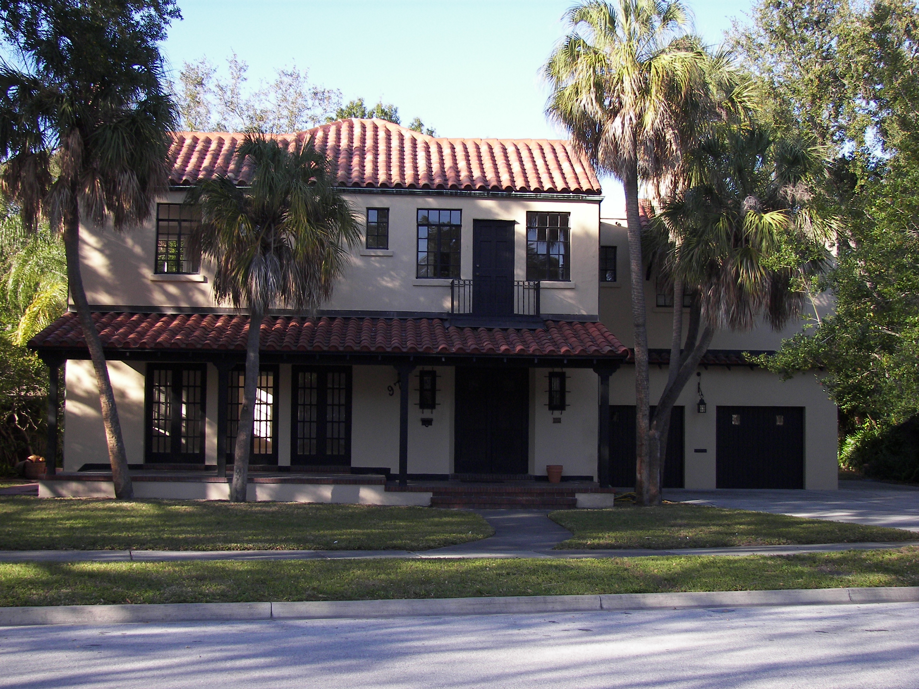
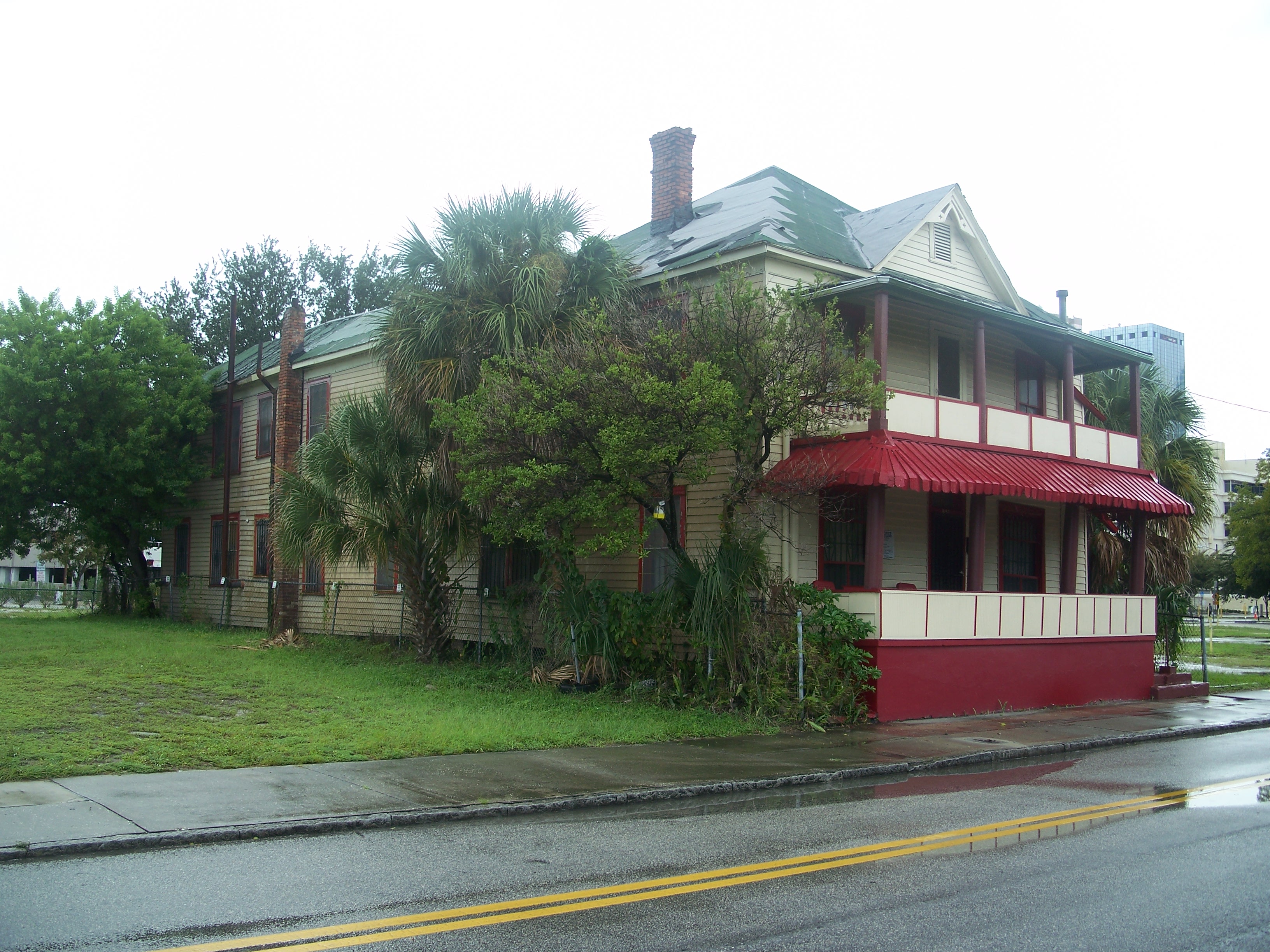
Hutchinson House |
|
01977-11-01November 1, 1977 |
304 Plant Avenue
27°56′28″N 82°27′46″W / 27.941111°N 82.462778°W / 27.941111; -82.462778 (Hutchinson House) |
Tampa |
|
| 45 |
Hyde Park Historic Districts |
|
01985-03-04March 4, 1985 |
Roughly bounded by the Hillsborough River and Bay, Howard Avenue, and Kennedy Boulevard
27°56′11″N 82°28′23″W / 27.936389°N 82.473056°W / 27.936389; -82.473056 (Hyde Park Historic Districts) |
Tampa |
|
| 46 |
Captain William Parker Jackson House |
|
02011-04-08April 8, 2011 |
800 E Lambright St
28°00′24″N 82°27′09″W / 28.006667°N 82.4525°W / 28.006667; -82.4525 (Captain William Parker Jackson House) |
Tampa |
|
| 47 |
Jackson Rooming House |
|
02007-03-07March 7, 2007 |
851 Zack Street
27°57′08″N 82°27′07″W / 27.952222°N 82.451944°W / 27.952222; -82.451944 (Jackson Rooming House) |
Tampa |
|
| 48 |
Johnson-Wolff House |
|
01974-07-24July 24, 1974 |
6823 South DeSoto Street
27°51′59″N 82°31′34″W / 27.866389°N 82.526111°W / 27.866389; -82.526111 (Johnson-Wolff House) |
Tampa |
|
| 49 |
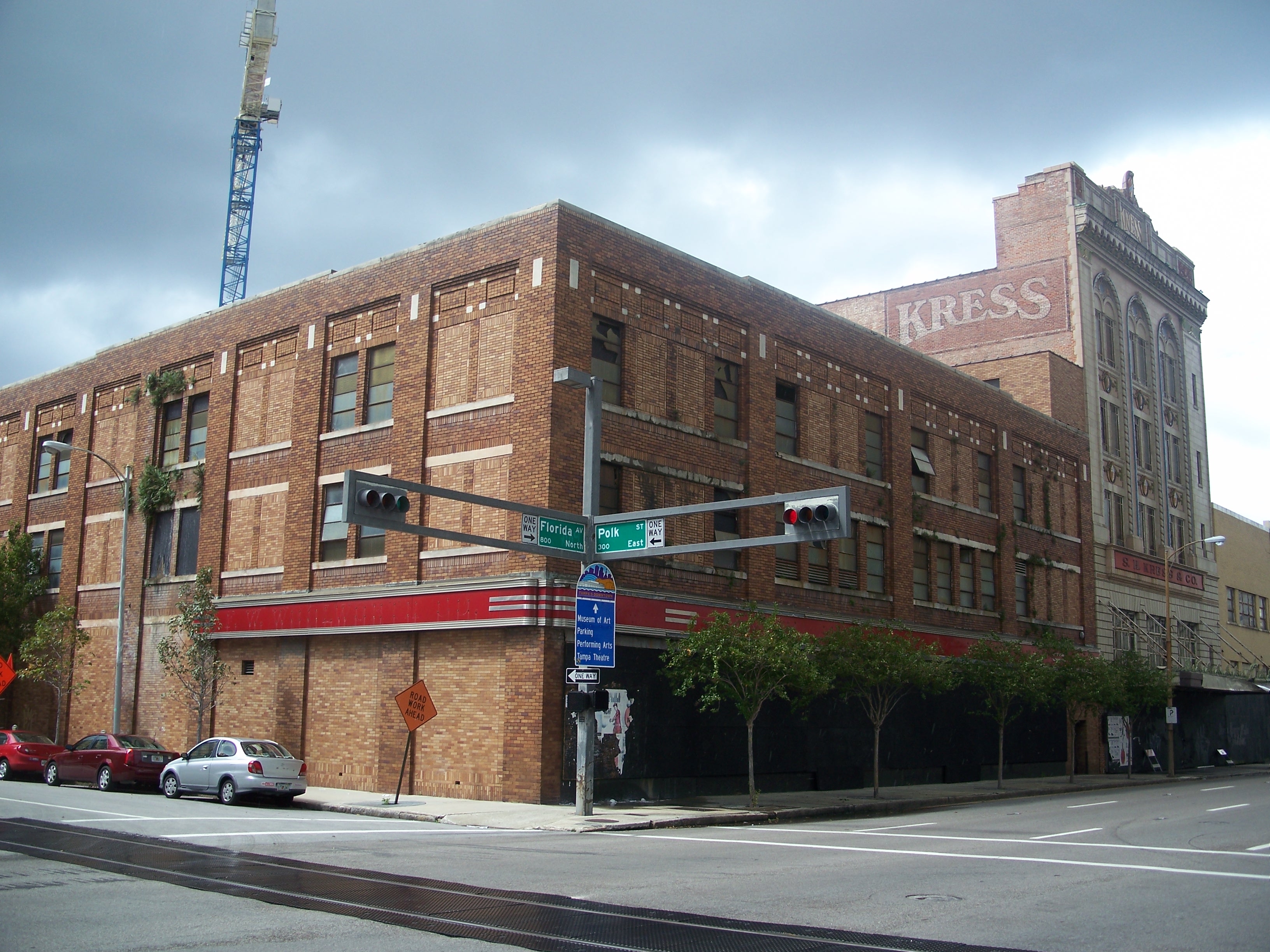
S. H. Kress and Co. Building |
|
01983-04-07April 7, 1983 |
811 North Franklin Street
27°57′03″N 82°27′34″W / 27.950833°N 82.459444°W / 27.950833; -82.459444 (S. H. Kress and Co. Building) |
Tampa |
|
| 50 |
A. M. Lamb House |
|
02007-10-12October 12, 2007 |
2410 West Shell Road
27°43′15″N 82°27′44″W / 27.720833°N 82.462222°W / 27.720833; -82.462222 (A. M. Lamb House) |
Ruskin |
|
| 51 |
LeClaire Apartments |
|
01988-11-16November 16, 1988 |
3013-3015 San Carlos
27°55′22″N 82°29′37″W / 27.922778°N 82.493611°W / 27.922778; -82.493611 (LeClaire Apartments) |
Tampa |
|
| 52 |
Leiman House |
|
01974-09-09September 9, 1974 |
716 South Newport Street
27°56′08″N 82°28′18″W / 27.935556°N 82.471667°W / 27.935556; -82.471667 (Leiman House) |
Tampa |
|
| 53 |
Masonic Temple No. 25 |
|
01986-09-11September 11, 1986 |
508 East Kennedy Boulevard
27°56′54″N 82°27′04″W / 27.948333°N 82.451111°W / 27.948333; -82.451111 (Masonic Temple No. 25) |
Tampa |
|
| 54 |
Meacham Elementary School |
|
02005-09-15September 15, 2005 |
1225 India Street
27°57′19″N 82°27′11″W / 27.955278°N 82.453056°W / 27.955278; -82.453056 (Meacham Elementary School) |
Tampa |
Part of the Florida's Historic Black Public Schools MPS. In 2007, the school building was demolished as part of a redevelopment project of the area.[5] |
| 55 |
George McA. Miller House |
|
01974-07-23July 23, 1974 |
508 Tamiami Trail
27°42′49″N 82°26′05″W / 27.713611°N 82.434722°W / 27.713611; -82.434722 (George McA. Miller House) |
Ruskin |
|
| 56 |
Moseley Homestead |
|
01985-01-31January 31, 1985 |
1820 West Brandon Boulevard
27°56′20″N 82°18′51″W / 27.938889°N 82.314167°W / 27.938889; -82.314167 (Moseley Homestead) |
Brandon |
|
| 57 |
North Franklin Street Historic District |
|
02002-03-28March 28, 2002 |
Roughly bounded by Florida Avenue and East Fortune, Tampa, Franklin, and East Harrison Streets
27°57′15″N 82°27′37″W / 27.954167°N 82.460278°W / 27.954167; -82.460278 (North Franklin Street Historic District) |
Tampa |
|
| 58 |
North Plant City Residential District |
|
01993-05-27May 27, 1993 |
Bounded by Herring, Wheeler, Tever, and Palmer Streets
28°01′16″N 82°07′31″W / 28.021111°N 82.125278°W / 28.021111; -82.125278 (North Plant City Residential District) |
Plant City |
|
| 59 |
Old Hillsborough County High School |
|
02007-05-15May 15, 2007 |
2704 North Highland Avenue
27°58′05″N 82°27′47″W / 27.968056°N 82.463056°W / 27.968056; -82.463056 (Old Hillsborough County High School) |
Tampa |
|
| 60 |
Old Lutz Elementary School |
|
01996-08-15August 15, 1996 |
18819 U.S. Route 41, North
28°08′51″N 82°27′43″W / 28.1475°N 82.461944°W / 28.1475; -82.461944 (Old Lutz Elementary School) |
Lutz |
|
| 61 |
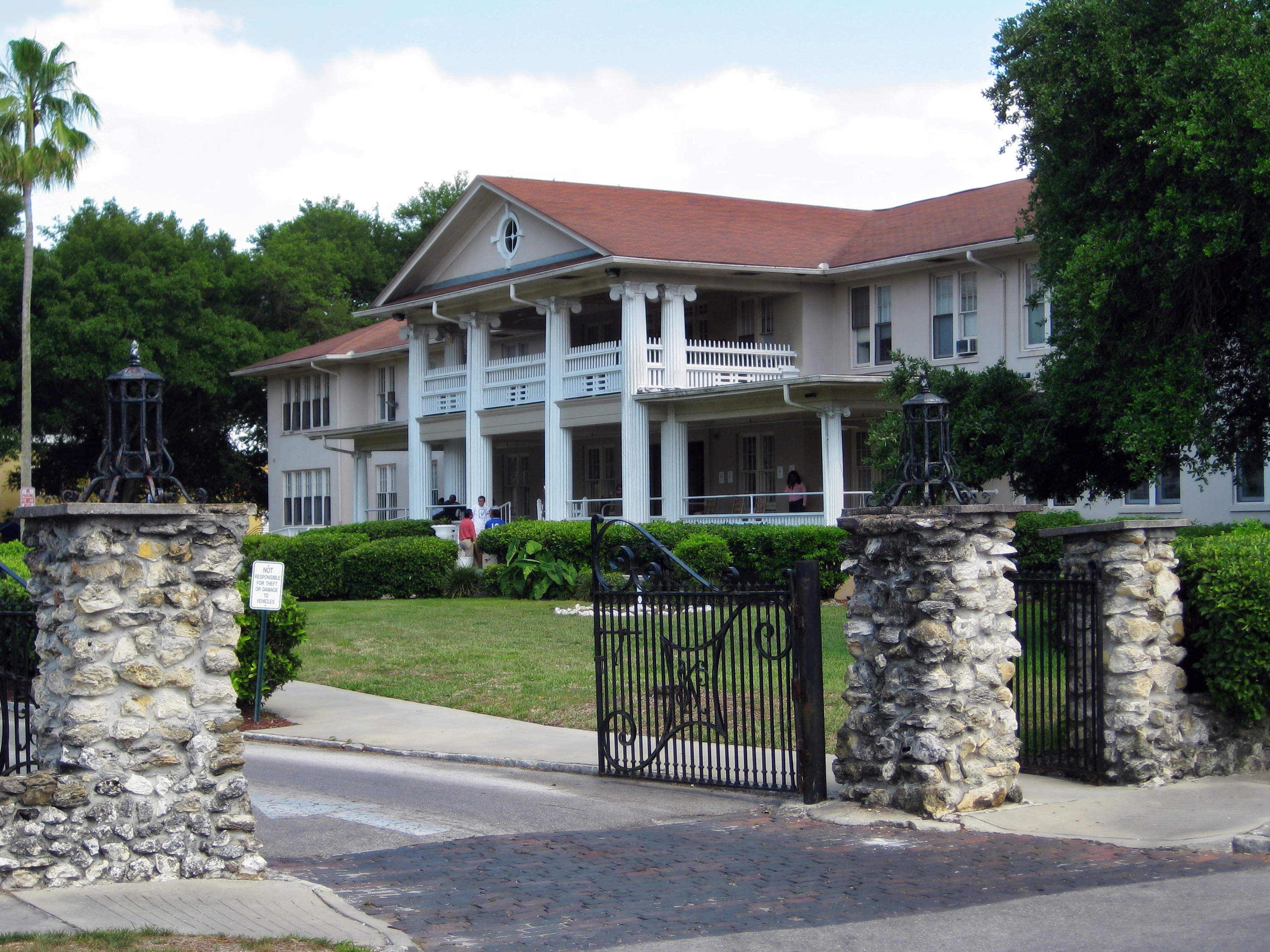
Old People's Home |
|
02000-10-17October 17, 2000 |
1203 East 22nd Avenue
27°57′41″N 82°26′48″W / 27.961389°N 82.446667°W / 27.961389; -82.446667 (Old People's Home) |
Tampa |
|
| 62 |
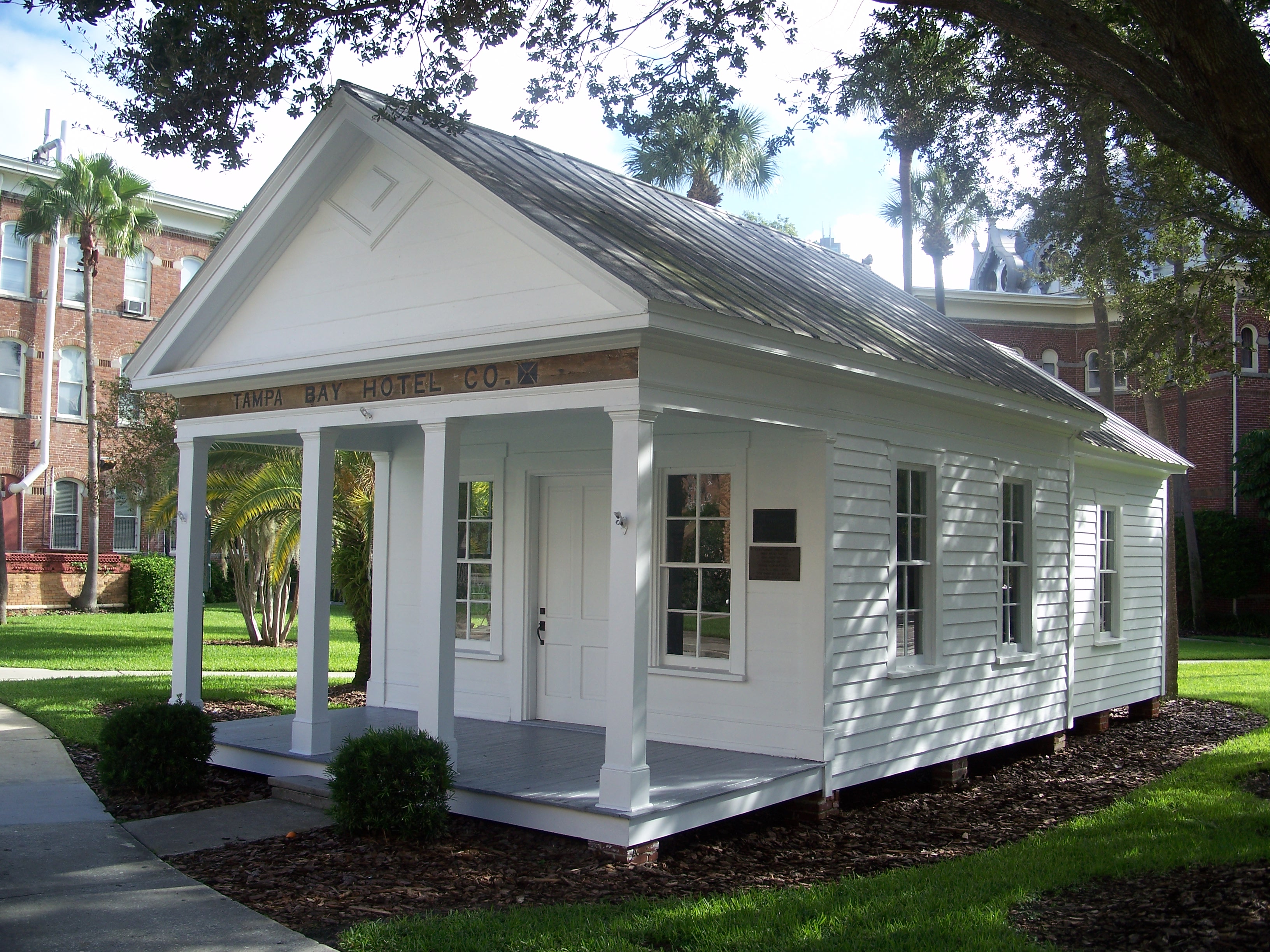
Old School House |
|
01974-12-04December 4, 1974 |
Lafayette Street on the University of Tampa campus
27°56′48″N 82°27′55″W / 27.946667°N 82.465278°W / 27.946667; -82.465278 (Old School House) |
Tampa |
|
| 63 |
Old Tampa Children's Home |
|
01999-07-22July 22, 1999 |
3302 North Tampa Avenue
27°58′27″N 82°27′35″W / 27.974167°N 82.459722°W / 27.974167; -82.459722 (Old Tampa Children's Home) |
Tampa |
|
| 64 |
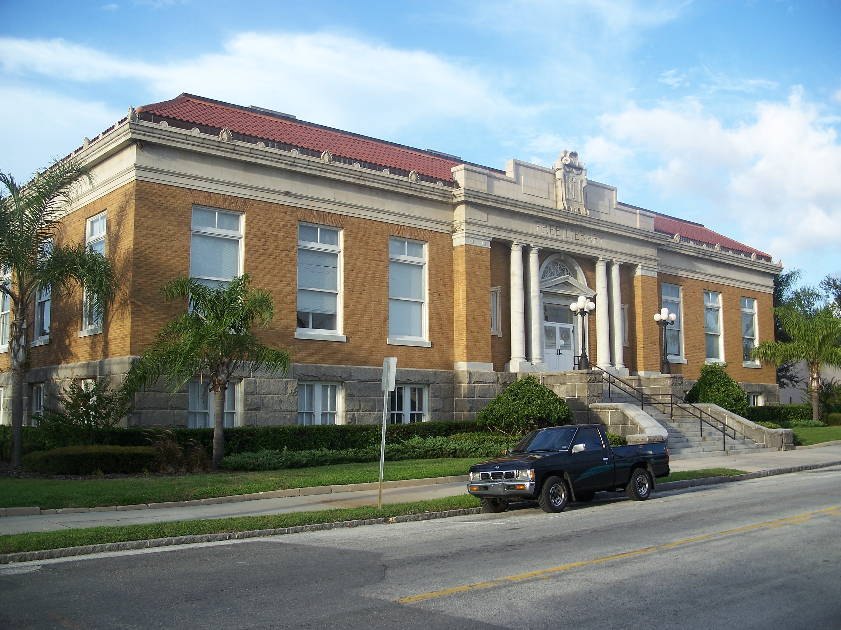
Old Tampa Free Public Library |
|
01991-05-16May 16, 1991 |
102 East Seventh Avenue
27°57′37″N 82°27′38″W / 27.960278°N 82.460556°W / 27.960278; -82.460556 (Old Tampa Free Public Library) |
Tampa |
|
| 65 |
Old Union Depot Hotel |
|
02000-12-11December 11, 2000 |
858 East Zack Street
27°57′10″N 82°27′05″W / 27.952778°N 82.451389°W / 27.952778; -82.451389 (Old Union Depot Hotel) |
Tampa |
Demolished[6] |
| 66 |
Palace of Florence Apartments |
|
01989-08-03August 3, 1989 |
45 East Davis Boulevard
27°56′02″N 82°27′28″W / 27.933889°N 82.457778°W / 27.933889; -82.457778 (Palace of Florence Apartments) |
Tampa |
Part of the Mediterranean Revival Style Buildings of Davis Islands MPS |
| 67 |
Palmerin Hotel |
|
01989-08-03August 3, 1989 |
115 East Davis Boulevard
27°55′46″N 82°27′22″W / 27.929444°N 82.456111°W / 27.929444; -82.456111 (Palmerin Hotel) |
Tampa |
Part of the Mediterranean Revival Style Buildings of Davis Islands MPS |
| 68 |
Plant City High School |
|
01981-02-04February 4, 1981 |
North Collins Street
28°01′09″N 82°07′36″W / 28.019167°N 82.126667°W / 28.019167; -82.126667 (Plant City High School) |
Plant City |
|
| 69 |
Plant City Union Depot |
|
01975-04-14April 14, 1975 |
East North Drane Street
28°00′55″N 82°07′18″W / 28.015278°N 82.121667°W / 28.015278; -82.121667 (Plant City Union Depot) |
Plant City |
|
| 70 |
Horace T. Robles House |
|
02006-03-02March 2, 2006 |
2604 East Hanna Avenue
28°00′13″N 82°25′48″W / 28.003611°N 82.43°W / 28.003611; -82.43 (Horace T. Robles House) |
Tampa |
|
| 71 |
Roosevelt Elementary School |
|
02006-05-31May 31, 2006 |
3205 South Ferdinand Avenue
27°54′59″N 82°29′52″W / 27.916389°N 82.497778°W / 27.916389; -82.497778 (Roosevelt Elementary School) |
Tampa |
|
| 72 |
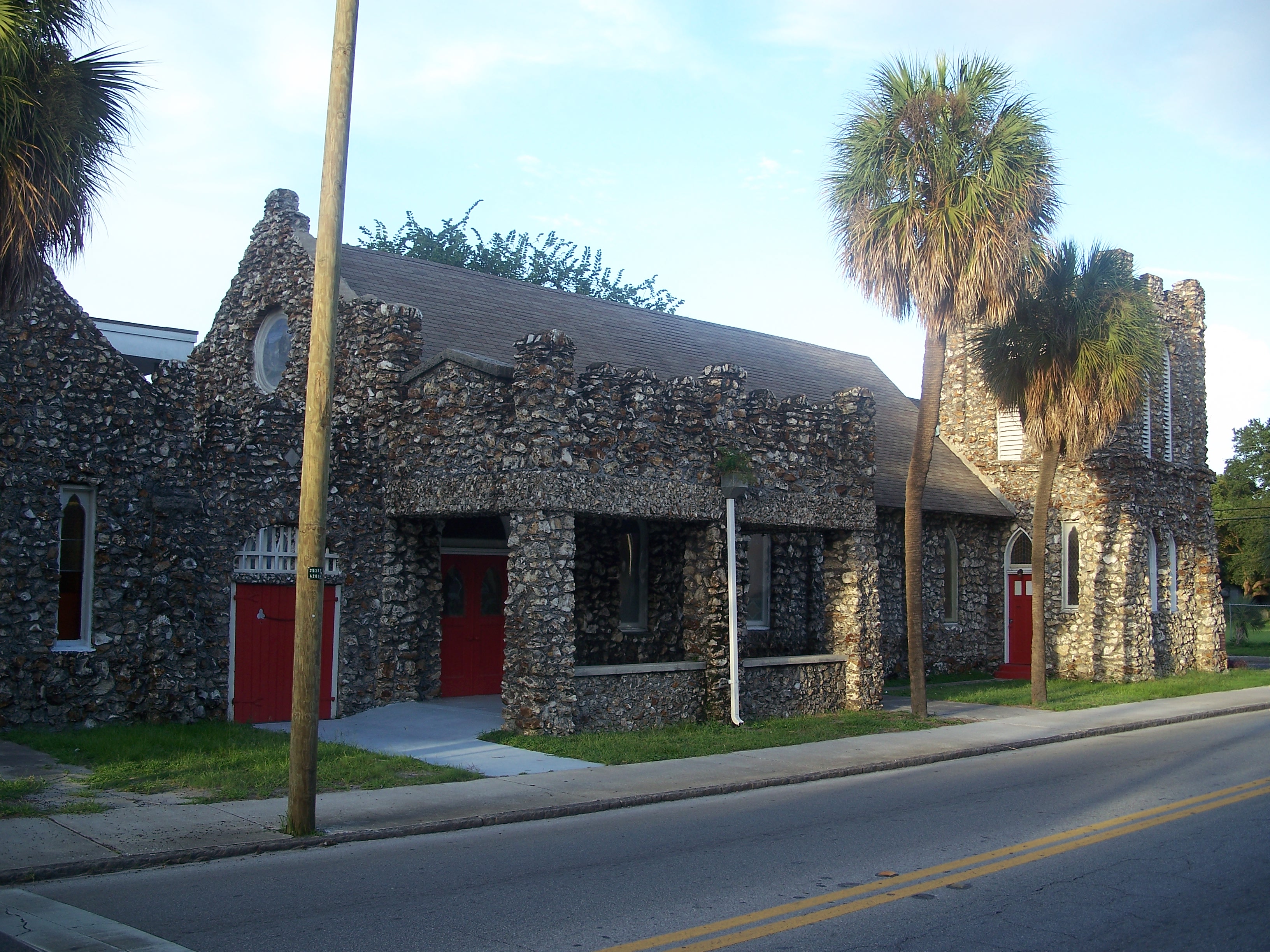
St. Andrews Episcopal Church |
|
02009-04-15April 15, 2009 |
505 N. Marion St.
27°56′58″N 82°27′24″W / 27.949392°N 82.456739°W / 27.949392; -82.456739 (St. Andrews Episcopal Church) |
Tampa |
|
| 73 |
Seminole Heights Residential District |
|
01993-08-05August 5, 1993 |
Roughly bounded by Osborne, Florida, Hanna, and Cherokee Avenues
27°59′45″N 82°27′25″W / 27.995833°N 82.456944°W / 27.995833; -82.456944 (Seminole Heights Residential District) |
Tampa |
|
| 74 |
Spanish Apartments |
|
01989-08-03August 3, 1989 |
16 East Davis Boulevard
27°56′08″N 82°27′35″W / 27.935556°N 82.459722°W / 27.935556; -82.459722 (Spanish Apartments) |
Tampa |
Part of the Mediterranean Revival Style Buildings of Davis Islands MPS |
| 75 |
SS AMERICAN VICTORY (Victory ship) |
|
02002-02-04February 4, 2002 |
705 Channelside Dr., Berth 271
27°56′42″N 82°26′39″W / 27.945°N 82.444167°W / 27.945; -82.444167 (SS AMERICAN VICTORY (Victory ship)) |
Tampa |
|
| 76 |
Standard Oil Service Station |
|
01996-09-06September 6, 1996 |
1111 North Wheeler Street
28°01′29″N 82°07′35″W / 28.024722°N 82.126389°W / 28.024722; -82.126389 (Standard Oil Service Station) |
Plant City |
|
| 77 |
Stovall House |
|
01974-09-04September 4, 1974 |
4621 Bayshore Boulevard
27°53′47″N 82°29′24″W / 27.896389°N 82.49°W / 27.896389; -82.49 (Stovall House) |
Tampa |
|
| 78 |
T. C. Taliaferro House |
|
01974-10-01October 1, 1974 |
305 South Hyde Park
27°56′28″N 82°27′52″W / 27.941111°N 82.464444°W / 27.941111; -82.464444 (T. C. Taliaferro House) |
Tampa |
|
| 79 |
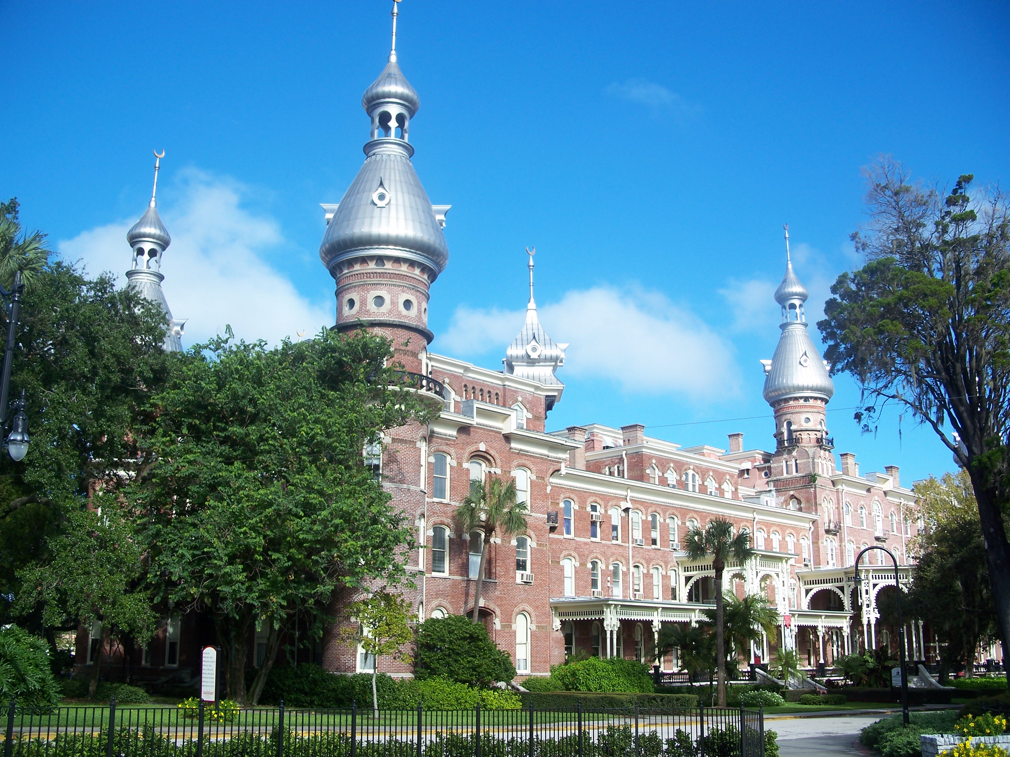
Tampa Bay Hotel |
|
01972-12-05December 5, 1972 |
401 West Kennedy Boulevard
27°56′46″N 82°27′51″W / 27.946111°N 82.464167°W / 27.946111; -82.464167 (Tampa Bay Hotel) |
Tampa |
|
| 80 |
Tampa City Hall |
|
01974-10-01October 1, 1974 |
315 John F. Kennedy Boulevard, East
27°56′50″N 82°27′27″W / 27.947222°N 82.4575°W / 27.947222; -82.4575 (Tampa City Hall) |
Tampa |
|
| 81 |
Tampa Heights Historic District |
|
01995-08-04August 4, 1995 |
Roughly bounded by Adalee Street, Interstate 275, 7th Avenue, and North Tampa Avenue
27°57′54″N 82°27′27″W / 27.965°N 82.4575°W / 27.965; -82.4575 (Tampa Heights Historic District) |
Tampa |
|
| 82 |
Tampa Theatre |
|
01978-01-03January 3, 1978 |
711 Franklin Street
27°57′00″N 82°27′32″W / 27.95°N 82.458889°W / 27.95; -82.458889 (Tampa Theatre) |
Tampa |
|
| 83 |
Tampania House |
|
01985-09-12September 12, 1985 |
4611 North A Street
27°56′45″N 82°30′19″W / 27.945833°N 82.505278°W / 27.945833; -82.505278 (Tampania House) |
Tampa |
|
| 84 |
Union Railroad Station |
|
01974-06-05June 5, 1974 |
601 North Nebraska Street
27°57′08″N 82°27′04″W / 27.952222°N 82.451111°W / 27.952222; -82.451111 (Union Railroad Station) |
Tampa |
|
| 85 |
Upper North Franklin Street Commercial District |
|
02010-06-09June 9, 2010 |
Bounded by E Oak Ave, N Florida Ave, Kay St, and N Tampa St
27°57′34″N 82°27′37″W / 27.959444°N 82.460278°W / 27.959444; -82.460278 (Upper North Franklin Street Commercial District) |
Tampa |
|
| 86 |
Upper Tampa Bay Archeological District |
|
01985-12-10December 10, 1985 |
Address Restricted
28°00′48″N 82°38′05″W / 28.013333°N 82.634722°W / 28.013333; -82.634722 (Upper Tampa Bay Archeological District) |
Tampa |
|
| 87 |
West Tampa Historic District |
|
01983-10-18October 18, 1983 |
Roughly bounded by Cypress and Ivy Streets, Fremont and Habana Avenues
27°57′34″N 82°29′02″W / 27.959444°N 82.483889°W / 27.959444; -82.483889 (West Tampa Historic District) |
Tampa |
|
| 88 |
Ybor City Historic District |
|
01974-08-28August 28, 1974 |
Roughly bounded by 6th Avenue, 13th Street, 10th Avenue and 22nd Street, East Broadway between 13th and 22nd Streets
27°57′45″N 82°26′28″W / 27.9625°N 82.441111°W / 27.9625; -82.441111 (Ybor City Historic District) |
Tampa |
|
| 89 |
Ybor Factory Building |
|
01972-11-15November 15, 1972 |
7th Avenue between 13th and 14th Streets
27°57′38″N 82°26′43″W / 27.960556°N 82.445278°W / 27.960556; -82.445278 (Ybor Factory Building) |
Tampa |
|
 Location of Hillsborough County in Florida