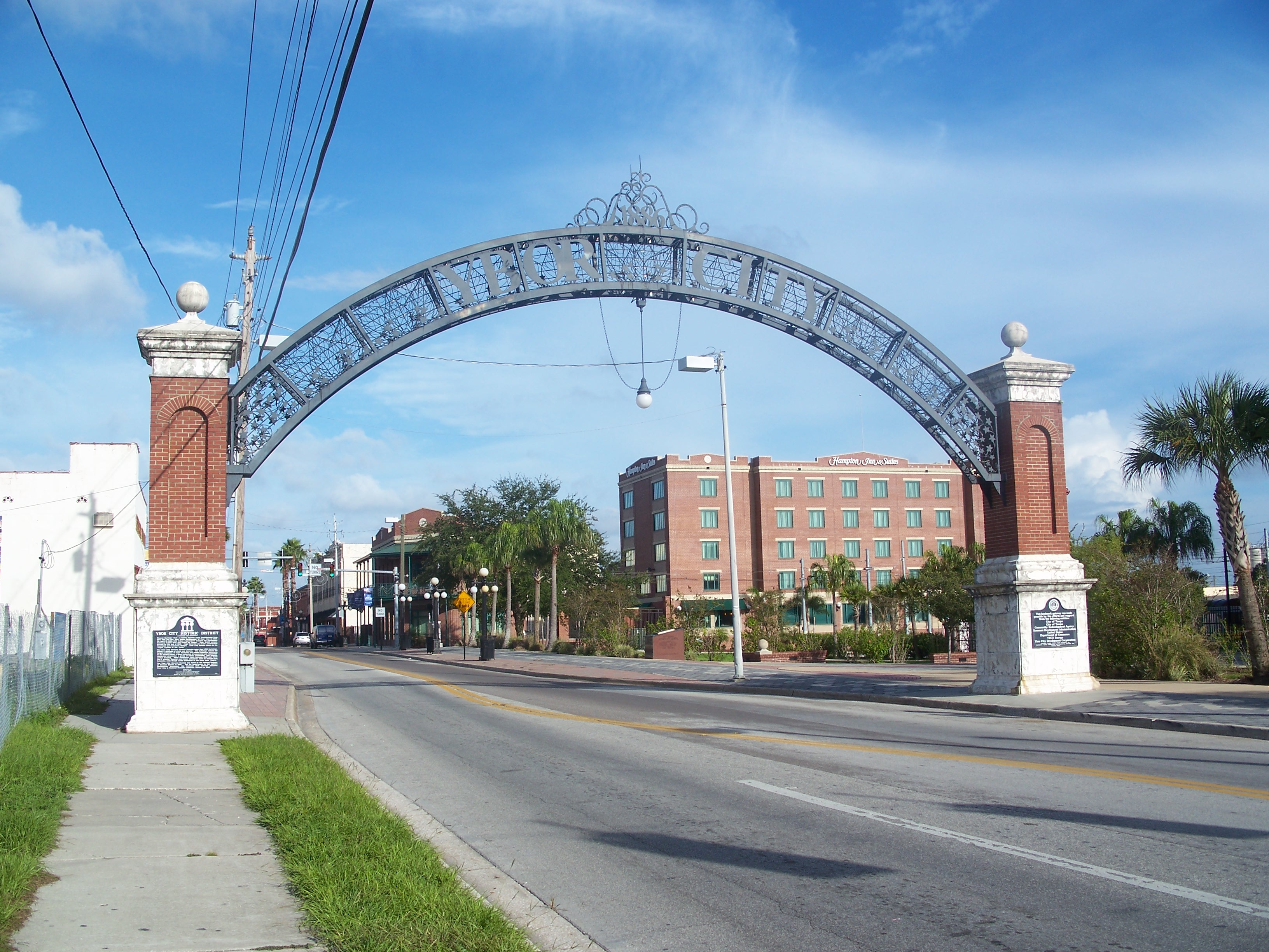
Ybor City Historic District
- Ybor City Historic District
Infobox nrhp2
name = Ybor City Historic District
nhld = yes
boxwidth = 270px

imagesize = 270px
caption = Western entrance gate into Ybor City
location = Tampa, Florida
mapcaption = Ybor City in Florida
mapwidth = 170
locmapin = Florida
lat_degrees = 27.965
lat_minutes = 0
lat_direction = N
long_degrees = 82.435
long_minutes = 0
long_direction = W
area = convert|3690|acre|km2|lk=on[cite web|url=http://www.nationalregisterofhistoricplaces.com/FL/Hillsborough/districts.html|title=National Register of Historical Places - Florida (FL), Hillsborough County|date=2007-09-22|work=National Register of Historic Places|publisher=National Park Service] ]
designated_nhl = December 14, 1990[ [http://tps.cr.nps.gov/nhl/detail.cfm?ResourceId=1427&ResourceType=District Ybor City Historic District] at [http://tps.cr.nps.gov/nhl National Historic Landmarks Program] ] ]
added = August 28, 1974
refnum = 72000322
visitation_num =
visitation_year =
governing_body = PrivateThe Ybor City Historic District [pronounce [The name "Ybor" is pronounced "ee-bohr" (evenly).] ] is a U.S. National Historic Landmark District (designated as such on August 28, 1974) located in Tampa, Florida. The district is bounded by 6th Avenue, 13th Street, 10th Avenue and 22nd Street, East Broadway between 13th and 22nd Streets.
Ybor City contains a total of 956 historic buildings.
The Ybor City Museum State Park is part of the district.
ee also
* Ybor City, Tampa, Florida
* Tampa, Florida
Notes
External links
* [http://www.tampagov.net/dept_Historic_Preservation/files/maps/yborhist_exp_12-10-01ri.pdf Map of Ybor City Historic District]
Wikimedia Foundation.
2010.
Look at other dictionaries:
Ybor City — Neighborhood Centro Ybor complex with a TECO Line car passing in front Nickname(s) … Wikipedia
Ybor City, Tampa, Florida — Infobox Settlement official name = Ybor City nickname = Florida s Latin Quarter image caption = Centro Ybor complex with a TECO Line car passing in front settlement type = Neighborhood subdivision type = Country subdivision type1 = State… … Wikipedia
Ybor City — 27° 57′ 23″ N 82° 26′ 04″ W / 27.9564, 82.4344 … Wikipédia en Français
Ybor City Museum State Park — Infobox protected area | name = Ybor City Museum State Park iucn category = V caption = location = Hillsborough County, Florida, USA nearest city = Tampa, Florida lat degrees = 27 lat minutes = 57 lat seconds = 40 lat direction = N long degrees … Wikipedia
National Register of Historic Places listings in Hillsborough County, Florida — Location of Hillsborough County in Florida This is a list of the National Register of Historic Places listings in Hillsborough County, Florida. This is intended to be a complete list of the properties and districts on the National Register of… … Wikipedia
Liste des National Historic Landmarks de Floride — … Wikipédia en Français
Liste der National Historic Landmarks in Florida — Die Liste der National Historic Landmarks in Florida führt alle Objekte und Stätten im US amerikanischen Bundesstaat Florida auf, die vom National Register of Historic Places zur National Historic Landmark erklärt wurden. Liste In Florida gibt es … Deutsch Wikipedia
Channel District — Coordinates: 27°56′51″N 82°26′38″W / 27.9476089°N 82.4438019°W / 27.9476089; 82.4438019 … Wikipedia
East Ybor, Tampa, Florida — This article is about a residential neighborhood. For the historic district to the west, please see Ybor City, Tampa, Florida. East Ybor is a neighborhood within the city limits of Tampa, Florida. As of the 2000 census the neighborhood had a… … Wikipedia
V.M. Ybor, Tampa, Florida — This article is about a residential neighborhood. For the historic district to the south, please see Ybor City, Tampa, Florida. V.M. Ybor is a neighborhood within the city limits of Tampa, Florida. As of the 2000 census the neighborhood had a… … Wikipedia

