- Valrico, Florida
Infobox Settlement
official_name = Valrico, Florida
other_name =
native_name =
nickname =
settlement_type = CDP
motto =
imagesize =
image_caption =
flag_size =
image_
seal_size =
image_shield =
shield_size =
image_blank_emblem =
blank_emblem_type =
blank_emblem_size =
imagesize =
image_caption =
flag_size =
image_
seal_size =
image_shield =
shield_size =
image_blank_emblem =
blank_emblem_type =
blank_emblem_size =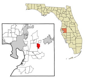
mapsize = 250x200px
map_caption = Location in Hillsborough County and the state ofFlorida
mapsize1 =
map_caption1 =
image_dot_
dot_mapsize =
dot_map_caption =
dot_x =
dot_y =
pushpin_
pushpin_label_position =
pushpin_map_caption =
pushpin_mapsize =
subdivision_type = Country
subdivision_name = flag|United States
subdivision_type1 = State
subdivision_name1 = flag|Florida
subdivision_type2 = County
subdivision_name2 = noflag|Hillsborough
subdivision_type3 =
subdivision_name3 =
subdivision_type4 =
subdivision_name4 =
government_footnotes =
government_type =
leader_title =
leader_name =
leader_title1 =
leader_name1 =
leader_title2 =
leader_name2 =
leader_title3 =
leader_name3 =
leader_title4 =
leader_name4 =
established_title =
established_date =
established_title2 =
established_date2 =
established_title3 =
established_date3 =
area_magnitude =
unit_pref = Imperial
area_footnotes =
area_total_km2 = 14.7
area_land_km2 = 14.5
area_water_km2 = 0.2
area_total_sq_mi = 5.7
area_land_sq_mi = 5.6
area_water_sq_mi = 0.1
area_water_percent =
area_urban_km2 =
area_urban_sq_mi =
area_metro_km2 =
area_metro_sq_mi =
area_blank1_title =
area_blank1_km2 =
area_blank1_sq_mi =
population_as_of = 2000
population_footnotes =
population_note =
population_total = 6582
population_density_km2 = 447.8
population_density_sq_mi = 1154.7
population_metro =
population_density_metro_km2 =
population_density_metro_sq_mi =
population_urban =
population_density_urban_km2 =
population_density_urban_sq_mi =
population_blank1_title =
population_blank1 =
population_density_blank1_km2 =
population_density_blank1_sq_mi =
timezone = Eastern (EST)
utc_offset = -5
timezone_DST = EDT
utc_offset_DST = -4
latd = 27 |latm = 56 |lats = 27 |latNS = N
longd = 82 |longm = 14 |longs = 33 |longEW = W
elevation_footnotes =
elevation_m = 17
elevation_ft = 56
postal_code_type =ZIP code s
postal_code = 33594-33596
area_code = 813
blank_name = FIPS code
blank_info = 12-73700GR|2
blank1_name = GNIS feature ID
blank1_info = 0292725GR|3
website =
footnotes =Valrico is an unincorporated
census-designated place in Hillsborough County,Florida ,United States . The population was 6,582 at the 2000 census.History
Valrico began as a region of
cotton plantations known as Long Pond. The arrival of the Florida Central and Peninsular Railroad in1890 brought many new immigrants from points north. William G. Tousey, aphilosophy professor fromTufts College , gave the community its current name, Spanish for "rich valley".Geography
Valrico is located at coor dms|27|56|27|N|82|14|33|W|city (27.940774, -82.242551)GR|1.
According to the
United States Census Bureau , the community has a total area of 5.7square mile s (14.7km² ), of which, 5.6 square miles (14.5 km²) of it is land and 0.1 square miles (0.2 km²) of it (1.41%) is water.Demographics
As of the
census GR|2 of 2000, there were 6,582 people, 2,632 households, and 1,826 families residing in the community. Thepopulation density was 1,176.9 people per square mile (454.6/km²). There were 2,831 housing units at an average density of 506.2/sq mi (195.5/km²). The racial makeup of the community was 89.32% White, 3.21% African American, 0.49% Native American, 1.47% Asian, 3.57% from other races, and 1.94% from two or more races. Hispanic or Latino of any race were 12.82% of the population.There were 2,632 households out of which 29.4% had children under the age of 18 living with them, 57.0% were married couples living together, 8.4% had a female householder with no husband present, and 30.6% were non-families. 25.8% of all households were made up of individuals and 14.4% had someone living alone who was 65 years of age or older. The average household size was 2.49 and the average family size was 2.99.
In the community the population was spread out with 24.2% under the age of 18, 6.5% from 18 to 24, 29.1% from 25 to 44, 22.5% from 45 to 64, and 17.7% who were 65 years of age or older. The median age was 39 years. For every 100 females there were 95.0 males. For every 100 females age 18 and over, there were 93.1 males.
The median income for a household in the community was $39,155, and the median income for a family was $55,475. About 3.8% of families and 7.5% of the population were below the
poverty line , including 7.3% of those under age 18 and 8.4% of those age 65 or over.Education
Valrico is served by: [http://fl.localschooldirectory.com/schools.php/cPath/3068]
*Alafia Elementary School
*Bloomingdale High School
*Buckhorn Elementary School
*Cimino Elementary School
*Lithia Springs Elementary School
*Mulrennan Middle School
*Valrico Elementary SchoolReferences
External links
* [http://www.city-data.com/city/Valrico-Florida.html Valrico's profile from city-data.com]
Wikimedia Foundation. 2010.