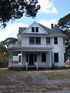
National Register of Historic Places listings in Brevard County, Florida

National Register of Historic Places listings in Brevard County, Florida
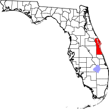
Location of Brevard County in Florida

This is a list of the National Register of Historic Places listings in Brevard County, Florida.

This is intended to be a complete list of the properties and districts on the National Register of Historic Places in Brevard County, Florida, United States. The locations of National Register properties and districts for which the latitude and longitude coordinates are included below, may be seen in a Google map.[1]

There are 41 properties and districts listed on the National Register in the county, including 2 National Historic Landmarks.

This National Park Service list is complete through NPS recent listings posted November 10, 2011.[2]


Contents: Counties in Florida   (non-linked contain no National Register listings)
Alachua - Baker - Bay - Bradford - Brevard - Broward - Calhoun - Charlotte - Citrus - Clay - Collier - Columbia - DeSoto - Dixie - Duval - Escambia - Flagler - Franklin - Gadsden - Gilchrist - Glades - Gulf - Hamilton - Hardee - Hendry - Hernando - Highlands - Hillsborough - Holmes - Indian River - Jackson - Jefferson - Lafayette - Lake - Lee - Leon - Levy - Liberty - Madison - Manatee - Marion - Martin - Miami-Dade - Monroe - Nassau - Okaloosa - Okeechobee - Orange - Osceola - Palm Beach - Pasco - Pinellas - Polk - Putnam - Santa Rosa - Sarasota - Seminole - St. Johns - St. Lucie - Sumter - Suwannee - Taylor - Union - Volusia - Wakulla - Walton - Washington


Current listings

[3] Landmark name [4] Image Date listed Location City or town Summary
1 Aladdin Theater
Aladdin Theater
01991-10-17October 17, 1991 300 Brevard Avenue
28°21′19″N 80°43′35″W / 28.355278°N 80.726389°W / 28.355278; -80.726389 (Aladdin Theater)
Cocoa
2 Barton Avenue Residential District
Barton Avenue Residential District
01992-08-21August 21, 1992 11-59 Barton Avenue
28°20′N 80°43′W / 28.33°N 80.72°W / 28.33; -80.72 (Barton Avenue Residential District)
Rockledge
3 Cape Canaveral Air Force Station
Cape Canaveral Air Force Station
01984-04-16April 16, 1984 Launch Pads 5, 6, 13, 14, 19, 26, 34, and Mission Control Center (demolished in 2010)
28°28′26″N 80°34′28″W / 28.473889°N 80.574444°W / 28.473889; -80.574444 (Cape Canaveral Air Force Station)
Cocoa
4 Central Instrumentation Facility
Central Instrumentation Facility
02000-01-21January 21, 2000 Kennedy Space Center
28°31′27″N 80°39′22″W / 28.524167°N 80.656111°W / 28.524167; -80.656111 (Central Instrumentation Facility)
Merritt Island
5 City Point Community Church
City Point Community Church
01995-06-20June 20, 1995 3783 North Indian River Drive
28°25′23″N 80°45′11″W / 28.423056°N 80.753056°W / 28.423056; -80.753056 (City Point Community Church)
Cocoa
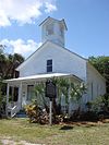
6 Community Chapel of Melbourne Beach
Community Chapel of Melbourne Beach
01992-05-14May 14, 1992 501 Ocean Avenue
28°04′06″N 80°33′49″W / 28.068333°N 80.563611°W / 28.068333; -80.563611 (Community Chapel of Melbourne Beach)
Melbourne Beach
7 Crawlerway
Crawlerway
02000-01-21January 21, 2000 Kennedy Space Center
28°36′13″N 80°37′39″W / 28.603611°N 80.6275°W / 28.603611; -80.6275 (Crawlerway)
Merritt Island
8 J. R. Field Homestead
J. R. Field Homestead
01997-09-11September 11, 1997 750 Field Manor Drive
28°23′53″N 80°43′00″W / 28.398056°N 80.716667°W / 28.398056; -80.716667 (J. R. Field Homestead)
Indianola
9 Florida Power and Light Company Ice Plant
Florida Power and Light Company Ice Plant
01982-11-17November 17, 1982 1604 South Harbor City Boulevard
28°34′13″N 80°36′15″W / 28.570278°N 80.604167°W / 28.570278; -80.604167 (Florida Power and Light Company Ice Plant)
Melbourne
10 William H. Gleason House
William H. Gleason House
01997-01-25January 25, 1997 1736 Pineapple Avenue
28°08′06″N 80°37′45″W / 28.135°N 80.629167°W / 28.135; -80.629167 (William H. Gleason House)
Melbourne
11 Headquarters Building
Headquarters Building
02000-12-01December 1, 2000 Kennedy Space Center
28°31′27″N 80°39′04″W / 28.524167°N 80.651111°W / 28.524167; -80.651111 (Headquarters Building)
Merritt Island
12 Dr. George E. Hill House
Dr. George E. Hill House
01994-03-03March 3, 1994 870 Indianola Drive
28°23′45″N 80°43′09″W / 28.395833°N 80.719167°W / 28.395833; -80.719167 (Dr. George E. Hill House)
Merritt Island
13 Hotel Mims
Hotel Mims
01995-07-28July 28, 1995 3202 State Road 46
28°39′54″N 80°50′46″W / 28.665°N 80.846111°W / 28.665; -80.846111 (Hotel Mims)
Mims
14 Indian Fields
Indian Fields
01994-04-14April 14, 1994 Address Restricted
Titusville
15 Jorgensen's General Store
Jorgensen's General Store
01999-06-25June 25, 1999 5390 U.S. Route 1
27°55′44″N 80°31′38″W / 27.928889°N 80.527222°W / 27.928889; -80.527222 (Jorgensen's General Store)
Grant-Valkaria
16 La Grange Church and Cemetery
La Grange Church and Cemetery
01995-12-07December 7, 1995 1575 Old Dixie Highway
28°38′23″N 80°49′39″W / 28.639722°N 80.8275°W / 28.639722; -80.8275 (La Grange Church and Cemetery)
Titusville
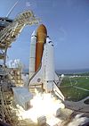
17 Launch Complex 39
Launch Complex 39
01973-05-24May 24, 1973 Kennedy Space Center
28°36′08″N 80°37′43″W / 28.602222°N 80.628611°W / 28.602222; -80.628611 (Launch Complex 39)
Titusville
18 Launch Complex 39-Pad A
Launch Complex 39-Pad A
02000-01-21January 21, 2000 Kennedy Space Center
28°36′29″N 80°36′16″W / 28.608056°N 80.604444°W / 28.608056; -80.604444 (Launch Complex 39-Pad A)
Merritt Island
19 Launch Complex 39-Pad B
Launch Complex 39-Pad B
02000-01-21January 21, 2000 Kennedy Space Center
28°37′37″N 80°37′16″W / 28.626944°N 80.621111°W / 28.626944; -80.621111 (Launch Complex 39-Pad B)
Merritt Island
20 Launch Control Center
Launch Control Center
02000-01-21January 21, 2000 Kennedy Space Center
28°35′07″N 80°38′59″W / 28.585278°N 80.649722°W / 28.585278; -80.649722 (Launch Control Center)
Merritt Island
21 Melbourne Beach Pier
Melbourne Beach Pier
01984-04-12April 12, 1984 Ocean Avenue and Riverside Drive
28°04′05″N 80°34′05″W / 28.068056°N 80.568056°W / 28.068056; -80.568056 (Melbourne Beach Pier)
Melbourne Beach
22 Missile Crawler Transporter Facilities
Missile Crawler Transporter Facilities
02000-01-21January 21, 2000 Kennedy Space Center
Merritt Island
23 Old Haulover Canal
Old Haulover Canal
01978-12-19December 19, 1978 Address Restricted
28°44′11″N 80°45′17″W / 28.736389°N 80.754722°W / 28.736389; -80.754722 (Old Haulover Canal)
Merritt Island
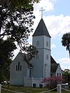
24 Old St. Luke's Episcopal Church and Cemetery
Old St. Luke's Episcopal Church and Cemetery
01990-06-15June 15, 1990 5555 North Tropical Trail
28°27′26″N 80°43′03″W / 28.457222°N 80.7175°W / 28.457222; -80.7175 (Old St. Luke's Episcopal Church and Cemetery)
Courtenay
25 Operations and Checkout Building
Operations and Checkout Building
02000-01-21January 21, 2000 Kennedy Space Center
28°31′25″N 80°38′47″W / 28.523611°N 80.646389°W / 28.523611; -80.646389 (Operations and Checkout Building)
Merritt Island
26 Persimmon Mound
Persimmon Mound
01994-04-14April 14, 1994 Address Restricted
Rockledge
27 Porcher House
Porcher House
01986-01-06January 6, 1986 434 Delannoy Avenue
28°21′45″N 80°43′32″W / 28.3625°N 80.725556°W / 28.3625; -80.725556 (Porcher House)
Cocoa
28 Press Site–Clock and Flag Pole
Press Site–Clock and Flag Pole
02000-01-21January 21, 2000 Kennedy Space Center
28°34′56″N 80°38′44″W / 28.582222°N 80.645556°W / 28.582222; -80.645556 (Press Site–Clock and Flag Pole)
Merritt Island
29 Pritchard House
Pritchard House
01990-01-12January 12, 1990 424 South Washington Avenue
28°36′37″N 80°48′28″W / 28.610278°N 80.807778°W / 28.610278; -80.807778 (Pritchard House)
Titusville
30 Judge George Robbins House
Judge George Robbins House
01990-01-12January 12, 1990 703 Indian River Avenue
28°36′27″N 80°48′23″W / 28.6075°N 80.806389°W / 28.6075; -80.806389 (Judge George Robbins House)
Titusville
31 Rockledge Drive Residential District
Rockledge Drive Residential District
01992-08-21August 21, 1992 15-23 Rockledge Avenue, 219-1361 Rockledge Drive, and 1-11 Orange Avenue
28°20′14″N 80°43′13″W / 28.337222°N 80.720278°W / 28.337222; -80.720278 (Rockledge Drive Residential District)
Rockledge
32 James Wadsworth Rossetter House
James Wadsworth Rossetter House
02005-07-27July 27, 2005 1328 Houston Street
28°07′42″N 80°37′34″W / 28.128333°N 80.626111°W / 28.128333; -80.626111 (James Wadsworth Rossetter House)
Melbourne
33 Spell House
Spell House
01990-01-12January 12, 1990 1200 Riverside Drive
28°36′07″N 80°48′22″W / 28.601944°N 80.806111°W / 28.601944; -80.806111 (Spell House)
Titusville
34 St. Gabriel's Episcopal Church
St. Gabriel's Episcopal Church
01972-12-05December 5, 1972 414 Palm Avenue
28°36′28″N 80°48′39″W / 28.607778°N 80.810833°W / 28.607778; -80.810833 (St. Gabriel's Episcopal Church)
Titusville
35 St. Joseph's Catholic Church
St. Joseph's Catholic Church
01987-12-03December 3, 1987 Miller Street, Northeast
28°02′00″N 80°35′12″W / 28.033333°N 80.586667°W / 28.033333; -80.586667 (St. Joseph's Catholic Church)
Palm Bay
36 Titusville Commercial District
Titusville Commercial District
01990-01-10January 10, 1990 Roughly bounded by Julia Street, Hopkins Avenue, Main Street, and Indian River Avenue
28°36′43″N 80°48′26″W / 28.611944°N 80.807222°W / 28.611944; -80.807222 (Titusville Commercial District)
Titusville
37 Valencia Subdivision Residential District
Valencia Subdivision Residential District
01992-08-21August 21, 1992 14-140 Valencia Road, 825-827 Osceola Drive, and 24-28 Orange Avenue
28°20′11″N 80°43′18″W / 28.336389°N 80.721667°W / 28.336389; -80.721667 (Valencia Subdivision Residential District)
Rockledge
38 Vehicle Assembly Building-High Bay and Low Bay
Vehicle Assembly Building-High Bay and Low Bay
02000-01-21January 21, 2000 Kennedy Space Center
28°35′08″N 80°39′05″W / 28.585556°N 80.651389°W / 28.585556; -80.651389 (Vehicle Assembly Building-High Bay and Low Bay)
Merritt Island
39 Wager House
Wager House
01990-01-10January 10, 1990 621 Indian River Avenue
28°36′29″N 80°48′23″W / 28.608056°N 80.806389°W / 28.608056; -80.806389 (Wager House)
Titusville
40 Marion S. Whaley Citrus Packing House
Marion S. Whaley Citrus Packing House
01993-04-08April 8, 1993 2275 U.S. Route 1
28°18′46″N 80°42′37″W / 28.312778°N 80.710278°W / 28.312778; -80.710278 (Marion S. Whaley Citrus Packing House)
Rockledge
41 Windover Archeological Site (8BR246)
Windover Archeological Site (8BR246)
01987-04-20April 20, 1987 Address Restricted
Titusville

See also

References

  1. ^ The latitude and longitude information provided in this table was derived originally from the National Register Information System, which has been found to be fairly accurate for about 99% of listings. For about 1% of NRIS original coordinates, experience has shown that one or both coordinates are typos or otherwise extremely far off; some corrections may have been made. A more subtle problem causes many locations to be off by up to 150 yards, depending on location in the country: most NRIS coordinates were derived from tracing out latitude and longitudes off of USGS topographical quadrant maps created under the North American Datum of 1927, which differs from the current, highly accurate WGS84 GPS system used by Google maps. Chicago is about right, but NRIS longitudes in Washington are higher by about 4.5 seconds, and are lower by about 2.0 seconds in Maine. Latitudes differ by about 1.0 second in Florida. Some locations in this table may have been corrected to current GPS standards.
  2. ^ "National Register of Historic Places: Weekly List Actions". National Park Service, United States Department of the Interior. Retrieved on November 10, 2011.
  3. ^ Numbers represent an ordering by significant words. Various colorings, defined here, differentiate National Historic Landmark sites and National Register of Historic Places Districts from other NRHP buildings, structures, sites or objects.
  4. ^ "National Register Information System". National Register of Historic Places. National Park Service. . http://nrhp.focus.nps.gov/natreg/docs/All_Data.html. 

Wikimedia Foundation. 2010.

Игры ⚽ Поможем написать курсовую

Look at other dictionaries:

Share the article and excerpts

Direct link
Do a right-click on the link above
and select “Copy Link”