- National Register of Historic Places listings in Brewster County, Texas
-
List of Registered Historic Places in Brewster County, Texas
This is intended to be a complete list of properties and districts listed on the National Register of Historic Places in Brewster County, Texas. The locations of National Register properties and districts (at least for all showing latitude and longitude coordinates below) may be seen in a Google map by clicking on "Map of all coordinates".[1]
-
- This National Park Service list is complete through NPS recent listings posted November 10, 2011.[2]
[3] Landmark name [4] Image Date listed Location City or town Summary 1 Brewster County Courthouse and Jail July 17, 1978 Courthouse Sq.
30°21′30″N 103°39′48″W / 30.358333°N 103.663333°WAlpine 2 Burro Mesa Archeological District September 11, 1985 Address Restricted Panther Junction 3 Castolon Historic District 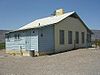
September 6, 1974 Along Rio Grande at jct. of Park Rtes. 5, 9, and 35
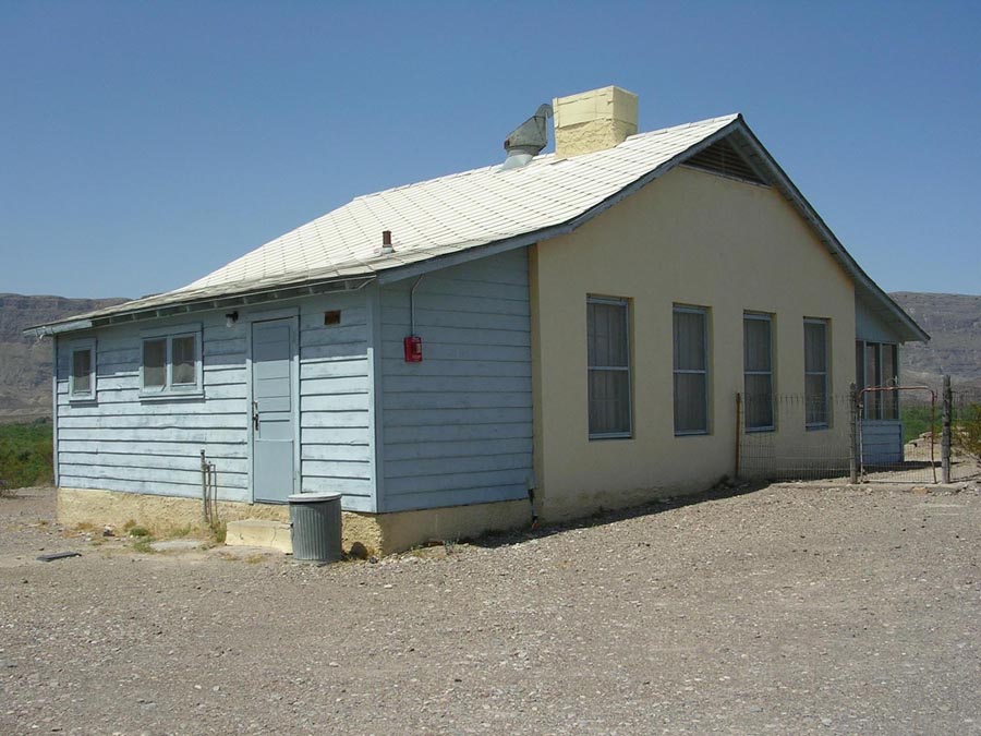
29°08′03″N 103°30′51″W / 29.134167°N 103.514167°WBig Bend National Park 4 Daniels Farm House 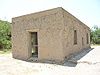
October 20, 1989 W of Rio Grande Village in Big Bend National Park
29°11′08″N 102°58′18″W / 29.185556°N 102.971667°WRio Grande Village 5 Hot Springs 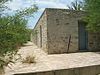
September 17, 1974 W of Rio Grande Village
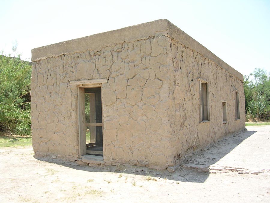
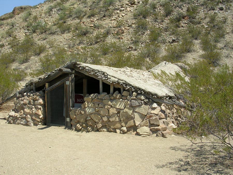
29°10′45″N 102°59′42″W / 29.179167°N 102.995°WBig Bend National Park 6 Luna Jacal 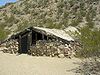
November 8, 1974 At base of Pena Mountain in Big Bend National Park
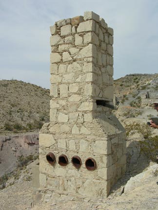
29°12′55″N 103°32′04″W / 29.215278°N 103.534444°WBig Bend National Park 7 Mariscal Mine 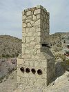
September 13, 1974 River Rd.
29°05′42″N 103°11′17″W / 29.095°N 103.188056°WBig Bend National Park 8 Nolte-Rooney House April 17, 1997 307 E. Sul Ross Ave.
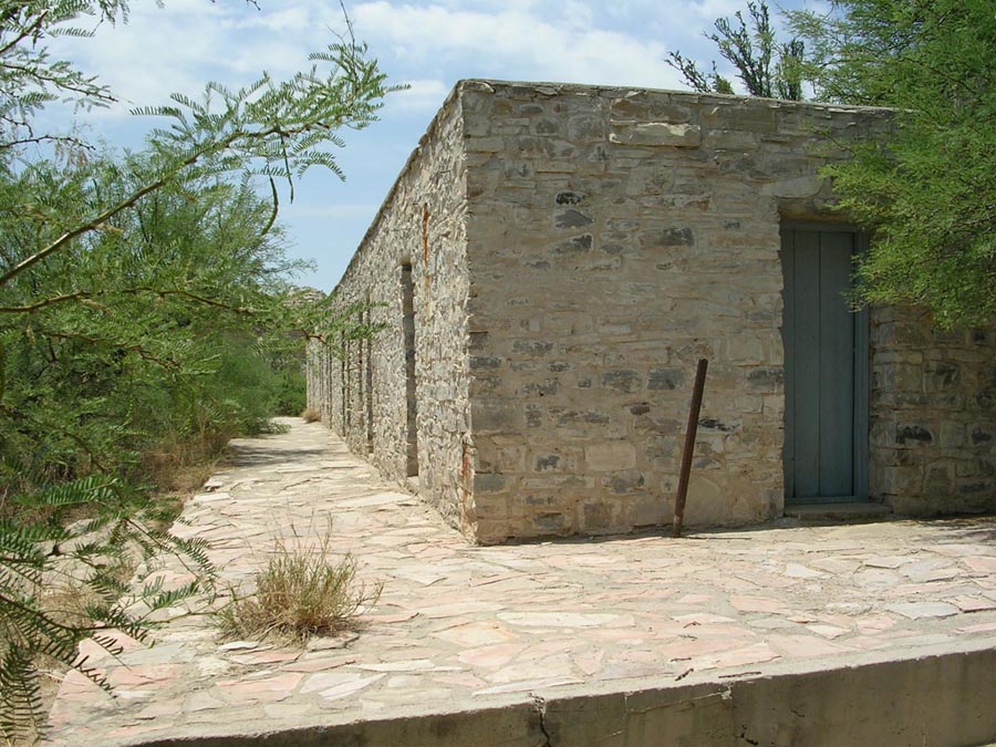
30°21′37″N 103°39′32″W / 30.360278°N 103.658889°WAlpine 9 Rancho Estelle September 3, 1974 On the Rio Grande River
29°09′20″N 103°34′35″W / 29.155556°N 103.576389°WBig Bend National Park 10 Terlingua Historic District March 10, 1996 7 mi. W of jct. of TX 118 and TX 170
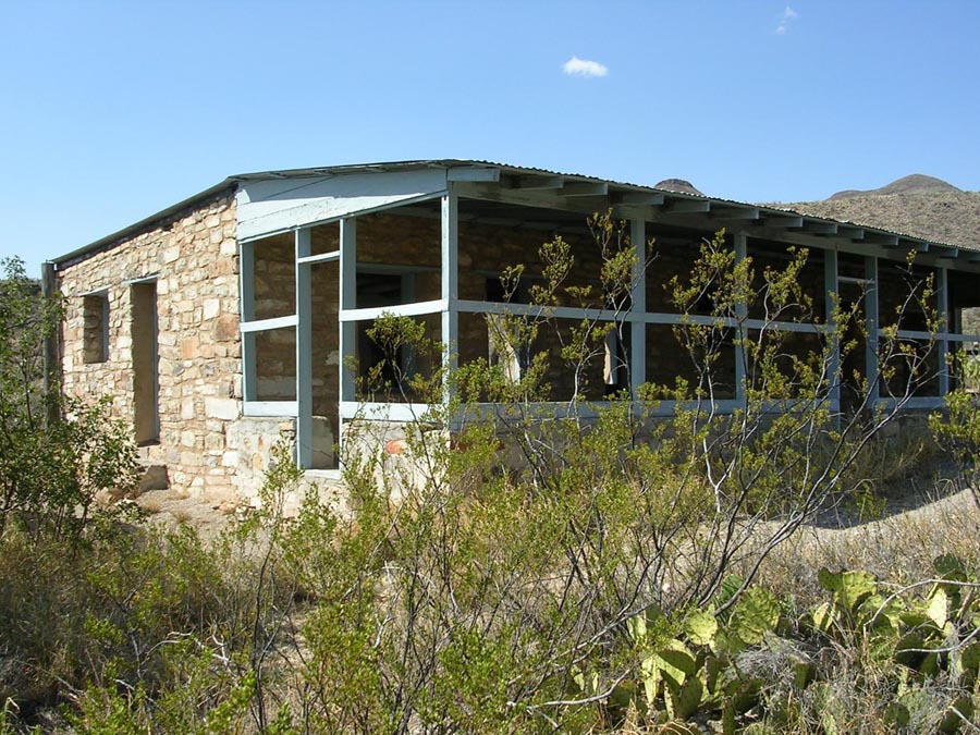
29°19′15″N 103°36′57″W / 29.320833°N 103.615833°WTerlingua 11 Homer Wilson Ranch 
April 14, 1975 8 mi. S of Santa Elena Junction on Park Rte. 5, Big Bend National Park
29°12′50″N 103°22′00″W / 29.213889°N 103.366667°WSanta Elena Junction See also
- Registered Historic Places in Texas, Counties A-C
References
- ^ The latitude and longitude information provided in this table was derived originally from the National Register Information System, which has been found to be fairly accurate for about 99% of listings. For about 1% of NRIS original coordinates, experience has shown that one or both coordinates are typos or otherwise extremely far off; some corrections may have been made. A more subtle problem causes many locations to be off by up to 150 yards, depending on location in the country: most NRIS coordinates were derived from tracing out latitude and longitudes off of USGS topographical quadrant maps created under North American Datum of 1927, which differs from the current, highly accurate GPS system used by Google maps. Chicago is about right, but NRIS longitudes in Washington are higher by about 4.5 seconds, and are lower by about 2.0 seconds in Maine. Latitudes differ by about 1.0 second in Florida. Some locations in this table may have been corrected to current GPS standards.
- ^ "National Register of Historic Places: Weekly List Actions". National Park Service, United States Department of the Interior. Retrieved on November 10, 2011.
- ^ Numbers represent an ordering by significant words. Various colorings, defined here, differentiate National Historic Landmark sites and National Register of Historic Places Districts from other NRHP buildings, structures, sites or objects.
- ^ "National Register Information System". National Register of Historic Places. National Park Service. . http://nrhp.focus.nps.gov/natreg/docs/All_Data.html.
U.S. National Register of Historic Places Topics Lists by states Alabama • Alaska • Arizona • Arkansas • California • Colorado • Connecticut • Delaware • Florida • Georgia • Hawaii • Idaho • Illinois • Indiana • Iowa • Kansas • Kentucky • Louisiana • Maine • Maryland • Massachusetts • Michigan • Minnesota • Mississippi • Missouri • Montana • Nebraska • Nevada • New Hampshire • New Jersey • New Mexico • New York • North Carolina • North Dakota • Ohio • Oklahoma • Oregon • Pennsylvania • Rhode Island • South Carolina • South Dakota • Tennessee • Texas • Utah • Vermont • Virginia • Washington • West Virginia • Wisconsin • WyomingLists by territories Lists by associated states Other  Category:National Register of Historic Places •
  Portal:National Register of Historic PlacesCategories:
- Brewster County, Texas
- National Register of Historic Places in Texas
- Buildings and structures in Brewster County, Texas
-
Wikimedia Foundation. 2010.