- National Register of Historic Places listings in Lamoille County, Vermont
-
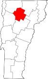 Location of Lamoille County in Vermont
This is a list of the National Register of Historic Places listings in Lamoille County, Vermont.
This is intended to be a complete list of the properties and districts on the National Register of Historic Places in Lamoille County, Vermont, United States. Latitude and longitude coordinates are provided for many National Register properties and districts; these locations may be seen together in a Google map.[1]
There are 29 properties and districts listed on the National Register in the county.
-
- This National Park Service list is complete through NPS recent listings posted November 10, 2011.[2]
Contents: Counties in Vermont Addison - Bennington - Caledonia - Chittenden - Essex - Franklin - Grand Isle - Lamoille - Orange - Orleans - Rutland - Washington - Windham - Windsor Current listings
[3] Landmark name [4] Image Date listed Location City or town Summary 1 Bridge 6 
December 20, 2007 Railroad St.
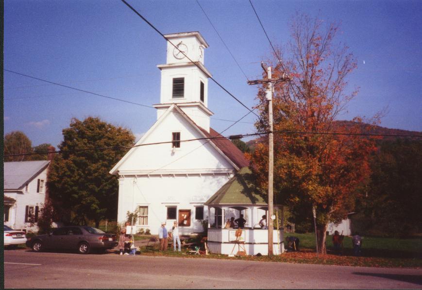
44°38′03″N 72°41′05″W / 44.634167°N 72.684722°WJohnson 2 Cambridge Meetinghouse 
February 6, 1981 Church St.
44°38′36″N 72°49′53″W / 44.643333°N 72.831389°WJeffersonville Former multi-denominational church is now the Cambridge Town Offices and US Post Office 3 Elmore State Park March 29, 2002 856 VT 12
44°32′16″N 72°32′34″W / 44.537778°N 72.542778°WElmore 4 Fisher Covered Railroad Bridge 
October 1, 1974 Southeast of Wolcott, over the Lamoille River
44°31′56″N 72°25′43″W / 44.532222°N 72.428611°WWolcott 5 Gates Farm Covered Bridge 
November 19, 1974 Off VT 15, over the Seymour River
44°38′44″N 72°52′23″W / 44.645556°N 72.873056°WCambridge 6 Gold Brook Covered Bridge 
October 1, 1974 South of Stowe
44°26′25″N 72°40′49″W / 44.440278°N 72.680278°WStowe 7 Grist Mill Covered Bridge 
June 13, 1974 East of Cambridge over the Brewster River
44°38′11″N 72°49′32″W / 44.636389°N 72.825556°WCambridge 8 Jaynes Covered Bridge 
October 1, 1974 Northeast of Waterville, over the North Branch of the Lamoille River
44°42′43″N 72°45′23″W / 44.711944°N 72.756389°WWaterville 9 Jeffersonville Bridge 
November 14, 1991 VT 108 over the Lamoille River
44°38′57″N 72°49′51″W / 44.649167°N 72.830833°WCambridge 10 Jeffersonville Historic District 
April 10, 1987 Church, Main, Maple, and School Sts., Carlton Ave., VT 108, and Brewster Ave.
44°38′42″N 72°49′43″W / 44.645°N 72.828611°WCambridge 11 Johnson Railroad Depot November 28, 1980 Railroad St.
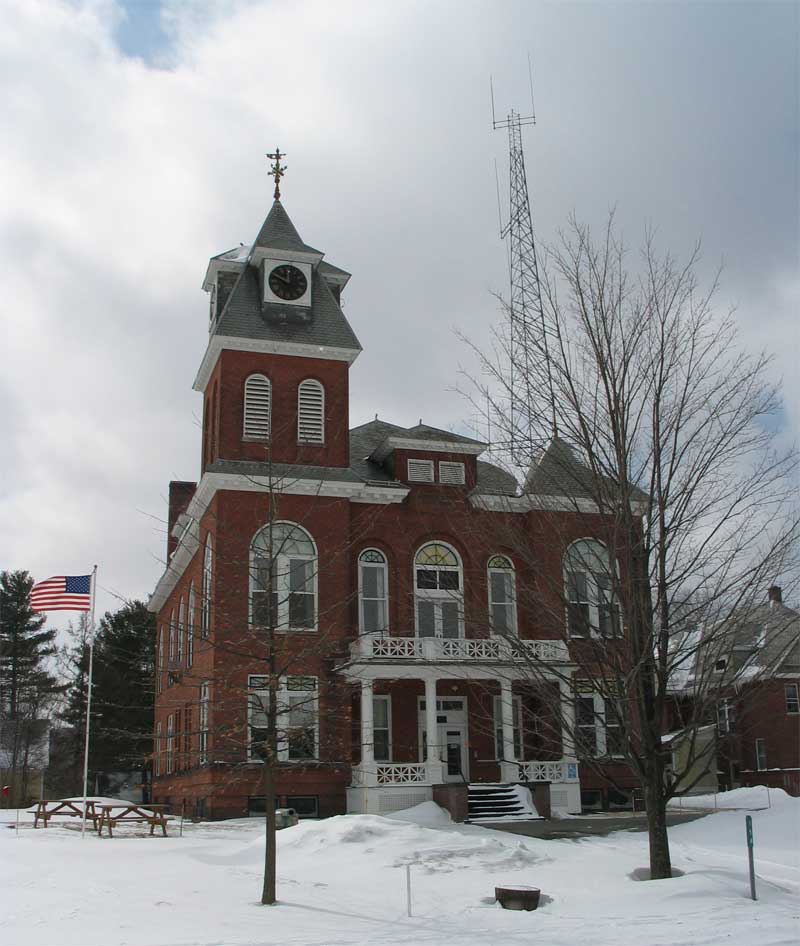
44°37′52″N 72°41′15″W / 44.631111°N 72.6875°WJohnson 12 Lamoille County Courthouse 
January 11, 1996 Main St.
44°35′35″N 72°37′04″W / 44.593056°N 72.617778°WHyde Park 13 Lamoille River Route 15-A Bridge November 14, 1991 VT 15-A over the Lamoille River
44°33′51″N 72°34′01″W / 44.564167°N 72.566944°WMorristown 14 Mill Covered Bridge 
November 19, 1974 Off VT 109 over the North Branch of the Lamoille River
44°44′37″N 72°44′29″W / 44.743611°N 72.741389°WBelvidere 15 Montgomery Covered Bridge 
October 18, 1974 Northeast of Waterville over the North Branch of the Lamoille River
44°42′20″N 72°45′39″W / 44.705556°N 72.760833°WWaterville 16 Morgan Covered Bridge 
November 19, 1974 Off VT 109, over the North Branch of the Lamoille River
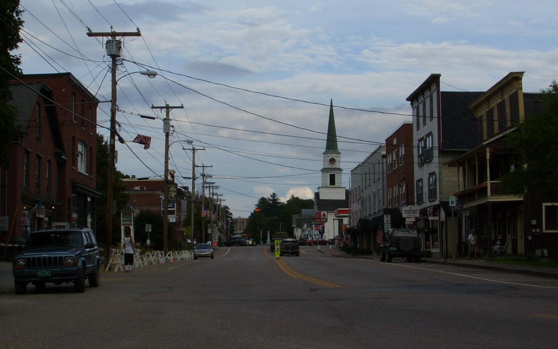
44°44′36″N 72°43′37″W / 44.743333°N 72.726944°WBelvidere 17 Morrisville Historic District 
January 19, 1983 Portland, Main, Railroad and Foundry Sts.; also Portland, Lower Main, Upper Main, Railroad, and Foundry Sts.
44°33′45″N 72°35′59″W / 44.5625°N 72.599722°WMorrisville Second set of boundaries represents a boundary increase 18 Moscow Village Historic District July 31, 2008 Moscow Rd., Shaw Hill Rd., Adams Mill Rd., and River Rd.
44°26′28″N 72°42′53″W / 44.441103°N 72.714772°WStowe 19 Nye Block 
August 19, 1977 Main and Railroad Sts.
44°38′07″N 72°40′54″W / 44.635278°N 72.681667°WJohnson 20 Peoples Academy-Copley Building, Grout Observatory and Community Bandshell 
March 7, 1996 5 Copley Ave.
44°33′45″N 72°35′27″W / 44.5625°N 72.590833°WMorristown 21 Poland Covered Bridge 
October 9, 1974 Off VT 15, over the Lamoille River
44°39′04″N 72°48′54″W / 44.651111°N 72.815°WCambridge Junction Officially, Cambridge Junction Bridge (see sign). Poland was a retired judge who led a lawsuit against the town to have the bridge built.[5] 22 Power House Covered Bridge 
October 9, 1974 Off VT 100, over the Gihon River
44°37′51″N 72°41′05″W / 44.630833°N 72.684722°WJohnson 23 Red Covered Bridge 
October 16, 1974 Southwest of Morristown, over Sterling Brook
44°31′07″N 72°40′40″W / 44.518611°N 72.677778°WMorristown 24 Scribner Covered Bridge 
October 1, 1974 East of Johnson over the Gihon River
44°38′20″N 72°38′57″W / 44.638889°N 72.649167°WJohnson 25 Stowe CCC Side Camp February 14, 2002 6992 Mountain Rd.
44°31′34″N 72°46′37″W / 44.526111°N 72.776944°WStowe 26 Stowe Village Historic District November 15, 1978 VT 100 and VT 108
44°27′58″N 72°41′09″W / 44.466111°N 72.685833°WStowe 27 Village Covered Bridge 
December 16, 1974 Over the North Branch of the Lamoille River
44°41′24″N 72°46′16″W / 44.69°N 72.771111°WWaterville 28 Waterman Covered Bridge June 13, 1974 South of Johnson over Waterman Brook
44°36′33″N 72°41′04″W / 44.609167°N 72.684444°WJohnson 29 Waterville Village Historic District 
September 28, 2007 VT 109, Oakes Rd., Church St., Griffin Rd., Fox Hill Rd., Beals Hill Rd., and Lapland Rd.
44°41′25″N 72°46′10″W / 44.690196°N 72.769318°WWaterville See also
- List of National Historic Landmarks in Vermont
- National Register of Historic Places listings in Vermont
References
- ^ The latitude and longitude information provided in this table was derived originally from the National Register Information System, which has been found to be fairly accurate for about 99% of listings. For about 1% of NRIS original coordinates, experience has shown that one or both coordinates are typos or otherwise extremely far off; some corrections may have been made. A more subtle problem causes many locations to be off by up to 150 yards, depending on location in the country: most NRIS coordinates were derived from tracing out latitude and longitudes off of USGS topographical quadrant maps created under the North American Datum of 1927, which differs from the current, highly accurate WGS84 GPS system used by Google maps. Chicago is about right, but NRIS longitudes in Washington are higher by about 4.5 seconds, and are lower by about 2.0 seconds in Maine. Latitudes differ by about 1.0 second in Florida. Some locations in this table may have been corrected to current GPS standards.
- ^ "National Register of Historic Places: Weekly List Actions". National Park Service, United States Department of the Interior. Retrieved on November 10, 2011.
- ^ Numbers represent an ordering by significant words. Various colorings, defined here, differentiate National Historic Landmark sites and National Register of Historic Places Districts from other NRHP buildings, structures, sites or objects.
- ^ "National Register Information System". National Register of Historic Places. National Park Service. . http://nrhp.focus.nps.gov/natreg/docs/All_Data.html.
- ^ http://www.virtualvermont.com/coveredbridges/cambridgejct.html
U.S. National Register of Historic Places Topics Lists by states Alabama • Alaska • Arizona • Arkansas • California • Colorado • Connecticut • Delaware • Florida • Georgia • Hawaii • Idaho • Illinois • Indiana • Iowa • Kansas • Kentucky • Louisiana • Maine • Maryland • Massachusetts • Michigan • Minnesota • Mississippi • Missouri • Montana • Nebraska • Nevada • New Hampshire • New Jersey • New Mexico • New York • North Carolina • North Dakota • Ohio • Oklahoma • Oregon • Pennsylvania • Rhode Island • South Carolina • South Dakota • Tennessee • Texas • Utah • Vermont • Virginia • Washington • West Virginia • Wisconsin • WyomingLists by territories Lists by associated states Other Municipalities and communities of Lamoille County, Vermont Towns Belvidere | Cambridge | Eden | Elmore | Hyde Park | Johnson | Morristown | Stowe | Waterville | Wolcott

Villages Unincorporated
communityCategories:- National Register of Historic Places in Vermont by county
- Lamoille County, Vermont
-


Wikimedia Foundation. 2010.