- National Register of Historic Places listings in Franklin County, Vermont
-
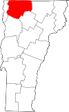 Location of Franklin County in Vermont
This is a list of the National Register of Historic Places listings in Franklin County, Vermont.
This is intended to be a complete list of the properties and districts on the National Register of Historic Places in Franklin County, Vermont, United States. Latitude and longitude coordinates are provided for many National Register properties and districts; these locations may be seen together in a Google map.[1]
There are 54 properties and districts listed on the National Register in the county.
-
- This National Park Service list is complete through NPS recent listings posted November 10, 2011.[2]
Contents: Counties in Vermont Addison - Bennington - Caledonia - Chittenden - Essex - Franklin - Grand Isle - Lamoille - Orange - Orleans - Rutland - Washington - Windham - Windsor Current listings
[3] Landmark name [4] Image Date listed Location City or town Summary 1 Ballard Farm 
November 4, 1993 Junction of Ballard Rd. and Town Highway 6
44°42′41″N 73°07′21″W / 44.711367°N 73.122425°WGeorgia 2 Billado Block 
October 16, 2007 371 Main St.
44°54′36″N 72°48′18″W / 44.91°N 72.805°WEnosburgh 3 Sheldon Boright House 
June 2, 1989 122 River St.
45°00′01″N 72°40′44″W / 45.000278°N 72.678889°WRichford 4 Bridge 9 
December 20, 2007 Shawville Rd.
44°54′42″N 72°58′22″W / 44.911667°N 72.972778°WSheldon 5 Bridge 12 
December 20, 2007 Boston Post Rd.
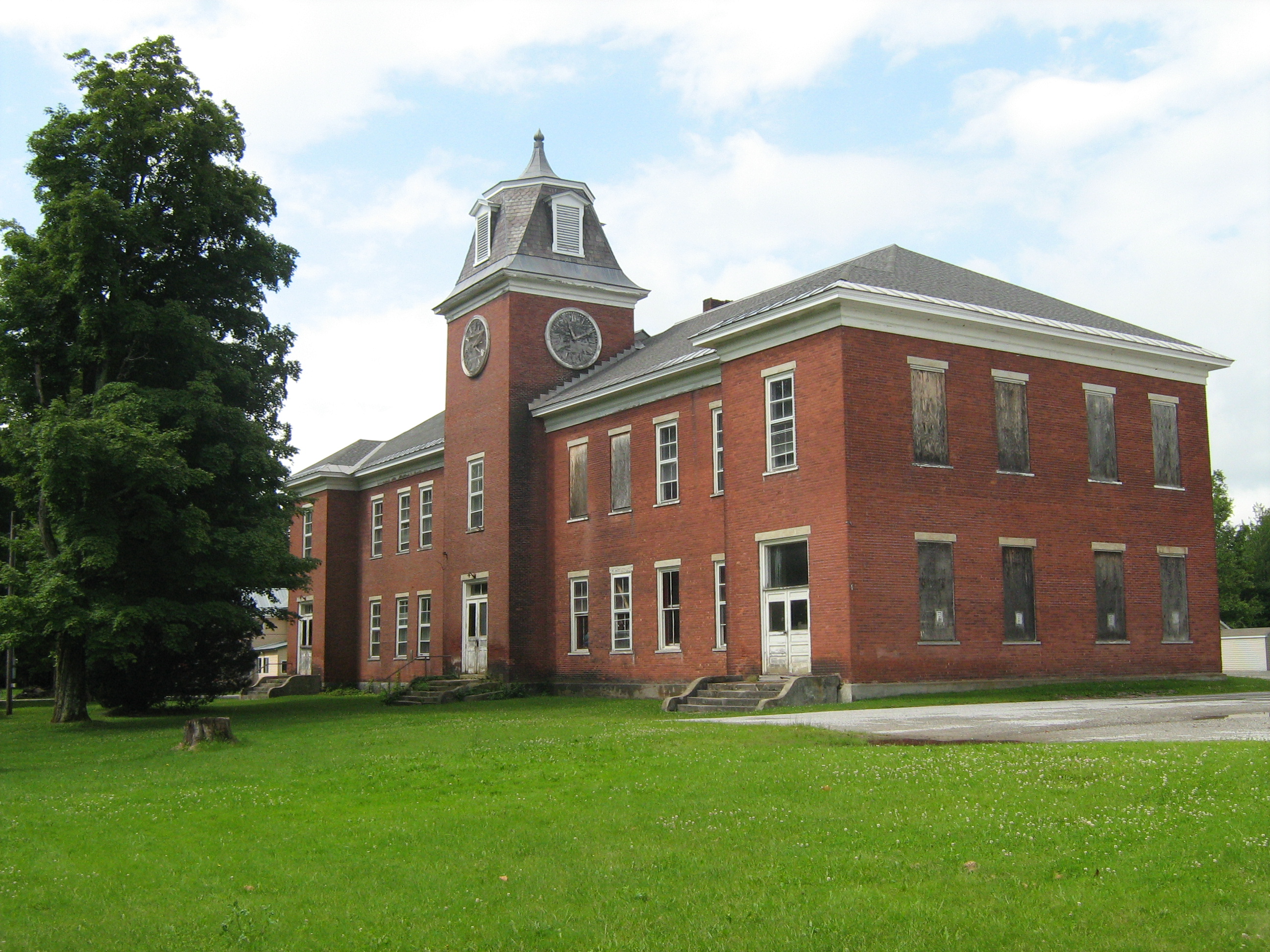
44°55′11″N 72°45′26″W / 44.919722°N 72.757222°WEnosburgh 6 Brigham Academy 
December 13, 1995 Junction of VT 108 and Academy Rd.
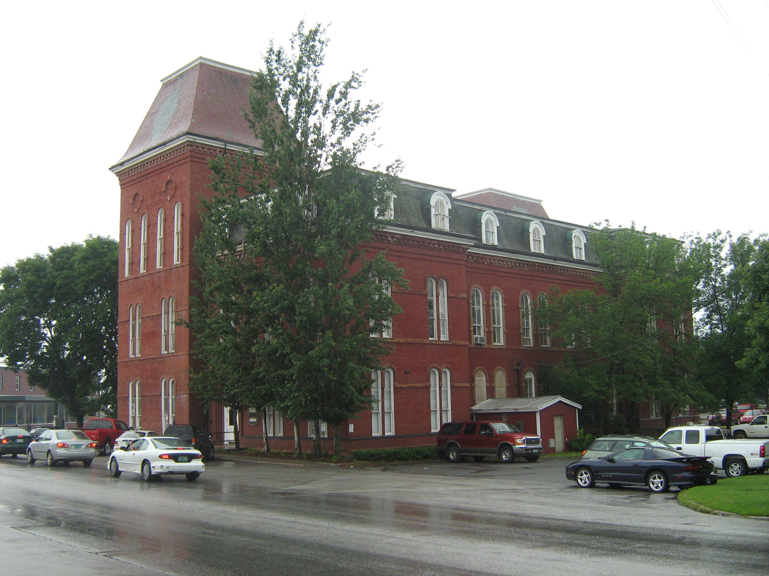
44°47′12″N 72°48′11″W / 44.786667°N 72.803056°WBakersfield 7 Central Vermont Railroad Headquarters 
January 21, 1974 Bounded roughly by Federal, Catherine, Allen, Lower Welden, Houghton, and Pine Sts.
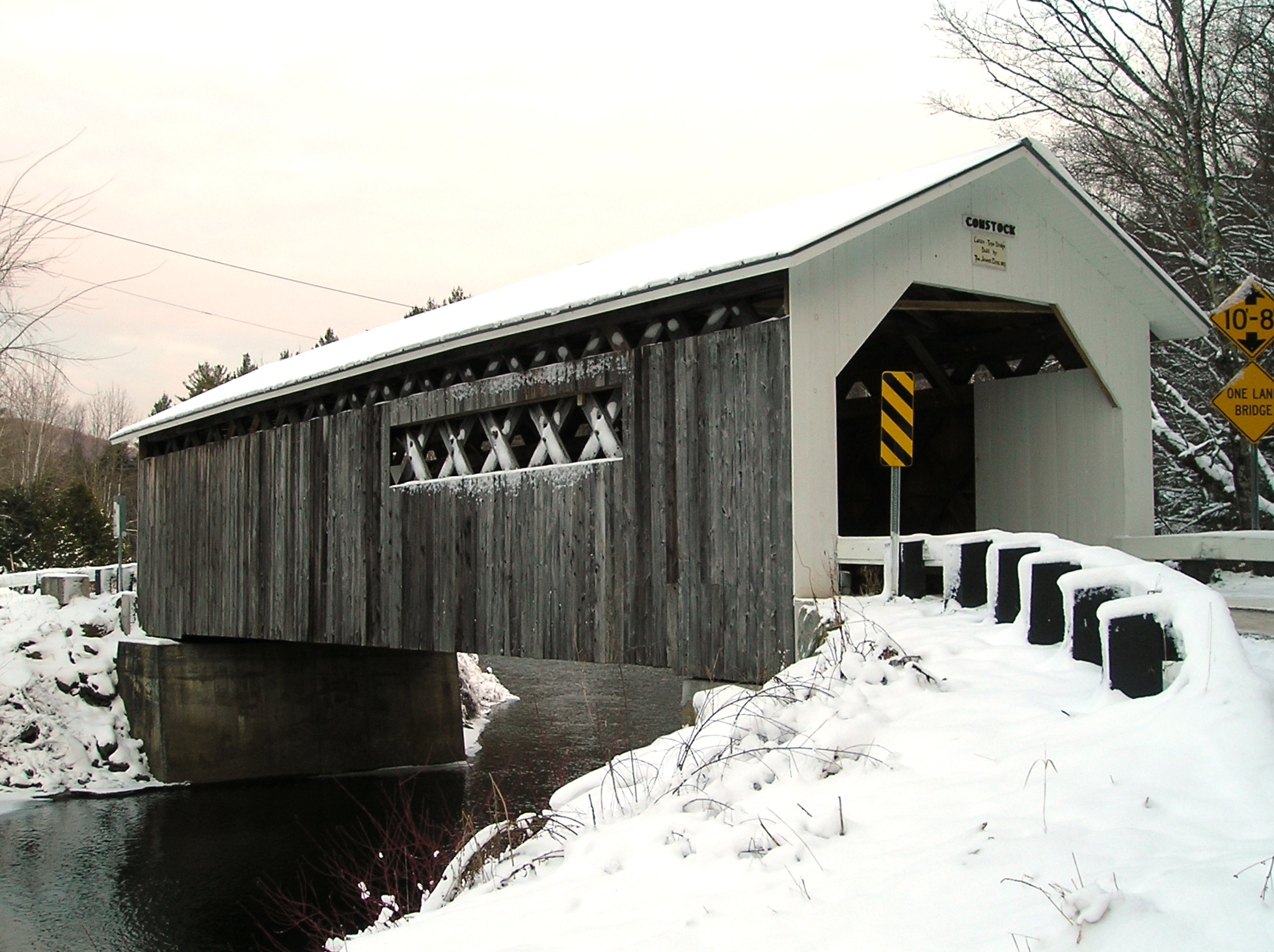
44°48′41″N 73°05′15″W / 44.811389°N 73.0875°WSt. Albans 8 Comstock Covered Bridge 
November 19, 1974 Off VT 118 spanning the Trout River
44°53′59″N 72°38′39″W / 44.899722°N 72.644167°WMontgomery 9 District No. 2 School 
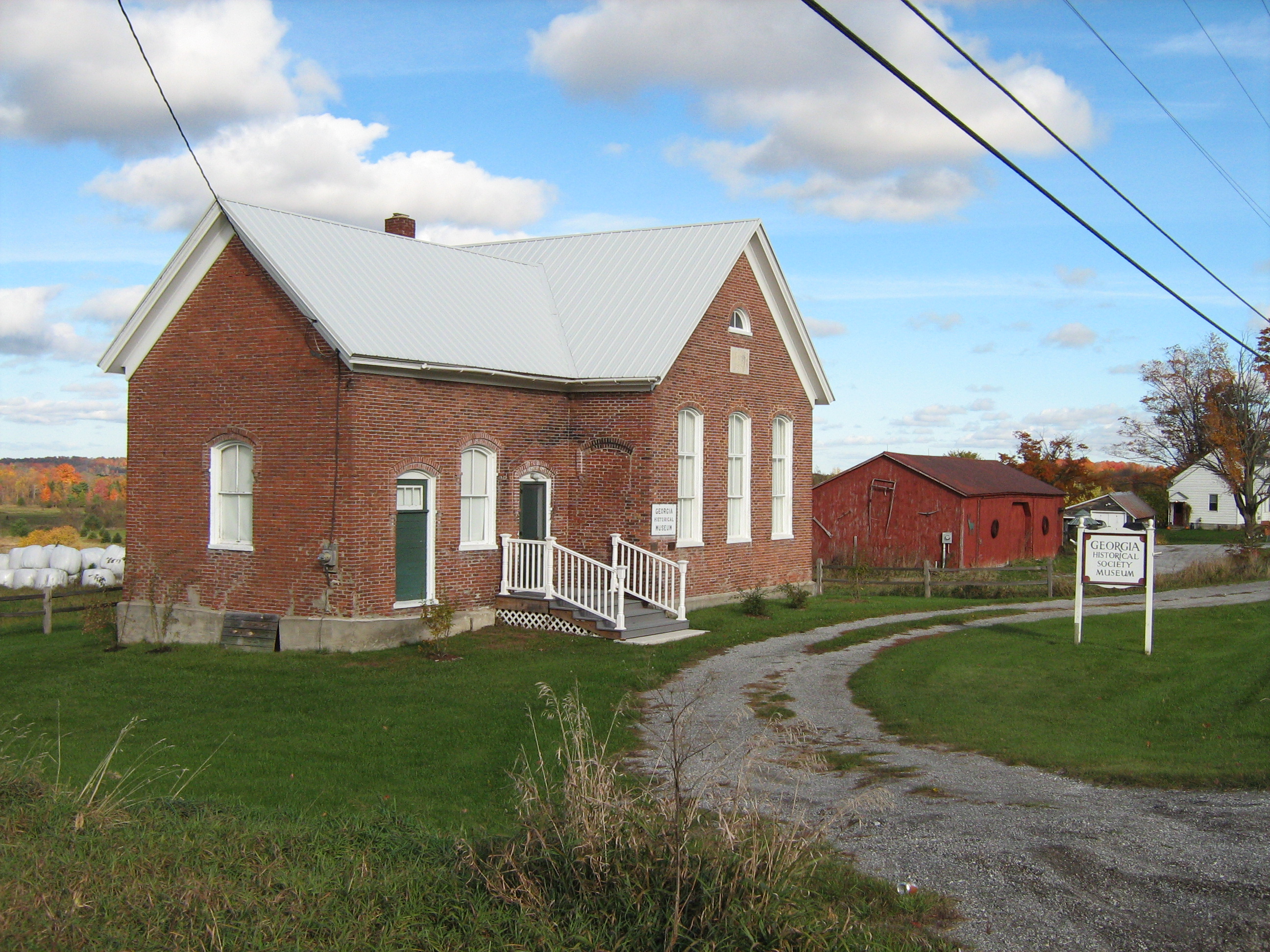
February 4, 2000 2442 Polly Hubbard Rd.
44°45′22″N 73°09′24″W / 44.756111°N 73.156667°WGeorgia 10 District School No. 8 School 
October 30, 1998 U.S. Route 7
44°43′51″N 73°07′04″W / 44.730833°N 73.117778°WGeorgia 11 Douglas & Jarvis Patent Parabolic Truss Iron Bridge 
March 21, 1974 U.S. Route 2 over the Missisquoi River in Highgate Falls
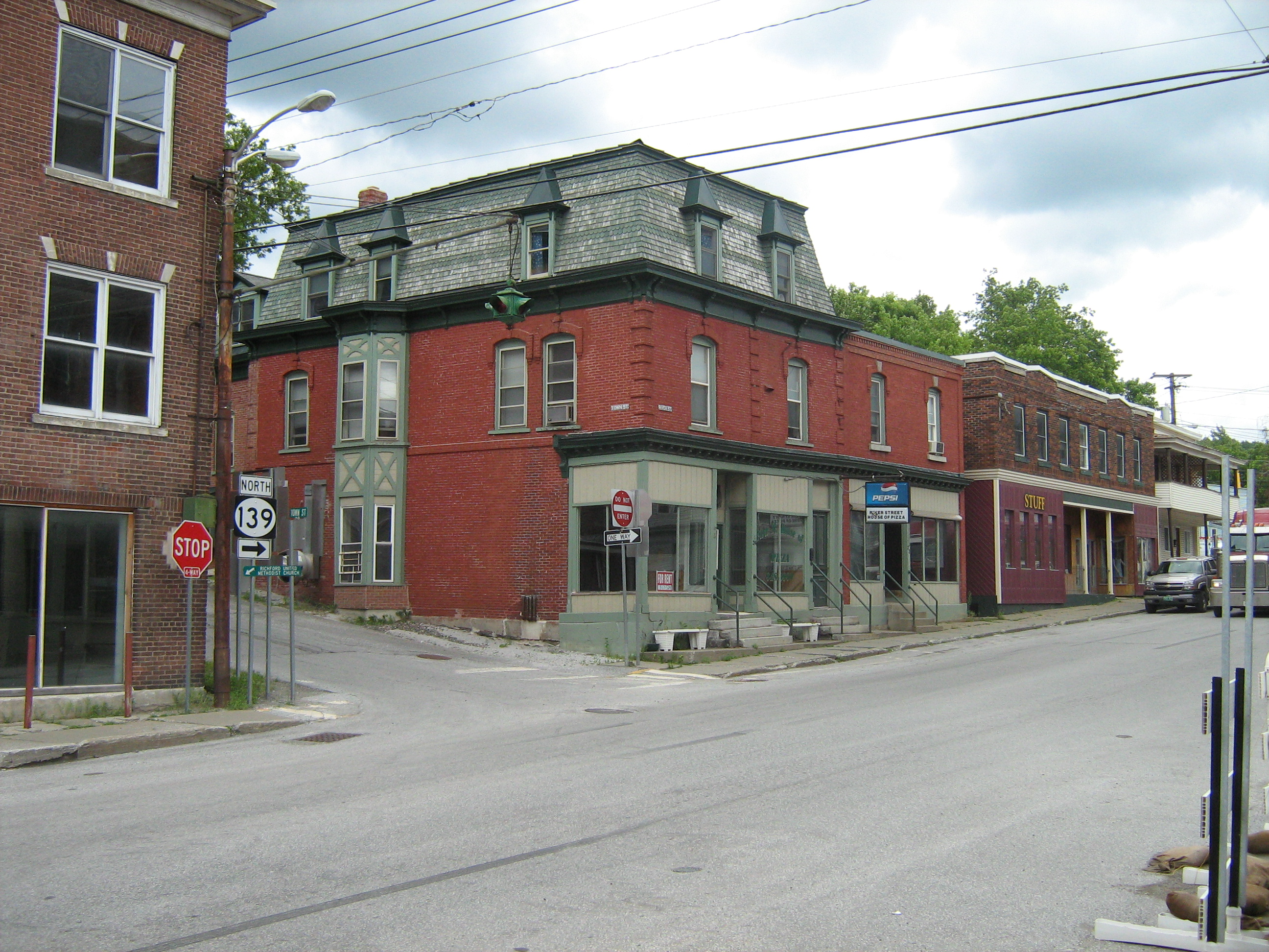
44°56′03″N 73°02′53″W / 44.934167°N 73.048056°WHighgate 12 Downtown Richford Historic District 
August 22, 1980 Main and River Sts.
44°59′47″N 72°40′19″W / 44.996389°N 72.671944°WRichford 13 East Fairfield Covered Bridge 
November 19, 1974 Off VT 108, over Black Creek, near East Fairfield
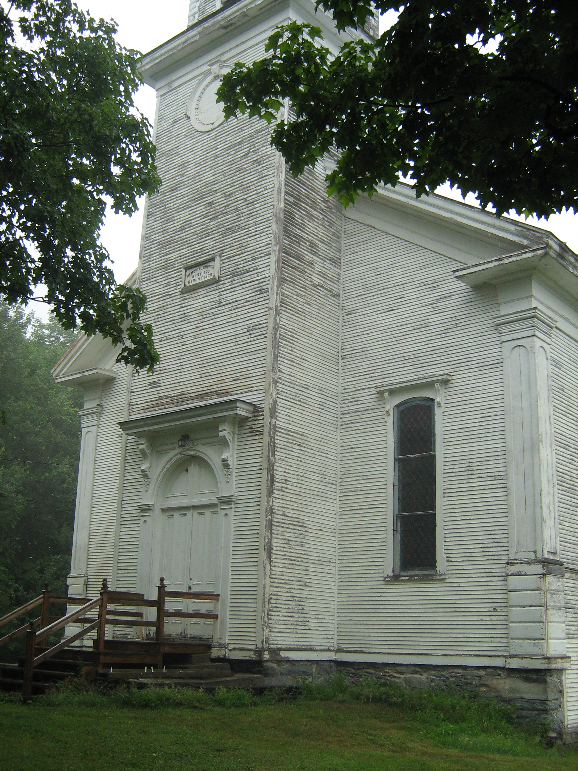
44°47′08″N 72°51′49″W / 44.785556°N 72.863611°WFairfield 14 Enosburg Congregational Memorial Church 
March 2, 2001 Town Highway 2
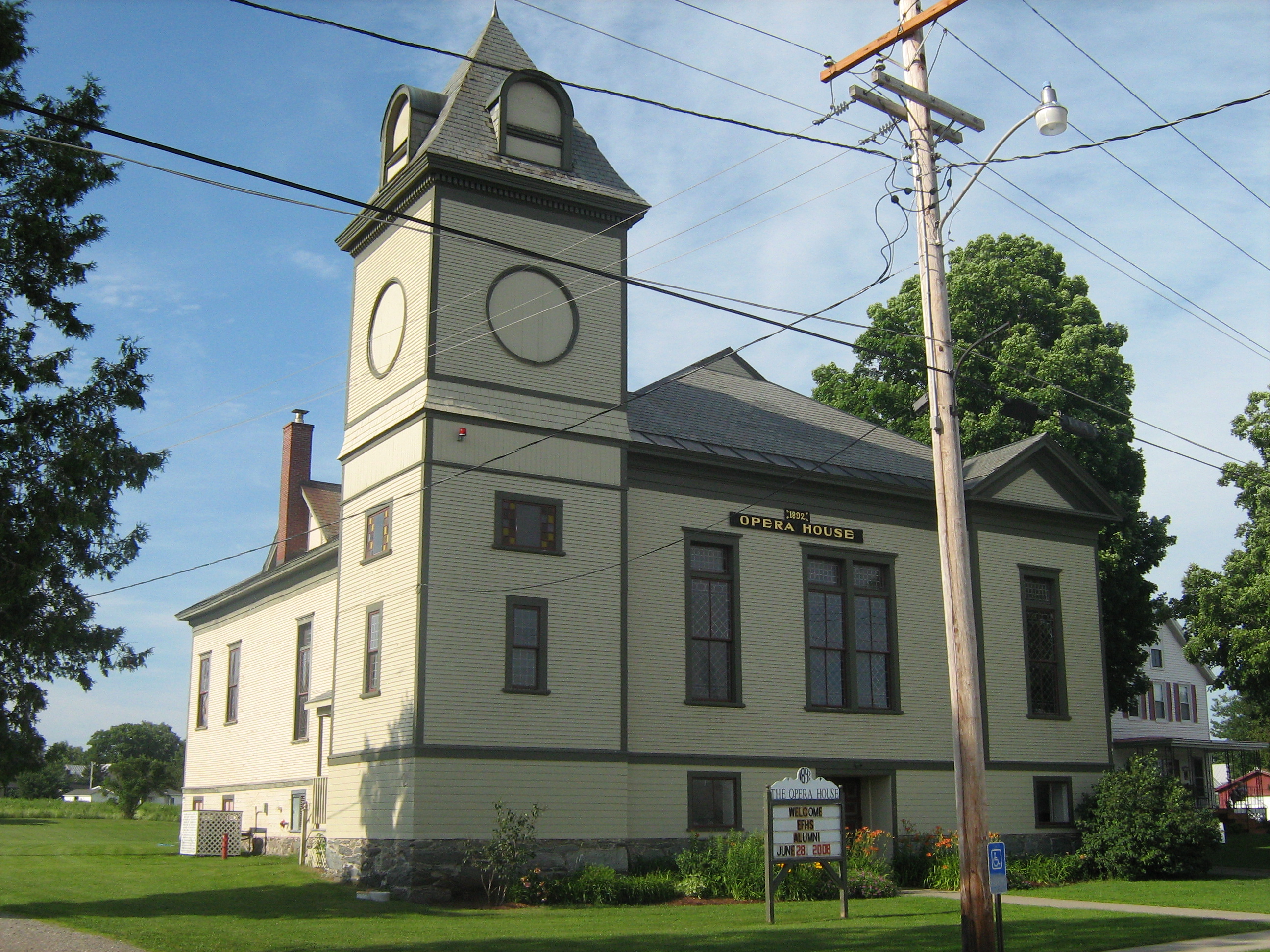
44°52′58″N 72°45′15″W / 44.882778°N 72.754167°WEnosburgh 15 Enosburg Opera House 
September 20, 1978 31 Depot St.
44°54′31″N 72°48′08″W / 44.908611°N 72.802222°WEnosburg Falls 16 Evarts-McWilliams House 
October 21, 1982 Georgia Shore Rd.
44°46′56″N 73°08′34″W / 44.782222°N 73.142778°WGeorgia Now a bed & breakfast inn 17 Fairfax Covered Bridge 
November 5, 1974 Off VT 104 over Mill Brook
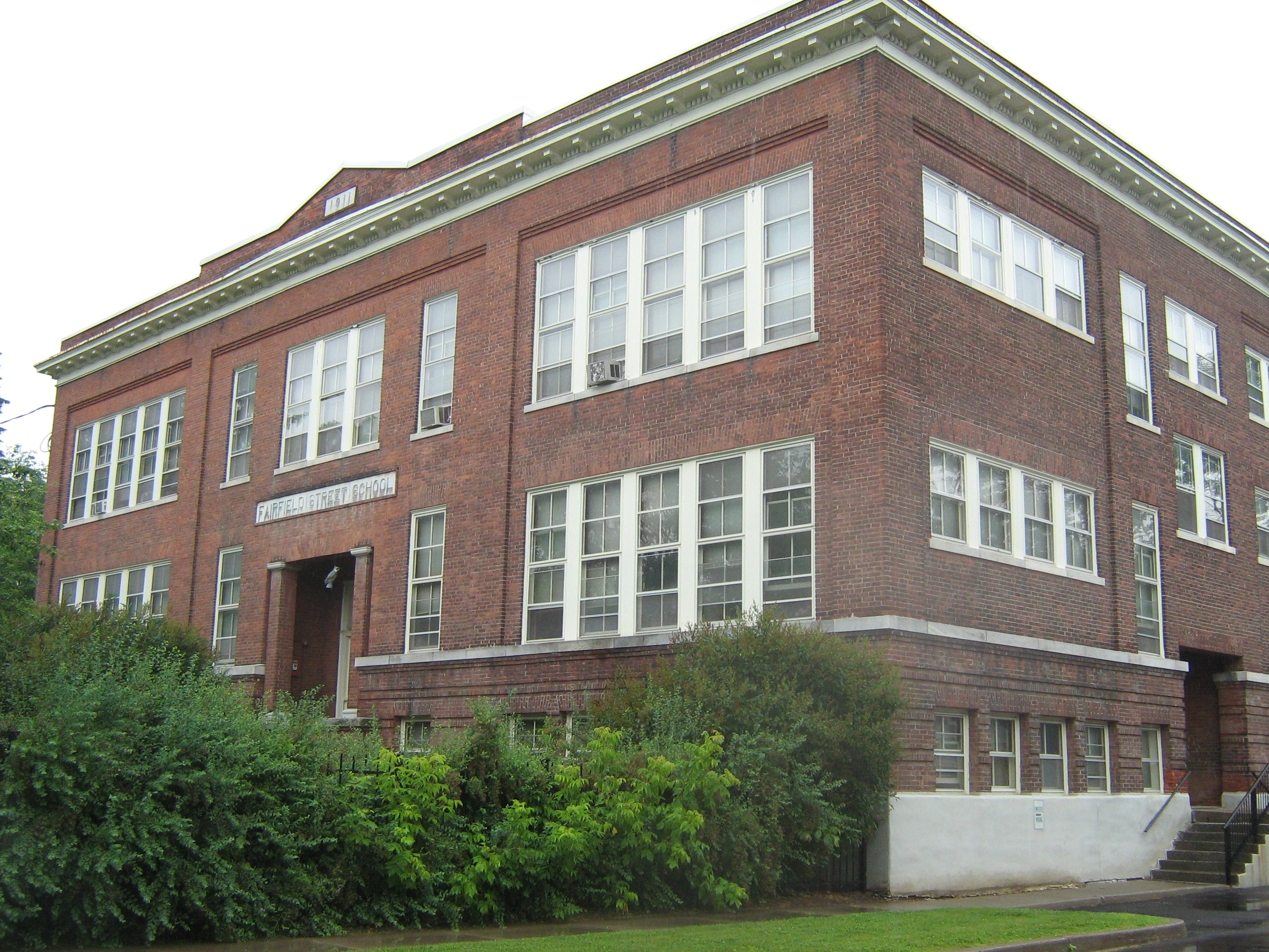
44°39′49″N 73°00′39″W / 44.663611°N 73.010833°WFairfax 18 Fairfield Street School 
November 7, 1996 78 Fairfield St.
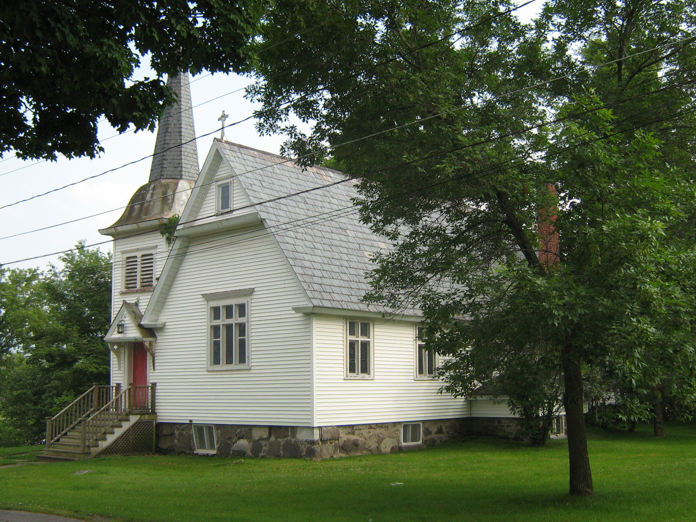
44°48′31″N 73°04′45″W / 44.808611°N 73.079167°WSt. Albans 19 First Congregational Church of Swanton March 2, 2001 42 Academy St.
44°55′02″N 73°07′21″W / 44.917222°N 73.1225°WSwanton 20 Fletcher Union Church 
May 17, 1982 VT 1
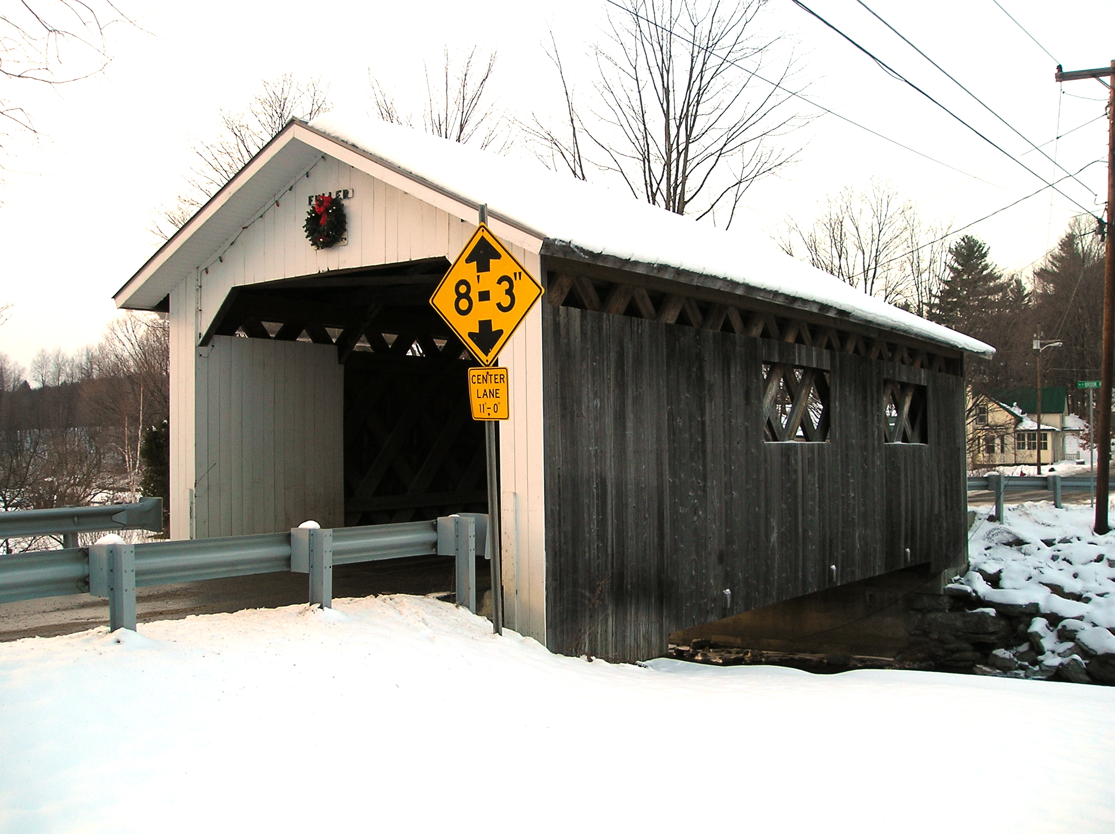
44°40′57″N 72°54′42″W / 44.6825°N 72.911667°WFletcher 21 Fuller Covered Bridge 
December 23, 1974 Town road over Black Falls Brook at Montgomery Village
44°54′13″N 72°38′23″W / 44.903611°N 72.639722°WMontgomery 22 Georgia Plain Baptist Church 
March 2, 2001 Stonebridge Rd. and Georgia Plain Rd.
44°43′15″N 73°10′02″W / 44.720833°N 73.167222°WGeorgia 23 Giroux Furniture Company Building 
November 8, 2006 10-18 Catherine St.
44°48′45″N 73°05′09″W / 44.8125°N 73.085833°WSt. Albans 24 Solomon Goodrich Homestead July 28, 2004 4787 Ethan Allen Highway
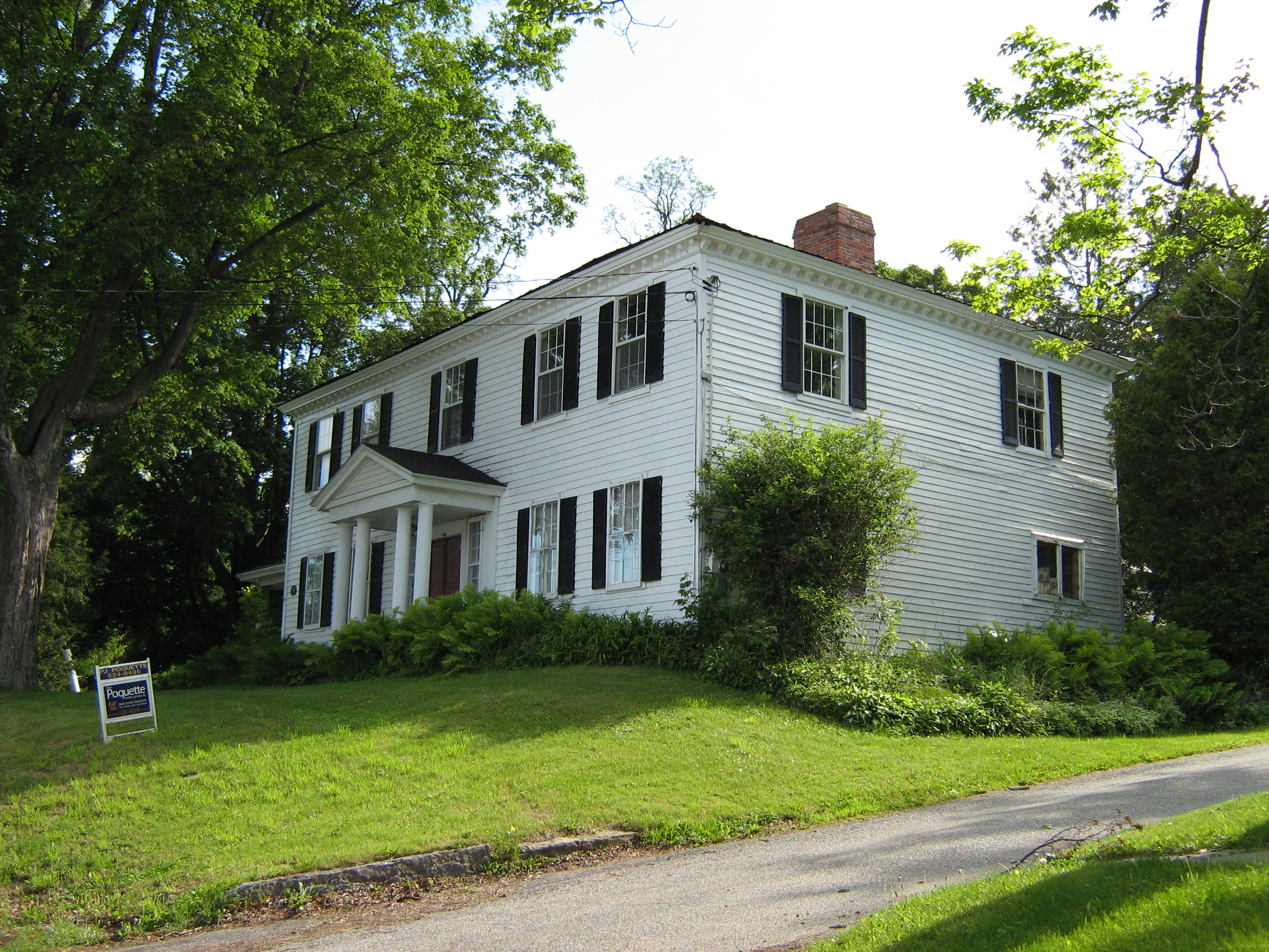
44°44′30″N 73°06′54″W / 44.741667°N 73.115°WGeorgia 25 Hathaway's Tavern 
July 14, 1983 255 N. Main St.
44°49′21″N 73°04′52″W / 44.8225°N 73.081111°WSt. Albans Franklin County was organized in 1795, but did not have a courthouse until 1803, during which time terms of the court were held at Silas Hathaway's tavern, the oldest house in the city.[5] 26 Hectorville Covered Bridge November 20, 1974 1.8 mi (2.9 km) south of Montgomery Center over the South Branch of the Trout River
44°51′13″N 72°36′50″W / 44.853611°N 72.613889°WMontgomery Bridge has been dismantled and is awaiting repairs[6] 27 Hopkins Covered Bridge 
November 20, 1974 Town road over the Trout River
44°55′15″N 72°40′23″W / 44.920833°N 72.673056°WEnosburgh 28 Houghton House 
September 4, 1972 86 S. Main St.
44°48′27″N 73°05′05″W / 44.8075°N 73.084722°WSt. Albans 29 Hutchins Covered Bridge 
December 30, 1974 South of Montgomery Center over the South Branch of the Trout River
44°51′30″N 72°36′45″W / 44.858333°N 72.6125°WMontgomery 30 Kemp-Shepard House November 13, 1997 VT 104A, 1 mi (1.6 km) southeast of U.S. Route 7
44°40′56″N 73°05′24″W / 44.682222°N 73.09°WGeorgia 31 Dr. B. J. Kendall Company 
August 2, 1993 228 N. Main St.
44°54′40″N 72°48′12″W / 44.911111°N 72.803333°WEnosburgh 32 L'Ecole Saintes-Anges 
November 28, 1980 247 Lake St.
44°48′42″N 73°05′40″W / 44.811667°N 73.094444°WSt. Albans 33 Longley Covered Bridge 
December 30, 1974 Northwest of Montgomery over the Trout River
44°54′25″N 72°39′21″W / 44.906944°N 72.655833°WMontgomery 34 Methodist Episcopal Church March 2, 2001 25 Grand Ave.
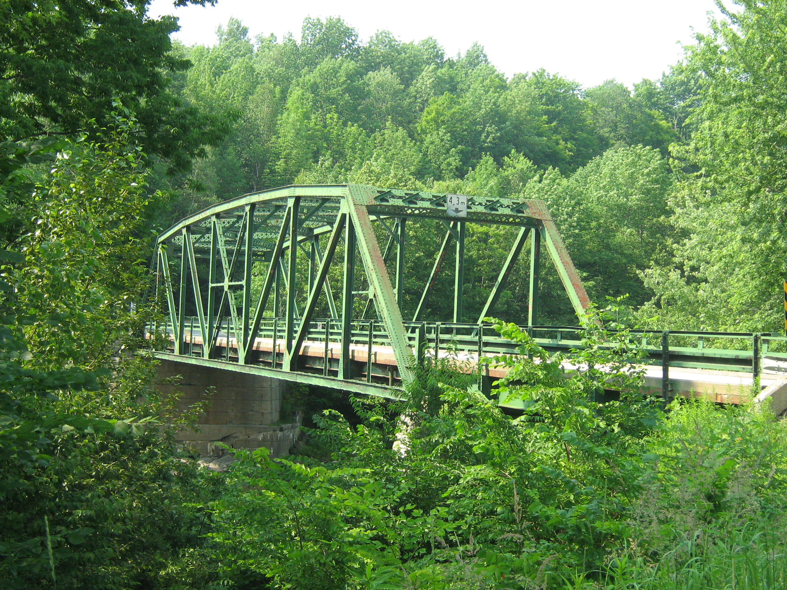
44°55′07″N 73°07′30″W / 44.918611°N 73.125°WSwanton 35 Missisquoi River Bridge 
October 11, 1990 VT 105-A over the Missisquoi River
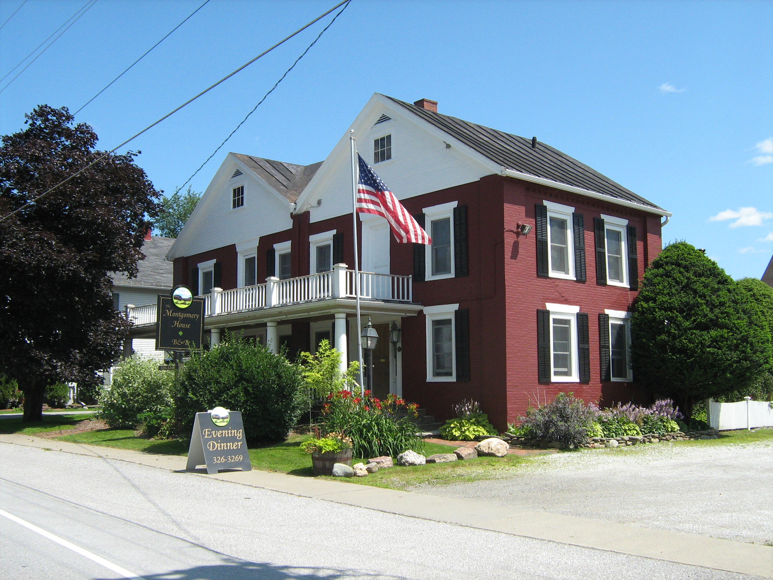
45°00′49″N 72°35′16″W / 45.013611°N 72.587778°WRichford 36 Montgomery House 
August 20, 1992 VT 118
44°54′05″N 72°38′27″W / 44.901389°N 72.640833°WMontgomery 37 Parish of the Holy Trinity March 2, 2001 38 Grand Ave.
44°55′02″N 73°07′27″W / 44.917222°N 73.124167°WSwanton 38 Richford Primary School 
May 12, 2004 140 Intervale Ave.
44°59′47″N 72°40′31″W / 44.996389°N 72.675278°WRichford 39 Richwood Estate 
November 3, 1988 North of St. Albans off U.S. Route 7
44°51′48″N 73°05′48″W / 44.863333°N 73.096667°WSt. Albans 40 Rockledge 
May 19, 1994 Highgate Rd. (Vermont Route 207)
44°52′41″N 73°04′17″W / 44.878056°N 73.071389°WSwanton 41 St. Albans Historic District 
May 1, 1980 U.S. Route 7 and VT 36
44°48′43″N 73°05′00″W / 44.811944°N 73.083333°WSt. Albans 42 St. Albans Town Hall 
March 14, 1996 VT 36 (Lake Rd.)
44°48′30″N 73°08′20″W / 44.808333°N 73.138889°WSt. Albans 43 St. Ann's Episcopal Church 
March 12, 2001 Junction of Church and Town Sts.
44°59′52″N 72°40′20″W / 44.997778°N 72.672222°WRichford 44 St. Bartholomew's Episcopal Church September 1, 1988 VT 118
44°54′08″N 72°38′18″W / 44.902222°N 72.638333°WMontgomery 45 St. George's Catholic Church 
March 2, 2001 VT 25
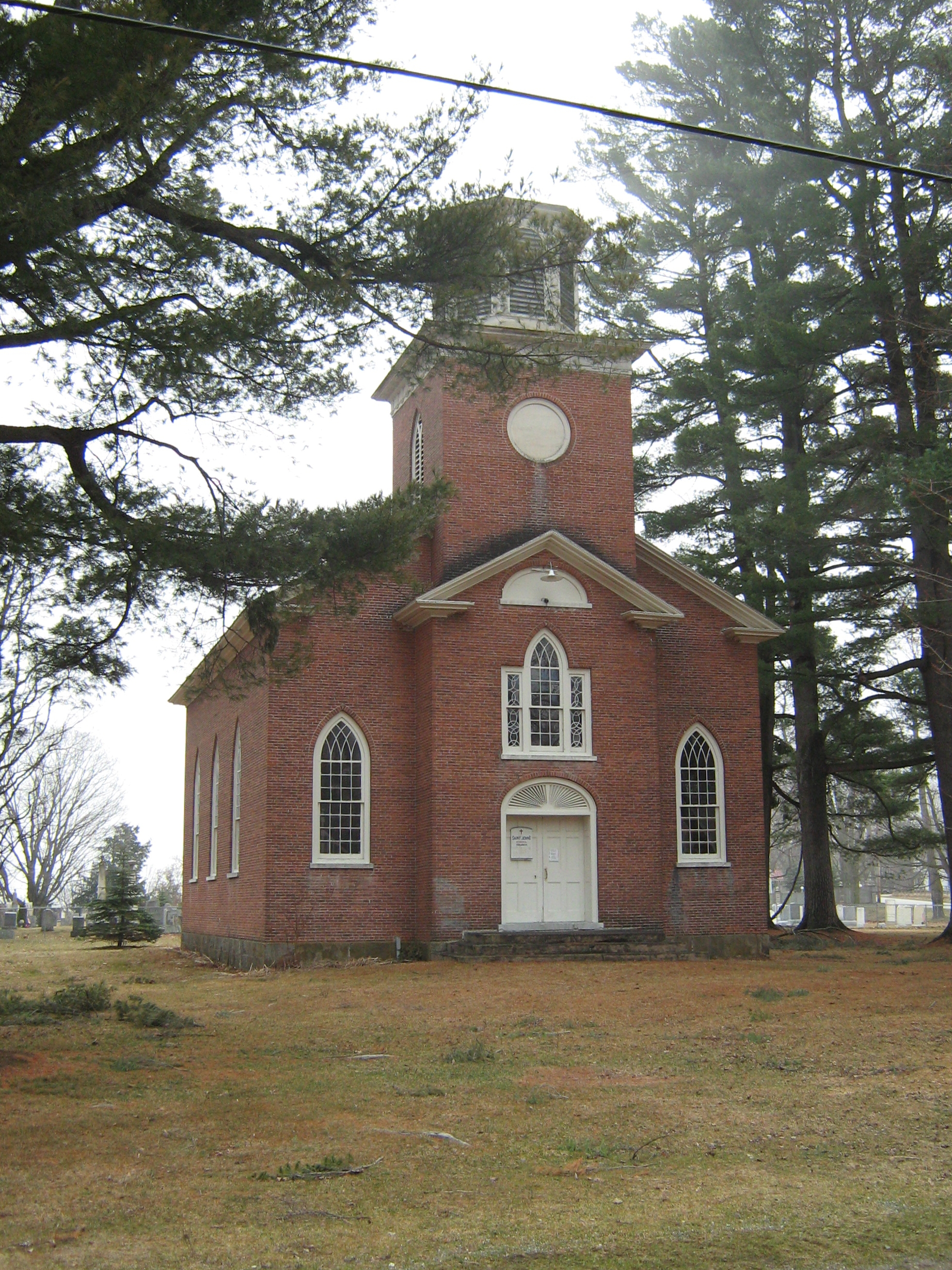
44°46′53″N 72°48′02″W / 44.781389°N 72.800556°WBakersfield 46 St. John's Episcopal Church 
September 3, 1976 Highgate Falls village green
44°55′48″N 73°02′56″W / 44.93°N 73.048889°WHighgate 47 Swanton Covered Railroad Bridge June 18, 1973 South of Swanton over the Missisquoi River
44°54′58″N 73°07′40″W / 44.916111°N 73.127778°WSwanton Destroyed in 1987[7] 48 Swanton School 
March 1, 2002 53 Church St.
44°54′58″N 73°07′26″W / 44.916111°N 73.123889°WSwanton 49 Sweat-Comings Company House 
May 12, 2004 10-12 Powell St.
44°59′46″N 72°40′27″W / 44.996111°N 72.674167°WRichford 50 Warner Home 
October 20, 1988 133 High St.
44°49′09″N 73°04′36″W / 44.819167°N 73.076667°WSt. Albans 51 West Berkshire School 
November 4, 1993 Junction of Town Highways 3 and 26
44°59′10″N 72°48′36″W / 44.986111°N 72.81°WBerkshire 52 West Hill Covered Bridge 
December 31, 1974 3.2 miles (5.1 km) south of Montgomery over West Hill Brook
44°52′03″N 72°38′53″W / 44.8675°N 72.648056°WMontgomery Restored in 2009[8] 53 F.W. Wheeler House 
May 12, 2004 31 Intervale Ave.
44°59′37″N 72°40′31″W / 44.993611°N 72.675278°WRichford 54 Willard Manufacturing Company Building 
December 6, 2006 25 Stowell St.
44°48′38″N 73°05′11″W / 44.810556°N 73.086389°WSt. Albans See also
- List of National Historic Landmarks in Vermont
- National Register of Historic Places listings in Vermont
References
- ^ The latitude and longitude information provided in this table was derived originally from the National Register Information System, which has been found to be fairly accurate for about 99% of listings. For about 1% of NRIS original coordinates, experience has shown that one or both coordinates are typos or otherwise extremely far off; some corrections may have been made. A more subtle problem causes many locations to be off by up to 150 yards, depending on location in the country: most NRIS coordinates were derived from tracing out latitude and longitudes off of USGS topographical quadrant maps created under North American Datum of 1927, which differs from the current, highly accurate GPS system used by Google maps. Chicago is about right, but NRIS longitudes in Washington are higher by about 4.5 seconds, and are lower by about 2.0 seconds in Maine. Latitudes differ by about 1.0 second in Florida. Some locations in this table may have been corrected to current GPS standards.
- ^ "National Register of Historic Places: Weekly List Actions". National Park Service, United States Department of the Interior. Retrieved on November 10, 2011.
- ^ Numbers represent an ordering by significant words. Various colorings, defined here, differentiate National Historic Landmark sites and National Register of Historic Places Districts from other NRHP buildings, structures, sites or objects.
- ^ "National Register Information System". National Register of Historic Places. National Park Service. . http://nrhp.focus.nps.gov/natreg/docs/All_Data.html.
- ^ St. Albans Through The Years, St. Albans Historical Society, 4.
- ^ http://www.virtualvermont.com/coveredbridges/hectorville.html
- ^ An Outline of Swanton History, Swanton Historical Society, 2008. Accessed 2009-12-05.
- ^ http://www.VirtualVermont.com/coveredbridges/westhill.html
U.S. National Register of Historic Places Topics Lists by states Alabama • Alaska • Arizona • Arkansas • California • Colorado • Connecticut • Delaware • Florida • Georgia • Hawaii • Idaho • Illinois • Indiana • Iowa • Kansas • Kentucky • Louisiana • Maine • Maryland • Massachusetts • Michigan • Minnesota • Mississippi • Missouri • Montana • Nebraska • Nevada • New Hampshire • New Jersey • New Mexico • New York • North Carolina • North Dakota • Ohio • Oklahoma • Oregon • Pennsylvania • Rhode Island • South Carolina • South Dakota • Tennessee • Texas • Utah • Vermont • Virginia • Washington • West Virginia • Wisconsin • WyomingLists by territories Lists by associated states Other  Category:National Register of Historic Places •
  Portal:National Register of Historic Places
Municipalities and communities of Franklin County, Vermont Shire town: St. Albans City 
Towns Bakersfield | Berkshire | Enosburgh | Fairfax | Fairfield | Fletcher | Franklin | Georgia | Highgate | Montgomery | Richford | Sheldon | Swanton | St. Albans
Villages Unincorporated
communitiesCategories:- National Register of Historic Places in Vermont by county
- Franklin County, Vermont
-


Wikimedia Foundation. 2010.