- National Register of Historic Places listings in Orange County, Vermont
-
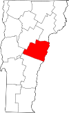 Location of Orange County in Vermont
This is a list of the National Register of Historic Places listings in Orange County, Vermont.
This is intended to be a complete list of the properties and districts on the National Register of Historic Places in Orange County, Vermont, United States. Latitude and longitude coordinates are provided for many National Register properties and districts; these locations may be seen together in a Google map.[1]
There are 59 properties and districts listed on the National Register in the county, including 1 National Historic Landmark.
-
- This National Park Service list is complete through NPS recent listings posted November 10, 2011.[2]
Contents: Counties in Vermont Addison - Bennington - Caledonia - Chittenden - Essex - Franklin - Grand Isle - Lamoille - Orange - Orleans - Rutland - Washington - Windham - Windsor Current listings
[3] Landmark name [4] Image Date listed Location City or town Summary 1 Allis State Park March 29, 2002 RR 2, Box 192
44°02′41″N 72°38′12″W / 44.044722°N 72.636667°WBrookfield 2 Aloha Camp September 5, 2003 2039 Lake Morey Rd.
43°55′51″N 72°09′26″W / 43.930833°N 72.157222°WFairlee 3 Aloha Hive Camp September 5, 2003 846 VT 244
43°54′12″N 72°13′24″W / 43.903333°N 72.223333°WWest Fairlee 4 Bayley Historic District July 28, 1983 VT 5 and Oxbow St.
44°05′11″N 72°03′09″W / 44.086389°N 72.0525°WNewbury 5 Bedell Covered Bridge 
May 28, 1975 Crosses the Connecticut River between Haverhill and Newbury
44°02′53″N 72°04′20″W / 44.048056°N 72.072222°WNewbury 6 Bradford Village Historic District May 28, 1975 Residential area along Main, Depot, Pleasant, High, and Mill Sts., Wrights Ave., Goshen Rd., and U.S. Route 5
43°59′52″N 72°07′29″W / 43.997778°N 72.124722°WBradford 7 Braley Covered Bridge 
June 13, 1974 East of Randolph off VT 14, over the Second Branch of the White River
43°55′42″N 72°33′26″W / 43.928333°N 72.557222°WRandolph 8 Bridge 22 November 3, 2010 Town Highway 27 (Creamery Rd)
43°59′17″N 72°07′48″W / 43.988056°N 72.13°WBradford Metal Truss, Masonry, and Concrete Bridges in Vermont MPS 9 Brock Hill Schoolhouse August 4, 2003 North Rd.
44°05′59″N 72°08′30″W / 44.099722°N 72.141667°WNewbury 10 Brookfield Village Historic District March 28, 1974 Sunset Lake area
44°02′35″N 72°36′07″W / 44.043056°N 72.601944°WBrookfield 11 Camp Billings January 11, 2006 1452 VT 244
43°53′25″N 72°13′58″W / 43.890278°N 72.232778°WThetford 12 Camp Wyoda September 5, 2003 43 Middlebrook Rd.
43°53′31″N 72°13′54″W / 43.891944°N 72.231667°WWest Fairlee 13 Chandler Music Hall and Bethany Parish House July 16, 1973 71 Main St.
43°55′32″N 72°39′57″W / 43.925556°N 72.665833°WRandolph 14 Elwin Chase House November 2, 1977 Off VT 25
44°07′12″N 72°14′21″W / 44.12°N 72.239167°WEast Topsham 15 Chelsea Village Historic District 
September 29, 1983 N. and S. Main, Jail, School, Court, and Church Sts., and Maple and Highland Aves.
43°59′23″N 72°26′51″W / 43.989722°N 72.4475°WChelsea 16 Cilley Covered Bridge September 10, 1974 Southwest of Tunbridge over the First Branch of the White River
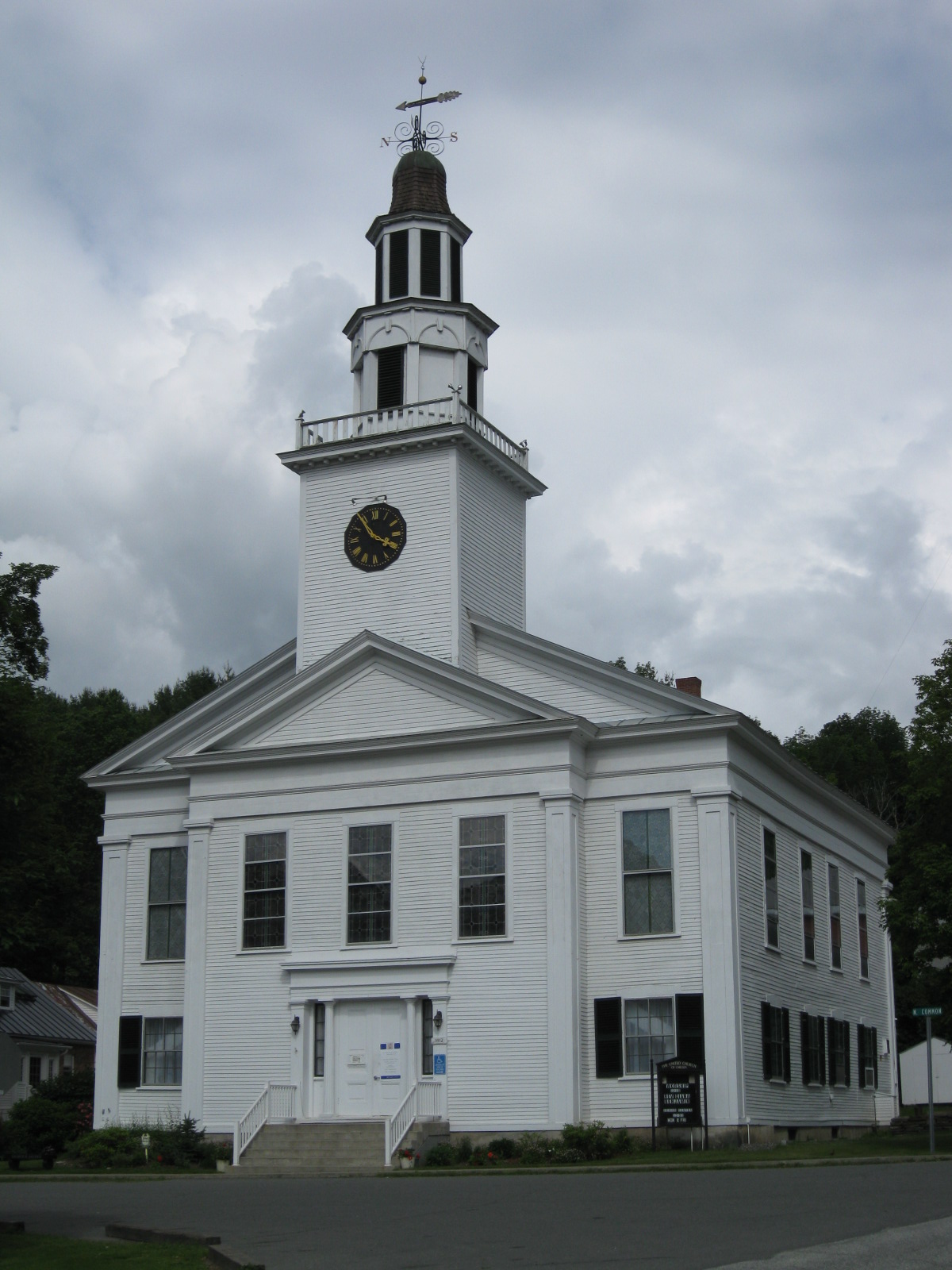
43°52′59″N 72°30′17″W / 43.883056°N 72.504722°WTunbridge 17 Congregational Church of Chelsea 
September 3, 1976 Chelsea Green
43°59′19″N 72°26′48″W / 43.988611°N 72.446667°WChelsea 18 Depot Square Historic District May 29, 1975 Both sides of Main, Pleasant and Salisbury Sts., and both sides of the Central Vermont Railway tracks
43°55′23″N 72°39′58″W / 43.923056°N 72.666111°WRandolph 19 Ely Boston & Maine Railroad Depot December 9, 1994 U.S. Route 5 south of its junction with VT 244
43°52′24″N 72°10′40″W / 43.873333°N 72.177778°WFairlee 20 Fairlee Railroad Depot July 23, 1998 Between U.S. Route 5 and the Boston and Maine Railroad tracks
43°54′23″N 72°08′40″W / 43.906389°N 72.144444°WFairlee 21 Flint Covered Bridge 
September 10, 1974 Northeast of Tunbridge off VT 110, over the First Branch of the White River
43°56′56″N 72°27′31″W / 43.948889°N 72.458611°WTunbridge 22 Foundry Bridge July 11, 2007 VT 25
43°54′52″N 72°28′37″W / 43.914444°N 72.476944°WTunbridge 23 Gifford Covered Bridge 
July 30, 1974 South of Randolph off VT 14 over the Second Branch of the White River
43°55′00″N 72°33′25″W / 43.916667°N 72.556944°WEast Randolph 24 Goshen Church September 3, 1976 North of Bradford on Goshen Rd.
44°02′52″N 72°08′54″W / 44.047778°N 72.148333°WBradford 25 Hayward and Kibby Mill 
March 12, 1992 Spring Rd. at the First Branch of the White River
43°53′29″N 72°29′31″W / 43.891389°N 72.491944°WTunbridge 26 Howe Covered Bridge September 10, 1974 South of Tunbridge off VT 110, over the First Branch of the White River
43°51′53″N 72°29′58″W / 43.864722°N 72.499444°WTunbridge 27 Kimball Public Library March 14, 1985 67 Main St.
43°55′31″N 72°39′58″W / 43.925278°N 72.666111°WRandolph 28 Kingsbury Covered Bridge 
July 30, 1974 South of East Randolph off VT 14 over the Second Branch of the White River
43°52′52″N 72°34′56″W / 43.881111°N 72.582222°WEast Randolph 29 Lanakila Camp September 5, 2003 2899 Lake Morey Rd.
43°56′12″N 72°06′28″W / 43.936667°N 72.107778°WFairlee 30 Larkin Covered Bridge July 30, 1974 Northeast of North Tunbridge off VT 110 over the First Branch of the White River
43°55′22″N 72°27′56″W / 43.922778°N 72.465556°WNorth Tunbridge 31 Mari-Castle May 24, 1990 41 S. Main St.
43°55′03″N 72°40′06″W / 43.9175°N 72.668333°WRandolph 32 Asa May House April 7, 1993 Town Highway 4 (Blood Brook Rd.) southeast of West Fairlee Center
43°55′33″N 72°12′32″W / 43.925833°N 72.208889°WWest Fairlee 33 Mill Covered Bridge July 30, 1974 West of VT 110, over the First Branch of the White River
43°53′29″N 72°29′31″W / 43.891389°N 72.491944°WTunbridge 34 Justin Smith Morrill Homestead 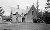
October 15, 1966 South of the Common
43°51′46″N 72°22′33″W / 43.862778°N 72.375833°WStrafford Gothic Revival home of Justin Smith Morrill, Vermont Representative and Senator known for the 1862 and 1890 Morrill Land-Grant Colleges Acts. 35 Moxley Covered Bridge September 10, 1974 South of Chelsea over the First Branch of the White River
43°57′25″N 72°27′49″W / 43.956944°N 72.463611°WChelsea 36 Newbury Town House 
July 28, 1983 Scotch Hollow Rd.
44°06′22″N 72°07′34″W / 44.106111°N 72.126111°WNewbury 37 Newbury Village Historic District August 4, 1983 Main, Pulaski, Cross, and Pine Sts., Chapel Rd. and Romance Lane
44°04′40″N 72°03′29″W / 44.077778°N 72.058056°WNewbury 38 Marvin Newton House June 11, 1980 Ridge Rd.
44°01′27″N 72°36′07″W / 44.024167°N 72.601944°WBrookfield Center 39 Oxbow Historic District July 28, 1983 VT 5
44°00′33″N 72°03′06″W / 44.009167°N 72.051667°WNewbury 40 Peabody Library September 27, 1984 VT 113
43°53′07″N 72°15′40″W / 43.885278°N 72.261111°WThetford 41 Post Mills Church October 29, 1992 VT 244 east of its junction with VT 113
43°53′14″N 72°15′08″W / 43.887222°N 72.252222°WThetford 42 Randolph Center Historic District November 21, 1974 West and Main Sts.
43°56′18″N 72°36′46″W / 43.938333°N 72.612778°WRandolph 43 South Newbury Village Historic District July 28, 1983 U.S. Route 5 and Doe Hill Rd.
44°02′44″N 72°05′11″W / 44.045556°N 72.086389°WSouth Newbury 44 South Tunbridge Methodist Episcopal Church March 2, 2001 VT 110 1/3 mile north of the Royalton town line
43°51′24″N 72°30′07″W / 43.856667°N 72.501944°WTunbridge 45 Strafford Village Historic District June 20, 1974 Roughly both sides of the Morrill Highway and Sharon Brook Rd.
43°51′54″N 72°22′44″W / 43.865°N 72.378889°WStrafford 46 Stratton's Inn July 29, 1982 East of Brookfield on East St.
44°02′50″N 72°35′05″W / 44.047222°N 72.584722°WBrookfield 47 Thetford Center Covered Bridge September 17, 1974 Over the Ompompanoosuc River
43°49′55″N 72°15′12″W / 43.831944°N 72.253333°WThetford 48 Thetford Center Historic District March 5, 1998 Roughly along VT 113, Tucker Hill Rd., and Buzzell Bridge Rd.
43°49′46″N 72°15′02″W / 43.829444°N 72.250556°WThetford 49 Thetford Hill Historic District October 27, 1988 Roughly VT 113 and Academy Rd.
43°49′01″N 72°13′44″W / 43.816944°N 72.228889°WThetford 50 Thetford Hill State Park February 14, 2002 622 Academy Rd.
43°48′43″N 72°14′24″W / 43.811944°N 72.24°WThetford 51 Tunbridge Village Historic District June 24, 1994 Roughly, along VT 110 and adjacent roads including Town Road 45 and Spring and Stafford Rds.
43°53′15″N 72°29′42″W / 43.8875°N 72.495°WTunbridge 52 Union Village Covered Bridge September 17, 1974 Over the Ompompanoosuc River
43°47′19″N 72°15′17″W / 43.788611°N 72.254722°WUnion Village 53 Waits River Schoolhouse September 27, 1988 VT 25 north of Waits River
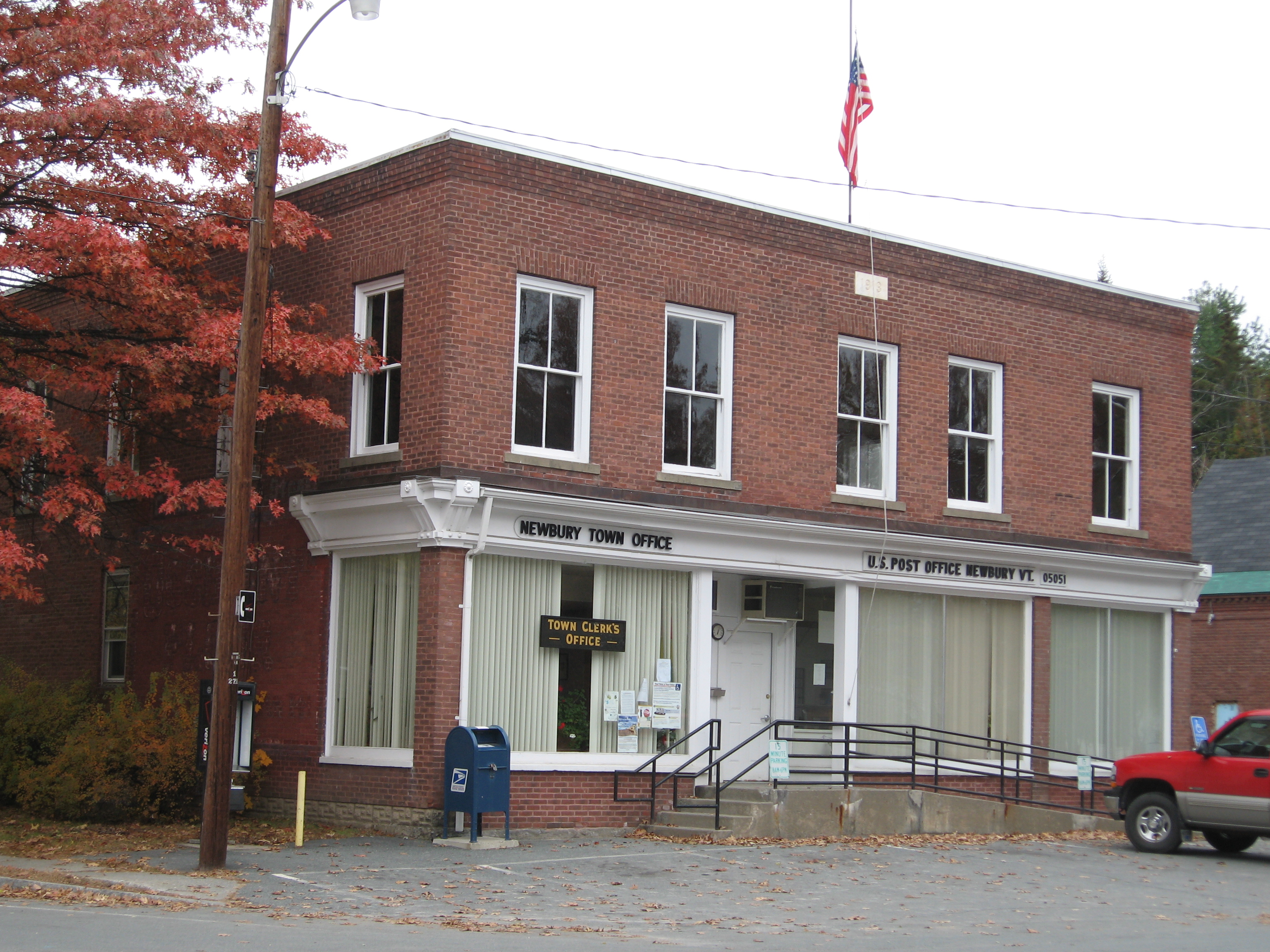
44°05′29″N 72°17′09″W / 44.091389°N 72.285833°WWaits River 54 Well River Graded School September 3, 1976 Main St.
44°09′06″N 72°02′44″W / 44.151667°N 72.045556°WWells River 55 Wells River Village Historic District July 28, 1983 Main, Center, Grove, Cross, and Water Sts.
44°09′08″N 72°02′53″W / 44.152222°N 72.048056°WNewbury 56 West Fairlee Center Church June 21, 2002 3870 Middlebrook Rd.
43°56′34″N 72°13′31″W / 43.942778°N 72.225278°WWest Fairlee 57 West Newbury Village Historic District September 15, 1983 Snake and Tucker Mtn. Rds.
44°03′44″N 72°07′29″W / 44.062222°N 72.124722°WWest Newbury 58 Harlie Whitcomb Farm September 11, 1979 Northeast of Barre off U.S. Route 302
44°09′19″N 72°24′04″W / 44.155278°N 72.401111°WBarre 59 Wildwood Hall October 2, 1978 Southwest of Newbury off U.S. Route 5
44°04′11″N 72°04′50″W / 44.069722°N 72.080556°WNewbury See also
- List of National Historic Landmarks in Vermont
- National Register of Historic Places listings in Vermont
References
- ^ The latitude and longitude information provided in this table was derived originally from the National Register Information System, which has been found to be fairly accurate for about 99% of listings. For about 1% of NRIS original coordinates, experience has shown that one or both coordinates are typos or otherwise extremely far off; some corrections may have been made. A more subtle problem causes many locations to be off by up to 150 yards, depending on location in the country: most NRIS coordinates were derived from tracing out latitude and longitudes off of USGS topographical quadrant maps created under the North American Datum of 1927, which differs from the current, highly accurate WGS84 GPS system used by Google maps. Chicago is about right, but NRIS longitudes in Washington are higher by about 4.5 seconds, and are lower by about 2.0 seconds in Maine. Latitudes differ by about 1.0 second in Florida. Some locations in this table may have been corrected to current GPS standards.
- ^ "National Register of Historic Places: Weekly List Actions". National Park Service, United States Department of the Interior. Retrieved on November 10, 2011.
- ^ Numbers represent an ordering by significant words. Various colorings, defined here, differentiate National Historic Landmark sites and National Register of Historic Places Districts from other NRHP buildings, structures, sites or objects.
- ^ "National Register Information System". National Register of Historic Places. National Park Service. . http://nrhp.focus.nps.gov/natreg/docs/All_Data.html.
U.S. National Register of Historic Places Topics Lists by states Alabama • Alaska • Arizona • Arkansas • California • Colorado • Connecticut • Delaware • Florida • Georgia • Hawaii • Idaho • Illinois • Indiana • Iowa • Kansas • Kentucky • Louisiana • Maine • Maryland • Massachusetts • Michigan • Minnesota • Mississippi • Missouri • Montana • Nebraska • Nevada • New Hampshire • New Jersey • New Mexico • New York • North Carolina • North Dakota • Ohio • Oklahoma • Oregon • Pennsylvania • Rhode Island • South Carolina • South Dakota • Tennessee • Texas • Utah • Vermont • Virginia • Washington • West Virginia • Wisconsin • WyomingLists by territories Lists by associated states Other Municipalities and communities of Orange County, Vermont Towns Bradford | Braintree | Brookfield | Chelsea | Corinth | Fairlee | Newbury | Orange | Randolph | Strafford | Thetford | Topsham | Tunbridge | Vershire | Washington | West Fairlee | Williamstown

Villages Newbury | Post Mills | Wells River
CDP Categories:- National Register of Historic Places in Vermont by county
- Orange County, Vermont
-


Wikimedia Foundation. 2010.