- National Register of Historic Places listings in Bennington County, Vermont
-
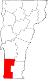 Location of Bennington County in Vermont
This is a list of the National Register of Historic Places listings in Bennington County, Vermont.
This is intended to be a complete list of the properties and districts on the National Register of Historic Places in Bennington County, Vermont, United States. Latitude and longitude coordinates are provided for many National Register properties and districts; these locations may be seen together in a Google map.[1]
There are 49 properties and districts listed on the National Register in the county.
-
- This National Park Service list is complete through NPS recent listings posted November 10, 2011.[2]
Contents: Counties in Vermont Addison - Bennington - Caledonia - Chittenden - Essex - Franklin - Grand Isle - Lamoille - Orange - Orleans - Rutland - Washington - Windham - Windsor Current listings
[3] Landmark name [4] Image Date listed Location City or town Summary 1 Arlington Green Covered Bridge August 28, 1973 Off VT 313 west of Arlington
43°06′16″N 73°13′14″W / 43.104444°N 73.220556°WArlington 2 Arlington Village Historic District 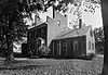
November 2, 1989 Roughly Main St., School St., E. Arlington Rd., and Battenkill Dr.
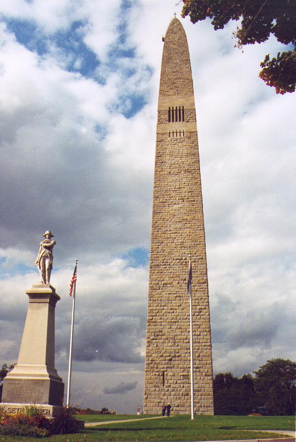
43°04′22″N 73°09′23″W / 43.072778°N 73.156389°WArlington 3 Bennington Battle Monument 
March 31, 1971 Monument Circle
42°53′20″N 73°13′00″W / 42.888889°N 73.216667°WBennington 4 Bennington Falls Covered Bridge August 28, 1973 Northwest of Bennington off VT 67A
42°54′46″N 73°14′03″W / 42.912778°N 73.234167°WBennington 5 Bennington Fish Hatchery April 21, 1994 South Stream Rd.
42°51′24″N 73°10′00″W / 42.856667°N 73.166667°WBennington 6 Bennington High School August 26, 2005 650 Main St.
42°52′49″N 73°11′24″W / 42.880278°N 73.19°WBennington 7 Bennington Post Office December 12, 1976 118 South St.
42°52′32″N 73°11′51″W / 42.875556°N 73.1975°WBennington 8 Bennington Railroad Station November 9, 1988 Depot and River Sts.
42°52′54″N 73°11′58″W / 42.881667°N 73.199444°WBennington 9 W. H. Bradford Hook and Ladder Fire House October 28, 1999 212 Safford St.
42°52′52″N 73°11′19″W / 42.881111°N 73.188611°WBennington 10 Carrigan Lane Historic District September 3, 1998 Roughly along Carrigan Ln., from Division St. to Safford St.
42°52′59″N 73°11′19″W / 42.883056°N 73.188611°WBennington 11 Center Shaftsbury Historic District November 9, 1988 VT 7A
42°59′05″N 73°12′42″W / 42.984722°N 73.211667°WShaftsbury 12 Dorset Village Historic District April 18, 1985 Roughly bounded by Main and Church Sts. and Dorset Hollow Rd.; also the junction of Church St. and West Rd.
43°15′26″N 73°06′15″W / 43.257222°N 73.104167°WDorset Second set of boundaries represents a boundary increase 13 Downtown Bennington Historic District April 1, 1980 U.S. Route 7 and VT 9; also North, Main, and Silver Sts.
42°52′43″N 73°11′51″W / 42.878611°N 73.1975°WBennington Second set of boundaries represents a boundary increase 14 East Arlington Village Historic District July 5, 1996 Roughly bounded by Old Mill, Ice Pond, E. Arlington, and Warm Brook Rds., Maple and Pleasnt Sts., and the Lane
43°03′42″N 73°08′40″W / 43.061667°N 73.144444°WArlington 15 Equinox House November 21, 1972 Main St.
43°09′43″N 73°04′25″W / 43.161944°N 73.073611°WManchester 16 Equinox House Historic District June 3, 1980 Main and Union Sts.
43°09′43″N 73°04′23″W / 43.161944°N 73.073056°WManchester 17 First Congregational Church of Bennington 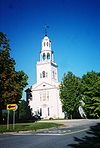
April 24, 1973 Monument Ave.
42°53′00″N 73°12′48″W / 42.883333°N 73.213333°WBennington 18 Robert Frost Farm May 23, 1968 0.25 mi (0.40 km) west of U.S. Route 7 on Buck Hill Rd.
42°56′28″N 73°11′42″W / 42.941111°N 73.195°WSouth Shaftsbury 19 Furnace Grove Historic District June 27, 1997 VT 9, 1 mi (1.6 km) east of the junction of VT 9 and Burgess Rd.
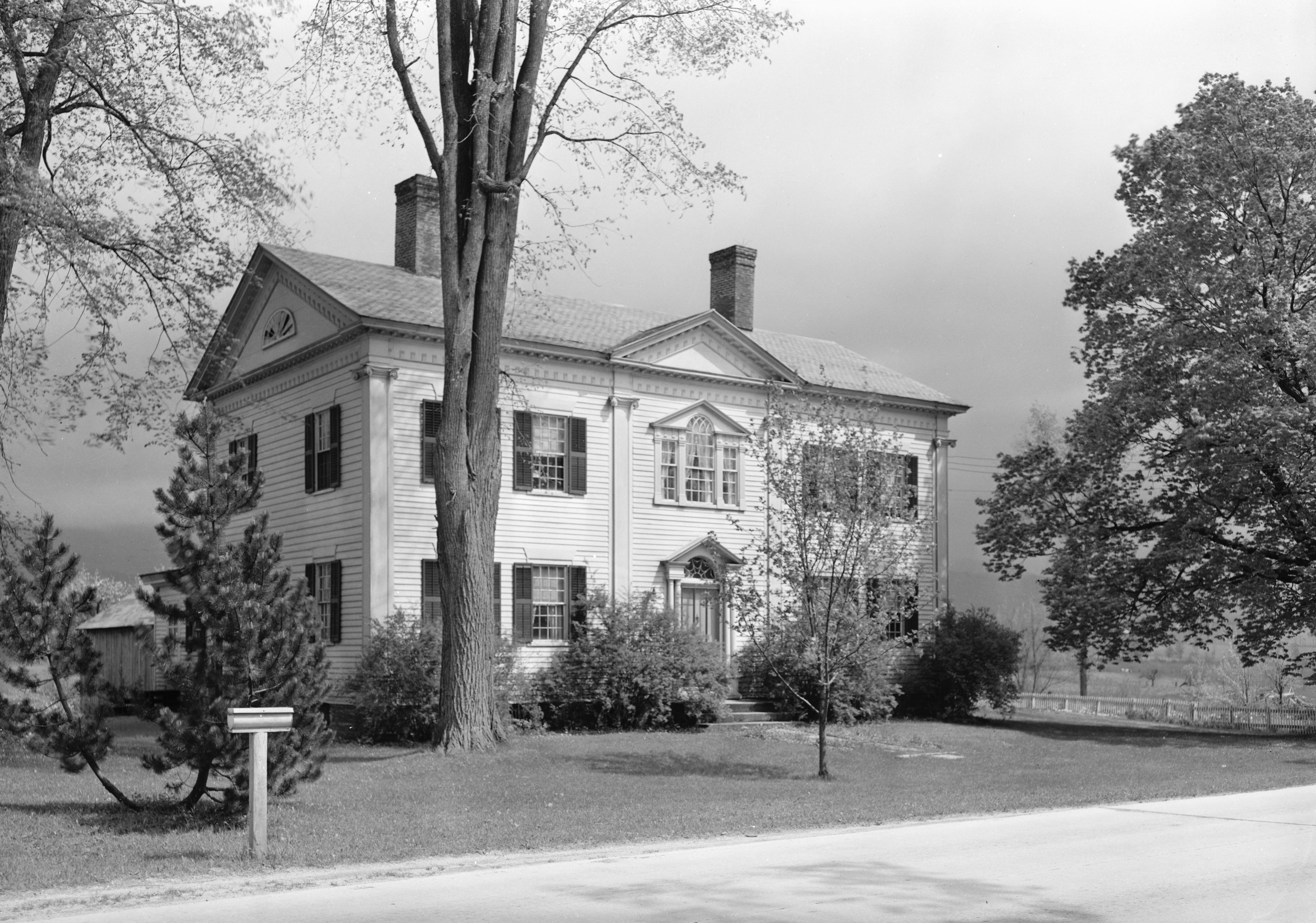
42°53′06″N 73°09′24″W / 42.885°N 73.156667°WBennington 20 Gov. Jonas Galusha Homestead 
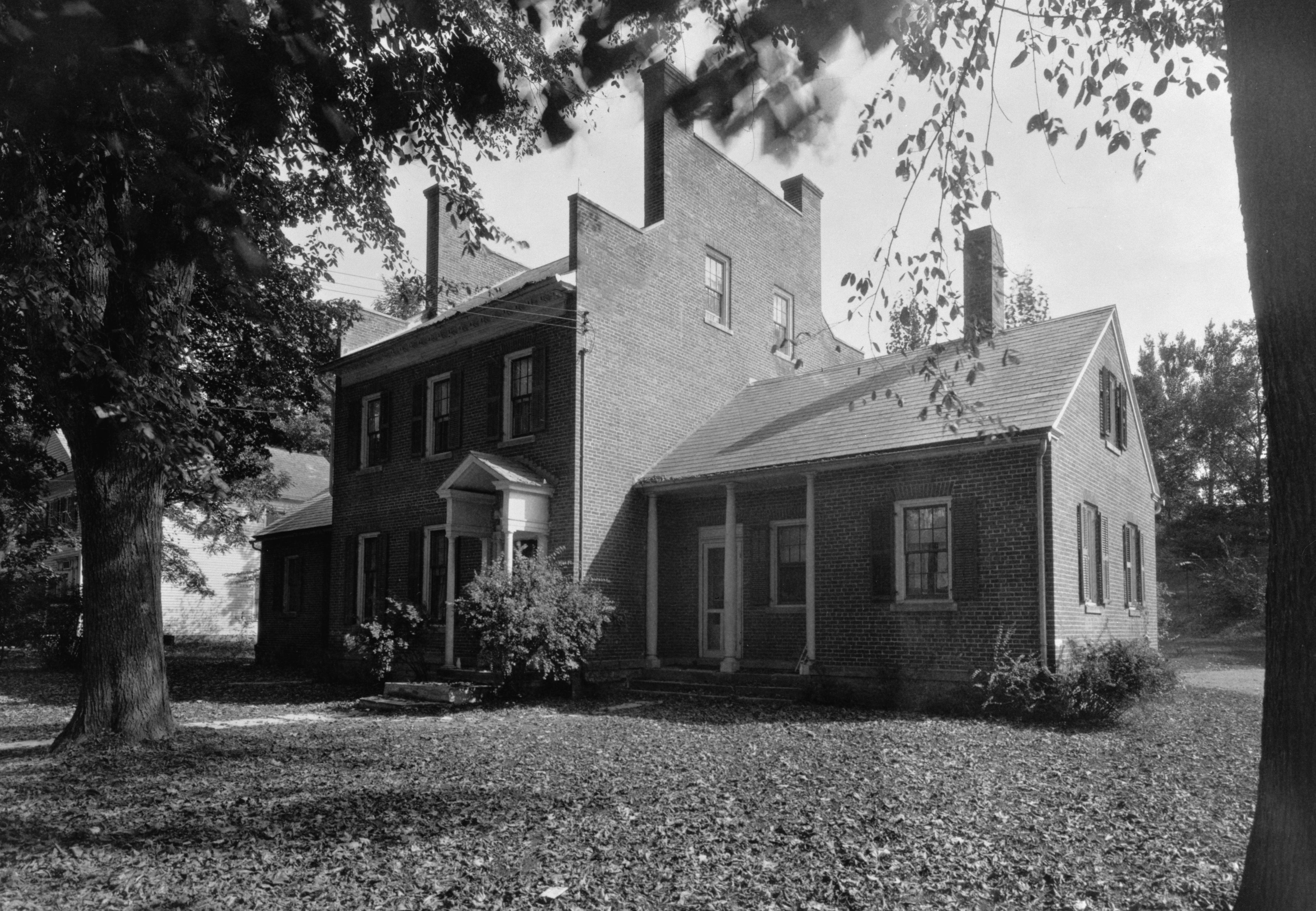
November 30, 1979 U.S. Route 7
42°59′23″N 73°12′54″W / 42.989722°N 73.215°WCenter Shaftsbury 21 Zera Hard House November 9, 1988 River Rd.
43°07′49″N 73°04′56″W / 43.130278°N 73.082222°WManchester 22 Henry Covered Bridge 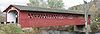
August 28, 1973 Northwest of Bennington off VT 67A
42°54′45″N 73°15′18″W / 42.9125°N 73.255°WBennington 23 William Henry House 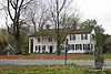
November 9, 1988 River Rd.
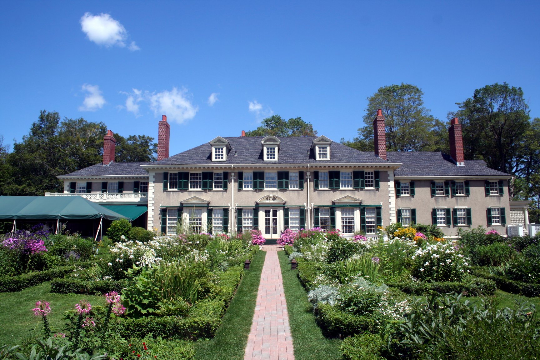
42°54′30″N 73°15′20″W / 42.908333°N 73.255556°WBennington 24 Hildene 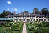
October 28, 1977 820 Hildene Rd.
43°08′13″N 73°04′25″W / 43.136944°N 73.073611°WManchester 25 Holden-Leonard Mill Complex November 14, 1988 160 Benmont Ave.
42°53′06″N 73°12′13″W / 42.885°N 73.203611°WBennington 26 Holden-Leonard Workers Housing Historic District May 19, 2011 121-139, 124-150 Benmont Ave. & 105-115, 117-123 Holden St.
42°53′00″N 73°12′07″W / 42.883333°N 73.201944°WBennington 27 Jenks Tavern March 17, 1994 Junction of Dorset West Rd. and VT 315
43°16′20″N 73°07′35″W / 43.272222°N 73.126389°WRupert 28 Johnny Seesaw's Historic District July 18, 2008 3574 VT 11
43°12′58″N 72°55′28″W / 43.216111°N 72.924444°WPeru 29 Kent Neighborhood Historic District July 14, 1978 South of Dorset at Dorset West and Nichols Hill Rds.
43°14′22″N 73°05′54″W / 43.239444°N 73.098333°WDorset 30 Amos Lawrence House May 21, 1985 Richville Rd.
43°09′55″N 73°03′11″W / 43.165278°N 73.053056°WManchester 31 Manchester Village Historic District January 26, 1984 U.S. Route 7A, Union St., and Taconic Ave.
43°09′38″N 73°04′22″W / 43.160556°N 73.072778°WManchester 32 Manley-Lefevre House January 26, 1990 Dorset West Rd., Town Highway 1
43°13′36″N 73°05′13″W / 43.226667°N 73.086944°WDorset 33 David Mathews House September 10, 1979 VT 67
42°56′27″N 73°16′28″W / 42.940833°N 73.274444°WBennington Extends into Rensselaer County, New York 34 Munro-Hawkins House 
May 17, 1973 0.5 mi (0.80 km) south of Shaftsbury Center on U.S. Route 7
42°57′24″N 73°12′31″W / 42.956667°N 73.208611°WShaftsbury Center 35 North Bennington Depot April 11, 1973 Main St. at the Vermont Railway tracks
42°56′03″N 73°14′31″W / 42.934167°N 73.241944°WNorth Bennington 36 North Bennington Historic District August 29, 1980 VT 67 and VT 67A
42°55′48″N 73°14′35″W / 42.93°N 73.243056°WNorth Bennington 37 Old Bennington Historic District October 4, 1984 Roughly bounded by the former Rutland Railway line, Monument Ave. and Circle, West Rd., Seminary Lane, and Elm and Fairview Sts.
42°53′01″N 73°12′45″W / 42.883611°N 73.2125°WBennington 38 The Orchards April 24, 2000 982 Mansion Dr.
42°52′08″N 73°13′13″W / 42.868889°N 73.220278°WBennington 39 Park-McCullough House October 26, 1972 Southwestern corner of West and Park Sts.
42°55′42″N 73°14′49″W / 42.928333°N 73.246944°WNorth Bennington 40 Pratt-McDaniels-LaFlamme House July 11, 2002 501-507 South St.
42°52′21″N 73°11′50″W / 42.8725°N 73.197222°WBennington 41 Ritchie Block November 6, 1986 465-473 Main St.
42°52′39″N 73°11′44″W / 42.8775°N 73.195556°WBennington 42 School Street Duplexes March 13, 2007 343-345 and 347-349 School St.
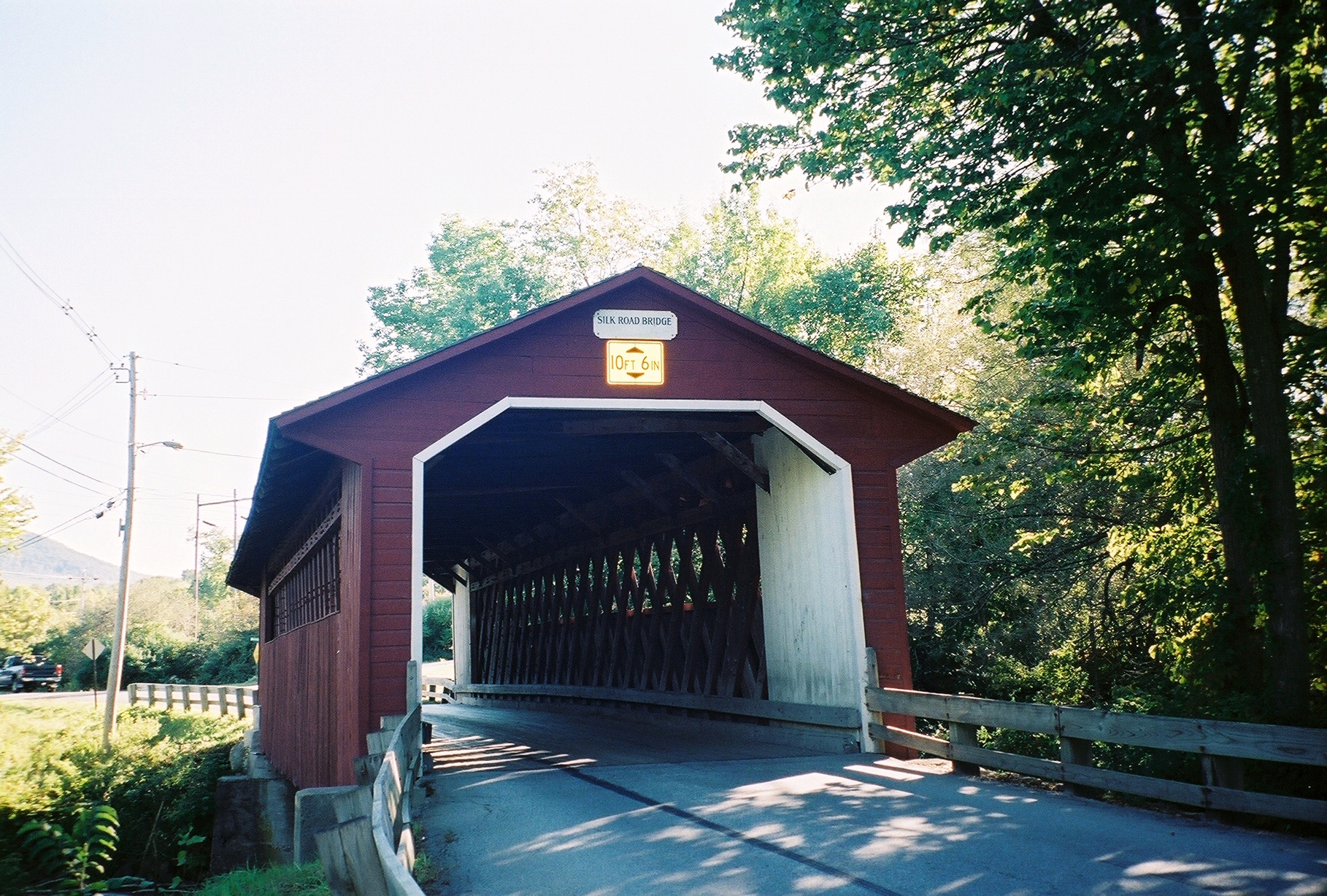
42°53′09″N 73°11′40″W / 42.885833°N 73.194444°WBennington 43 Silk Covered Bridge 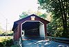
August 28, 1973 Northwest of Bennington off VT 67A
42°54′34″N 73°13′33″W / 42.909444°N 73.225833°WBennington 44 Frederick Squire House July 30, 1992 185 North St.
42°52′57″N 73°11′50″W / 42.8825°N 73.197222°WBennington 45 Tudor House September 10, 1979 VT 8
42°45′05″N 73°04′11″W / 42.751389°N 73.069722°WStamford 46 Wait Block November 7, 1996 Near the junction of Main and Bonnet Sts. in Manchester Center
43°10′36″N 73°03′24″W / 43.176667°N 73.056667°WManchester 47 Cora B. Whitney School November 19, 2001 814 Gage St.
42°52′53″N 73°10′59″W / 42.881389°N 73.183056°WBennington 48 Wilson House December 13, 1995 Junction of Village St. and Mad Tom Rd.
43°14′22″N 73°00′33″W / 43.239444°N 73.009167°WEast Dorset 49 Yester House November 10, 1988 West Rd.
43°10′39″N 73°04′39″W / 43.1775°N 73.0775°WManchester Now the Southern Vermont Arts Center See also
- List of National Historic Landmarks in Vermont
- National Register of Historic Places listings in Vermont
References
- ^ The latitude and longitude information provided in this table was derived originally from the National Register Information System, which has been found to be fairly accurate for about 99% of listings. For about 1% of NRIS original coordinates, experience has shown that one or both coordinates are typos or otherwise extremely far off; some corrections may have been made. A more subtle problem causes many locations to be off by up to 150 yards, depending on location in the country: most NRIS coordinates were derived from tracing out latitude and longitudes off of USGS topographical quadrant maps created under the North American Datum of 1927, which differs from the current, highly accurate WGS84 GPS system used by Google maps. Chicago is about right, but NRIS longitudes in Washington are higher by about 4.5 seconds, and are lower by about 2.0 seconds in Maine. Latitudes differ by about 1.0 second in Florida. Some locations in this table may have been corrected to current GPS standards.
- ^ "National Register of Historic Places: Weekly List Actions". National Park Service, United States Department of the Interior. Retrieved on November 10, 2011.
- ^ Numbers represent an ordering by significant words. Various colorings, defined here, differentiate National Historic Landmark sites and National Register of Historic Places Districts from other NRHP buildings, structures, sites or objects.
- ^ "National Register Information System". National Register of Historic Places. National Park Service. . http://nrhp.focus.nps.gov/natreg/docs/All_Data.html.
U.S. National Register of Historic Places Topics Lists by states Alabama • Alaska • Arizona • Arkansas • California • Colorado • Connecticut • Delaware • Florida • Georgia • Hawaii • Idaho • Illinois • Indiana • Iowa • Kansas • Kentucky • Louisiana • Maine • Maryland • Massachusetts • Michigan • Minnesota • Mississippi • Missouri • Montana • Nebraska • Nevada • New Hampshire • New Jersey • New Mexico • New York • North Carolina • North Dakota • Ohio • Oklahoma • Oregon • Pennsylvania • Rhode Island • South Carolina • South Dakota • Tennessee • Texas • Utah • Vermont • Virginia • Washington • West Virginia • Wisconsin • WyomingLists by territories Lists by associated states Other Municipalities and communities of Bennington County, Vermont Towns Arlington | Bennington | Dorset | Glastenbury‡ | Landgrove | Manchester | Peru | Pownal | Readsboro | Rupert | Sandgate | Searsburg | Shaftsbury | Stamford | Sunderland | Winhall | Woodford

Villages CDPs Footnotes ‡ Disincorporated
Categories:- National Register of Historic Places in Vermont by county
- Bennington County, Vermont
-


Wikimedia Foundation. 2010.