- Manchester (village), Vermont
-
Manchester, Vermont — Village — Location within the state of Vermont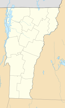
 Manchester, Vermont
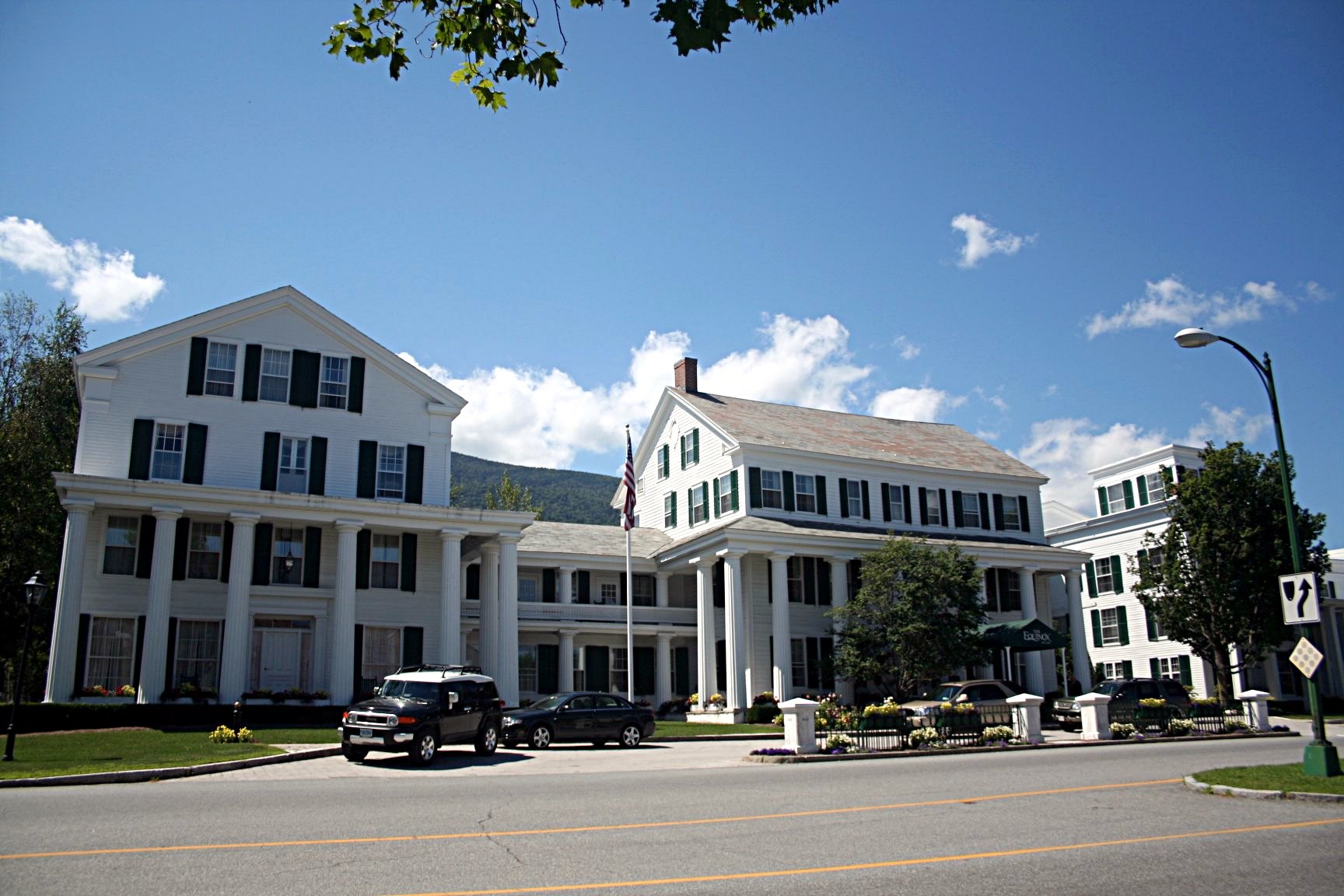
Coordinates: 43°9′43″N 73°4′18″W / 43.16194°N 73.07167°WCoordinates: 43°9′43″N 73°4′18″W / 43.16194°N 73.07167°W Country United States State Vermont County Bennington Area – Total 3.6 sq mi (9.3 km2) – Land 3.6 sq mi (9.3 km2) – Water 0.0 sq mi (0.0 km2) Elevation 883 ft (269 m) Population (2000) – Total 602 – Density 168.1/sq mi (64.9/km2) Time zone Eastern (EST) (UTC-5) – Summer (DST) EDT (UTC-4) ZIP code 05254 Area code(s) 802 FIPS code 50-42700[1] GNIS feature ID 1461117[2] Manchester Village Historic District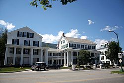 The Equinox Hotel in Manchester
Location: US 7A, Union St., and Taconic Ave., Manchester, Vermont Coordinates: 43°9′38″N 73°4′22″W / 43.16056°N 73.07278°WCoordinates: 43°9′38″N 73°4′22″W / 43.16056°N 73.07278°W Area: 90 acres (36 ha) Architectural style: Colonial, Federal, Greek Revival Governing body: Local NRHP Reference#: 84003438[3] Added to NRHP: January 26, 1984 Manchester is an incorporated village in the town of Manchester, Bennington County, Vermont, United States. The population was 602 at the 2000 census.
The village center, located in the vicinity of Vermont Route 7A, Union Street and Taconic Avenue, was added to the National Register of Historic Places as Manchester Village Historic District in 1984. The district includes 65 contributing and 19 non-contributing properties spread over an area of 90 acres (360,000 m2). The centerpiece of the district is the Equinox House, which is listed separately on the National Register.
Contents
History
Manchester Village was first settled in 1761. Through the middle of the 19th century, Manchester was primarily a crossroads village and the site of several taverns and inns. The village's first inn was built in 1769 on the property that is now the site of the Equinox House. Settlement was slow until after the American Revolutionary War, when the area received an influx of settlers, as Vermont temporarily became the fastest growing U.S. state.[4]
Geography
Manchester Village is located on the banks of Batten Kill in the north-south trending valley between the Green Mountains on the east and the Taconics on the west. U.S. Route 7A runs north-south through the village and Batten Kill forms its eastern boundary.[5] According to the United States Census Bureau, the village has a total area of 3.6 square miles (9.3 km²), of which 3.6 square miles (9.3 km²) is land and 0.28% is water.
Demographics
As of the census[1] of 2000, there were 602 people, 284 households, and 170 families residing in the village. The population density was 168.1 people per square mile (64.9/km²). There were 483 housing units at an average density of 134.9/sq mi (52.1/km²). The racial makeup of the village was 98.50% White, 0.17% Black or African American, 0.33% Asian, 0.66% from other races, and 0.33% from two or more races. Hispanic or Latino of any race were 1.99% of the population.
There were 284 households out of which 20.8% had children under the age of 18 living with them, 54.2% were married couples living together, 4.9% had a female householder with no husband present, and 39.8% were non-families. 35.2% of all households were made up of individuals and 23.9% had someone living alone who was 65 years of age or older. The average household size was 2.12 and the average family size was 2.70.
In the village the population was spread out with 19.3% under the age of 18, 3.3% from 18 to 24, 16.6% from 25 to 44, 32.2% from 45 to 64, and 28.6% who were 65 years of age or older. The median age was 52 years. For every 100 females there were 83.5 males. For every 100 females age 18 and over, there were 80.0 males.
The median income for a household in the village was $57,321, and the median income for a family was $92,044. Males had a median income of $60,469 versus $22,250 for females. The per capita income for the village was $40,851. None of the families and 5.0% of the population were living below the poverty line, including no under eighteens and 11.6% of those over 64.
References
- ^ a b "American FactFinder". United States Census Bureau. http://factfinder.census.gov. Retrieved 2008-01-31.
- ^ "US Board on Geographic Names". United States Geological Survey. 2007-10-25. http://geonames.usgs.gov. Retrieved 2008-01-31.
- ^ "National Register Information System". National Register of Historic Places. National Park Service. 2009-03-13. http://nrhp.focus.nps.gov/natreg/docs/All_Data.html.
- ^ Village of Manchester Plan of Development, August 2010
- ^ Village of Manchester Plan of Development, August 2010. Section 1.1 (page 1)
External links
Municipalities and communities of Bennington County, Vermont Towns Arlington | Bennington | Dorset | Glastenbury‡ | Landgrove | Manchester | Peru | Pownal | Readsboro | Rupert | Sandgate | Searsburg | Shaftsbury | Stamford | Sunderland | Winhall | Woodford

Villages Manchester | North Bennington | Old Bennington
CDPs Footnotes ‡ Disincorporated
{National Register of Historic Places}}
Categories:- Historic districts in the United States
- Incorporated villages in Vermont
- Manchester, Vermont
- Populated places in Bennington County, Vermont
- Historic districts in Vermont


Wikimedia Foundation. 2010.