Ompompanoosuc River

Ompompanoosuc River
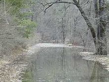
The Ompompanoosuc River near the Union Village Dam in Thetford

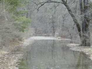
The Ompompanoosuc River (pronounced /ˈɒmpɒmpənuːsək/)[1] is a river, about 25 mi (40 km) long, in eastern Vermont in the United States. It is a tributary of the Connecticut River, which flows to Long Island Sound. According to the Geographic Names Information System, the river has also been known by the names "Om-pom-pa-noos-uc" and "Pompanoosuc."[2]

The Ompompanoosuc River rises in eastern Orange County in the town of Vershire, and flows generally southwardly through the towns of West Fairlee and Thetford into northeastern Windsor County, where it joins the Connecticut River in the town of Norwich.[3]

In Thetford the river is dammed by the Union Village Dam,[3] which was completed in 1950 as part of a U.S. Army Corps of Engineers project for flood control.[4].

The West Branch Ompompanoosuc River flows generally southeastwardly through the towns of Vershire and Strafford to Thetford, where it joins the main stem of the river.[3][5]

See also

  • List of Vermont rivers

References

  1. ^ Columbia Gazetteer of North America entry
  2. ^ U.S. Geological Survey Geographic Names Information System: Ompompanoosuc River
  3. ^ a b c DeLorme (1996). Vermont Atlas & Gazetteer. Yarmouth, Maine: DeLorme. ISBN 0-89933-016-9
  4. ^ Union Village Dam website from the U.S. Army Corps of Engineers
  5. ^ U.S. Geological Survey Geographic Names Information System: West Branch Ompompanoosuc River


Coordinates: 43°55′41″N 72°18′30″W / 43.928119°N 72.3083707°W / 43.928119; -72.3083707


Wikimedia Foundation. 2010.

Игры ⚽ Поможем сделать НИР

Look at other dictionaries:

  • Bahnstrecke White River Junction–Lennoxville — White River Junction VT– Lennoxville QC[1][2][3][4] Streckenlänge: 227 km Spurweite: 1435 mm (Normalspur) Legende …   Deutsch Wikipedia

  • Connecticut River — Coordinates: 41°16′20″N 72°20′03″W / 41.27222°N 72.33417°W / 41.27222; 72.33417 …   Wikipedia

  • Connecticut River — Einzugsgebiet des Flusses Daten …   Deutsch Wikipedia

  • List of rivers of Vermont — This is a list of rivers in the U.S. state of Vermont, sorted by drainage basin, and ordered from lower to higher, with the towns at their mouths: Connecticut River The Connecticut River drains south. Flowing into it are:* West River, Brattleboro …   Wikipedia

  • National Register of Historic Places listings in Orange County, Vermont — Location of Orange County in Vermont This is a list of the National Register of Historic Places listings in Orange County, Vermont. This is intended to be a complete list of the properties and districts on the National Register of Historic Places …   Wikipedia

  • Norwich, Vermont —   Town   Located in Windsor County, Vermont …   Wikipedia

  • Río Connecticut — Saltar a navegación, búsqueda Río Connecticut Arriba: Cuenca del río C …   Wikipedia Español

  • Acid mine drainage — Yellow boy in a stream receiving acid drainage from surface coal mining. Acid mine drainage (AMD), or acid rock drainage (ARD), refers to the outflow of acidic water from (usually abandoned) metal mines or coal mines. However, other areas where… …   Wikipedia

  • Norwich (Vermont) — Norwich …   Deutsch Wikipedia

  • Abbott Brook — ist der Name mehrerer Flüsse in den Vereinigten Staaten: Abbott Brook (Westfield River), ein Fluss im US Bundesstaat Massachusetts Abbott Brook (Ashuelot River), ein Fluss im US Bundesstaat New Hampshire Abbott Brook (Indian Stream), ein Fluss im …   Deutsch Wikipedia

Share the article and excerpts

Direct link
Do a right-click on the link above
and select “Copy Link”