- Thetford, Vermont
Infobox Settlement
official_name = Pagename
other_name =
native_name =
nickname =
settlement_type = Town
motto =
imagesize =
image_caption =
flag_size =
image_
seal_size =
image_shield =
shield_size =
image_blank_emblem =
blank_emblem_size =
mapsize = 250px
map_caption = Located in Orange County, Vermont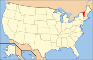
mapsize1 = 195px
map_caption1 = Location of Vermont with the U.S.A.
subdivision_type = Country
subdivision_name =United States
subdivision_type1 = State
subdivision_name1 =Vermont
subdivision_type2 = County
subdivision_name2 = Orange
subdivision_type3 =
subdivision_name3 =
subdivision_type4 =
subdivision_name4 =
government_footnotes =
government_type =
leader_title =
leader_name =
leader_title1 =
leader_name1 =
leader_title2 =
leader_name2 =
leader_title3 =
leader_name3 =
leader_title4 =
leader_name4 =
established_title = Chartered
established_date = 1761
area_magnitude =
unit_pref = Imperial
area_footnotes =
area_total_km2 = 114.4
area_land_km2 = 112.8
area_water_km2 = 1.6
area_total_sq_mi = 44.2
area_land_sq_mi = 43.6
area_water_sq_mi = 0.6
area_water_percent =
population_as_of = 2000
population_footnotes =
population_note =
population_total = 2617
population_density_km2 = 23.2
population_density_sq_mi = 60.1
population_blank1_title = Households
population_blank1 = 1032
population_blank2_title = Families
population_blank2 = 730
timezone = EST
utc_offset = -5
timezone_DST = EDT
utc_offset_DST = -4
latd = 43 |latm = 49 |lats = 36 |latNS = N
longd = 72 |longm = 14 |longs = 44 |longEW = W
elevation_footnotes =
elevation_m = 184
elevation_ft = 600
postal_code_type =ZIP code
postal_code = 05074
area_code = 802
blank_name = FIPS code
blank_info = 50-72400GR|2
blank1_name = GNIS feature ID
blank1_info = 1462226GR|3
website = [http://www.thetfordvermont.us/ Thetford Official Website]
footnotes =Thetford is a town in Orange County,
Vermont , in theConnecticut River Valley . Created onAugust 12 ,1761 by way of aroyal charter whichKing George III of England issued to GovernorBenning Wentworth ofNew Hampshire . The population was 2,617 at the 2000 census. Thetford is home toThetford Academy , Vermont's oldest secondary school. Swift Water Girl Scout Council also has a summer residential camp here called Camp Farnsworth. Camp Farnsworth originally started under private ownership by Chelebe and Madama Farnsworth in 1908 when it was called Camp Hanoum.Geography
According to the
United States Census Bureau , the town has a total area of 44.2square mile s (114.4km² ), of which, 43.6 square miles (112.8 km²) of it is land and 0.6 square miles (1.6 km²) of it (1.36%) is water. TheOmpompanoosuc River flows through the town, and Interstate Highway 91 traverses it. [DeLorme (1996). "Vermont Atlas & Gazetteer". Yarmouth, Maine: DeLorme. ISBN 0-89933-016-9] Villages within the town of Thetford include East Thetford, Thetford Hill, Thetford Center, and Rices Mills. The town office is in Thetford CenterDemographics
As of the
census GR|2 of 2000, there were 2,617 people, 1,032 households, and 730 families residing in the town. Thepopulation density was 60.1 people per square mile (23.2/km²). There were 1,193 housing units at an average density of 27.4/sq mi (10.6/km²). The racial makeup of the town was 97.44% White, 0.46% African American, 0.23% Native American, 0.57% Asian, 0.19% from other races, and 1.11% from two or more races. Hispanic or Latino of any race were 0.46% of the population.There were 1,032 households out of which 36.8% had children under the age of 18 living with them, 59.4% were married couples living together, 7.1% had a female householder with no husband present, and 29.2% were non-families. 23.2% of all households were made up of individuals and 6.6% had someone living alone who was 65 years of age or older. The average household size was 2.54 and the average family size was 3.00.
In the town the population was spread out with 26.9% under the age of 18, 5.5% from 18 to 24, 29.8% from 25 to 44, 27.4% from 45 to 64, and 10.3% who were 65 years of age or older. The median age was 39 years. For every 100 females there were 94.6 males. For every 100 females age 18 and over, there were 90.5 males.
The median income for a household in the town was $48,333, and the median income for a family was $55,323. Males had a median income of $35,121 versus $29,839 for females. The
per capita income for the town was $22,870. About 4.0% of families and 5.7% of the population were below thepoverty line , including 8.8% of those under age 18 and 6.9% of those age 65 or over.Educational and cultural institutions
Thetford Elementary School in Thetford Hill serves town resident students from Kindergarten through 6th grade. The town then sends its students primarily to
Thetford Academy , a private secondary school. Thetford is also home toOpen Fields School , a private elementary and middle school.The Thetford Public Library has two branches: the main office in Thetford Hill, and a branch in Post Mills.
The Thetford Historical Society is in the same building in Thetford Hill as the main library branch. Additional material is located in a barn nearby, which is open once a year.
Parish Players community theater operates in the historic grange hall in Thetford Hill.
History
In 1974, Thetford became the first U.S. municipality to call for the impeachment of President Richard M. Nixon. [http://www.washingtonpost.com/wp-dyn/articles/A64186-2005Mar1.html]
Notable residents
*
Ruth Dwyer , politician and Republican candidate for governor
*John Eaton, brevet brigadier general in the US Army.
*Harvey Newcomb , clergyman and writer.
*Grace Paley , National Book Award winning fiction writer and poet
*Annie Proulx (former resident), author
*James Rage , Vermont author and radio personality
*Henry Wells , businessman and co-founder ofWells Fargo andAmerican Express .
*Dean Conant Worcester ,zoologist , public official, and authority on thePhilippines .
*Andrew Cook , businessman
*Noel Perrin , essayist
*William Closson , artistExternal links
* [http://www.thetfordvermont.us/ Thetford Vermont Official Town Website]
*References
ources
* [http://www.virtualvermont.com/index.php?loc=http://www.virtualvermont.com/towns/thetford.html| Virtual Vermont]

Wikimedia Foundation. 2010.