- Orange County, Vermont
-
For other uses, see Orange County (disambiguation).
Orange County, Vermont 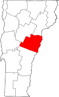
Location in the state of Vermont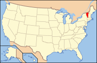
Vermont's location in the U.S.Founded 1781 Shire Town Chelsea Largest town Randolph Area
- Total
- Land
- Water
692 sq mi (1,792 km²)
689 sq mi (1,785 km²)
3 sq mi (8 km²), 0.46%Population
- (2010)
- Density
28,936
42/sq mi (16.21/km²)Orange County is a county located in the U.S. state of Vermont. As of 2010, the population was 28,936. Its shire town is Chelsea[1].
Orange County is part of the Lebanon, NH–VT Micropolitan Statistical Area.
Contents
Geography
According to the U.S. Census Bureau, the county has a total area of 692 square miles (1,790 km2), of which 689 square miles (1,780 km2) is land and 3 square miles (7.8 km2) (0.46%) is water.
Adjacent counties
- Caledonia County, Vermont - northeast
- Grafton County, New Hampshire - east
- Windsor County, Vermont - southwest
- Addison County, Vermont - west
- Washington County, Vermont - northwest
Demographics
Historical populations Census Pop. %± 1790 10,526 — 1800 18,238 73.3% 1810 25,247 38.4% 1820 24,681 −2.2% 1830 27,285 10.6% 1840 27,873 2.2% 1850 27,296 −2.1% 1860 25,455 −6.7% 1870 23,090 −9.3% 1880 23,525 1.9% 1890 19,575 −16.8% 1900 19,313 −1.3% 1910 18,703 −3.2% 1920 17,279 −7.6% 1930 16,694 −3.4% 1940 17,048 2.1% 1950 17,027 −0.1% 1960 16,014 −5.9% 1970 17,676 10.4% 1980 22,739 28.6% 1990 26,149 15.0% 2000 28,226 7.9% 2010 28,936 2.5% [2][3][4] As of the census[5] of 2000, there were 28,226 people, 10,936 households, and 7,611 families residing in the county. The population density was 41 people per square mile (16/km²). There were 13,386 housing units at an average density of 19 per square mile (8/km²). The racial makeup of the county was 98.02% White, 0.24% Black or African American, 0.27% Native American, 0.35% Asian, 0.04% Pacific Islander, 0.13% from other races, and 0.95% from two or more races. 0.58% of the population were Hispanic or Latino of any race. 24.3% were of English, 12.8% French, 11.5% American, 10.8% Irish, 6.0% German and 5.5% French Canadian ancestry according to Census 2000. 97.4% spoke English and 1.5% French as their first language.
There were 10,936 households out of which 33.40% had children under the age of 18 living with them, 56.10% were married couples living together, 8.90% had a female householder with no husband present, and 30.40% were non-families. 23.40% of all households were made up of individuals and 9.20% had someone living alone who was 65 years of age or older. The average household size was 2.52 and the average family size was 2.97.
In the county, the population was spread out with 25.60% under the age of 18, 7.80% from 18 to 24, 28.20% from 25 to 44, 25.60% from 45 to 64, and 12.80% who were 65 years of age or older. The median age was 39 years. For every 100 females there were 99.20 males. For every 100 females age 18 and over, there were 96.60 males.
The median income for a household in the county was $39,855, and the median income for a family was $45,771. Males had a median income of $30,679 versus $24,144 for females. The per capita income for the county was $18,784. About 6.10% of families and 9.10% of the population were below the poverty line, including 11.40% of those under age 18 and 8.80% of those age 65 or over.
Politics
Presidential election results[6] Year Democrat Republican 2008 64.6% 9,799 33.3% 5,047 2004 54.8% 8,159 43.1% 6,421 2000 45.6% 6,694 46.7% 6,858 Education
The county is served by 4 school districts (supervisory unions)[7]:
- Orange East Supervisory Union (Superintendent:Wendy Baker[8])
- Orange North Supervisory Union
- Orange Southwest Supervisory Union
- Orange Windsor Supervisory Union.
Orange North Supervisory Union
Its superintendent is Douglas Shiok.[9] It includes[9]:
- Orange Center School (Principal:Richard P. Jacobs[10])
- Washington Village School (Principal:Charles R. Witters, Jr.[11])
- Williamstown Elementary School (Principal:Elaine K. Watson[12])
- Williamstown Middle High School (Principal:Heidi Moccia (middle); Juanita Burch-Clay (high)[13]).
Cities and towns
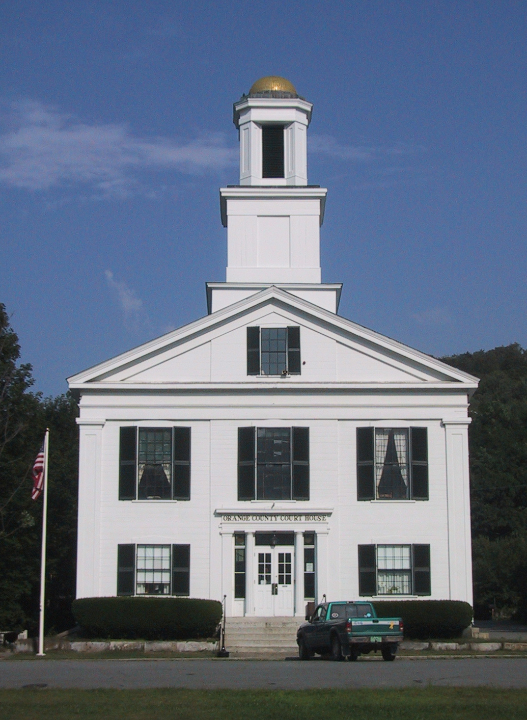
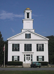 Orange County courthouse in Chelsea
- Bradford
- Braintree
- Brookfield
- Chelsea
- Corinth
- Fairlee
- Newbury
- Orange
- Randolph
- Strafford
- Thetford
- Topsham
- Tunbridge
- Vershire
- Washington
- West Fairlee
- Williamstown
See also
References
- ^ "Find a County". National Association of Counties. http://www.naco.org/Counties/Pages/FindACounty.aspx. Retrieved 2011-06-07.
- ^ http://www.census.gov/population/www/censusdata/cencounts/files/vt190090.txt
- ^ http://factfinder2.census.gov/faces/tableservices/jsf/pages/productview.xhtml?pid=DEC_10_PL_QTPL&prodType=table
- ^ http://mapserver.lib.virginia.edu/
- ^ "American FactFinder". United States Census Bureau. http://factfinder.census.gov. Retrieved 2008-01-31.
- ^ "Dave Leip's Atlas of U.S. Presidential Elections". http://uselectionatlas.org/RESULTS/. Retrieved 2011-06-11.
- ^ Education, Vermont Department of (2009-04-30). "Directories : Vermont Supervisory Unions/Districts (O-R)". http://education.vermont.gov/new/html/directories/su_sd_O_R.html. Retrieved 2009-05-30.
- ^ Union, Orange East Supervisory. "Home Page". http://orangeeast.k12.vt.us/. Retrieved 2009-05-30.
- ^ a b Union, Orange North Supervisory. "ONSU Office Staff". http://www.onsu.org/administration/Central%20Office%20Staff. Retrieved 2009-05-30.
- ^ School, Orange Center (2009-05-16). "Message From The Principal". http://www.orangecenterschool.org/administration/Message_From_The_Principal. Retrieved 2009-05-30.[dead link]
- ^ School, Washington Village. "Copy: principals message". http://www.washingtonvillageschool.org/Principal/principal_page. Retrieved 2009-05-30.[dead link]
- ^ School, Williamstown Elementary. "homepage". http://www.williamstownelem.org/administration/principal/. Retrieved 2009-05-30.
- ^ School, Williamstown Middle High. "Williamstown Middle High School, Vermont". http://www.williamstownmhs.org/. Retrieved 2009-05-30.
External links
- National Register of Historic Places: Orange County, Vermont
- The Political Graveyard: Orange County, Vermont

Washington County Caledonia County Addison County 
Grafton County, New Hampshire  Orange County, Vermont

Windsor County Municipalities and communities of Orange County, Vermont Towns Bradford | Braintree | Brookfield | Chelsea | Corinth | Fairlee | Newbury | Orange | Randolph | Strafford | Thetford | Topsham | Tunbridge | Vershire | Washington | West Fairlee | Williamstown

Villages Newbury | Post Mills | Wells River
CDP  State of Vermont
Regions Counties Addison · Bennington · Caledonia · Chittenden · Essex · Franklin · Grand Isle · Lamoille · Orange · Orleans · Rutland · Washington · Windham · Windsor
Metropolitan areas Burlington-South Burlington metropolitan area
Cities Barre · Burlington · Montpelier · Newport · Rutland · St. Albans · South Burlington · Vergennes · Winooski
Festivals Vermont State Fair · Green Mountain Film Festival
Topics Delegations · Constitution · Culture · Geography · Government · History · Images · People · Politics · Towns · Villages · Visitor Attractions
Categories:- Vermont counties
- Orange County, Vermont
- 1781 establishments in the United States
- Lebanon micropolitan area
- Populated places established in 1781


Wikimedia Foundation. 2010.