- Orleans County, Vermont
-
Orleans County, Vermont 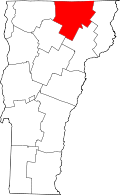
Location in the state of Vermont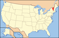
Vermont's location in the U.S.Founded 1792 Shire Town Newport Largest city Newport Area
- Total
- Land
- Water
721 sq mi (1,867 km²)
698 sq mi (1,808 km²)
23 sq mi (60 km²), 3.25%Population
- (2010)
- Density
27,231
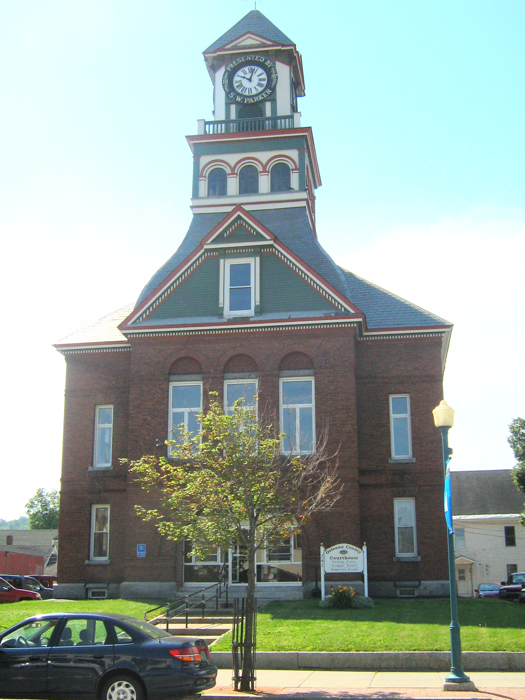
39/sq mi (15/km²) Orleans County Courthouse
Orleans County is one of the four northernmost counties in the U.S. state of Vermont. It borders Canada. In 2010, the population was 27,231. Its county seat is Newport.[1] As in the rest of New England, few governmental powers have been granted to the county. The county is an expedient way of grouping and distributing state-controlled governmental services.
Contents
Geography
According to the U.S. Census Bureau, the county has a total area of 721 square miles (1,870 km2).It is the fifth largest county in Vermont. It is larger than the nation of Guadeloupe and smaller than the country of Mauritius.[2]
There are 37.7 persons per square mile. 698 square miles (1,810 km2) is land and 23 square miles (60 km2) (3.25%) is water.
The county lies between the eastern and western ranges of the Green Mountains.
It has the largest area of the three counties comprising the Northeast Kingdom.
The highest point in the county is Jay Peak in the town of Jay, at 3,858 feet (1,176 m). The lowest is the surface of Lake Memphremagog at 682 feet (208 m).[3]
The county is mainly drained by four river systems: the Barton, the Black, the Clyde and the Missisquoi River. The first three run north.[4] The last meanders west through Canada and the U.S. An exception is found at the southern end of the county: Greensboro, Craftsbury, and southern Glover are largely drained south and west by the Lamoille River. The county is unique in eastern Vermont for mostly draining north as a part of the St. Lawrence River basin. All Vermont counties directly to the south (and east of the Green Mountains) drain into the Connecticut River, as does much of Essex county, to the east.
The Barton River drains Crystal Lake, runs north through Barton, Brownington, Coventry and drains through Newport into Lake Memphremagog. The Barton River watershed also includes the towns of Derby, Irasburg, Westmore, and the water bodies of Lake Willoughby, Crystal Lake, and Shadow and Parker ponds.[5]
The Black River is about 30 miles (48 km) in length. It rises in some ponds in Craftsbury, and passes through Albany, Irasburg, and Coventry. It reaches Lake Memphremagog at Salem. The watershed also includes Albany, Lake Eligo and the Hosmer Ponds.[5]
The Clyde River has four hydroelectric dams before reaching Lake Memphremagog. The watershed includes Brighton (Essex County), Charleston, Morgan (Essex County), Derby, Seymour Pond, Echo Lakes, and Island, Clyde and Pensioner ponds.[5]
Additionally, the Canadian rivers of Coaticook and Tomifobia watersheds include Derby, Holland, and Norton Pond, Holland Pond, and Great and Little Averill Ponds.[5]
The county contains more ponds than any other in the state.[6]
The county contains three state forests: Hazen's Notch, Jay, and Willoughby.
Climate
The average growing season is about 130 frost-free days in the Newport area.[7] As this is the lowest point in the county, the growing season for other places in the county which are more elevated, should be less.
Tornadoes have struck the county four times from 1950–1995, all F1s. One caused an injury.[8] This level is 2.7 times below than the national average.[9]
Adjacent counties
- American
- Essex County, Vermont - east
- Caledonia County, Vermont - south
- Lamoille County, Vermont - southwest
- Franklin County, Vermont - west
- Canadian
Government
As in all Vermont counties, there is a small executive function which is mostly consolidated at the state level. Remaining county government is judicial. There are no "county taxes."
In 2007, median property taxes in the county were $1,940, placing it 265 out of 1,817 counties in the nation with populations over 20,000.[10]
The budget for 2006 was $428,612.51. Town taxes accounted for over 65% of this money. The budget was all fulfilled by the state. Almost 32% of the money was spent on courthouse personnel. Over 22% of the money was spent on the Sheriff Department's expenses.[11]
Executive
The Assistant, or "Side," Judges, Superior Court, approve the budget for county expenses.
- Assistant Judge (elected) - Robert Goodby
- Assistant Judge (elected) - Benjamin M. Batchelder
- Road commissioners (appointed for one-year terms by the Superior Court)[12] Citizens may appeal to this commission when they believe that a town has failed to properly maintain a road or a bridge.
- Shawn Austin
- Thomas Berrier
- Dale Carpenter, Jr.
Judicial
The Superior, Family and Probate courts are all located at 247 Main Street, Newport Vermont.
Superior Court presiding judge (appointed by the state) - Christina Reiss
- Court clerk - Laura Dolgin
Family court presiding judge - Christina Reiss[13]
- Magistrate - Barbara Zander
- Assistant Judges - Robert Goodby and Benjamin M. Batchelder
- County Clerk (appointed) - Constance Daigle
- Probate Judge (elected) - John P. Monette[14]
The District Court is located at 217 Main Street, Newport, Vermont, as is the State Attorney.[15] The District court presiding judge is Walter Morris.[16] The Court Manager is Tina de la Bruere. The State's Attorney (elected) is Keith Flynn.
The sheriff's office and jail facilities are located at 255 Main Street, Newport, Vermont, next to the Superior Court building. The sheriff, who is normally elected, is Kirk Martin. He was appointed by the governor to fill the remaining two years for Lance Bowen, who resigned for health reasons.[17]
Legislators
The Essex-Orleans Senate district includes all of Orleans County, as well as parts or all of Essex County, Franklin County and Lamoille County. It is represented in the Vermont Senate by Vincent Illuzzi (R) and Robert A. Starr (D).
Elections
Presidential election results[18] Year Democrat Republican 2008 62.6% 7,998 35.1% 4,482 2004 51.7% 6,330 46.3% 5,666 2000 45.1% 5,472 47.8% 5,799 Normally voting among the most conservative counties in Vermont, the county overwhelmingly supported the Democratic presidential candidate in 2008 with nearly 63% of the vote. No town supported the Republican opponent. Nevertheless, the county elected only Republicans to the state senate and legislature and voted overwhelmingly for a Republican governor and lieutenant governor, yet Democratic for all other state offices.[19] With one exception in the legislature for one district, the vote was not close for any office.
A record seventy-three percent of the voters turned out for the general election in 2000.[20]
History
The county shares the same pre-Columbian history with the Northeast Kingdom.
In 1753, the Abenakis brought the ransomed John Stark down Lake Memphremagog and came ashore where Newport is now. They then traveled southeast to his home in New Hampshire.
Rogers' Rangers were forced to retreat through the county following their attack on Saint-Francis, Quebec in 1759. To confound their avenging pursuers, they split up on the east shore of Lake Memphremagog. One group followed the Clyde River. Another followed the Barton River south to the falls at the outlet of Crystal Lake where they were able to catch fish. From there, they continued south over the summit into the Passumpsic River Valley.[21]
The British Crown sent out surveyors to mark the border between its two colonies of Canada and America in accordance with the Quebec Act of 1774. This was supposed to be on the 45th parallel. The result, however was a crooked line up to .75 miles (1.21 km) north of this intended border. This was resolved in favor of the crooked line by the Webster–Ashburton Treaty of 1842. This affected Orleans County, particularly Derby Line, which would have otherwise reverted to Canada.[22]
In 1779 or 1780, General Moses Hazen constructed the Bayley-Hazen Military Road from Newbury, Vermont through Hardwick, Greensboro, Craftsbury, and Albany to Hazen's Notch in northern Vermont. This purpose of this road was to invade Canada. It was never used for that purpose, but was instrumental in the settlement of this area.[23] However, it was five or more years before the wilderness was inhabited by other than a few Abenaki Indians, and that during the summer.
Vermont was divided into two counties in March, 1778. In 1781 the legislature divided the northernmost county, Cumberland, into three counties: Windham and Windsor, located about where they are now. The northern remainder was called Orange county. This latter tract nearly corresponded with the old New York county of Gloucester, organized by that province March 16, 1770, with Newbury as the shire town.[24]
The state granted a town to Ebenezer Crafts, and sixty-three associates, on November 6, 1780. The town name was changed to Craftsbury, in honor of Ebenezer Crafts on October 27, 1790. Crafts was the first settler in the county.[25]
On September 3, 1783, as a result of the signing of the Treaty of Paris the Revolutionary War ended with Great Britain recognizing the independence of the United States. Vermont's border with Quebec was established at 45 degrees north latitude.[26][27]
From 1791 to 1793, Timothy Hinman built what is now called the "Hinman Settler Road" linking Greensboro north to Derby and Canada.[28]
On November 5, 1792, the legislature divided Chittenden and Orange counties into six separate counties, as follows: Chittenden, Orange, Franklin, Caledonia, Essex, and Orleans.[24] No reason is given for the county being named after Orléans, France.[29]
Orleans lost territory when the new Jefferson county[30] was created in 1797.[24]
In 1810, Runaway Pond suddenly flooded the Barton River Valley with 1,988,000,000 US gallons (7.53×10⁹ l; 1.655×10⁹ imp gal)[31]of water in the greatest natural catastrophe in Orleans County post-Columbian history. Incredibly, no lives were lost.
On December 27, 1813, the county was invaded by British militia from nearby Stanstead, Quebec, during the War of 1812 in order to destroy an undefended barracks at Derby and to forage for supplies. No one was injured. Until the invasion, local inhabitants, like most New Englanders, opposed the war. A number had smuggled supplies to the British. After the invasion, their enthusiasm for their neighbors diminished substantially.[32][33]
June 1816 brought 1 foot (0.30 m) of snow to the county followed by agricultural devastation. 1816 became known as the Year without a summer.[34]
When Lamoille county was formed in October 1835, Orleans lost the towns of Eden, Hyde Park, Morristown, and Wolcott.[24]
In 1858, Barton (and Orleans County) obtained a triangular piece of land from Sheffield (and Caledonia County) which included all of May Pond, the entire area south of Crystal Lake, and the village of South Barton.[35]
During the Civil War, Company D, 4th Vermont Infantry was recruited largely from Orleans County.[36]
In 1864, 267 men from the 11th Vermont Infantry were captured at the Weldon Railroad in the Overland campaign. today better known as the Battle of Jerusalem Plank Road. It was a considerable source of local concern when it was learned that these prisoners had been taken to Andersonville prison, a place known, even then, for its poor living conditions. 54 of these prisoners were from Orleans County. Many of them died in prison.[37]
French immigration into the county started before the Civil War.[38] It continued afterwards.
Like the rest of the state, Orleans County sent up to one-quarter of its eligible men to the Civil War. Ten percent of these died. Others came back too maimed to continue working their farms, which most volunteers had left.[39] The sudden offering of many farms for sale in the mid-1860s resulted in a precipitous drop in farm prices. Nearby French-Canadians took advantage of this.[40] As a result of this and loss of native farm labor to other states, Vermont, particularly the northern part, saw many migrants then and through the turn of the twentieth century.
After increasing in population since its founding, the county began losing population starting in 1900. It reached a twentieth century low in population in 1960 at 20,143. The population has risen ever since.
In 1903, a state law allowed each town to decide whether to permit the sale of liquor within their boundaries. By 1905, no town in the county allowed the sale of alcoholic beverages. The change was not that dramatic since state law had theoretically forbidden alcohol prior to 1903, but this law was unevenly enforced.[35]
In 1967, researcher and scientist Gerald Bull constructed a laboratory for hisSpace Research Corporation in Highwater, just north of the county's Canadian border. The property overlapped into the county in North Troy. His intent was to fire research packages into orbit using heavy artillery.
In 2004, what was then billed as the final concert of the band Phish was held in Coventry on August 14–15. The concert was the single largest gathering of people in the town's history. With 70,000 tickets sold, Coventry's augmented population was one of the largest in the state's history.
The county has twenty-three places on the National Register of Historic Places.
In 2008, the state notified residents of Albany, Craftsbury, Irasburg, Lowell, Newport Town, Troy, Westfield and six towns in the adjacent counties of Lamoille and Franklin, that a review of health records from 1995 to 2006 had revealed that residents within 10 miles (16 km) of the former asbestos mine on Belividere Mountain had higher than normal rates of contracting asbestosis. The state and federal government continues to study this problem.[41][42] A critic replied that the entire basis of the study were three unidentified people who died from asbestosis 1995-2005 out of a total population of 16,700.[43] In April 2009 the Vermont Department of health released a revised study which found that all of deaths related to the asbestos mine were caused by occupational exposure. The report also concluded that people living near the mines had no increased risk of asbestos related illness than people living anywhere else in Vermont.[44] However, the site will still need to be cleaned up. In 2009, the expected cost of cleanup was $300 million.[45]
Demographics
See Historical U.S. Census Totals for Orleans County, Vermont.
Population
Historical populations Census Pop. %± 1800 1,439 — 1810 5,838 305.7% 1820 6,976 19.5% 1830 13,980 100.4% 1840 13,634 −2.5% 1850 15,707 15.2% 1860 18,981 20.8% 1870 21,035 10.8% 1880 22,083 5.0% 1890 22,101 0.1% 1900 22,024 −0.3% 1910 23,337 6.0% 1920 23,913 2.5% 1930 23,036 −3.7% 1940 21,718 −5.7% 1950 21,190 −2.4% 1960 20,143 −4.9% 1970 20,153 0% 1980 23,440 16.3% 1990 24,053 2.6% 2000 26,277 9.2% 2010 27,231 3.6% [46][47][48] Of the four Vermont counties bordering Canada, Orleans County is the largest. That said, all four counties have the lowest population in Vermont.
- People - 26,277
- Households - 10,446
- Families - 7,155
- Population density - 15/km² (38/sq mi)
- Housing units - 14,673
- Density of housing units - 8/km² (21/sq mi)
The racial makeup of the county
- White - 97.16%
- from two or more races - 1.37%
- Hispanic or Latino - 0.72%
- Native American - 0.65%
- Black or African American - 0.37%
- Asian - 0.30%
- Other races - 0.13%
- Pacific Islander - 0.02%
94.5% were born in the United States. 90.58% spoke English at home, while 7.72% spoke French.[50]
Population distribution
In the county, the population was distributed by age as follows:
- Under the (18 year spread) - 25.10%
- From 18 to 24 (7 year spread) - 7.10%
- From 25 to 44 (20 year spread) - 26.80%
- From 45 to 64 (20 year spread) - 25.90%
- 65 years of age or older - 15.00%
The median age was 39 years.
For every 100 females there were 98.60 males.
For every 100 females age 18 and over, there were 95.10 males.
Ancestry
- French/French Canadian - 30%[51]
- English - 17%
- Irish - 11%
- German - 5%
- Scottish - 4%
- Italian - 3%
- Scots-Irish - 2%
- Polish - 2%
- Canadian - 2%
- American Indian - 2%
- Swedish - 1%
- Dutch - 1%
- Welsh - 1%
- Russian - 1%
Religion
In 2000, the following were counted by denomination:[52]
- Catholics 7,775
- Mainline Protestant 2,064
- Evangelical Protestant 838
- Other 304
- Unclaimed 15,296
Other
An estimated 2,500 military veterans reside in the county.[53]
Economy
Orleans County has the fifth lowest average household spending in the country.[54]
Households and housing
- Households - 10,446
- Children under the living in household - 32.10%
- married couples living together - 54.40%
- Female householder with no husband present - 9.60%
- Non-families - 31.50%
- Individuals - 25.20%
- Someone living alone who was 65 years of age or older - 10.90%
- Average household size - 2.45
- Average family size - 2.91
- Owned their own homes - 74.1%
- Lived in multi-unit dwellings - 14.9%
- Average value of owner occupied homes - $78,800.
In 2004, Orleans County had the least expensive rental housing in Vermont.[55] In 2008, one-third of residential housing were used as second homes.[56]
Personal income
Incomes
- Family = $36,630
- Household = $31,084
- Males = $27,964
- Females = $20,779
- Per capita income = $16,518.
Poverty statistics
The following were below the poverty line:
- Under age 18 = 17.90%
- Population = 14.10%
- Age 65 or over = 10.90%
- Families = 10.60%
The poverty rate for Orleans County was highest in Vermont for 2003.[57] Median wages were the second lowest in the state.[58]
See also Vermont locations by per capita income
Unemployment
In March 2008, the unemployment rate was 9.1% seasonally uncorrected, the highest in the state, which averaged 5.3%.[59]
Business and industry
There were 838 private non-farm establishments, employing 7,392 people. In 2002, there was $238 million manufacturer's shipments. That year, the county had $240 million in retail sales. Retail sales per capita were $9,000. 24% of firms were owned by women.
In 2003, there were 194 dairy farms in the county.[60] This was the third largest number in the state. In March 2010, the number of dairy farms had declined to 139.[61] In March 2007 county farms produced 29,585,000 pounds (13,420,000 kg) of milk.[62] The total number of farms increased between 1992 and 2007. Total area farmed decreased from 149,503 acres (60,502 ha) in 1992 to 130,308 acres (52,734 ha) in 2007.[63]
For forest products, from 1988 to 2004, Orleans County showed the greatest employment increase in the state.[64]
Retail
There are five pharmacies in the county, three are regional chains. When the Rite Aid drugstores bought the Brooks pharmacies in 2007, this would have reduced competition by one in the area. The Vermont Attorney General intervened and one of the two drugstores will be sold to a competitor.[65]
There are four national chain fast food restaurants in the county, one in Orleans, one in Derby and two in the city of Newport.
There are two regional chain supermarkets in the county, both in Derby. There are local groceries as well.
There is one cinema, a tri-plex, in Newport.
Tourism
The county is tied for first place in Vermont with the highest percentage of second home ownership.[66][67]
Education
78.2% of residents had at least a high school education. 16.1% had at least an undergraduate degree.
There are three public high schools in the county: North Country Union High School (1063 students), Lake Region Union High School (396), and Craftsbury Academy (59).[68] Wheeler Mountain Academy, grades 7-12, aids students who have emotional, behavioral or learning challenges. 15 are enrolled.[69] United Christian Academy is a private religious school K-12, enrolling 108 students.[70]
In 2007, the juniors in three public secondary schools in three different schools districts, North Country, Lake Region, and Craftsbury, scored lower than the state averages on standardized tests with one exception. North Country scored better than average in reading.[71] Areas tested were math, reading and writing.
In 2008, there was no correlation between the performance of students on the standardized New England Common Assessment Program tests and poverty (free lunch). The five wealthiest schools were among the ten worst performers; of the five poorest schools, three were among the top ten performers in the county. Schools in the Orleans Central Supervisory Union(the top four) appeared to outperform the North Country Supervisory Union (eight out of ten worst performing).[72]
There are about 85 home schooled students in the county, grades 1-12.
The Northeast Kingdom Learning Services is a non-profit agency that provides a central clearing house for learning services. It is located in the village of Orleans.[73][74]
The Central Orleans Family Education Center was establishined in 2002 to offer childcare, pre-K programs, after-school programs, and migrant education classes in the village of Orleans.[73]
Higher education
Craftsbury Common is home to Sterling College, an accredited four year institution with nearly 100 students.[75]
The city of Newport is home to a branch of the Community College of Vermont which enrolls nearly 300 students.[76] It awards an Associate's Degree for these undergraduate studies.
Cultural
There are thirteen libraries in the county,[77] all of them 501(c) corporations. This includes two full time libraries in Derby Line and the city of Newport. The rest often have one part-time paid librarian. Much of the staff are volunteers. One is endowed. The rest depend upon fundraising and municipal contributions.
With the French immigrants came their religion, Catholicism, which is the plurality religion in the county today.[78] Formal dance included the galop.
Cities, towns, and villages
There are eighteen towns and one city in the county.
Most towns contract with the County Sheriff for policing.[80]
- Albany
- Barton
- Brownington
- Charleston
- Coventry
- Craftsbury
- Derby
- Beebe Plain (an unincorporated village of Derby)
- Derby Center (a village of Derby)
- Derby Line (a village of Derby)
- Glover
- Greensboro
- Holland
- Irasburg
- Jay
- Lowell
- Morgan
- Newport (city)
- Newport (town)
- Troy
- North Troy (a village of Troy)
- Westfield
- Westmore
Health and public safety
- Orleans-Essex Visiting Nurses Association and Hospice - non-profit palliative care
Media
Newspapers
- The Chronicle - published weekly in Barton
- The Newport Daily Express - published weekdays in Newport
Radio
Television
- W14CK - Channel 14; Newport
- NEK-TV[81] - Channels 14 and 15;[82] Northeast Kingdom Television, Newport.[83]
Utilities and communication
Communication
Fairpoint Communications supplies hard line telephone coverage for the entire county.[84]
Cell phones
In 2007, AT&T bought out Unicel in Orleans County, and in the next year replaced Unicel.[85]
Verizon Wireless covers Newport city and the south Derby-I-91 area. Owl's Head in Canada may provide "roaming" service in the North part of the county.
Broadband
- Broadband coverage as of 2006[86]
- Total Coverage = 86%[87]
- Cable = 52%
- DSL = 44%
- Wireless Internet Service Provider = 69%
Transportation
Major routes
The opening of Interstate 91 north from Barton on November 9, 1972 and opening south from the county in 1978 had an impact on the county comparable to the opening of the railway a century earlier. In 1980, the county registered its first population gain in a century.[35]
The interstate has five exits in the county. Two are in the town of Barton, servicing the villages of Barton and Orleans; three are in the town of Derby: the southernmost one, exit 27, actually services Newport city a mile away, 28 services village of Derby Center and the shopping areas, 29, the village of Derby Line.
The county has 1,041 miles (1,675 km) of state highway and class 1, 2 and 3 roads. 606 miles (975 km) of these are dirt roads (class 3). 141 miles (227 km) are unused roads (Class 4). As in most of New England, the county government does not build nor maintain any roads.
Derby has the most road mileage, 102; Westfield the least with 31.[88]
The county has seven stoplights, five in the city of Newport and two in Derby. Six are on Route 5.
 Interstate 91 - Barton to Derby
 U.S. Route 5 - Barton to Derby
 VT 5A - Westmore to Derby
 VT Route 14 - Irasburg to Coventry and Newport
 Vermont Route 16 - Greensboro to Westmore
 Vermont Route 58 - Lowell to Westmore
 VT Route 100 - Newport through Eden. One of the few good roads west/southwest from the county.
 Vermont Route 101 - Connects North Troy and Route 105 with Troy Village
 VT Route 105 - Troy to Charleston. Road east of Charleston was closed for awhile due to flood damage from Tropical Storm Irene in 2011
 Vermont Route 111 - Derby to Morgan
 VT Route 114 - Goes through Morgan
 VT 122 - Glover southeast to Sheffield
 Vermont Route 191 - "Access Road", connects I-91, Exit 27, to the city of Newport
 Vermont Route 242 - connects route 101 in Jay, with Jay Peak Village
 Vermont Route 243 - Connects North Troy to Mansonville, apparently retaining the same number on the Canadian side of the border
Local community public and private transportation
The RCT (Rural Community Transportation), a non-profit organization, runs out of Saint Johnsbury and services Caledonia, Essex, Lamoille and Orleans Counties. For general use, there are four buses north and south during the week from west Newport city to Derby Center, and two buses each way on Saturday. The fare is US 25 cents.[89]
Railroads
Washington County Railroad (The Vermont Railway System) - WACR has just recently been awarded a 30 year contract to operate the track running from White River Junction North through St. Johnsbury and Newport. Users ship freight on this route.
There are no stops in the county. A line once ran up the east side of Lake Memphremagog, but this line has been abandoned and in some cases, torn up for use as hiking trails. This crossed the line near Beebe. The line still in operation goes northwest to Canada through North Troy.
Airport
The county is served by the Newport State Airport. It contains two runways of 4,000 feet (1,200 m) each 05-23, and 18-36.
Ecological concerns
The Nature Conservancy has acted to protect areas against development. Specific areas in the county include: May Pond, Barton, Wheeler Mountain, the north beach at Willoughby Lake, the Westmore Town Forest, the Willoughby Falls Wildlife Management Area, and the South Bay Wildlife Management Area (Memphremagog).[90]
Notable residents
- John Gunther, author and part-time resident of Greensboro
- Henry M. Leland, machinist, inventor, engineer and automotive entrepreneur. Created and named both the original Cadillac and the original Lincoln. At one time he was President or Chief Executive of both divisions or companies. Born in Barton.
- Gilbert C. Lucier - last surviving Civil War veteran in Vermont. Died 1944 in Jay.[91]
- Howard Frank Mosher, author of many books set in the Northeast Kingdom. Lives in Irasburg.
- William Hubbs Rehnquist, Chief Justice of the U.S. Supreme Court and part-time resident of Greensboro
- Theodore Robinson, impressionist landscape painter. Born in Irasburg.
- Wallace Stegner, Pulitzer prize-winning author (part-time resident of Greensboro)
- William Barstow Strong, president of the Atchison, Topeka and Santa Fe Railway. Born in Brownington.
- Alexander Twilight, first African American to serve on a state legislature, and first African American to receive a degree from an American University. Lived in Brownington.
See also
- Essex-Orleans Vermont Senate District, 2002-2012
- Historical U.S. Census Totals for Orleans County, Vermont
- List of counties in Vermont
- List of towns in Vermont
- National Register of Historic Places listings in Orleans County, Vermont
Footnotes
- ^ "Find a County". National Association of Counties. http://www.naco.org/Counties/Pages/FindACounty.aspx. Retrieved 2011-06-07.
- ^ http://www.mongabay.com/igapo/world_statistics_by_area.htm retrieved on May 22, 2007
- ^ Lake Memphremagog Fishing in Orleans County
- ^ Author Howard Frank Mosher has written a number of books about the area including Where the Rivers Flow North.
- ^ a b c d Public invited to meetins about Memphremagog watershed. the Chronicle. August 8, 2007.
- ^ Gazetteer of Vermont by John Hayward, 1849
- ^ Draft Environmental Assessment retrieved May 28, 2008
- ^ Vermont Tornadoes
- ^ Orleans County, Vermont detailed profile - houses, real estate, agriculture, wages, work, ancestries, and more
- ^ McLean, Dan (December 17, 2008). Property tax bills among highest. Burlington Free Press.
- ^ 2006 Financial Report of Orleans County General Fund, The Chronicle, March 7, 2007, page 26
- ^ The Vermont Statutes Online
- ^ [1]
- ^ [2]
- ^ and the state offices of Human Services
- ^ [3]
- ^ Creaser, Richard (October 22, 2008). There's a new sheriff in town. the Chronicle.
- ^ "Dave Leip's Atlas of U.S. Presidential Elections". http://uselectionatlas.org/RESULTS/. Retrieved 2011-06-11.
- ^ An Obama sweep, and a conservative upset. Burlington Free Press. November 7, 2008.
- ^ Pollina easily outdistances Symington in county. the Chronicle. November 5, 2008.
- ^ Darrell Hoyt (1985). Sketches of Orleans, Vermont. Mempremagog Press. ISBN 0-9610860-2-5., page 1
- ^ Farfan, Matthew (August 2007). "The Crooked Border". Vermont's Northland Journal: 17.
- ^ "RootsWeb". The Hazen Military Road. http://www.rootsweb.com/~vermont/HistoryHazenMilitaryRoad.html. Retrieved 2007-01-03.
- ^ a b c d Child, Hamilton. (May 1887). Gazetteer of Lamoille and Orleans Counties, VT.; 1883-1884. Hamilton Child.
- ^ Gazetteer of Lamoille and Orleans Counties, VT.; 1883-1884, Compiled and Published by Hamilton Child; May 1887
- ^ Van Zandt, Franklin K. Boundaries of the United States and the Several States. Geological Survey Professional Paper 909. Washington, DC; Government Printing Office, 1976. The Standard Compilation for its subject. P. 12.
- ^ Parry, Clive, ed. Consolidated Treaty Series. 231 Volumes. Dobbs Ferry, New York; Oceana Publications, 1969-1981. Volume 48; pp. 481; 487; 491-492.
- ^ "Vermont History". The Checkered Career of Timothy Hinman. http://www.google.com/search?q=cache:9PyVwK4aF2QJ:www.vermonthistory.org/journal/70/vt703_403.pdf+hinman+settler+road+built+timothy&hl=en&gl=us&ct=clnk&cd=2. Retrieved 2006-12-27.
- ^ [4]
- ^ later called Washington County, Vermont November 8, 1814
- ^ Boisvert, Jacques (July 2003). Long Pond Lost!. The Kingdom Historical.
- ^ Derby Attacked! The War of 1812 Comes to Vermont. Kingdom Historical. July 2003.
- ^ [5]
- ^ [6]
- ^ a b c Young, Darlene (1998). A history of Barton Vermont. Crystal Lake Falls Historical Association.
- ^ "Revised Roster Vermont Volunteers 1892". Northeast Kingdom Civil War Roundtable: 4. September 2011.
- ^ Taylor, Dan (August 2010). "Ellery Webster, Union POW - Part Three". Vermont's Northland Journal 9 (5): 13.
- ^ The French Settlement Of Vermont: 1609-1929
- ^ vermont
- ^ French Canadian Emigration to the United States, 1840-1930 - Readings - Quebec History
- ^ Rathke, Lisa (December 12, 2008). Neighbors worry about mine's impact on health. Burlington Free Press.
- ^ [7]
- ^ Avery, Don (January 7, 2009). Letter to the editor:The Vermont Department of Health has done a great disservice to the people of Eden and Lowell. the Chronicle.
- ^ http://healthvermont.gov/enviro/asbestos/vagm-healthstudy.aspx
- ^ Braithwaite, Chris (8 July 2009). "Feds to recover a fraction of mine cleanup costs". Barton, Vermont: the Chronicle. pp. 22.
- ^ http://www.census.gov/population/www/censusdata/cencounts/files/vt190090.txt
- ^ http://factfinder2.census.gov/faces/tableservices/jsf/pages/productview.xhtml?pid=DEC_10_PL_QTPL&prodType=table
- ^ http://mapserver.lib.virginia.edu/
- ^ "American FactFinder". United States Census Bureau. http://factfinder.census.gov. Retrieved 2008-01-31.
- ^ [8]
- ^ Orleans County, VT - Orleans County, Vermont - Ancestry & family history - ePodunk
- ^ [9]
- ^ Joseph Gresser, "Veterans ask for clinic closer to home", The Chronicle, July 1, 2009, page 14
- ^ Best Places to Live in Rural America. Progressive Farmer's 2007 Annual Report. 2007.
- ^ "Vermont Housing & Conservation Board" (PDF). Between a Rock and a Hard Place: Housing and Wages in Vermont. http://www.vhcb.org/pdfs/housing-wages-2004.pdf. Retrieved 2007-01-05.[dead link]
- ^ [10] retrieved September 14, 2008
- ^ "Rural Policy and Research Institute" (PDF). Demographic and Economic Profile - Vermont. Archived from the original on 2006-09-27. http://web.archive.org/web/20060927143123/http://www.rupri.org/resources/rnumbers/states/Vermont.pdf. Retrieved 2007-01-05.
- ^ "Vermont Department of Housing and Community Affairs" (PDF). Vermont Statewide Trends. http://www.dhca.state.vt.us/Housing/ConPlan/Volume%20I/Statewide%20Trends.pdf. Retrieved 2007-01-05.
- ^ Jobless rate dropped in April. the Chronicle. May 21, 2008.
- ^ http://www.vermontdairy.com/files/downloads/vermont-dairy-stats.xls
- ^ Dunbar, Bethany M. (5 May 2010). "Dairy farm crisis deepens". Barton, Vermont: the Chronicle. pp. 1A.
- ^ Dunbar, Bethany (August 29, 2007). Higher milk prices help farmers catch up. the Chronicle.
- ^ Creaser, Richard (18 August 2010). "Watershed association seeks to combat farm runoff". Barton, Vermont: the Chronicle. pp. 16.
- ^ "Vermont Sustainable Jobs Fund" (PDF). Forest and Forest Products Trends. Archived from the original on 2007-07-05. http://web.archive.org/web/20070705001108/http://www.vsjf.org/sd-projects/documents/Forest_Trends_001.pdf. Retrieved 2007-01-05.
- ^ Braithwaite, Chris (May 30, 2007). Deal will preserve two drugstores in Newport Derby market. the Chronicle.
- ^ The first is Windham County
- ^ Starr, Tena (7 July 2010). "Glover to study summer people's spending habits". Barton, Vermont: the Chronicle. pp. 10A.
- ^ http://www.nvda.net/pdf/regionalplan/Volume%20II%20-%20Chapter%203%20-%20Utilities%20&%20Facilities.pdf
- ^ http://education.vermont.gov/new/pdfdoc/pgm_independent/directory_020807.pdf retrieved on June 13, 2007
- ^ http://www.ucaonline.org/uca/profile.html retrieved on June 13, 2007
- ^ Braithwaite, Chris (March 12, 2008). High schools get disappointing test results. the Chronicle.
- ^ Braithwaite, Chris (February 4, 2009). Local schools fare well in NECAP tests. the Chronicle.
- ^ a b Creaser, Richard (December 10, 2008). School district office move is under fire. the Chronicle.
- ^ [11]
- ^ Sterling College
- ^ Facts & Figures - Community College of Vermont
- ^ [12]
- ^ [13]
- ^ While incorporated villages may be separate census divisions, they are still part of the towns they are in
- ^ various articles,The Chronicle,March 7, 2007
- ^ NEK-TV
- ^ http://www.nektv.com/contact.htm
- ^ VAN Roster | Vermont Access Network
- ^ Johnson, Carolyn Y. (January 17, 2007). "Verizon to sell lines in N.H., Vt., and Maine". The Boston Globe. http://www.boston.com/business/technology/articles/2007/01/17/verizon_to_sell_lines_in_nh_vt_and_maine/.
- ^ http://www.rutlandherald.com/apps/pbcs.dll/article?AID=/20071205/NEWS04/712050397/1011/BUSINESS
- ^ Rural Vt. wants it's broadband,Burlington Free Press,February 8, 2007, page 1A
- ^ Statewide average is 87%
- ^ Microsoft Word - 2004 Miles by County-Town.rtf
- ^ Rural Community Transportation Large Format Bus Schedule - The Highlander (Newport/Derby/Derby Line. 2008.
- ^ Dunbar, Bethany (29 July 2010). "Guidebook describes 50 years of converving nature". Barton, Vermont: the Chronicle. pp. 3.
- ^ "Gilbert C. Lucier, 11th Vermont Infantry, Company "F"". tripod.com. 2010-08-26. http://members.tripod.com/~k_lucier/glucier.htm.
External links
- National Register of Historic Places listing for Orleans Co., Vermont
- Philip, Abenaki Indian Chief, and Philip’s Grant (Orleans and Essex Counties)
- "The Political Graveyard". Orleans County Vermont. http://politicalgraveyard.com/geo/VT/OL.html#CEM. Retrieved 2006-12-27.
- "RootsWeb". Child's 1887 Gazetteer Orleans County Vermont. http://www.rootsweb.com/~vermont/GazetterOrleansCounty03.html. Retrieved 2006-12-27., historical excerpt
- Government Agencies and non-profits
- 1914 Industrial snapshot of the area
Municipalities and communities of Orleans County, Vermont City 
Towns Albany | Barton | Brownington | Charleston | Coventry | Craftsbury | Derby | Glover | Greensboro | Holland | Irasburg | Jay | Lowell | Morgan | Newport | Troy | Westfield | Westmore
Villages Albany | Barton | Derby Center | Derby Line | North Troy | Orleans
Unincorporated
community State of Vermont
Regions Counties Addison · Bennington · Caledonia · Chittenden · Essex · Franklin · Grand Isle · Lamoille · Orange · Orleans · Rutland · Washington · Windham · Windsor
Metropolitan areas Burlington-South Burlington metropolitan area
Cities Barre · Burlington · Montpelier · Newport · Rutland · St. Albans · South Burlington · Vergennes · Winooski
Festivals Vermont State Fair · Green Mountain Film Festival
Topics Delegations · Constitution · Culture · Geography · Government · History · Images · People · Politics · Towns · Villages · Visitor Attractions
Categories:- Vermont counties
- Orleans County, Vermont
- 1792 establishments in the United States
- Northeast Kingdom, Vermont
- Populated places established in 1792
- American


Wikimedia Foundation. 2010.