- Irasburg, Vermont
Infobox Settlement
official_name = Pagename
other_name =
native_name =
nickname =
settlement_type = Town
motto =
imagesize =
image_caption =
flag_size =
image_
seal_size =
image_shield =
shield_size =
image_blank_emblem =
blank_emblem_size =
mapsize = 250px
map_caption = Located in Orleans County, Vermont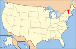
mapsize1 = 195px
map_caption1 = Location of Vermont with the U.S.A.
subdivision_type = Country
subdivision_name =United States
subdivision_type1 = State
subdivision_name1 =Vermont
subdivision_type2 = County
subdivision_name2 = Orleans
subdivision_type3 =
subdivision_name3 =
subdivision_type4 =
subdivision_name4 =
government_footnotes =
government_type =
leader_title =
leader_name =
leader_title1 = Chair, Selectboard
leader_name1 =
leader_title2 =
leader_name2 =
leader_title3 =
leader_name3 =
leader_title4 =
leader_name4 =
established_title = Chartered
established_date = February 23, 1781
area_magnitude =
unit_pref = Imperial
area_footnotes =
area_total_km2 = 105.1
area_land_km2 = 105.0
area_water_km2 = 0.2
area_total_sq_mi = 40.6
area_land_sq_mi = 40.5
area_water_sq_mi = 0.1
area_water_percent =
population_as_of = 2000
population_footnotes =
population_note =
population_total = 1077
population_density_km2 = 10.3
population_density_sq_mi = 26.6
population_blank1_title = Households
population_blank1 = 405
population_blank2_title = Families
population_blank2 = 317
timezone = EST
utc_offset = -5
timezone_DST = EDT
utc_offset_DST = -4
latd = 44 |latm = 48 |lats = 22 |latNS = N
longd = 72 |longm = 16 |longs = 4 |longEW = W
elevation_footnotes =
elevation_m = 313
elevation_ft = 814
postal_code_type =ZIP code
postal_code = 05845
area_code = 802
blank_name = FIPS code
blank_info = 50-35575GR|2
blank1_name = GNIS feature ID
blank1_info = 1462124GR|3
website =
footnotes =Irasburg is a town in Orleans County,
Vermont ,United States . The population was 1,077 at the 2000 census.Government
Town
*Moderator - David Turner
*Selectman - Randy Wells [Small number of voters make some significant decisions,"The Chronicle",March 7, 2007, page13] , Roger Gagnon (2010)
*Town Clerk - Barbara Lawson
*Town Treasurer - Barbara Lawson
*Tax Collector - Alan Butler
*Auditor (2007-2010) - Carmen Lamarche
*Auditor (2007-2009) - Angela Goodrich
*Lister (2007-2010) - Mark Fontaine
*Lister (2007-2009) - Alice Couture
*Lister (2007-2008) - Todd Rivers
*First Constable - Corey Lefebvre
*Second Constable - Jason LarameeBudget - $370,576
chool District
*Director - Amy Leroux
*Director (2007-2010) - Kimico Perry
*Member,Orleans Central Supervisory Union - Renee Fontaine (2007-2010)
*Budget - $1,803,259 plus assessment for Lake Region Union High School
*Number of students - 154
*Special Needs students - 20%
*Per student - "over $16,000"Geography
According to the
United States Census Bureau , the town has a total area of 40.6square mile s (105.1km² ), of which, 40.5 square miles (105.0 km²) of it is land and 0.1 square miles (0.2 km²) of it (0.15%) is water.The Black River flows through the town in a northerly direction, receiving a number of small streams. The current is generally slow. It enters east of Potters Pond. It continues its tortuous route northeast and then east to the village of Irasburg. Just upstream of the village, the very sinuous Lords Creek enters. This creek is about convert|10|mi|km|0 long and drains a watershed that is convert|17|sqmi|km2|0. Downstream of Irasburg, the Black River continues north in a narrower valley with less meandering. It then flows into the town of Coventry. [http://www.anr.state.vt.us/dec//waterq/planning/docs/pl_basin17.assessment_report.pdf] retrieved July 17, 2008]
The
Barton River , after leaving Orleans, flows through eastern Irasburg, and enters Coventry.Demographics
As of the
census GR|2 of 2000, there were 1,077 people, 405 households, and 317 families residing in the town. Thepopulation density was 26.6 people per square mile (10.3/km²). There were 493 housing units at an average density of 12.2/sq mi (4.7/km²). The racial makeup of the town was 98.61% White, 0.74% Native American, 0.09% Asian, 0.09% Pacific Islander, 0.19% from other races, and 0.28% from two or more races. Hispanic or Latino of any race were 0.28% of the population.There were 405 households out of which 40.0% had children under the age of 18 living with them, 66.9% were married couples living together, 7.2% had a female householder with no husband present, and 21.7% were non-families. 16.5% of all households were made up of individuals and 7.7% had someone living alone who was 65 years of age or older. The average household size was 2.66 and the average family size was 2.98.
In the town the population was spread out with 28.3% under the age of 18, 7.1% from 18 to 24, 29.7% from 25 to 44, 23.6% from 45 to 64, and 11.3% who were 65 years of age or older. The median age was 37 years. For every 100 females there were 95.5 males. For every 100 females age 18 and over, there were 97.9 males.
The median income for a household in the town was $36,154, and the median income for a family was $39,167. Males had a median income of $27,802 versus $22,240 for females. The
per capita income for the town was $16,315. About 5.9% of families and 9.1% of the population were below thepoverty line , including 8.2% of those under age 18 and 14.5% of those age 65 or over.History
Vermont granted this town on February 23, 1781, to
Ira Allen and sixty-nine others.cite book | author = Child, Hamilton. |title = Gazetteer of Lamoille and Orleans Counties, VT.; 1883-1884 | publisher = Hamilton Child | month = May | year = 1887]The Old Heerman Mill was located here.
In 1862, Company E of the
9th Vermont Infantry was recruited, in part, from Irasburg.In 1877, the town was still spelled "Irasburgh." [ [http://www.rootsweb.ancestry.com/~vermont/OrleansIrasburg.html] ]
The Irasburg town hall was built in 1911 and remodeled in 1990. [cite book | author = Old Stone House Museum |title = Big band dance to honor Korean War veterans | publisher = the Chronicle | date = June 29, 2007]
Cultural Events
The Irasburg Church Fair is held annually on the Common. [http://www.vtcucc.org/churches/Irasburg.html retrieved July 19, 2007]
Notable residents
*
Theodore Robinson , impressionist landscape painter.
*Howard Frank Mosher , author of many books set in the Northeast KingdomFootnotes
External links

Wikimedia Foundation. 2010.