- Derby Line, Vermont
-
Derby Line — Village — Haskell Free Library and Opera House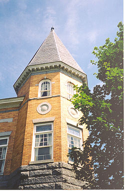 Location of the town of Derby in which the village is located.
Coordinates: 45°00′17.98″N 72°05′57.97″W / 45.0049944°N 72.0994361°W Country United States State Vermont County Orleans County Town Derby Area – Total 0.7 sq mi (1.9 km2) – Land 0.7 sq mi (1.9 km2) – Water 0.0 sq mi (0.0 km2) Elevation 1,056 ft (322 m) Population (2000) – Total 776 – Density 1,057.5/sq mi (408.3/km2) Time zone EST (UTC-5) – Summer (DST) EDT (UTC-4) ZIP code 05830 Area code(s) 802 FIPS code 50-17500[1] GNIS feature ID 1457154[2] Derby Line is an incorporated village in the town of Derby in Orleans County, Vermont, United States, slightly north of the 45th parallel, the normal U.S.-Canadian boundary. The population was 776 at the 2000 census.
The village is located on the Canada-United States border and is contiguous with the district of Rock Island in the town of Stanstead, Quebec.[3]
Notable buildings include the Haskell Free Library and Opera House.
Contents
History
The village was incorporated in 1791.[4] It lies on an elevation at the far north of Derby, which was chartered on October 29, 1779 and first settled in 1795. By 1859, the area was noted for the beauty of its farmhouses and luxuriant farmland, set before the distant vista of Lake Memphremagog and the Green Mountains.[5]
Because of an erratic survey, the border separating Canada from the United States was drawn incorrectly by the surveyors in the 18th century, above the 45th parallel which was the agreed boundary. Derby Line was founded based on that line, above the 45th parallel. The boundary was confirmed by the Webster-Ashburton Treaty in 1842.
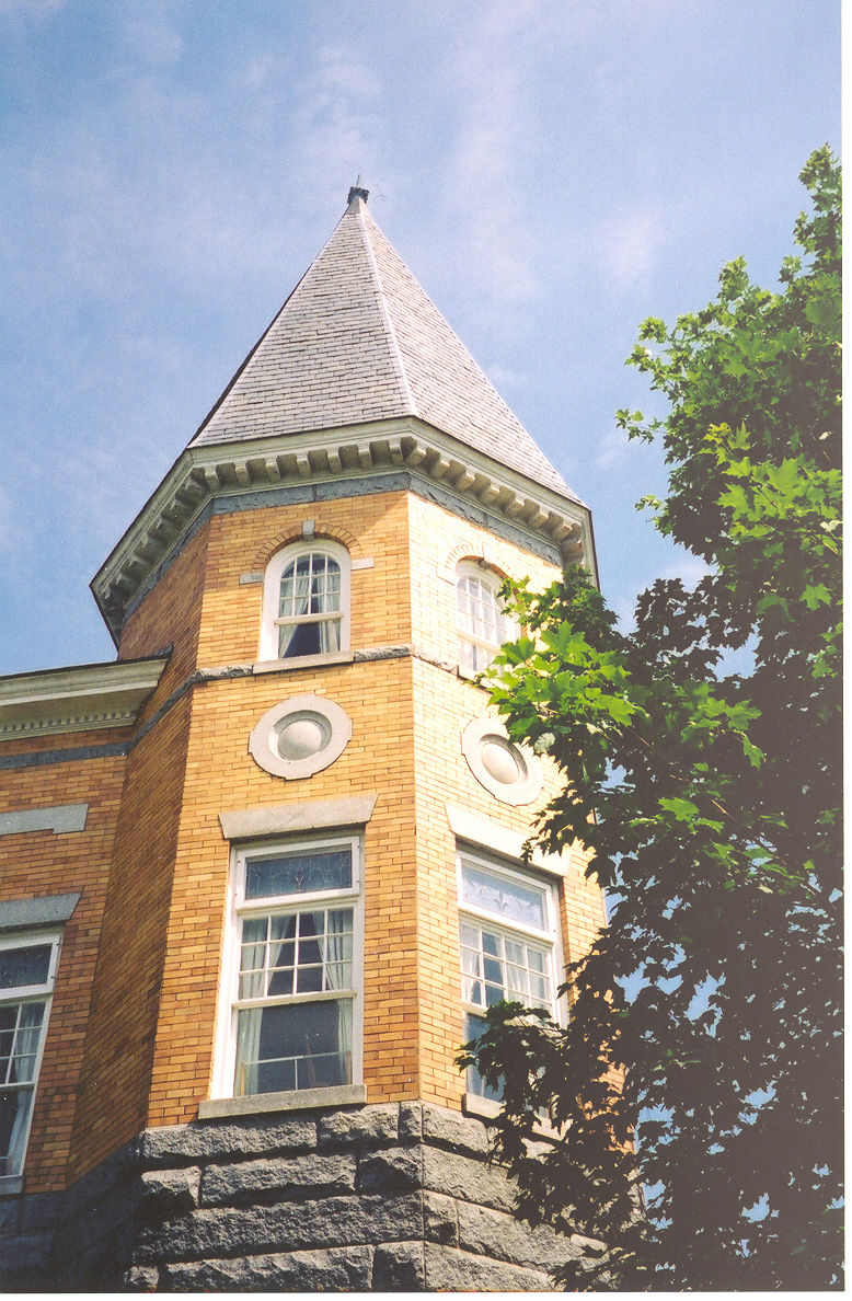
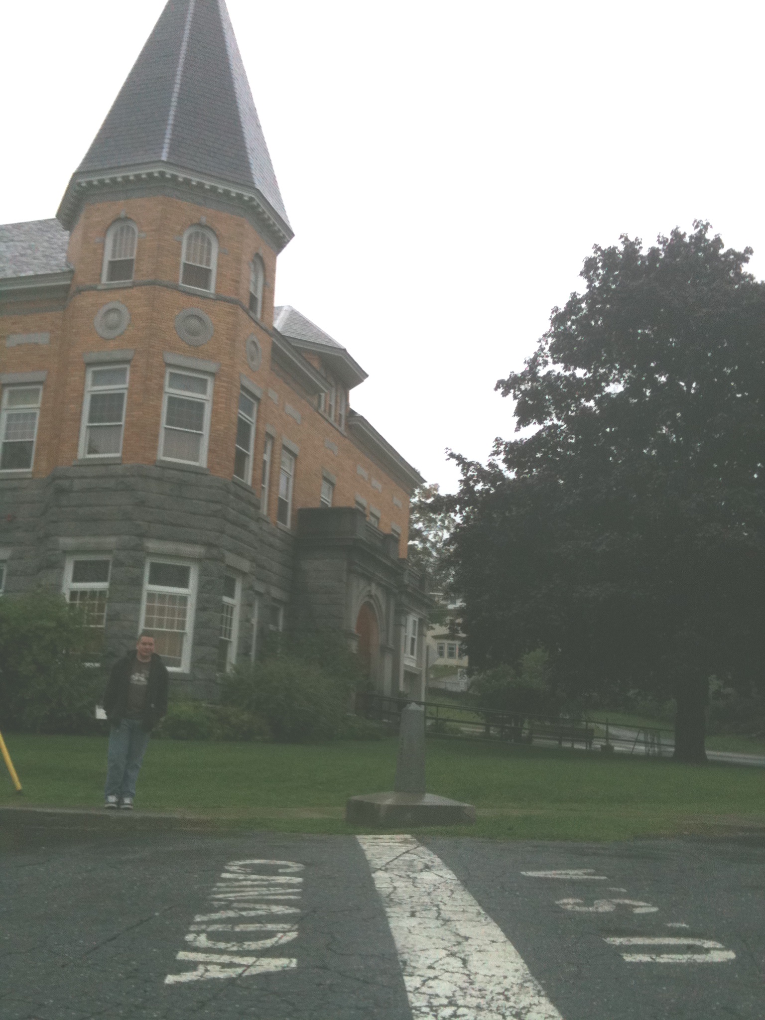
Derby Line is known for the Haskell Free Library and Opera House, deliberately constructed on the international border and opened in 1904. The donors were a binational couple: Carlos F. Haskell was a local American businessman who owned a number of sawmills, while Martha Stewart Haskell was Canadian. The intent was that people on both sides of the border would have use of the facility, which is now a designated historic site. Patrons of the library from either side of the border may use the facility without going through border security.[6]
In some places, the international border runs through individual homes, so that meals prepared in one country are eaten in the other. An entire tool-and-die factory, once operated by the Butterfield division of Litton Industries, is also divided in two by the border.[7] The factory in Canada closed in 1982 after a lengthy strike by Canadian workers.[8] The factory in Derby Line is still open, but was bought in 1988 by Group Tivoly, a cutting tools company based in France.[9]
There are unusual ramifications living directly on the border of another country. For example, the Border Patrol has expressed a desire to close off streets which have historically run together with those of Stanstead. They are concerned about illegal immigration. In 2007, the village met with the Mayor and Council of Stanstead in joint session in Québec, to be addressed by the authorities. That is, the village trustee meeting was held in a foreign country, following Vermont procedural rules.[10][11]
-
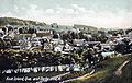
View from station c. 1908
-
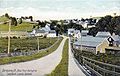
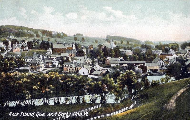
The twin villages c. 1906
-
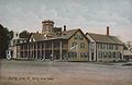
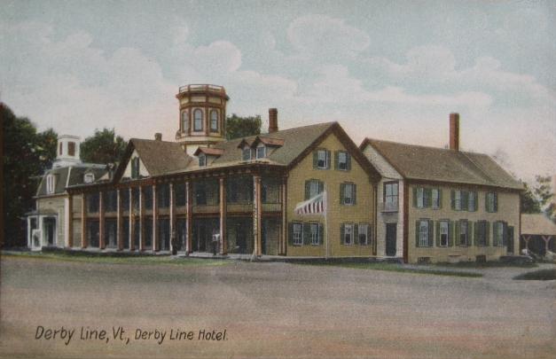
Derby Line Hotel c. 1908
-

Haskell Free Library on the US-Canadian border, 2011
Geography
According to the United States Census Bureau, the village has a total area of 0.7 square miles (1.8 km2), all land.
The village is the northern terminus of both Interstate 91 and US 5.
Demographics
As of the census[1] of 2000, there were 776 people, 329 households, and 225 families residing in the village. The population density was 1,057.5 /sq mi (408.3 /km2). There were 364 housing units at an average density of 496.0 per square mile (192.5/km²). The racial makeup of the village was 96.78% White, 0.39% African American, 0.90% Native American, 0.64% Asian, and 1.29% from two or more races. Hispanic or Latino of any race were 0.13% of the population.
There were 329 households out of which 31.6% had children under the age of 18 living with them, 52.6% were married couples living together, 11.6% had a female householder with no husband present, and 31.6% were non-families. 27.1% of all households were made up of individuals and 11.9% had someone living alone who was 65 years of age or older. The average household size was 2.36 and the average family size was 2.80.
In the village the population was spread out with 24.7% under the age of 18, 7.0% from 18 to 24, 25.6% from 25 to 44, 26.5% from 45 to 64, and 16.1% who were 65 years of age or older. The median age was 39 years. For every 100 females there were 92.1 males. For every 100 females age 18 and over, there were 86.0 males.
Economics
Personal income
The median income for a household in the village was $33,966, and the median income for a family was $37,375. Males had a median income of $30,208 versus $21,667 for females. The per capita income for the village was $15,202. About 11.4% of families and 12.8% of the population were below the poverty line, including 17.8% of those under age 18 and 11.9% of those age 65 or over.
Industry
A local subsidiary of an international tool manufacturer employs 180 workers from the area.[12]
Infrastructure
Drinking water for the adjacent towns of Derby Line and Stanstead is pumped from wells in Canada, stored in a reservoir in the United States and distributed through a system maintained by Canadians. Derby Line’s sewage makes a cross-border trip for treatment.[13]
Derby Line shares emergency crews with Stanstead. Each responds to calls on both sides of the border.
References
- ^ a b "American FactFinder". United States Census Bureau. http://factfinder.census.gov. Retrieved 2008-01-31.
- ^ "US Board on Geographic Names". United States Geological Survey. 2007-10-25. http://geonames.usgs.gov. Retrieved 2008-01-31.
- ^ http://www.nytimes.com/2007/07/18/world/americas/18border.html
- ^ Holland Historical Society (2004). Holland and Its Neighbors. Arcadia Publishing. pp. 39. ISBN 0-7385-3614-8.
- ^ Austin J. Coolidge & John B. Mansfield, A History and Description of New England; Boston, Massachusetts 1859
- ^ Ring, William (2007-05-25). "Border crackdown could hit binational library". Burlington Free Press.
- ^ "History of Butterfield's". The Stanstead Journal. 1952-07-31. http://news.google.com/newspapers?nid=805&dat=19520731&id=KQ8MAAAAIBAJ&sjid=A0kDAAAAIBAJ&pg=1656,1467984
- ^ [1]
- ^ http://www.tivolyinc.com/about.htm
- ^ Greeser, Joseph (2007-05-23). "Border meeting set for Thursday". The Chronicle.
- ^ "A border runs through it: Tiny town worries feds". CNN.com (AP). 2007-05-26. Archived from the original on 2007-06-18. http://web.archive.org/web/20070618080148/http://www.cnn.com/2007/US/05/26/border.quirk.ap/index.html.
- ^ [2]
- ^ New York Times retrieved July 3, 2009
External links
- Town of Derby, Vermont
- Haskell Free Library and Opera House
- Derby Historical Society
- Partly in Vermont: A Borderline Case (Time)
Municipalities and communities of Orleans County, Vermont City 
Towns Albany | Barton | Brownington | Charleston | Coventry | Craftsbury | Derby | Glover | Greensboro | Holland | Irasburg | Jay | Lowell | Morgan | Newport | Troy | Westfield | Westmore
Villages Albany | Barton | Derby Center | Derby Line | North Troy | Orleans
Unincorporated
communityCoordinates: 45°0′17.98″N 72°5′57.97″W / 45.0049944°N 72.0994361°W
Categories:- Canada–United States border crossings
- Incorporated villages in Vermont
- Derby, Vermont
- Border irregularities of the United States
- Populated places in Orleans County, Vermont
- Populated places established in 1791
-


Wikimedia Foundation. 2010.