- Westmore, Vermont
Infobox Settlement
official_name = Pagename
other_name =
native_name =
nickname =
settlement_type = Town
motto =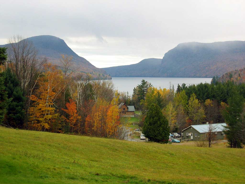
imagesize =
image_caption = Westmore, Vermont (Mount Pisgah, Lake Willoughby, Mount Hor)
flag_size =
image_
seal_size =
image_shield =
shield_size =
image_blank_emblem =
blank_emblem_size =
mapsize = 250px
map_caption = Located in Orleans County, Vermont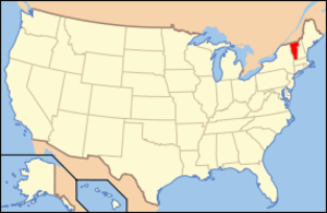
mapsize1 = 195px
map_caption1 = Location of Vermont with the U.S.A.
subdivision_type = Country
subdivision_name =United States
subdivision_type1 = State
subdivision_name1 =Vermont
subdivision_type2 = County
subdivision_name2 = Orleans
subdivision_type3 =
subdivision_name3 =
subdivision_type4 =
subdivision_name4 =
government_footnotes =
government_type =
leader_title =
leader_name =
leader_title1 =
leader_name1 =
leader_title2 =
leader_name2 =
leader_title3 =
leader_name3 =
leader_title4 =
leader_name4 =
established_title = Chartered
established_date = August 17, 1781
area_magnitude =
unit_pref = Imperial
area_footnotes =
area_total_km2 = 97.0
area_land_km2 = 89.4
area_water_km2 = 7.6
area_total_sq_mi = 37.5
area_land_sq_mi = 34.5
area_water_sq_mi = 2.9
area_water_percent =
population_as_of = 2000
population_footnotes =
population_note =
population_total = 306
population_density_km2 = 3.4
population_density_sq_mi = 15.4
population_blank1_title = Households
population_blank1 = 133
population_blank2_title = Families
population_blank2 = 90
timezone = EST
utc_offset = -5
timezone_DST = EDT
utc_offset_DST = -4
latd = 44 |latm = 45 |lats = 25 |latNS = N
longd = 72 |longm = 1 |longs = 34 |longEW = W
elevation_footnotes =
elevation_m = 554
elevation_ft = 1170
postal_code_type =ZIP code s
postal_code = 05822, 05860
area_code = 802
blank_name = FIPS code
blank_info = 50-81700GR|2
blank1_name = GNIS feature ID
blank1_info = 1462254GR|3
website =
footnotes =Westmore is a town in Orleans County,
Vermont ,United States . The population was 306 at the 2000 census, making it the least populated town in the county. The town contains one unincorporated village clustered aroundLake Willoughby . [ [http://www.rootsweb.com/~vtgenweb/vttowns/VTtowns.htm Vermont Villages, Towns, Counties ] ]Government
Town
*Chairman of the Selectmen - Nancy Mallary [Milfoil and water pumps debated in Westmore,"The Chronicle", March 7, 2007, page 14]
*Selectman - John Alexander
*Selectman - David Stevens
*Treasurer and Town Clerk - Greg Gallagher
*Delinquent Tax Collector - Robert Decker
*Agent - Greg Gallagher
*Auditor - Mellisa Zebrowski
*Auditor - Millie Davis
*Grand Juror - Michael Branon
*Cemetery Commissioner - Steve Richardschool District
High schools students are sent to
Lake Region Union High School . The town pays an assessment for this and elects a board member to theOrleans Central Supervisory Union .History
Originally named Westford, the town was chartered on
August 17 ,1781 . Since Chittenden County had a town named Westford, after six years the name was changed to Westmore.The first vacation house was built on the Lake in 1860. It is known as the "Cheney House, after an owner in the late 19th century. cite book | author = Gresser, Joseph |title = Cheney House for sale to highest bidder | publisher = the Chronicle | date = September 17, 2008]
Westmore never attracted many settlers. The town's peak population was in the census year of 1880 with 485 people.
Songadeewin Camp for girls was located here in the 1920s-1940s. [Not to be confused with a camp of the same name operating on Lake Dunmore in 2007]
In 1970, the state of Vermont acquired convert|7600|acre as part of Willoughby State Forest which included the Cheney House.cite book | author = Gresser, Joseph |title = Cheney House for sale to highest bidder | publisher = the Chronicle | date = September 17, 2008]
Nudity is everywhere legal in Vermont. [though public disrobing is not] [ [http://www.boston.com/news/local/vermont/articles/2006/08/23/law_of_nature_prevails_in_vermont] ] In 2007-8, the town discussed whether to ban nudity aimed at sunbathers on the south beach of Lake Willoughby. [ [http://news.aol.com/story/_a/vermont-nude-beach-sparks-controversy/20080617063209990001 aol news] retrieved June 17, 2008]
Geography
According to the
United States Census Bureau , the town has a total area of 37.5square mile s (97.0km² ), of which, 34.5 square miles (89.4 km²) of it is land and 2.9 square miles (7.6 km²) of it (7.85%) is water.One of the town's most prominent feature is
Lake Willoughby . The lake has a maximum depth of 312 feet making it the deepest lake totally contained withinVermont , and one of the deepest lakes in all ofNew England .Fact|date=February 2007 The relatively young 12,000-year-old glacier-carved lake is flanked on the east by Mount Pisgah convert|2752|ft|m|0 and the west by Mount Hor convert|2654|ft|m|0. The mountains, which have hundreds of feet of rock cliffs, are located in the WillougbyState Forest and the cliffs have been designated aNational Natural Landmark . In recent decades, severalPeregrine Falcons have been found there.Local mountains also include Goodwin convert|2936|ft|m|0, Bald convert|3316|ft|m|0, Hedgehog convert|2201|ft|m|0, Haystack convert|2713|ft|m|0, and Bartlet convert|2047|ft|m|0.
The town has a local weather recording and reporting station. [ [http://www.wunderground.com/weatherstation/WXDailyHistory.asp?ID=KVTWESTM1 Westmore Weather Station Data] ]
Demographics
As of the
census GR|2 of 2000, there were 306 people, 133 households, and 90 families residing in the town. Thepopulation density was 8.9 people per square mile (3.4/km²). There were 530 housing units at an average density of 15.4/sq mi (5.9/km²). The racial makeup of the town was 97.39% White, 1.63% Native American, 0.65% Asian, and 0.33% from two or more races.There were 133 households out of which 20.3% had children under the age of 18 living with them, 58.6% were married couples living together, 6.8% had a female householder with no husband present, and 32.3% were non-families. 26.3% of all households were made up of individuals and 6.8% had someone living alone who was 65 years of age or older. The average household size was 2.30 and the average family size was 2.74.
In the town the population was spread out with 16.7% under the age of 18, 7.8% from 18 to 24, 22.5% from 25 to 44, 36.3% from 45 to 64, and 16.7% who were 65 years of age or older. The median age was 46 years. For every 100 females there were 100.0 males. For every 100 females age 18 and over, there were 112.5 males.
The median income for a household in the town was $27,375, and the median income for a family was $38,333. Males had a median income of $26,875 versus $18,958 for females. The
per capita income for the town was $14,522. About 7.8% of families and 14.6% of the population were below thepoverty line , including 25.8% of those under the age of eighteen and 3.8% of those sixty five or over.Footnotes
External links
*
*

Wikimedia Foundation. 2010.