- Morgan Covered Bridge
-
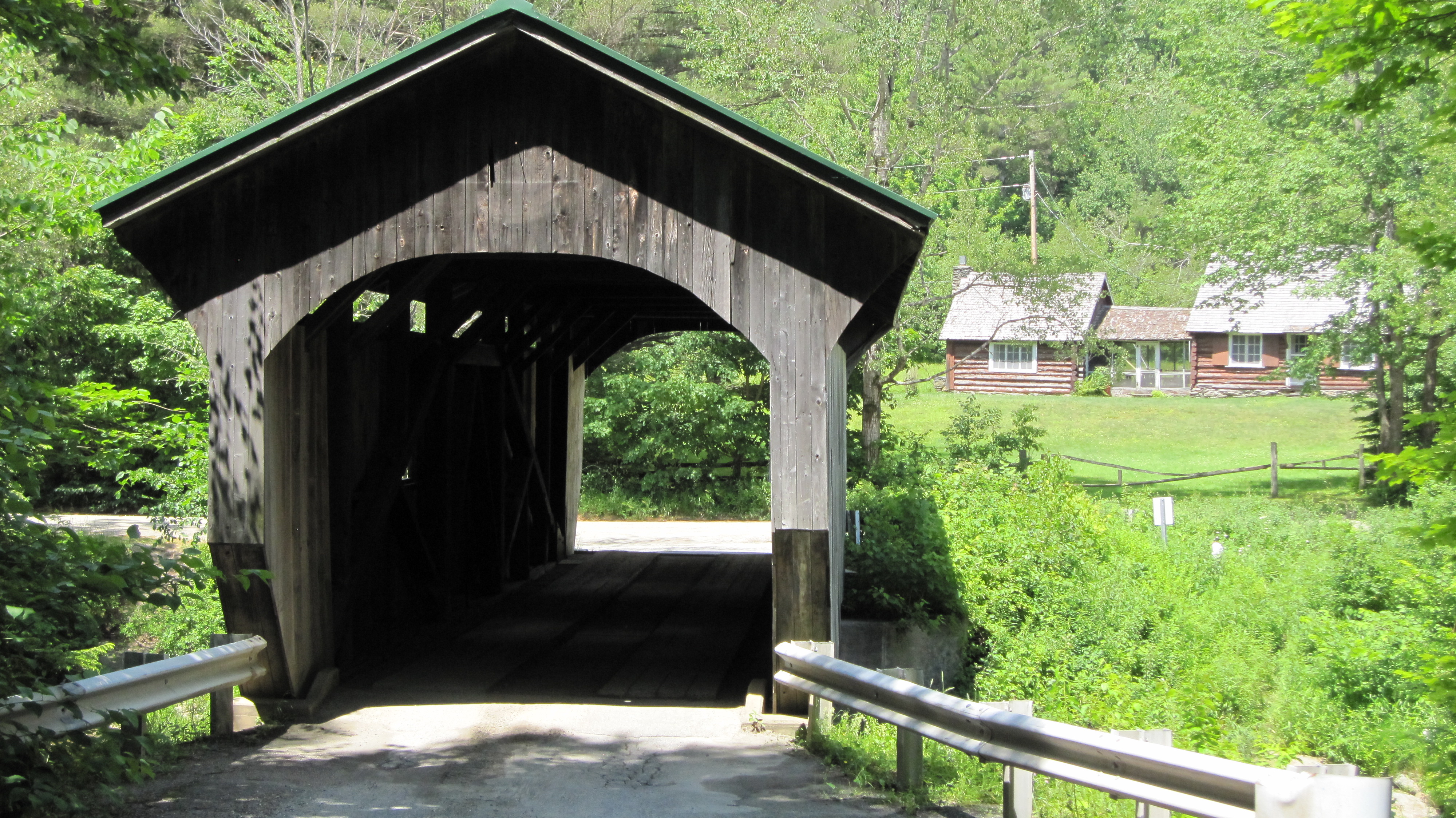
Morgan Covered Bridge 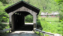
Carries Automobile Crosses North Branch of Lamoille River Locale Belvidere, Vermont Maintained by Town of Belvidere ID number VT-08-07 Design Covered, Town lattice Material Wood Total length 70 ft 11 in (21.62 m) Width 12 ft 2.75 in (3.7275 m) Number of spans 1 Load limit 5 tons Vertical clearance 8 ft 6 in (2.59 m) Constructed by Lewis Robinson, et al. Construction end 1887

Coordinates: 44°44′36″N 72°43′40″W / 44.74333°N 72.72778°WCoordinates: 44°44′36″N 72°43′40″W / 44.74333°N 72.72778°W NRHP Reference#: 74000220 Added to NRHP: November 19, 1974[1] The Morgan Covered Bridge, also known as the Upper Covered Bridge[2] is a wooden covered bridge that crosses the Lamoille River in Belvidere, Vermont on Morgan Bridge Road. It was listed on the National Register of Historic Places in 1974.[1]
The bridge is of Queen post design built by Lewis Robinson, Charles Leonard and Fred Tracy.
Recent history
There have been no major repairs necessary with this bridge recently, save for a new standing seam metal roof which a large number of covered bridges in Vermont received due to a grant. A study in the 1990s by the Vermont Agency of Transportation revealed that certain design details of the trusses allowed the bridge to be rated for a 9 ton load (1 ton more than the standard load limit for wooden deck bridges).[3] At this time, a sign at the bridge posts the limit at 5 tons.
References
- ^ a b "National Register Information System". National Register of Historic Places. National Park Service. no date specified. http://nrhp.focus.nps.gov/natreg/docs/All_Data.html.
- ^ U.S. Geological Survey Geographic Names Information System: Morgan Covered Bridge
- ^ Evans, Benjamin and June. New England's Covered Bridges. University Press of New England, 2004. ISBN 1584653205
U.S. National Register of Historic Places Topics Lists by states Alabama • Alaska • Arizona • Arkansas • California • Colorado • Connecticut • Delaware • Florida • Georgia • Hawaii • Idaho • Illinois • Indiana • Iowa • Kansas • Kentucky • Louisiana • Maine • Maryland • Massachusetts • Michigan • Minnesota • Mississippi • Missouri • Montana • Nebraska • Nevada • New Hampshire • New Jersey • New Mexico • New York • North Carolina • North Dakota • Ohio • Oklahoma • Oregon • Pennsylvania • Rhode Island • South Carolina • South Dakota • Tennessee • Texas • Utah • Vermont • Virginia • Washington • West Virginia • Wisconsin • WyomingLists by territories Lists by associated states Other Categories:- Belvidere, Vermont
- Bridges completed in 1887
- Bridges on the National Register of Historic Places in Vermont
- Covered bridges in Vermont
- Truss bridges
- Wooden bridges in the United States
- Buildings and structures in Lamoille County, Vermont
- Transportation in Lamoille County, Vermont
- Visitor attractions in Lamoille County, Vermont
- Road bridges in Vermont
- Vermont Registered Historic Places building and structure stubs

Wikimedia Foundation. 2010.