- Montgomery Covered Bridge
-
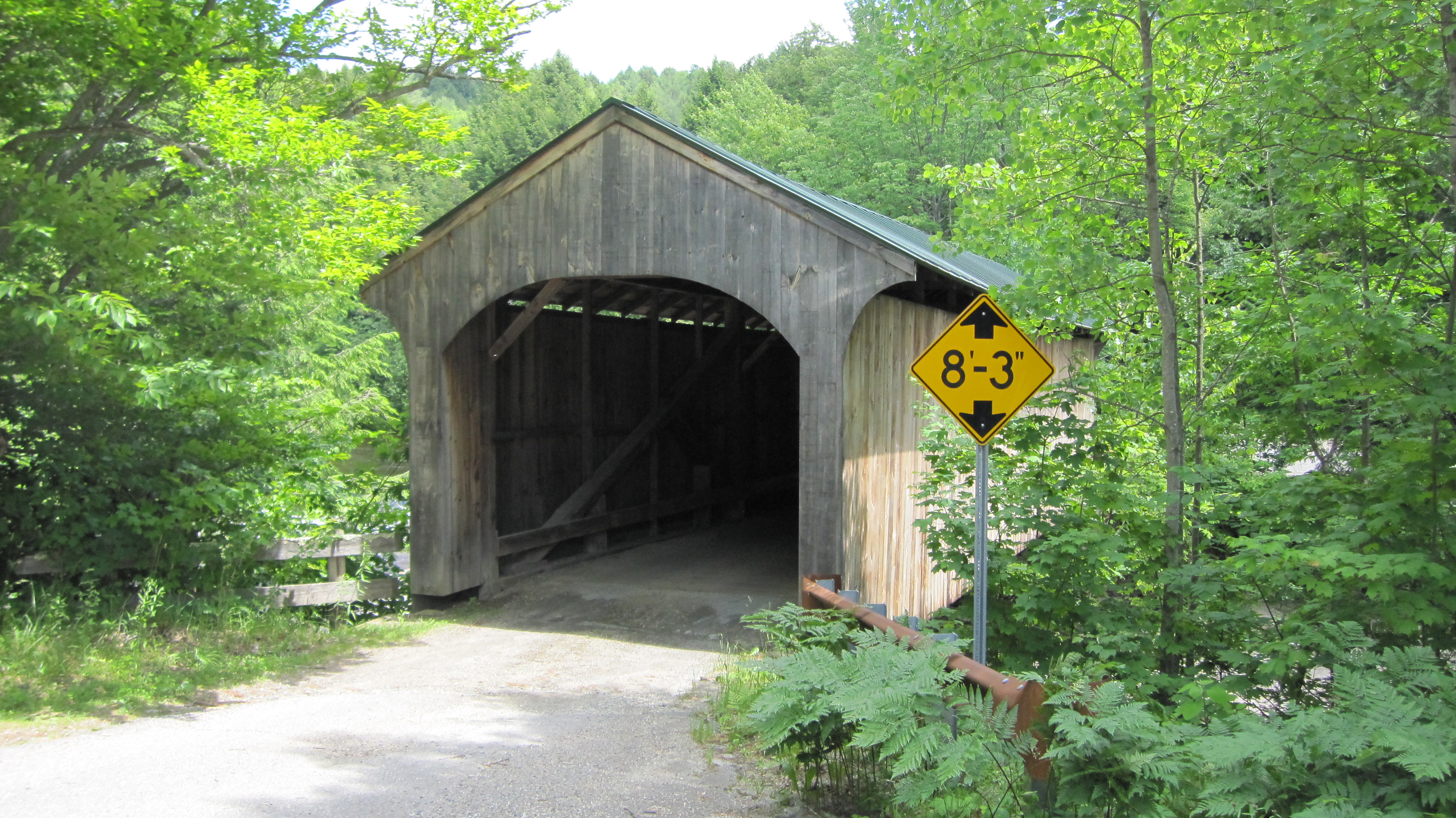
Montgomery Covered Bridge 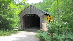
Carries Automobile Crosses North Branch of Lamoille River Locale Waterville, Vermont Maintained by Town of Waterville ID number VT-08-14 Design Covered, Town lattice Material Wood Total length 70 ft 3.75 in (21.4313 m) Width 12 ft 5.25 in (3.7910 m) Number of spans 1 Vertical clearance 8 ft 3 in (2.51 m) Construction end 1887

Coordinates: 44°41′42″N 72°45′56″W / 44.695°N 72.76556°WCoordinates: 44°41′42″N 72°45′56″W / 44.695°N 72.76556°W NRHP Reference#: 74000228 Added to NRHP: October 18, 1974[1] The Montgomery Covered Bridge, also known as the Lower Covered Bridge[2] is a wooden covered bridge that crosses the North Branch of the Lamoille River in Waterville, Vermont on Montgomery Road. It was listed on the National Register of Historic Places in 1974.[1]
The bridge is of Queen post design built by an unknown builder. Despite the Geographical Names Information System (GNIS) database listing Lower as one of the names of this bridge, this may be an error as it is commonly known as the Middle Covered Bridge since it is between the Jaynes Covered Bridge (also known as the Upper bridge) and the Village Covered Bridge (also known as the Lower bridge). All cross the same waterway.[3]
Recent history
In 1969 a large snowstorm deposited 5 feet of snow concentrated more on one side of the roof than the other which induced a lean. Dallas Montgomery, a farmer for whom the bridge is now named, got up on the roof to remove some of the snow. Local resident Wilmer Locke used a winch to right the lean and added bracing. In 1971 an asphalt truck fell through the deck into the river below (luckily with only minor injuries to the driver). The bridge was subsequently reinforced with steel beams. There are apparently accounts of major repairs made in 1997.[3]
References
- ^ a b "National Register Information System". National Register of Historic Places. National Park Service. no date specified. http://nrhp.focus.nps.gov/natreg/docs/All_Data.html.
- ^ U.S. Geological Survey Geographic Names Information System: Montgomery Covered Bridge
- ^ a b Evans, Benjamin and June. New England's Covered Bridges. University Press of New England, 2004. ISBN 1584653205
U.S. National Register of Historic Places Topics Lists by states Alabama • Alaska • Arizona • Arkansas • California • Colorado • Connecticut • Delaware • Florida • Georgia • Hawaii • Idaho • Illinois • Indiana • Iowa • Kansas • Kentucky • Louisiana • Maine • Maryland • Massachusetts • Michigan • Minnesota • Mississippi • Missouri • Montana • Nebraska • Nevada • New Hampshire • New Jersey • New Mexico • New York • North Carolina • North Dakota • Ohio • Oklahoma • Oregon • Pennsylvania • Rhode Island • South Carolina • South Dakota • Tennessee • Texas • Utah • Vermont • Virginia • Washington • West Virginia • Wisconsin • WyomingLists by territories Lists by associated states Other Categories:- Waterville, Vermont
- Bridges completed in 1887
- Bridges on the National Register of Historic Places in Vermont
- Covered bridges in Vermont
- Truss bridges
- Wooden bridges in the United States
- Buildings and structures in Lamoille County, Vermont
- Transportation in Lamoille County, Vermont
- Visitor attractions in Lamoille County, Vermont
- Road bridges in Vermont
- Vermont Registered Historic Places building and structure stubs

Wikimedia Foundation. 2010.