- National Register of Historic Places listings in Rock County, Wisconsin
-
Buildings, sites, structures, districts, and objects in Rock County listed on the National Register of Historic Places
-
- This National Park Service list is complete through NPS recent listings posted November 10, 2011.[1]
Current listings
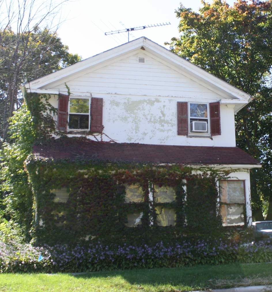
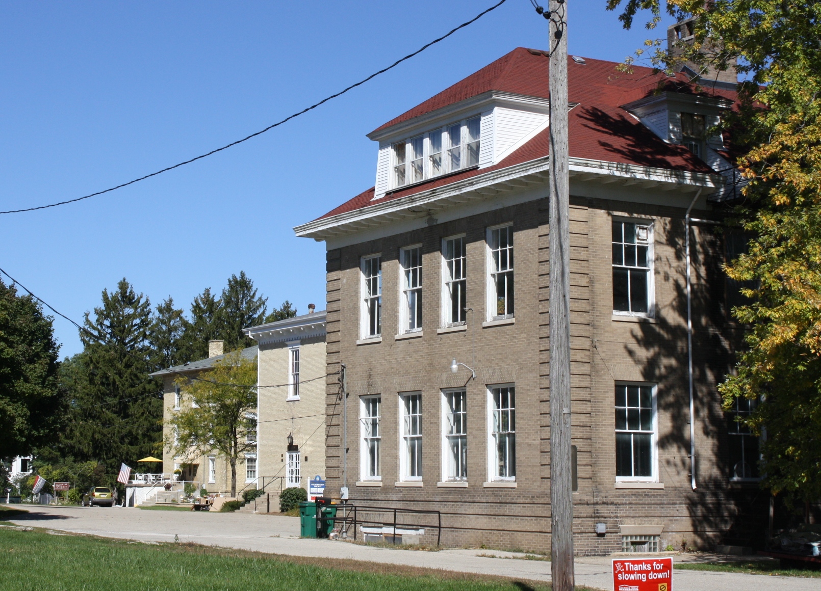
[2] Landmark name [3] Image Date listed Location City or town Summary 1 John Alexander Wheat Warehouse 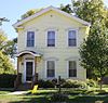
September 13, 1978 304 S. Janesville St.
42°46′29″N 88°56′11″W / 42.774722°N 88.936389°WMilton 2 Abram Allen House 
September 13, 1978 205 E. Madison Ave.
42°46′45″N 88°56′54″W / 42.779167°N 88.948333°WMilton 3 The Armory November 21, 1978 10 S. High St.
42°40′49″N 89°01′40″W / 42.680278°N 89.027778°WJanesville 4 Bartlett Memorial Historical Museum April 11, 1977 2149 St. Lawrence Ave.
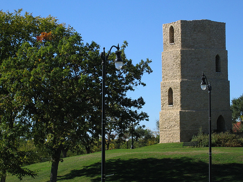
42°30′15″N 89°04′10″W / 42.504167°N 89.069444°WBeloit 5 Beloit Water Tower 
January 7, 1983 1005 Pleasant St.
42°30′33″N 89°01′49″W / 42.509167°N 89.030278°WBeloit 6 Benton Avenue Historic District March 7, 1996 Roughly bounded by Benton Ave., Wilton Ave., Sherman Ave., Richardson St., Blaine Ave. and Prairie Ave.
42°41′48″N 89°00′48″W / 42.696667°N 89.013333°WJanesville 7 Selvy Blodgett House May 23, 1980 417 Bluff St.
42°29′59″N 89°02′29″W / 42.499722°N 89.041389°WBeloit 8 Bluff Street Historic District January 7, 1983 Roughly both sides of Bluff St. from Shirland Ave. to Merrill St.
42°30′04″N 89°02′30″W / 42.501111°N 89.041667°WBeloit 9 Bostwick Avenue Historic District April 24, 2006 404-436 Bostwick Ave. and 1118 and 1128 Grace St.
42°40′56″N 89°00′37″W / 42.682222°N 89.010278°WJanesville 10 Brasstown Cottage March 4, 1983 1701 Colley Rd.
42°30′26″N 89°00′53″W / 42.507222°N 89.014722°WBeloit 11 Church of St. Thomas the Apostle January 7, 1983 822 E. Grand Ave.
42°29′58″N 89°01′41″W / 42.499444°N 89.028056°WBeloit 12 Citizens Bank August 1, 1985 Front & Allen Sts.
42°33′12″N 88°51′46″W / 42.553333°N 88.862778°WClinton 13 City of Beloit Waterworks and Pump Station September 13, 1990 1005 Pleasant St.
42°30′32″N 89°01′51″W / 42.508889°N 89.030833°WBeloit 14 Clark-Brown House September 13, 1985 3457 Riverside Dr.
42°33′45″N 89°02′06″W / 42.5625°N 89.035°WBeloit 15 Clinton Village Hall August 1, 1985 301 Cross St.
42°33′18″N 88°51′42″W / 42.555°N 88.861667°WClinton 16 Clinton Water Tower March 7, 1985 High St.
42°33′39″N 88°51′48″W / 42.560833°N 88.863333°WClinton 17 Columbus Circle Historic District May 19, 2005 Columbus Circle generally bounded by N. Adams and E. Milwaukee Sts. and N. Garfield Ave.
42°41′24″N 89°00′38″W / 42.69°N 89.010556°WJanesville 18 Conrad Cottages Historic District March 11, 1993 235-330 Milton Ave.
42°41′12″N 89°01′03″W / 42.686667°N 89.0175°WJanesville 19 Cooksville Cheese Factory 
September 17, 1980 SR 1
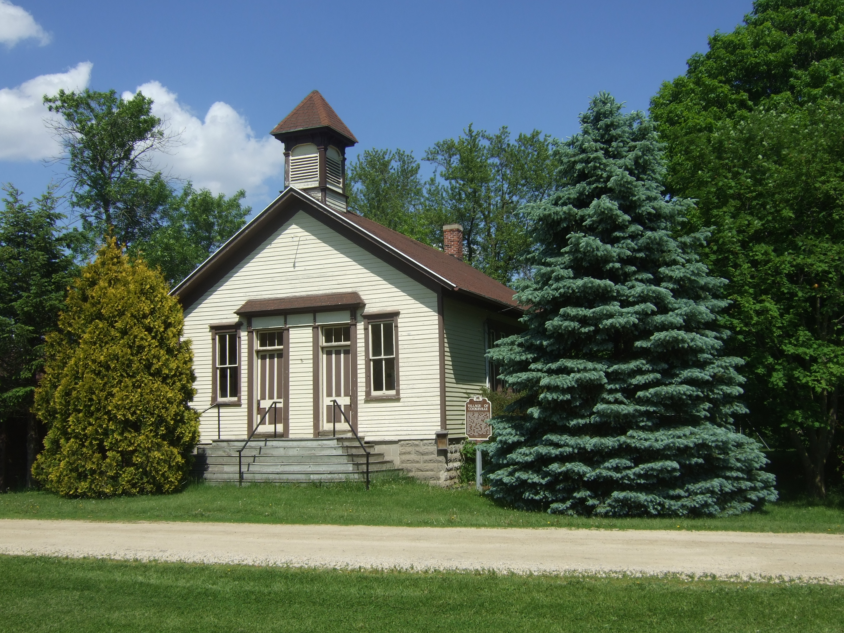
42°50′06″N 89°14′36″W / 42.835°N 89.243333°WEvansville 20 Cooksville Historic District 
October 25, 1973 Both sides of streets bordering the Public Sq. and Rock St.
42°50′08″N 89°14′19″W / 42.835556°N 89.238611°WCooksville Boundary increase (listed September 17, 1980): Roughly Tolles Rd., Church St., Rock St., Dane St., and Main St. 21 Cooksville Mill and Mill Pond Site September 17, 1980 SR 1
42°50′19″N 89°14′32″W / 42.838611°N 89.242222°WEvansville 22 Cooper-Gillies House 
September 17, 1980 SR 1
42°50′03″N 89°15′17″W / 42.834167°N 89.254722°WEvansville 23 Court Street Methodist Church November 17, 1977 36 S. Main St.
42°40′55″N 89°01′17″W / 42.681944°N 89.021389°WJanesville 24 Courthouse Hill Historic District January 17, 1986 Roughly bounded by E. Milwaukee St., Garfield and Oakland Aves., S. Main St., and E. Court St. and Milton Ave.
42°41′00″N 89°00′58″W / 42.683333°N 89.016111°WJanesville 25 J. W. Crist House January 7, 1983 2601 Afton Rd.
42°32′26″N 89°03′04″W / 42.540556°N 89.051111°WBeloit 26 Crosby Block August 1, 1985 102 Allen St.
42°33′12″N 88°51′46″W / 42.553333°N 88.862778°WClinton 27 James B. Crosby House December 14, 1995 1005 Sutherland Ave.
42°41′41″N 89°01′27″W / 42.694722°N 89.024167°WJanesville 28 Charles L. Culton House August 22, 1977 708 Washington St.
42°50′19″N 89°04′34″W / 42.838611°N 89.076111°WEdgerton 29 De Jean House 
September 13, 1978 27 Third St.
42°46′54″N 88°57′33″W / 42.781667°N 88.959167°WMilton 30 Erastus Dean Farmstead December 4, 1978 E of Janesville on U.S. 14
42°39′20″N 88°52′50″W / 42.655556°N 88.880556°WJanesville 31 Homer B. DeLong House August 1, 1985 500 Milwaukee Rd.
42°33′29″N 88°51′51″W / 42.558056°N 88.864167°WClinton 32 Dougan Round Barn 
June 4, 1979 444 West Colley Rd.
42°30′29″N 88°59′20″W / 42.508056°N 88.988889°WBeloit 33 John T. Dow House 
September 17, 1980 SR 1
42°50′05″N 89°14′49″W / 42.834722°N 89.246944°WEvansville 34 Eager Free Public Library August 16, 1977 39 W. Main St.
42°47′05″N 89°03′23″W / 42.784722°N 89.056389°WEvansville 35 Almeron Eager Funerary Monument and Plot July 20, 2011 8012 N. Cemetery Rd.
42°46′59″N 89°17′21″W / 42.783056°N 89.289167°WEvansville 36 East Milwaukee Street Historic District February 8, 1980 N. Parker Dr. and E. Milwaukee St.
42°41′01″N 89°01′18″W / 42.683611°N 89.021667°WJanesville 37 Edgerton Depot April 13, 1998 20 S. Main St.
42°50′00″N 89°04′13″W / 42.833333°N 89.070278°WEdgerton 38 Edgerton Post Office October 24, 2000 104 N. Swift St.
42°50′08″N 89°04′16″W / 42.835556°N 89.071111°WEdgerton 39 Edgerton Public Grade Schools January 14, 1987 116 N. Swift St.
42°50′09″N 89°04′11″W / 42.835833°N 89.069722°WEdgerton 40 Emerson Hall September 20, 1979 Beloit College campus
42°30′26″N 89°01′43″W / 42.507222°N 89.028611°WBeloit 41 Evansville Historic District November 16, 1978 roughly bounded by Allens Creek, Liberty, 4th and Garfield Sts.
42°46′46″N 89°18′10″W / 42.779444°N 89.302778°WEvansville 42 Evansville Standpipe February 27, 2008 288 N. 4th St.
42°47′05″N 89°18′47″W / 42.784722°N 89.313056°WEvansville 43 Fairbanks Flats January 7, 1983 205, 215 Birch Ave. and 206, 216 Carpenter Ave.
42°31′19″N 89°02′24″W / 42.521944°N 89.04°WBeloit 44 First Congregational Church January 23, 1975 801 Bushnell St.
42°30′06″N 89°01′40″W / 42.501667°N 89.027778°WBeloit 45 Footville Condensery May 7, 1982 Beloit St.
42°40′00″N 89°12′27″W / 42.666667°N 89.2075°WFootville 46 Footville State Bank May 7, 1982 158 Depot St.
42°40′11″N 89°12′40″W / 42.669722°N 89.211111°WFootville 47 Fredendall Block March 25, 1982 33-39 S. Main St.
42°40′56″N 89°01′17″W / 42.682222°N 89.021389°WJanesville 48 Fulton Congregational Church June 7, 1976 Fulton St.
42°48′21″N 89°07′44″W / 42.805833°N 89.128889°WFulton 49 Fulton Street Historic District July 1, 1999 Along Fulton St., roughly bounded by Main ans Albion Sts.; 11-21 Swift St.
42°50′03″N 89°04′13″W / 42.834167°N 89.070278°WEdgerton 50 Gempeler Round Barn June 4, 1979 SW of Orfordville
42°39′50″N 89°19′50″W / 42.663889°N 89.330556°WOrfordville 51 Gifford House 
September 13, 1978 308 Vernal
42°46′51″N 88°57′36″W / 42.780833°N 88.96°WMilton 52 Gilley-Tofsland Octagonal Barn June 4, 1979 NW of Edgerton
42°50′40″N 89°10′30″W / 42.844444°N 89.175°WEdgerton 53 Goodrich Blacksmith Shop September 13, 1978 28 S. Janesville St.
42°46′34″N 88°56′10″W / 42.776111°N 88.936111°WMilton 54 Goodrich-Buten House 
September 13, 1978 528 E. Madison St.
42°46′38″N 88°56′22″W / 42.777222°N 88.939444°WMilton 55 Grove Street Historic District August 10, 2011 103, 111, 112, 116, 119, 125, 126, 133 & 134 Grove St.
42°47′00″N 89°18′08″W / 42.783464°N 89.302222°WEvansville NRHP # 11000531 56 Hanchett Block March 20, 1980 307 State St.
42°29′56″N 89°02′08″W / 42.498889°N 89.035556°WBeloit 57 Hilton House Hotel November 7, 2003 434 E. Grand Ave.
42°29′58″N 89°02′02″W / 42.499444°N 89.033889°WBeloit 58 How-Beckman Mill September 7, 1977 Address Restricted Beloit 59 John and Martha Hugunin House June 1, 2005 2739 Beloit Ave.
42°38′30″N 89°00′41″W / 42.641667°N 89.011389°WJanesville 60 Janesville Cotton Mill July 16, 1980 220 N. Franklin St.
42°41′02″N 89°01′39″W / 42.683889°N 89.0275°WJanesville 61 Janesville High School June 25, 1999 408 S. Main St.
42°40′40″N 89°01′02″W / 42.677778°N 89.017222°WJanesville Also known as Marshall Junior High School 62 Janesville Public Library July 1, 1981 64 S. Main St.
42°40′53″N 89°01′15″W / 42.681389°N 89.020833°WJanesville 63 Janesville Pumping Station March 7, 1985 500 Blk. River St.
42°40′48″N 89°01′22″W / 42.68°N 89.022778°WJanesville 64 Jefferson Avenue Historic District April 19, 2006 Bounded by Oakland, Garfield and Ruger Aves. and Forest Park Blvd.
42°41′10″N 89°00′40″W / 42.686111°N 89.011111°WJanesville 65 John H. Jones House March 14, 2008 538 S. Main St.
42°40′36″N 89°00′56″W / 42.676667°N 89.015556°WJanesville 66 Samuel S. Jones Cobblestone House February 23, 1978 E of Clinton on Milwaukee Rd.
42°33′57″N 88°49′02″W / 42.565833°N 88.817222°WClinton 67 Kinney Farmstead-Tay-e-he-Dah Site February 17, 1978 Address Restricted Edgerton 68 Lappin-Hayes Block November 7, 1976 20 E. Milwaukee St.
42°40′58″N 89°01′21″W / 42.682778°N 89.0225°WJanesville 69 LaPrairie Grange Hall No. 79 April 11, 1977 SE of Janesville on Town Hall Rd.
42°37′37″N 88°57′12″W / 42.626944°N 88.953333°WJanesville 70 Lathrop-Munn Cobblestone House August 22, 1977 524 Bluff St.
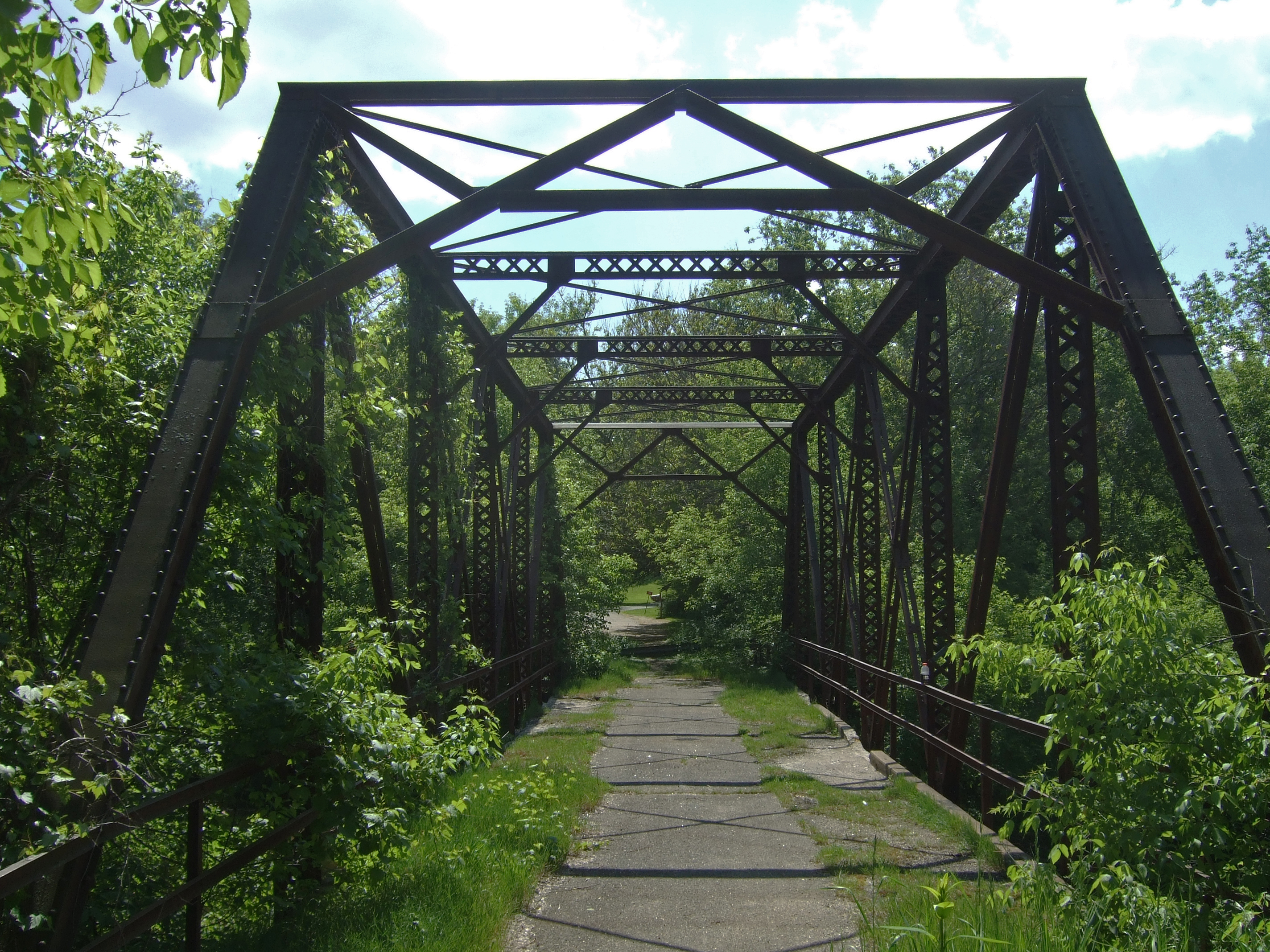
42°30′03″N 89°02′31″W / 42.500833°N 89.041944°WBeloit 71 Leedle Mill Truss Bridge 
September 17, 1980 SR 1
42°50′37″N 89°15′08″W / 42.843611°N 89.252222°WEvansville 72 Look West Historic District March 26, 1987 Roughly bounded by Mineral Point Ave., N. Franklin and Race Sts., Laurel Ave., and N. Chatham St.
42°41′03″N 89°02′00″W / 42.684167°N 89.033333°WJanesville Boundary increase (listed December 10, 1993): Roughly bounded by Laurel Ave. and N. Madison, W. Court and N. Palm Sts. 73 Lovejoy and Merrill-Nowlan Houses January 21, 1980 220 and 202 St. Lawrence Ave.
42°40′55″N 89°01′07″W / 42.681944°N 89.018611°WJanesville 74 Peter McEwan Warehouse 
September 13, 1978 711 E. High St.
42°46′22″N 88°56′19″W / 42.772778°N 88.938611°WMilton 75 Merrill Avenue Historic District February 19, 1993 103, 107, 111, 115 Merrill Ave.
42°30′34″N 89°02′13″W / 42.509444°N 89.036944°WBeloit 76 Miller House September 17, 1980 SR 1
42°49′40″N 89°14′25″W / 42.827778°N 89.240278°WEvansville 77 Milton College Historic District 
May 27, 1980 College St.
42°46′27″N 88°56′32″W / 42.774167°N 88.942222°WMilton 78 Milton House 
February 1, 1972 18 S. Janesville St.
42°46′37″N 88°56′11″W / 42.776944°N 88.936389°WMilton 79 Moran's Saloon January 7, 1983 312 State St.
42°29′57″N 89°02′09″W / 42.499167°N 89.035833°WBeloit 80 Mouth of the Yahara Archeological District April 28, 1975 Address Restricted Fulton 81 Murray-George House September 13, 1985 SR P
42°30′33″N 88°56′18″W / 42.509167°N 88.938333°WBeloit 82 Peter Myers Pork Packing Plant and Willard Coleman Building July 7, 1983 117-123 N. Main St.
42°41′03″N 89°01′26″W / 42.684167°N 89.023889°WJanesville 83 Myers-Newhoff House May 18, 1979 121 N. Parker Dr.
42°41′05″N 89°01′22″W / 42.684722°N 89.022778°WJanesville 84 Near East Side Historic District January 7, 1983 Roughly bounded by Pleasant, Clary Sts., Wisconsin and E. Grand Aves.
42°30′10″N 89°01′40″W / 42.502778°N 89.027778°WBeloit 85 Elbert Neese House January 7, 1983 1302 Bushnell St
42°30′04″N 89°01′15″W / 42.501111°N 89.020833°WBeloit 86 North Main Street Historic District February 8, 1980 N. Main St. and N. Parker Dr.
42°41′02″N 89°01′23″W / 42.683889°N 89.023056°WJanesville 87 Sterling North House January 9, 1997 409 W. Rollin St.
42°50′14″N 89°04′04″W / 42.837222°N 89.067778°WEdgerton 88 Clark Nye House January 7, 1983 2501 Spring Creek Rd.
42°31′34″N 89°04′45″W / 42.526111°N 89.079167°WBeloit 89 Old Fourth Ward Historic District May 30, 1990 Roughly bounded by Washington St., Center Ave., Court St., Franklin St., and Monterey Park
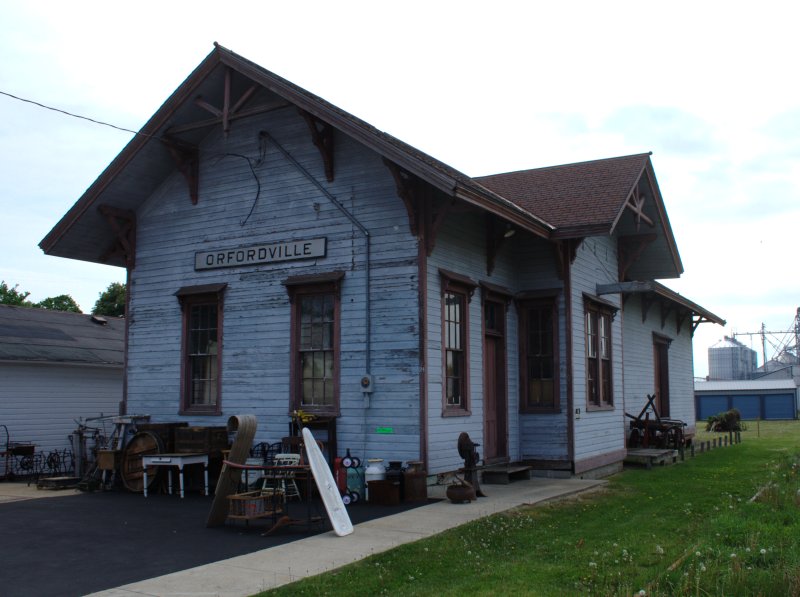
42°40′24″N 89°01′45″W / 42.673333°N 89.029167°WJanesville 90 Orfordville Depot 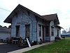
October 13, 1988 Beloit St.
42°37′41″N 89°15′22″W / 42.628056°N 89.256111°WOrfordville 91 William J. Owen Store May 7, 1982 220 Depot St.
42°40′11″N 89°12′40″W / 42.669722°N 89.211111°WFootville 92 J. L. Pangborn House August 1, 1985 300 Allen St.
42°33′20″N 88°51′47″W / 42.555556°N 88.863056°WClinton 93 Payne-Craig House July 2, 1987 2200 W. Memorial Dr.
42°41′44″N 89°02′52″W / 42.695556°N 89.047778°WJanesville 94 Pearsons Hall of Science June 30, 1980 Beloit College campus
42°30′13″N 89°01′53″W / 42.503611°N 89.031389°WBeloit 95 Pomeroy and Pelton Tobacco Warehouse July 9, 1998 1 W. Fulton St.
42°50′00″N 89°04′10″W / 42.833333°N 89.069444°WEdgerton Also known as Dickinson Tobacco Warehouse 96 J. K. Porter Farmstead September 17, 1980 SR 1
42°50′09″N 89°13′35″W / 42.835833°N 89.226389°WEvansville 97 Prospect Hill Historic District November 5, 1992 Roughly bounded by Eisenhower, Prospect and Atwood Aves., Milwaukee St., Parker Dr. and Centerway
42°41′10″N 89°01′16″W / 42.686111°N 89.021111°WJanesville 98 Brewster Randall House March 1, 1984 1412 Ruger Ave.
42°41′10″N 89°00′19″W / 42.686111°N 89.005278°WJanesville 99 Rasey House December 27, 1974 517 Prospect St.
42°30′05″N 89°01′50″W / 42.501389°N 89.030556°WBeloit 100 Charles Rau House January 7, 1983 757 Euclid Ave.
42°30′01″N 89°02′56″W / 42.500278°N 89.048889°WBeloit 101 Richardson Grout House September 17, 1980 SR 1
42°49′06″N 89°12′41″W / 42.818333°N 89.211389°WEvansville 102 Hamilton Richardson House July 17, 1978 429 Prospect Ave.
42°41′14″N 89°01′13″W / 42.687222°N 89.020278°WJanesville 103 Richardson-Brinkman Cobblestone House July 28, 1977 607 W. Milwaukee Rd.
42°33′27″N 88°51′58″W / 42.5575°N 88.866111°WClinton 104 Rindfleisch Building January 7, 1983 512 E. Grand Ave.
42°29′58″N 89°02′00″W / 42.499444°N 89.033333°WBeloit 105 Risum Round Barn June 4, 1979 Southwest of Orfordville
42°35′55″N 89°17′35″W / 42.598611°N 89.293056°WOrfordville 106 John C. and Mary Robinson Farmstead January 7, 2010 18002 W. County Trunk Highway C
42°47′14″N 89°21′26″W / 42.787339°N 89.357269°WUnion 107 Shopiere Congregational Church August 13, 1976 Buss Rd., near Shopiere Rd.
42°34′14″N 88°56′17″W / 42.570556°N 88.938056°WShopiere 108 South First Street Residential Historic District August 10, 2011 341, 348, 349, 402, 408, 409, 412, 419, 433, 439 & 443, S. 1st St.
42°46′29″N 89°18′03″W / 42.774722°N 89.300833°WEvansville NRHP # 11000532 109 Stephen Slaymaker House January 7, 1983 348 Euclid Ave.
42°29′59″N 89°02′32″W / 42.499722°N 89.042222°WBeloit 110 Samuel Smiley House October 21, 1982 SE of Orfordville on WI 213
42°35′59″N 89°12′25″W / 42.599722°N 89.206944°WOrfordville 111 John Smith House August 1, 1985 312 Pleasant St.
42°33′24″N 88°52′04″W / 42.556667°N 88.867778°WClinton 112 South Main Street Historic District June 1, 1990 Roughly S. Main St. from Milwaukee St. to Rock Co. Courthouse grounds and E. Court St. from Parker Dr. to Rock R.
42°40′55″N 89°01′17″W / 42.681944°N 89.021389°WJanesville 113 St. Paul's Episcopal Church April 4, 1978 212 W. Grand Ave.
42°30′05″N 89°02′22″W / 42.501389°N 89.039444°WBeloit 114 Stark-Clint House September 13, 1985 Creek Rd.
42°35′04″N 88°55′32″W / 42.584444°N 88.925556°WTiffany 115 Harrison Stebbins House September 17, 1980 SR 1
42°49′36″N 89°12′55″W / 42.826667°N 89.215278°WEvansville 116 Soloman J. Strang House May 7, 1982 231 North Gilbert
42°40′25″N 89°12′32″W / 42.673611°N 89.208889°WFootville 117 Strong Building January 7, 1983 400-408 E. Grand Ave.
42°29′58″N 89°02′07″W / 42.499444°N 89.035278°WBeloit 118 Strong Partridge Mound Group March 1, 1994 1750 Arrowhead Dr.
42°31′09″N 89°00′37″W / 42.519167°N 89.010278°WBeloit 119 John and Eleanor Strunk House March 11, 2008 2306 N. Parker Dr.
42°42′38″N 89°01′59″W / 42.710556°N 89.033056°WJanesville 120 Tallman House October 15, 1970 440 N. Jackson St.
42°41′10″N 89°01′53″W / 42.686111°N 89.031389°WJanesville 121 A. E. Taylor House August 1, 1985 318 Durand St.
42°33′25″N 88°51′51″W / 42.556944°N 88.864167°WClinton 122 Turtleville Iron Bridge 
September 15, 1977 N of Beloit on Lathers Rd.
42°33′56″N 88°57′52″W / 42.565556°N 88.964444°WBeloit 123 West Luther Valley Lutheran Church May 27, 1980 SW of Orfordville on W. Church Rd.
42°36′26″N 89°19′35″W / 42.607222°N 89.326389°WOrfordville 124 West Milwaukee Street Historic District May 17, 1990 Roughly bounded by Wall, River, Court, and Academy Sts.
42°40′52″N 89°01′33″W / 42.681111°N 89.025833°WJanesville 125 Frances Willard Schoolhouse October 5, 1977 Craig Ave.
42°41′29″N 89°00′19″W / 42.691389°N 89.005278°WJanesville 126 Wyman-Rye Farmstead November 7, 1977 N of Clinton on Wyman-Rye Dr.
42°35′28″N 88°52′18″W / 42.591111°N 88.871667°WClinton 127 Florence Yates House January 7, 1983 1614 Emerson St.
42°30′16″N 89°00′59″W / 42.504444°N 89.016389°WBeloit Formerly listed
[2] Landmark name Image Date listed Location City or town Summary 1 J.B. Dow House and Carpenter Douglas Barn May 12, 2009[4] 910 Board St. Beloit Listed January 7, 1983.[3] See also
- List of National Historic Landmarks in Wisconsin
- National Register of Historic Places listings in Wisconsin
References
- ^ "National Register of Historic Places: Weekly List Actions". National Park Service, United States Department of the Interior. Retrieved on November 10, 2011.
- ^ a b Numbers represent an ordering by significant words. Various colorings, defined here, differentiate National Historic Landmark sites and National Register of Historic Places Districts from other NRHP buildings, structures, sites or objects.
- ^ a b "National Register Information System". National Register of Historic Places. National Park Service. . http://nrhp.focus.nps.gov/natreg/docs/All_Data.html.
- ^ "Weekly List". National Park Service. May 22, 2009. http://www.nps.gov/history/nr/listings/20090522.HTM. Retrieved May 24, 2009.
U.S. National Register of Historic Places Topics Lists by states Alabama • Alaska • Arizona • Arkansas • California • Colorado • Connecticut • Delaware • Florida • Georgia • Hawaii • Idaho • Illinois • Indiana • Iowa • Kansas • Kentucky • Louisiana • Maine • Maryland • Massachusetts • Michigan • Minnesota • Mississippi • Missouri • Montana • Nebraska • Nevada • New Hampshire • New Jersey • New Mexico • New York • North Carolina • North Dakota • Ohio • Oklahoma • Oregon • Pennsylvania • Rhode Island • South Carolina • South Dakota • Tennessee • Texas • Utah • Vermont • Virginia • Washington • West Virginia • Wisconsin • WyomingLists by territories Lists by associated states Other Municipalities and communities of Rock County, Wisconsin Cities Beloit | Brodhead‡ | Edgerton‡ | Evansville | Janesville | Milton

Villages Towns CDP Hanover
Unincorporated
communitiesAfton | Avalon | Avon | Belcrest | Bergen | Cainville | Charlie Bluff | Cooksville | Crestview | Emerald Grove | Foxhollow | Fulton | Indianford | Johnstown | Johnstown Center | Koshkonong‡ | Leyden | Lima Center | Magnolia | Newark | Newville | Shopiere | Tiffany | Union | Victory Heights
Ghost town Jefferson Prairie Settlement
Footnotes ‡This populated place also has portions in an adjacent county or counties
Categories:- Rock County, Wisconsin
- Lists of historic places in Wisconsin
-


Wikimedia Foundation. 2010.