- National Register of Historic Places listings in Grant County, Wisconsin
-
Buildings, sites, structures, districts, and objects in Grant County listed on the National Register of Historic Places
-
- This National Park Service list is complete through NPS recent listings posted November 10, 2011.[1]
Current listings
[2] Landmark name Image Date listed Location City or town Summary 1 Agriculture and Manual Arts Building/Platteville State Normal School March 14, 1985 Univ. of WI, Platteville
42°44′03″N 90°29′10″W / 42.734167°N 90.486111°WPlatteville 2 L. J. Arthur House September 5, 1985 210 N. Jefferson St.
42°50′57″N 90°42′39″W / 42.849167°N 90.710833°WLancaster 3 James Ballantine House June 7, 1976 720 North 4th Street
42°53′16″N 90°55′34″W / 42.887778°N 90.926111°WBloomington 4 Bass Site (47Gt25) September 9, 1982 Address Restricted Lancaster 5 Bayley Avenue Historic District July 19, 2007 100-400 Bayley Av., 400 Blk. S Court St., 150, 210, 270 Rountree Av. & 65 Mitchell Av.
42°43′52″N 90°28′46″W / 42.731111°N 90.479444°WPlatteville 6 Beebe House August 7, 1979 390 W. Adams St.
42°44′19″N 90°28′49″W / 42.738611°N 90.480278°WPlatteville 7 Bode-Wad-Mi Rockshelter June 23, 1995 Address Restricted Castle Rock 8 Boscobel Grand Army of the Republic Hall 
December 27, 2007 102 Mary Street
43°07′55″N 90°42′23″W / 43.131944°N 90.706389°WBoscobel Still in use as a meeting hall and museum 9 Boscobel High School 
December 30, 1986 207 Buchanan Street
43°07′59″N 90°42′11″W / 43.133056°N 90.703056°WBoscobel Romanesque revival building now called Rock School 10 Central House Hotel 
November 27, 1996 1005 Wisconsin Avenue
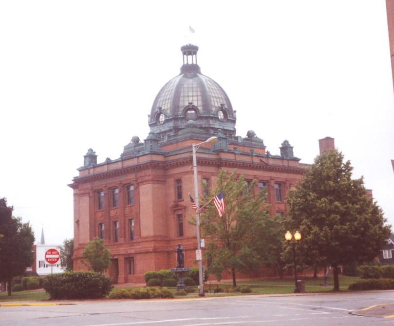
43°08′04″N 90°42′20″W / 43.134444°N 90.705556°WBoscobel Built in 1863; the "birthplace" of the Gideon Bible 11 Courthouse Square Historical District April 7, 2006 Cherry, Jefferson, Madison, and Maple Sts.
42°50′51″N 90°42′36″W / 42.8475°N 90.71°WLancaster 12 Denniston House February 20, 1975 117 E. Front St
42°42′45″N 90°59′25″W / 42.7125°N 90.990278°WCassville 13 Division Street Historic District July 19, 2007 200-300 Blk. Division St., 145, 170, 175, 190, 195, 220 S Chestnut St.
42°43′57″N 90°28′54″W / 42.7325°N 90.481667°WPlatteville 14 Eagle Valley Mound District July 11, 2001 Address Restricted Glen Haven 15 Jonathan H. Evans House June 1, 1982 440 W. Adams St.
42°44′20″N 90°28′53″W / 42.738889°N 90.481389°WPlatteville 16 First Congregational Church June 19, 1985 80 Market
42°44′09″N 90°28′42″W / 42.735833°N 90.478333°WPlatteville 17 Grant County Courthouse 
October 19, 1978 126 W. Main St.
42°50′51″N 90°42′36″W / 42.8475°N 90.71°WLancaster 18 Hazel Green Town Hall January 26, 1989 2130 N. Main St.
42°32′00″N 90°26′05″W / 42.533333°N 90.434722°WHazel Green 19 Hog Hollow Site May 10, 1996 Address Restricted Potosi 20 Patrick and Margaret Kinney House March 6, 2008 424 N. Fillmore St.
42°51′06″N 90°43′10″W / 42.851667°N 90.719444°WLancaster 21 Lancaster Municipal Building March 10, 1983 206 S. Madison St.
42°50′51″N 90°42′33″W / 42.8475°N 90.709167°WLancaster 22 Lancaster Post Office October 24, 2000 236 W. Maple St.
42°50′52″N 90°42′43″W / 42.847778°N 90.711944°WLancaster 23 Main Street Commercial Historic District March 9, 1990 Roughly bounded by Chestnut, Furnace, Bonson, Mineral, Oak, and Pine
42°44′04″N 90°28′42″W / 42.734444°N 90.478333°WPlatteville 24 Mitchell-Rountree House February 23, 1972 Jewett and Lancaster Sts.
42°44′29″N 90°28′57″W / 42.741389°N 90.4825°WPlatteville 25 Dwight T. Parker Public Library 
March 10, 1983 925 Lincoln Ave.
42°59′00″N 90°39′18″W / 42.983333°N 90.655°WFennimore 26 Potosi Badger Huts Site December 27, 1996 .5 mi. SW of jct. of WI 133 and WI U
42°41′10″N 90°42′45″W / 42.686111°N 90.7125°WPotosi 27 Potosi Brewery November 19, 1980 Main St.
42°40′37″N 90°43′32″W / 42.676944°N 90.725556°WPotosi 28 Rountree Hall December 17, 1974 30 North Elm St.
42°44′07″N 90°28′53″W / 42.735278°N 90.481389°WPlatteville 29 J. H. Rountree Mansion June 13, 1986 150 Rountree Ave.
42°43′56″N 90°28′41″W / 42.732222°N 90.478056°WPlatteville 30 St. John Mine June 4, 1979 WI 133
42°41′10″N 90°42′56″W / 42.686111°N 90.715556°WPotosi 31 Stonefield May 19, 1970 2.5 mi. W of Cassville, on CR VV
42°44′03″N 91°01′18″W / 42.734167°N 91.021667°WCassville 32 West Main Street Historic District July 19, 2007 ROughly bounded by N & S Elm, W Pine, N & S Hickory & W Mineral Sts. Platteville 33 Wyalusing State Park Mounds Archeological District September 21, 1999 13342 Cty. Hwy. C
42°58′52″N 91°06′42″W / 42.981111°N 91.111667°WBagley 34 John Young House September 26, 1994 323 S. Wisconsin Ave.
43°10′57″N 90°26′35″W / 43.1825°N 90.443056°WMuscoda See also
References
- ^ "National Register of Historic Places: Weekly List Actions". National Park Service, United States Department of the Interior. Retrieved on November 10, 2011.
- ^ Numbers represent an ordering by significant words. Various colorings, defined here, differentiate National Historic Landmark sites and National Register of Historic Places Districts from other NRHP buildings, structures, sites or objects.
U.S. National Register of Historic Places Topics Lists by states Alabama • Alaska • Arizona • Arkansas • California • Colorado • Connecticut • Delaware • Florida • Georgia • Hawaii • Idaho • Illinois • Indiana • Iowa • Kansas • Kentucky • Louisiana • Maine • Maryland • Massachusetts • Michigan • Minnesota • Mississippi • Missouri • Montana • Nebraska • Nevada • New Hampshire • New Jersey • New Mexico • New York • North Carolina • North Dakota • Ohio • Oklahoma • Oregon • Pennsylvania • Rhode Island • South Carolina • South Dakota • Tennessee • Texas • Utah • Vermont • Virginia • Washington • West Virginia • Wisconsin • WyomingLists by territories Lists by associated states Other Municipalities and communities of Grant County, Wisconsin Cities Boscobel | Cuba City‡ | Fennimore | Lancaster | Platteville

Villages Bagley | Bloomington | Blue River | Cassville | Dickeyville | Hazel Green‡ | Livingston‡ | Montfort‡ | Mount Hope | Muscoda‡ | Patch Grove | Potosi | Tennyson | Woodman
Towns Beetown | Bloomington | Boscobel | Cassville | Castle Rock | Clifton | Ellenboro | Fennimore | Glen Haven | Harrison | Hazel Green | Hickory Grove | Jamestown | Liberty | Lima | Little Grant | Marion | Millville | Mount Hope | Mount Ida | Muscoda | North Lancaster | Paris | Patch Grove | Platteville | Potosi | Smelser | South Lancaster | Waterloo | Watterstown | Wingville | Woodman | Wyalusing
CDPs Glen Haven | Kieler | Sandy Hook
Unincorporated
communitiesAnnaton | Arthur | Bigpatch | British Hollow | Brodtville | Burton | Centerville | Cornelia | Ellenboro | Elmo | Fair Play | Five Points | Flora Fountain | Georgetown | Hickory Grove | Hurricane | Lancaster Junction | Louisburg | McCartney | Millville | Mount Ida | Prairie Corners | Rockville | Rutledge | Saint Rose | Sinsinawa | Stitzer | Union | Wyalusing
Footnotes ‡This populated place also has portions in an adjacent county or counties
Categories:- Grant County, Wisconsin
- Lists of historic places in Wisconsin
-


Wikimedia Foundation. 2010.