- National Register of Historic Places listings in Dane County, Wisconsin
-
This document aims to provide a comprehensive listing of buildings, sites, structures, districts, and objects in Dane County, Wisconsin listed on the National Register of Historic Places.
-
- This National Park Service list is complete through NPS recent listings posted November 10, 2011.[1]
The locations of National Register properties, the latitude and longitude coordinates of which are included below, may be seen in a Google map.[2]
Contents
Current listings
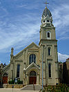
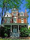
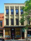
[3] Landmark name Image Date listed Location City or town Summary 1 Agricultural Chemistry Building June 19, 1985 420 Henry Mall, University of Wisconsin campus
43°04′26″N 89°24′38″W / 43.073889°N 89.410556°WMadison 1912, Paul Cret, Warren Laird, Arthur Peabody, Georgian revival style 2 Agricultural Dean's House September 20, 1984 10 Babcock Dr., University of Wisconsin campus
43°04′37″N 89°24′46″W / 43.076944°N 89.412778°WMadison 1896, Conover and Porter, Queen Anne style 3 Agricultural Engineering Building June 27, 1985 460 Henry Mall, University of Wisconsin campus
43°04′29″N 89°24′37″W / 43.074722°N 89.410278°WMadison 1905, Arthur Peabody, Georgian revival style 4 Agricultural Heating station March 14, 1985 1535 Observatory Dr., University of Wisconsin campus
43°04′34″N 89°24′42″W / 43.076111°N 89.411667°WMadison 1899, John T.W. Jennings, Richardsonian Romanesque 5 Agriculture Hall March 14, 1985 1450 Linden Dr., University of Wisconsin campus
43°04′32″N 89°24′29″W / 43.075556°N 89.408056°WMadison 1902, John T.W. Jennings, Beaux-Arts classical revival style 6 American Exchange Bank August 18, 1980 1 N. Pinckney St.
43°04′33″N 89°22′59″W / 43.075833°N 89.383056°WMadison 1871, Stephen V. Shipman, Italianate 7 American Tobacco Company Warehouses Complex June 26, 2003 651 W. Doty St.
43°03′57″N 89°23′30″W / 43.065833°N 89.391667°WMadison 1899-1901, Claude and Starck, utilitarian-industrial design 8 Francis Marian Ames Farmstead November 5, 1992 221 US 14
42°51′26″N 89°20′40″W / 42.857222°N 89.344444°WRutland 9 Badger State Shoe Company April 11, 1989 123 N. Blount St.
43°04′52″N 89°22′42″W / 43.081111°N 89.378333°WMadison ca. 1915, Ferdinand Kronenberg, utilitarian design with neo-Classical styling 10 Bascom Hill Historic District September 12, 1974 Bounded by Observatory Dr., University Ave., and N. Park, Langdon, and State Sts., UW campus
43°04′31″N 89°24′06″W / 43.075278°N 89.401667°WMadison 11 Robert M. Bashford House March 14, 1973 423 N. Pinckney St.
43°04′44″N 89°23′13″W / 43.078889°N 89.386944°WMadison 1856-57, August Kutzbock, Italian villa style 12 Baskerville Apartment Building October 13, 1988 121-129 S. Hamilton St.
43°04′17″N 89°23′05″W / 43.071389°N 89.384722°WMadison 1913-14, Robert L. Wright, early 20th-century apartment house design 13 Bedrud-Olson Farmstead April 1, 1999 996 E. Church Rd.
42°57′12″N 89°05′14″W / 42.953333°N 89.087222°WChristiana 14 Bellevue Apartment Building March 13, 1987 29 E. Wilson St.
43°04′22″N 89°22′48″W / 43.072778°N 89.38°WMadison 1913-14, Charles E. Marks, early 20th-century apartment house design 15 Belmont Hotel January 18, 1990 101 E. Mifflin St.
43°04′35″N 89°23′00″W / 43.076389°N 89.383333°WMadison 1924, Beaux-Arts style 16 Bernard-Hoover Boathouse July 30, 1981 622 E. Gorham St.
43°04′55″N 89°22′55″W / 43.081944°N 89.381944°WMadison 1915, built by William Bernard, utilitarian design 17 Biederstaedt Grocery March 25, 1982 851-853 Williamson St.
43°04′45″N 89°22′10″W / 43.079167°N 89.369444°WMadison ca. 1874, Italianate style 18 Blackhawk Country Club Mound Group (47 DA 131) August 1, 1979 Address Restricted Madison 3 bear effigies and 1 goose effigy, Late Woodland culture 19 James B. Bowen House March 1, 1982 302 S. Mills St.
43°03′50″N 89°24′16″W / 43.063889°N 89.404444°WMadison 1855, Italianate farmhouse of local sandstone 20 Harold C. Bradley House February 23, 1972 106 N. Prospect Ave.
43°04′08″N 89°25′16″W / 43.068889°N 89.421111°WMadison 1908-1910, Louis Sullivan and George Grant Elmslie, Prairie School style 21 Judge Arthur B. Braley House November 28, 1980 422 N. Henry St.
43°04′33″N 89°23′29″W / 43.075833°N 89.391389°WMadison ca. 1873, neo-Grec, Aesthetic details on dormers, replaced Gothic revival porch ca. 1900 22 Bram Mound Group March 25, 1993 Address Restricted Dunn 23 Brittingham Park Boathouse June 30, 1982 N. Shore Dr.
43°03′55″N 89°23′18″W / 43.065278°N 89.388333°WMadison 1910, George B. Ferry & Alfred C. Clas, City Beautiful movement with Arts and Crafts detailing 24 Charles E. Brown Indian Mounds January 5, 1984 Address Restricted Madison 25 Brown-Sewell House April 22, 2003 101 S. Fifth St.
42°55′05″N 89°12′59″W / 42.918056°N 89.216389°WStoughton 26 Burrows Park Effigy Mound and Campsite December 31, 1974 Address Restricted Madison straight-winged bird effigy, Late Woodland Culture 27 Cambridge Public School and High School June 23, 1998 103 South St.
43°00′06″N 89°00′54″W / 43.001667°N 89.015°WCambridge 28 Camp Randall June 7, 1971 Camp Randall Memorial Park, University of Wisconsin campus
43°04′11″N 89°24′34″W / 43.069722°N 89.409444°WMadison Civil War training and staging ground, stockade for Confederate POWs 29 Cardinal Hotel September 2, 1982 416 E. Wilson St.
43°04′32″N 89°22′37″W / 43.075556°N 89.376944°WMadison ca. 1908, Ferdinand Kronenberg, block and brick 30 Chase Grain Elevator August 12, 2010 123 Railroad St.
43°10′43″N 89°12′53″W / 43.178611°N 89.214722°WSun Prairie 31 City Market November 28, 1978 101 N. Blount St.
43°04′52″N 89°22′41″W / 43.081111°N 89.378056°WMadison 1909, Robert L. Wright, Prairie School style 32 Bascom B. Clarke House November 28, 1980 1150 Spaight St.
43°04′55″N 89°21′46″W / 43.081944°N 89.362778°WMadison 1899, Claude and Starck, Queen Anne style with Arts and Crafts elements 33 Jens and Ingeborg Cold House March 26, 2003 111 S Fifth St.
42°55′05″N 89°12′58″W / 42.918056°N 89.216111°WStoughton 34 College Hills Historic District December 9, 2002 Roughly bounded by Colombia Rd., Amherst Dr., Bowdoin Rd., Corporate Limit, University Bay, and Harvard Dr.
43°04′45″N 89°26′20″W / 43.079167°N 89.438889°WShorewood Hills 35 William Collins House December 3, 1974 704 E. Gorham St.
43°04′57″N 89°22′50″W / 43.0825°N 89.380556°WMadison ca. 1911, Claude and Starck, Prairie School style 36 John R. Commons House March 14, 1985 1645 Norman Way
43°04′56″N 89°28′44″W / 43.082222°N 89.478889°WMadison 1913, Cora Tuttle, Bungalow style 37 Dr. Charles G. Crosse House February 24, 1993 133 W. Main St.
43°10′59″N 89°12′54″W / 43.183056°N 89.215°WSun Prairie 1864, Gothic revival style 38 Curtis-Kittleson House April 10, 1980 1102 Spaight St.
43°04′51″N 89°21′51″W / 43.080833°N 89.364167°WMadison 1901, Gordon and Paunack, Queen Anne style 39 Judson C. Cutter House July 12, 1978 1030 Jenifer St.
43°04′50″N 89°21′58″W / 43.080556°N 89.366111°WMadison 1882, Stick/Eastlake style 40 Henry L. and Sarah Dahle House November 26, 2003 312 S. Fourth St.
43°00′16″N 89°44′07″W / 43.004444°N 89.735278°WMount Horeb 41 Herman B. and Anne Marie Dahle House November 26, 2003 200 N. Second St.
43°00′39″N 89°44′19″W / 43.010833°N 89.738611°WMount Horeb 42 Onon B. and Betsy Dahle House April 16, 2008 10779 Evergreen Ave.
42°54′57″N 89°48′54″W / 42.915878°N 89.814994°WPerry 43 Nathaniel W. Dean House November 7, 1980 4718 Monona Dr.
43°04′06″N 89°19′32″W / 43.068333°N 89.325556°WMadison 1856, Italianate 44 Christian Dick Block December 19, 2002 106 E. Doty St.
43°04′28″N 89°22′49″W / 43.074444°N 89.380278°WMadison 45 John Sweet Donald Farmstead June 7, 1984 1972 WI 92
42°57′52″N 89°41′08″W / 42.964444°N 89.685556°WSpringdale 46 Dowling Apartment Building October 7, 2002 445-447 W. Wilson St.
43°04′05″N 89°23′14″W / 43.068056°N 89.387222°WMadison 1922, early 20th-century apartment house design 47 Drohman Cabin September 28, 1981 6701 E. Broadway
43°02′01″N 89°15′35″W / 43.033611°N 89.259722°WMadison moved to Spring Green, Wisconsin 48 Adam Dunlap Farmstead November 15, 2001 9646 Dunlap Hollow Rd.
43°12′28″N 89°43′53″W / 43.207778°N 89.731389°WMazomanie 49 Dunroven House November 28, 1980 7801 Dunroven Rd.
43°17′04″N 89°28′23″W / 43.284444°N 89.473056°WDane 50 East Dayton Street Historic District December 27, 1988 649-53 E. Dayton St. and 114 N. Blount St.
43°04′51″N 89°22′43″W / 43.080833°N 89.378611°WMadison 51 East End Historic District July 25, 2003 7002-7016 Hubbard Ave., 1812-1916 Park St. (even only) 7002-7227,7233,7235,7237 Elmwood Ave.
43°05′45″N 89°30′12″W / 43.095833°N 89.503333°WMiddleton 52 East Park Historic District May 1, 2003 108-324 S. Lynn St., 700-816 Park St., and East Park
42°55′02″N 89°12′41″W / 42.917222°N 89.211389°WStoughton 53 East Side Historic District January 9, 1997 Roughly bounded by Ridge, Henry, Vernon, and Academy Sts.
42°55′06″N 89°12′31″W / 42.918333°N 89.208611°WStoughton 54 East Wilson Street Historic District April 3, 1986 402-524 E. Wilson and 133 S. Blair Sts.
43°04′36″N 89°22′34″W / 43.076667°N 89.376111°WMadison 55 Edgewood College Mound Group Archeological District June 7, 1991 Address Restricted Madison 1 bird effigy, 2 linear mounds, and 8 conicals 56 Ernest Eggiman House June 17, 1994 857 S. Shore Dr.
43°03′25″N 89°23′52″W / 43.056944°N 89.397778°WMadison 1936, prefabricated metal house 57 Edward C. Elliott House August 11, 1978 137 N. Prospect Ave.
43°04′15″N 89°25′07″W / 43.070833°N 89.418611°WMadison ca. 1911, Claude and Starck, Prairie School style 58 Elmside Park Mounds April 10, 1991 Address Restricted Madison effigies of a lynx and a bear 59 Richard T. Ely House December 16, 1974 205 N. Prospect Ave.
43°04′18″N 89°24′58″W / 43.071667°N 89.416111°WMadison 1896, Charles Sumner Frost, Georgian revival style 60 Farwell's Point Mound Group December 27, 1974 Address Restricted Madison 11 conicals and remnants of 2 panthers, 1 bird, 3 linears 61 Fess Hotel September 21, 1978 123 E. Doty Street
43°04′28″N 89°22′48″W / 43.074444°N 89.38°WMadison 1858, remodeled 1901 by J. O. Gordon and F. W. Paunack 62 Fire Station No. 4 March 1, 1984 1329 W. Dayton St.
43°04′15″N 89°24′31″W / 43.070833°N 89.408611°WMadison 1903-04, Lew Porter 63 First Church of Christ Scientist November 24, 1982 315 Wisconsin Ave.
43°04′39″N 89°23′13″W / 43.0775°N 89.386944°WMadison 1929, Frank M. Riley, Classical Revival style 64 First Lutheran Church June 16, 1988 Pleasant View Rd. at Old Sauk Rd.
43°04′31″N 89°32′11″W / 43.075278°N 89.536389°WMiddleton 1866, steeple added 1884, Gothic Revival style 65 First National Bank October 16, 2007 113 N. Main St.
42°55′36″N 89°23′04″W / 42.926667°N 89.384444°WOregon 66 First Unitarian Society Meeting House April 11, 1973 900 University Bay Dr.
43°04′34″N 89°26′04″W / 43.076111°N 89.434444°WShorewood Hills 1947, Frank Lloyd Wright 67 Forest Hill Cemetery Mound Group December 27, 1974 Address Restricted Madison 68 Forest Products Laboratory August 25, 1995 1 Gifford Pinchot Dr.
43°04′28″N 89°25′41″W / 43.074444°N 89.428056°WMadison 1932, Holabird & Root, Art Deco or International Art Moderne style 69 Fort Blue Mounds September 24, 2001 Address Restricted Blue Mounds 70 Fourth Lake Ridge Historic District February 26, 1998 Roughly bounded by Lake Mendota, N. Brearly, E. Johnson, and N. Franklin Sts.
43°05′03″N 89°22′44″W / 43.084167°N 89.378889°WMadison 71 Fox Hall December 1, 1983 5183 County Hwy. M
42°56′57″N 89°24′01″W / 42.949167°N 89.400278°WFitchburg 72 Frey School July 14, 2011 8847 County Road Y
43°14′58″N 89°40′19″W / 43.249444°N 89.671944°WRoxbury 73 John Fritz Farmstead July 15, 1998 642 Fritz Rd.
42°53′24″N 89°35′46″W / 42.89°N 89.596111°WMontrose 74 Fuhremann Canning Company Factory September 15, 2004 151 Market St.
43°10′51″N 89°12′40″W / 43.180833°N 89.211111°WSun Prairie 75 John and Flora Gilbert House September 6, 2007 357 N. Main St.
42°55′54″N 89°23′02″W / 42.931667°N 89.383889°WOregon 76 Eugene A. Gilmore House March 14, 1973 120 Ely Pl.
43°04′15″N 89°25′06″W / 43.070833°N 89.418333°WMadison 1908, Frank Lloyd Wright, Prairie School style 77 Grace Episcopal Church January 1, 1976 6 N. Carroll St.
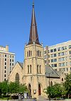
43°04′26″N 89°23′08″W / 43.073889°N 89.385556°WMadison 1855-58, James Douglas, Gothic revival style 78 Sereno W. Graves House September 29, 1982 4006 Old Stage Rd.
42°51′49″N 89°18′50″W / 42.863611°N 89.313889°WRutland 79 Grimm Book Bindery April 3, 1986 454 W. Gilman St.
43°04′26″N 89°23′43″W / 43.073889°N 89.395278°WMadison ca. 1923, Georgian revival style, modeled on Benjamin Franklin's bindery 80 Nicholas Haight Farmstead October 29, 1993 4926 Lacy Rd.
43°00′08″N 89°22′42″W / 43.002222°N 89.378333°WFitchburg 81 Samuel Hall House December 23, 1993 924 Hillside Rd.
42°54′03″N 89°02′31″W / 42.900833°N 89.041944°WAlbion 82 Halvorson Mound Group March 25, 1993 Address Restricted Madison 83 Hauge Log Church December 31, 1974 1 mi (1.6 km). N of Daleyville on CR Z
42°55′48″N 89°49′13″W / 42.93°N 89.820278°WDaleyville 84 Heim Mound March 31, 2004 Address Restricted
43°05′38″N 89°29′21″W / 43.093889°N 89.489167°WMiddleton effigy of a fox or wolf 85 Heiney's Meat Market September 27, 1984 1221 Mills St.
43°08′16″N 89°44′52″W / 43.137778°N 89.747778°WBlack Earth 86 Henry Mall Historic District January 22, 1992 420, 425, 440, 445, 460 and 465 Henry Mall and 1450 Linden Dr., University of Wisconsin campus
43°04′30″N 89°24′40″W / 43.075°N 89.411111°WMadison 87 Louis Hirsig House December 2, 1974 1010 Sherman Ave.
43°05′14″N 89°22′32″W / 43.087222°N 89.375556°WMadison designed by Claude and Starck, Prairie School style 88 Hoff Department Store February 14, 1989 101-103 Main St.
43°00′30″N 89°44′16″W / 43.008333°N 89.737778°WMount Horeb 89 Hornung Mound Group April 26, 1996 Address Restricted Roxbury 90 Horticulture and Agricultural Physics and Soil Science Building March 14, 1985 1525 Observatory Dr., University of Wisconsin campus
43°04′35″N 89°24′38″W / 43.076389°N 89.410556°WMadison 1894 + 1896, John T.W. Jennings, Richardsonian Romanesque 91 Hotel Loraine October 10, 2002 119-123 W. Washington Ave.
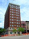
43°04′23″N 89°23′08″W / 43.073056°N 89.385556°WMadison 1925, Beaux-Arts style 92 Samuel Hunt House September 30, 1982 632 Center Rd.
42°52′51″N 89°18′35″W / 42.880833°N 89.309722°WRutland 93 Hyer's Hotel September 22, 1983 854 Jenifer St.
43°04′43″N 89°22′09″W / 43.078611°N 89.369167°WMadison 1854, Greek Revival and Italianate styles 94 Gaute Ingebretson Loft House March 13, 1987 1212 Pleasant Hill Rd.
42°54′47″N 89°10′12″W / 42.913056°N 89.17°WStoughton 95 Iverson-Johnson House January 21, 1988 327 E. Washington St.
42°55′02″N 89°13′00″W / 42.917222°N 89.216667°WStoughton 96 Jackman Building March 27, 1980 111 S. Hamilton St.
43°04′22″N 89°23′02″W / 43.072778°N 89.383889°WMadison 1913-14, Claude and Starck, Classical Revival 97 Herbert and Katherine Jacobs First House July 24, 1974 441 Toepfer Ave.
43°03′31″N 89°26′29″W / 43.058611°N 89.441389°WMadison 1937, Frank Lloyd Wright, Usonian; designated National Historic Landmark July 31, 2003 98 Herbert and Katherine Jacobs Second House December 31, 1974 3995 Shawn Trail
43°04′26″N 89°32′05″W / 43.073889°N 89.534722°WMiddleton 1943, Frank Lloyd Wright; designated National Historic Landmark July 31, 2003 99 Jenifer-Spaight Historic District October 13, 2004 Jenifer and Spaight Sts. roughly bounded by S. Brearly St. and Williamson St.
43°04′42″N 89°22′07″W / 43.078333°N 89.368611°WMadison 100 Gulbrand and Bertha Jensvold House April 30, 2008 1033 WI 78
42°54′48″N 89°49′01″W / 42.9132°N 89.816814°WPerry 101 Adolph H. Kayser House November 28, 1980 802 E. Gorham St.
43°05′03″N 89°22′44″W / 43.084167°N 89.378889°WMadison 1902, Claude and Starck, Prairie School and classical detailing 102 Kehl Winery January 2, 1976 E of Prairie du Sac on WI 188
43°17′19″N 89°42′27″W / 43.288611°N 89.7075°WRoxbury 103 John and Margarethe Kemp Cabin December 10, 2008 6950 WI Hwy. 78
43°14′15″N 89°43′47″W / 43.237433°N 89.729614°WMazomanie 104 Friederich Kohlmann House December 27, 1974 W of Springfield Corners off WI 19
43°11′10″N 89°38′22″W / 43.186111°N 89.639444°WSpringfield Corners 105 Robert M. LaFollette House October 15, 1966 733 Lakewood Blvd.
43°06′52″N 89°22′22″W / 43.114444°N 89.372778°WMaple Bluff 106 Lake Farms Archeological District December 22, 1978 Address Restricted Madison 107 Lake View Sanatorium April 15, 1993 1204 Northport Dr.
43°08′18″N 89°22′29″W / 43.138333°N 89.374722°WMadison 1929-30, E. A. Stubenrauch, Art Deco 108 Lamb Building August 2, 1984 114 State St.
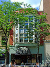
43°04′26″N 89°23′58″W / 43.073889°N 89.399444°WMadison 1905, Claude and Starck, Queen Anne style 109 Robert M. Lamp House January 3, 1978 22 N. Butler St.
43°04′37″N 89°22′56″W / 43.076944°N 89.382222°WMadison 1903, Frank Lloyd Wright, Chicago School transitioning to Prairie School 110 Langdon Street Historic District June 26, 1986 Roughly bounded by Lake Mendota, Wisconsin Ave., Langdon, and N. Lake Sts.
43°04′37″N 89°23′37″W / 43.076944°N 89.393611°WMadison 111 August Cornelius Larson House May 19, 1994 1006 Grant St.
43°03′49″N 89°24′53″W / 43.063611°N 89.414722°WMadison 1911, Claude and Starck, Prairie School style 112 Lathrop Hall July 11, 1985 1050 University Ave., University of Wisconsin campus
43°04′25″N 89°24′09″W / 43.073611°N 89.4025°WMadison 1910, Warren Laird, Paul Cret, Arthur Peabody, neo-Renaissance style 113 William T. Leitch House July 18, 1975 752 E. Gorham St.
43°05′02″N 89°22′45″W / 43.083889°N 89.379167°WMadison 1857-58, Gothic Revival, Westport sandstone 114 William Ellery Leonard House February 25, 1993 2015 Adams St.
43°03′40″N 89°25′01″W / 43.061111°N 89.416944°WMadison 115 Lewis Mound Group (47-Da-74) December 15, 1984 Address Restricted McFarland 116 Library Park January 26, 1981 Bounded by Vine, Main, Park and Pearl Sts.
42°51′33″N 89°32′00″W / 42.859167°N 89.533333°WBelleville 1894 (Village Hall) 117 Aslak Lie Cabin April 3, 1986 3022 County Trunk P
43°01′14″N 89°40′05″W / 43.020556°N 89.668056°WMount Horeb 118 Lincoln School August 28, 1980 728 E. Gorham St.
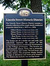
43°04′59″N 89°22′49″W / 43.083056°N 89.380278°WMadison 1915, Claude and Starck, Prairie School style 119 Lincoln Street Historic District April 12, 2006 W. Lincoln St., bet. Main St. and Market St.
42°55′55″N 89°23′04″W / 42.931944°N 89.384444°WOregon 120 Little Norway March 16, 1998 3576 CTH JG
43°01′32″N 89°47′44″W / 43.025556°N 89.795556°WBlue Mounds 121 Lockwood Barn September 29, 1982 Old Stage Rd
42°51′54″N 89°19′22″W / 42.865°N 89.322778°WRutland 122 Longfellow School March 7, 1996 1010 Chandler St.
43°03′53″N 89°24′09″W / 43.064722°N 89.4025°WMadison 1917, Law, Law, and Potter, Tudor Revival style 123 George A. Lougee House June 7, 1978 620 S. Ingersoll St.
43°04′48″N 89°21′49″W / 43.08°N 89.363611°WMadison 1907, Claude and Starck, Prairie School style 124 Lower Mud Lake Archeological Complex March 31, 2004 Address Restricted Dunn 125 Machinery Row April 12, 1982 601-627 Williamson St.
43°04′33″N 89°22′29″W / 43.075833°N 89.374722°WMadison 1898-1914, Conover and Porter, utilitarian-industrial design with Richardsonian Romanesque styling 126 Madison Candy Company March 28, 1997 744 Williamson St.
43°04′41″N 89°22′19″W / 43.078056°N 89.371944°WMadison 1903, John Nader, utilitarian-commercial/industrial design 127 Madison Gas and Electric Company Powerhouse December 6, 2002 100 S. Blount St.
43°04′43″N 89°22′29″W / 43.078611°N 89.374722°WMadison ca. 1908, Claude and Starck, industrial design with neo-Classical styling 128 Madison Masonic Temple September 13, 1990 301 Wisconsin Ave.
43°04′39″N 89°23′12″W / 43.0775°N 89.386667°WMadison 1925, James R. & Edward J. Law, neo-Classical style 129 Madison Waterworks August 18, 1980 N. Hancock St.
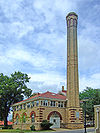
43°04′49″N 89°22′59″W / 43.080278°N 89.383056°WMadison Balch & Lippert, early 20th-century utilitarian design with Arts and Crafts detailing 130 John Mann House July 8, 1982 6261 Nesbitt Rd.
43°00′34″N 89°28′44″W / 43.009444°N 89.478889°WFitchburg 131 Mansion Hill Historic District June 4, 1997 Roughly bounded by E. Dayton, E. Johnson, E. Gorham, N. Butler, Langdon, and W. Gilman Sts., and Lake Mendota
43°04′39″N 89°23′17″W / 43.0775°N 89.388056°WMadison 132 Marquette Bungalows Historic District April 14, 1997 Bounded by S. Thornton Ave., Rutledge, S. Dickinson, and Spaight Sts.
43°05′06″N 89°21′25″W / 43.085°N 89.356944°WMadison 133 Mazomanie Downtown Historic District August 19, 1992 1-118 Brodhead, 2-46 Hudson, 37-105 Crescent and 113 E. Exchange Sts.
43°10′32″N 89°47′36″W / 43.175556°N 89.793333°WMazomanie 134 Mazomanie Town Hall October 22, 1980 51 Crescent St.
43°10′34″N 89°47′33″W / 43.176111°N 89.7925°WMazomanie 135 Timothy C. and Katherine McCarthy House July 17, 2002 848 Jenifer St.
43°04′41″N 89°22′11″W / 43.078056°N 89.369722°WMadison 1896, Conover and Porter, Queen Anne style 136 McCormick-International Harvester Company Branch House April 27, 2010 301 South Blount St.
43°04′39″N 89°22′25″W / 43.077622°N 89.373586°WMadison 137 McCoy Farmhouse May 29, 1980 South of Madison at 2925 Syene Rd.
43°00′51″N 89°23′49″W / 43.014167°N 89.396944°WFitchburg 138 McFarland House November 3, 1988 5923 Exchange St.
43°00′48″N 89°17′19″W / 43.013333°N 89.288611°WMcFarland 1857, Greek Revival 139 Mendota State Hospital Mound Group December 27, 1974 Address Restricted Madison 3 eagles, 2 panthers, 2 bears, 1 deer, several conicals 140 Merrill Springs Mound Group II Archeological District June 7, 1991 Address Restricted Madison 2 linears, 2 conicals, and remnants of 2 effigies 141 Middleton Depot, Chicago, Milwaukee, and St. Paul Railroad April 29, 1999 1811 Parmenter St.
43°05′42″N 89°30′40″W / 43.095°N 89.511111°WMiddleton 1895, J. U. Nettenstrom, Late Victorian style 142 Miller House November 8, 1979 647 E. Dayton St.
43°04′51″N 89°22′44″W / 43.080833°N 89.378889°WMadison 1853, moved from corner of Pinckney & Johnson Streets in 1904 143 Mills Woods Mound June 7, 1991 Address Restricted Madison effigy may be a lizard, turtle, or panther 144 Simeon Mills House August 13, 1987 2709 Sommers Ave.
43°05′34″N 89°20′39″W / 43.092778°N 89.344167°WMadison 1863, Italian villa style 145 Monona Mound (47DA275) December 1, 1989 Address Restricted Monona water spirit effigy mound, 800-1100 146 Moore Mound Group August 5, 1993 Address Restricted Dunn 147 Mt. Horeb Opera Block February 23, 1989 109-117 E. Main St.
43°00′30″N 89°44′19″W / 43.008333°N 89.738611°WMount Horeb 148 Mount Horeb Public School May 28, 2010 207 Academy St.
43°00′13″N 89°44′13″W / 43.003494°N 89.73705°WMount Horeb 149 Jens Naeset House March 14, 1985 126 E. Washington
42°55′04″N 89°13′09″W / 42.917778°N 89.219167°WStoughton 150 Nakoma Historic District February 26, 1998 Roughly bounded by Odana Rd., Mantou Wy., Mowhack Dr., and Whedona Dr.
43°02′36″N 89°26′38″W / 43.043333°N 89.443889°WMadison 151 North Hall, University of Wisconsin October 15, 1966 University of Wisconsin campus
43°04′32″N 89°24′11″W / 43.075556°N 89.403056°WMadison 1851, John Rague, Italianate style 152 Northwest Side Historic District March 5, 1998 Roughly bounded by Van Buren, Clyde, Grant, and Main Sts.
42°55′09″N 89°13′36″W / 42.919167°N 89.226667°WStoughton 153 Observatory Hill Mound Group March 31, 2004 Address Restricted Madison bird and water spirit effigy mounds 154 Old Executive Mansion April 11, 1973 130 E. Gilman St.
43°04′47″N 89°23′12″W / 43.079722°N 89.386667°WMadison Italianate style, neo-Classical porch replaced by Paunack in the 1890s 155 Old Spring Tavern January 21, 1974 3706 Nakoma Rd.
43°03′02″N 89°26′18″W / 43.050556°N 89.438333°WMadison 1854, Greek revival style 156 Old Synagogue December 29, 1970 E. Gorham St. at N. Butler St.
43°04′47″N 89°23′05″W / 43.079633°N 89.384861°WMadison 1863, August Kutzbock, Rundbogenstil 157 Old U.S. Forest Products Laboratory September 12, 1985 1509 University Ave., University of Wisconsin campus
43°04′23″N 89°24′40″W / 43.073056°N 89.411111°WMadison 1909, Arthur Peabody, Georgian revival style 158 Oregon High School April 23, 1998 220 N. Main St.
42°55′41″N 89°22′58″W / 42.928056°N 89.382778°WOregon 159 Oregon Masonic Lodge June 18, 1992 117-119 S. Main St.
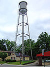
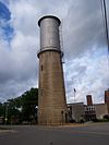
42°55′33″N 89°23′06″W / 42.925833°N 89.385°WOregon 160 Oregon Water Tower and Pump House October 16, 2007 134 Janesville St.
42°55′31″N 89°23′01″W / 42.925278°N 89.383611°WOregon 161 Orpheum Theater January 23, 2008 216 State St.
43°04′30″N 89°23′19″W / 43.075°N 89.388611°WMadison 1926, Rapp and Rapp 162 Orton Park December 18, 1978 1100 Spaight St.
43°04′51″N 89°21′47″W / 43.080833°N 89.363056°WMadison 1887, Madison's first municipal facility of this type 163 Orton Park Historic District October 31, 1988 Roughly bounded by Spaight St., S. Few St., Lake Monona, and S. Ingersoll St.
43°04′41″N 89°21′46″W / 43.078056°N 89.362778°WMadison 164 John George Ott House September 23, 1982 754 Jenifer St.
43°04′39″N 89°22′16″W / 43.0775°N 89.371111°WMadison 1873, Italianate style 165 Outlet Mound October 9, 2003 Jct. of Ridgewood and Midwood Aves.
43°03′06″N 89°20′05″W / 43.051667°N 89.334722°WMonona Oval mound 166 Paoli Mills March 30, 1979 6890 Sun Valley Pkwy.
42°55′47″N 89°31′31″W / 42.929722°N 89.525278°WPaoli 4 buildings on a 5-acre (20,000 m2) site 167 Pflaum-McWilliams Mound Group June 7, 1991 Address Restricted Madison 168 Carrie Pierce House October 18, 1972 424 N. Pinckney St.
43°04′43″N 89°23′15″W / 43.078611°N 89.3875°WMadison 1857, August Kutzbock, Rundbogenstil 169 Plough Inn May 29, 1980 3402 Monroe St.
43°03′12″N 89°26′05″W / 43.053333°N 89.434722°WMadison 1853, with 1858 addition in Greek revival style 170 Daniel Pond Farmhouse June 30, 1980 E of Brooklyn on U.S. 14
42°50′58″N 89°20′02″W / 42.849444°N 89.333889°WBrooklyn 171 Quisling Towers Apartments January 9, 1984 1 E. Gilman St.
43°04′41″N 89°23′17″W / 43.078056°N 89.388056°WMadison ca. 1939, Louis Monberg, streamlined moderne style 172 Ole K. Roe House September 7, 1984 404 S. 5th St.
42°54′56″N 89°13′44″W / 42.915556°N 89.228889°WStoughton 173 Dr. Newman C. Rowley House April 29, 1999 7410 Hubbard Ave.
43°05′43″N 89°30′32″W / 43.095278°N 89.508889°WMiddleton 1867 174 Rutland United Brethren in Christ Meeting House and Cemetery September 15, 2004 687 US 14
42°52′59″N 89°21′05″W / 42.883056°N 89.351389°WRutland 175 St. Patrick's Roman Catholic Church September 16, 1982 404 E. Main St.
43°04′37″N 89°22′44″W / 43.076944°N 89.378889°WMadison 1888-89, John Nader, eclectic style influenced by Rundbogenstil 176 St. Peter's Roman Catholic Church September 23, 1980 W I K
43°08′23″N 89°32′27″W / 43.139722°N 89.540833°WAshton 177 Savage House September 17, 1980 SR 1
42°50′47″N 89°14′25″W / 42.846389°N 89.240278°WStoughton 178 Frederick Schumann Farmstead December 10, 1993 8313 WI 19
43°11′40″N 89°37′49″W / 43.194444°N 89.630278°WBerry 179 Sherman Avenue Historic District March 22, 1988 Sherman Ave. roughly between Marston Ave. and N. Brearly St.
43°05′24″N 89°22′27″W / 43.09°N 89.374167°WMadison 180 Shorewood Historic District November 29, 2002 Roughly bounded by Lake Mendota Dr., Tallyho Ln., Shorewood Blvd., and the Blackhawk Country Club
43°04′50″N 89°26′48″W / 43.080556°N 89.446667°WShorewood Hills 181 Siggelkow Park Mound Group (47-Da-504) March 14, 1985 Address Restricted McFarland 1 linear mound and remnants of 2 others 182 Simeon Mills Historic District June 25, 1987 102-118 King and 115-123 E. Main Sts.
43°04′29″N 89°22′50″W / 43.074722°N 89.380556°WMadison 183 Eric and Jerome Skindrud Farm September 26, 1994 3070 Town Hall Rd.
43°01′19″N 89°41′18″W / 43.021944°N 89.688333°WSpringdale 184 Adam and Mary Smith House April 30, 1998 south corner of Smith's Crossing and Leopold Way
43°09′47″N 89°15′53″W / 43.163056°N 89.264722°WSun Prairie ca. 1856-60, Samuel Donnel and August Kutzbock, Italianate style 185 Hiram Smith Hall and Annex March 14, 1985 1545 Observatory Dr., University of Wisconsin campus
43°04′33″N 89°24′42″W / 43.075833°N 89.411667°WMadison 1890-91, George B. Ferry and Alfred C. Clas, Queen Anne style 186 South Main Street Historic District June 15, 2000 S. Main St., jct. with Jefferson and Janesville Sts.
42°55′33″N 89°23′05″W / 42.925833°N 89.384722°WOregon 187 South School September 12, 1985 1009 Summit Ave.
42°54′37″N 89°13′08″W / 42.910278°N 89.218889°WStoughton 188 Southwest Side Historic District December 22, 1997 Roughly bounded by Lowell, S. Monroe, W. Main and S. Page Sts.
42°54′52″N 89°13′31″W / 42.914444°N 89.225278°WStoughton 189 Spring Harbor Mound Group June 7, 1991 Address Restricted Madison 190 State Historical Society of Wisconsin February 23, 1972 816 State St.
43°04′31″N 89°23′59″W / 43.075278°N 89.399722°WMadison 1896-1900, George B. Ferry & Alfred C. Clas, neo-Classicist style 191 State Office Building January 28, 1982 1 W. Wilson St.
43°04′19″N 89°22′54″W / 43.071944°N 89.381667°WMadison 1931-1959, Arthur Peabody, Art Deco style 192 Halle Steensland House November 30, 1982 315 N. Carroll St.
43°04′35″N 89°23′18″W / 43.076389°N 89.388333°WMadison 1901, Gordon and Paunack, Queen Anne style 193 Steinle Turret Machine Company December 13, 2007 149 Waubesa St.
43°05′48″N 89°20′37″W / 43.096667°N 89.343611°WMadison 1903 with additions up to 1920, utilitarian-industrial design 194 Stock Pavilion July 11, 1985 1675 Linden Dr., University of Wisconsin campus
43°04′29″N 89°24′54″W / 43.074722°N 89.415°WMadison 1909, Warren Laird, Paul Cret, and Arthur Peabody, vernacular style with Tudor revival elements 195 Joseph J. Stoner House January 17, 1980 321 S. Hamilton St.
43°04′11″N 89°23′04″W / 43.069722°N 89.384444°WMadison 1858, Italianate, sandstone in a distinctive masonry pattern 196 Stoughton High School January 17, 2002 211 N. Forrest St.
42°55′09″N 89°13′07″W / 42.919167°N 89.218611°WStoughton 197 Stoughton Main Street Commercial Historic District October 21, 1982 Main St. from the Yahara River to Forest St.
42°55′01″N 89°13′14″W / 42.916944°N 89.220556°WStoughton Boundary increase (listed May 12, 1994): Main St. from Forest St. to Fifth St. 198 Stoughton Universalist Church September 30, 1982 324 S. Page St.
42°54′58″N 89°13′25″W / 42.916111°N 89.223611°WStoughton 199 Stricker Pond I Site (47 DA 424) July 16, 1979 Address Restricted Middleton 200 John J. Suhr House June 17, 1982 121 Langdon St.
43°04′38″N 89°23′27″W / 43.077222°N 89.390833°WMadison 1886, Second Empire style, replaced porch 201 Sun Prairie Water Tower April 6, 2000 Jct. of Columbus, Church and Cliff Sts.
43°11′14″N 89°12′39″W / 43.187222°N 89.210833°WSun Prairie 202 Sure Johnson Mound Group May 26, 1994 Address Restricted McFarland 203 Tenney Park-Yahara River Parkway September 17, 1999 1220 E. Johnson St.; 501 S. Thornton Ave.
43°05′23″N 89°21′48″W / 43.089722°N 89.363333°WMadison 204 Thompson's Block June 7, 1984 119 E. Main St.
43°04′30″N 89°22′51″W / 43.075°N 89.380833°WMadison 1868, perhaps August Kutzbock, Italianate style 205 Thorstrand August 11, 1980 1-2 Thorstrand Rd.
43°05′28″N 89°28′56″W / 43.091111°N 89.482222°WMadison 206 Tompkins-Brindler Mound Group October 9, 2003 Monona Dr.
43°03′18″N 89°19′28″W / 43.055°N 89.324444°WMonona 207 United States Post Office and Federal Courthouse November 27, 2002 215 Martin Luther King Junior Blvd.
43°04′23″N 89°22′52″W / 43.073056°N 89.381111°WMadison 1927-29, James A. Wetmore, neo-Classical style 208 University Heights Historic District December 17, 1982 Roughly bounded by Regent, Allen, Lathrop Sts., and Kendall Ave. (both sides)
43°04′12″N 89°25′08″W / 43.07°N 89.418889°WMadison 209 University of Wisconsin Armory and Gymnasium November 4, 1993 716 Langdon St., University of Wisconsin campus
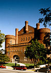
43°04′34″N 89°23′53″W / 43.076111°N 89.398056°WMadison 1892, Conover and Porter, Richardsonian Romanesque 210 University of Wisconsin Dairy Barn May 31, 2002 1915 Linden Dr., University of Wisconsin campus
43°04′28″N 89°25′06″W / 43.074444°N 89.418333°WMadison 1897, John T.W. Jennings, Normandy barn style, experimental round tower silo 211 University of Wisconsin Field House July 1, 1998 1450 Monroe St., University of Wisconsin campus
43°04′07″N 89°24′45″W / 43.068611°N 89.4125°WMadison 1930, Arthur Peabody and Paul Cret, Italian Renaissance style 212 University of Wisconsin Science Hall November 4, 1993 550 N. Park St., University of Wisconsin campus
43°04′33″N 89°24′03″W / 43.075833°N 89.400833°WMadison 1887, Allan Conover and Henry C. Koch, Richardsonian Romanesque 213 University Presbyterian Church and Student Center October 16, 2002 731 State St.
43°04′29″N 89°23′55″W / 43.074722°N 89.398611°WMadison 214 Vilas Circle Bear Effigy Mound and the Curtis Mounds December 30, 1974 Address Restricted Madison Late Woodland bear effigy in city park, 1 linear in adjacent private property 215 Vilas Park Mound Group April 10, 1991 Address Restricted Madison 1 bird effigy + 1 linear and 6 conical mounds in a Late Woodland group 216 Wakeley-Giles Commercial Building February 23, 1988 117-119 E. Mifflin St.
43°04′36″N 89°23′00″W / 43.076667°N 89.383333°WMadison 217 Washburn Observatory and Observatory Director's Residence March 14, 1985 1401 and 1225 Observatory Dr., University of Wisconsin campus
43°04′34″N 89°24′31″W / 43.076111°N 89.408611°WMadison 1878-1881, David R. Jones, Italianate style 218 Waubesa School July 17, 1997 3579 Sigglekow Rd.
43°01′34″N 89°16′38″W / 43.026111°N 89.277222°WBlooming Grove 1920, Louis A. Harrison, Bungalow/Craftsman style 219 Waunakee Railroad Depot February 14, 1978 South and Main Sts.
43°11′30″N 89°27′15″W / 43.191667°N 89.454167°WWaunakee 220 West Lawn Heights Historic District March 5, 1998 Roughly bounded by Virginia Ter., Regent St., S. Spooner Ave., and Illinois Central Railroad
43°03′56″N 89°25′26″W / 43.065556°N 89.423889°WMadison 221 West Madison Depot, Chicago, Milwaukee, and St. Paul Railway May 9, 1985 640 W. Washington Ave.
43°04′05″N 89°23′40″W / 43.068056°N 89.394444°WMadison 1903 222 West School January 22, 1992 404 Garfield St.
42°53′15″N 89°13′27″W / 42.8875°N 89.224167°WStoughton 223 Wiedenbeck-Dobelin Warehouse December 23, 1986 619 W. Mifflin St.
43°04′07″N 89°23′40″W / 43.068611°N 89.394444°WMadison 1907, Claude and Starck, utilitarian-industrial design 224 Wingra Park Historic District October 14, 1999 Roughly bounded by Monroe St., Garfield St., Chandler St., S. Randall Ave., Drake St., Vilas Ave., and Edgewood Ave.
43°03′45″N 89°24′55″W / 43.0625°N 89.415278°WMadison 225 Wisconsin Heights Battlefield January 31, 2002 .4 mi (6.4 km) SE of Jcto of Co. Rd. Y and WI 78.
43°14′41″N 89°43′05″W / 43.244722°N 89.718056°WRoxbury 226 Wisconsin Industrial School for Girls September 13, 1991 5212 WI M
42°57′42″N 89°22′39″W / 42.961667°N 89.3775°WFitchburg 227 Wisconsin Memorial Hospital Historic District November 3, 1988 816 Troy Dr.
43°07′52″N 89°24′18″W / 43.131111°N 89.405°WMadison 228 Wisconsin State Capitol October 15, 1970 Capitol Sq.
43°04′29″N 89°23′03″W / 43.074722°N 89.384167°WMadison 1917, Beaux-Arts style 229 Wisconsin Wagon Company Factory November 15, 2002 602 Railroad St.
43°04′39″N 89°22′35″W / 43.0775°N 89.376389°WMadison ca. 1906, early 20th-century utilitarian-industrial design See also
- List of National Historic Landmarks in Wisconsin
- National Register of Historic Places listings in Wisconsin
- National Historic Preservation Act of 1966
- Wisconsin Historical Society
References
- ^ "National Register of Historic Places: Weekly List Actions". National Park Service, United States Department of the Interior. Retrieved on November 10, 2011.
- ^ The latitude and longitude information provided is primarily from the National Register Information System, and has been found to be fairly accurate for about 99% of listings. For 1%, the location info may be way off. We seek to correct the coordinate information wherever it is found to be erroneous. Please leave a note in the Discussion page for this article if you believe any specific location is incorrect.
- ^ Numbers represent an ordering by significant words. Various colorings, defined here, differentiate National Historic Landmark sites and National Register of Historic Places Districts from other NRHP buildings, structures, sites or objects.
External links
U.S. National Register of Historic Places Topics Lists by states Alabama • Alaska • Arizona • Arkansas • California • Colorado • Connecticut • Delaware • Florida • Georgia • Hawaii • Idaho • Illinois • Indiana • Iowa • Kansas • Kentucky • Louisiana • Maine • Maryland • Massachusetts • Michigan • Minnesota • Mississippi • Missouri • Montana • Nebraska • Nevada • New Hampshire • New Jersey • New Mexico • New York • North Carolina • North Dakota • Ohio • Oklahoma • Oregon • Pennsylvania • Rhode Island • South Carolina • South Dakota • Tennessee • Texas • Utah • Vermont • Virginia • Washington • West Virginia • Wisconsin • WyomingLists by territories Lists by associated states Other Categories:- Dane County, Wisconsin
- Lists of historic places in Wisconsin
-
Wikimedia Foundation. 2010.


