- DeForest, Wisconsin
-
DeForest, Wisconsin — Village — Nickname(s): DeFo Location of De Forest, Wisconsin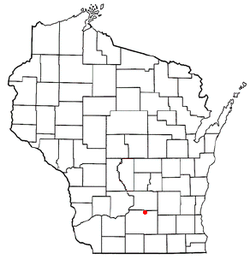
Coordinates: 43°14′45″N 89°20′45″W / 43.24583°N 89.34583°WCoordinates: 43°14′45″N 89°20′45″W / 43.24583°N 89.34583°W Country United States State Wisconsin County Dane Area – Total 4.9 sq mi (12.6 km2) – Land 4.8 sq mi (12.5 km2) – Water 0.1 sq mi (0.1 km2) Elevation[1] 948 ft (289 m) Population (2000) – Total 7,368 – Density 1,525.3/sq mi (588.9/km2) Time zone Central (CST) (UTC-6) – Summer (DST) CDT (UTC-5) FIPS code 55-19350[2] GNIS feature ID 1563756[1] Website www.vi.deforest.wi.us DeForest, originally part of the town of Windsor, is a village in Dane County, Wisconsin, United States, along the Yahara River. The population was 7,368 at the 2000 census. It is part of the Madison Metropolitan Statistical Area.
Contents
Name
The village was named for Isaac De Forest, who in 1856 bought the land on which the village sits today.[3] Its name was long spelled "De Forest," but has since been changed to "DeForest."[4]
Geography
DeForest is located at 43°14′45″N 89°20′45″W / 43.24583°N 89.34583°W (43.245751, -89.345869)[5].
According to the United States Census Bureau, the village has a total area of 4.9 square miles (12.6 km²), of which, 4.8 square miles (12.5 km²) of it is land and 0.1 square miles (0.1 km²) of it (1.02%) is water.
Demographics
As of the census[2] of 2000, there were 7,368 people, 2,675 households, and 2,000 families residing in the village. The population density was 1,525.3 people per square mile (589.0/km²). There were 2,761 housing units at an average density of 571.6 per square mile (220.7/km²). The racial makeup of the village was 95.34% White, 1.48% African American, 0.34% Native American, 0.68% Asian, 0.14% Pacific Islander, 0.62% from other races, and 1.40% from two or more races. Hispanic or Latino of any race were 2.19% of the population.
There were 2,675 households out of which 44.9% had children under the age of 18 living with them, 61.4% were married couples living together, 9.8% had a female householder with no husband present, and 25.2% were non-families. 19.3% of all households were made up of individuals and 7.2% had someone living alone who was 65 years of age or older. The average household size was 2.74 and the average family size was 3.15.
In the village the population was spread out with 31.1% under the age of 18, 6.3% from 18 to 24, 36.2% from 25 to 44, 18.3% from 45 to 64, and 8.1% who were 65 years of age or older. The median age was 33 years. For every 100 females there were 92.8 males. For every 100 females age 18 and over, there were 92.0 males.
The median income for a household in the village was $55,369, and the median income for a family was $60,781. Males had a median income of $40,096 versus $28,000 for females. The per capita income for the village was $21,089. About 1.7% of families and 3.6% of the population were below the poverty line, including 2.7% of those under age 18 and 9.7% of those age 65 or over.
Development
Over the last decade[when?], the Village of DeForest has experienced extensive growth. The Village of DeForest currently has several high quality developments under construction or in the planning stages including both residential and commercial properties.
- Residential developments
- Chapel Green - An 84-lot development by Mosaic Properties on the western edge of town including recreational trails and surrounded by two parks to the south and east.
- Conservancy Place - A 650-acre community along 3.5 miles of the Yahara River on the village's western edge bound by the interstate to the west and Windsor Road to the south. Designed with nature in mind, this development by Park Towne includes six connected yet distinct neighborhoods including: Hawthorne Point, Rivers Turn, Woods Glen, The Knolls, Innovation Springs(Office/Research), and The Promenade (Neighborhood Marketplace). Conservancy Place offers miles of trails along ample park space including the new Conservancy Commons Park. Future plans include an elementary school, office/research park, community marketplace and possible interstate exit at Cuba Valley Road.
- Country View Estates (approved but not yet developed)
- Heritage Gardens at Erickson Farms - A 320-lot development located centrally within the village. Heritage Gardens is architecturally controlled to ensure high quality development and is to include two pocket parks, a community park as well as an 11-acre public garden featuring a labyrinth as its main theme.
- Savannah Brooks (approved but not yet developed)
- Three Bridges (approved but not yet developed)
- Tuscan Ridge - A 24-parcel duplex-style condo development located off Main Street features high-quality duplex condos abutting the Yahara River.
- Commercial developments
- Bear Tree (pending approval)
- DeForest Business Park Expansion (pending approval)
- Innovation Springs Located within Conservancy Place
- Savannah Brooks - Commercial
- North Towne Corporate Park
The Town of Windsor is also experiencing growth within its boundaries, including several residential developments along with improvements to the Lake Windsor Country Club.
Education
DeForest Area School District:[2]
- DeForest Area High School
- DeForest Area Middle School
- Eagle Point Elementary School
- Morrisonville Elementary School
- Windsor Elementary School
- Yahara Elementary School
- Holum Center Half Day Kindergarten
In 2009, DeForest Superintendent Dr. Jon Bales was honored by the Wisconsin Association of School District Administrators as Wisconsin’s 2009 Superintendent of the Year. [6]
Religion
- The Old Catholic Church of America has its headquarters in De Forest.
Local Churches include:
- DeForest Evangelical Free Church
- Christ Lutheran Church
- Harvest Community Church
- Lord of Love Lutheran Church
- Norway Grove Memorial Lutheran Church
- St. Olaf's Catholic Church
- Moravian Church
- United Church of Christ
References
- ^ a b "US Board on Geographic Names". United States Geological Survey. 2007-10-25. http://geonames.usgs.gov. Retrieved 2008-01-31.
- ^ a b "American FactFinder". United States Census Bureau. http://factfinder.census.gov. Retrieved 2008-01-31.
- ^ http://www.vi.deforest.wi.us/index.asp?Type=B_BASIC&SEC={61F1DC4A-CCDB-4415-AD23-D4E17CFA1B11}
- ^ Population Estimates Boundary Changes, United States Census Bureau, 2007-07-01. Accessed 2008-11-05.
- ^ "US Gazetteer files: 2010, 2000, and 1990". United States Census Bureau. 2011-02-12. http://www.census.gov/geo/www/gazetteer/gazette.html. Retrieved 2011-04-23.
- ^ State of Wisconsin Senate Journal Ninety-Ninth Regular Session Monday January 5, 2009; Retrieved 2011/02/11 [1]
External links
Madison Metropolitan Area Surrounding
communities(over 10,000) (under 10,000) Arena | Arlington | Ashton Corners* | Blooming Grove* | Barneveld | Bristol* | Burke* | Columbus | Cottage Grove‡ | De Forest‡ | Dunkirk* | Dodgeville | Dunn* | Hope* | Lodi‡ | Lake Wisconsin, Wisconsin§ | Maple Bluff‡ | McFarland‡ | Mt Horeb‡ | Monona° | Montrose* | Oregon‡ | Pardeville | Pleasant Springs | Portage° | Poynette | Ridgeway | Shorewood Hills‡ | Springfield* | Town of Madison* | Verona° | | Westport* | Wisconsin Dells° | Windsor* | Wyocena*
Counties Categories:- Villages in Wisconsin
- Populated places in Dane County, Wisconsin
- Madison metropolitan area


Wikimedia Foundation. 2010.