- Poynette, Wisconsin
Infobox Settlement
official_name = Poynette, Wisconsin
settlement_type = Village
nickname =
motto =
imagesize =
image_caption =
image_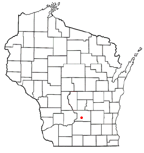
mapsize = 250px
map_caption = Location of Poynette, Wisconsin
mapsize1 =
map_caption1 =subdivision_type = Country
subdivision_name =United States
subdivision_type1 = State
subdivision_name1 =Wisconsin
subdivision_type2 = County
subdivision_name2 = Columbiagovernment_footnotes =
government_type =
leader_title =
leader_name =
leader_title1 =
leader_name1 =
established_title =
established_date =unit_pref = Imperial
area_footnotes =area_magnitude =
area_total_km2 = 6.3
area_land_km2 = 6.2
area_water_km2 = 0.0
area_total_sq_mi = 2.4
area_land_sq_mi = 2.4
area_water_sq_mi = 0.0population_as_of = 2000
population_footnotes =
population_total = 2266
population_density_km2 = 362.7
population_density_sq_mi = 939.3timezone = Central (CST)
utc_offset = -6
timezone_DST = CDT
utc_offset_DST = -5
elevation_footnotes = GR|3
elevation_m = 256
elevation_ft = 840
latd = 43 |latm = 23 |lats = 32 |latNS = N
longd = 89 |longm = 24 |longs = 3 |longEW = Wpostal_code_type =
postal_code =
area_code =
blank_name = FIPS code
blank_info = 55-64900GR|2
blank1_name = GNIS feature ID
blank1_info = 1571865GR|3
website =
footnotes =Poynette is a village in Columbia County,
Wisconsin ,United States . The population was 2,266 at the 2000 census.The village is served by the
Poynette School District , which includesPoynette High School , Poynette Elementary/Middle School, Dekorra Elementary Schools and Arlington Elementary School.Poynette has a fierce rivalry with its neighboring town, Lodi.
Geography
Poynette is located at coor dms|43|23|32|N|89|24|3|W|city (43.392256, -89.400703)GR|1.
According to the
United States Census Bureau , the village has a total area of 2.4square mile s (6.3km² ), of which, 2.4 square miles (6.2 km²) of it is land and 0.41% is water.Demographics
As of the
census GR|2 of 2000, there were 2,266 people, 919 households, and 578 families residing in the village. Thepopulation density was 939.3 people per square mile (363.0/km²). There were 957 housing units at an average density of 396.7/sq mi (153.3/km²). The racial makeup of the village was 97.35% White, 0.22% African American, 0.53% Native American, 0.09% Asian, 0.71% from other races, and 1.10% from two or more races. Hispanic or Latino of any race were 1.46% of the population.There were 919 households out of which 35.8% had children under the age of 18 living with them, 48.3% were married couples living together, 9.2% had a female householder with no husband present, and 37.0% were non-families. 30.5% of all households were made up of individuals and 13.9% had someone living alone who was 65 years of age or older. The average household size was 2.46 and the average family size was 3.04.
In the village the population was spread out with 28.4% under the age of 18, 7.1% from 18 to 24, 34.0% from 25 to 44, 18.9% from 45 to 64, and 11.5% who were 65 years of age or older. The median age was 34 years. For every 100 females there were 103.6 males. For every 100 females age 18 and over, there were 99.8 males.
The median income for a household in the village was $45,000, and the median income for a family was $53,804. Males had a median income of $35,813 versus $25,098 for females. The
per capita income for the village was $18,962. About 3.1% of families and 6.0% of the population were below thepoverty line , including 5.7% of those under age 18 and 11.5% of those age 65 or over.History
Poynette was named after Pierre Paquette (1796-1836) one of the early fur traders/settlers of south central Wisconsin. However, somehow Paquette's name was misspelled or misread as Poynette and so it remains to this day.
References
External links
* [http://www.poynette-wi.gov/ Poynette, Wisconsin]
* [http://www.poynettechamber.com/ Poynette, Wisconsin Chamber of Commerce]
Wikimedia Foundation. 2010.